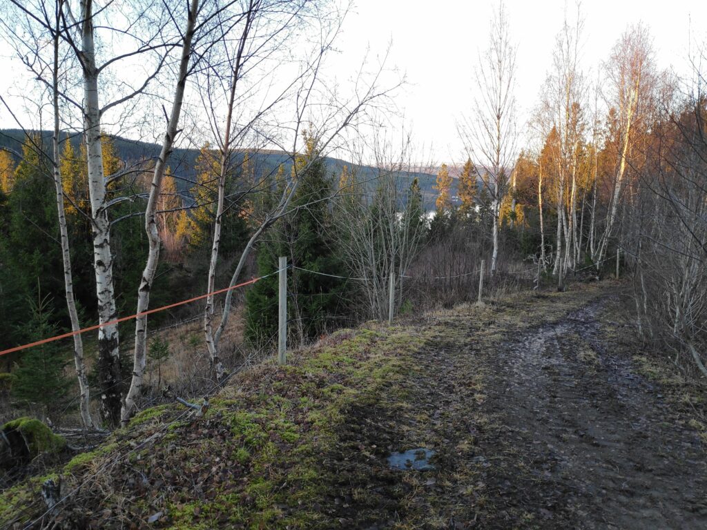
Today’s walk was just a short stretching of our legs on a drive. However this was one of the Inderøy walks this year and we got points for taking it.
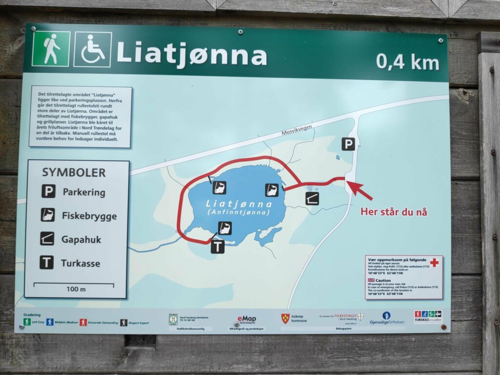
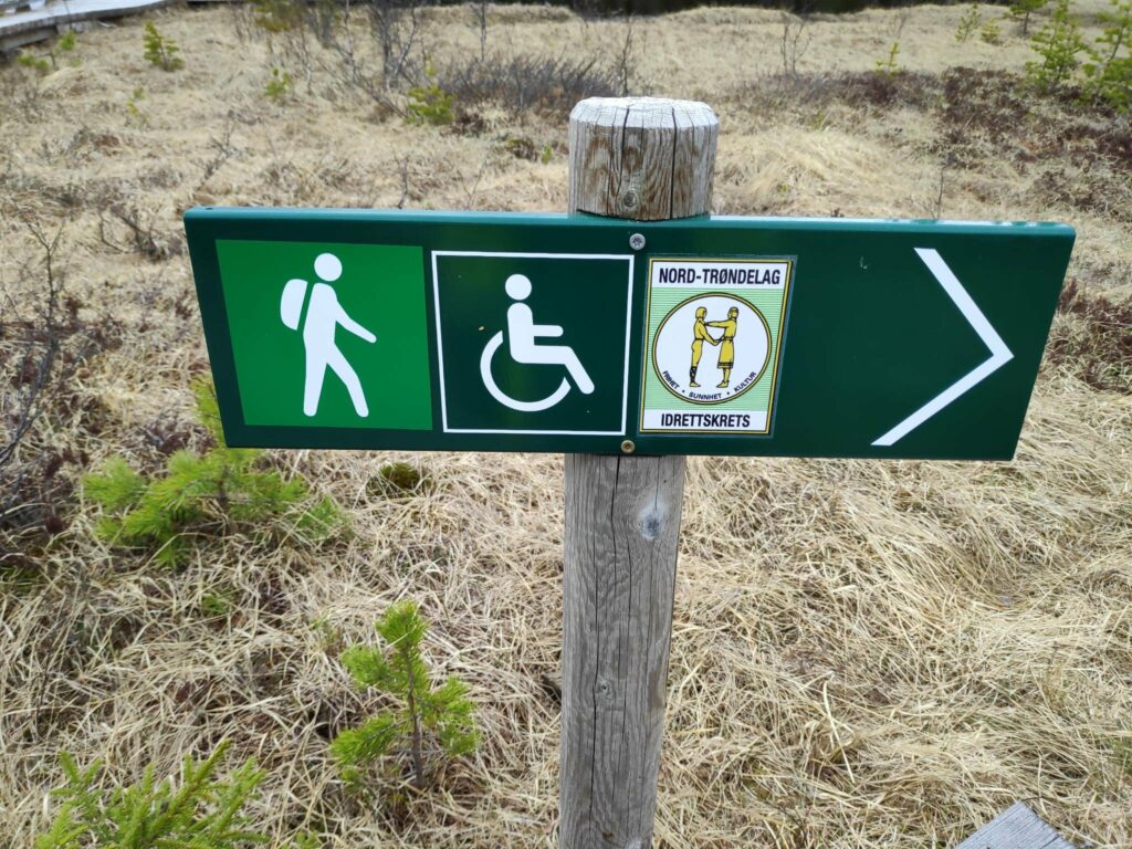
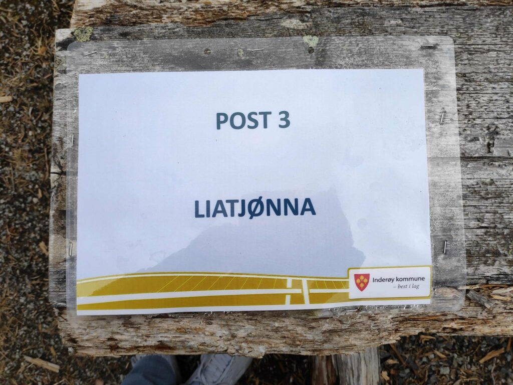
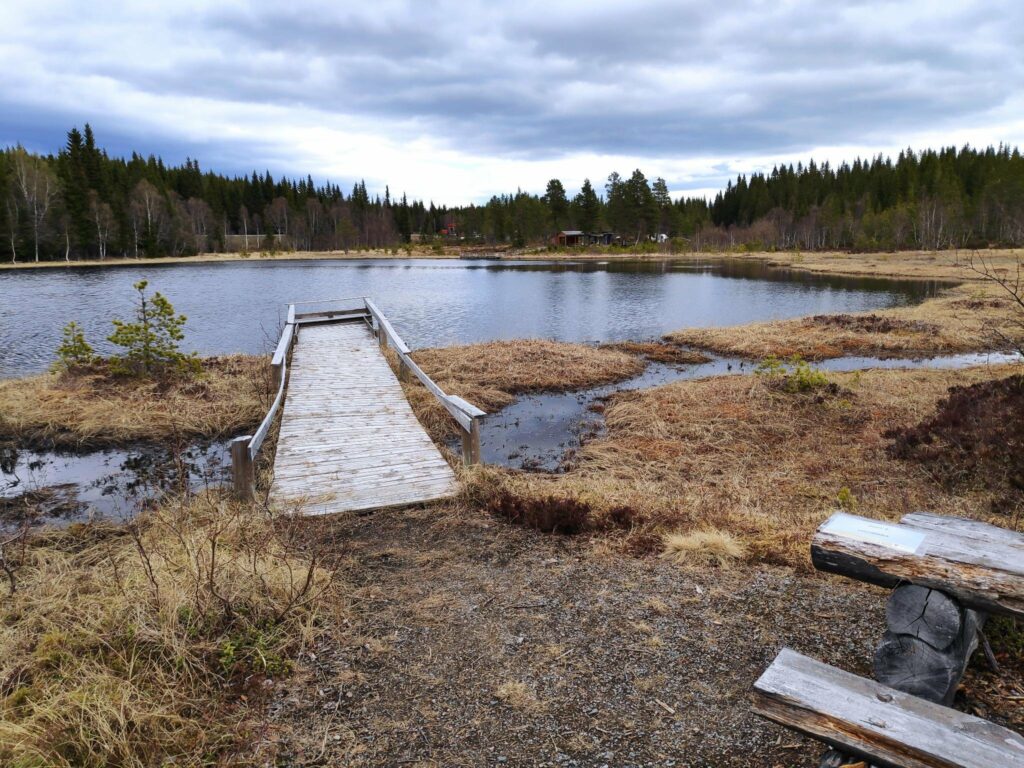
“Tjønna” in Norwegian would be best translated as “tern”, or a little lake. Mosvik has a lot of lakes and many of them would be good fishing lakes. This one has been improved with a picnic area and places for people who use wheelchairs to go fishing. If you want to fish in lakes, you have to have a fishing card for the area you want to fish.
Information on one of the signs says that a fishing card for this lake costs NOK 20 and is good for 4 hours. Children up to the age of 15 and the handicapped can fish free.
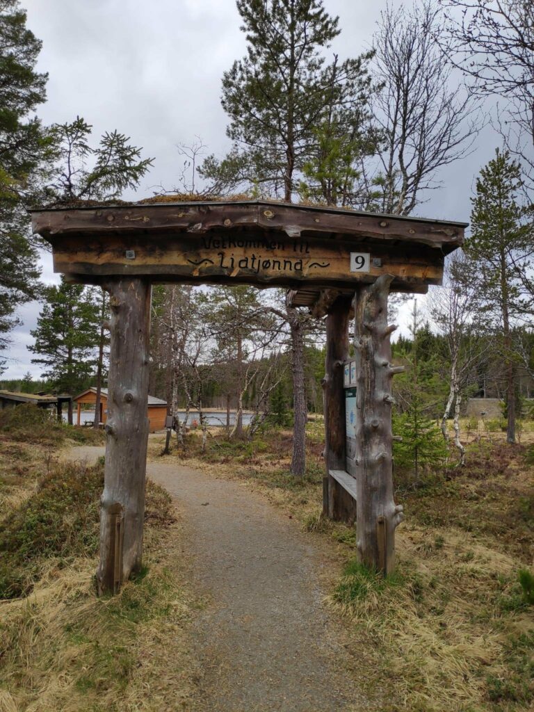
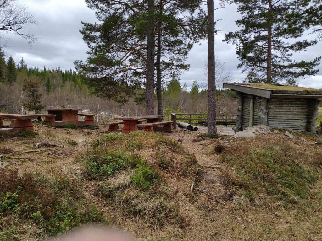
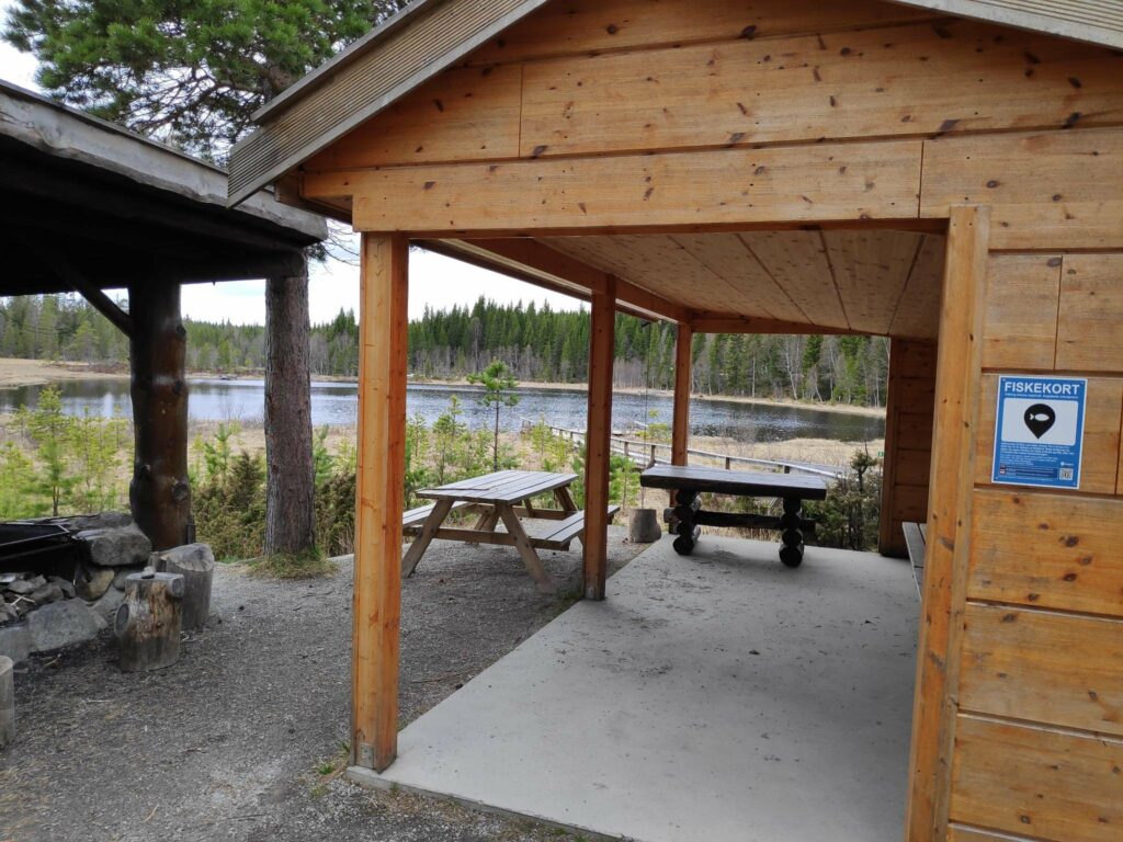
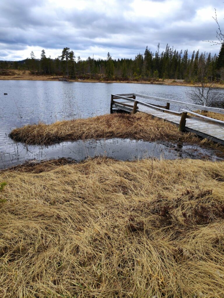
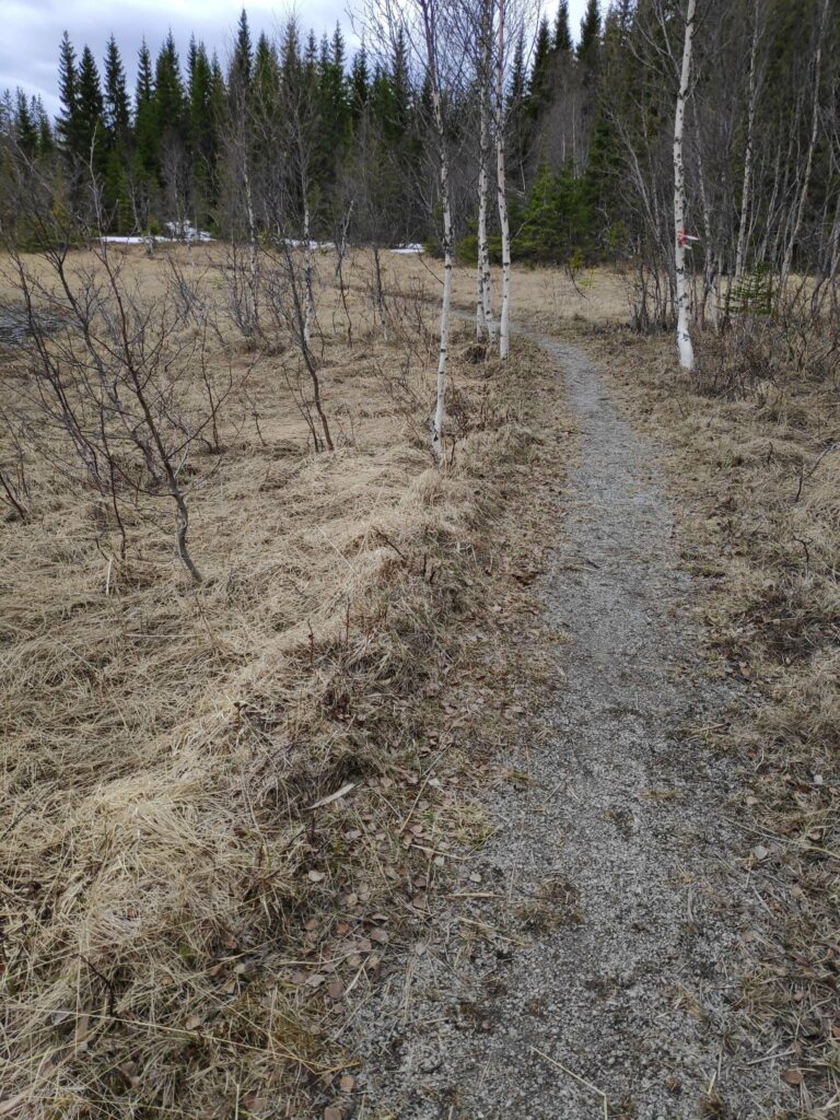
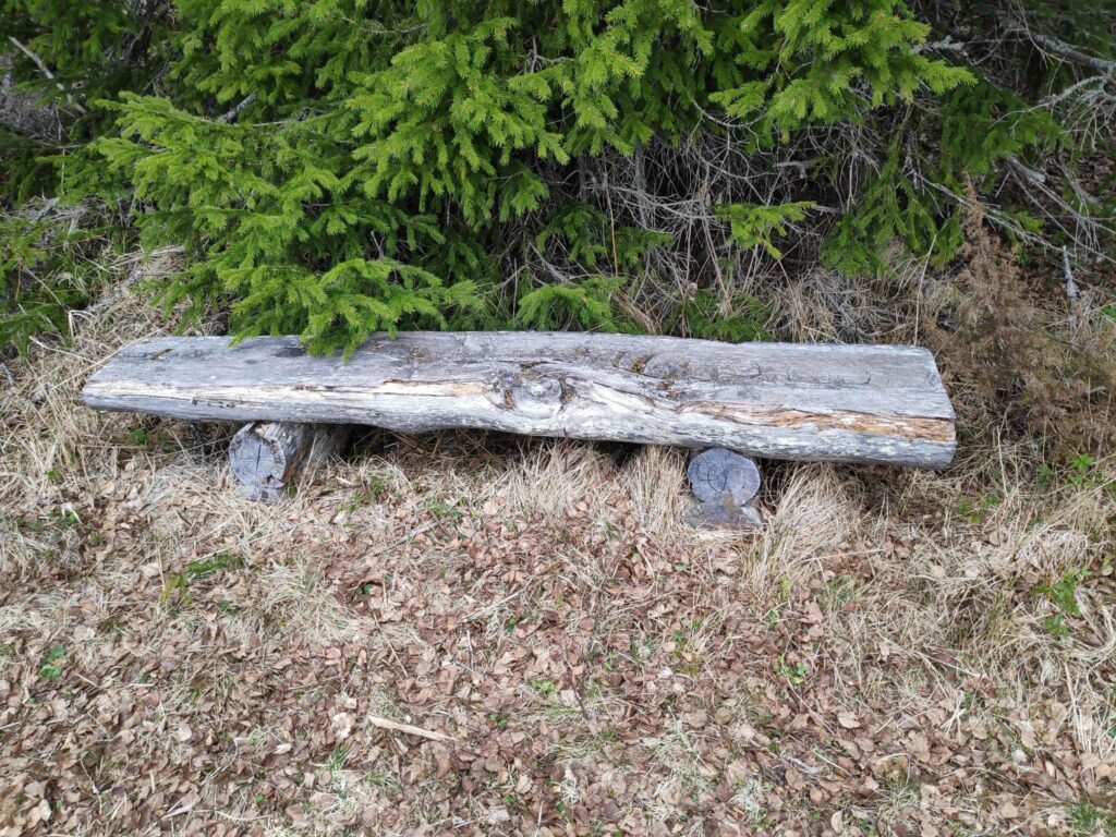
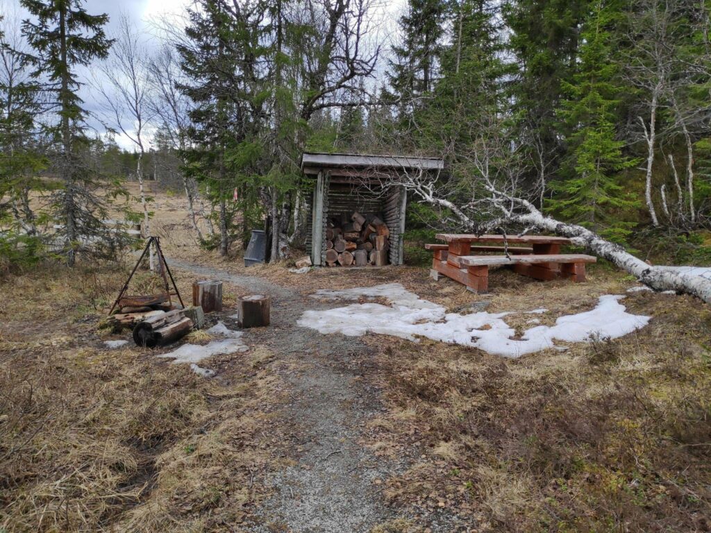
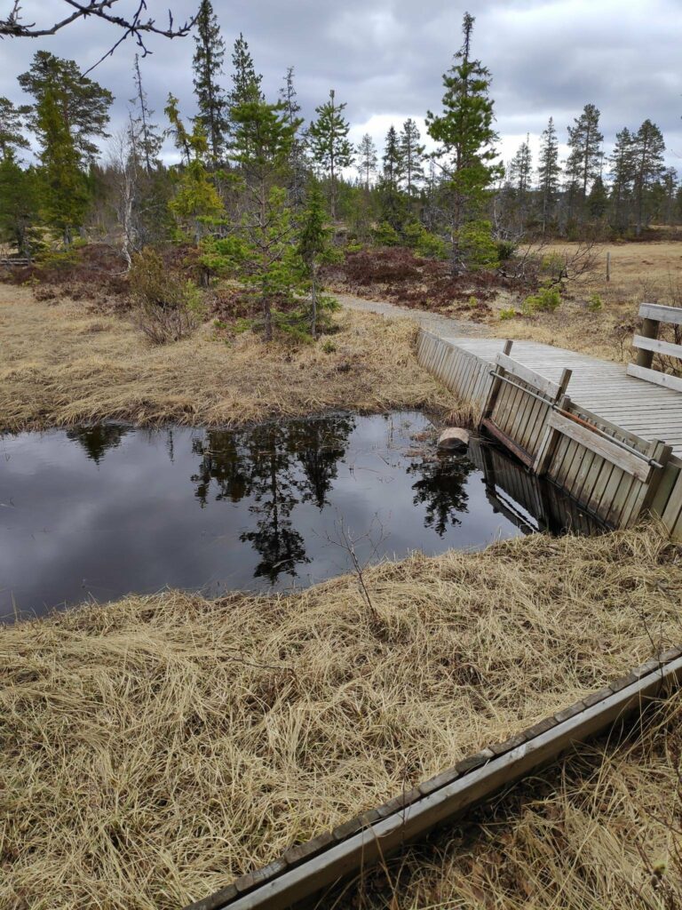
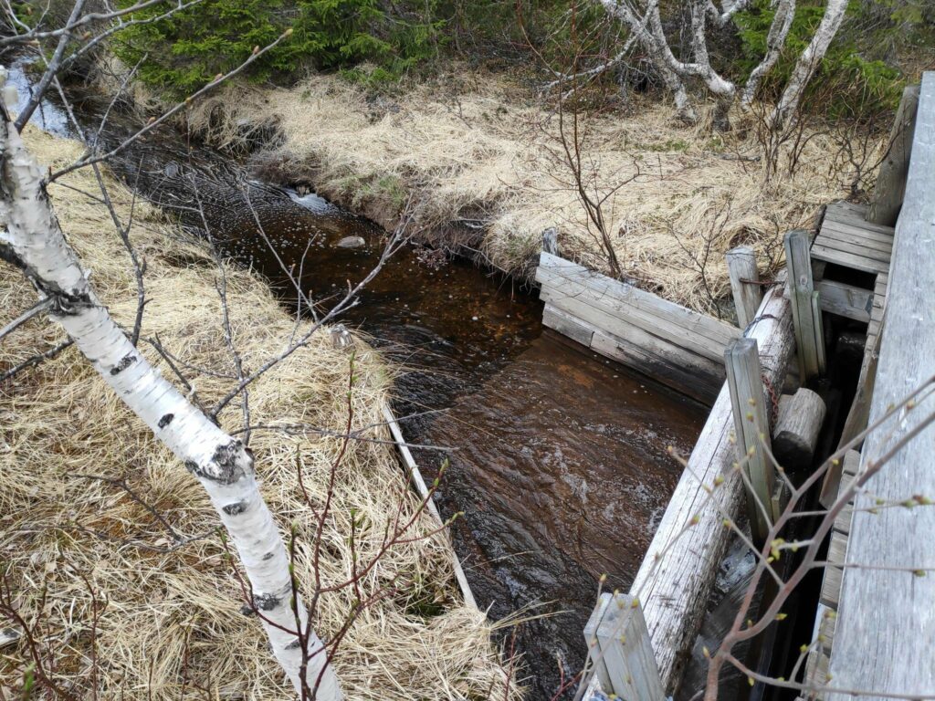
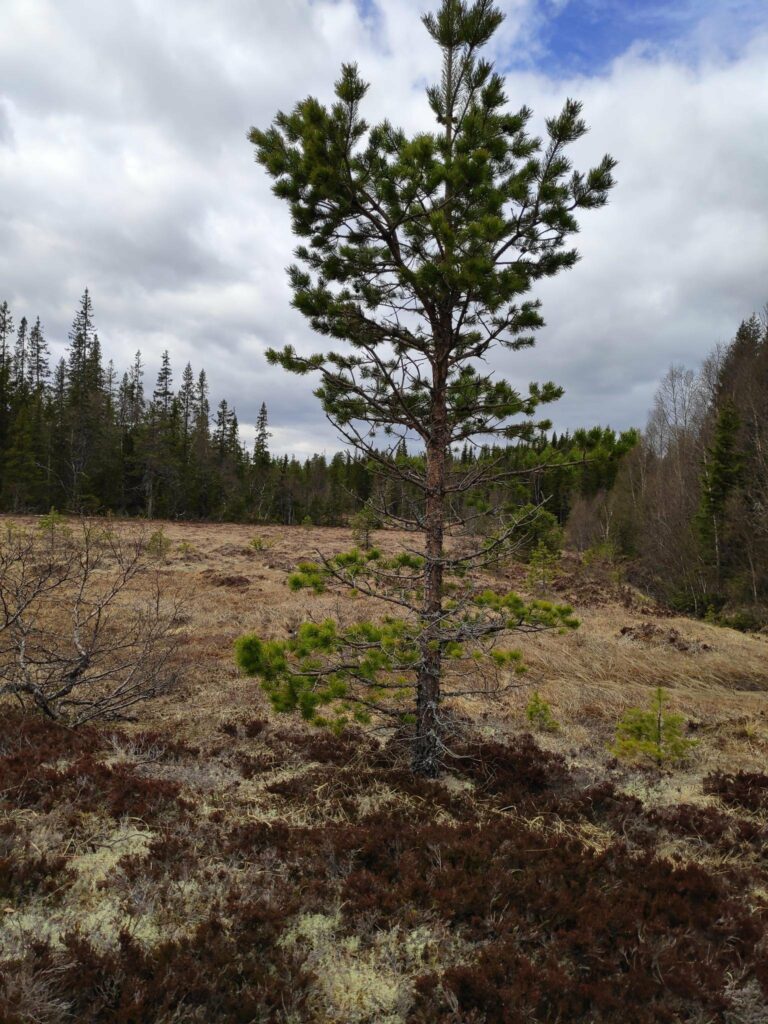
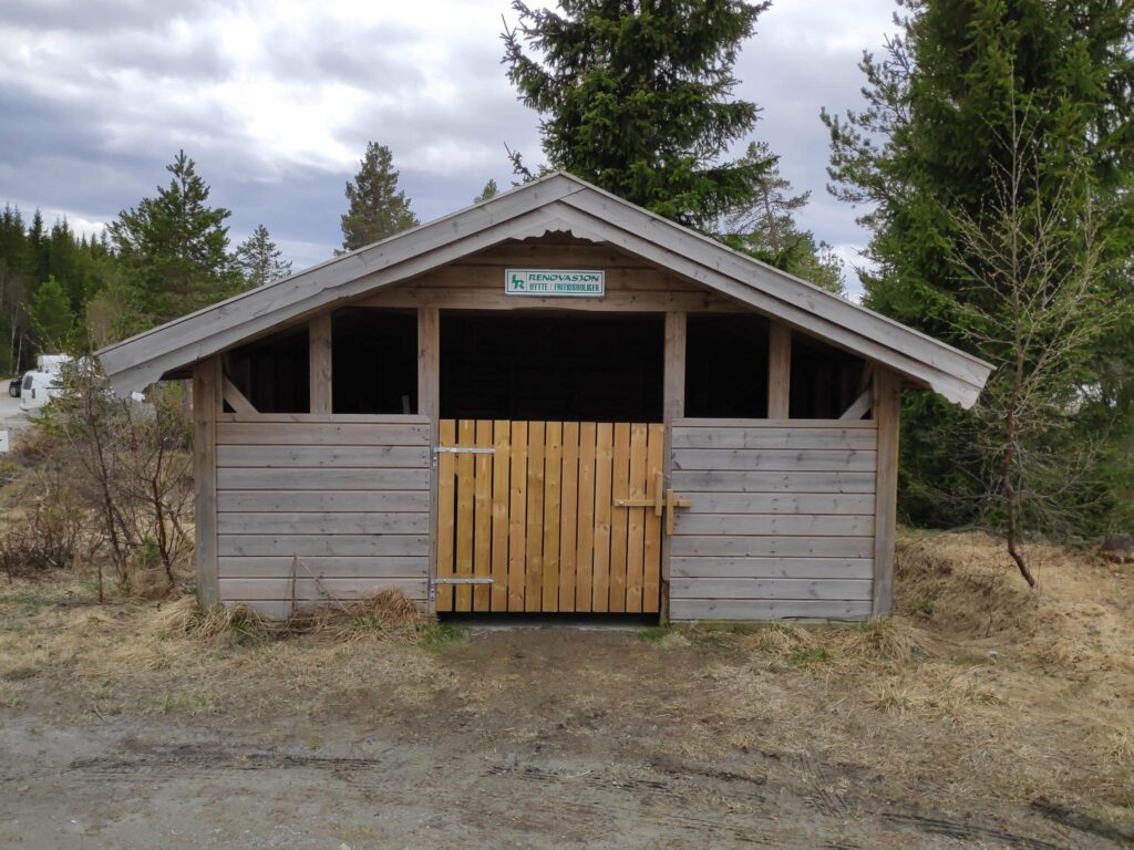
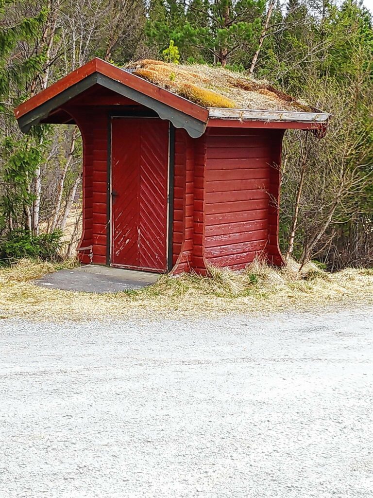
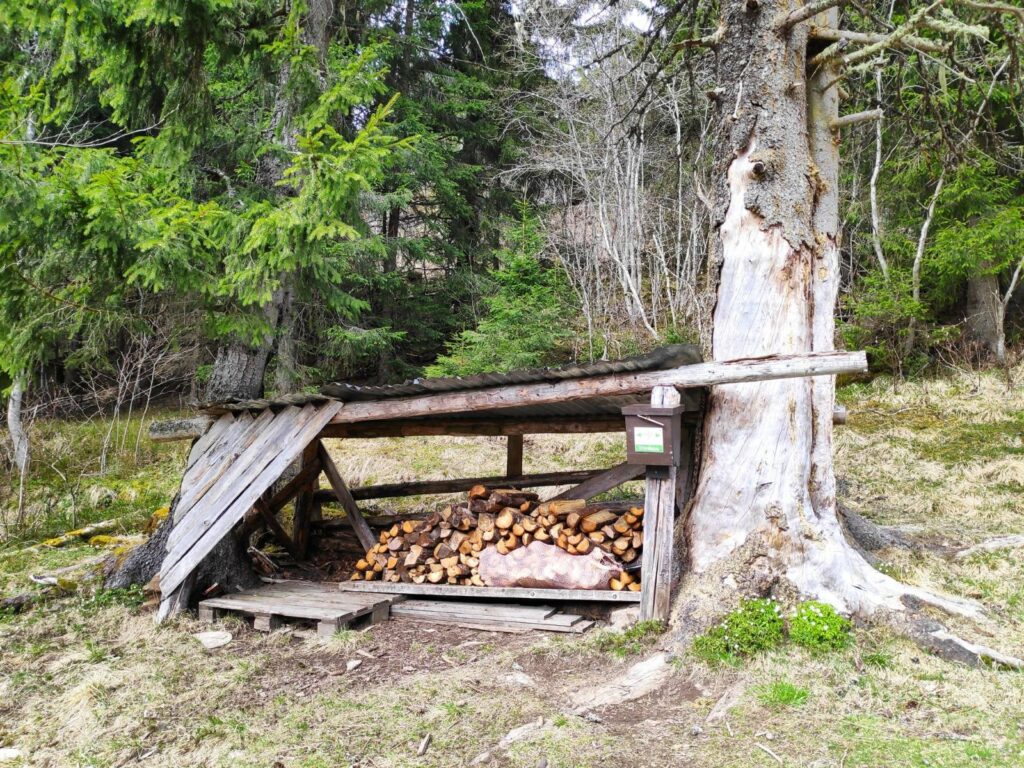
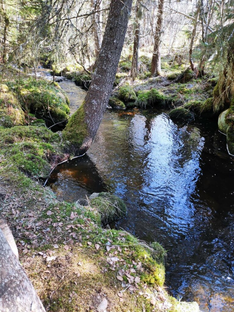
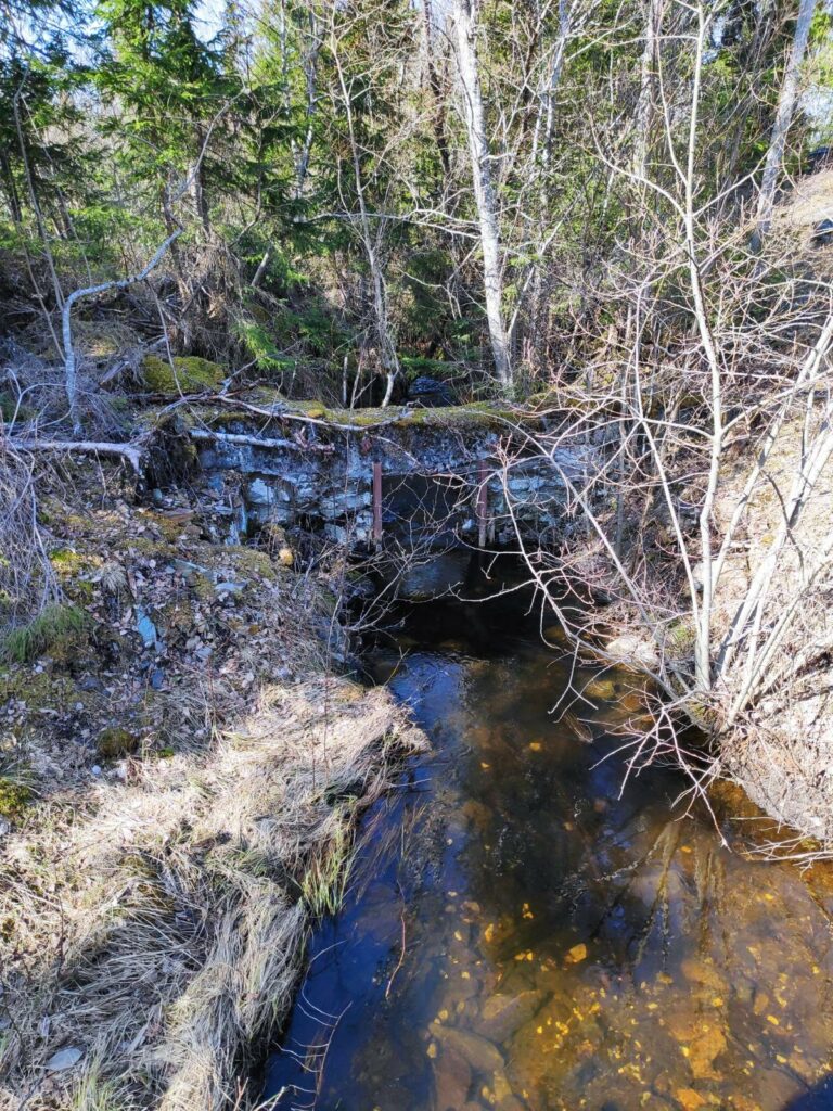
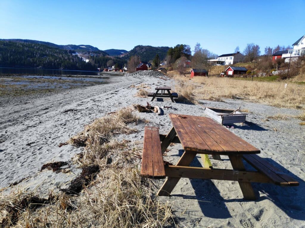
Entrance to the built up area around the little lake.This is a short walk of only 400 meters around part of a small lake. There are three places for fishing, otherwise it is quite swampy close to the lake.There were quite a few picnic benches and several places with roofs.More seating area, with the mandatory grill place to the left. You can see the little lake in the background.This is an easy walk and suitable for wheelchairs. It is the North Trøndelag Sports Club that has sponsored the work here.One of the fishing places, adapted for wheelchair users.The path has been put far enough away from the lake to be solid.In several places there were wooden benches to just sit and enjoy the view over the lake.On the far side of the lake, there is another open grill place with its own picnic bench and supply of firewood. There was still a bit of snow left on the ground. We are at over 200 meters above sea level here.This is where the water leaves the lake and heads to another larger lake, Meltingvatnet. Note how there is a very sturdy grate in the stream. This is to prevent the fish in the lake from leaving.Here the water is flowing downhill.We got to the goal of the walk.The third fishing spot. You can see where we started from on the opposite side of the lake.Though there were pine and spruce trees near the lake, we are at over 200 meters above sea level, so it is neither warm nor a long growing season here. Many of the trees looked quite stunted.Back at the parking area, there was a place to put garbage. There are many cabins in the area and this would be where they could deposit their garbage.Humans too have bodily needs which require the use of the little red building.
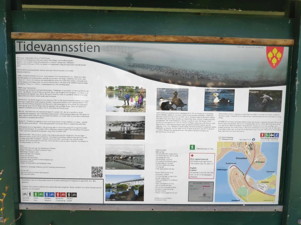
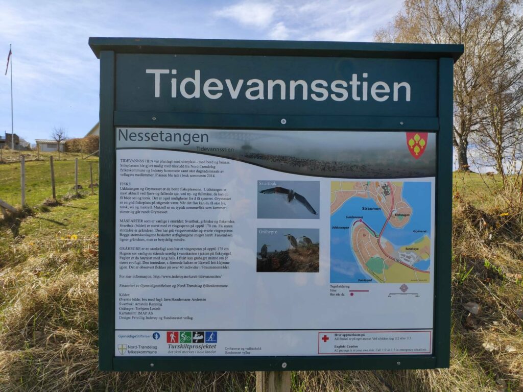
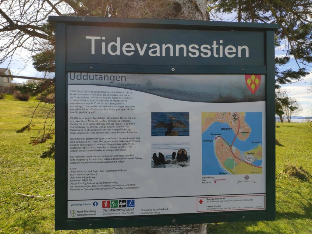
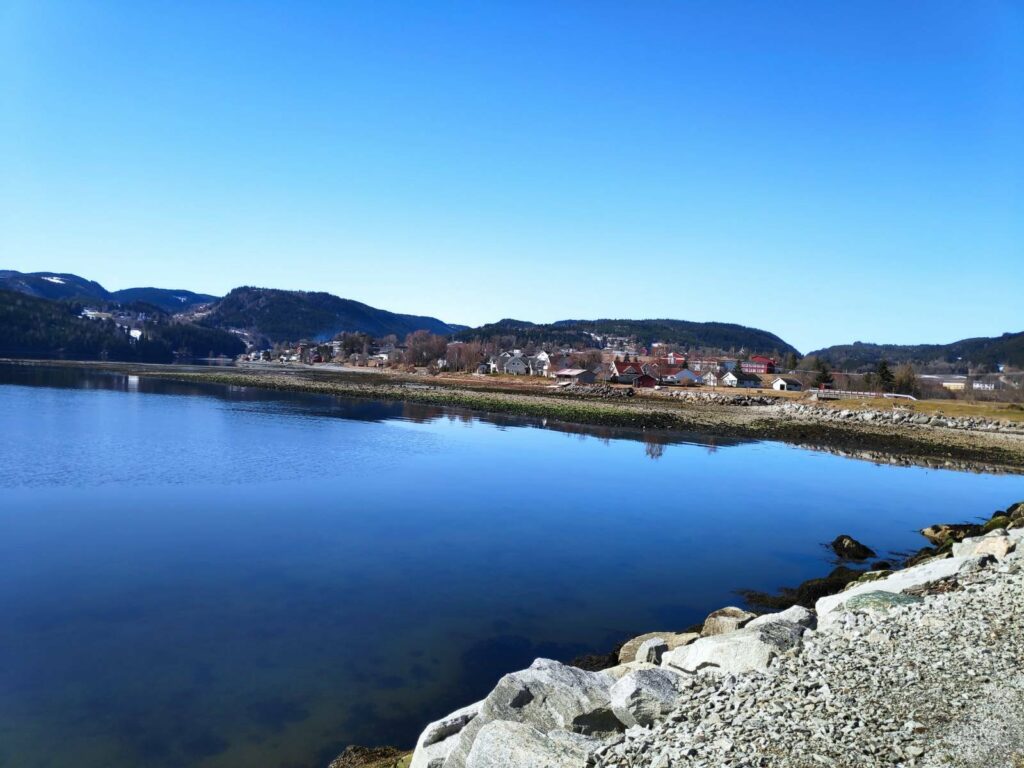
Tidevannsstien (The tidal water path) was built in 2009 and is on the south side of the sound that connects Trondheimsfjord and Borgenfjord (sometimes called Børgin). Trondheimsfjord is to the west and Borgenfjord is to the east. Borgenfjord is a very large body of tidal sea water about 10 km from north to south and between 1 and 3 km wide, so the amount of water that flows through this sound is considerable. The sound itself has an S-shape and the current will be much stronger on one side than the other in the bends. It is not advisable to take a boat against the tide. Most boat traffic on the sound would be at slack tide, when there isn’t as much current.
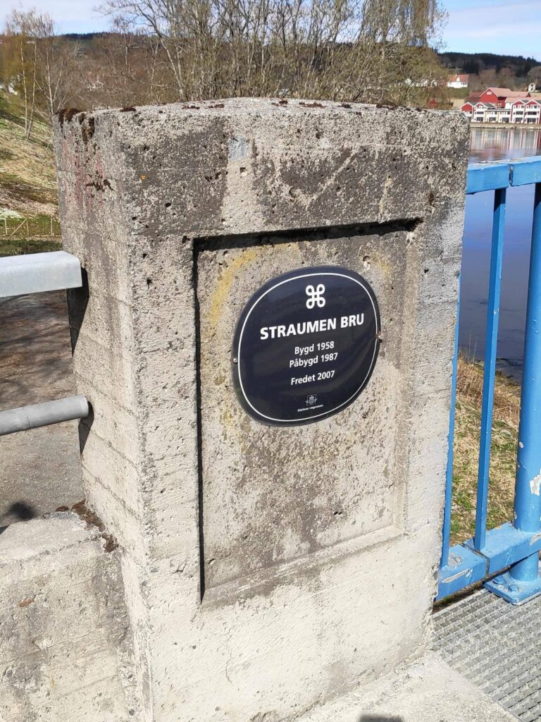
The name of the municipal center, Straumen, refers to the strong current that flows between these two bodies of water. There can be up to 1 to 1.5 meters difference in the water level on either side of the sound which creates a very strong current which tries to even out the difference. This is one of the strongest currents in Northern Europe. The water flow changes direction roughly every six hours. The average speed is between 7 to 9 knots (about 14 km an hour), but the top speed can be much faster.
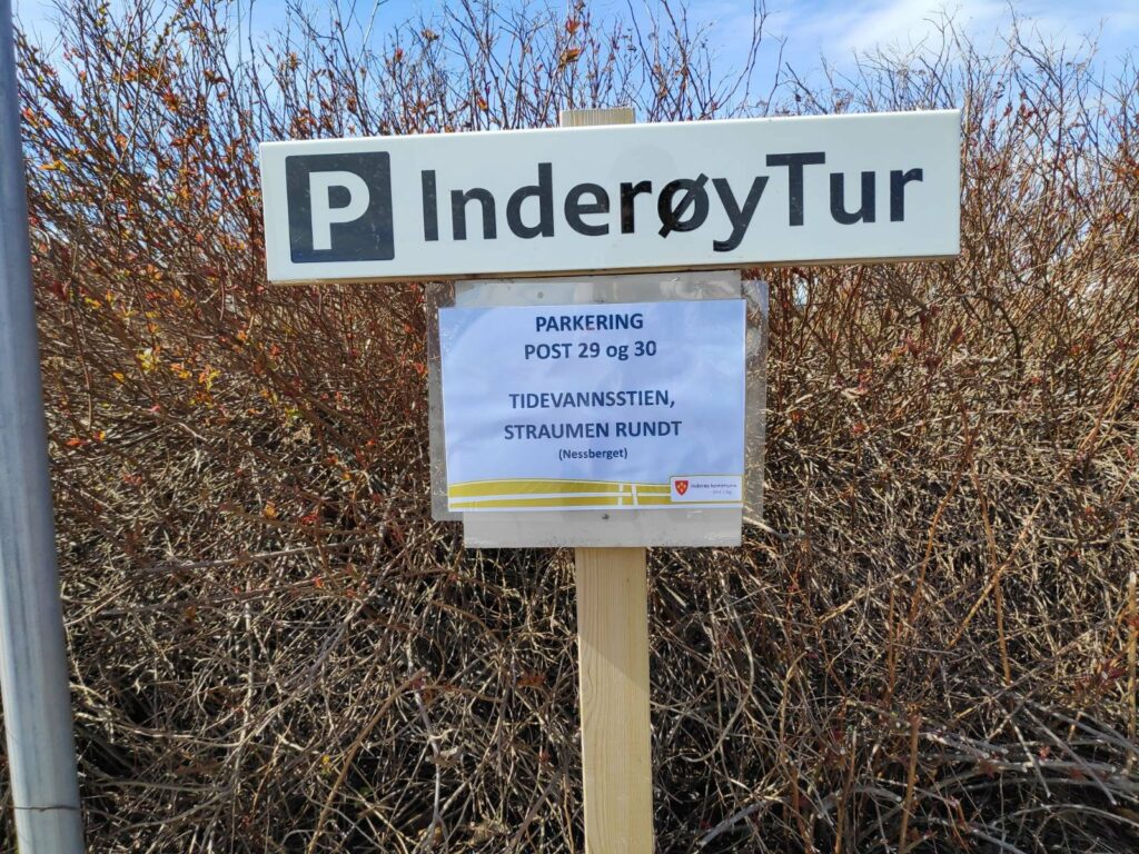
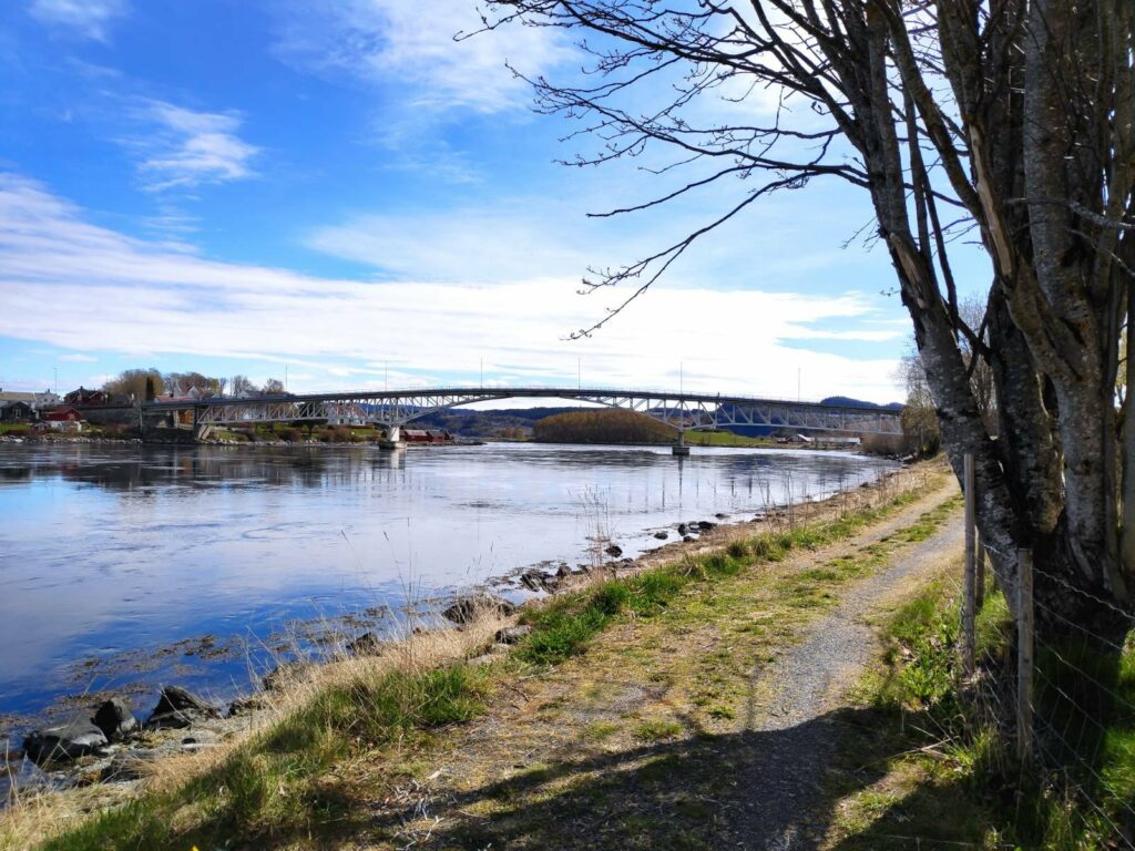
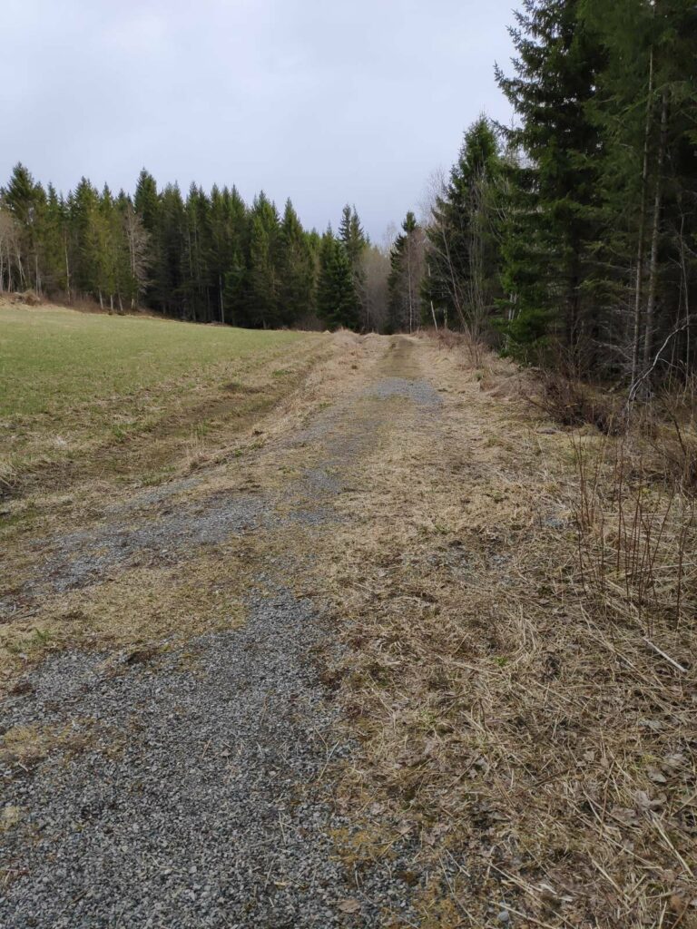
The tidal water path is about 300 meters long and leads to an open area below the housing on the slope. My husband and I took this walk on Monday, the 10th of May after doing an errand in Straumen. The sun was shining and we wanted to have a walk and this one wouldn’t take too much time. We got a slightly longer walk by parking on the north side of the bridge, crossing the bridge and then following the path. We returned to the car the same way that we came. The first picture was taken at 11:22 and the last picture was taken at 11:49, so we used only 27 minutes on the walk.
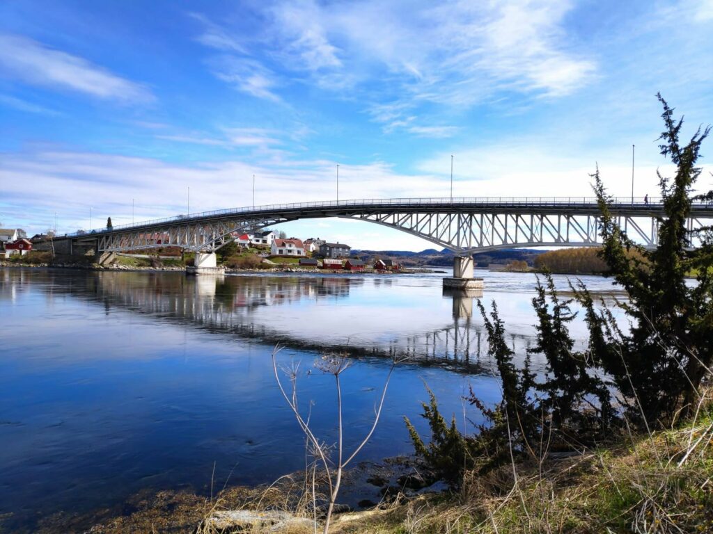
You can see in the map in the bottom left-hand corner the shape of the sound. Trondheimsfjord is to the left and Borgenfjord to the right. The bridge crosses st the narrowest point and the sound is about 100 meters wide at this point.
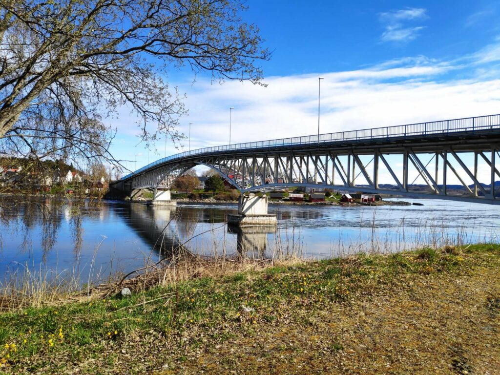
The first bridge over the sound was opened in 1861. Before that people had to take a ferry across. The first bridge had to open to allow ships to go through. You can see (though not very clearly) a picture of the old bridge in the information sign above (second picture on the left). In 1958 a second bridge made of steel and concrete was built and in 1987 a pedestrian path was added to the bridge on the western side. In 2007 the bridge was given protected status.
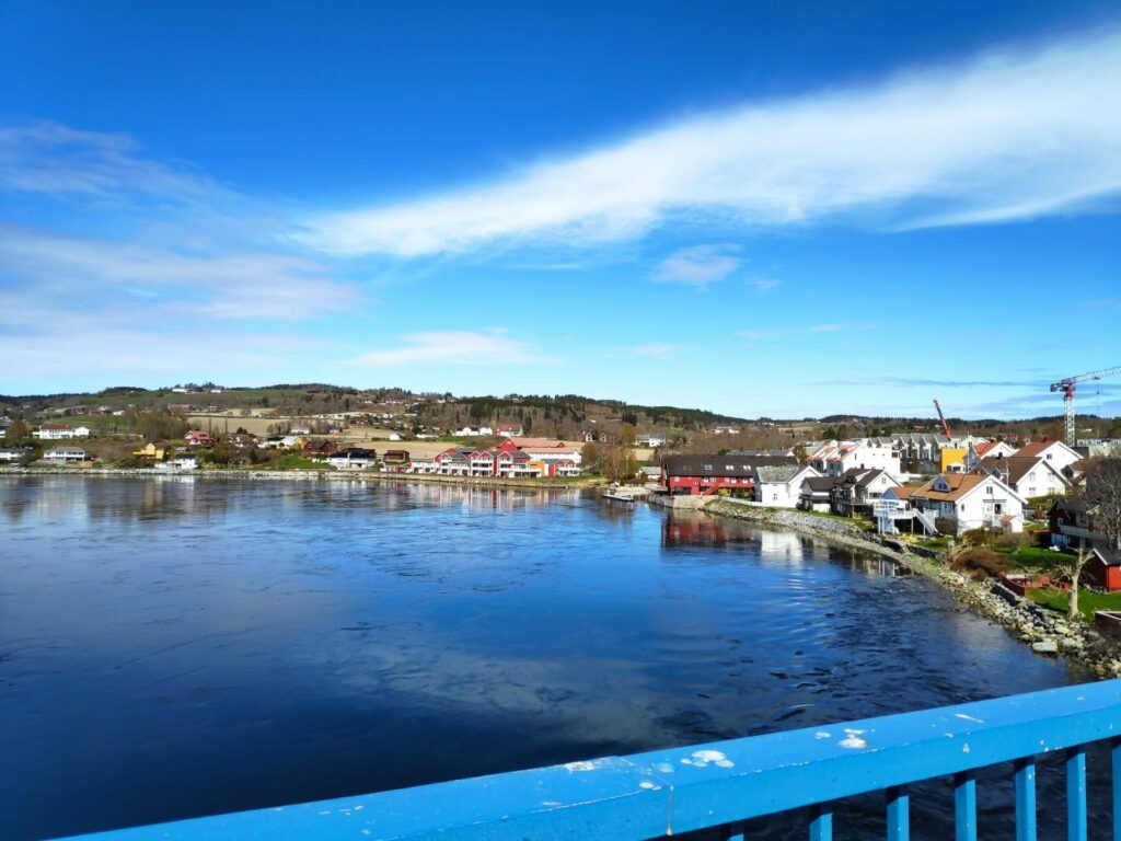
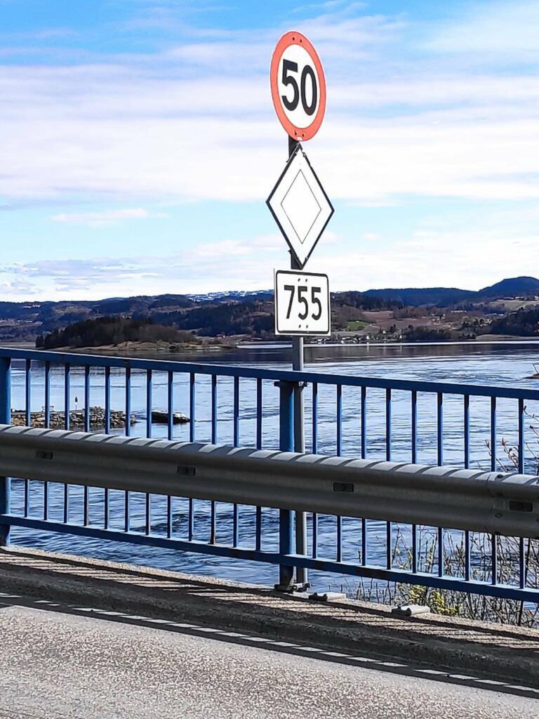
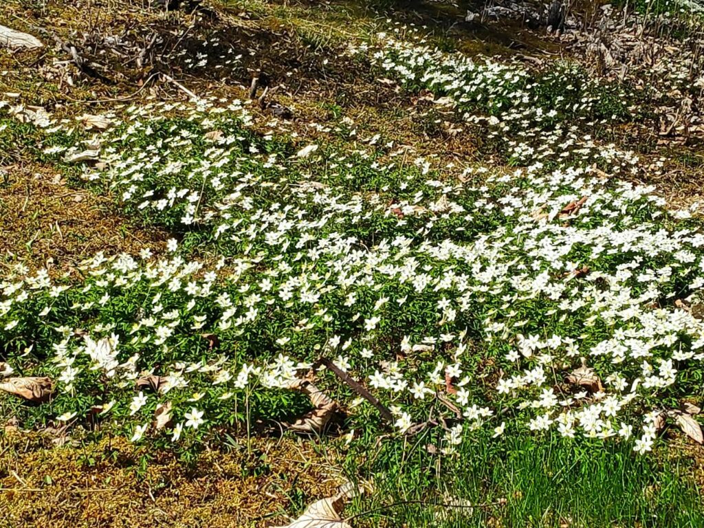
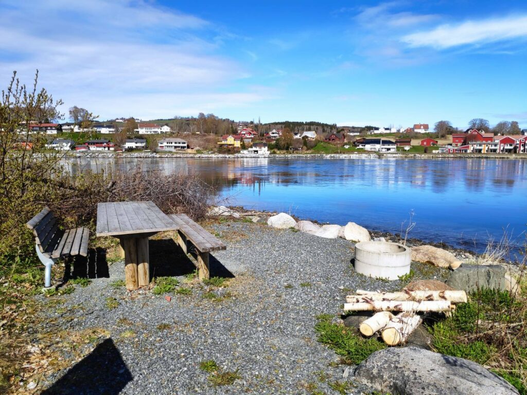
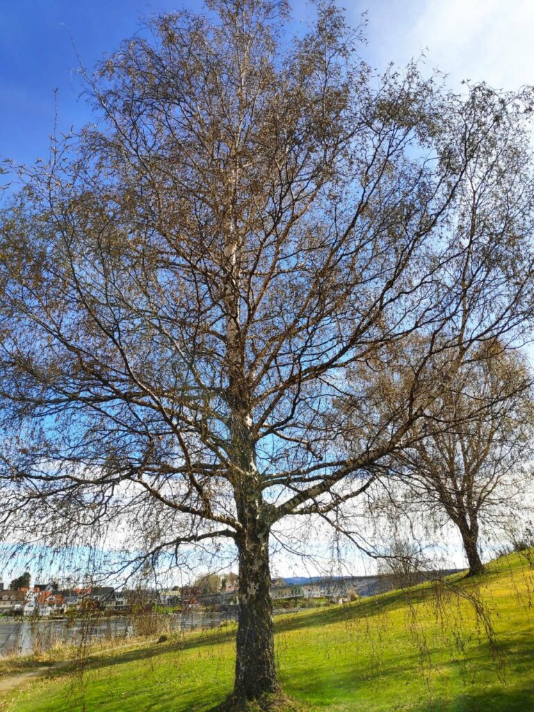
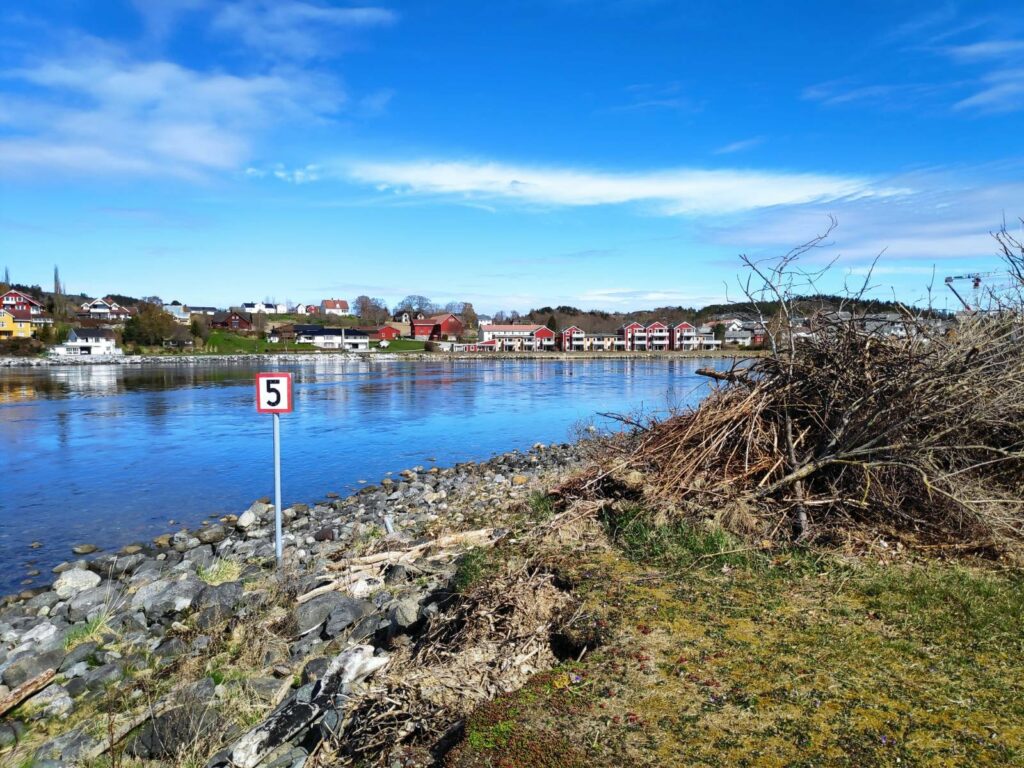
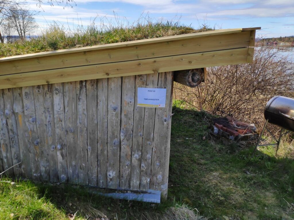
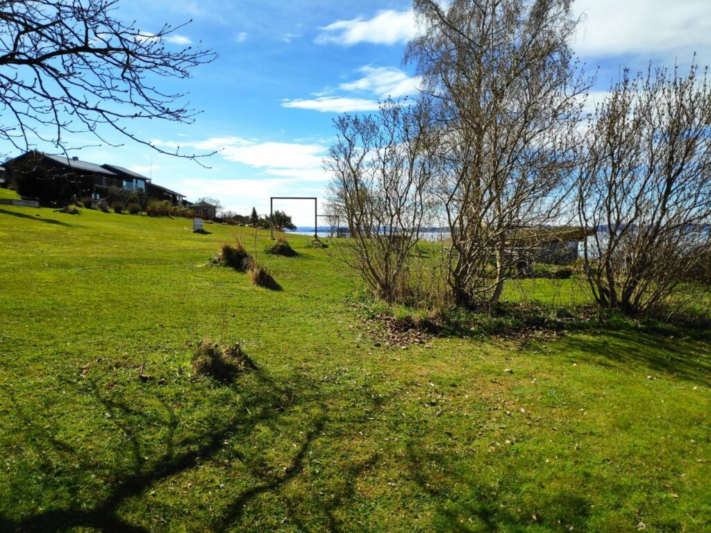
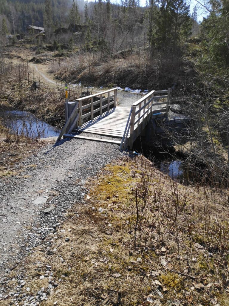
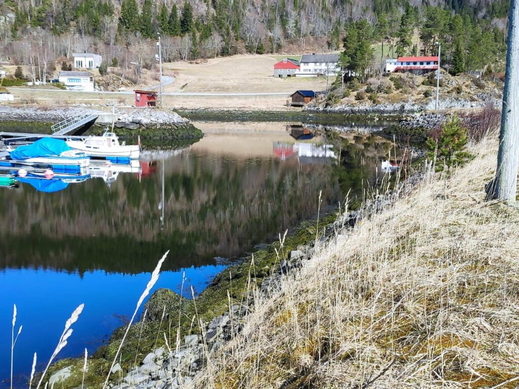
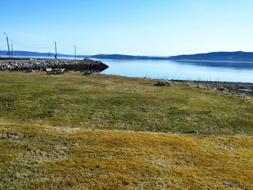
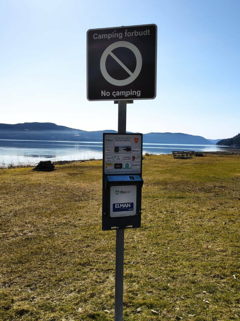
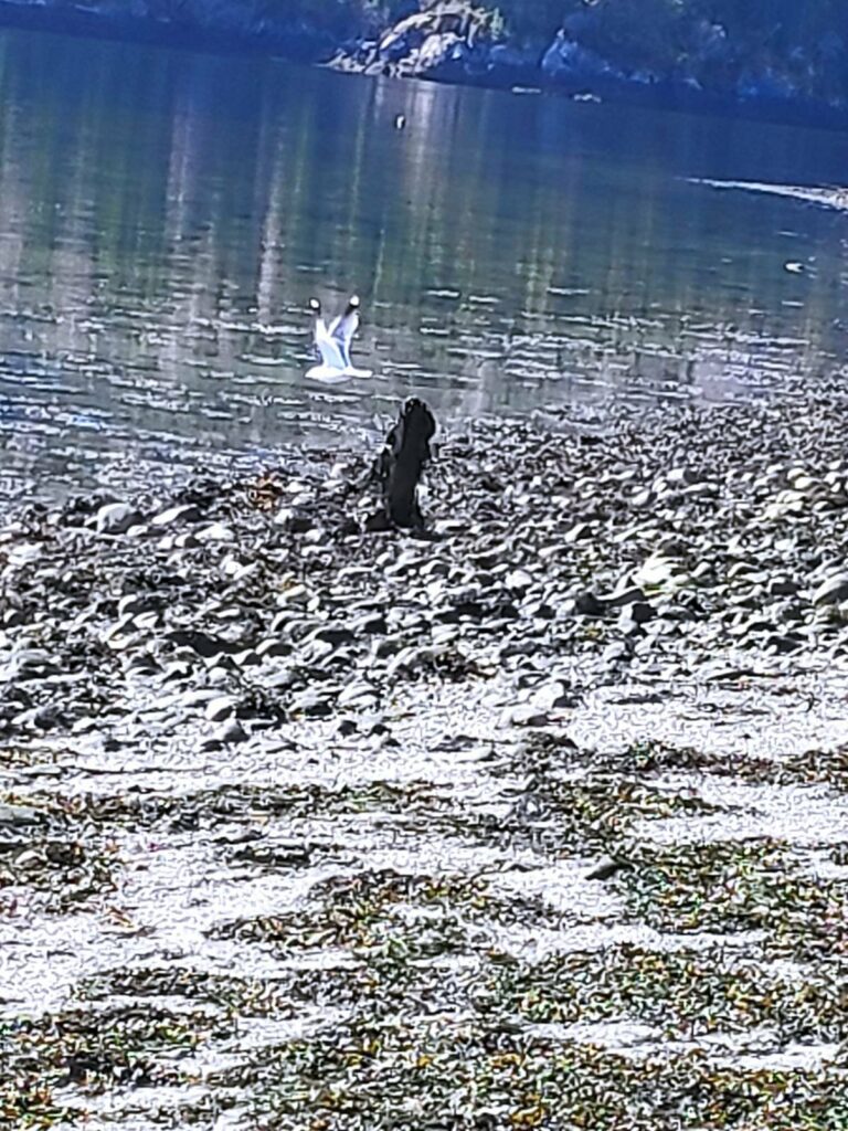
The parking area serves many purposes but this year it is the starting point for two walks. We are going to do post 30, Tidevannsstien.As we cross the bridge one can see some of the housing of Straumen. The tide is high on this side of the bridge and the water is flowing very swiftly toward me, especially on the right-hand side of the sound The crane on the right-hand side of the picture is where they are building a new nursing home which will be run by the municipality. An old one was torn down and a new modern building is under construction. I may be a resident there at some time in the future, though hopefully not for 15 to 20 years.The bridge as seen from the south side. The upper railings are painted blue and the under supports are painted white. The bridge is 202 meters in length and the main span is 72 meters. The sailing height is 12 meters.Information about the bridge can be found on both ends. Built 1958, added to in 1987 and protected in 2007.Borgenfjord is in the background and extends about 10 km to the left. The top sign, 50, gives the speed limit in kilometers per hour. The middle sign (though it is a bit faded) says that traffic on the bridge has right-of-way at intersections (after the bridge). The lower sign , 755, tells the route number. Road number 755 goes from Røra (east end of the route) to Vanviken (west end of the route) and is the road that goes over Skarnsund Bridge near us. You can also see the current racing under the bridge. High water would be at 11:56 so shortly after this picture was taken.Anemone nemorosa (“hvitveis” in Norwegian) is a very common flower in Norway. It blooms before the leaves come out on the trees, so that it gets a lot of sunshine. It can carpet large portions of the forest floor in open areas.Here is a bench and table to sit and enjoy the view. As usual, there is a place to grill. We are looking across the sound to Straumen.The information sign tells us that we are at “Nessetangen”, so one side of the point that sticks out into the sound. This area of Straumen is called “Sund” (sound), so there is Sund School, Sundsand, Sundsnes and Sundsøya. The birds on the information sign are one type of seagull and the grey heron both of which can be found here.Looking back towards the bridge. You can see the path that we have been walking along.A birch tree has a beautiful shape when it grows in the open. This one will be shedding a lot of pollen to bother those (like me) with pollen allergies. It may be another week before the leaves are out. Birch trees require a lot of water, but this one will have access to lots.The sign “5” means that boat traffic may not go faster than 5 knots. The reason for this low speed has to do with the amount of birds found in the sound. We have a lot of eider ducks that are here year round. We saw only two pairs today and none of them were close enough to get their picture taken. It is soon nesting season. I speculated on how fast the water was travelling, but I’m sure it was doing twice the speed limit for boats.The goal of our walk, a small shed with picnic tables and benches inside. The inevitable grilling unit on the extreme right of the picture.There is a large park area here between the houses and the shoreline. There is lots of space to spread out on the grass in warm weather. This information sign gives information about the park area which has been made by volunteers. The picnic tables and benches have also been made by local volunteers. The bird that is pictured is a cormorant, which can be up to 2-3 kg with a wingspan of 130 – 160 cm. The otter can also been seen here. The fast moving current provides a lot of food for ducks, birds and otters.StraumbruaThe name of the parking area. I didn’t know it had a name before.
We had a sunny morning for our walk. One could make it longer by continuing along the shore and coming to Sundsand, our local sandy beach. However, we just wanted a short half hour walk and returned to the car to head home again.
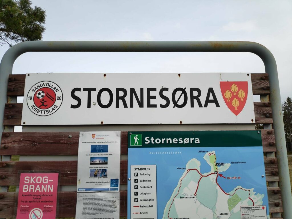
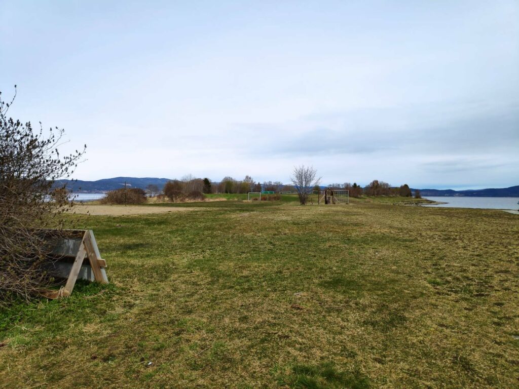
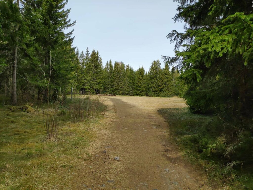
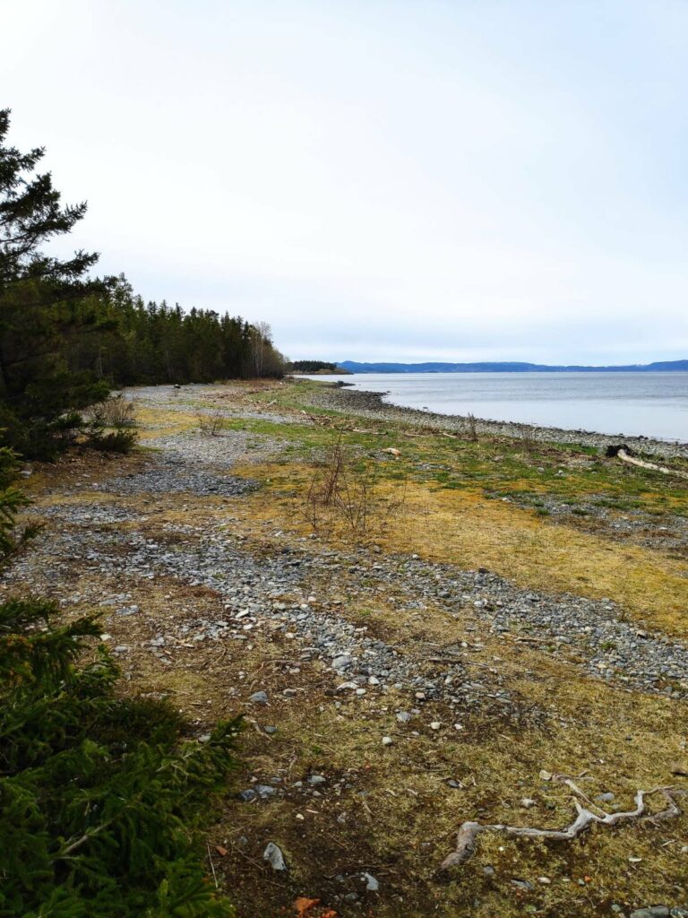
Størnesøra is a large park area that is used for junior soccer competitions as well as having a lot of picnic tables to encourage people to get out in the nice weather. There are also several paths to encourage people to go for walks. These walks are basically along the seashore and the one we took has no elevation changes.
The symbol at the left of the name on the sign indicates that this area is sponsored by the Sandvollan Sports Club which was founded in 1920. On the right is the municipality’s coat of arms, four flounders. Above the map, the green walking person indicates that the pathways are quite easy. Notice boards like this also have information about the rules to prevent contagion, particularly of Covid-19. In addition the red sign warns of forest fire danger and no open flames are allowed.
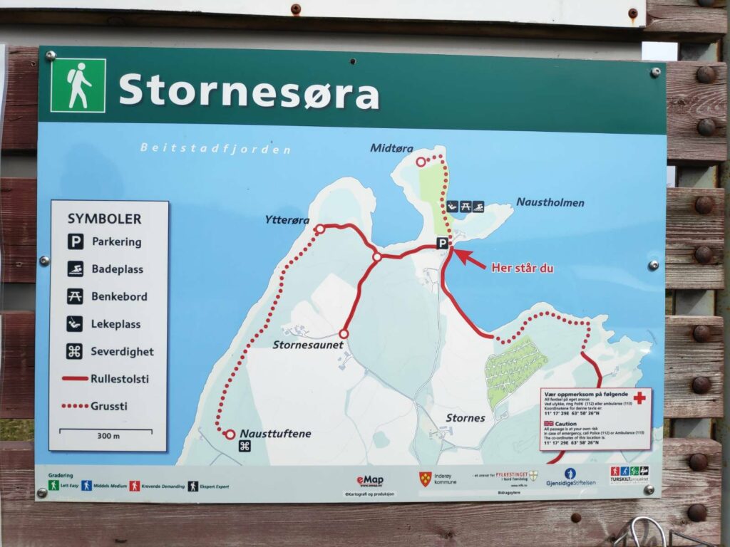
Let’s have a closer look at what is indicated on the map.
P = parking. This is where I am standing taking this picture, so there is also a red arrow indicating that this is where you are (“Her står du”).
Solid red lines indicate a pathway suitable for wheelchair users and a dotted red line indicates a gravel or dirt path.
There is also a bathing area (“badeplass”), picnic tables (“benkebord”) and a play area (“lekeplass”). In addition there is a historic site (“severdighet”) which are the remains of old boat houses. We didn’t walk quite that far.
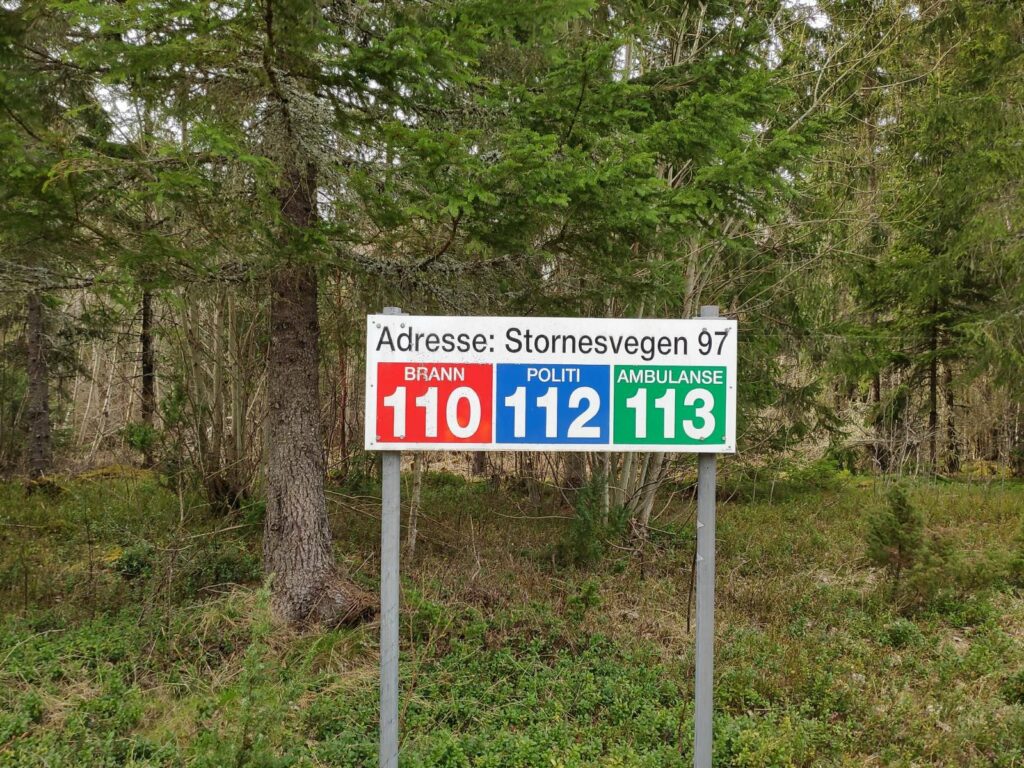
In the bottom right-hand corner there is a caution sign, that you are using this area at your own risk. The phone number for police and ambulance are given, as well as the coordinates of the location (11 degrees 17′ 29″E, 63 degrees, 58′, 26″N).
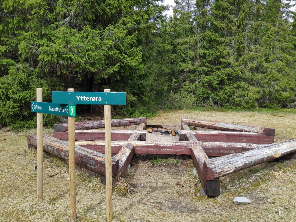
We are going to follow the path to Ytterøra and continue along the dotted line until we find a boathouse on the shore.
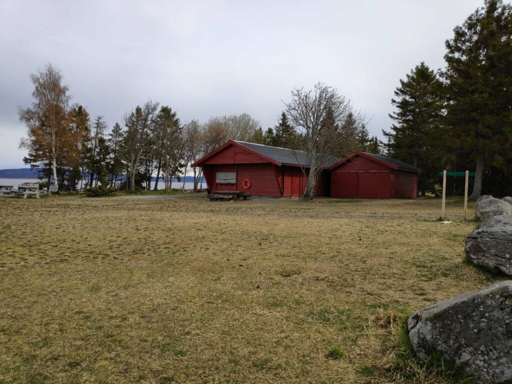
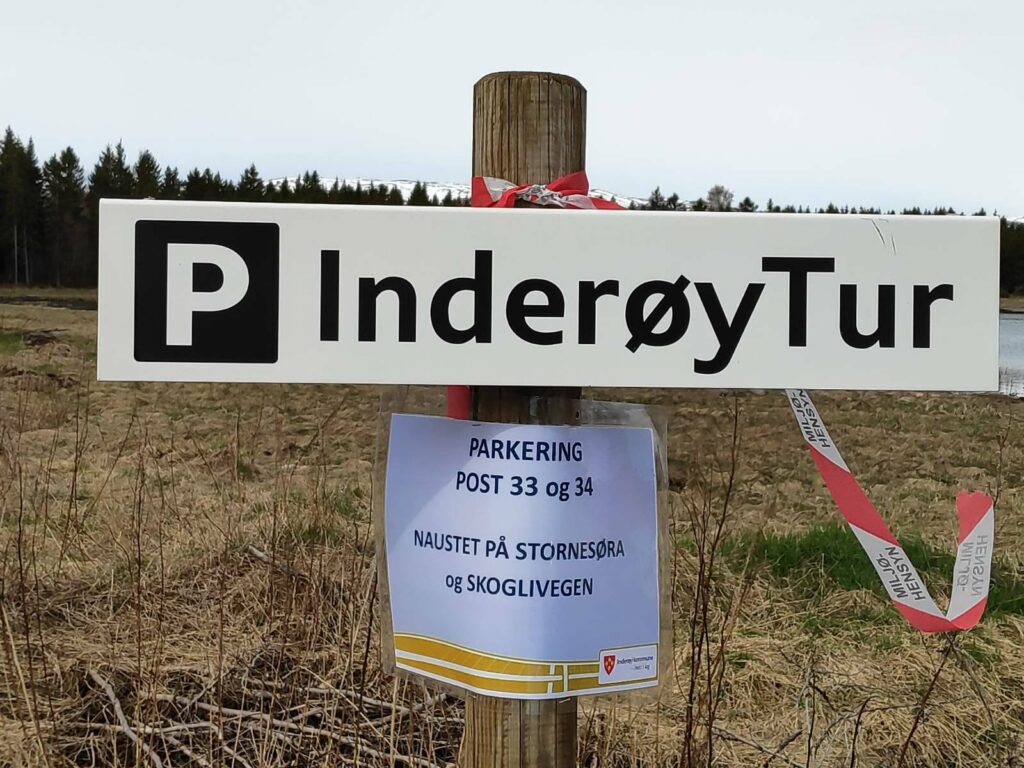
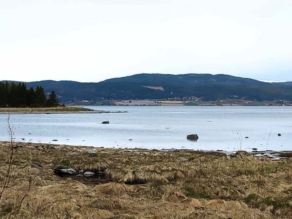
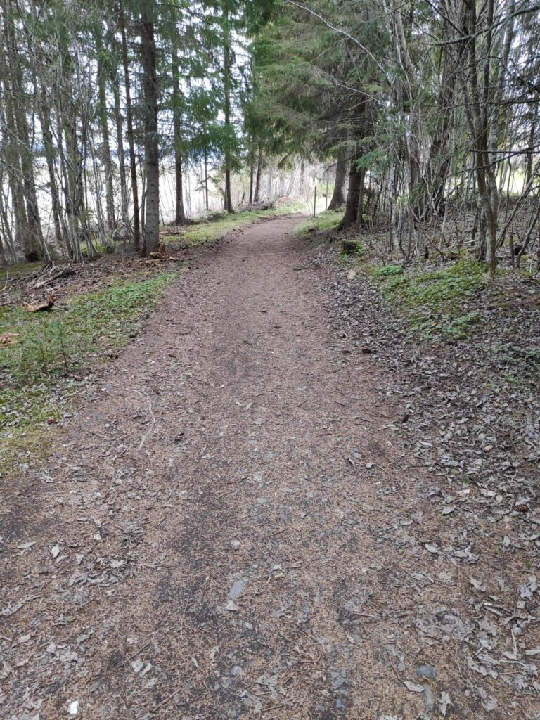
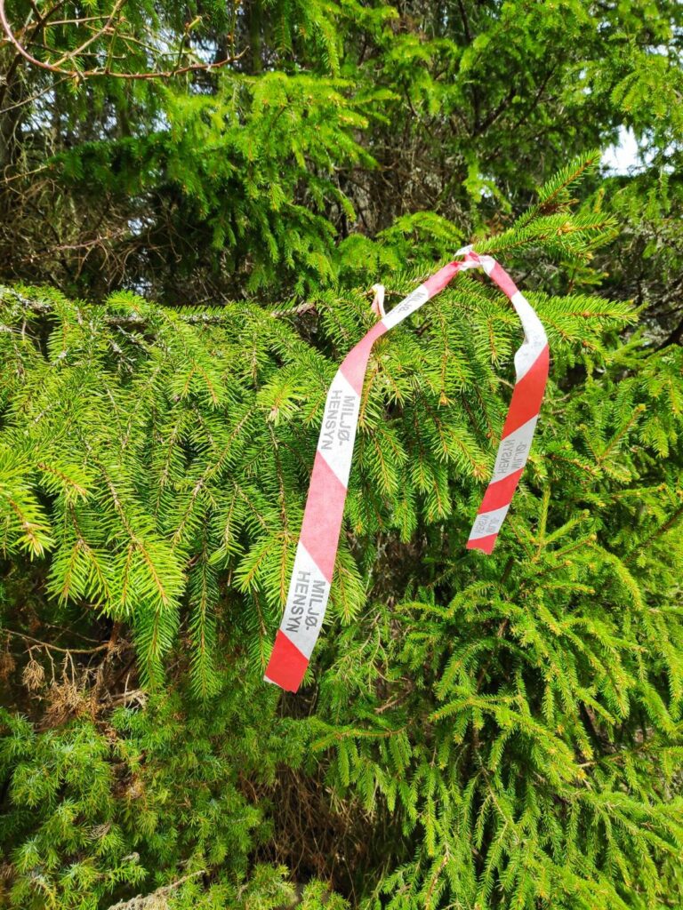
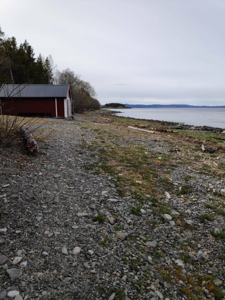
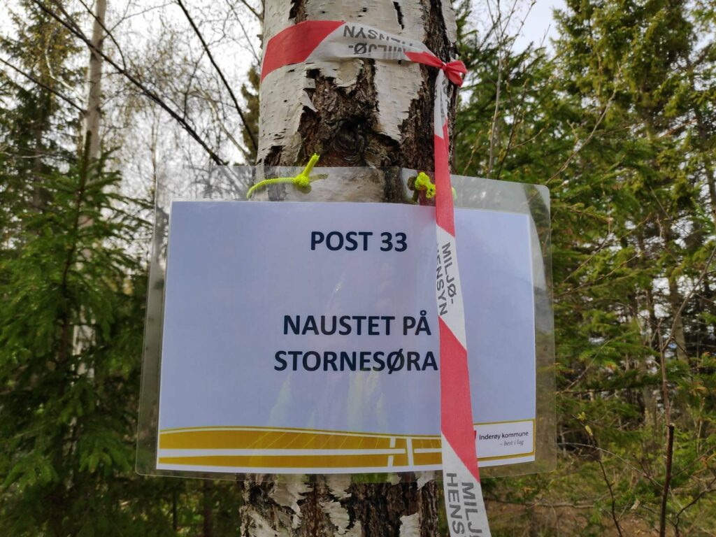
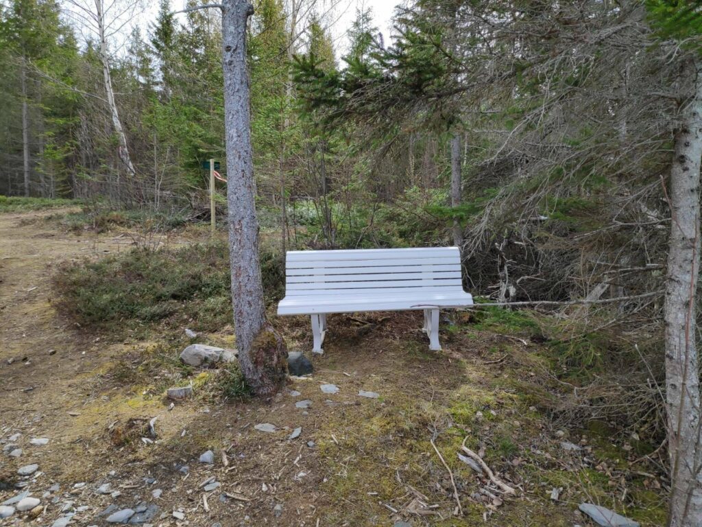
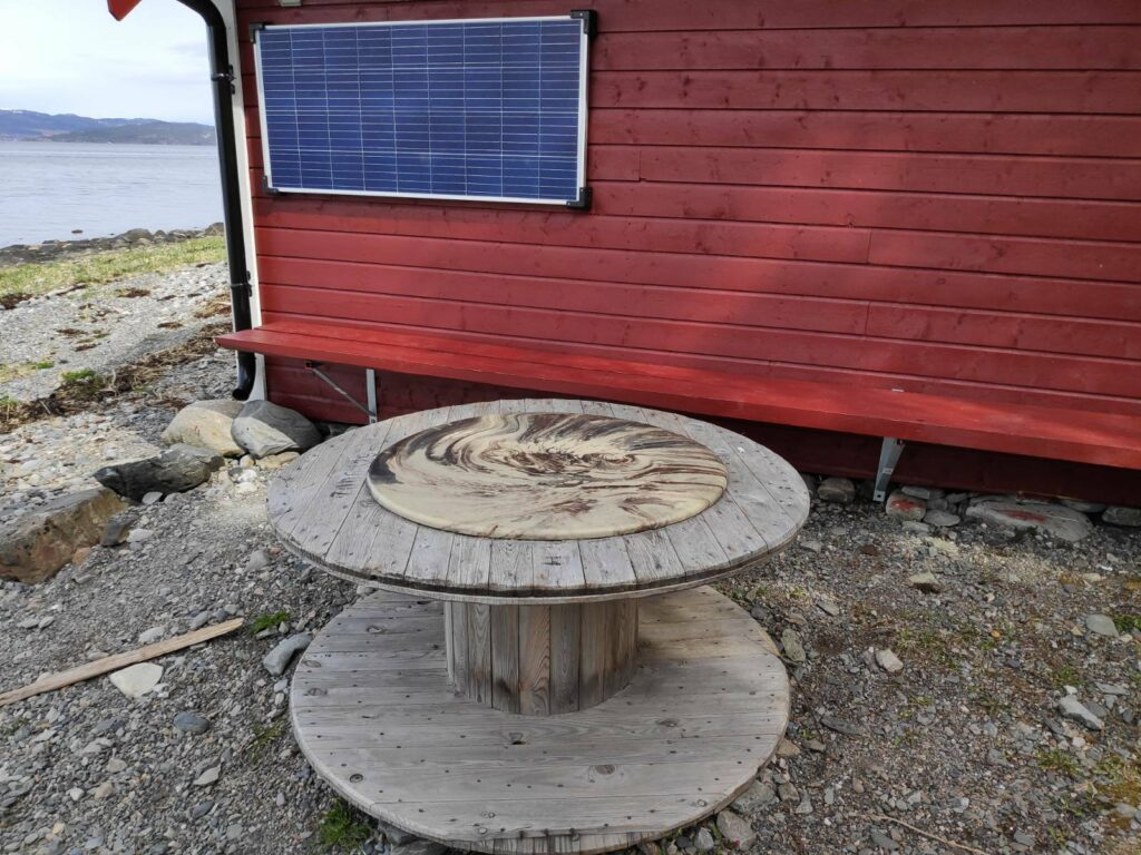
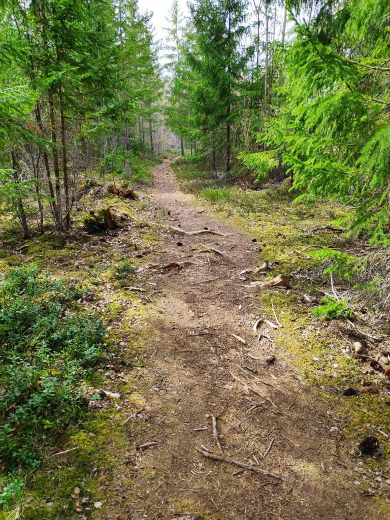
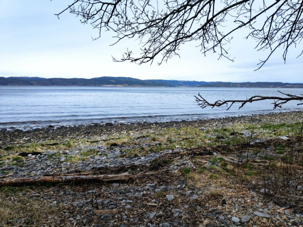
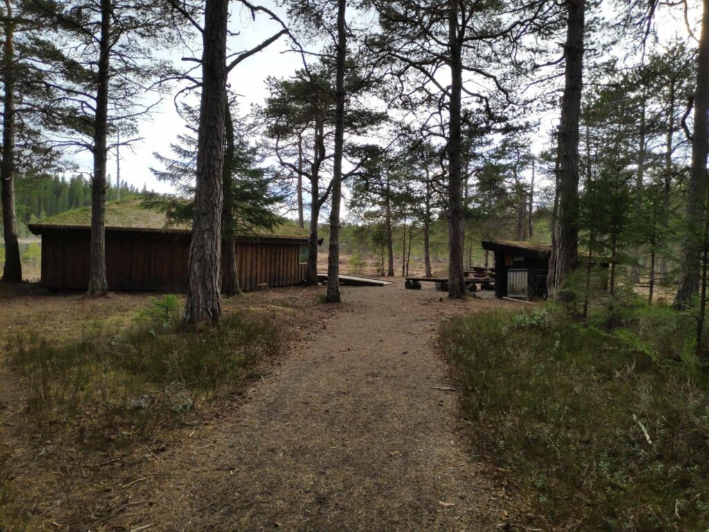
The picnic benches have not been set out yet. The red building has toilets at the back. The bathing area would be behind the clump of trees between the picnic benches and the red buildings.The sports field on the spit of land called Midtøra. I remember bringing my daughter here to play soccer when she was in elementary school. Because of the pandemic, there has been less sports activities planned for young people.Signs are in place so we know which posts are accessible from here. We are going to do post 33, Naustet på Stornesøra, which is an easy walk.First we have to walk around a little bay. It was high tide when we were walking on Sunday, the 9th of May. The area in the background is in the municipality of Steinkjer.The first part of the path was very easy walking.We came to an open area where in good weather, and no pandemic, people would congregate.This is the area called Ytterøra, with a place to grill and benches to sit on. The log benches were getting quite worn, an indication that they have been there for quite a while.If anything goes wrong, there is a sign with the address and what numbers to call – red is for fire, blue is for police and green is for the ambulance.With these planned walks for Inderøy Walks, the correct path to take is marked with red and white striped strips, usually hanging in the trees. Written on them is “Miljøhensyn” which means to look after the environment.Eventually the path led us to the shore and one could choose to continue on a dirt path through the trees or walk along the seashore. We chose to walk along the shore and we came back through the trees.Our goal and check-in point is at the boathouse on the shore.We made it to post 33.There was a newly painted white bench for tired walkers, but that wasn’t us. We returned back to the car.There was an interesting table beside the boathouse and a solar panel on the wall behind it.The path through the woods was pleasant but one had to watch out for the roots.View across the fjord to the municipality of Steinkjer.
This was not a long walk. My son and I are both suffering from pollen allergies, particularly from the birch trees, so our energy levels are low. A walk with no climbs was what suited us today. We used about a half hour on the walk, but we got out of the house, got some fresh air and some exercise. We enjoyed ourselves.
Inderøy is a municipality, but it is divided into several areas mostly based on the location of the elementary schools. In some cases the areas reflect municipal boundaries from the 1960s or earlier.
An information sign about Inderøy
If you look at the shape of Inderøy in the above map, you will see the central part is a large isthmus which is only joined at the top right to the mainland. In fact, the name Inderøy actually means the inner island (in Trondheims Fjord). This isthmus is divided into four main areas – Sandvollan, Straumen, Kjerknesvågen and Utøy. We live in Utøy.
To the left of the isthmus, that is to the west, there are two areas, Mosvik and Framverran which until 2012 were their own municipality. By that time the population had decreased so much that it was no longer viable to provide its own services to its residents. These two areas also have a large number of cabins which are used only part of the year and are not full-time residences.
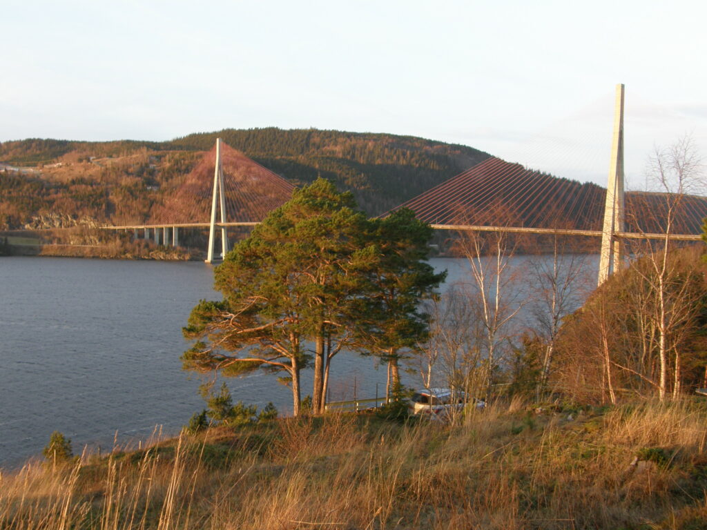
Mosvik and Framverran are joined to Utøy by a large bridge which is over a kilometer in length. The bridge spans Skarnsund which is a very deep trench between the mountains on either side. The trench is over 100 meters deep and is considered a good area for cold-water corals. It is a protected area from 2020.
Skarnsund Bridge, picture taken 2 January 2016. This bridge was built in 1991.
If you look at the map again, you will see there is one last area of the municipality, Røra, which is connected to Straumen by a bridge. Røra is where Inderøy has its one train station.
Straumbrua joins Straumen and Røra. I was standing on the Røra side when taking this picture. This bridge was built in 1958 and improved in 1987. There is a very strong current under the bridge when the tide is going in or coming out. At the time this picture was taken, the tide was going in, in other words going from left to right under the bridge.
Sandvollan and Røra were their own municipalities until 1962 when they were joined with Inderøy.
Straumen is the administrative center for the municipality and is also the area which has the shops, the bank, the junior high school, the senior high school, the city hall and the medical center. In recent years there have been a considerable number of apartments built in this area.
As Inderøy is an agricultural municipality, there are a lot of farms and open areas between the subdivisions. There is also some forested areas, particularly in Mosvik. So though I mention specific areas of the municipality, there will also be smaller neighborhoods, such as Småland or Venneshamn. Some of these areas will have their own store, but not all of them do.
At the moment, there are just under 7000 residents in Inderøy. If you want to read more about Inderøy, you could read here in English or here in Norwegian.
One of the reasons I decided to write this short article is that the Inderøy Walks for 2021 began yesterday. There are 42 walks where one gets points when one comes to a check-in place. Some give 10 points, many give 20 or 30 points depending on difficulty and length of walk. The most difficult walks give 40 or 50 points. I don’t do all of the walks any more, but I plan to write blog articles about the ones that I do. I thought it might be interesting for my readers (those who do not live locally) to have a better understanding of the different areas that these walks are in.
This year the list of the walks has been divided into these areas: Mosvik, 6 walks; Framverran, 5 walks; Kjerknesvågen, 5 walks; Utøy, 8 walks; Straumen, 7 walks; Sandvollan, 4 walks and Røra, 7 walks. Most of the walks are away from where people live, so you will be able to see some of the different types of landscapes we have in Inderøy.
On Sunday the second of May, my husband, my son and I went for our first walk of the season in the hills of Røra in Inderøy. As these lie at a higher elevation than we live at, there could still be snow, if we unlucky. It is a half hour drive to the parking area there and on our way it was snowing, sleeting and hailing. Not very good weather, but we decided to continue driving as it looked better where we were heading. The temperature was above zero so there shouldn’t be any particular build up of snow.
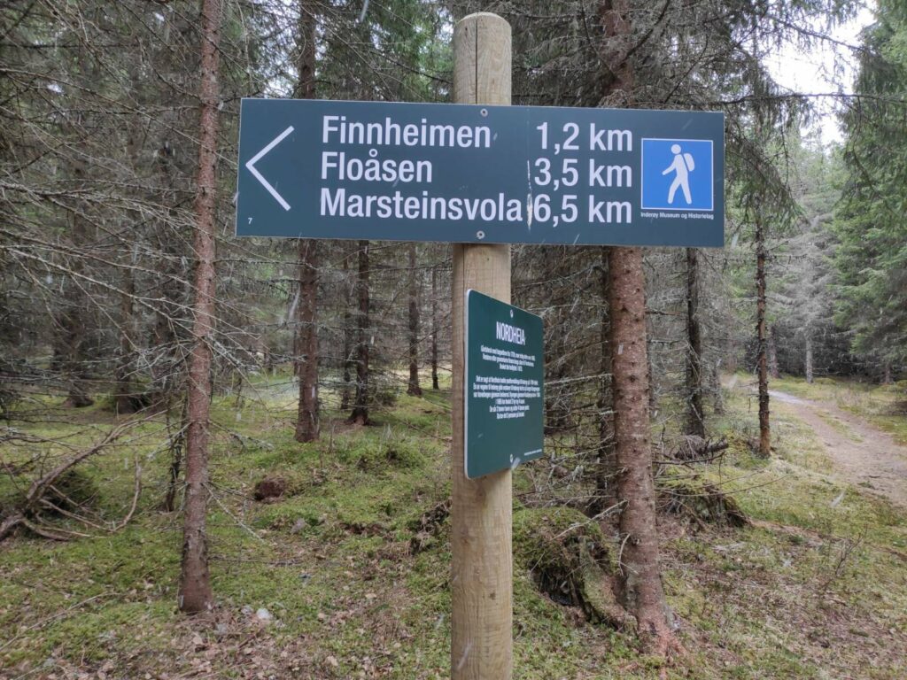
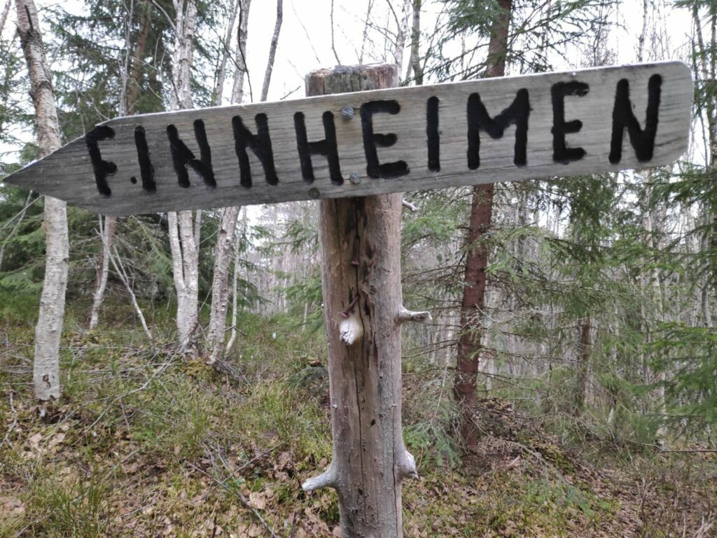
There was a map at the parking area at the beginning of the walk. The red lines are the paths. We are parked near the red dot at “1” and are going to walk to the northern end of a lake called Leklemvatnet, to a place called Finnheimen.
We are going to follow part of the old king’s highway (Gamle Kongeveg), then take off to the east. The trails we are following are well marked, plus I have taken many walks here and learned a bit about the area. It is always wise to have copy of the map on one’s telephone in case one needs to find out where a particular trail goes to and where it meets up with other trails. There was one time my husband and I were out walking and wondered if we could take a different way back to the car, but were unsure if we could take a circle route. We took the safe way back, the way we had come, but found out that we had parked right beside the map and should have had a picture with us so we could check things out when out in the terrain. Yes, we could have taken that other path and gotten back to the car by a different route.
One of the advantages of having a smart phone is how it can used in addition to using it as a phone (which I almost never use). When out walking, I have a map on my phone that will tell me where I am using the GPS system. I’ve always liked maps and learned to read them as a Girl Guide in my teens. Now, the map on my phone will also tell me exactly where I am in relation to what is on the map and show me the direction I am going in. One needs to be aware that one can loose coverage, especially in heavily forested areas or deep ravines. The other use of my phone/device is the camera, which for me is its main use. It is important to make sure one’s phone is charged up before leaving home or suddenly one can be out of battery and no map or camera available.
I’m going to divide this blog up into several sections: the trail, the signs, some history of the area and Finnheimen on the lake.
The trail
The trail is about 2 km in one direction and we followed the same trail back to the car. Most of the trail is in the woods and there are a couple of steep climbs so that one gets good exercise.
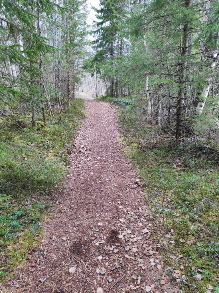
The first section of the trail is wide and easy to walk along, even two abreast.
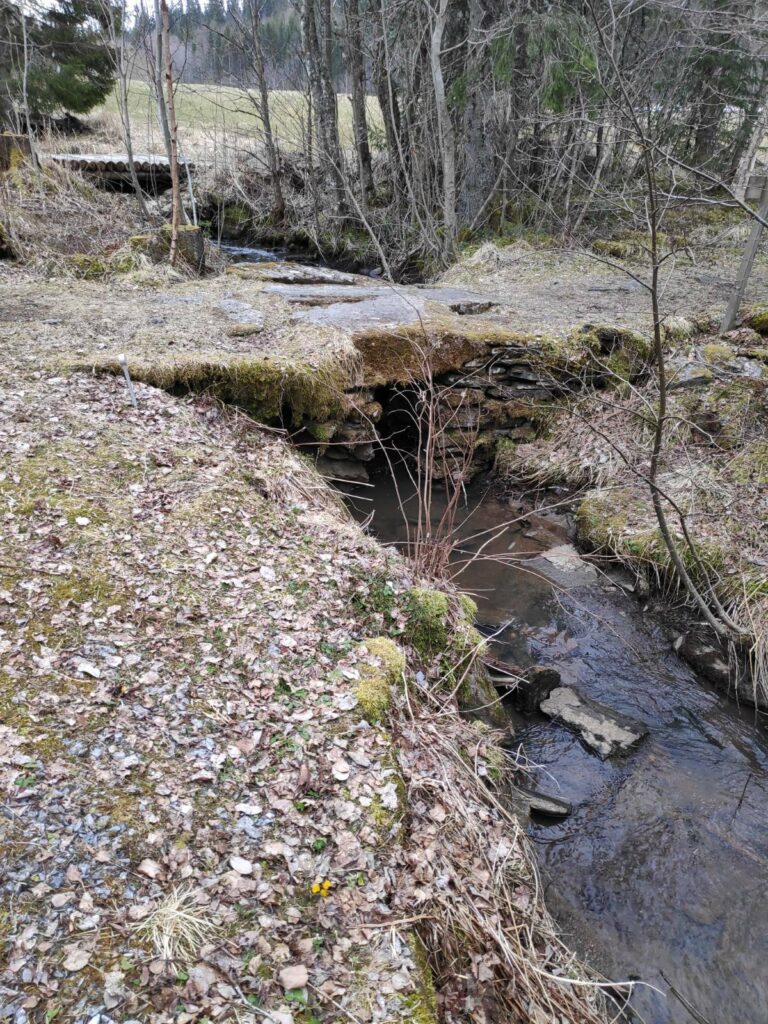
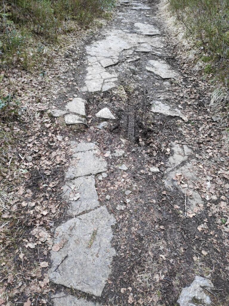
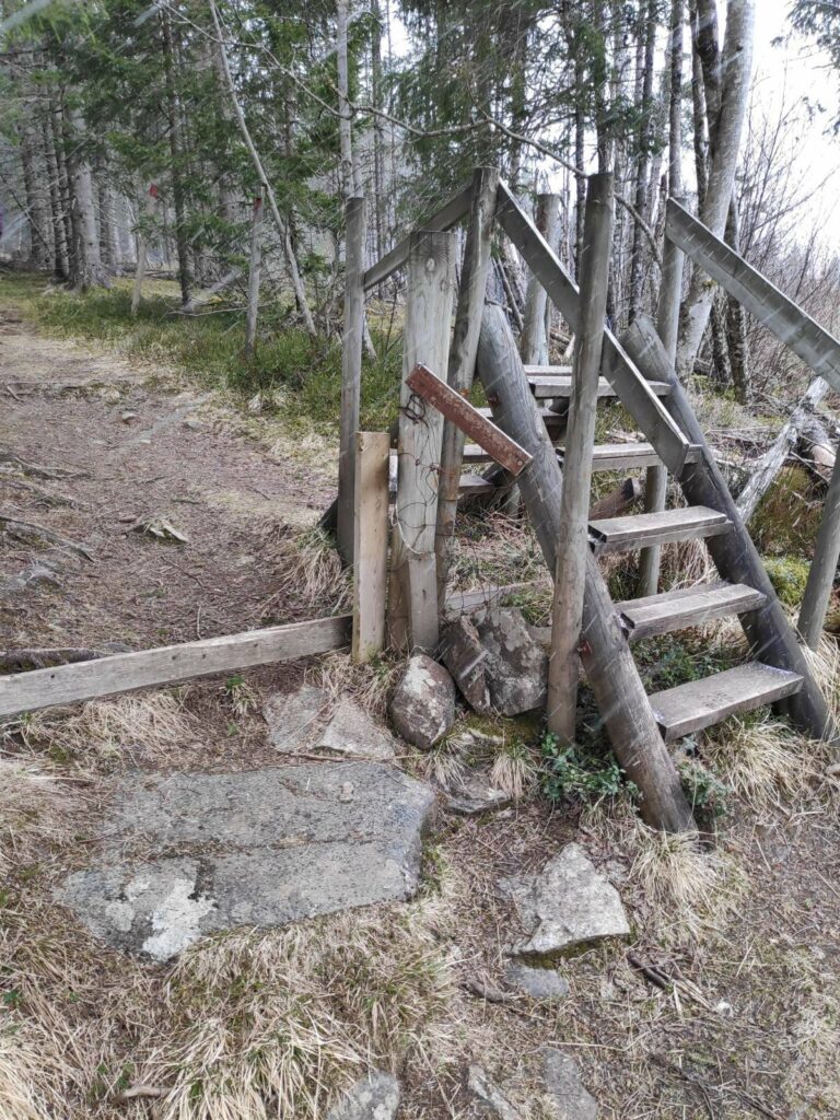
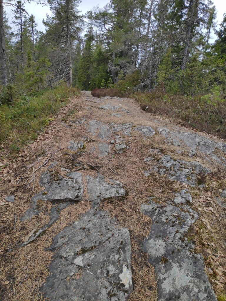
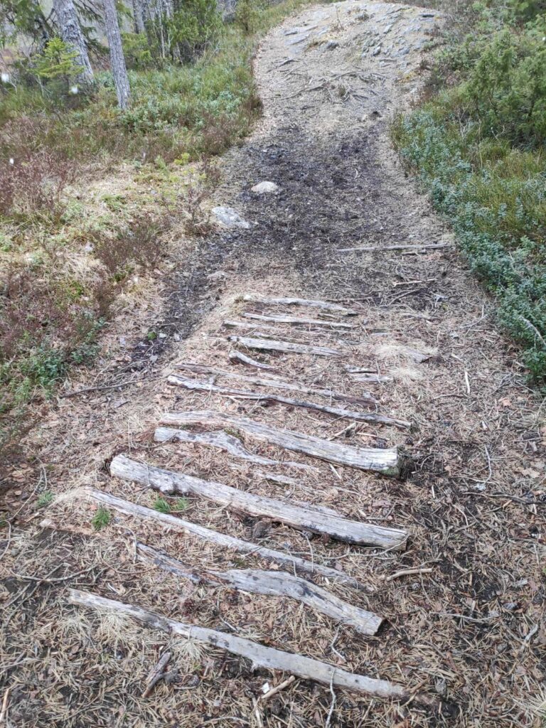
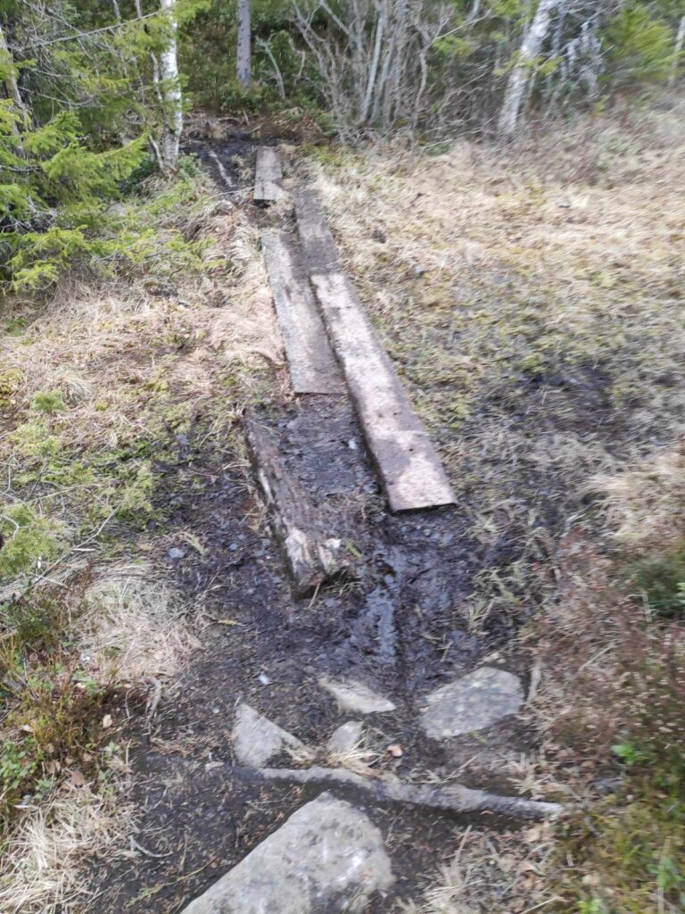
Here the path crossed a stream and the bridge was very large stone slabs on top of a stone foundation. In the background you can see a log bridge for tractors to get into the fields in the background.Some parts of the trail are a combination of mud and solid rock. This is part of the king’s highway, so wide enough to drive a carriage on it.In the summer time there are sheep out on one side of this fence, so a stile has been built so that walkers don’t have to open the gate and thus leave it open. Today there were no sheep out yet, so the gate had been left open.Here the trail was more rock than mud. We have now turned off the king’s highway and are on a different trail.But in between the rocky parts of the trail, logs had been put in the muddy bits. It wasn’t very wet while we were walking today, but it could be quite muddy here when it had been raining a lot.Here it was still muddy as there are swamps on either side of the trail here. Heavy planks have been used to keep walkers out of the mud.
The signs, old and new
Along this trail there are several different types of signs. First of all there are signs telling you what is in a particular direction and how far it is to walk there. I figure that I walk maximum 4 km an hour on relatively easy trails. So 2 km may take 30 to 40 minutes if the trail is a bit uneven.
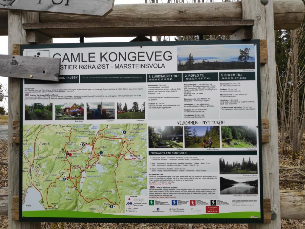
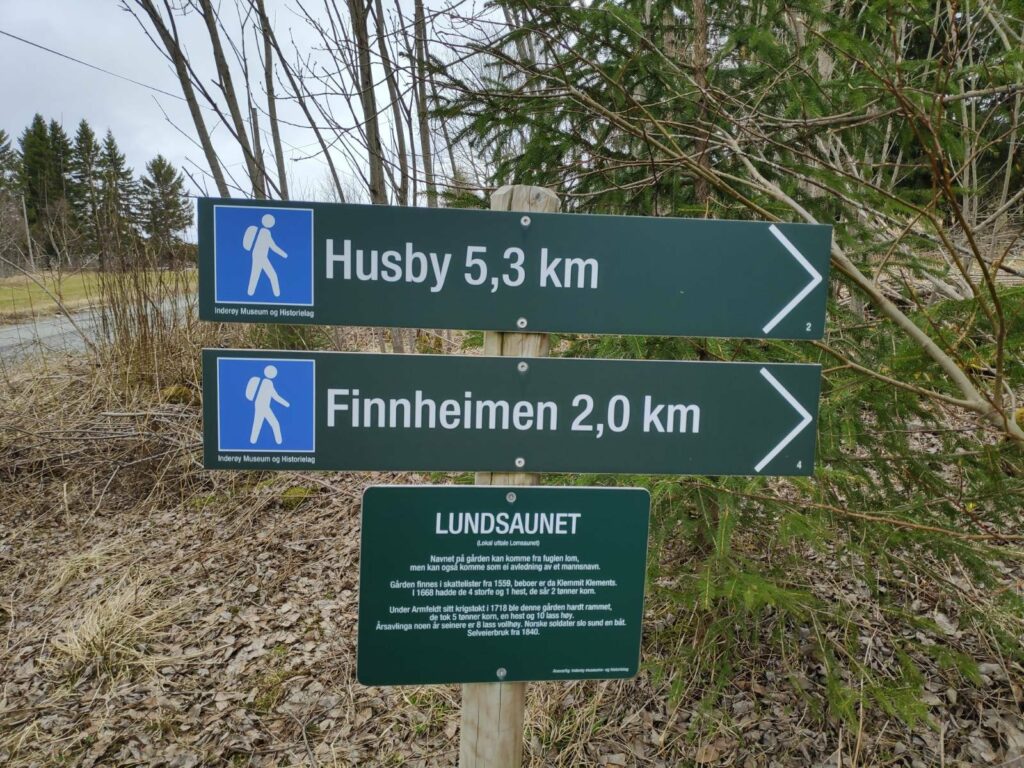
The other type of sign gives information about the location one is standing in. All these new signs have been sponsored by the Inderøy Museum and History Association.
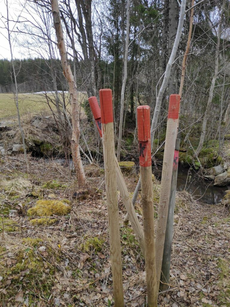
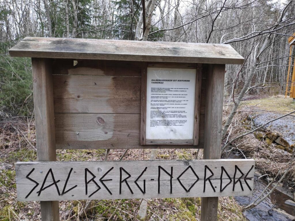
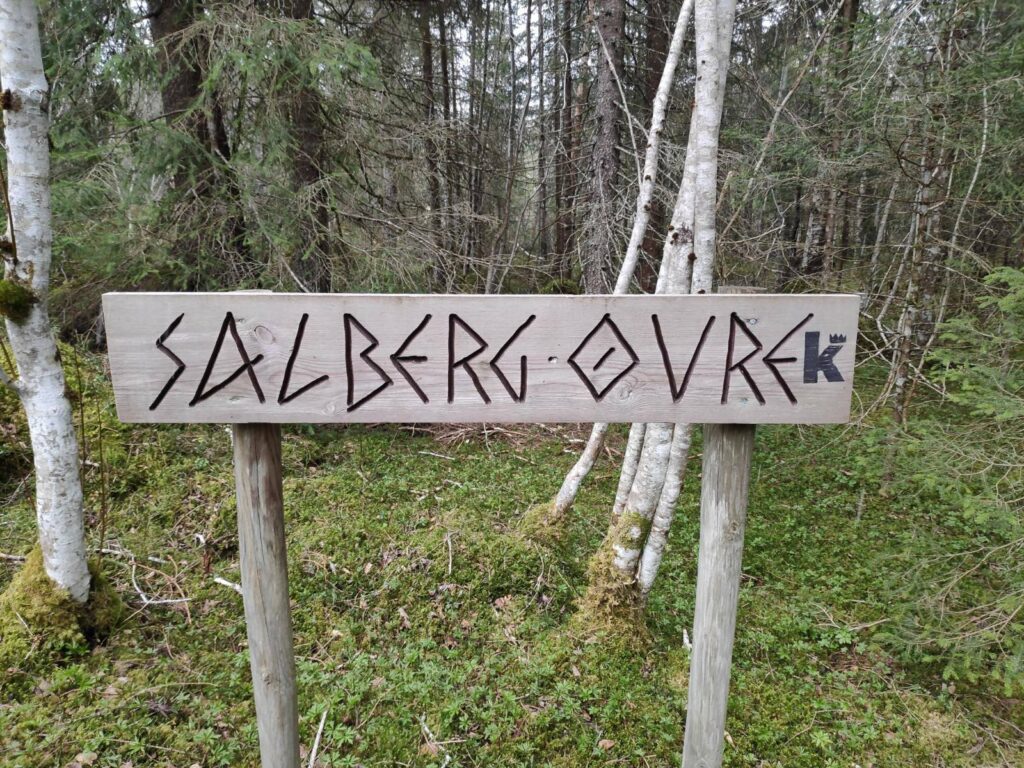
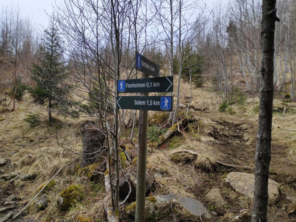
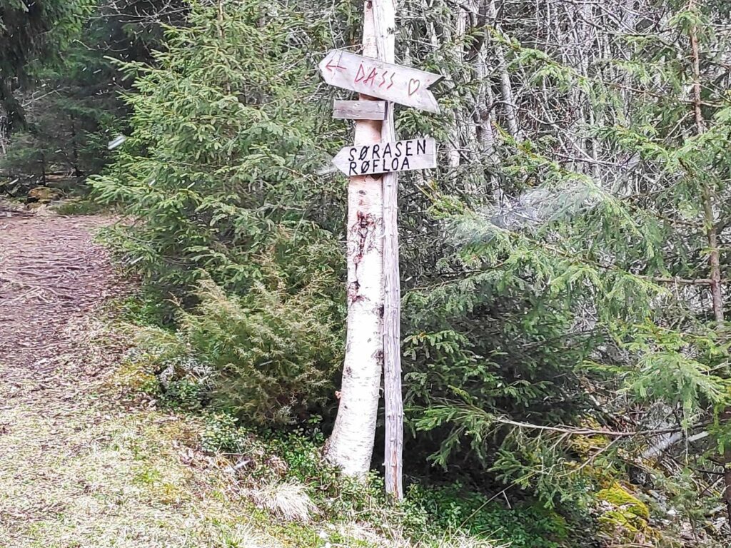
These signs are all at the parking area. and there are signs both to tell one the direction to walk in and information about the place one is at. We are starting from Lundsaunet and heading to Finnheimen, a walk of about 2 km through the woods. Lundsaunet has been a farm since at least 1559, so this area has been settled for at least 500 years.These posts have been used to mark the route. The “K” indicates that it is the king’s highway. The red paint makes the posts stand out, at all seasons. In the winter when snow covered the trail it would be quite important there there were posts that stuck up above the trail so one could see where it went.Salberg Nordre – the north farm at Salberg. This is beside a stream and the information is about the stream which drains the lake which is used for drinking water for Inderøy. In the past the stream has been used for running a sawmill, and once a train line went past farther downhill, the water was used for the steam locomotives.Upper Salberg on the king’s highway.We turn off the king’s highway at this point. You can see the king’s highway to the right and we headed off to the left. There are other places to walk to if you want a much longer walk.An older sign, no longer in use.We are almost there, only 100 meters to go. We have come down the very rough trail this is just to the right of the signs. Note that this is a blue trail, not so difficult, but can be over uneven terrain.Again, older signs. The important one for me was “Dass” with a heart – a toilet. The symbol for toilets in Norway is often a heart, whether it is an outdoor pit stop or an indoor flushing toilet.
History
I have looked at a bit of the history of “kongeveger” (king’s highways) in Norway (source) and it seems that they were built between 1660 and 1814, when Norway was ruled by the Danish kings. Primarily they indicate the main routes from various parts of the country to the city of Christiania (now Oslo). However, this area here is north of Trondheim and thus on the main route from Trondheim to the north of the country. The king’s highways were part of an improvement in the ability of people, especially the king’s employees, to get around the country and these roads would be use for driving carriages on or for sleds in the winter.
With its long coastline, much of the travel between parts of Norway would have been by boat. Therefore this road that we are following on this walk, is much higher than at sea level. There are indications from the information signs along the walk that this would also have been a post road.
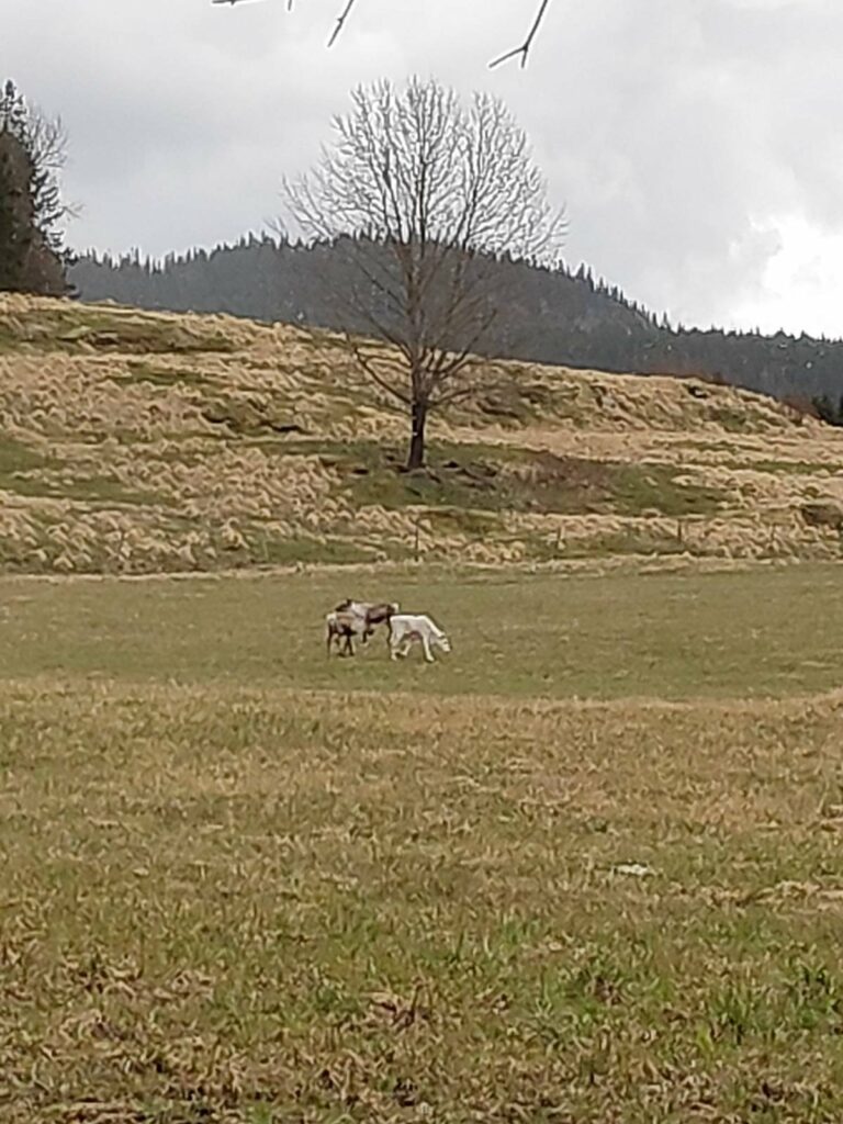
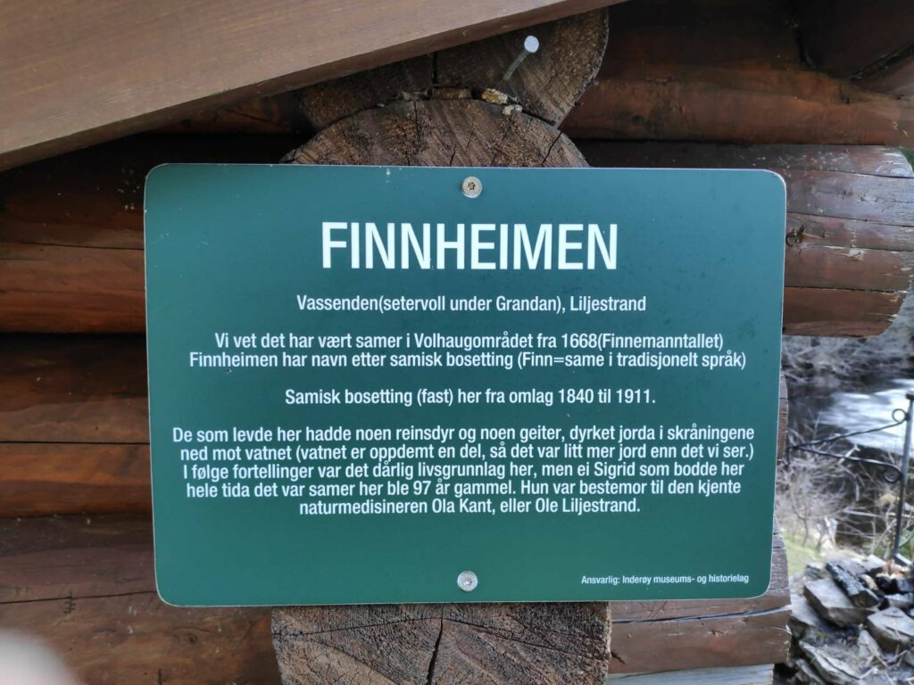
Traditionally, the people who kept reindeer in Norway were often called “Finns”, so the name “Finnheimen” (the home of the Finn) would refer to someone who herded reindeer.
They were in the distance and hard to get a clear picture, but these three animals were reindeer, one of them being all white.
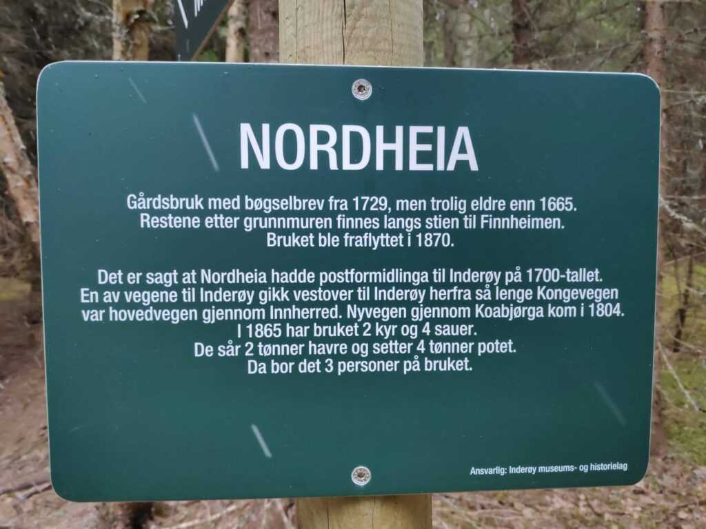
This house was built in 1902 near the mill on the stream. It was later moved to near the train station but was returned to its original location in 2005. It is called “Kvennstu – Eva Moestu”. Its last resident was Eva Moe. Today it is used for meetings and cultural events.Nordheia – This has been a farm from before 1665. The remains of the foundation can be seen along the trail to Finnheimen. The farm was abandoned in 1870. It is said that there was a post house here in the 1700s, serving Inderøy. One of the roads to Inderøy went westwards from here when the king’s highway was the main road through this area (Innherred). The new road at Koa (i.e. near sea level) came in 1804. In 1865, Nordheia had 2 cows and 4 sheep. They sowed 2 barrels of oats and 4 barrels of potatoes. There were three people living on the farm.
Finnheimen and Leklemsvatnet
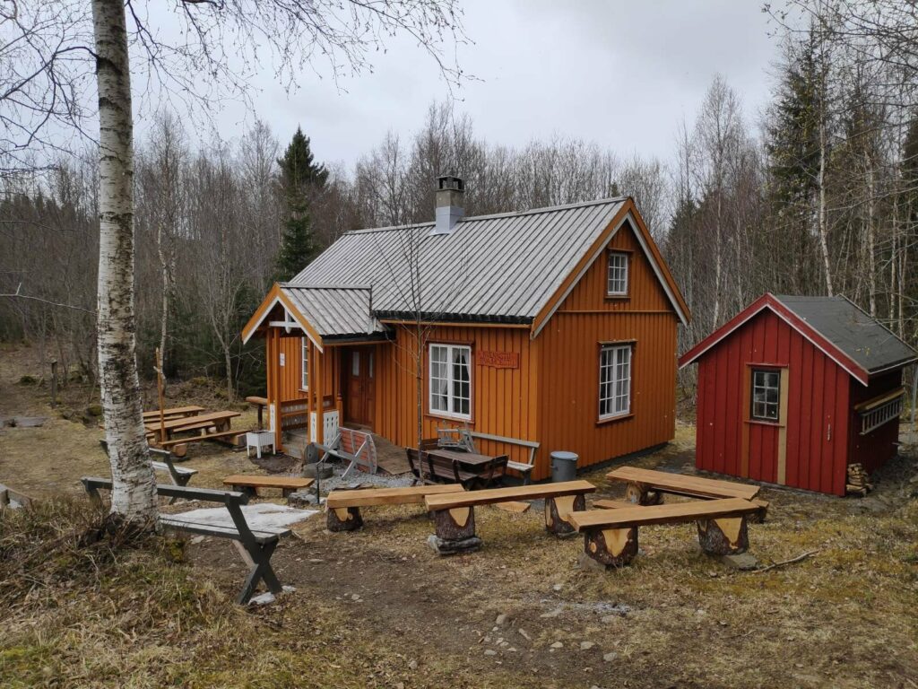
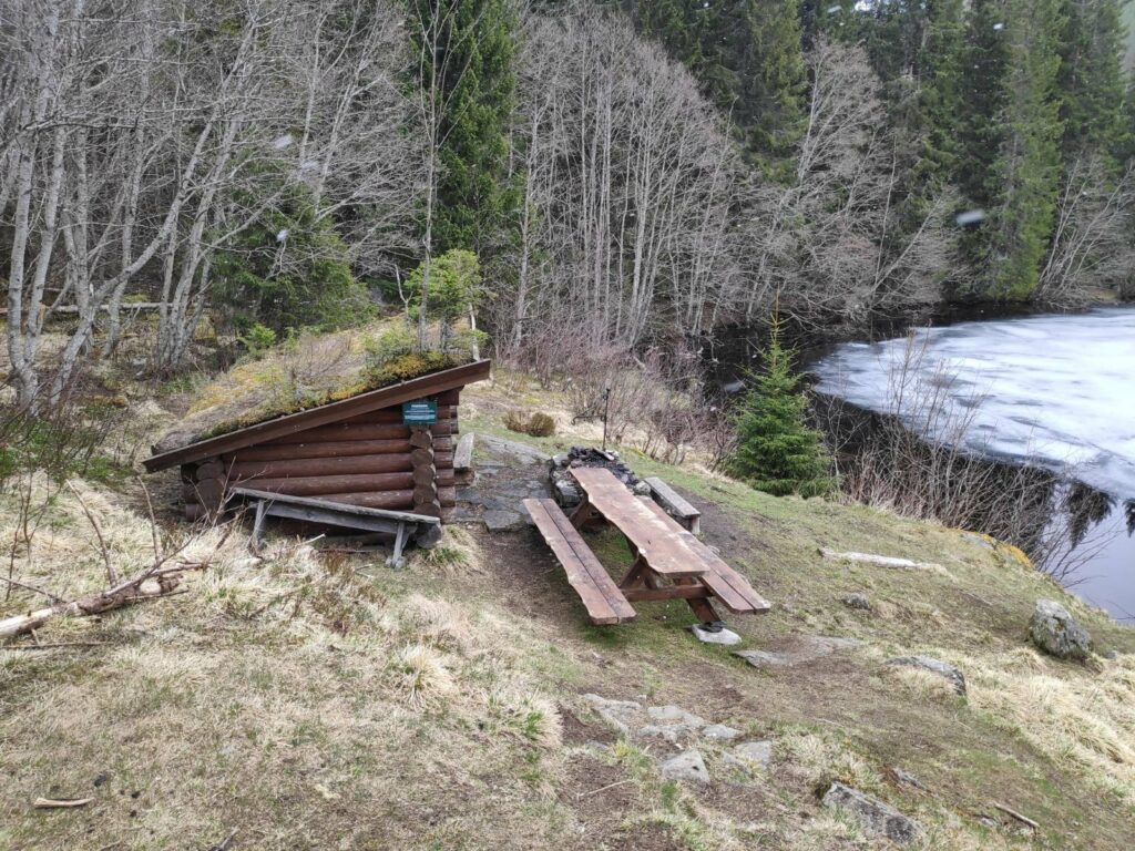
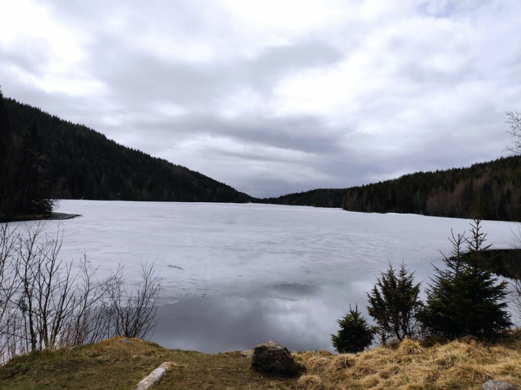
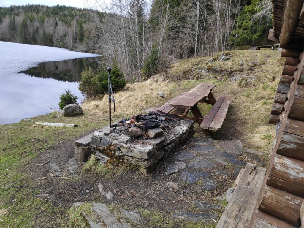
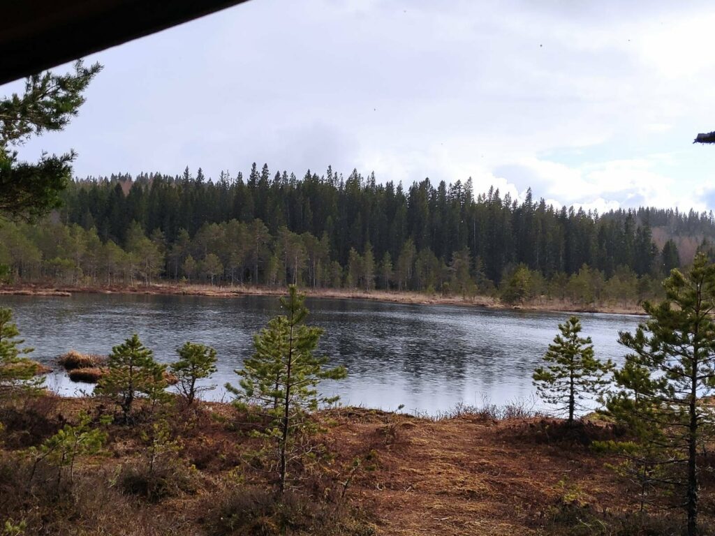
The end of the lake. We know there have been Sami in this area from 1668. There were Sami living here from 1840 to 1911. The people who lived here had some reindeer and some goats, and cultivated the land on the slope down to the lake. The lake is now dammed at the far end so there would have been more cultivated land in the past when the level of the water would have been lower.The goal of our walk – Finnheimen. With a small shelter, picnic tables and a grill place, close to the edge of the lake.Leklems Lake, which is located partly in Inderøy and partly in Verdal. The far end is dammed and I understand that the lake is a secondary water reserve for Verdal. My estimate is that the lake is about 1.5 kilometers long and perhaps 200 meters at its widest. It was still partly frozen on our visit.It is possible to grill food here.Firewood is available and the usual box with a book inside in which to write your name. These books have been less used during the pandemic.
As we walked back to the car, the weather had improved slightly. There was a view over Inderøy with the fjord in the distance.
Yesterday, after a shopping trip to Steinkjer, my husband and I decided to go to a small lake that we like. There is a parking lot, which was empty, and it is a relatively short walk to the lake, about half a kilometer.
The path to the lake is wide enough for two or three to walk abreast and suitable for either wheelchair users or people pushing baby buggies or strollers.
The path to the lake is wide, mostly gravelled and suitable for wheelchairs or baby buggies.
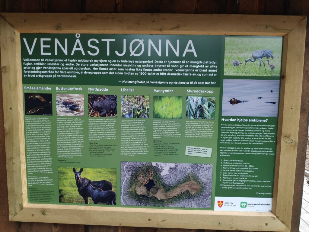
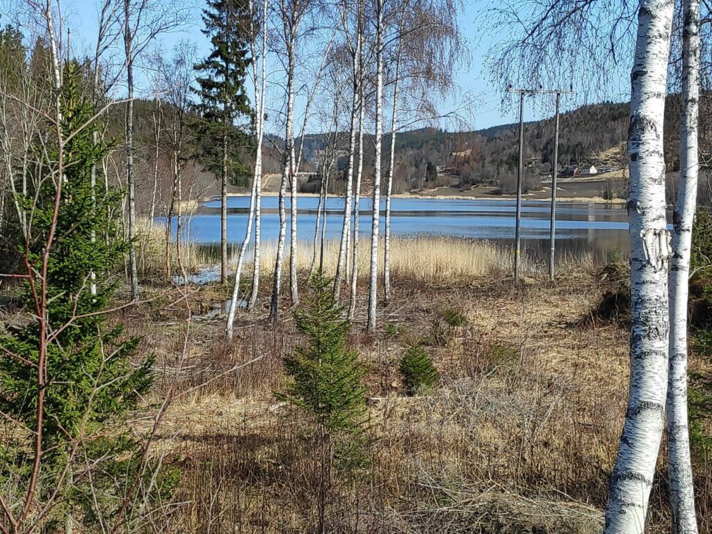
The name of the lake, Venåstjønna, is composed of two Norwegian words. The first word, Venås, is the name of the farm near the lake. The second word, tjønna, means the little lake. Usually this is a fairly small, shallow lake or pond, with very swampy ground around it.
As we got close to the lake, we could see the buildings that have been erected. We were still in the shelter of the trees here, and I didn’t realize at first how much it had started to rain.
Venåstjønna in the rain
The sign about the lake shows some of the more interesting types of animals and plants found her, including salamanders, frogs, and toads. At the bottom center of the sign is an aerial view of the lake which shows how much is water and how much is swampland around it.
As we approached the lake, it started to rain, quite heavily, even though the sun was shining. It was about 6 pm, so the sun was getting lower in the sky and able to shine under the clouds that were raining on us.
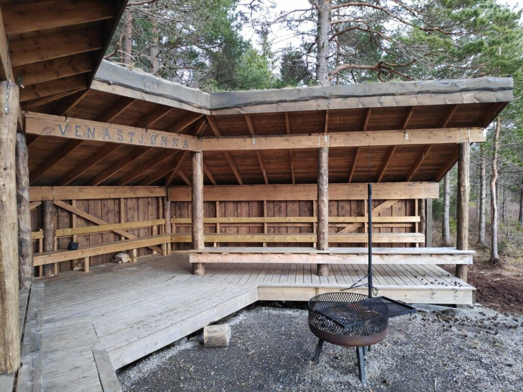
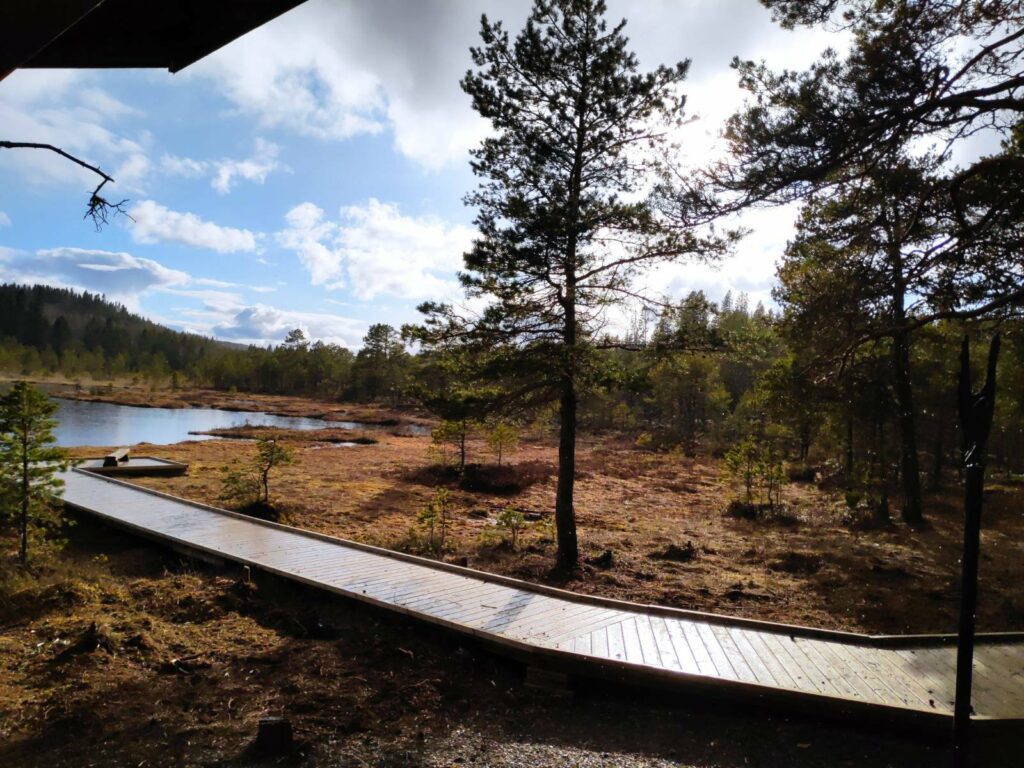
Thankfully, this little wild life area has been developed recently, so there was a place to take shelter. It is very important in swampy areas to limit where people tramp around. It was quite soggy still near the little lake, so the wooden pathway out to the lake is very beneficial to the surrounding area.
Benches to sit on, a roof to protect people from the rain and a place to grill food or cook coffee. This construction has just recently been added to the facilities at the lake.
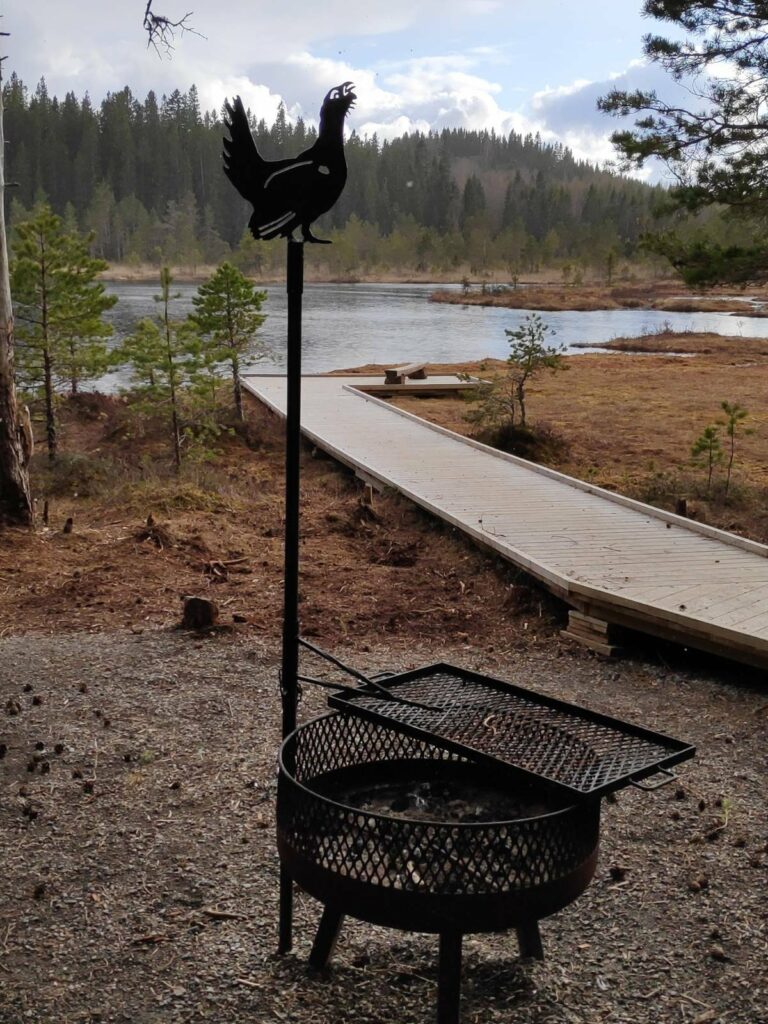
Here you can see the board walk out to the edge of the lake where there is a small bench to sit on while meditating. It was too wet for us to sit out there this time. Note the bird decorating the grill.
Here is the older shelter and grill area.
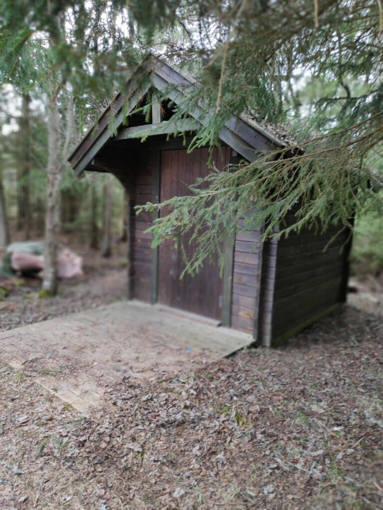
There aren’t many wild areas in Inderøy that offer toilet facilities, but here there was one.
There was even a supply of firewood for those who wanted to grill food.
There are also signs that in previous times there has been peat dug up here. This is quite common in swampy areas in this part of Norway. Today, it was very wet as it has been both raining and snowing in the last month.
Another view of the lake which shows a lot of the swampland around it.
The rain doesn’t show up in the picture, but you can see that the sun is shining as well.
When it isn’t raining, there are quite a few paths in the area around the lake. Some of them looked a bit muddy on this visit. On this trip we just enjoyed spending a few minutes in the peace and quiet of the lake before heading home.
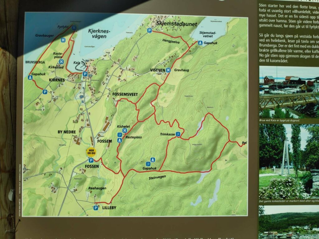
Today was another beautiful sunny day and as it was also a Sunday, we all three went for a walk together. First we drove to Skjemstadaunet where we parked the car near the information board. The walk to the lake is partly through the woods and partly in the open. It is difficult to know how long the walk actually was as I wasn’t watching the time. We perhaps used 20 minutes each way, making the walk about one kilometer.
We took the walk from the P at the top of the map, at Skjemstadaunet, up Hengjaelva to Skjemstad Lake (vatnet = the lake). There are also several other walks available in this area.
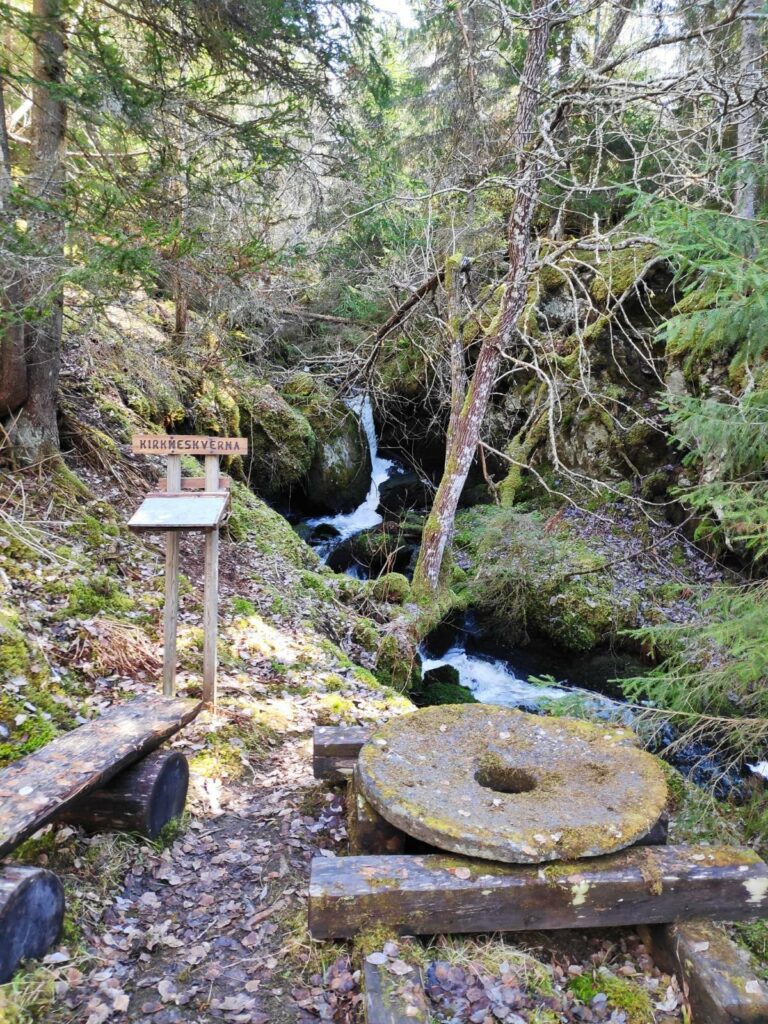
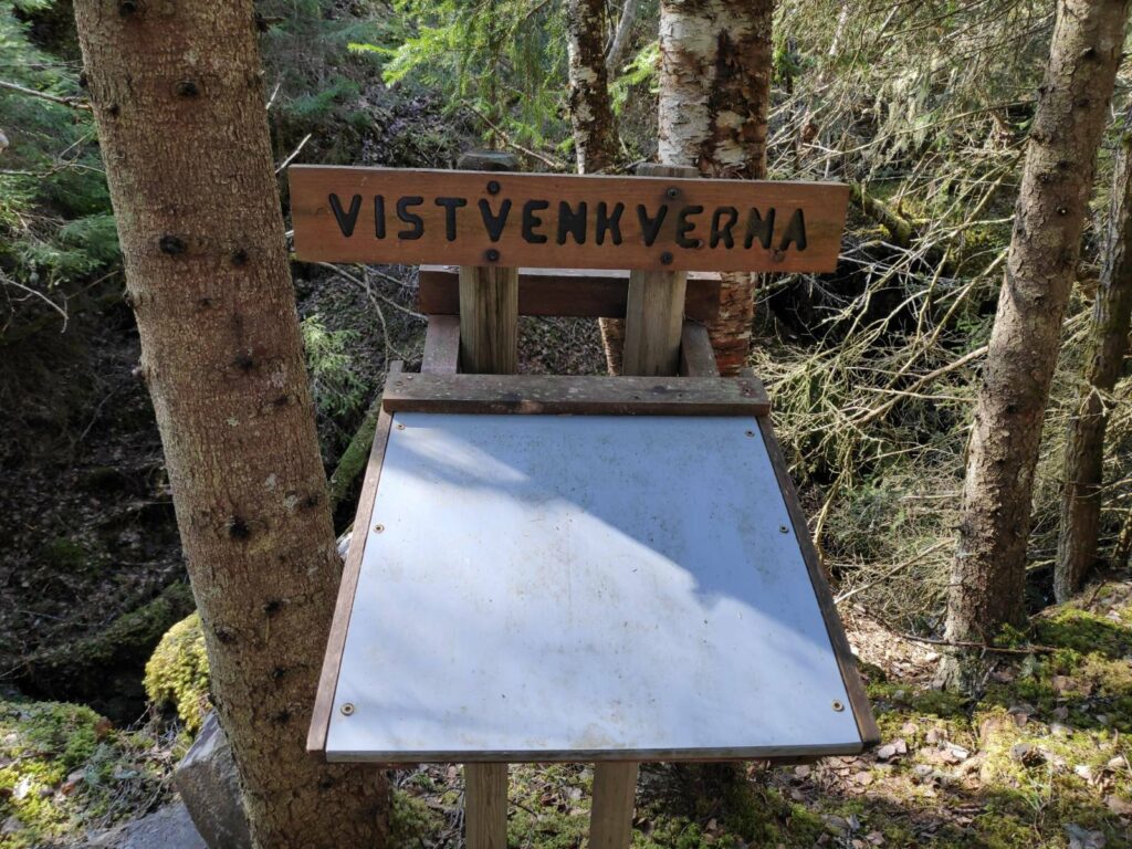
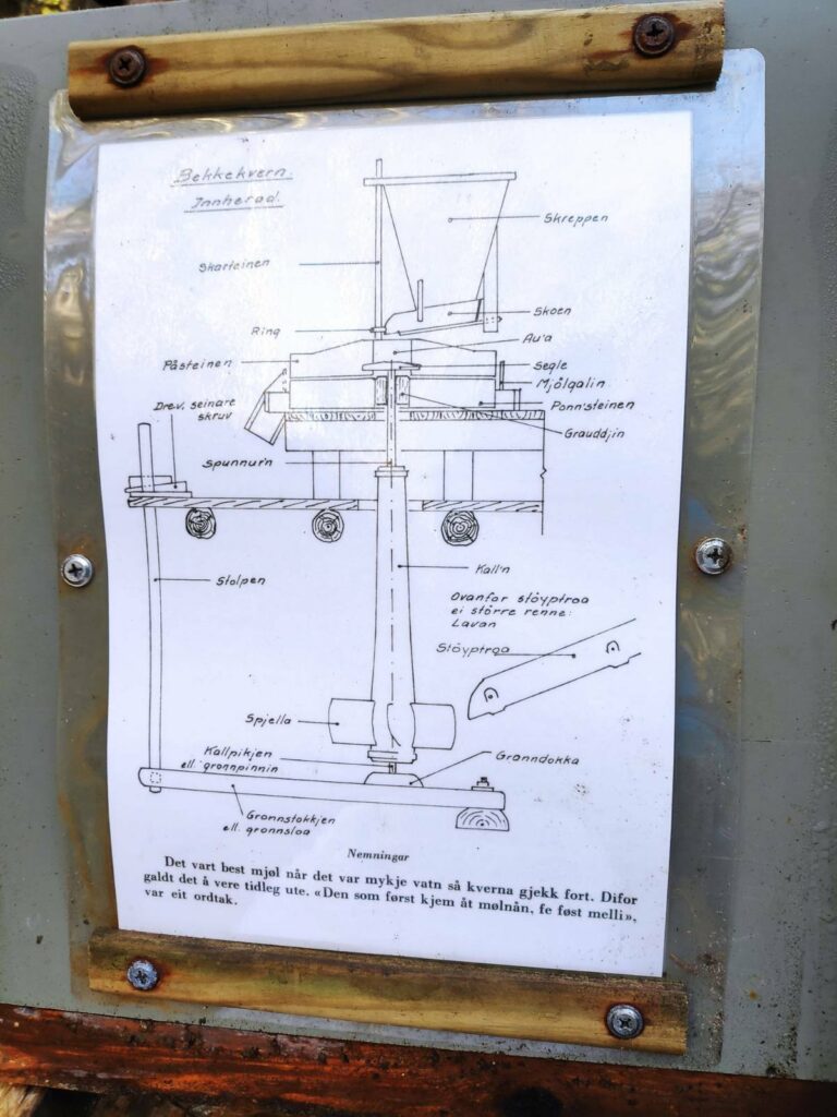
The walk follows the stream that drains the lake. This is a stream that has been used for grinding grain in the past. There were information boards in several place and old grindstones on display as well.
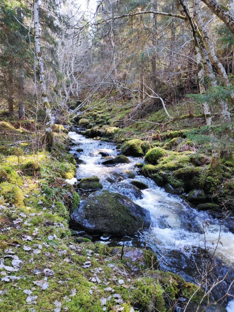
There was a lot of water running downhill and it was quite noisy. It isn’t long since we had the last snowfall, so there is still a lot of meltwater to make its way down to the fjord. Here you can see an old grindstone and an information board.
The stream is not very wide, but it was definitely very noisy today with a lot of water flowing quickly downhill.
“Kverna” means grinding mill. There were at least three locations along the stream with information about the old processes of grinding flour. The information boards close up when not being read so that they are protected from the weather.
At this information board, there was a diagram of how the grinding mill was actually built up. The comment at the bottom says that one would get the best flour when there was a lot of water so that the grindstone went quickly.
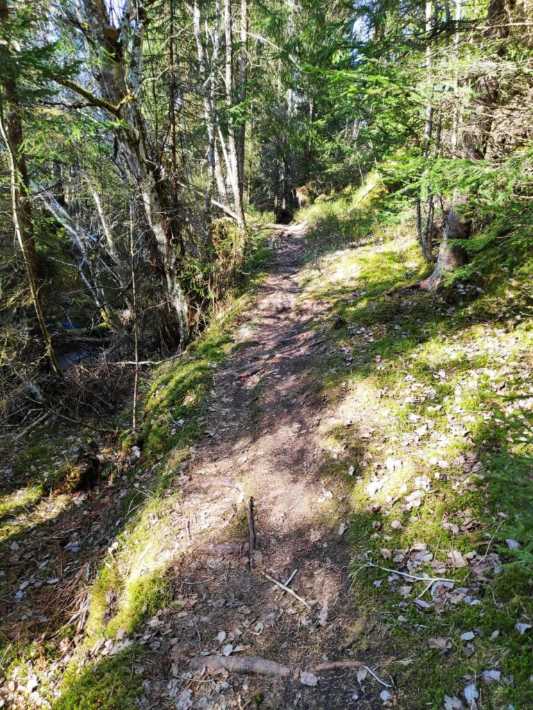
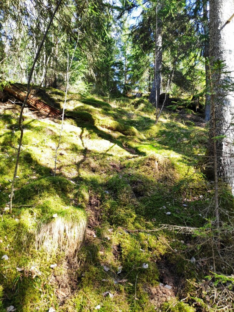
The path we were following was narrow and uneven. In parts it was also quite steep. Being beside a stream it was also quite moist in the air and the moss has been growing well.
The steep, mossy slope on one side of the trail. There were only a few patches of sunlight along this part of the trail, which was also the steep part of the trail.
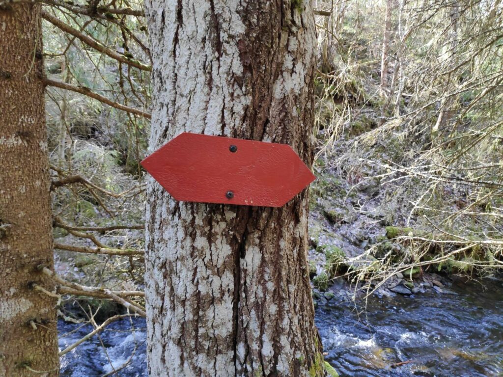
The old-fashioned method of marking trails in Inderøy was using red wooden arrows.
Eventually the slope became less steep and the stream was not flowing so noisily. We are walking up the stream, so going in the opposite direction of the water.
Then we came out into the open, where the forest has been cut back. There was a well-made bridge across the stream.
This picture was taken from the bridge and is looking downstream. At some point in the past, a stone wall has been built across the stream, with an opening that probably could be closed so that water was held at the top until one wanted to use the grinding mill.
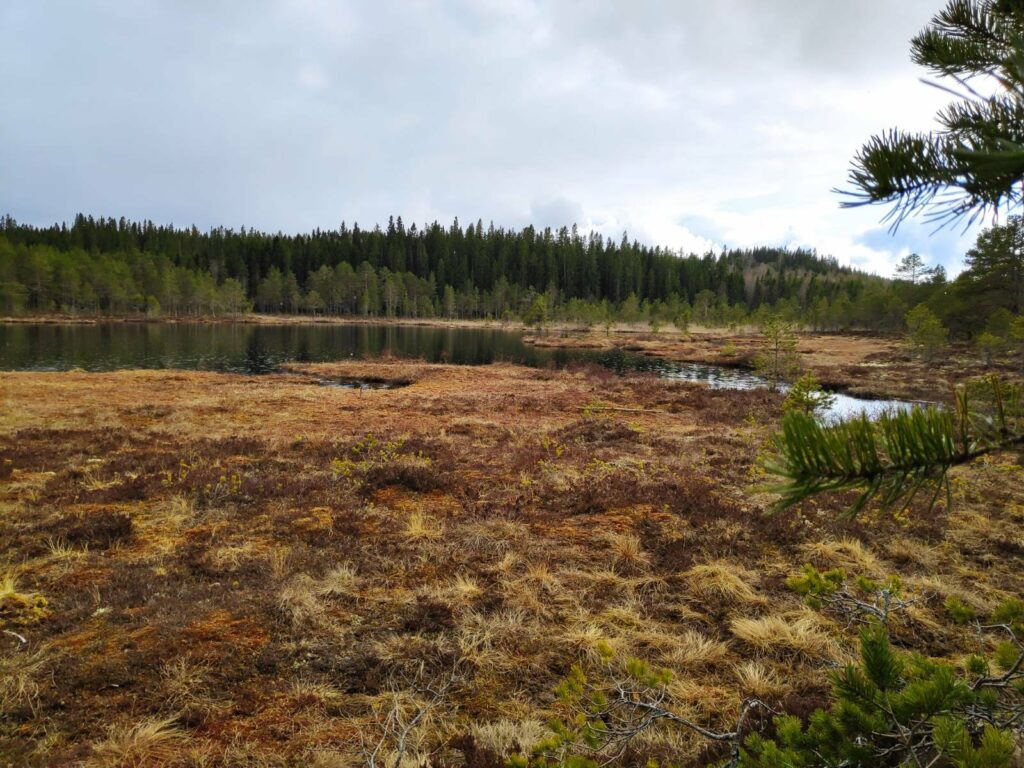
Skjemstad Lake. The area between me and the lake was very wet and mostly part of the stream. The lake is about 800 meters long and 500 meters wide. It was used as a water supply for the area from 1958 to 1996, when the water quality became too poor to be used as drinking water.
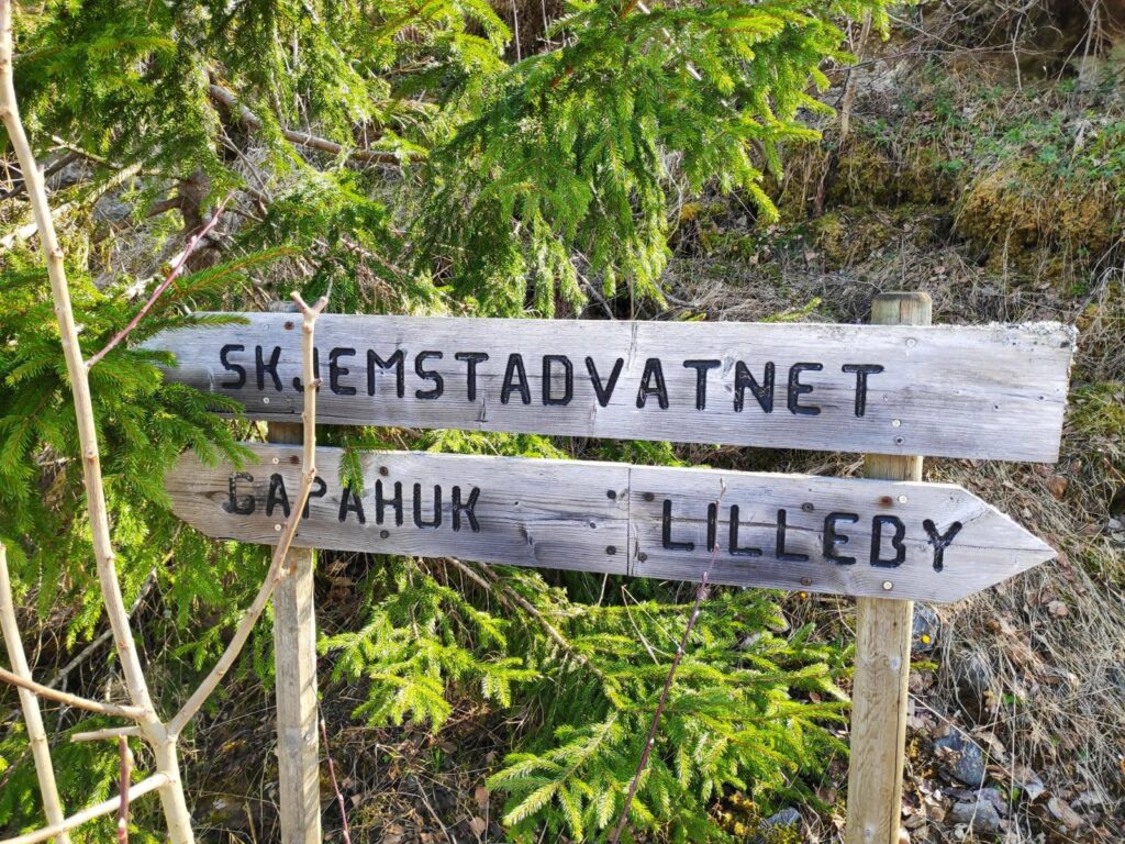
Where do you want to go? Three suggestions are given on these signs. We went left to the gapahuk at Skjemstad Lake.
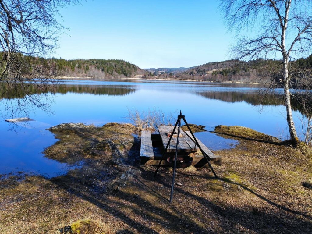
Picnic bench at Skjemstad Lake. The level of the lake is much higher than I have seen before, which explains how much water was racing down the stream. There would normally be considerably more dry area around the picnic table. Note the boat float on the left side of the picture is more under water than actually usable.
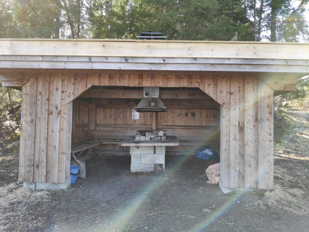
This is what they call a “gapahuk”. There is a roof and three sides, with seating and a place to grill food.
After gazing at the lake for a few minutes, we returned to the car, taking a slightly different route using roads instead of the steep part of the path in the dark woods.
This is a pleasant, though relatively short, walk for a Sunday afternoon. We probably used about 45 minutes for the round trip.
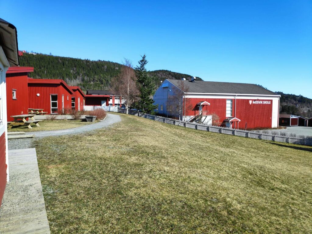
Today was a beautiful sunny day, eventually getting up to over 20 degrees Celsius sitting in the sun. But during the morning, my son and I took a walk in Mosvik, starting at the small boat harbor.
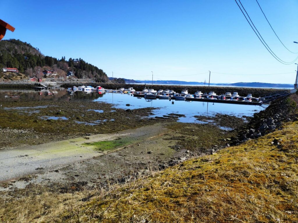
The small boat harbor in Mosvik is very well protected. Today while I was out walking it was very low tide. This was not the time to launch your boat from the ramp that is visible in the lower left of the picture.
There is a very small exit from the boat harbor, which makes the harbor very protected no matter which way the wind is blowing from. However at very low tides, it might be a bit awkward to manoeuvre the boat.
When we first moved to Vangshylla 32 years ago, Mosvik was its own municipality, but in 2012 it became part of Inderøy, having been its own municipality since 1901. There is a school, a kindergarten, a training center, a fuel pump and a food store in the village. It also has a new old-people’s home which was just completed this last winter. The village of Mosvik is 8 km from where we live and so we are there regularly. Today my son and I agreed that we wanted to be primarily in the sunshine so we chose a walk that took us along the fjord, then up into the housing area before heading back to the car.
It was very interesting that we came at a very low tide today, as one can see what is normally covered by water. Low tide this morning was at 9:19 and these pictures were taken between 10:30 and 11:30, so the tide was already coming in.
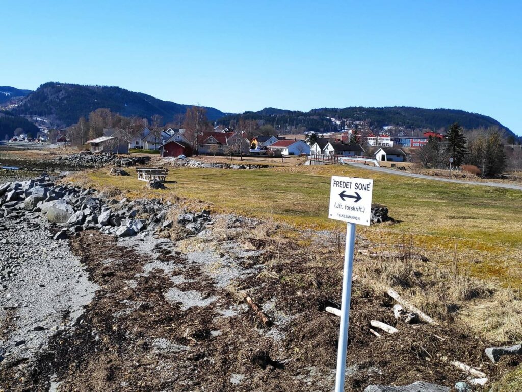
We walked along the water’s edge, past most of the houses that you see in this picture before heading up a slight hill.
Between the road we were walking along and the water, there were several areas with picnic tables and places to be outdoors when the weather was nice.
However, there are restrictions and these areas are not to be used for camping. They are for daytime use only.
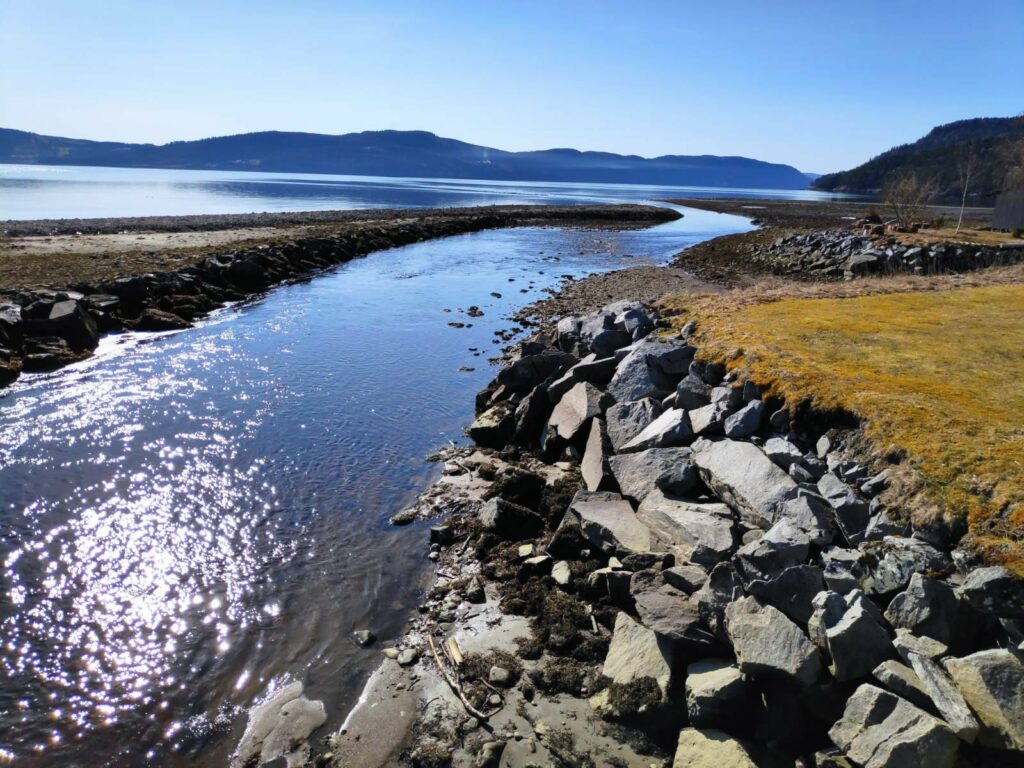
“Fredet sone” = means that this area belongs to the birds. Notice the road that we walked along at the upper right of the picture. It leads to a small bridge over the stream and on to the center of the villlage.
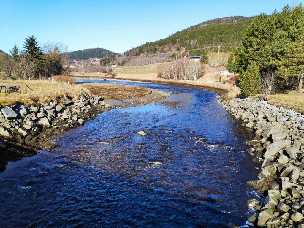
This stream has collected run-off water from the hills and flows out to the sea here. Note that this part of the stream is tidal.
Looking the other way from the same bridge, one can see the channel that the stream has cut for itself. At high tide, the bank on the left would be mostly covered.
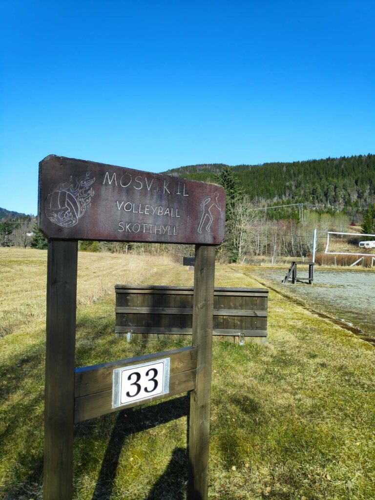
A playing field for sandvolleyball lies beside an area for playing “skothyll”, which is an old throwing game which seems to be most popular in Trøndelag in Norway (this is what the region where we live is called) . Note that the playing field even has been given an address number, 33, so that emergency services can find it on their GPS.
Another picnic area. A local resident that we stopped to chat to said that this was a very popular swimming beach. When the tide comes in over the warmed up sand, the water is very pleasant for swimming in the summer months.
One of the local residents took off just as I was trying to get his picture.
All roads are now named and buildings are given number addresses. This is primarily to aid emergency services finding locations, but it also helps people figure out where they are and how to get where they are going. Having addresses is useful when using GPS systems.
At this point we left the road going along the water and headed up a small hill to the residential area. Traditionally, Mosvik was one large wooded property owned by one family. This large property still exists, but, today, in addition, there are some small farms and a residential and small business area. The farm has beef production, grains and forestry as its main sources of income.
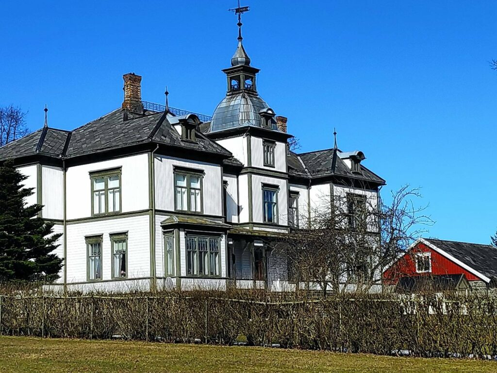
The main farm in Mosvik is called Vinje Bruk, and the owners have a rather large house which was built in the 1890s.
Mosvik Church lies just a few meters from Vinje Bruk and was built in 1884.
From here the walk was downhill, past the school and down to the water again.
The kindergarten is in the left-hand building and the elementary school on the right.
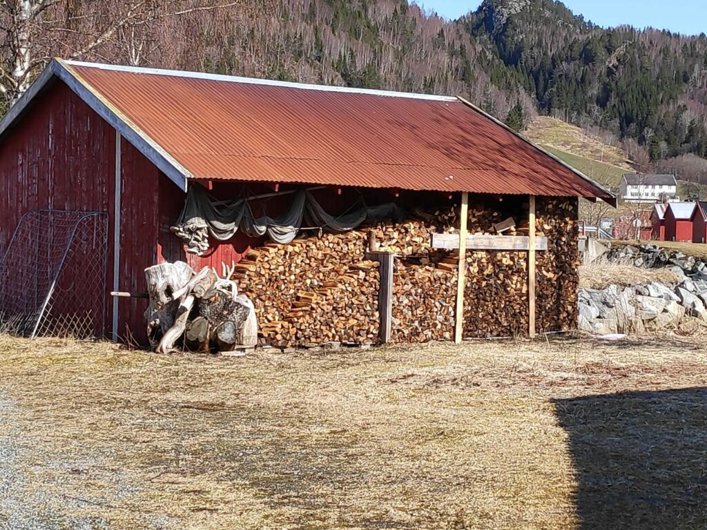
When you turn around and take the same road back again, you see different things. Here there was firewood stacked for drying and for use next winter as well as fishing nets under the eaves.
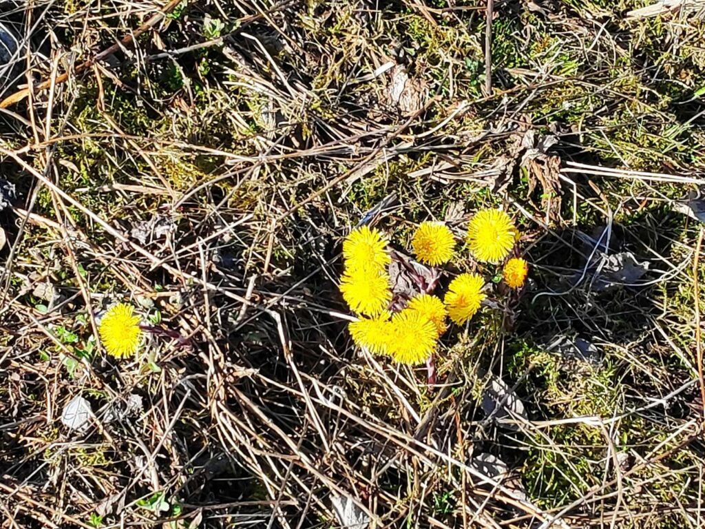
There aren’t many wildflowers blooming yet, but colt’s foot (Tussilago farfara) was everywhere. The sun brings out the bright yellow flowers. This plant has a very large leaf which comes out after the flowers are finished.
The last time I took this walk, I was with a girlfriend and we got soaked in a rain shower. Today it was beautiful. This is a walk I will do again. It takes about an hour to do a circle tour and there are several alternative routes one can take, especially through the residential area.
Today my walking season started and I have decided to resume blogging about some of the walks that I take. I’m not really a writer, but I enjoy taking pictures and sharing them with my readers. Sometimes I take pictures while walking uphill as that gives me a reason to stop on the hill and catch my breath. Other times I see things that I think are very Norwegian, meaning that I did not come across the custom until I moved to Norway, though that doesn’t mean that the custom doesn’t exist elsewhere. I will try to explain why I am including the pictures that I include. I usually take a lot more pictures than end up in the blog. For example, today I took about 40 pictures, using my smart phone and I am sharing 12 of them.
The weather today was grey, meaning that it was cloudy the whole time, but there was no precipitation while I was walking. I had worn a bright yellow rain jacket as it keeps me visible, as well as protecting me from the wind and the rain. The temperature was about 4 degrees Celsius during my walk, so I had several layers on. On this particular walk, there is a 20-25 minute climb uphill at the start, so I warmed up quickly and soon had my sweater off, but I left the jacket on. In the woods, I didn’t notice the wind, but towards the end of the walk when I was out in the open, it was good to have the jacket on to protect me from the wind.
The purpose of the walk was primarily to fill in about an hour and a half while my husband had some things to do in Straumen. We both had appointments at shortly after 1 pm for our Covid-19 vaccine, so I had a deadline as to when to arrive. I got dropped off about 3.5 km from Straumen, then I walked up the hill, perpendicular to the car road, then eventually headed off in the same direction as the car road, then went down the hill just before Straumen. I spent time in the woods, well away from car traffic and other noises. I enjoy walks like that.
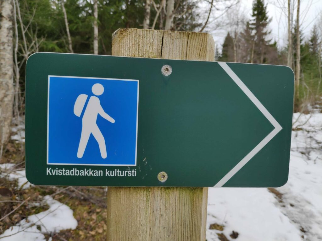
A lot of the trail that I was following is part of the Kvistadbakkan Culture Path. It is labelled as blue difficulty, which means that it is uneven terrain and can be steep in some parts. I would consider it a walk that would give me some serious exercise, but not a difficult trail to follow.
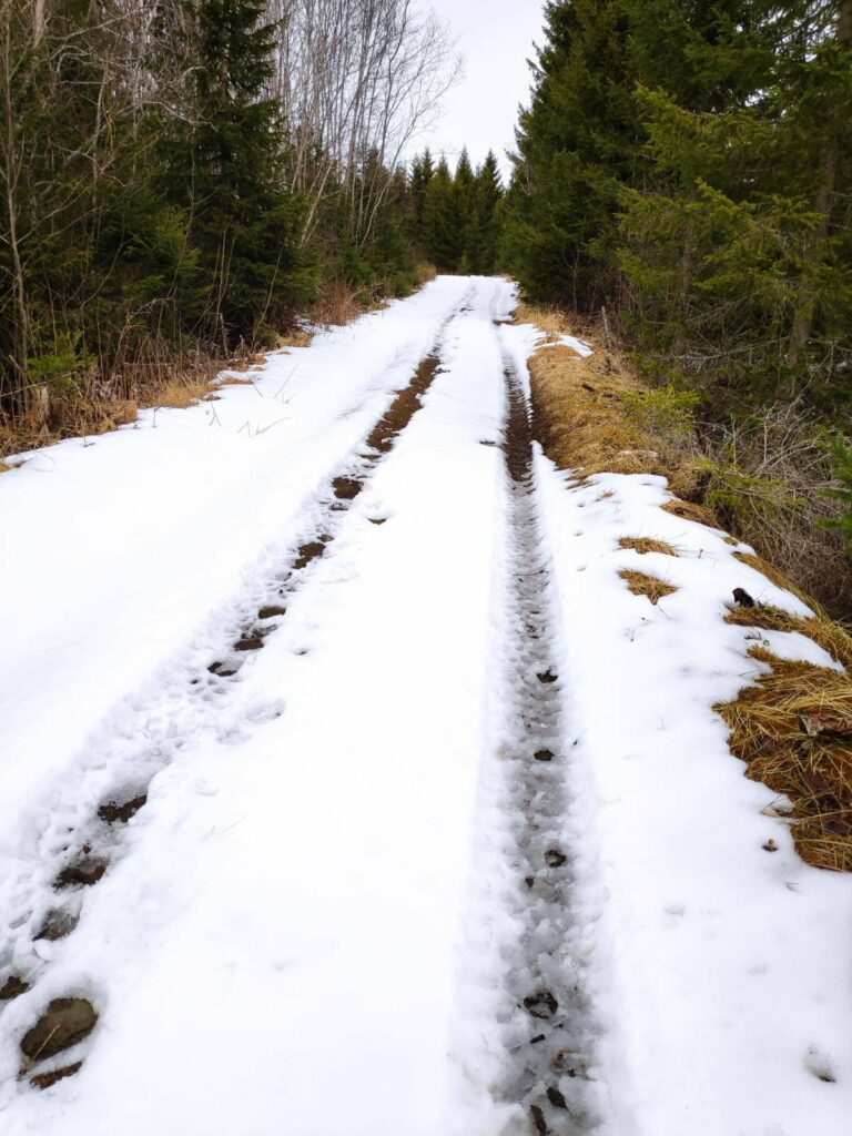
A lot of the trail that I was following was either tractor road or well-used footpath. Last weekend we had received a 20 cm snowfall, so I was prepared for snow on the trail. I have done this route before and was confident in my usage of time as well as knowing where to turn. This is an area with a lot of trails. Many people go for walks here and many will take their dogs for walks here too.
This is what much of the trail looked like today. The recent snowfall has not melted completely in higher areas, but is melting quickly when it is warm enough. Sunshine hastens the melting process, but in the woods, many areas may not get much sunshine. Today there was no sunshine while I was walking.
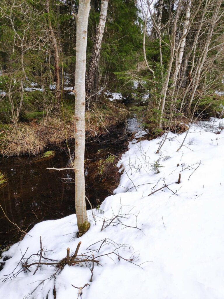
There was a stream along part of the trail and it was busy taking away the melt water.
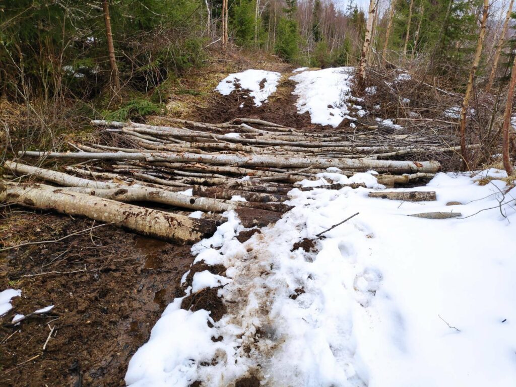
The path got quite muddy in parts and I came across all these trees lying across the tractor road. These had been placed there very deliberately. Underneath is a particularly muddy section where a small stream crosses the road. Putting down trees in this fashion will allow people to cross the muddy area and will also prevent wheeled vehicles, such as tractors or ATVs from sinking into the mud. You can see from the trail on the snow how muddy everyone’s feet had become on this section of the trail.
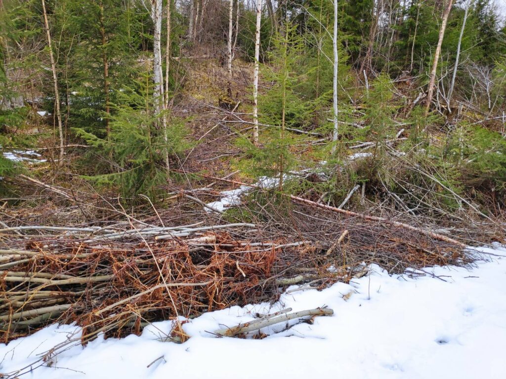
It was also obvious that someone had been at work clearing up along the trail, cutting back the trees that were growing close to the trail. By letting in more light, the trail will dry up more quickly after rain and it also lets the users get a better view.
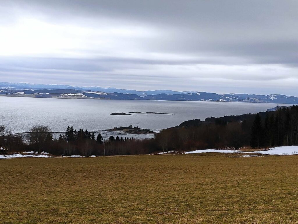
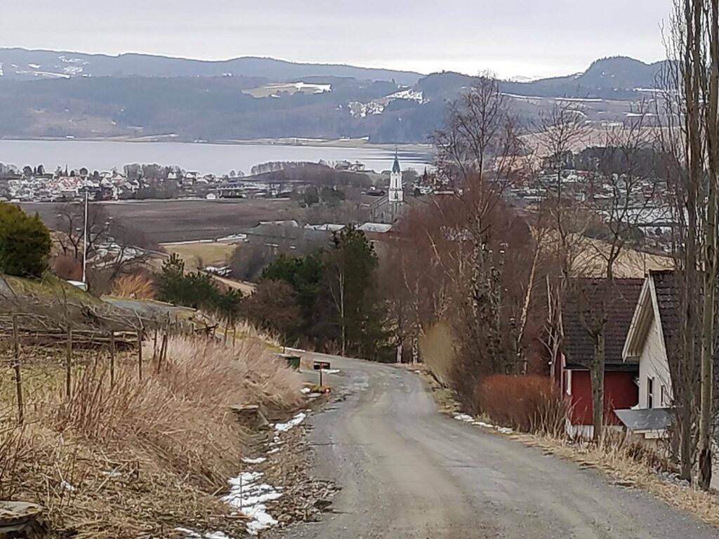
Eventually, I came out into the open again and could see out over Trondheim Fjord. The small islands (Kvamsholmen) are accessible at very low tides, but today the tide was coming in and about three-quarters of the way to high tide. The large island in the background is Ytterøy and in the far distance are the hills of Levanger. The field is mostly bare of snow, but snow is still lying around the edges where not much sun reaches.
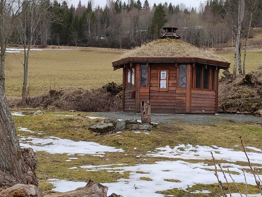
I came along the tractor road at the higher end of the field in this picture and saw this small construction and made my way to it. It was called a Grill Cabin. I do not remember seeing it before, so I presume it was constructed last summer.
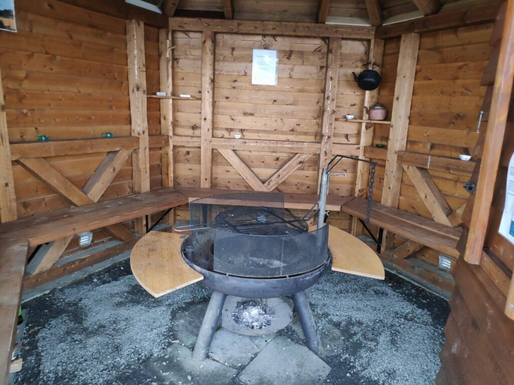
Inside there was seating around five of the six sides of the little cabin, and in the center there was a place to light a fire and grill food. I took the chance to sit down for a few minutes and eat the sandwich that I had brought with me.
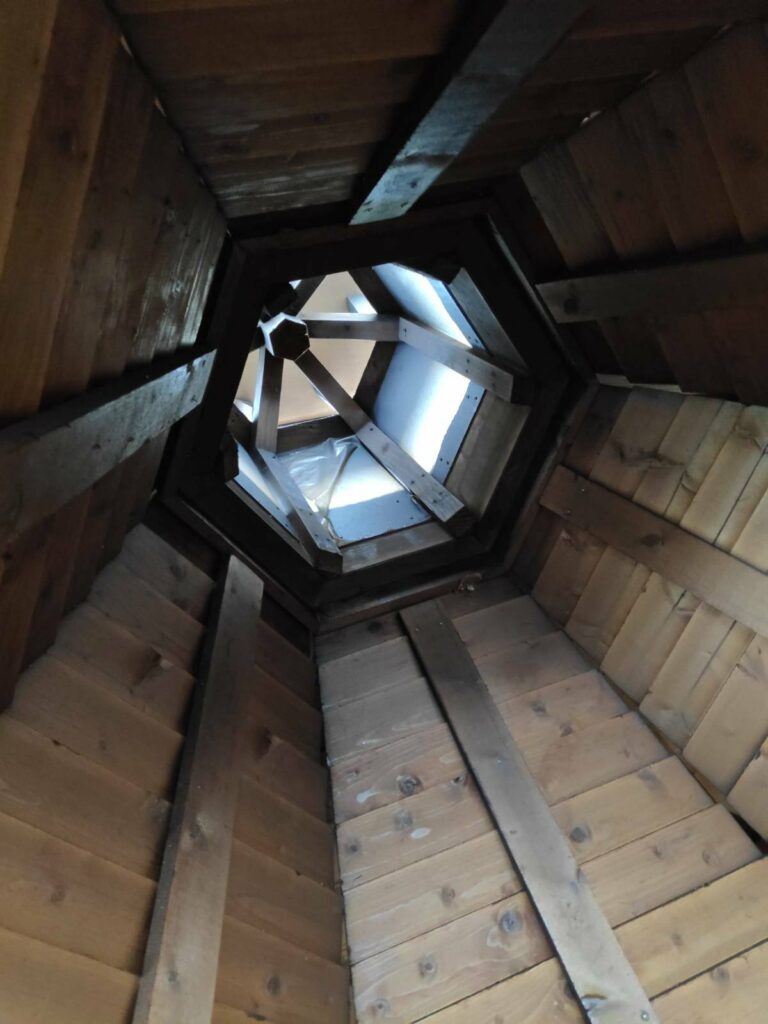
The ceiling has been built so that the smoke from the fire can get out.
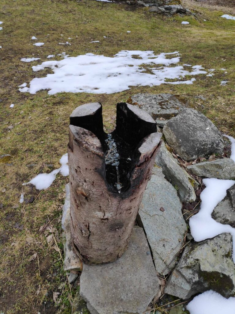
Outside the little cabin, was a stump of wood that is used to boil coffee. A fire is lighted in the center of the stump and the coffee pot (you can see one in the previous picture, hanging on the wall) fits snuggly over the fire. The four slots in the stump allow air to get to the fire, which slowly consumes the stump.
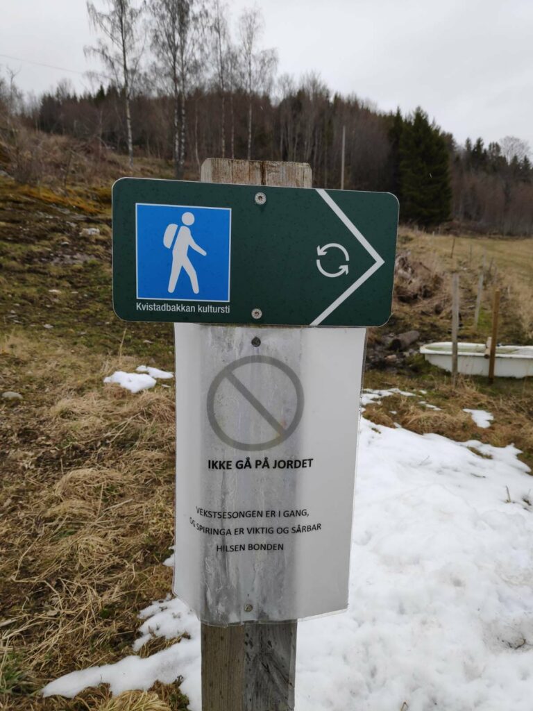
Translation of the sign: ” Do not walk on the field. The growing season has started and sprouting is important and sensitive. Greetings, the Farmer”. The fields are not green yet, but the early spring days are important for the growth of the grass on the fields. In Inderøy, many farmers will have cattle grazing the fields in the summer, or the grass will be cut to provide feed during the winter season.
Now it was just to walk down the hill and get to the store (to buy a few small food items) and city hall (where we would get vaccinated). There wasn’t much snow left at lower elevations.
This was a one-way walk, requiring that I got dropped off at one place and picked up at another. I used about one and a half hours between being dropped off and getting to the store. By road it is probably about 3.5 km, but I will have walked at least 6-7 km by going through the forest. It is a walk I will do again, when it is suitable.
Today’s walk started from home at about 11:30. We have a very short period of daylight at this time of year and as today was sunny, it was important to get out in the sunshine. My husband and son were my walking companions today and our goal was a small beach on the east side of Skarnsund.
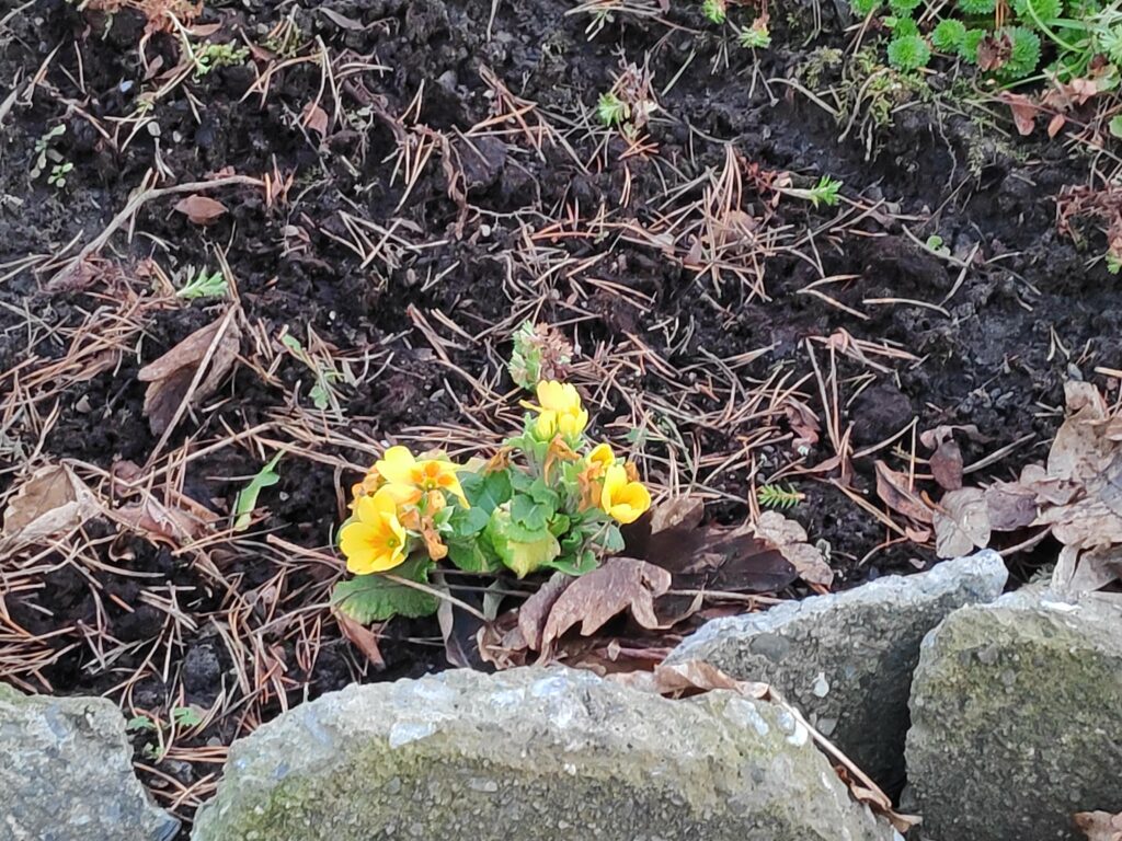
As we walked down our driveway, I saw the first “spring” flowers blooming. I normally buy primroses in January in a store, so these plants are used to blooming in the middle of winter. This plant got moved last summer to a new location and it seems to have done very well to be blooming in December. They often will continue to bloom under the snow.
Our walk continued across farm fields, around the neighbouring farm and across another field. We have no snow on the ground and the temperature today was about 7 degrees Celsius.
Here we are following a tractor road along the hillside. There were icy bits and it was very rough as the farmer’s cows have been out grazing in this direction. Skarnsund is just visible to our left and in the distance.When one sees the viewing platform in the woods, it is time to look for an opening in the fence as the trail goes down past the viewing platform The hill in the background is on the other side of Skarnsund. You would need to cross the bridge to get to it.The hole in the fence which can be blocked off in the summer when there are animals out grazing. In the winter the gap is usually left open.
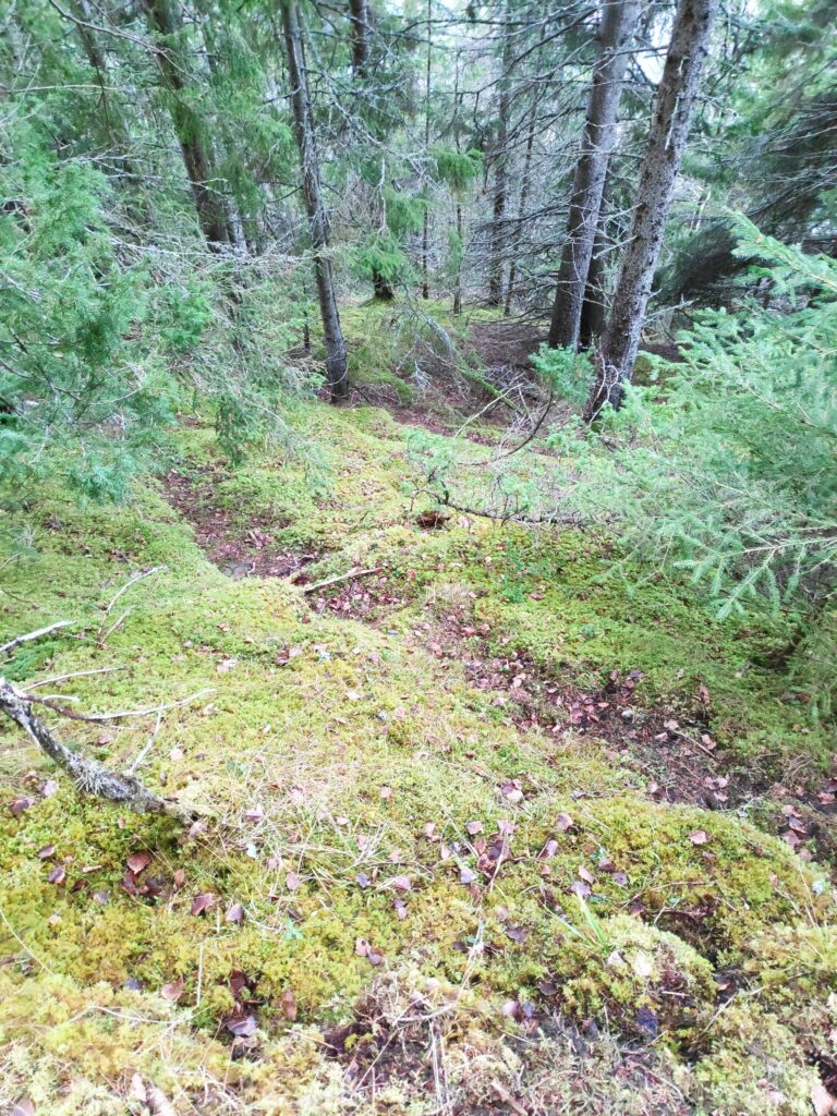
The slope down to the water is quite steep and one needs to walk carefully. I prefer to do it now when I am with others, in case of mishap. There are other trails in the woods here, most of them would be made by the deer. This area has not been logged recently, so it is nice old forest.
Here is the trail we are following which will take us down to two cabins and a beach. Note the green rope on the right which is a guide line down the slope. It is mostly just laying on the ground, sometimes covered in vegetation and not necessarily safe to grab, but it does show that you are on the right trail.
At this time of year, there are a lot of dead leaves on the path, which can make it slippery. However, there was no ice on the path as we are under the trees. It is hard to take pictures that show how steep the slopes are here, but one does not want to wander off the trail.
A deer trail taking off from the main trail we are following. We live in a temperate rain forest with primarily spruce trees. Where the trees stand tight together, little light gets to the floor of the forest so very little else grows. Here there are mosses and lichens under the trees.
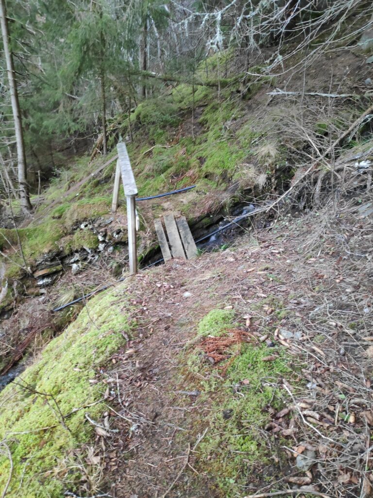
Eventually we came to the stream that drains this hillside. There is even a little bridge to help cross it and a sturdy handrail.
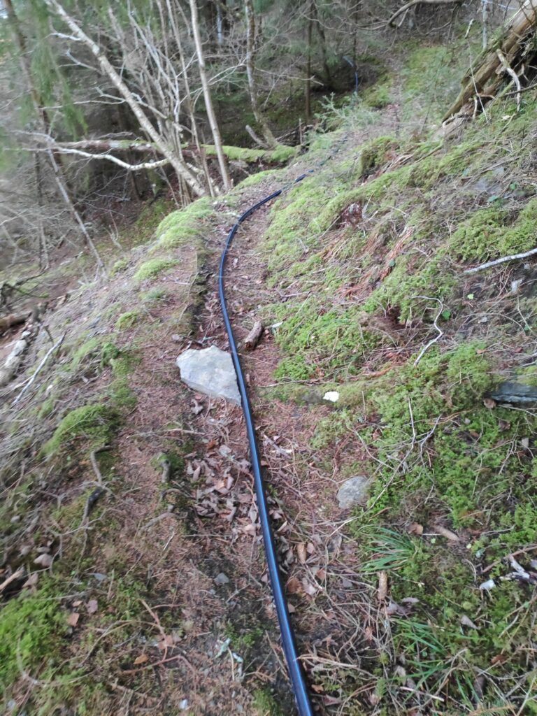
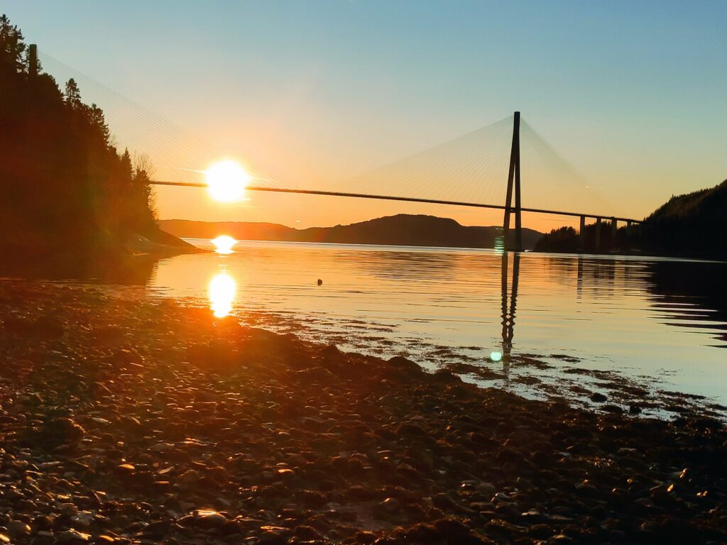
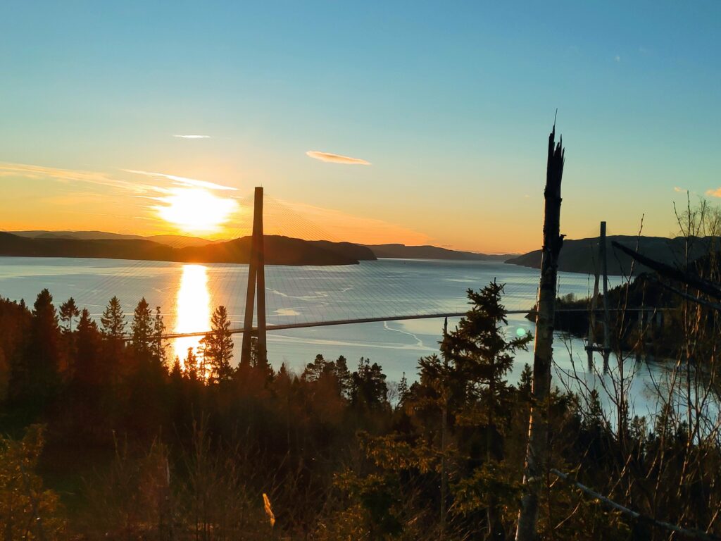
A small stream tumbles downhill. There are also two waterlines that will take water from the stream to the cabins below.We continued to follow the trail that now also had a waterline on it. This is a very common sight in the cabin areas around here. The lines may freeze in the winter, but people mostly use their cabins in the summer half of the year.Skarnsund Bridge from the north east. This photo was taken at 12:14, so approximately when the sun is at its highest in the sky for today.
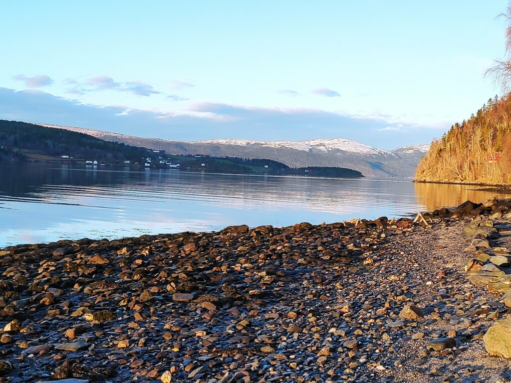
It was lovely to just be on the beach for a while. The sun was shining and there was no wind. The water was calm. There was snow on distant hills, but nothing close by. We were also far enough away from the bridge that the noise of the traffic was almost not heard. There were no fishermen out today. Everyone here is busy getting ready for Christmas celebrations.
Looking north. One’s location in relation to hillsides will decide if you get sunshine or not at this time of year. We live on the right side to get sunshine. The housing area on the other side of Skarnsund is Framverran.
The beach is not sandy at all, but in relation to many places along Skarnsund, there is a place to walk for a couple of hundred meters before the next impassable section of rock comes. At high tide, most of this beach would disappear under water. We were there when the tide was about halfway between low tide (at 9:17 and 122 cm) and high tide (at 15:36 and 290 cm), so an incoming tide.
A view of the bridge on our way back home, from the part of the trail that is possibly at the highest elevation. A check on the map on my cellphone tells me that we are at about 140 meters above sea level. It’s been a glorious sunny day.
I don’t take this walk very often, but today was a good day to do it. Sunshine, no wind, plus degrees in the air and two good companions. We used a little more than an hour and a half on our walk.