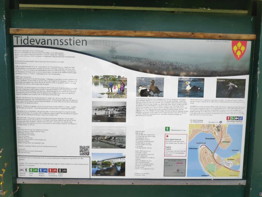
Tidevannsstien (The tidal water path) was built in 2009 and is on the south side of the sound that connects Trondheimsfjord and Borgenfjord (sometimes called Børgin). Trondheimsfjord is to the west and Borgenfjord is to the east. Borgenfjord is a very large body of tidal sea water about 10 km from north to south and between 1 and 3 km wide, so the amount of water that flows through this sound is considerable. The sound itself has an S-shape and the current will be much stronger on one side than the other in the bends. It is not advisable to take a boat against the tide. Most boat traffic on the sound would be at slack tide, when there isn’t as much current.
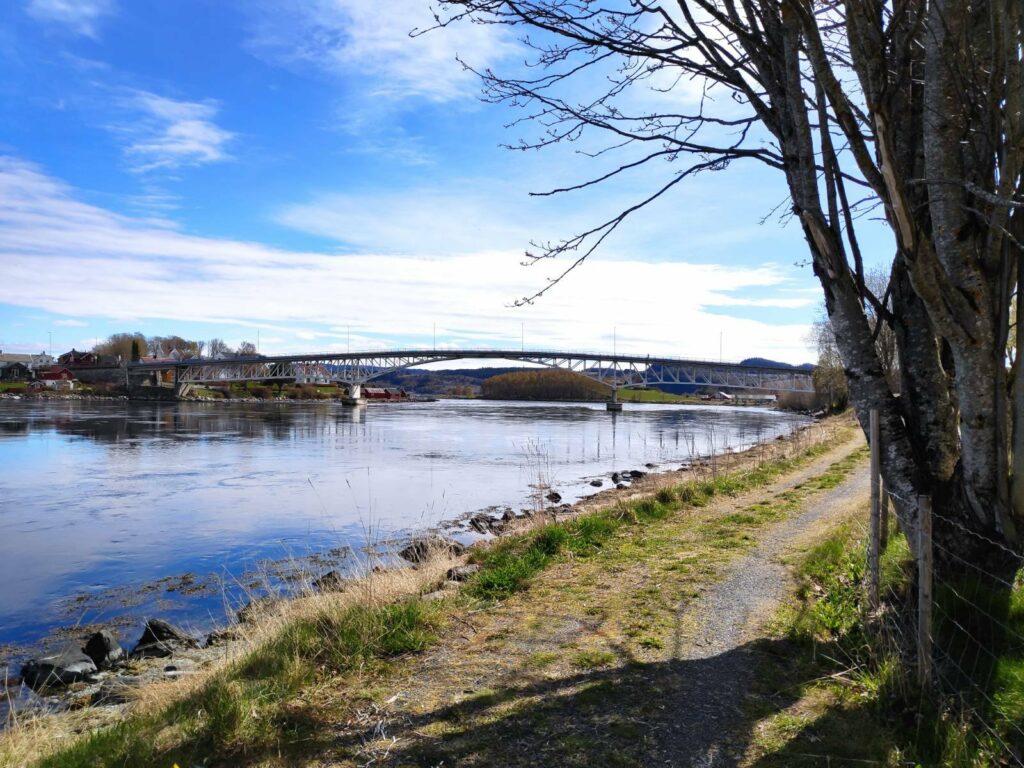
The name of the municipal center, Straumen, refers to the strong current that flows between these two bodies of water. There can be up to 1 to 1.5 meters difference in the water level on either side of the sound which creates a very strong current which tries to even out the difference. This is one of the strongest currents in Northern Europe. The water flow changes direction roughly every six hours. The average speed is between 7 to 9 knots (about 14 km an hour), but the top speed can be much faster.
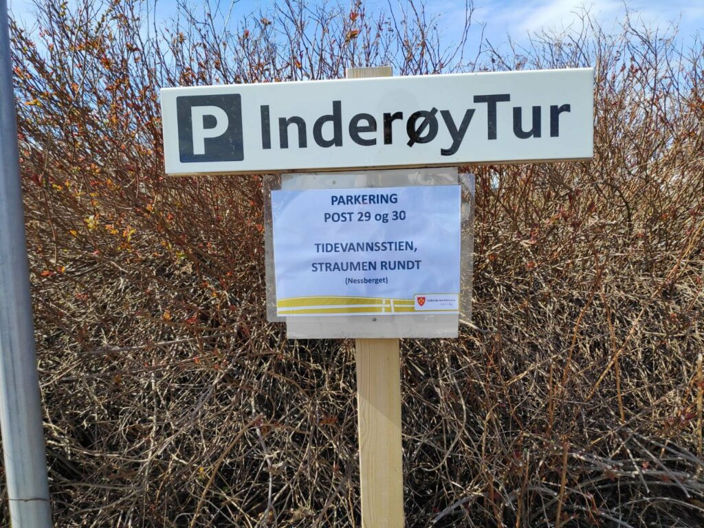
The tidal water path is about 300 meters long and leads to an open area below the housing on the slope. My husband and I took this walk on Monday, the 10th of May after doing an errand in Straumen. The sun was shining and we wanted to have a walk and this one wouldn’t take too much time. We got a slightly longer walk by parking on the north side of the bridge, crossing the bridge and then following the path. We returned to the car the same way that we came. The first picture was taken at 11:22 and the last picture was taken at 11:49, so we used only 27 minutes on the walk.
You can see in the map in the bottom left-hand corner the shape of the sound. Trondheimsfjord is to the left and Borgenfjord to the right. The bridge crosses st the narrowest point and the sound is about 100 meters wide at this point.
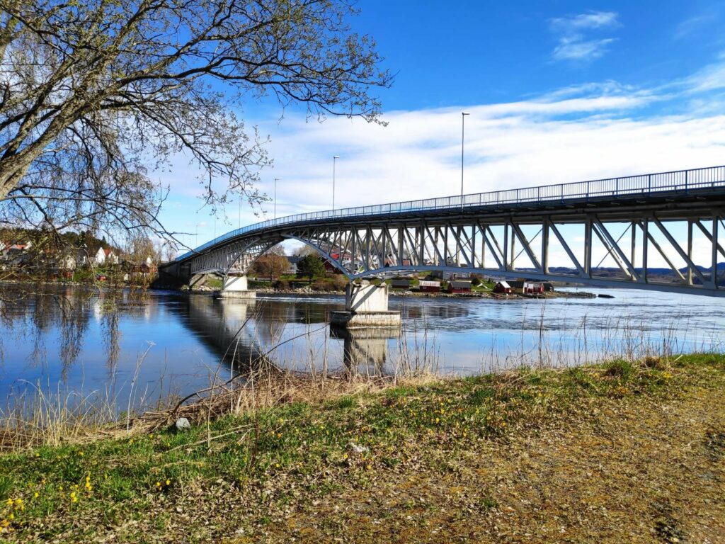
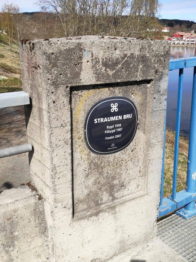
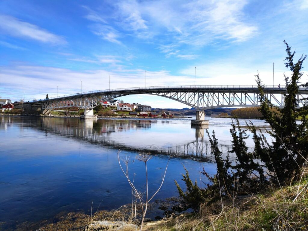
The first bridge over the sound was opened in 1861. Before that people had to take a ferry across. The first bridge had to open to allow ships to go through. You can see (though not very clearly) a picture of the old bridge in the information sign above (second picture on the left). In 1958 a second bridge made of steel and concrete was built and in 1987 a pedestrian path was added to the bridge on the western side. In 2007 the bridge was given protected status.
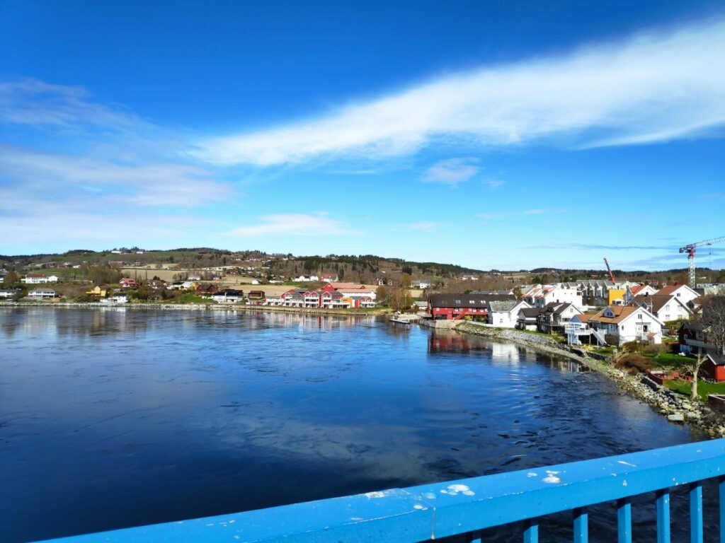
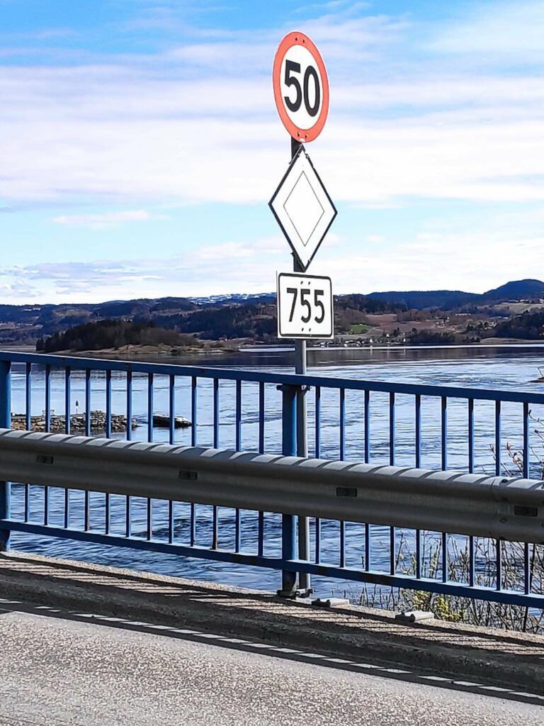
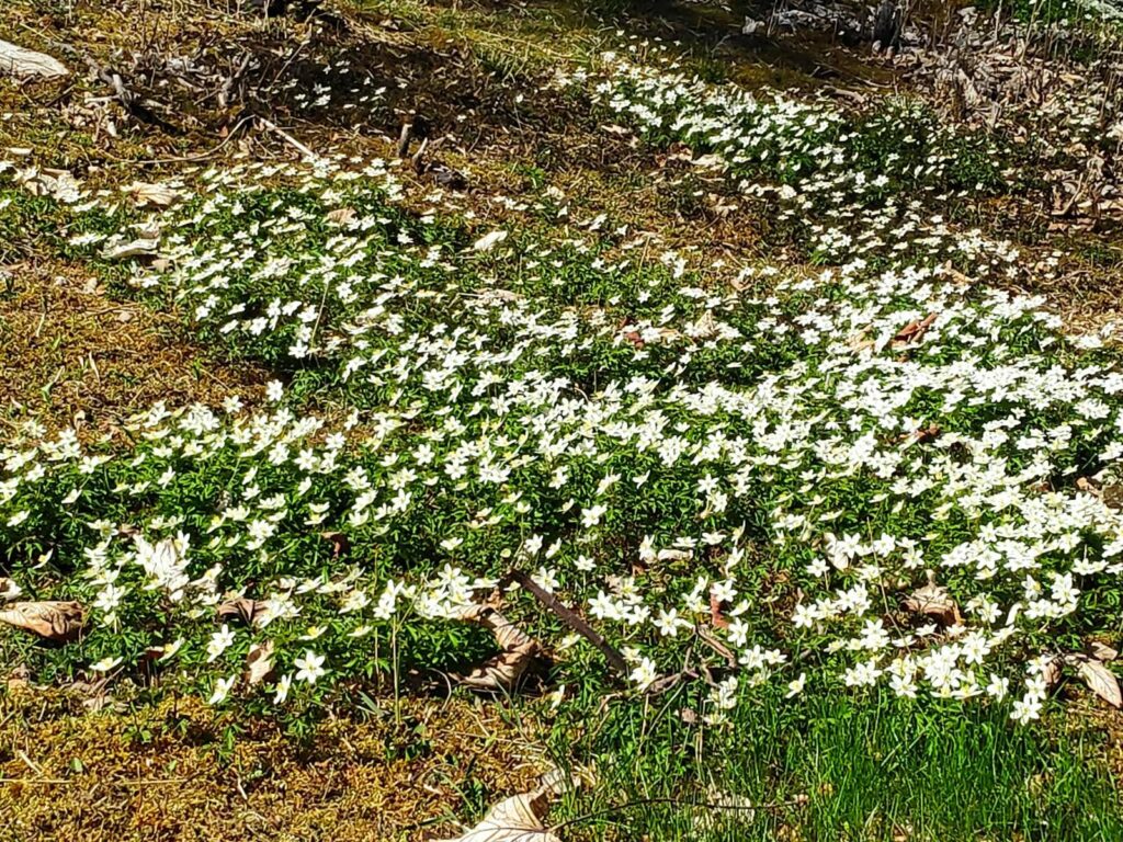
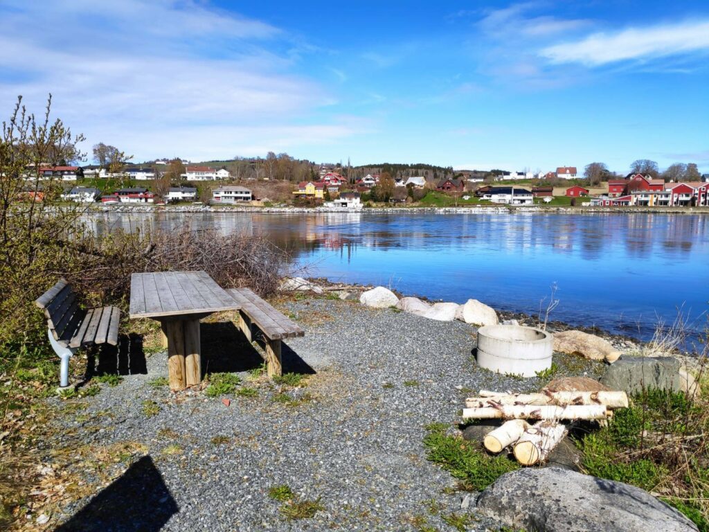
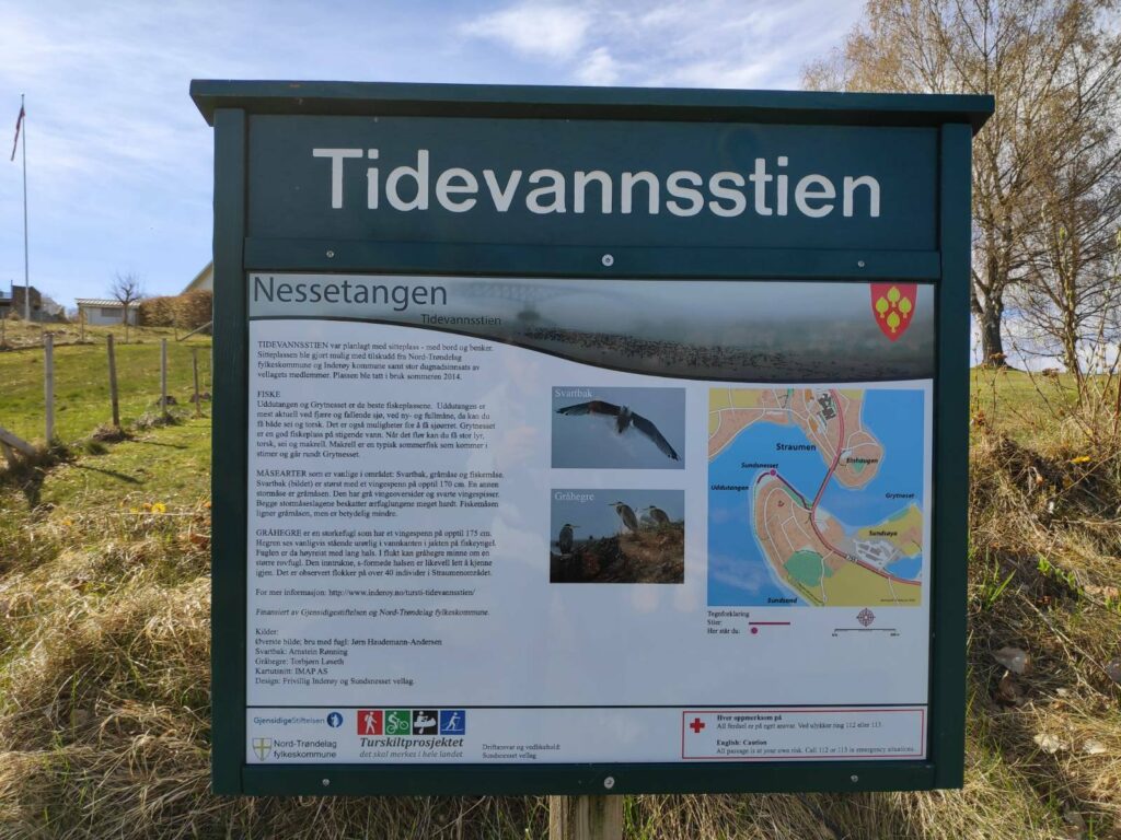
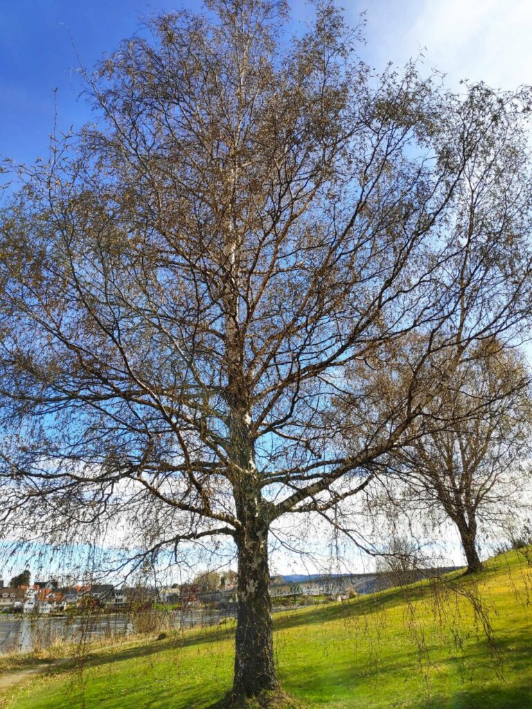
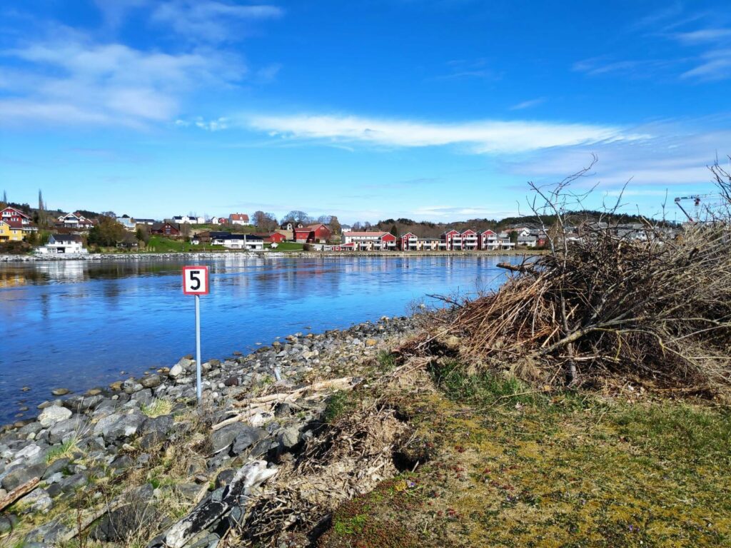
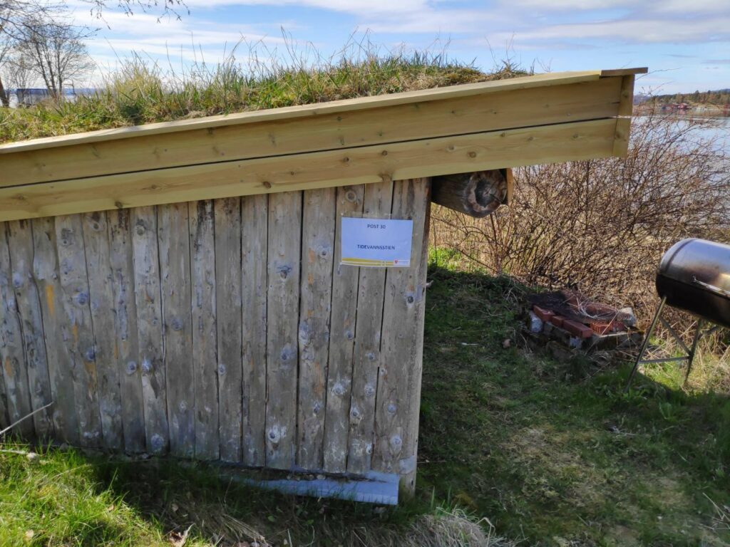
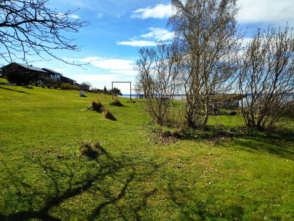
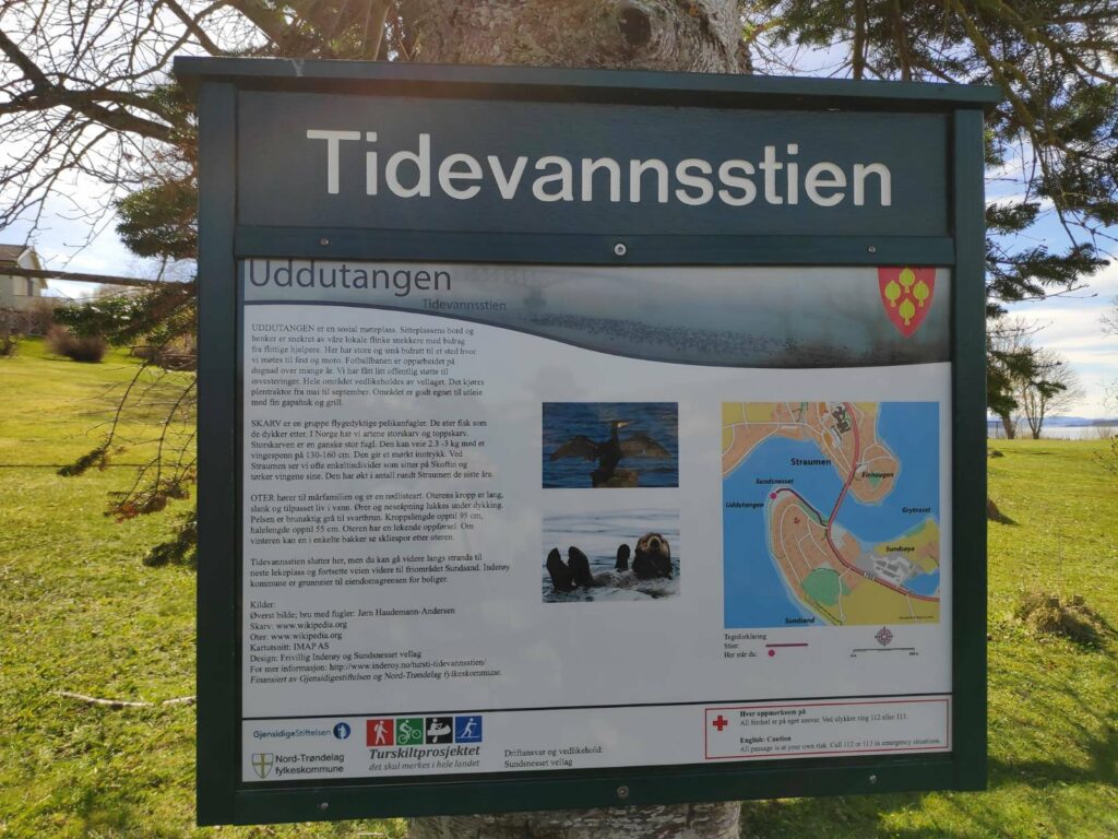
The parking area serves many purposes but this year it is the starting point for two walks. We are going to do post 30, Tidevannsstien.As we cross the bridge one can see some of the housing of Straumen. The tide is high on this side of the bridge and the water is flowing very swiftly toward me, especially on the right-hand side of the sound The crane on the right-hand side of the picture is where they are building a new nursing home which will be run by the municipality. An old one was torn down and a new modern building is under construction. I may be a resident there at some time in the future, though hopefully not for 15 to 20 years.The bridge as seen from the south side. The upper railings are painted blue and the under supports are painted white. The bridge is 202 meters in length and the main span is 72 meters. The sailing height is 12 meters.Information about the bridge can be found on both ends. Built 1958, added to in 1987 and protected in 2007.Borgenfjord is in the background and extends about 10 km to the left. The top sign, 50, gives the speed limit in kilometers per hour. The middle sign (though it is a bit faded) says that traffic on the bridge has right-of-way at intersections (after the bridge). The lower sign , 755, tells the route number. Road number 755 goes from Røra (east end of the route) to Vanviken (west end of the route) and is the road that goes over Skarnsund Bridge near us. You can also see the current racing under the bridge. High water would be at 11:56 so shortly after this picture was taken.Anemone nemorosa (“hvitveis” in Norwegian) is a very common flower in Norway. It blooms before the leaves come out on the trees, so that it gets a lot of sunshine. It can carpet large portions of the forest floor in open areas.Here is a bench and table to sit and enjoy the view. As usual, there is a place to grill. We are looking across the sound to Straumen.The information sign tells us that we are at “Nessetangen”, so one side of the point that sticks out into the sound. This area of Straumen is called “Sund” (sound), so there is Sund School, Sundsand, Sundsnes and Sundsøya. The birds on the information sign are one type of seagull and the grey heron both of which can be found here.Looking back towards the bridge. You can see the path that we have been walking along.A birch tree has a beautiful shape when it grows in the open. This one will be shedding a lot of pollen to bother those (like me) with pollen allergies. It may be another week before the leaves are out. Birch trees require a lot of water, but this one will have access to lots.The sign “5” means that boat traffic may not go faster than 5 knots. The reason for this low speed has to do with the amount of birds found in the sound. We have a lot of eider ducks that are here year round. We saw only two pairs today and none of them were close enough to get their picture taken. It is soon nesting season. I speculated on how fast the water was travelling, but I’m sure it was doing twice the speed limit for boats.The goal of our walk, a small shed with picnic tables and benches inside. The inevitable grilling unit on the extreme right of the picture.There is a large park area here between the houses and the shoreline. There is lots of space to spread out on the grass in warm weather. This information sign gives information about the park area which has been made by volunteers. The picnic tables and benches have also been made by local volunteers. The bird that is pictured is a cormorant, which can be up to 2-3 kg with a wingspan of 130 – 160 cm. The otter can also been seen here. The fast moving current provides a lot of food for ducks, birds and otters.StraumbruaThe name of the parking area. I didn’t know it had a name before.
We had a sunny morning for our walk. One could make it longer by continuing along the shore and coming to Sundsand, our local sandy beach. However, we just wanted a short half hour walk and returned to the car to head home again.