A Sunday Walk from Lundsaunet to Leklemsvatnet

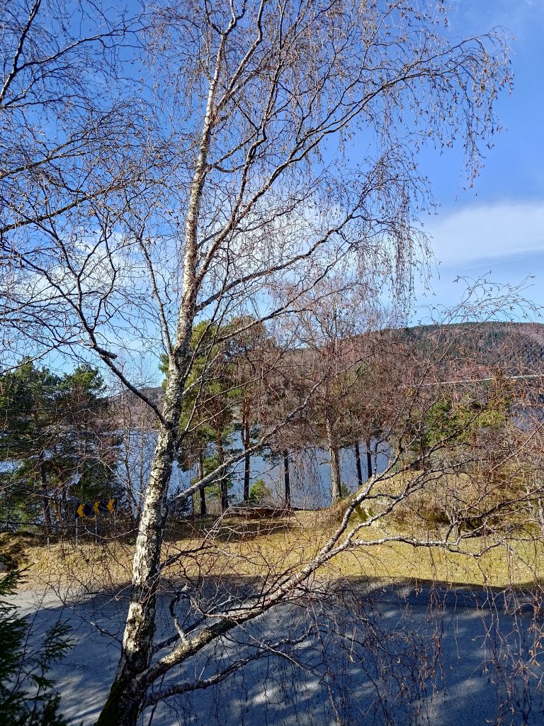
A sunny Sunday got us out of the house and walking in the woods. Though it was only 5 degrees centigrade when we left home, by the time we came back about three hours later it was up to 12 degrees. With sunshine all day long and almost no wind, it was the first really pleasant day this spring.

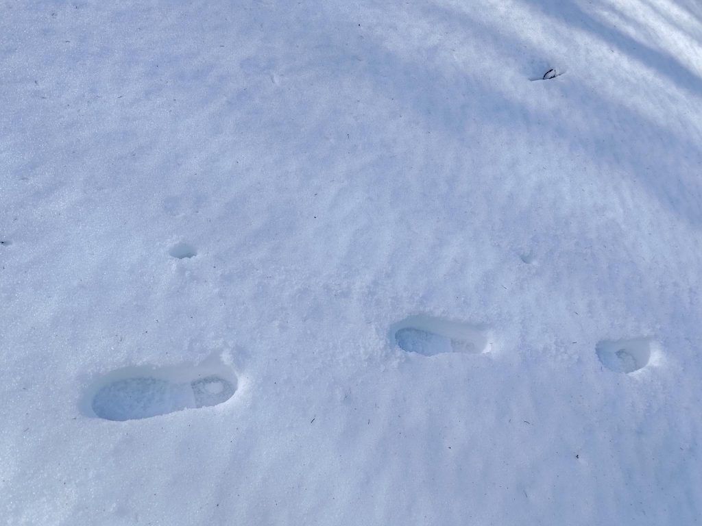
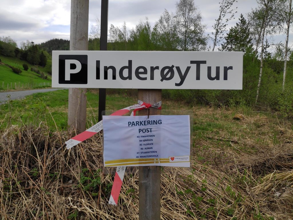
To get to the beginning of our walk we took a 25 minute drive up into the hills of Røra in Inderøy. We parked the car and headed uphill. Though we saw one family at the parking lot, and met one couple on our way back, we were alone with only the sounds of nature. Even the sounds of birds were seldom. As with many of the walks that we take, the first section was uphill, then there was a fairly even section, then downhill to the lake we were heading to. We walked back to the car on the same route this time. As it is a lengthy drive from home, when we come up into these hills we like to take a walk that is at least two to three hours.

The map at the parking place. We are at the red dot on the map, will walk south about 2.5 km to the south end of the lake called Leklemsvatnet. We walked back the same route. The information sign also gave several suggestions about different walks in the area and telling how long each walk was.

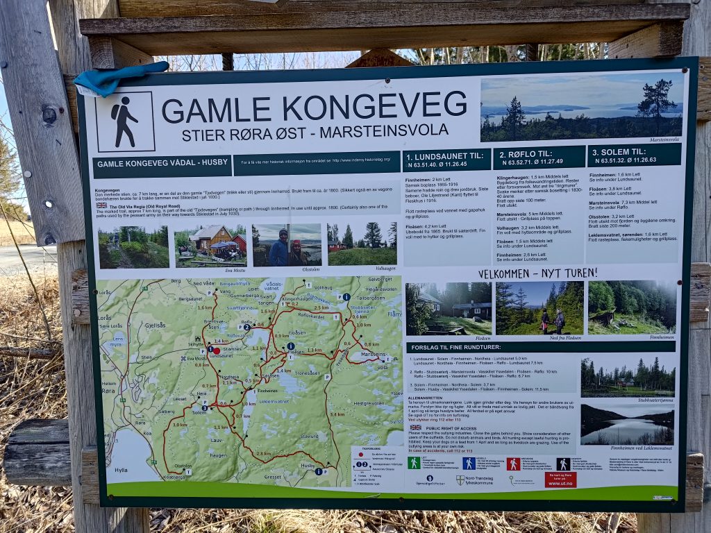
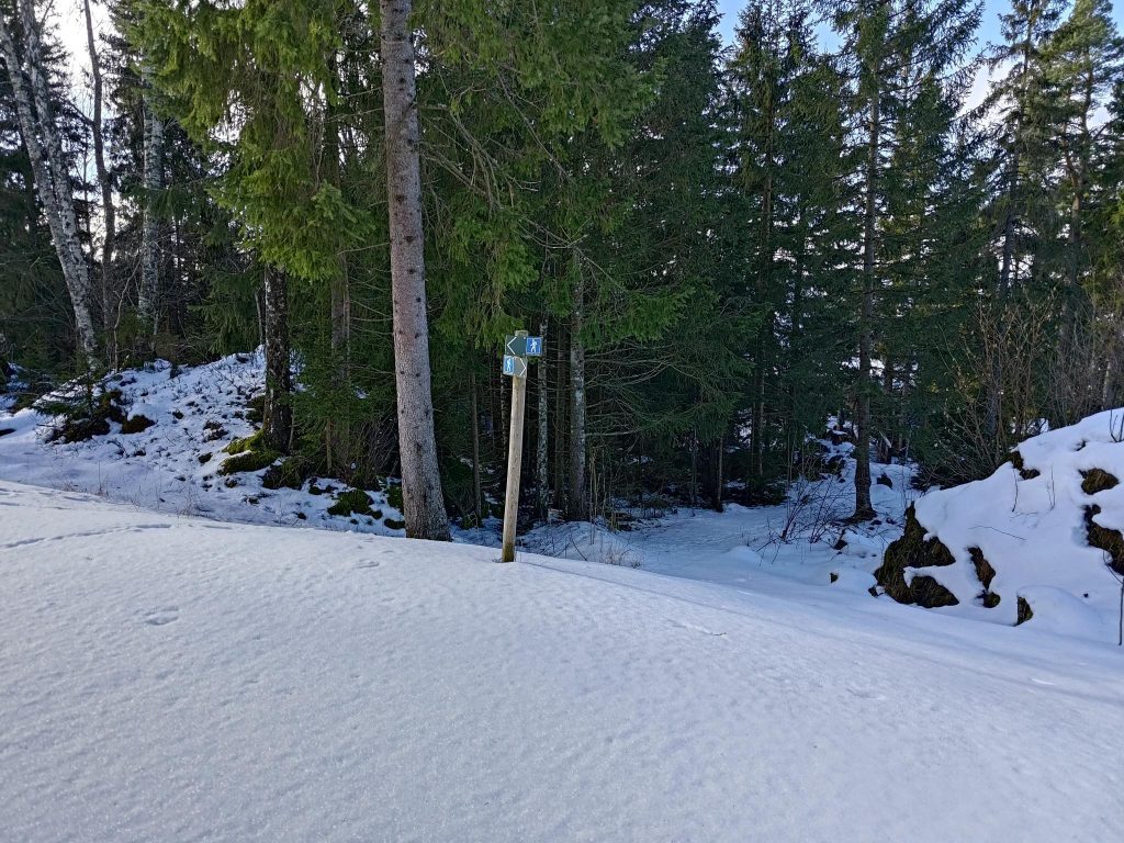
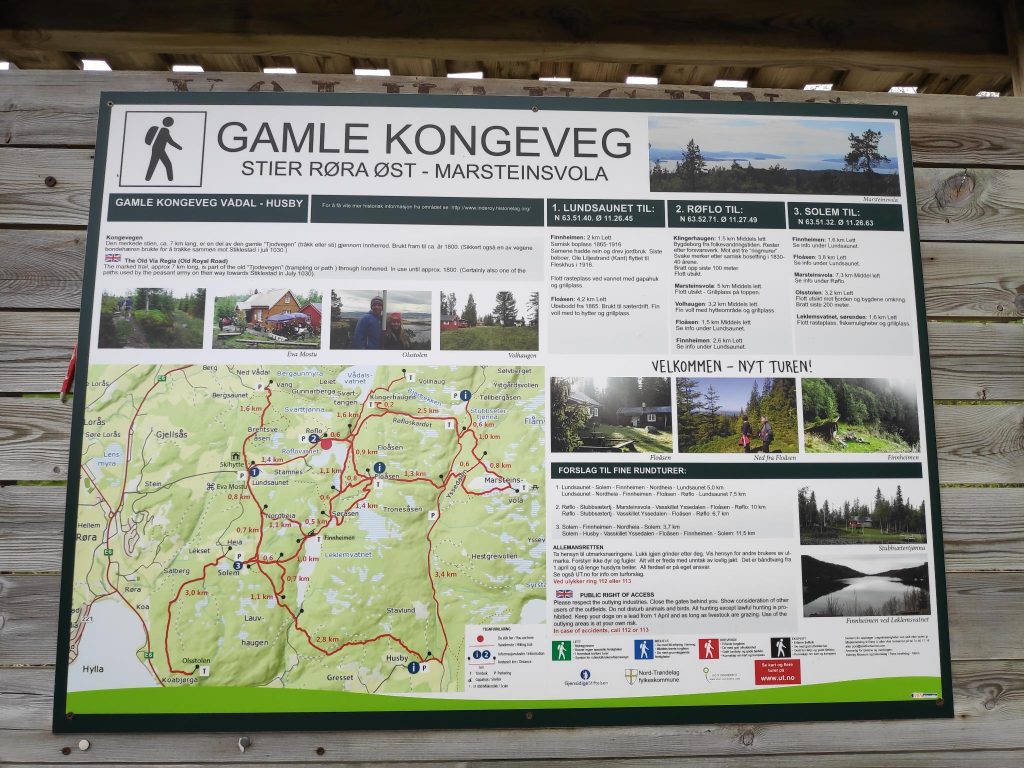
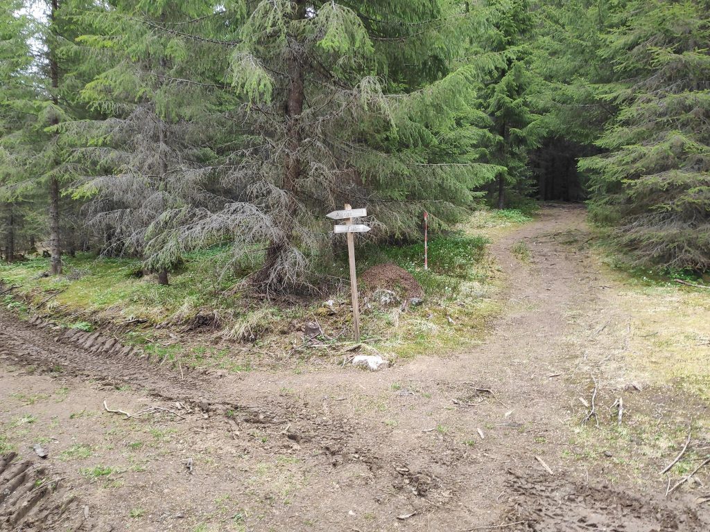
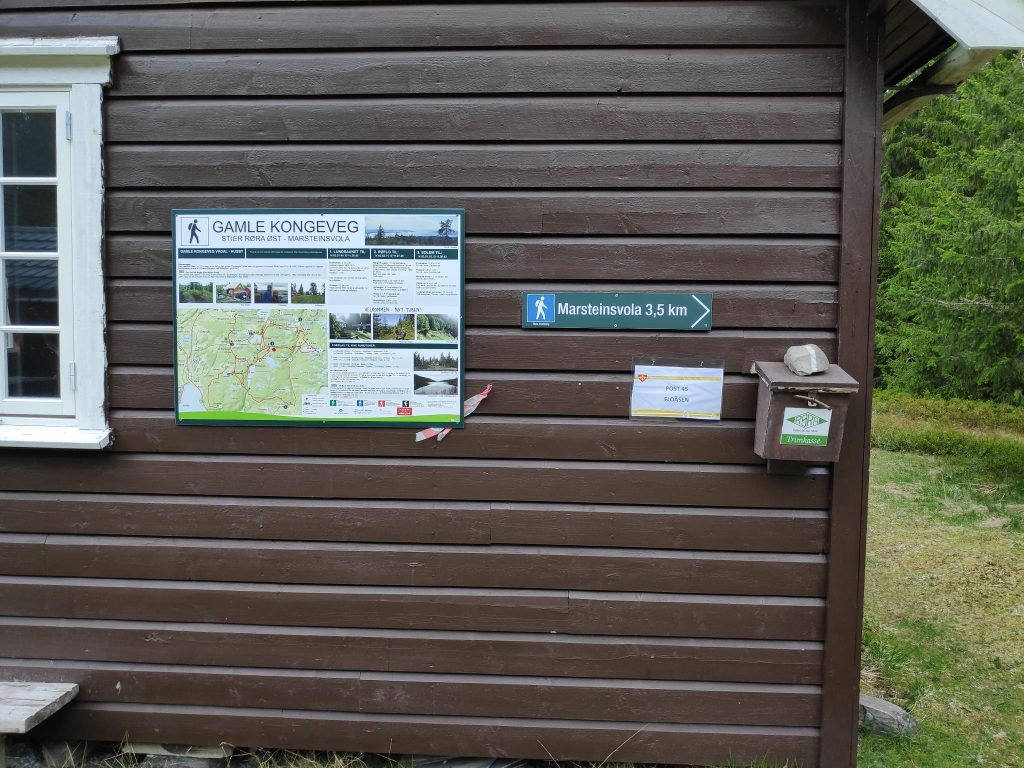
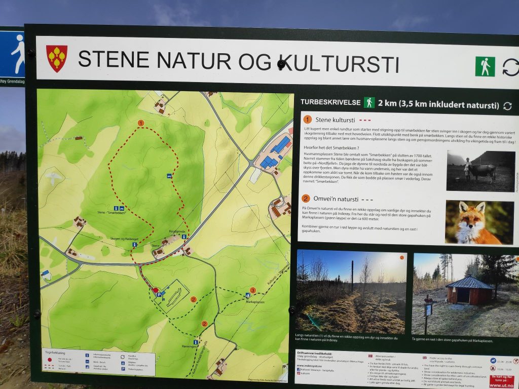
One thing I have learned to do is to always take a picture of the map at the parking spot. One may need to reference it during the walk to see if we are on the right path. There are all sorts of paths in these hills and we had a definite goal for our walk. In addition I have a map on my telephone, which I love. The advantage of a map on the phone is that it actually tells you where you are. I’ve always loved reading maps, but it is also important to actually know where you are. GPS, both in the car and on my phone, is very useful.

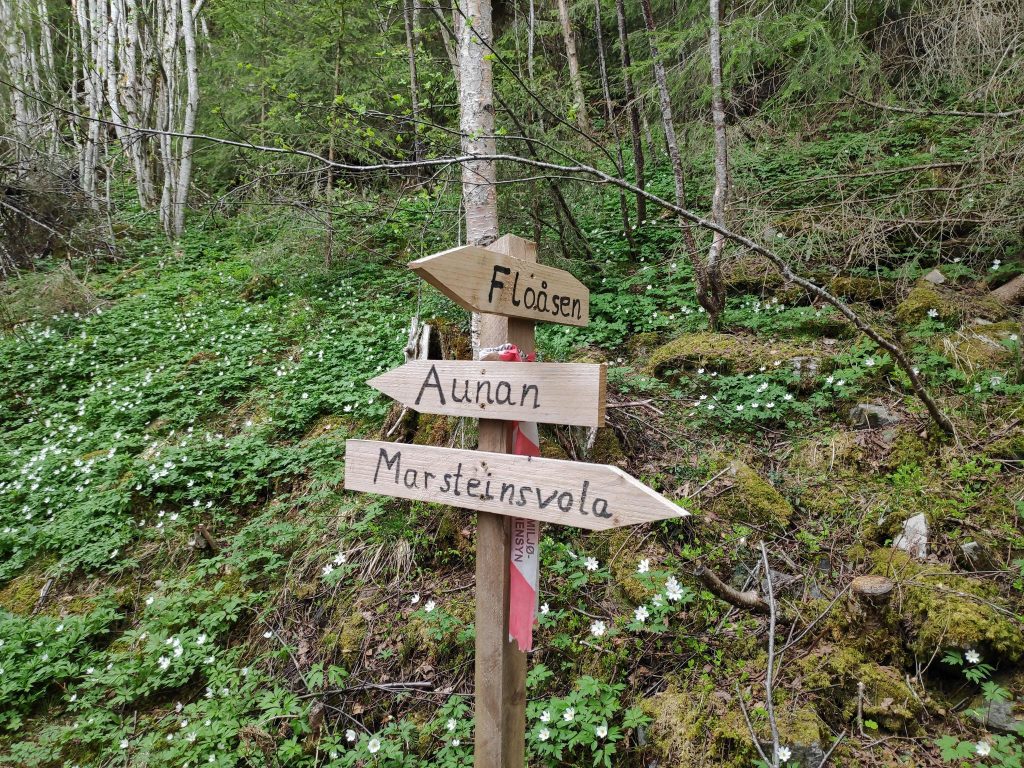
We are going to follow part of the Old Royal Road or King’s Road, which was used until about 1800 as the main road through our area. This section of road that has been preserved by the local history clubs is about 7 km, but we only went along part of it.

The starting point of our walk, at Lundsaunet.

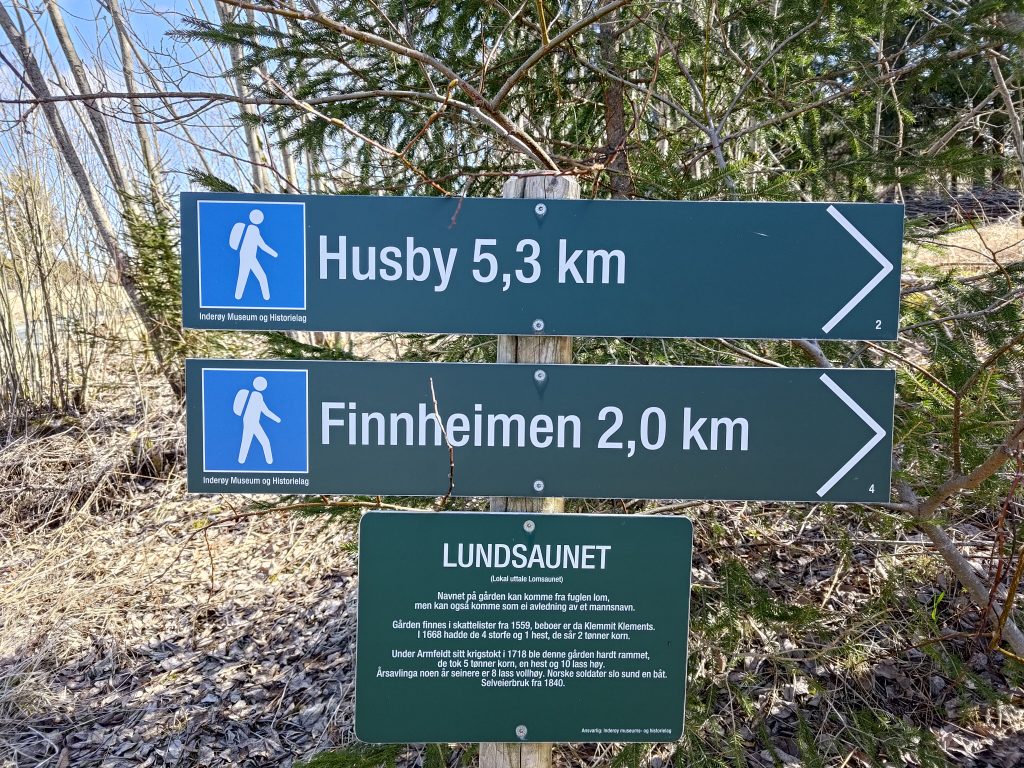
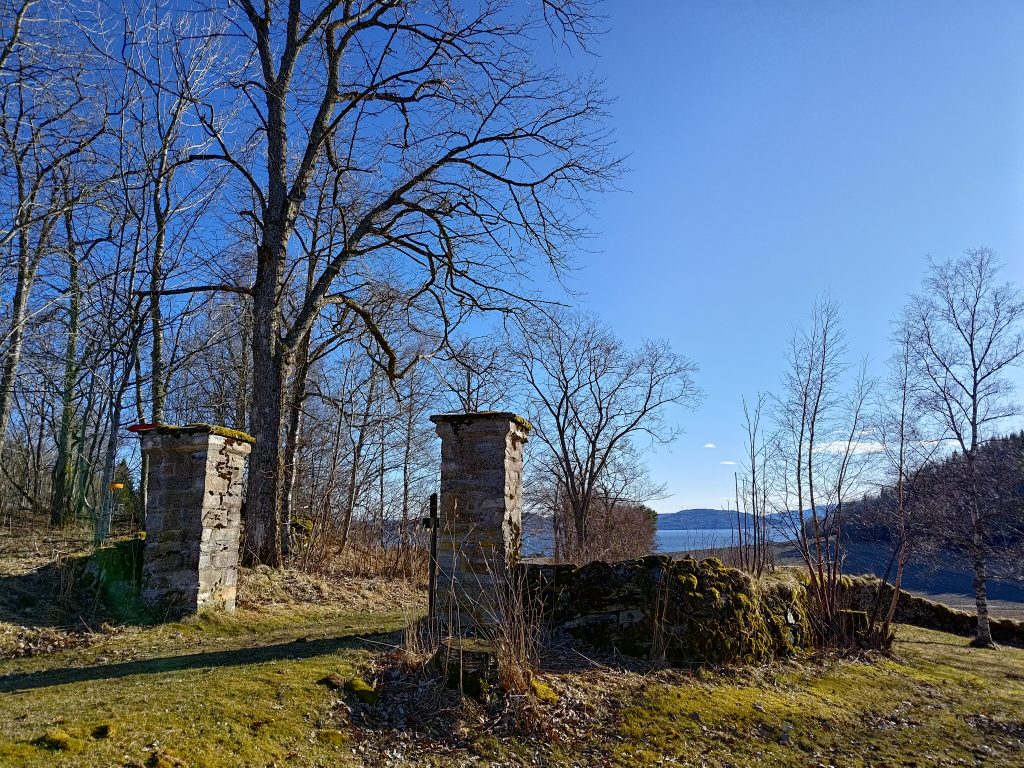
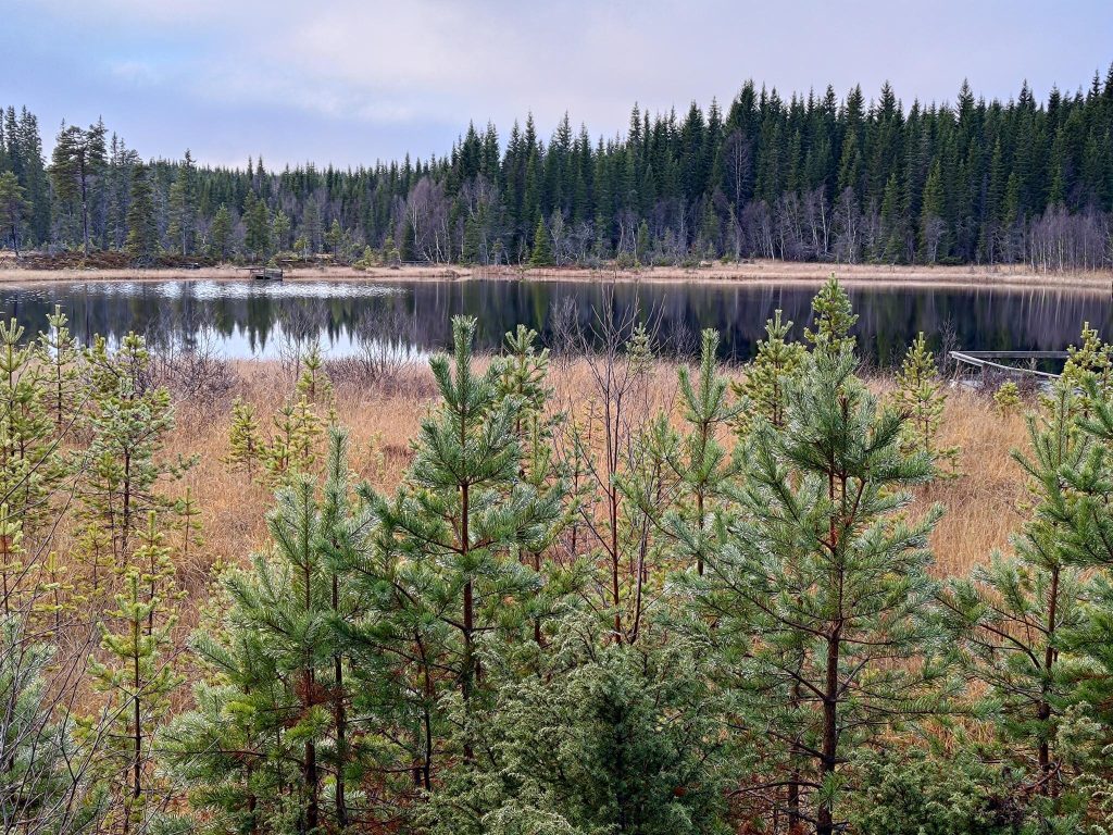
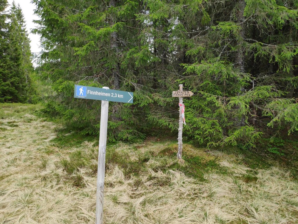
The name for the farm, Lundsaunet, which is where we parked, could come from the name of the bird, “lom” / loon, though it could come from a man’s name. The farm was registered in 1559 and is still a working farm. We often walk to Finnheimen at the north end of Leklemsvatnet, but today we decided to walk to the south end of the lake where there is a dam. We are headed in the direction of Husby, but only walk about half way, about 2.5 km.

Kvennstu- Eva Moestu

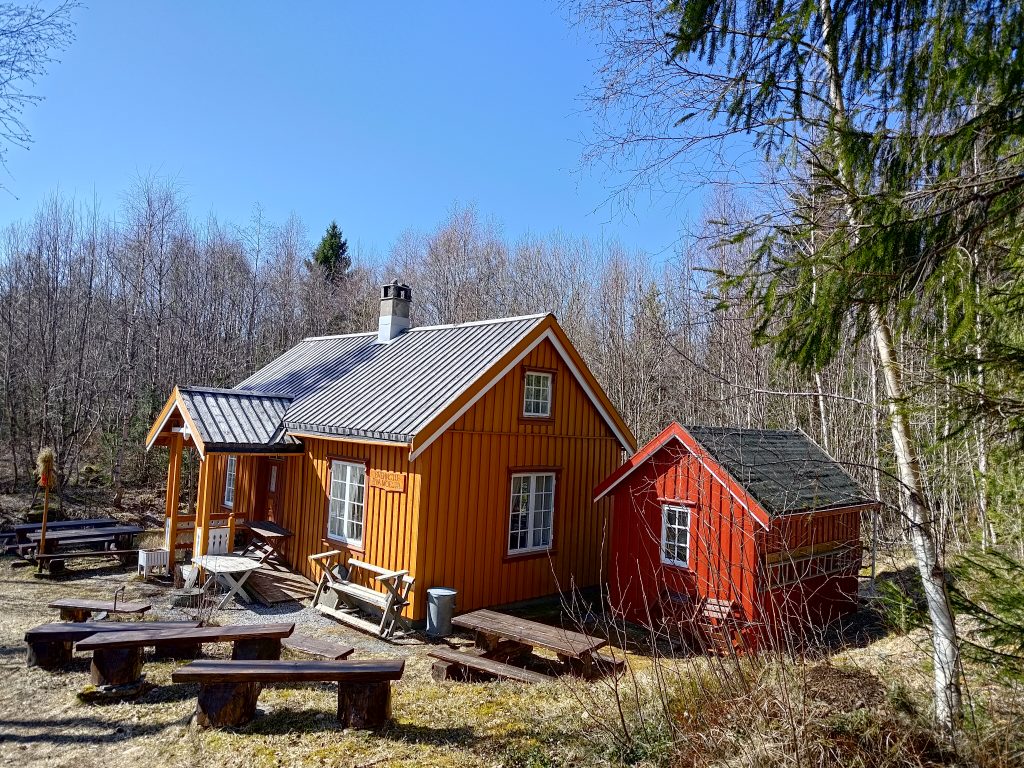
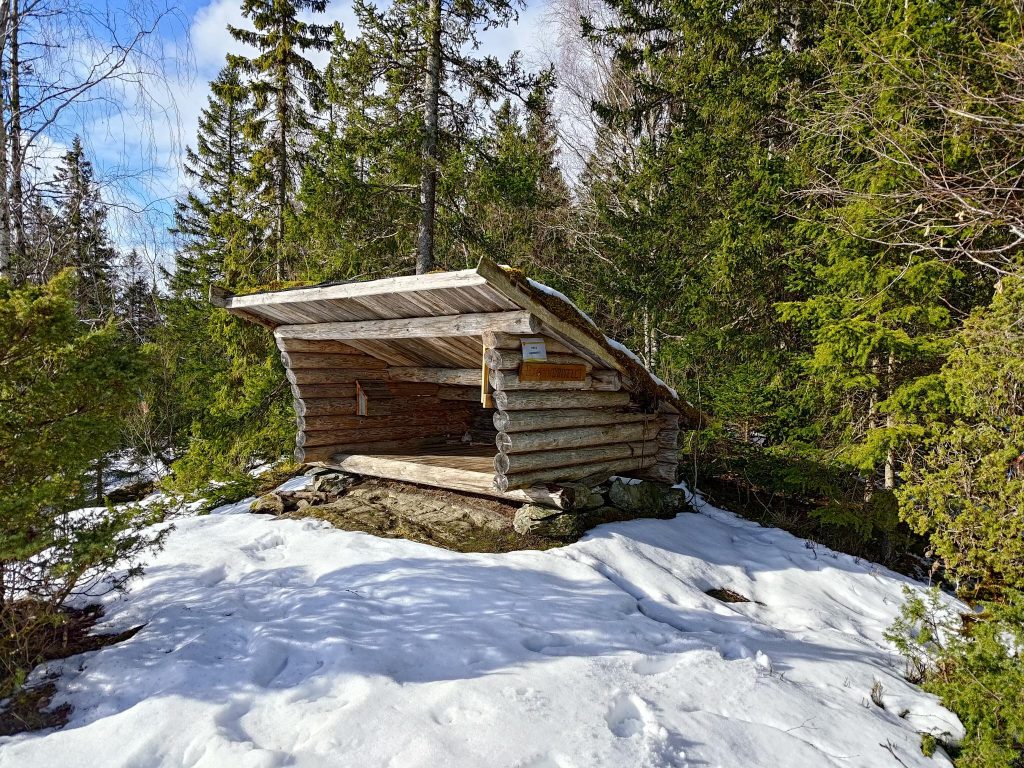
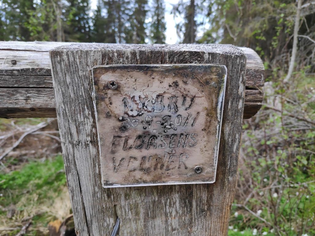
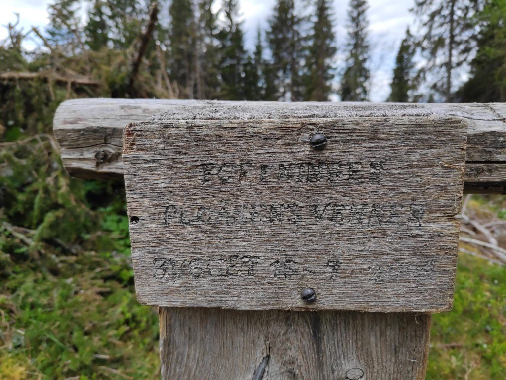
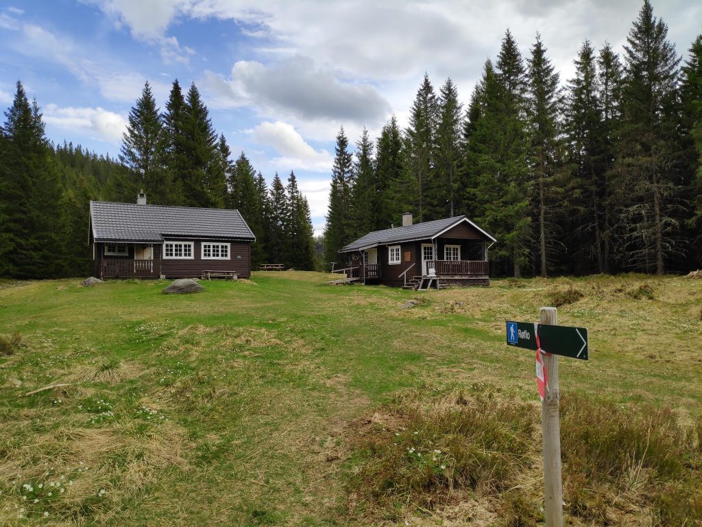
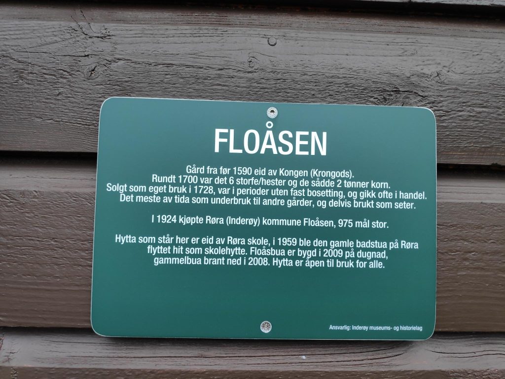
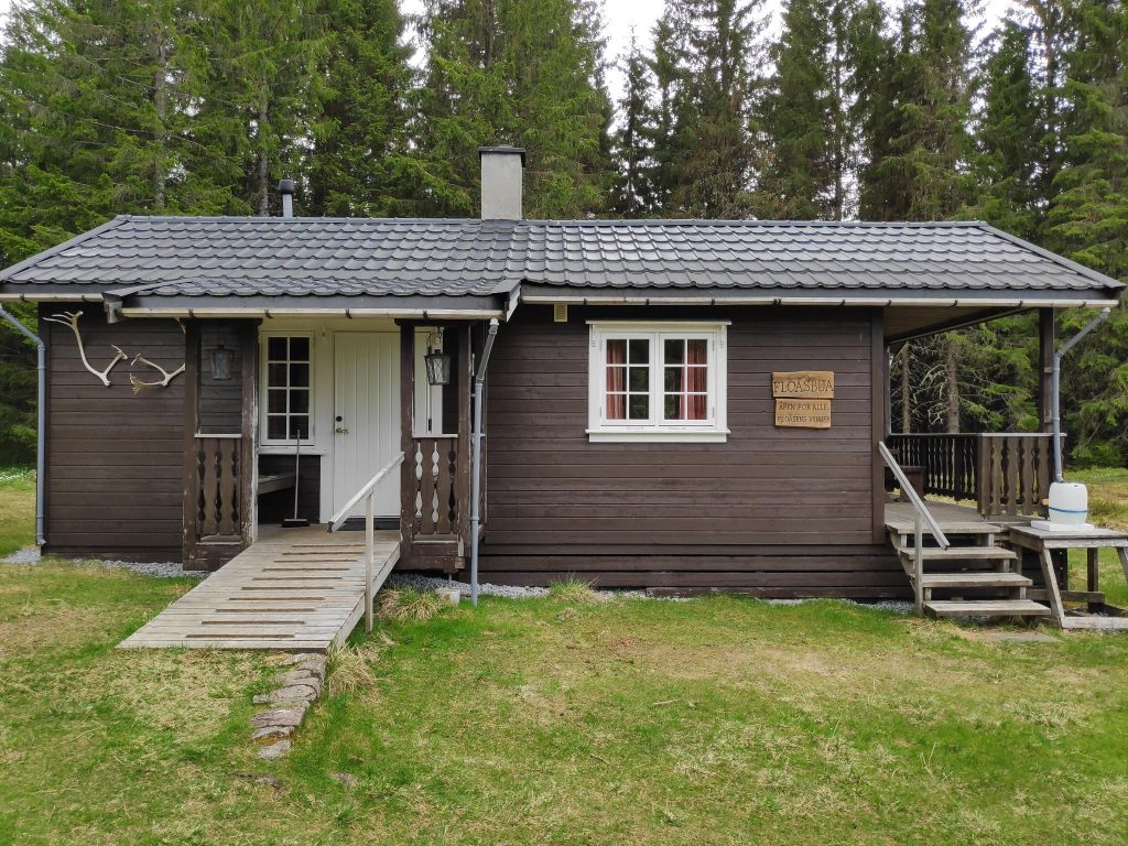
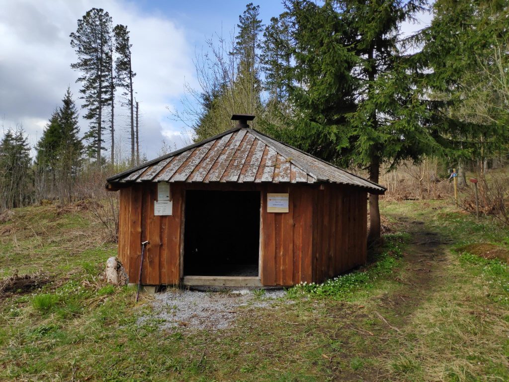
As we walk along the trail, we come across this building owned and operated by the Inderøy Museum and History Association. There are often meetings held here, but there was no activity as we walked by. They have made a lot of seating outside the building. This is the typical size house from the 1800s for those living in rural areas and not owning their own prestigious estate.

The trail through the woods

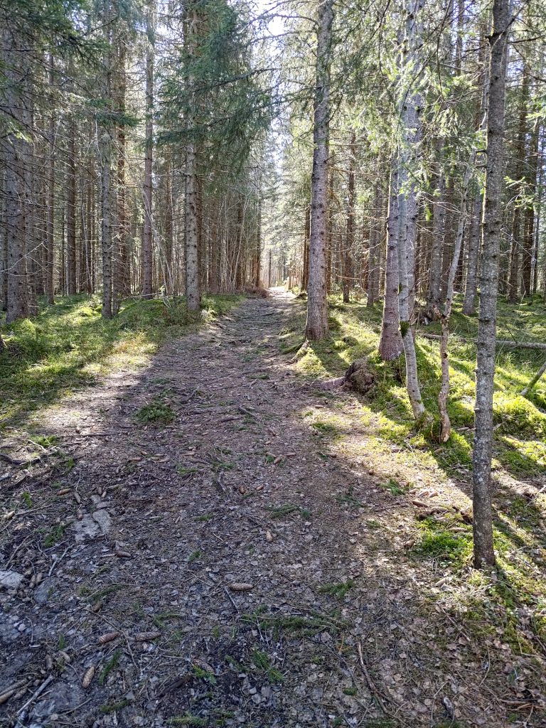
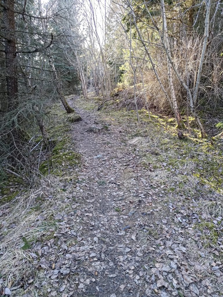
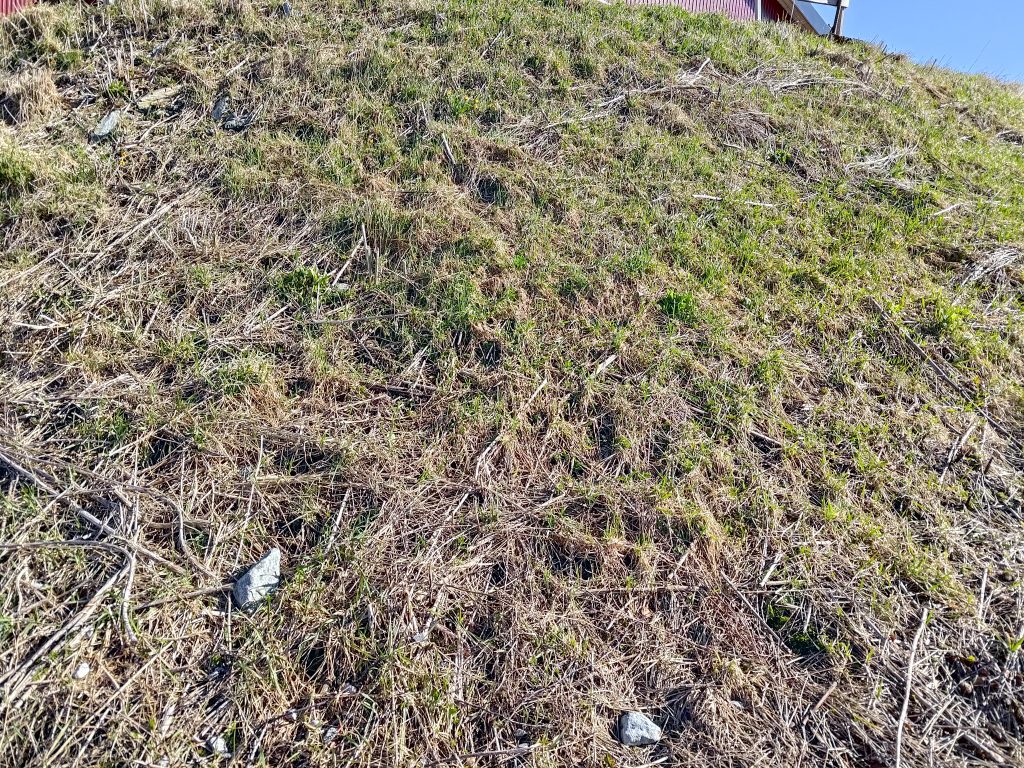
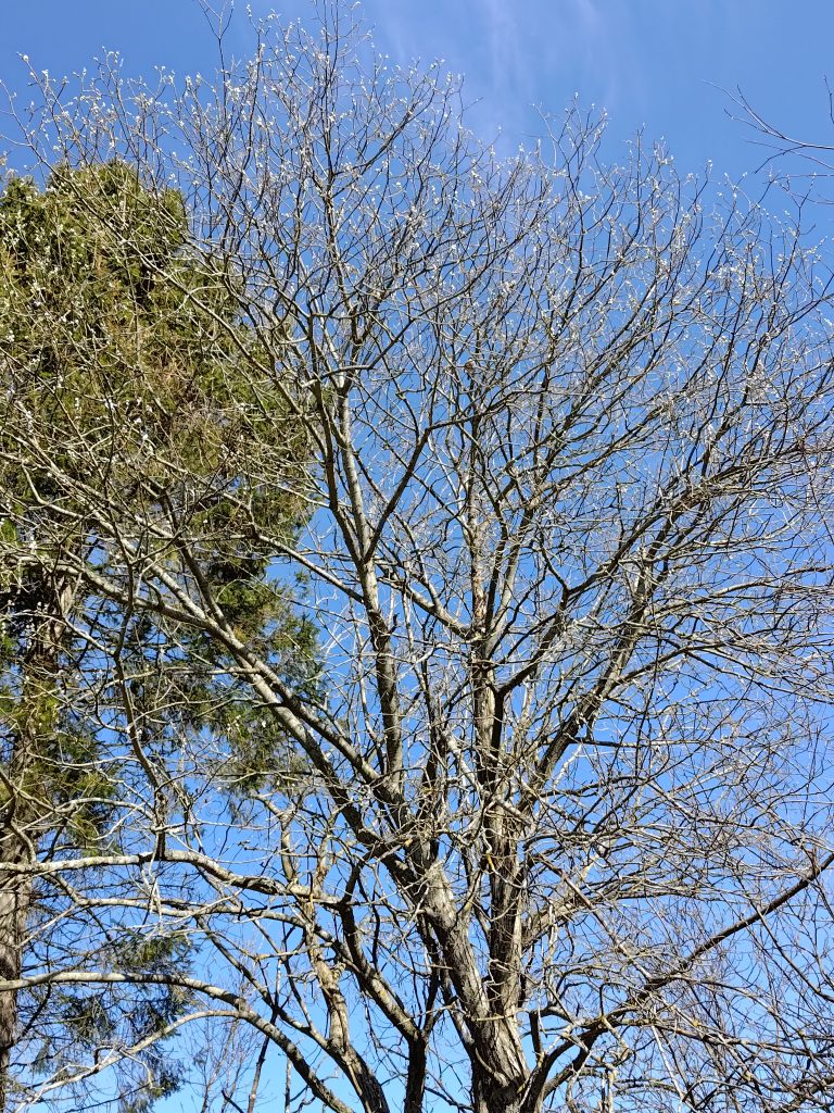
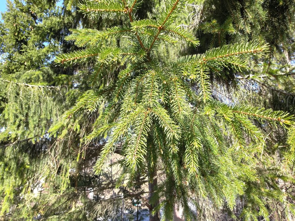
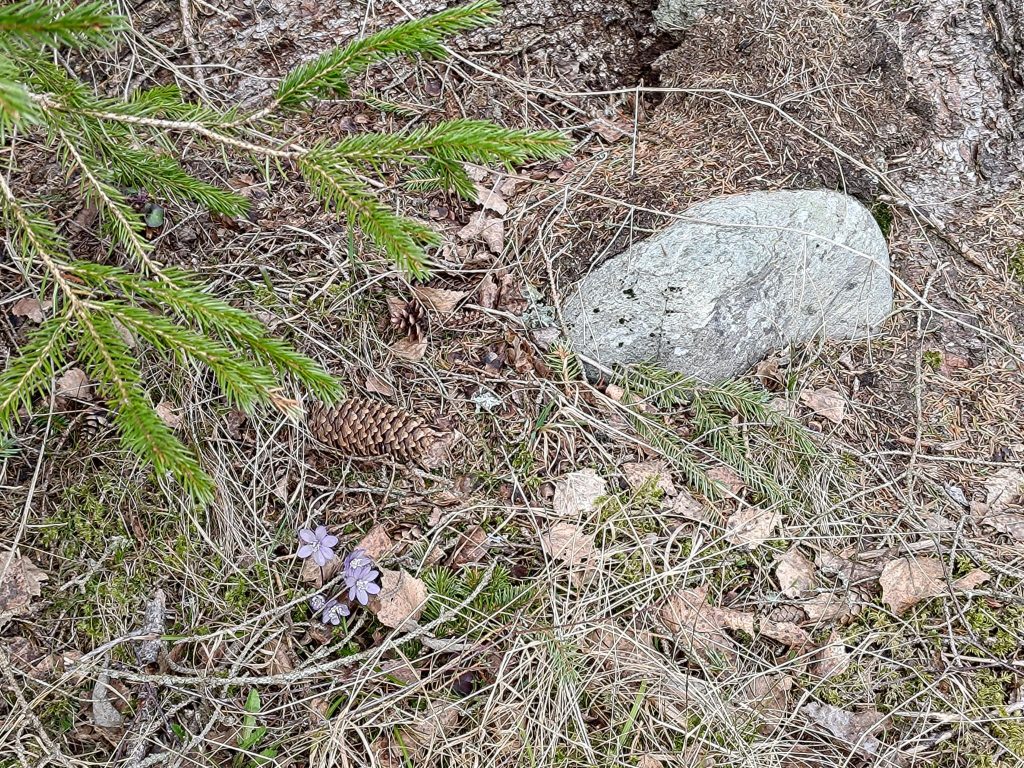
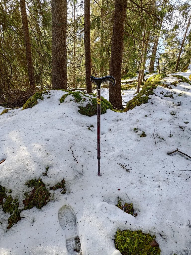
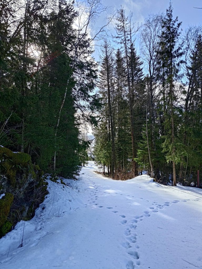
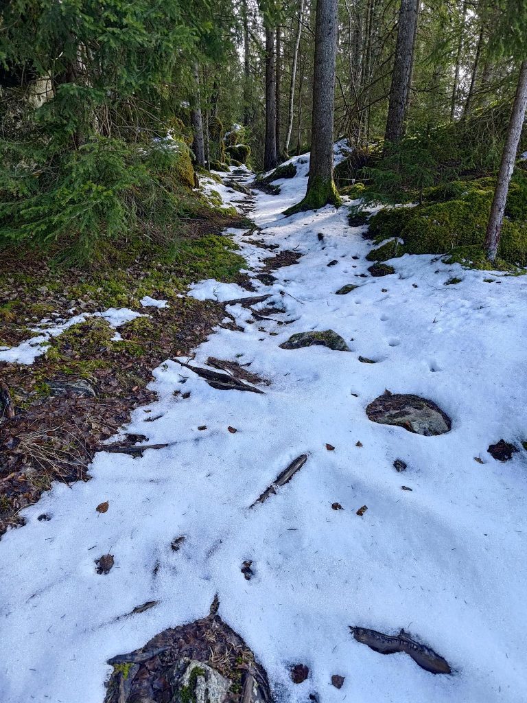
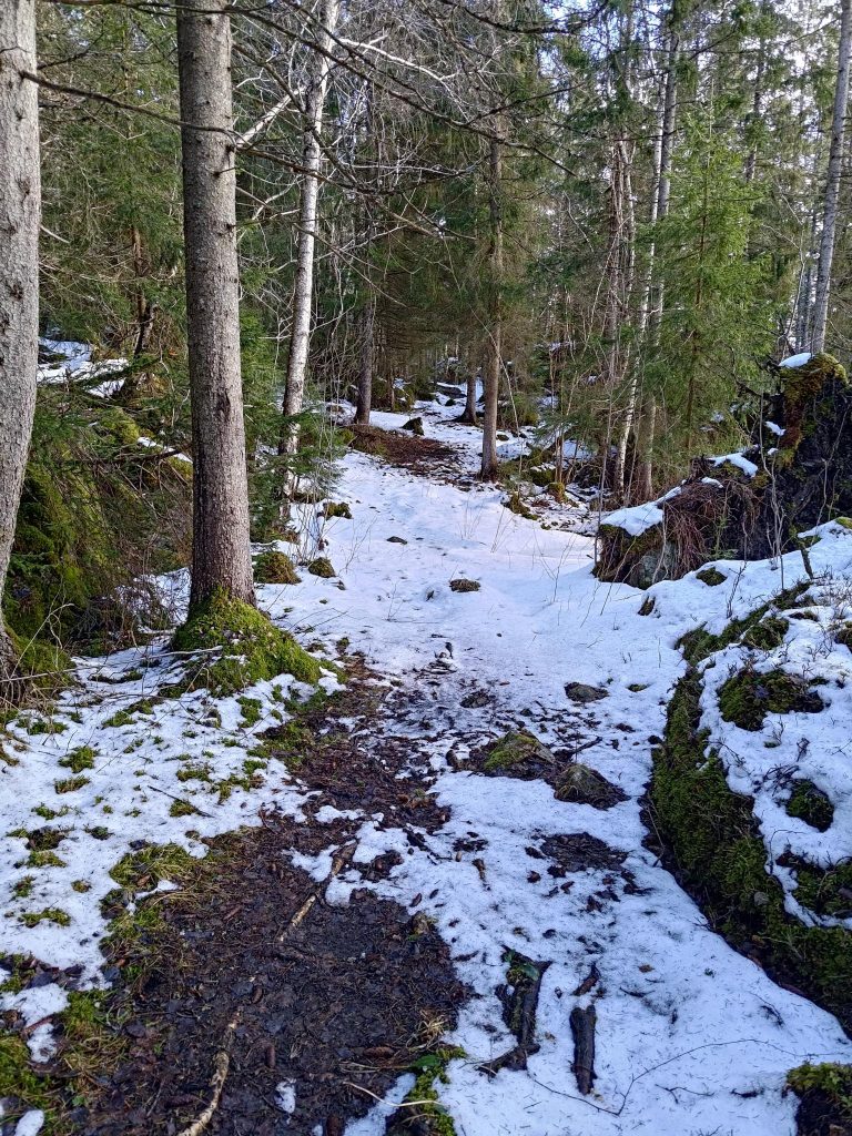
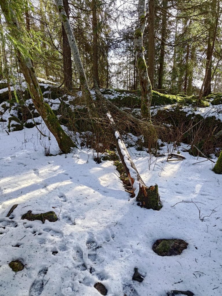
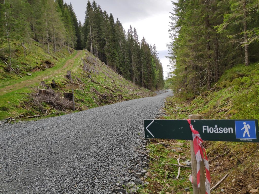
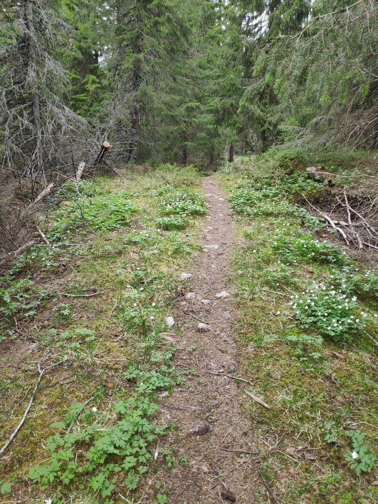
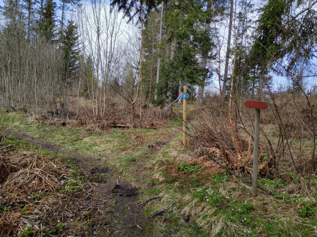
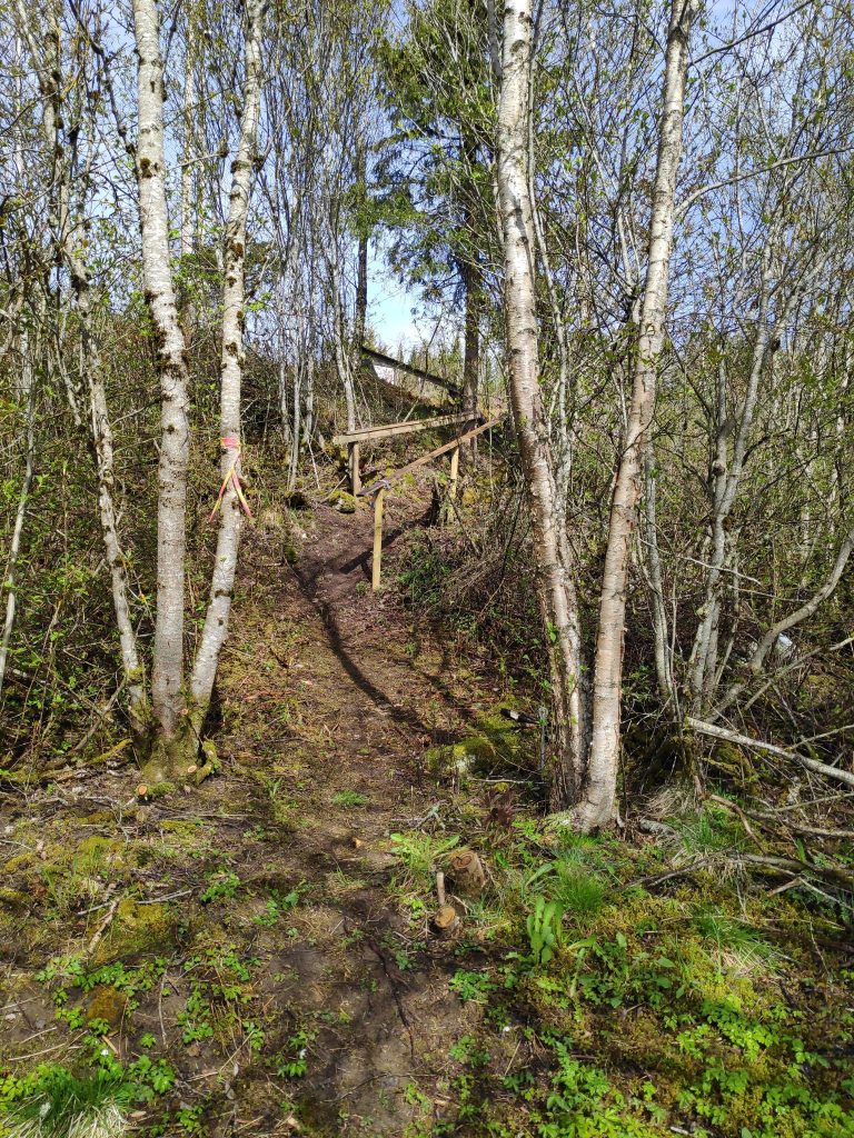
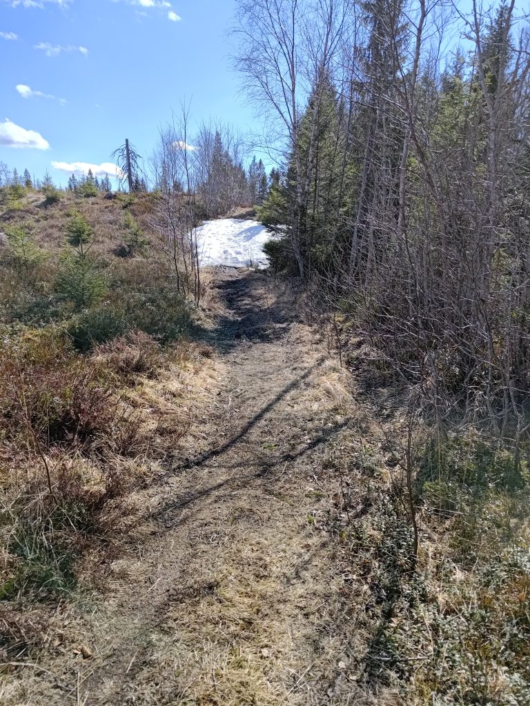
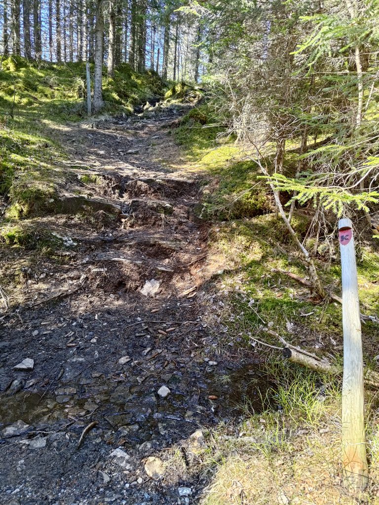
Most of our walk was through the woods. We were walking southwards, so often the sun was in our eyes. Even though I was wearing sunglasses, it wasn’t always easy to see with both bright sunshine and shade alternating on the path. The first 20 minutes or so of the walk was primarily uphill and in some places it was a bit rocky. Other places, like this section, were fairly level and covered with leaves and relatively easy walking.

The open gate and the stile for when the gate is closed.

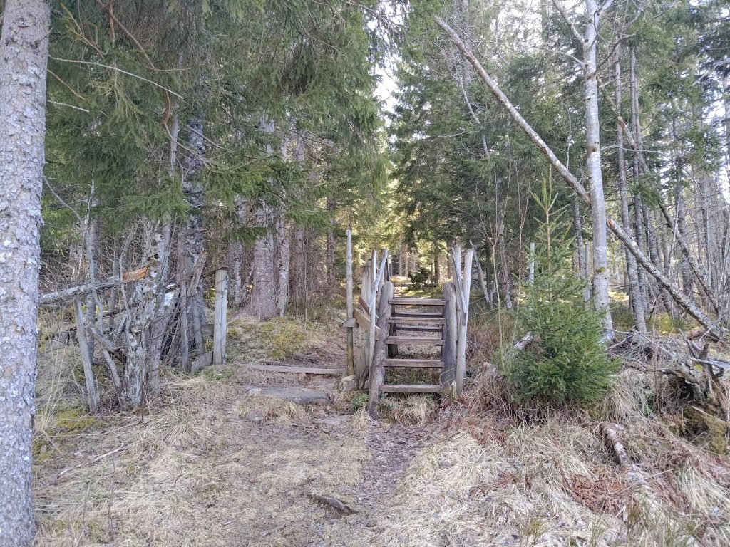
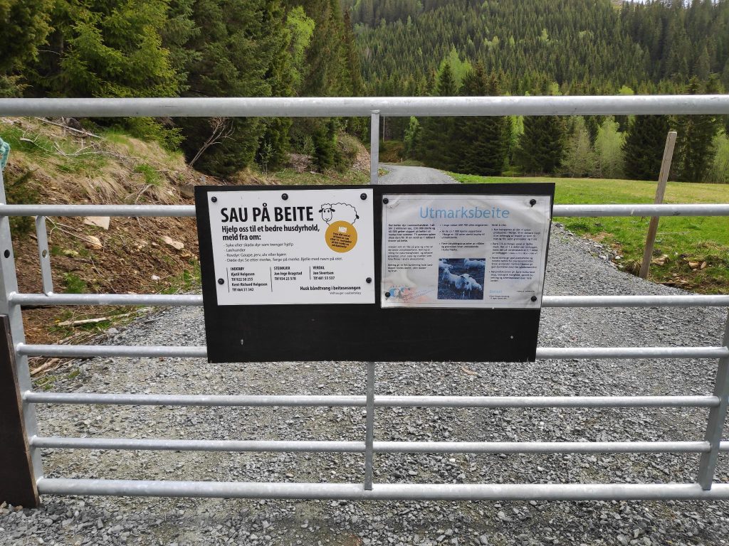
This is a farming area and in the summer months there will be sheep out grazing. They are kept away from the cultivated fields by fencing. As it is too early in the year for the sheep to be out, the gate has been put completely to the side so that walkers have no problems following the trail. Once the sheep are out, the gate will be closed and people will be expected to climb over the stile. This saves a lot of problems as not all people are good at closing gates behind them.

Eventually we got up high enough to get a view towards Straumen. The mountains in the distance still have a bit of snow on them.

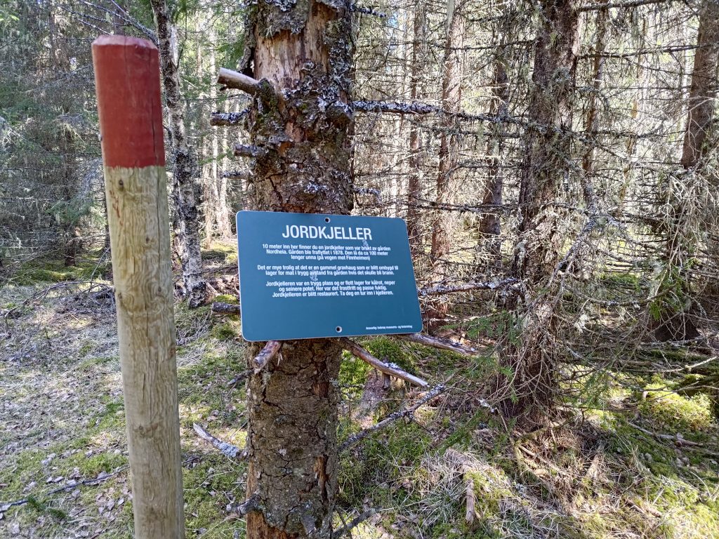
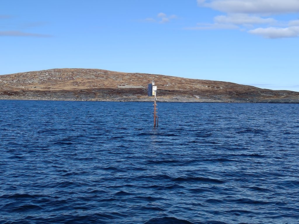
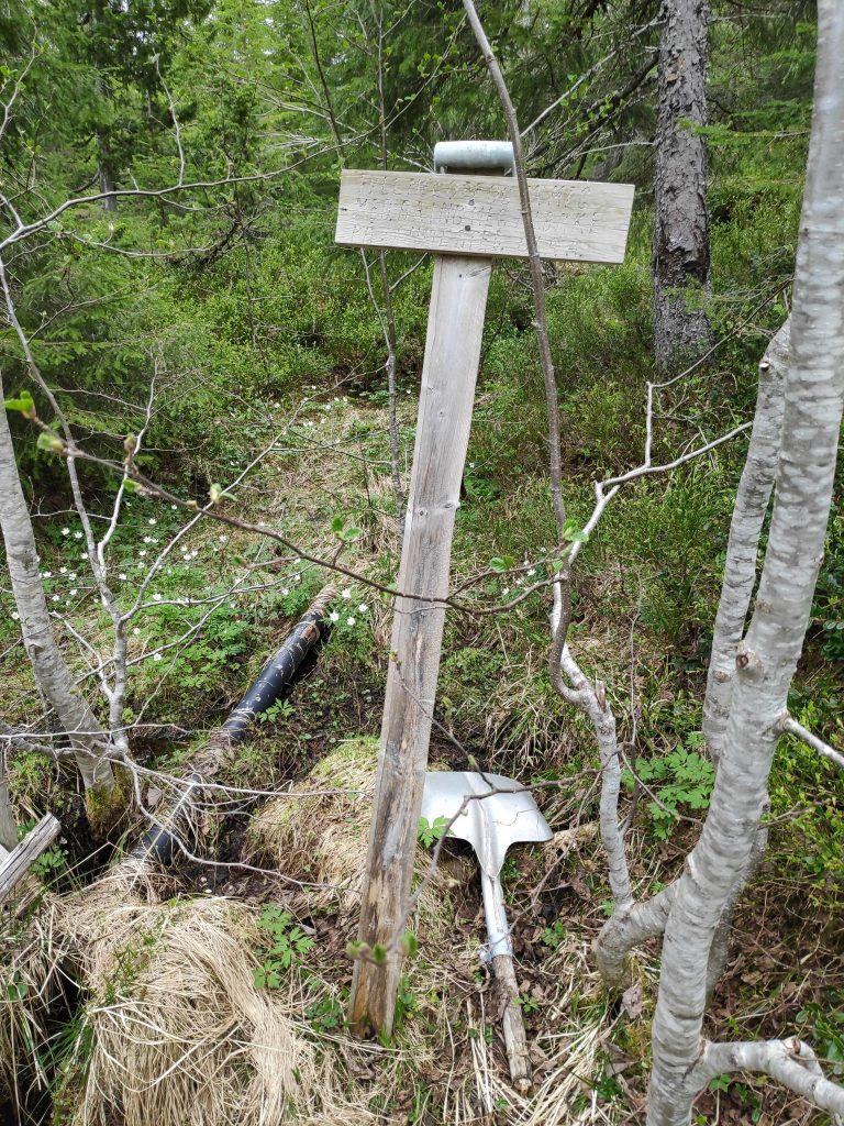
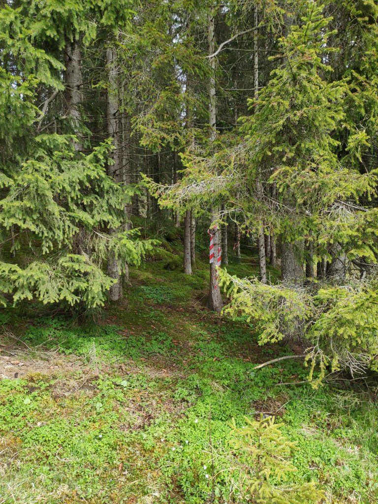
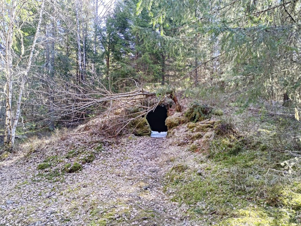
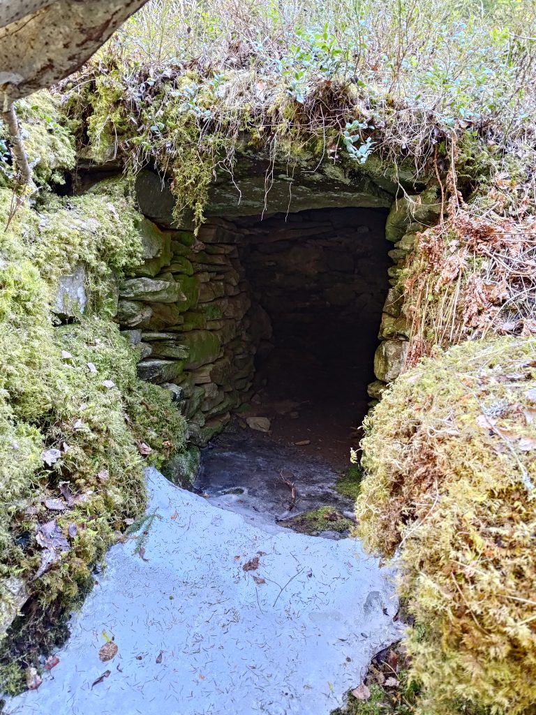
I hadn’t seen this sign before so I went to investigate it. The earth cellar was used by a farm nearby. The farm was abandoned in 1878. In the cellar they would have kept root vegetables, such as turnips and potatoes, in a damp, but above freezing place. This cellar is about 100 meters away from the farm buildings, a safe distance if there should be a fire. Note in the picture the pole with the red top which is used to mark trails so that they are visible both summer and winter.

The earth cellar, with a bit of snow still in the entrance way. This was in a very shady part of the forest.

The earth cellar, showing how it is built up with stones, then covered in earth and moss.

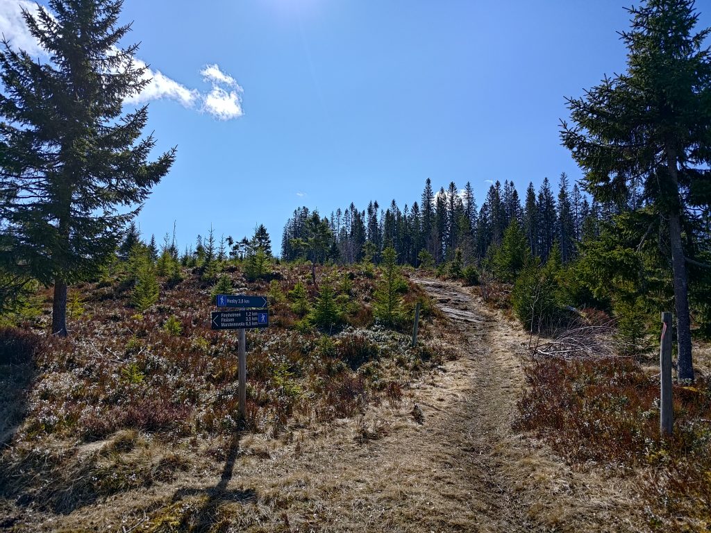
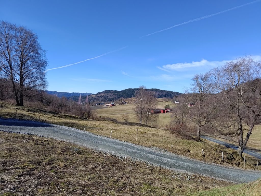
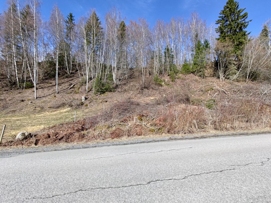
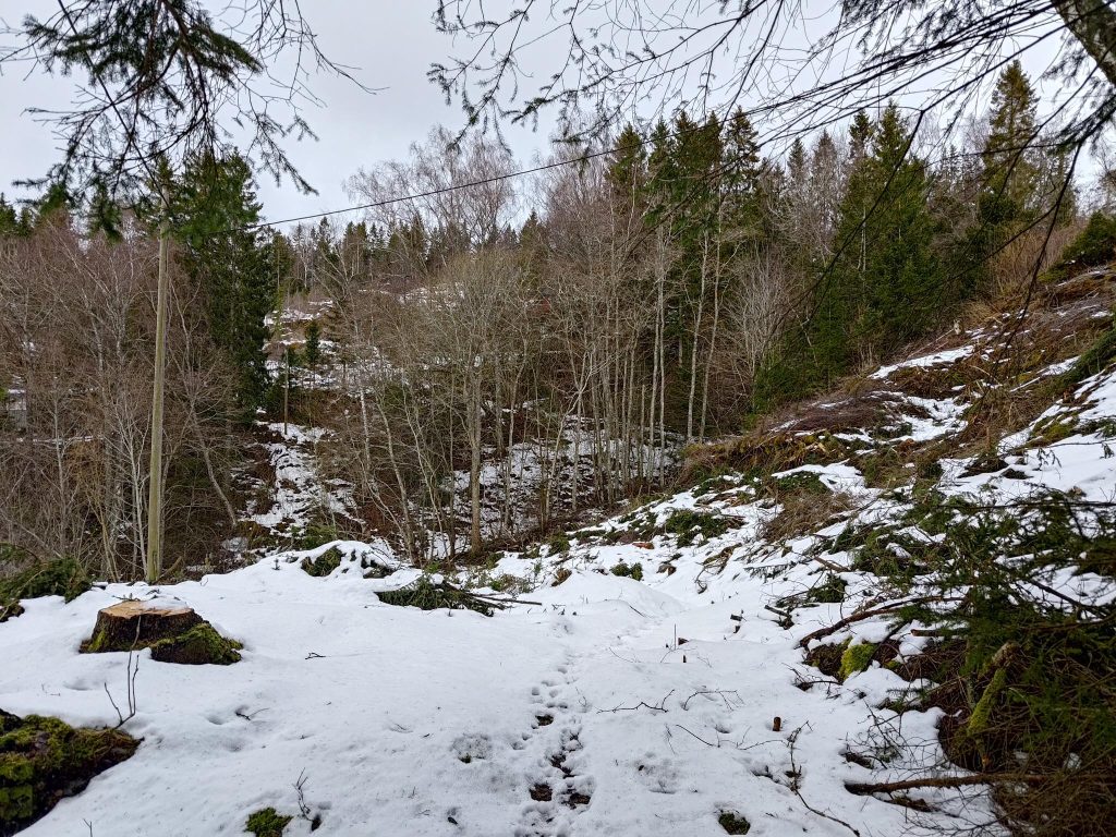
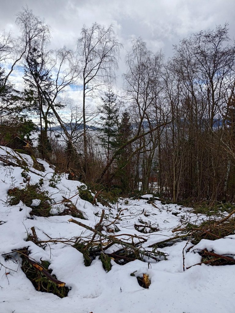
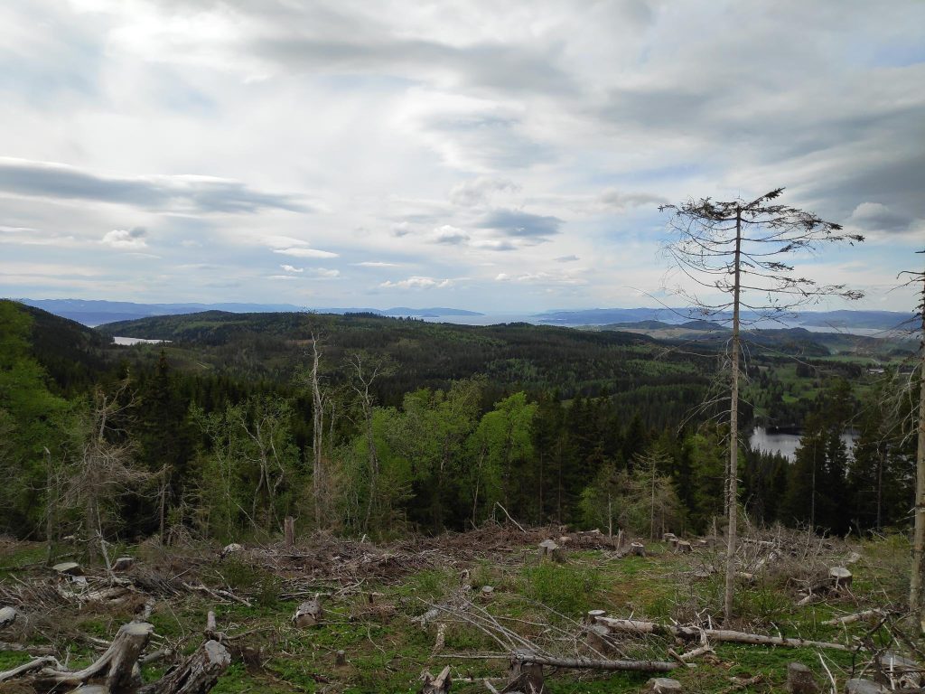
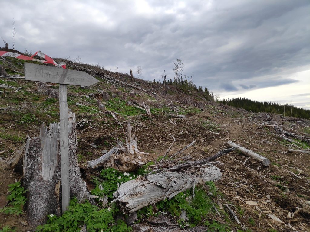
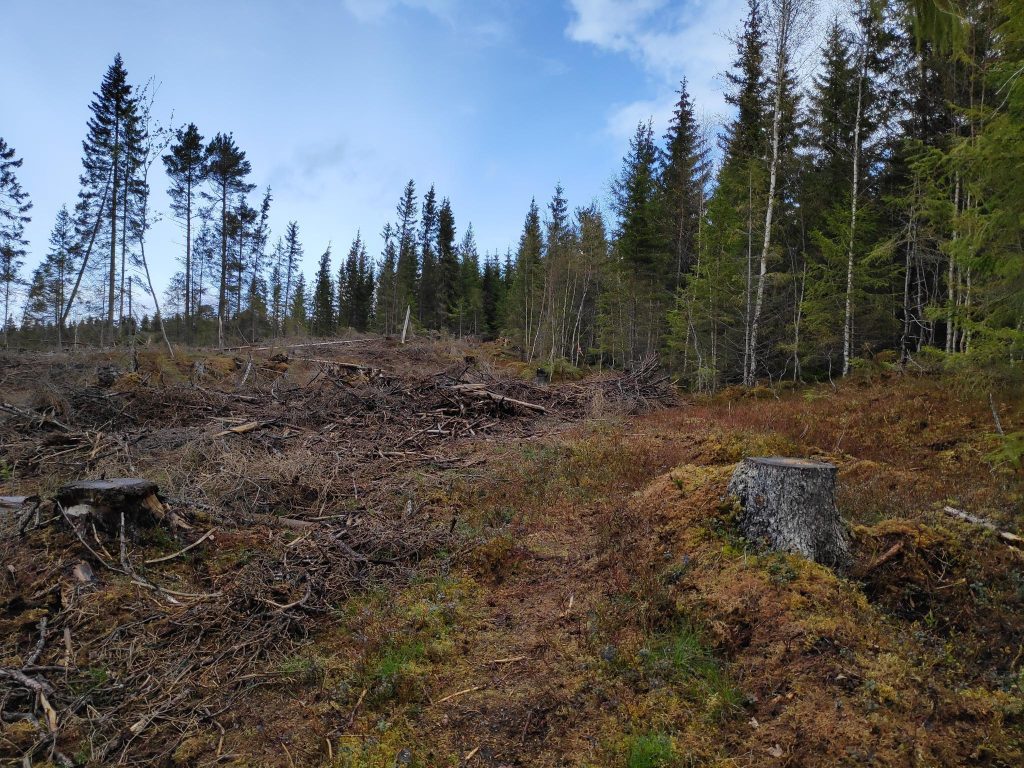
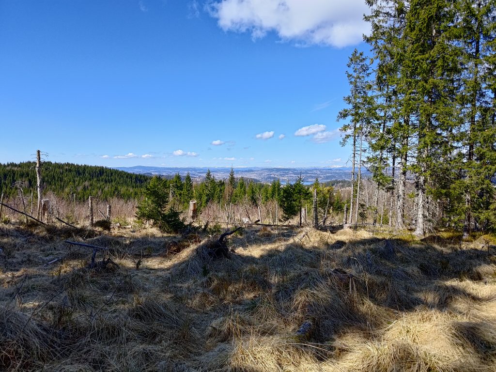
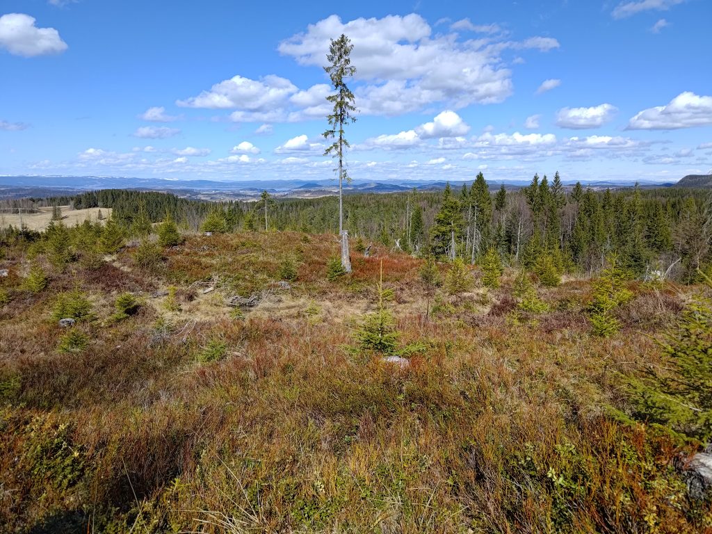
Eventually we began to climb again and came out into the open where the forest has been cut down relatively recently. Lots of choices on where one can go from here. We chose to continue on the trail towards Husby and climbed up the hill ahead of us.

This was the only place on the trail that we came across snow still on the trail itself. As the area is quite open, I expect the snow got blown onto the trail here and built up to a greater depth than elsewhere. Today it was in the sun, so I don’t imagine that it will last much longer.

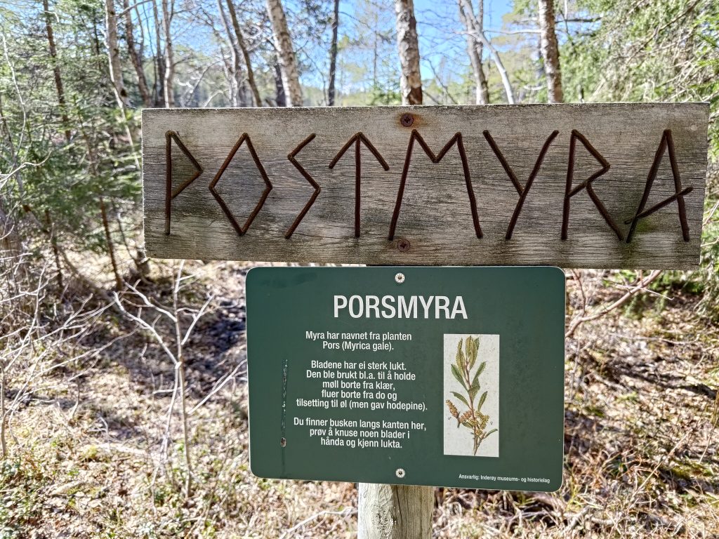
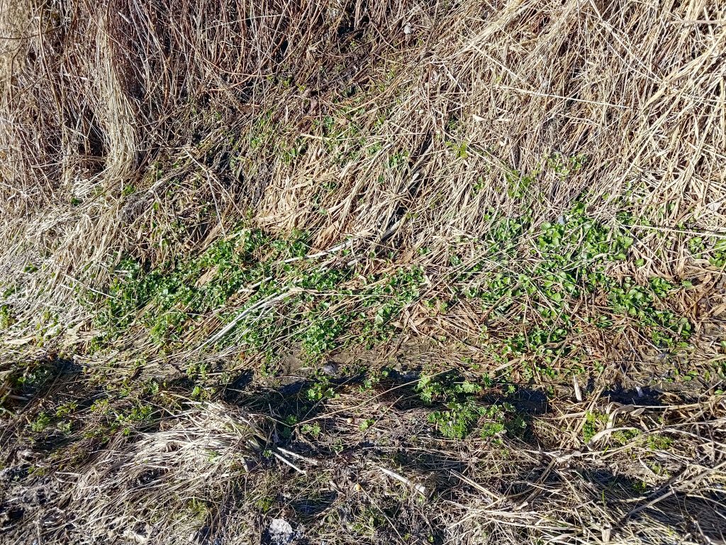
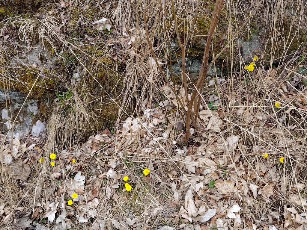
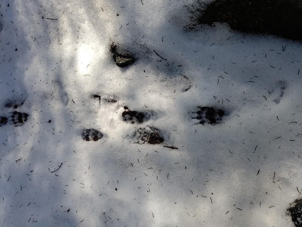
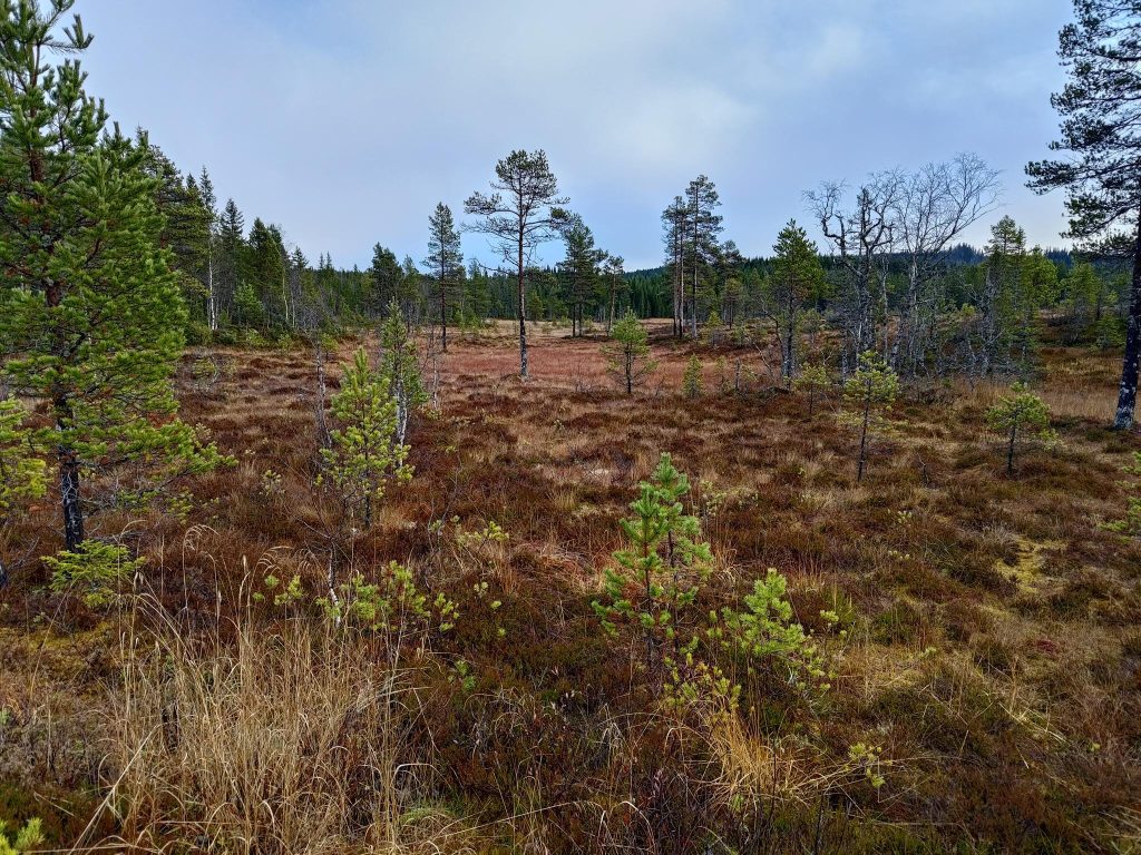
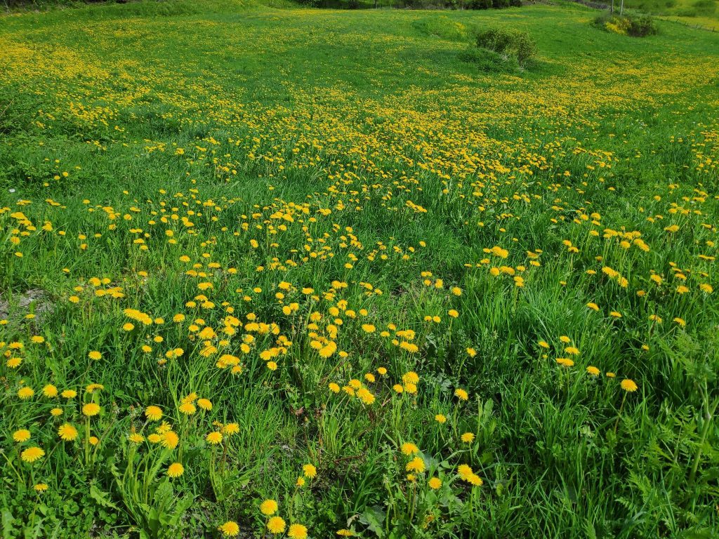
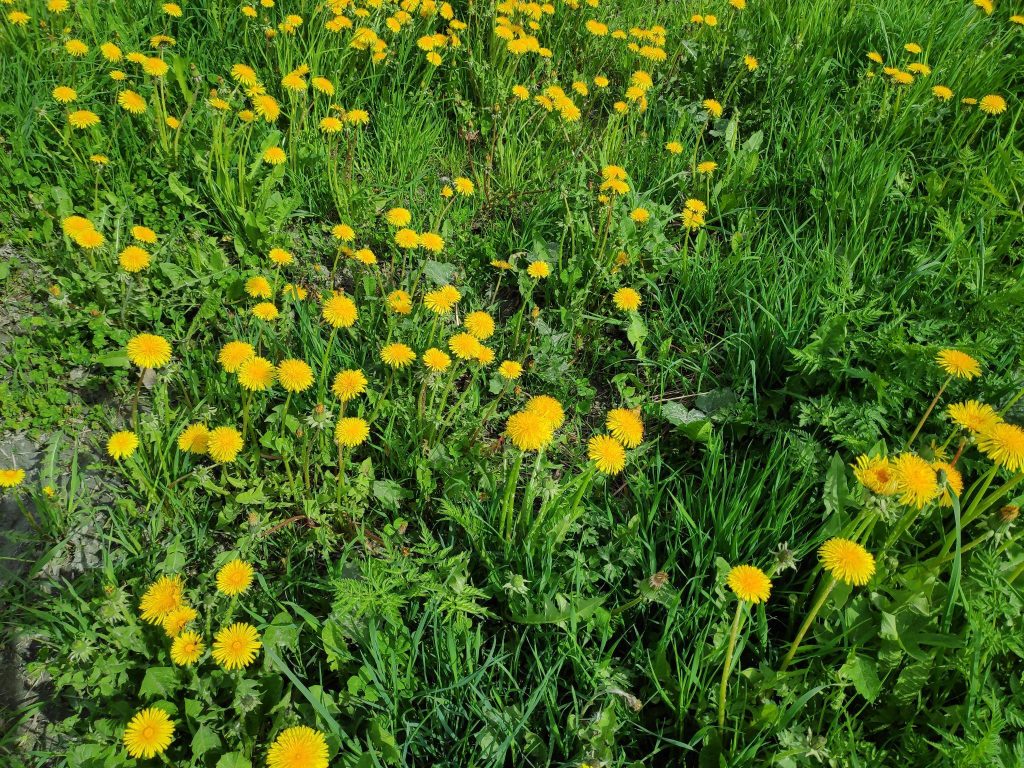
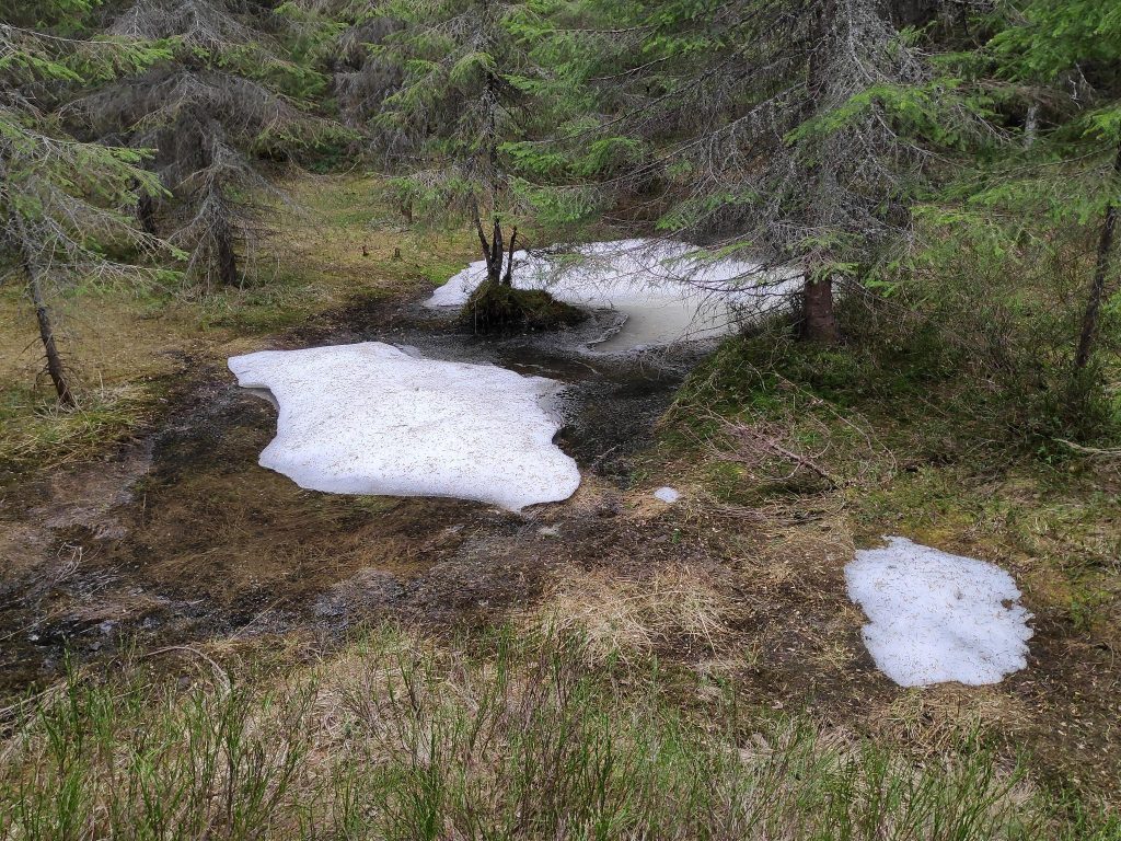
“Myr” is a swampy area. Though we haven’t had much rain recently, this would be a very wet area. This swamp is called “Porsmyra” because of the plant “pors” which grows here. Pors /myrica gale has a strong smell and was often used to keep moths from clothing, flies away from outside toilets and in making beer. Inderøy is full of swamps, but what was most interesting for us was seeing a pair of cranes feeding in the swamp.

Porsmyra, with two cranes located under the tallest tree. They are difficult to see as they were quite far away.

Cranes (grus grus) are the largest bird found in Inderøy. They are from 95 to 130 cm in height and can weigh between 4.5 to 6 kg. We have seen cranes several times this spring, including in the field next to our house. There seems to be more and more each year. They avoid people and quickly fly away if one gets too close to them. I have learned to recognize their trumpet-like call, so I heard them first then looked for them in the swamp.

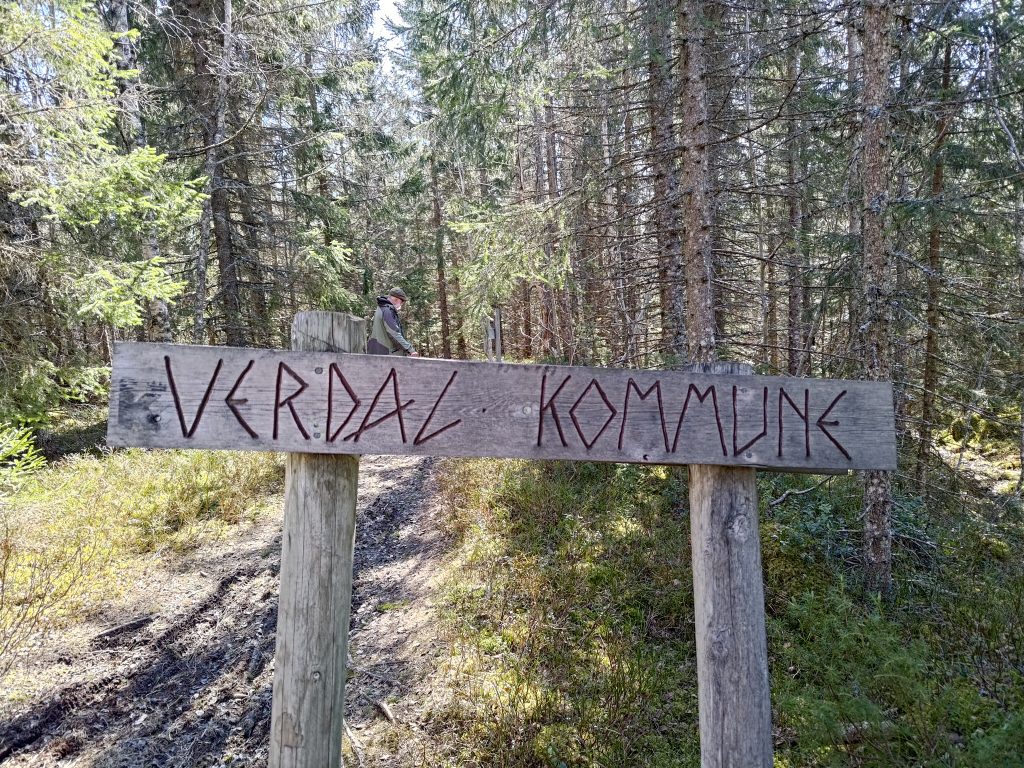
We crossed into the neighboring municipality on our walk. Behind the sign is my walking companion, dressed in traditional green and black.

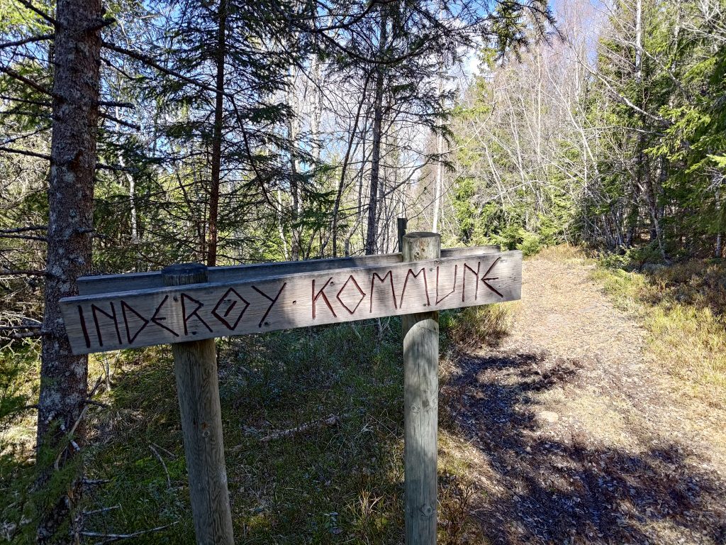
Of course, if we look back the way we came from, it shows that we have come from Inderøy municipality.

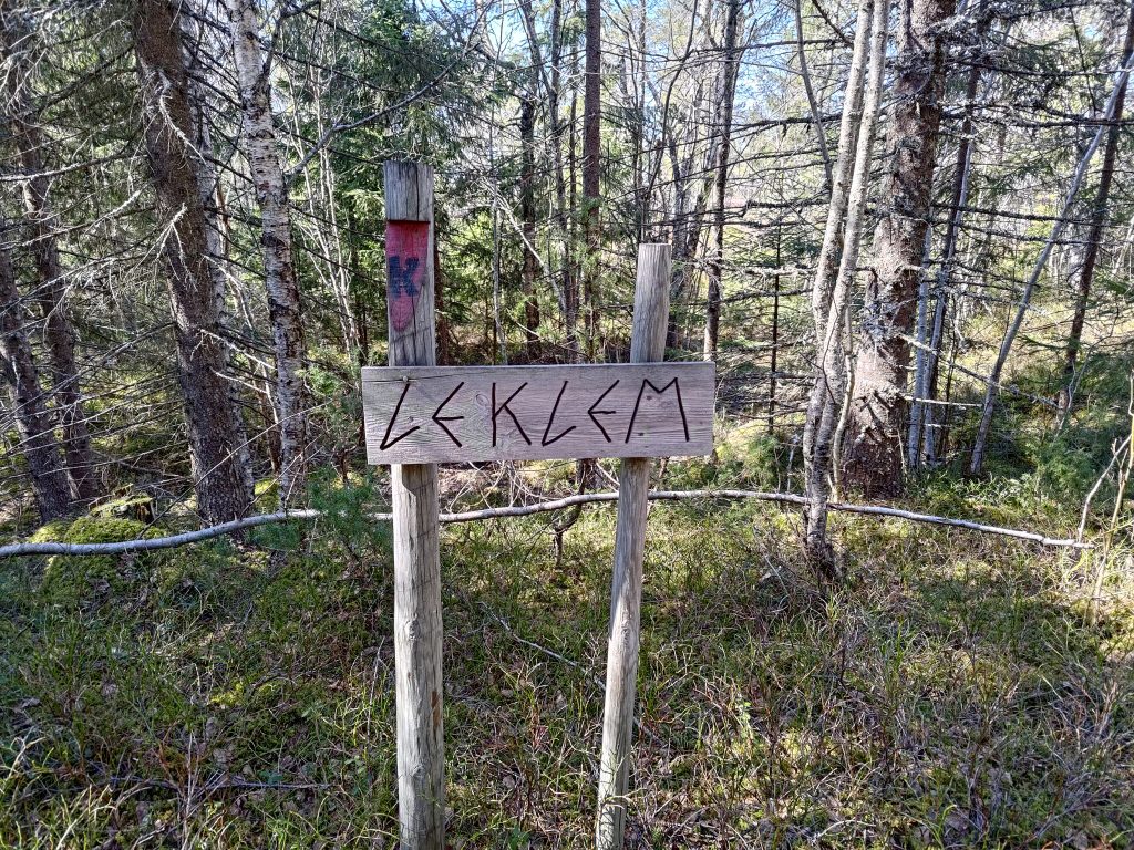
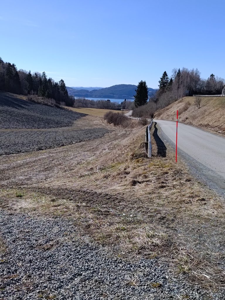
Once we had crossed into Verdal, we were in the area called Leklem, and we are headed to the south end of Leklem Lake. Note the post, with a red section and a large K, showing that we are on the King’s Road (Kongeveien).

The dam on the south end of Leklem Lake

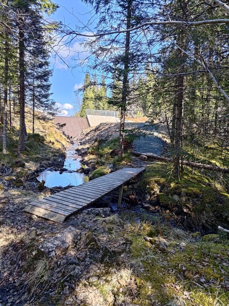
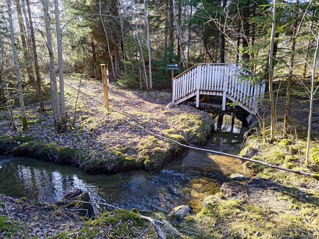
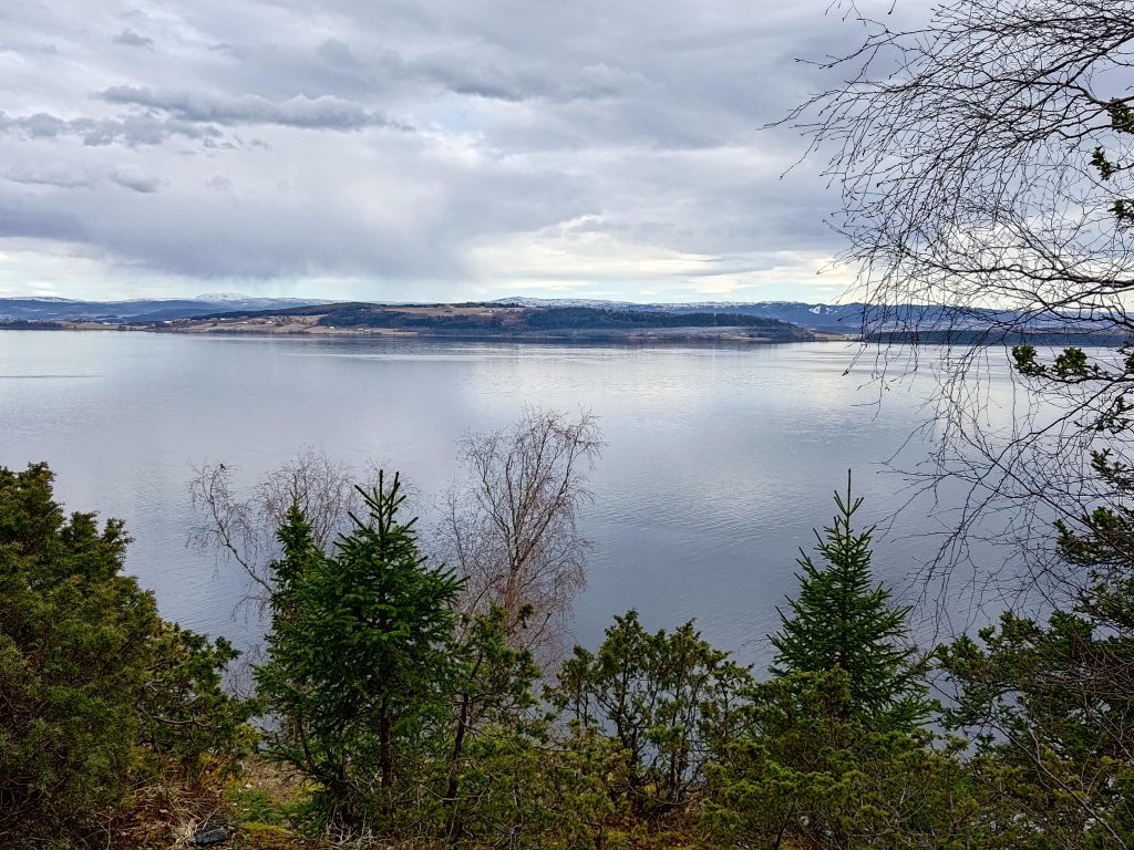
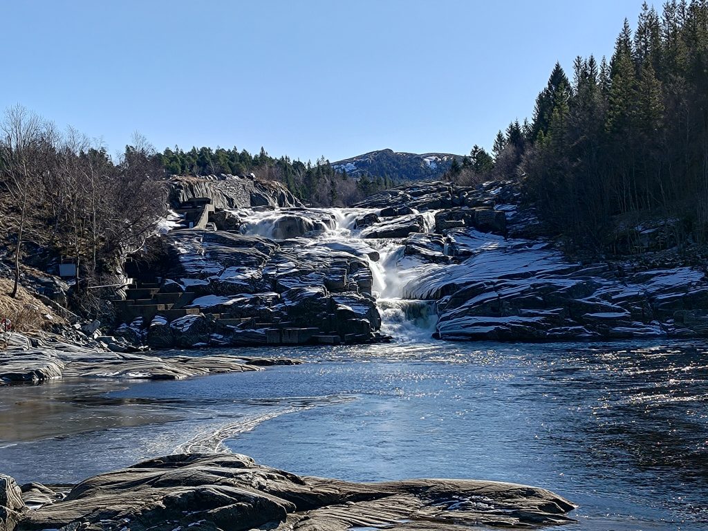
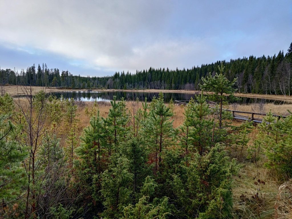
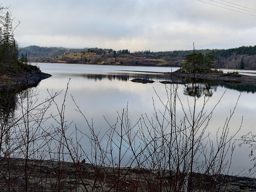
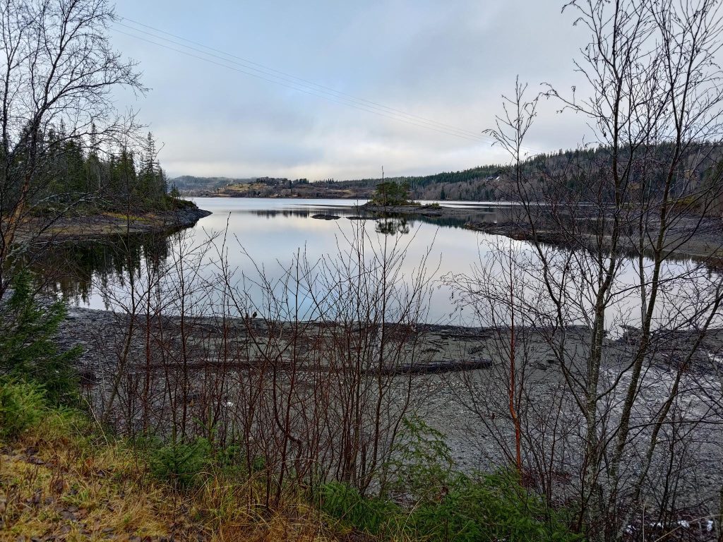
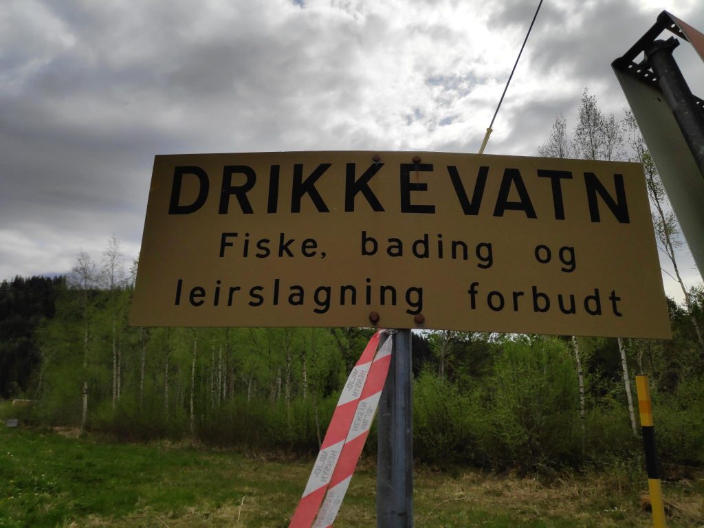
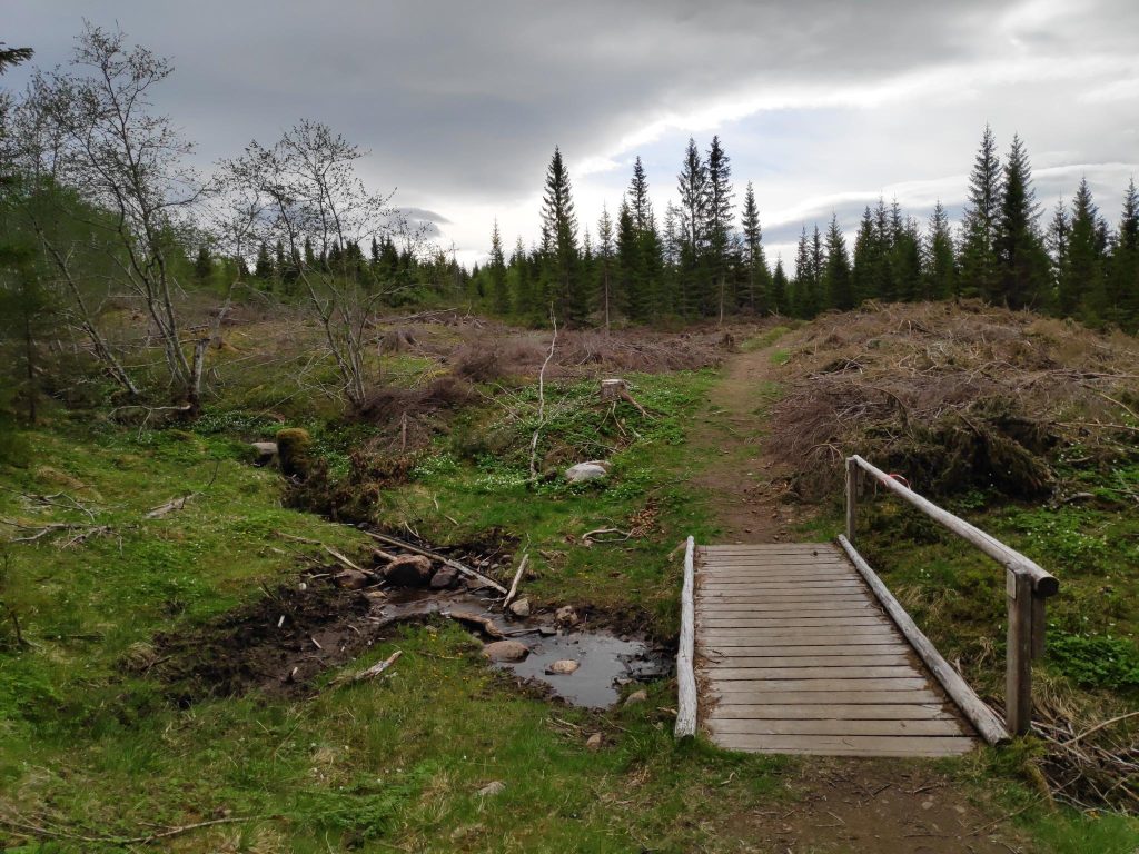
Our goal for the walk was to get to this dam. The first time we found this place, they had emptied the lake and were rebuilding the dam. The lake is a water reserve for Verdal municipality, but otherwise the water spilled over the top of the dam and ran down this stream that we crossed.

Not all parts of the trail were equally smooth. I imagine that when it is raining, this section is also a stream. I use two walking sticks when out in rough terrain and find it very useful on sections like this, especially when going downhill.
The top of the dam. There is a spillway and water was gently running over the top of the dam.
Leklemsvatnet

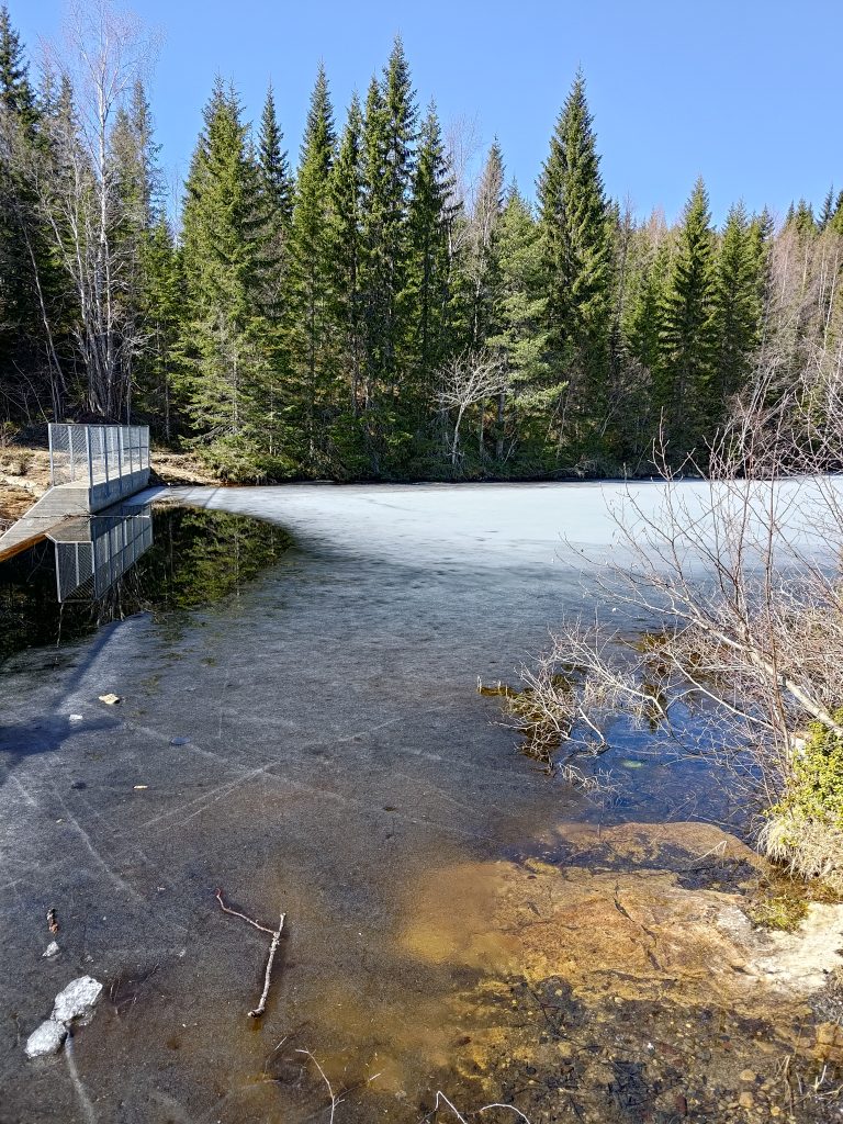
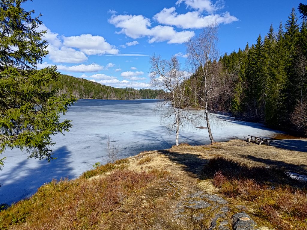
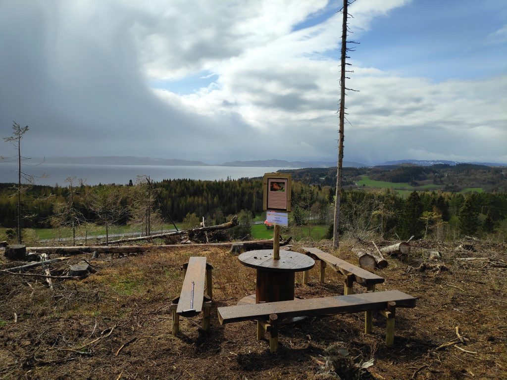
The lake was still partly frozen, but with 12 degrees and sunshine, I don’t imagine it will stay frozen very much longer. We found a picnic bench to sit at so we took a well-deserved pause in our walking. We had used one and a half hours to get to this point, with all the stops we had taken to look at the views, to watch birds and to take photos. We used only one hour to get back to the car, but I think there was less uphill on the way back, which certainly means that we walked quicker.

I have had the walking stick on the right for several years. It was purchased in Canada by my daughter many years ago, and I have been using it for the last couple of years. The walking stick on the left was purchased this winter (online from a Norwegian business but the stick is made in Germany) so that I could have two sticks when walking in rough terrain. I like having two out in the wooded hills and on rough ground. I like this type of handle as my weight is on the palm of my hand, not on my fingers which don’t always work well.

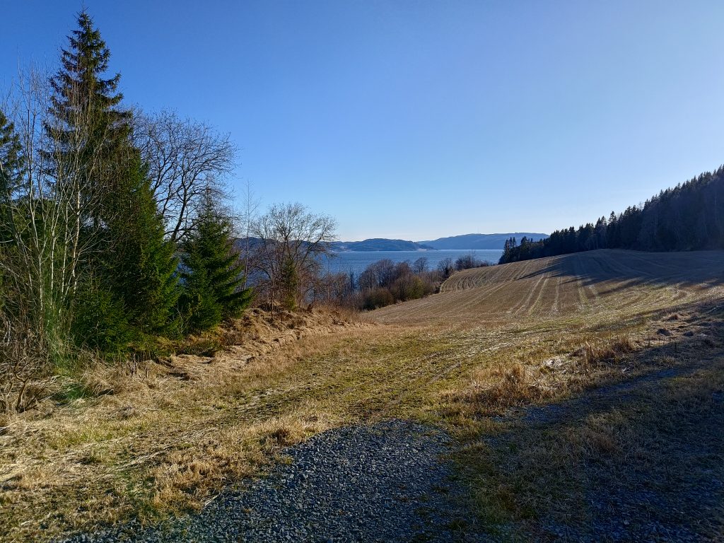
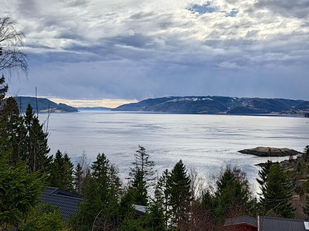
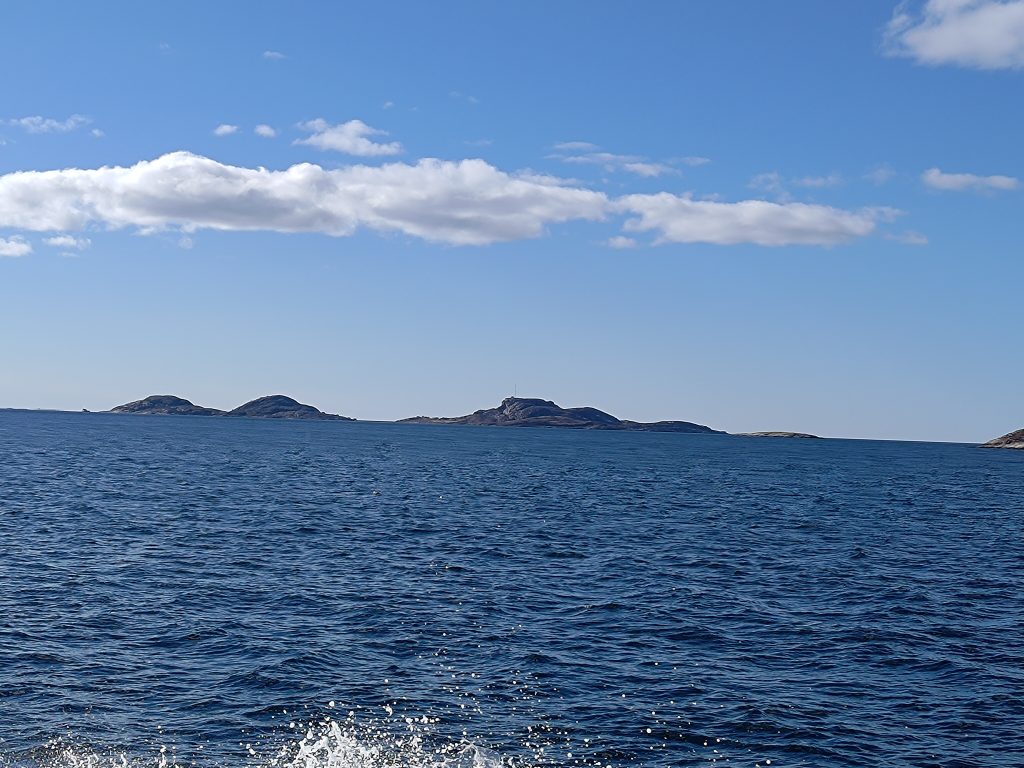
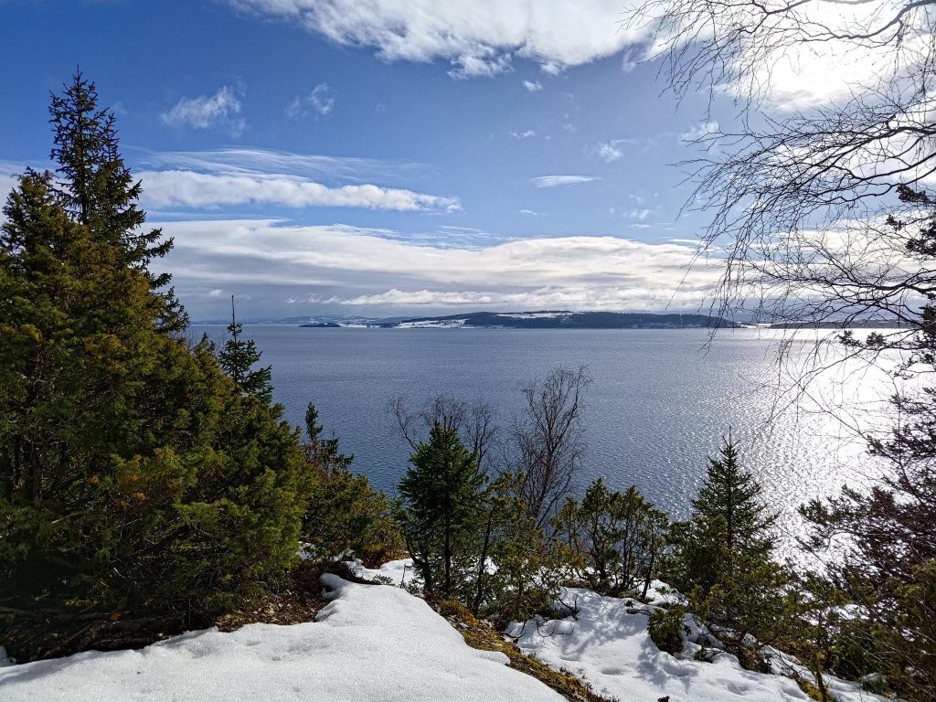
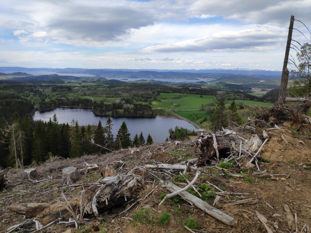
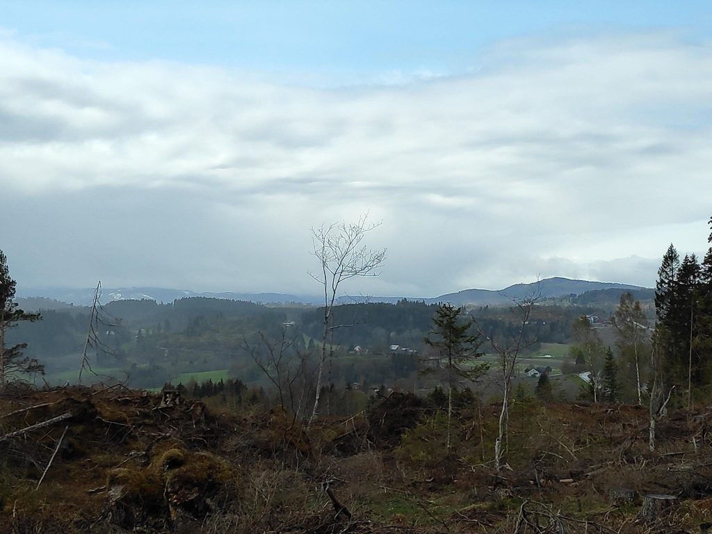
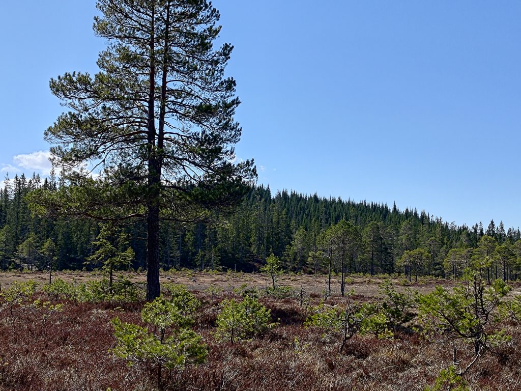
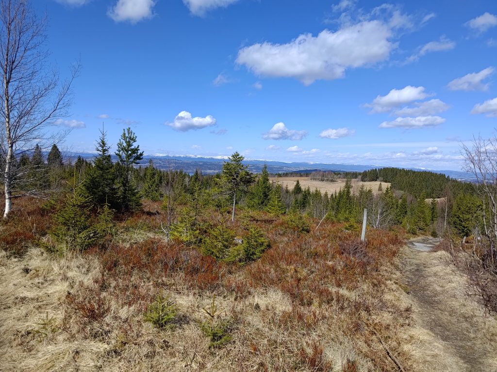
Walking north, back to the car, we saw the views that I quite like. The best views were from a logged area, where it was very open and the new trees were still quite short. Though there is a lot of wooded area on these hills, there are also a lot of farms in Inderøy and Steinkjer.

Looking north, with Steinkjer in the background.
Looking northeast, also towards Steinkjer

We used two and a half hours on our walk today, and we were healthily tired when we got back to the car. A thermos with coffee and two cookies each helped revive us. We also changed our shoes so that tired feet felt a bit of relief.

Something we could have done better was to have taken a small backpack with bottles of water. Today was the first warm day and the longest walk we have taken this year, but a drink of water would have been good when we took a break before heading back to the car. It can also be nice to have something to put clothing in as layers get taken off as the day gets warmer. I had taken off my wind jacket about half an hour into the walk. With no wind and lots of sunshine, it wasn’t needed.

This was a most enjoyable walk. We were well away from roads with traffic. It was quiet except for our noises and voices, which is something we both appreciate. The temperature was perfect for walking, not cold, nor too hot. Next time we come to these hills we will probably take a slightly different walk, but this is one I especially enjoy. I hope you were able to get out in nature on the weekend too. Being near trees is supposed to be very good for our mental health.

Evening walk at Rostad, Inderøy

One of the nice things about April is the light evenings which allow me to get out for a walk. This week I met a girl friend at about 6 pm and we took a 50 minute walk that we have done many times before, but this was the first time in 2024.

“Rostadrunden” means that the trails go in a circle and one can walk either way.

During the summer months, we can often get points for going to certain parts of this trail, but it is too early in the season yet for that. But it was a nice sunny evening, though there was a very cold wind blowing. The temperature was about +5 degrees centigrade, but there was a big difference between being in the sun or being in the shade. There is public parking near these signs, which holds five or six cars. We each drove a car as this location is halfway between where we live and we come from opposite directions.

The house at Rostad Farm in Inderøy

The property at Rostad was originally a wealthy family’s farm. The house has been well-preserved and is often used for meetings. The farm continues to be used as a farm. However, for about the last one hundred years, a residential school has existed on the property. Over the decades the type of school has changed and who has run the school has changed. The first school was an orphanage which started in 1902. The property is currently run by the CRUX Foundation. CRUX Rostad is an institution for teens aged 13-19 who need a place to live when their parents are not able to function. The institution has 12 residential places. The children live in other newer buildings on the estate.

Information about Rostad

At the parking spot there is information about Rostad. A former prime minister of Norway, Ole Richter, grew up here and later represented Norway during its union time with Sweden. He inherited the farm but had no descendants so at his death the estate was sold. Ebba Astrup became the first director of the orphanage that opened in 1902 and she worked there until 1918. In 1927, she gave money to start the Rostad Foundation. It is still run by a foundation.

The mausoleum where Ole Richter is buried.

There are not many mausoleums in Norway, but on this property there is one. Ole Richter was buried here after his death in 1888, along with his wife who had died a few years before.

The gate posts on the road up from the fjord

Though today this estate is easily reached by paved road, in the 19th century, access to the estate would have been from the fjord. There is a gravel, tractor road that we followed down the hill. The gate posts in the picture would have been the formal entrance to the main building. We decided to take the walk in the counter-clockwise direction, so we started by going downhill, about 500 meters towards the fjord. It was very windy on the water, so we avoided going right down to the fjord.

The trail through the woods

A lot of the walk goes through the woods. It goes up and down quite a bit, but there are no very steep sections. Most of it was quite dry, though the streams had plenty of water in them. The trees are quite bare still and the ground is covered with the leaves that came down in the fall. It is evening, so there are small patches of sunshine, but at times the woods are quite dark. It stays light until about 9 pm now.

A muddy section on the trail

There was only one section that was muddy, so here there is obviously water that drains off the hillside that is not put through a pipe. It was a very short section and very easy to get around.

White anemone, beside the trail

The white anemone is an early flower that comes out on the forest floor before the leaves come out on the deciduous trees and take away the sunshine. These were the first ones that I had seen this year, so it must be a spot that is both sheltered and sunny. Note that the moss seems to be growing quite well here as well.

A cute white bridge over the stream

There is a stream that runs through the property. Where it comes out at the fjord, there is quite a drop and it has been used to power a grain mill in the past. It doesn’t look like a very large stream here, but it is nice to have a bridge to cross it. At this point the trail divides and if one wanted to walk to Undersåker (approximately 2 km to the east by the trail), one could take off on a trail that goes off to the right from here. We are coming from the foreground, will cross the bridge and head off to the left. You can see directional signs, but there are also a lot of information signs on this part of the trail, primarily about dwellings in the past.

Farm field at Rostad, looking toward Trondheimfjord

As we came out of the woods, we looked across a farm field to see the fjord in the distance. This is a working farm with grains and grasses being grown.

It didn’t take us long from here to get back to our cars. It was lovely to get out. For me it is also a social time with a girl friend. I enjoy springtime, with sunny days and nature just starting to turn green again. The air can be cold still, but with no leaves on the deciduous trees, one can see more in the distance. I hope you can enjoy a walk today too.

Regular Walks

Most weeks I walk once or twice up to a local dairy farm, Åsvang, to buy fresh milk in bottles. And by “up” I mean a 25 minute walk uphill, and a little more than one and a half kilometers. According to Google Maps we live at 32 meters above sea level and the farm is 129 meters above sea level, meaning that there is an altitude difference of 97 meters. It is good exercise.

When one does the same walk many times, it may seem a bit repetitive, but as the seasons change, it is interesting to see what changes have happened since the last walk. Especially in spring, there can be quite a few changes, just in a week. We’ve recently had plenty of rain and the walk today was sunny, so nature is coming to life again after winter.

Coltsfoot / hestehov, 2024.04.16

Where just a few weeks ago, these first yellow flowers were hard to find, they are now coming out in large clumps and quickly spreading along the sunny road banks. All pictures in this blog were taken on 2024.04.16.

View from Åsvang, looking west, 2024.04.16

As one looks over the fields, some of them are just starting to turn green. The snow has disappeared, but it will be a while before the trees have leaves on them. If you look carefully, you can just see the tops of the two towers of Skarnsund Bridge.

Near Åsvang, 2024.04.16

I love it when the new growth is starting to be more visible. Even the deer are starting to find enough grass in the fields to eat. There is still a lot of dry grass from the last year, but the new growth will soon be tall enough that one won’t see last year’s growth which becomes fertilizer for the new growth.

On the road to Vangshylla, 2024.04.16

Though the fields are still mostly brown with dried grass, some of the fields have been plowed, often in the fall before the winter came. The road bank to the right of the road is just starting to show the promise of green grass. In the distance can be seen an island, Ytterøy, which means the outer island. We live in Inderøy, the inner island, which is actually a peninsula.

Along the road to Vangshylla, 2024.04.16

In the ditch, where there is still plenty of dampness from the heavy rains a few days ago, the leaves of flowering plants are showing that it won’t be long before there will be more flowers to be seen.

Along the road to Vangshylla 2024.04.16

In a previous blog I mentioned people cutting down trees for firewood. Here’s an area that has been attacked by such a person. There is a field to the left, but in the center of the picture quite a few trees have been cut down this spring, making the hillside look bare. The small branches are left to rot, which is fine, but it doesn’t look very good.

Birch tree, 2024.04.16

For many, spring is a problem with pollen. The birch tree is one that can cause quite a bit of problem, both for myself and many others. Already, the trees are putting out their pollen producing catkins, but it will be a month before the leaves come out on birches. There is a sharp difference in color between deciduous trees, like the birch, and the evergreens, either pine or spruce, which you can see in the background of this picture.

Willow tree, 2024.04.16

Willow trees put out their flowers long before the leaves come out. The pussy willows on this tree are just starting to come out and will soon be shedding their pollen. Checking today’s pollen warning shows “moderate” for willows, or salix.

Spruce tree, 2024.04.16

Trees are always hard to photograph close-up, in my opinion. What I see with my eye, is not always what appears in the photograph. Eyes are really much better devices than cameras in many ways, even older eyes. This year there have been a lot of spruce shoots from the ends of branches lying on the ground as if there has been too little food and animals have been eating the shoots. The new growth has not really started but at the very ends, there are signs of new growth just coming. The spruce trees did not bloom last year, and there are very few cones left for the squirrels to munch on, so I hope the trees bloom this year.

At Fjellheim, 2024.04.16

I am always eager to see what is coming up in my garden. Once the sprouts are showing from the bulbs, growth can happen amazingly quickly. Here are both tulips and daffodils coming up and there is also a peony plant that will emerge as well. The tulips don’t do very well anymore as the deer tend to eat them. But the daffodils do well as the deer don’t eat them.

At Fjellheim, 2024.04.16

Our house is called “Fjellheim” and we translate that as “Cliff Cottage”, though a more direct translation would be “mountain home”. The above plant is a wild orchid that comes up every year. When we first moved to the house, it was growing in a ditch, as it needs lots of water. I carefully moved it one year so that it didn’t get destroyed by people digging in the ditch and I managed to find a place where it thrives. It comes up early, and already the flower stem is starting to show in the middle. This one will have a dark purple flower.

At Fjellheim, 2024.04.16

The lilac bush’s buds are starting to open out in the sunshine. We still have frost at night, but the daytime temperatures can be up to about 10 degrees. This bush gets lots of sunshine and will be one of the first ones on our lot to put out its leaves and flowers.

At Fjellheim, 2024.04.16

Crocuses are the first bulbs to bloom and these ones are enjoying the sunshine under the lilac bush. These come up in a bed where we have been putting snow when clearing the driveway in the winter, so there are always a lot of stones in the bed. Eventually the largest of them will be put back on the driveway, though that is a tedious job.

These were some of the delights of nature this week. But the joy of this time of year is how things change quickly. The earliest flowers disappear, the leaves come out on the trees, and new flowering plants emerge. I hope you can get outdoors and enjoy the nature that is around you.

Spring 2024 walking season has started

I have been quite lazy this winter, doing very little walking outdoors except when going specific places, like the dairy farm or the egg farm. But today, the temperature was finally a bit more comfortable, at 12 degrees centigrade, so my husband and I put on walking trousers, hiking shoes and went for our first walk in the woods.

We have a favorite location that takes us along some gravel roads and a path in the woods. It takes about 20 minutes to get to Bear Cliff (Bjørnbrøttet), where there is a book to write one’s name in and a small shelter to take a short pause. I have written blogs about this walk previously. You might like to contrast today’s walk with the one in 2023 when the weather was quite different.

The view from Bear Cliff taken at 16:31, looking towards the island of Ytterøy with Levanger in the background.

As you can see from the picture, it was cloudy and there had been rain showers earlier in the day. We did not have any rain while we were walking and we were out for about an hour. But shortly after we were home again, there was another short rain shower.

As this was the first time for this walk in 2024, it was interesting to see if there were any changes, either in nature, or to the cabins we walked by. There were a couple of trees that had been blown over, some that had been cut down. There seemed to be more open spaces as if cabin owners wanted more sunshine or a better view. At this time of year I am always looking to see what flowers are out. The two earliest ones here in Inderøy are coltsfoot (which is yellow) and anemone hepatica (which is blue).

Coltsfoot /hestehov) or tussilago farfara. The flowers come out from the rhizome first before any leaves appear. The leaves are very large but disappear during the summer. These flowers like the sunshine and appear first in sheltered, sunny spots and along the roadsides.
The blue anemone, sometimes called liverwort, (hepatica nobilis / blåveis) is a bit hard to see, but they are also very common in Inderøy and one of the signs of spring. They will eventually cover large areas as the days warm up. They are quite small and are often found under trees.
You’ll have to look closely in the photo to see the hepatica / blåveis, but it is in several parts of the photo.

Getting out in the fresh air is important. Getting walking exercise helps keep us in good shape. I was surprised that I was in such good shape as I did not labor up any of the hills. So that is a good sign. I also feel that it is important for our eyes to look far in the distance and not always to be looking at a screen or things close to us, for example, knitting projects.

Looking south-west towards Trondheim, through Norviksund, with Mosvik on the right and Ytterøy on the left. There are rain clouds in the distance but they didn’t get to us until after we were inside again. Looking at the small island on the right, we see that it was relatively low tide.

We live in an area with quite a variation in tides. When this picture was taken (at 16:46), the tide was still going out and low tide was at 18:40 and at 6 cm above the base level. At high tide, later this evening, the water level will be at about 324 cm, so the water level will be more than 3 meters higher than at low tide.

As we came up our own driveway, I looked to see if there was anything flowering yet. I have lots of bulbs, but the ground has been frozen until the last few days. Crocuses are just starting to show some color and only need a few days of sunshine to come out in full bloom.

Not wild flowers, but planted in my garden. Crocuses are the first flowers that bloom in my garden. These need a bit more sunshine before opening out.

I hope you too are able to get out for longer walks out in nature, now that we are in April. Enjoy the nature you have around you.

Skjærvøya

This building on the quay on Skjærvøya has a waiting room for passengers.

It’s been Easter week in Norway and there are many days where everything is closed down, including Thursday, Friday, Sunday (Easter Day) and Monday. Many people take most of the week off and I’ve been enjoying having my son at home for the week. We were invited to visit a family that have a holiday cabin on this remote island. Wednesday was the only day we would be able to make a day trip there, that is, get out to the island and back to the mainland on the same day. The weather forecast was good for the end of March so we made arrangements to go visit our friends.

We started from home about 10 am and we had a two-hour drive to where we would get the ferry out to the island. We had an extra half an hour so we could take breaks along the way. The first break, after about 50 minutes, was to change drivers, stretch our legs and drink a cup of coffee. The second break was more interesting and we grabbed a little something to eat as well as taking some photos of the waterfall, Nordmelandfossen, on the Luna River.

Nordmelandfossen, on the Luna River, in the municipality of Osen.
One of the first wild flowers to bloom is colt’s foot (hestehov) and this was the first one I had seen this year. Otherwise there wasn’t much growing yet. Shady areas still had snow.

It wasn’t that warm, even though the sun was shining. There is still snow on the rocks that are mostly in the shade. There were still frozen sections on the river, and small chunks of ice floating downhill. We didn’t stop long as we still had a few kilometers to drive before parking the car for the day and taking a passenger ferry out to the island of Skjærvøya.

MS Osen, operated by the transport company AtB, at the quay in Sandviksberget, in Osen Municipality. This was the passenger ferry that we took, both out to the island and back again later in the day (in the dark).

I love taking ferries and it has been quite a while since I have taken one. This is a small passenger-only ferry which can hold up to 48 passengers, though there were not that many on it when we took it. It was warm enough to stand outside the whole time as long as one was in the lee of the boat itself. The trip out to the island takes about 20 minutes, depending on whether there are other stops on the way.

The engine was powerful once we were out of the harbor and there was a fascinating stern wave to look at and photograph.
Looking back to where we had come from, Sandviksberget, on the mainland. There is a small community here which also has a school. The rural municipality of Osen has about 900 residents.

These islands are very rocky and this little bit was extra rocky. I wondered if the waves had moved some of the large rocks during storms. This is the end of March, so there are no leaves on deciduous trees and most things have not started to grow at all. So what will be green later in the summer, is still a winter brown.

Here the ferry is coming into Ramsøya to pick up one passenger. There seems to be a farm here and about 8 houses or cabins. There aren’t many trees on these islands that are quite open to the storms from the North Sea.
It was high tide when we went out to Skjærvøya, but there were a lot of markers sticking up from the water. I presume that these mark rocks that are dangerous to navigation. They would be lighted at night.

Skjærvøya is really two islands joined by a concrete wall that one can walk or drive over. The only vehicles are small electric cars, motorcycles, tractors or all-terrain vehicles. There seem to be several small farms on each island and I did see some sheep out grazing. All the housing is primarily on the south and south-east sides of the islands, protected from the worst of the storm winds. There are still a few people that live her year-round, but there is no longer a school or a store here.

Ytre (outer) Skjærvøya is on the right, in the middle of the picture, and has a tall mast on its highest point. Indre (inner) Skjærvøya is on the left and has two lumps. They are joined by a concrete wall, which provides a sheltered bay for boats.
On the mainland, there are wind farms producing electricity, however that has been a lot of disagreement on whether the owners of the windmills had a right to build on the land that is used for reindeer grazing.
The quay on the outer island with the boat that we came on.

We were met at the ferry by our friends and we had a 25 minute walk to their cabin. The above picture is taken from the concrete wall that connects the two islands. Our destination is a cabin on the inner island. Most of our walk was on the sheltered side of the island and was quite pleasant. Though there was a little uphill section, most of the walk was reasonably flat and on a road.

Photo taken by Simon Gulstad from the mast on the outer island. From here you can see the concrete wall between the islands. We walked across the wall, around to the left in the picture and around to the other side of the rocky hill on the far island.

These islands are quite isolated, especially in bad weather, so the numbers of people living there full-time has decreased over the decades. However, from Easter week and through the summer, Norwegians enjoying coming to out-of-the-way places to get away from the cities and towns. Note the houses in the pictures, which look like they were built in the 1950s. In the past, when fishermen rowed out to the fishing areas, one wanted to be as close as possible and therefore many families lived on these rather remote islands. Today fish farming has become very common in the Norwegian fjords and employ quite a few people.

A local fish farm accessed from Inner Skjærvøya. The mainland is in the background.
Our friends’ cabin, nestled among the rocks. Photo courtesy of Alasdair McLellan, who was also on this day trip.

When one looks at the houses that were built 50 to 100 years ago, they were always nestled so that they were sheltered from the worst of the wind. Having a view over the water was less important than staying protected. This cabin was built about 15 years ago. It was sunny and about +10 degrees centigrade, so we kept our coats on and sat outside for at least an hour or more before going inside to eat. The small building on the left was used by a nine-year old as a place to make things and hide away from the adults. At the back of the house is an annex with more sleeping places. Upstairs is basically a lot of sleeping places, often as bunk beds. They could probably sleep 15 people there without problems.

The cabin has modern conveniences, including electricity, running water, a hot water tank, shower, and small laundry machine. Life is kept simple and the idea is to relax and enjoy just being with the people who are there with you.

I have always liked walking around on rocky coastline like this, though on this trip I noticed that I’m not as young as I used to be. The rocks were dry and easy to move around on, but my balance isn’t as good as it used to be and I had to be much more careful than I would have been 10 years ago. Where I live now, there isn’t this sort of rock to walk on much, so I’m out of practice.

As the sun was setting, suddenly the Coastal Express Ship from Hurtigruten came into sight in the distance. Richard With was sailing north through an inside channel, giving its passengers an interesting view of the coast of Trøndelag. It was actually quite far away, but the sun was shining on the ship, so it showed up quite well. Usually I have been on the mainland to see the ship pass by on its northward journey. Those traveling south travel at night and do not take the inside route, but would head straight to Trondheim.

The Hurtigruten’s Richard With sailing north. Photo courtesy of Alasdair McLellan.

I enjoyed my visit to the island of Inner Skjærvøya. Being on the island was relaxing. We enjoy being with the people we visited. We got a bit of a walk each way to the ferry and we were fed a very nice meal while we were there. The ferry ride back to the mainland was in the dark, so not nearly as interesting as the outward trip. I did not enjoy the two hour drive each way to the ferry, so it will probably not be a trip that we take very often. As I get older, I do not enjoy driving on windy, bumpy roads any more. The experience of being on a different island was very rewarding.

Spring 2023 is around the corner

Today I went for my first walk in the woods in 2023. I’ve been wanting to do it for quite a while, but both in February and March we have had quite a bit of snow which required removal from our long driveway. So, there was no energy left for pleasant walks in the woods.

The snow is not gone, but today is the vernal/spring equinox, (at 22:24 our time), so the feeling is that spring is just around the corner. The weather today has been a mixture of sunshine, rain and sleet, with plus degrees. But underfoot there is still snow or mud. I didn’t see any flowers yet. Here the first wild ones are usually seen at the beginning of April, so there is still two weeks before that sign of spring should appear.

For safety sake, I often carry a walking stick with me. It helps give me better balance both when it is slippery or I’m on slopes. I’ve accepted that I’m not so young any more.

Animal Tracks

With snow on the ground, it is easy to see where wild animals walk. We are used to seeing deer, squirrels and birds in our yard, usually near the bird feeder which has sunflower seeds. But once I got away from our own property, it was interesting to see other tracks in the snow.

These are definitely the tracks of a human who uses a walking stick in her right hand.
These tracks are deer tracks, the most common tracks I see near us, often across our lawn and through the flower beds.
These tracks are much larger than the deer tracks and belong to a moose. Moose are common in the woods in Inderøy, but I seldom see them on our lot.
I’m not positive, but I think these are the tracks of a wolverine. They were seen in the woods, away from the cabins. Wolverines are often nocturnal animals.

The Trail

In the summer months, this is a road that can be driven on by car, but it is not cleared in the winter. Most of the tracks were animal tracks, but some were human bootprints. The snow was not so deep that there was any problem walking.
In some places there were even few tracks from before.
As I went away from the road and into the woods, there was even less snow. It was almost muddy.
This section of the trail is often a small stream. The ground was soft and it was thawing, but there were no problems with running water or large pools, yet.
The turn-around point of my walk, “Bjønnbrottet” or Bear Cliff as I call it in English. Inside the lean-to there is a box with a book in it, so that visitors can write the date and their name. I like to count how many times I write my name in the book. Today was the first time for 2023. There were a few names before mine, but not many yet in 2023.
Here is the book that is used for walkers to register their visit, if they wish. Over the years, the book itself has been decorated as well.
The view from the lean-to, looking south to the island of Ytterøy.

Changes

When I haven’t been to a place for a while, it is always interesting to see if there are changes. In the woods, winter storms can blow down trees. Near the cabins, humans can also make changes.

This tree looks like it just rotted and fell over. This has happened during the winter as the trail used to go on both sides of the tree.
Suddenly I came to an open area which used to be dark from the trees. The cabin up the slope on the right has probably wanted a better view.
The view from the open area where the trail goes. People in the cabin up on the hill would probably see over the trees. The view is looking south-west out over Trondheimsfjord. When I got farther along on my walk, the wind was blowing up from the fjord in that direction.

This is a walk I usually take many times in a year, and I will certainly be doing it many more times in 2023. It takes about an hour and has several uphill sections so that I get good exercise. I was lucky with the weather when I was out today. Shortly after I came indoors, it poured with rain.

How would you define spring where you live? I think of spring as the first wildflowers blooming, the snow disappearing, the farmers ploughing fields, the temperature being above zero degrees and more hours of daylight. So spring is still around the corner here, but I don’t think it will be long. We have plus degrees in the daytime, many more hours of daylight than we had in January and the snow is slowly disappearing.

I hope you are also starting to get out for walks in nature. It is said that being near trees is very good for our mental health. Have a good week and a good spring.

Liatjønna and Melting Lake, Mosvik

Liatjønna, Mosvik

I haven’t been writing many blogs this summer as most of the walks I have taken, I have written about before. But today, my husband and I went to a little lake, Liatjønna, that has a short walk part way around it and then we decided to go for a longer walk along the gravel road that gives access to this little lake but also continues for about 3 kilometers.

When my husband asked me where I wanted to go walking this Sunday, I suggested somewhere the sun was shining. In November, the daylight comes late (today sunrise was at 8:12) and leaves early (today sunset was at 15:45). With only about 7 hours of daylight, getting some sunshine becomes important. After checking my weather app on my phone, we headed to Mosvik and the little lake, Liatjønna, that you see in the picture above.

As you can see from the picture, there was a little bit of blue sky, some clouds, but very little direct sunshine. The sun does not rise very high in the sky at this time of year, but at least it felt a bit bright. There was no wind and about 5 degrees Celsius. There is a gravel path about three quarters of the way around the lake, but you have to come back the same way. In places the path was quite damp as we have had lots of rain lately, and I am sure they get more rain up here in the hills of Mosvik than we get down by the fjord.

Liatjønna, Mosvik

It is now fall/autumn and nature reflects the time of year. Deciduous trees have lost their leaves. Coniferous trees are still green. In the foreground you will see small pine trees and in the distance there are primarily spruce trees. Between me and the lake there is swampland and most of the grasses growing there have turned brown.

When we got back to the car, we felt that we hadn’t walked enough and wanted to walk more as it was pleasant to be out of the house and out in the fresh air. So we chose to just walk along the gravel road that goes across the swampy areas, through some forest and out along a narrow peninsula that juts out into the bigger lake, Melting Lake.

Melting Lake, Mosvik

Melting Lake is a large lake with a very irregular shape. We are actually walking along a little peninsula that juts out into the lake and though we never saw the lake on both sides of us at the same time, we did see it occasionally on the other side as well. As you can see in the picture above, the sky is quite cloudy and though the far side of the lake is in brighter light, we are walking in a relatively dark area.

Melting Lake, Mosvik

Melting Lake is a regulated lake and is used to make electricity for our region. As you can see in the picture above, there is quite a shoreline, showing that, in spite of a lot of rain all summer, the water is being used to produce electricity.

Near Liatjønna, Mosvik

We walked about 2 km along the gravel road, then decided that we were half tired, so turned around and headed back to the car where a thermos of coffee and two mugs were waiting for us. As we headed back, we met a couple with a dog, and a van passed us going back to the road. We weren’t the only ones out on a Sunday morning.

We were out of the house for over 2 hours and probably were walking for about one and a half hours. It was a walk I would do another time. Walking around the little lake, there was noise from the road that goes close by, but once we were walking on the gravel road, we quickly got away from traffic noise. It was a pleasant Sunday walk.

Dandelion Season

We live in the municipality of Inderøy and its official flower is the dandelion. When one looks at the fields in Inderøy during the second half of May, it can be seen why this flower has been chosen.

A field in Inderøy, picture taken on 25 May 2022.

As an agricultural municipality, there are many fields in Inderøy which are devoted to growing grass to feed animals. These fields are not plowed every year and each year the crop of dandelions in any given field will increase. Then the farmer plows the field and the field becomes primarily green the first summer.

The Latin name for the common dandelion is Taraxacum officinale. In Norwegian it is called løvetann (lion’s tooth). The English name, dandelion, seems to come from the French name for the plant, dent-de-lion, which also means the lion’s tooth.

Lots of dandelions in this field and they mostly bloom at the same time.

Here in Norway, the dandelion will have its first flowering in May, or perhaps June at higher altitudes. Where I live, it will be found along the edges of roads as well as in gardens and fields. Beekeepers say that it is an important flower for the bees early in the season. This year there have been comments in the Norwegian press to refrain from cutting one’s lawn and letting wild flowers grow, as the bees need the nourishment.

A group of dandelions growing in a grassy field. Picture taken 27 May 2022.

Dandelions have a characteristic yellow flower that opens wide on sunny days and long toothed leaves. When they grow in the open, they are very upright plants. When they grow with other plants, they can grow very tall in the competition for sunlight. They do not have to be pollinated and therefore can produce seeds that have the same genetic information as the parent flower. This means that even without insects, the flowers will go to seed. The flower grows on a hollow stem and the leaves grow separately from the long root. If the leaves and flower are broken off, the plant will regrow from the root.

All parts of the dandelion are edible and provide vitamins A and K, as well as calcium and iron.

At night, the dandelion closes its flowers. On a cloudy morning, the flowers have not opened completely. Some are closed completely while the seed is formed.
If a dandelion grows where the grass is cut, it’s leaves will spread out along the ground instead of growing primarily upright. The flower will come out on a very short stem.
Some of the dandelion flowers have become gray and the fluffy seeds will spread in the wind. In this picture we can see that the dandelions on this road bank are almost finished and the next flowering plant (Anthriscus sylvestris / hundekjeks / cow parsley or Queen Anne’s lace) will soon dominate the roadside.

I usually consider the dandelion a weed and will remove as many as possible before they go to seed. However, I do find it an attractive flower and quite understand how it is an important flower for bees.

Aunan and Floåsen

The view from Aunan, looking west. The gap in the distance is Trondheim Fjord with Levanger on the left and Mosvik on the right.

Tuesday, May the 24th, was a Bahá’í holy day, so my husband and I decided to take a walk in the hills at Røra. It is an area we both enjoy walking in. Today’s walk was about 2 hours plus a sandwich break for about 15 minutes. I have been to both Aunan and Floåsen before and if you want to read about the walk taken to Aunan in August 2021, you can read it here.

As we started our walk, I wondered what sort of theme I should have for this blog and my husband suggested “signs”, so that will be the main theme. What sorts of signs do we see while walking in the woods? Some are easy to read, some are directional (i.e. which way to go), some were about the place where we found the sign, some were almost impossible to read, some were official signs, some were hand-made. I think one thing that can be learned from some of these pictures is that signs with writing on them need to be looked after.

The parking area at Røflo Lake has a sign indicating that one is allowed to park here. There is also a sign showing which posts can be reached from this parking area.

When taking an Inderøy walk, one of the first signs one sees is the indication of where parking is allowed. This year they are wanting people to park in one place and find multiple posts from the same parking spot. From this parking area, one can walk to six different posts depending on how far one wants to walk. We visited two posts, nr. 46 Aunan and nr. 45 Fløåsen.

This map covers an area called “The Old King’s Road” and up to Marsteinsvola which is a hilltop at the junction of the municipalities of Steinkjer, Inderøy and Verdal.

One of the things I have learned over the years (at least since having a camera on a smart phone) is to take a picture of the map that is posted at the parking area. One can always look at it if one isn’t sure which trail goes through. The app for the Inderøy Walks has a good map, but not all trails are actually marked on it. Today we were walking on some good trails that didn’t seem to be on the app’s map at all, though the dot that shows us where we actually are indicated that we were going in the correct direction.

Our walk started at Røflo lake which is the main drinking water source for the municipality of Inderøy. The water is purified before sending it out to the customers which also include a juice factory.

Drinking water – fishing, bathing and camping are forbidden.
This is an older sign which has been looked after. It is important to repaint the lettering regularly. Translation: “Røflo Lake is the municipality’s source of drinking water. Help us keep the water clean. It is not allowed to bathe in the water or to camp in the area. Fishing is only allowed for those who have special permission.”
Røflo Lake would freeze over in the winter, so it becomes important to have a warning sign. Translation: “Danger: Unsafe ice. Traffic on the ice is forbidden. Openings can occur because of draining.” Notice also the gray box below the sign has a number on it. These gray boxes are usually connected to electricity.
Near the parking area, there were a lot of electricity poles which, of course, each have a sign on them warning of the danger. “High voltage, life threatening” plus a number.
These two signs indicate that there are grazing sheep on the other side and give information on the purpose of this area as well as contact information if one sees injured animals or other problems. Dogs must be on a leash.

The field closest to the parking area had cows out today. They are usually kept close to the barn for milking. However sheep are sent up into the hills for the summer and are expected to look after themselves. Here there is a fence so that they don’t get out onto the road. We saw the sheep briefly and the lambs are still quite small. We saw two lambs laying on the grass resting and eating the grass that was in reach!

We will cross the road and head up the steep trail on the other side.

Most of the walks in Inderøy have good signs to indicate how to get places. The sign above shows that we are on a blue trail (not so easy trail, but not too difficult either) taking us to Floåsen. Under the blue man is the name of the organization that is responsible for this trail, Røra Sports Club, and at the extreme lower left hand corner is the number 28. All this type of signs have a number. The red and white tape on the sign indicate that this is a marked trail for this year’s Inderøy Walks.

We came to a bridge with a railing, crossing a stream that was very gentle today. Wooden bridges like this can get very slippery in the rain so having a railing on one side is very nice. On this bridge there were also two signs, neither of which were easy to read.

Not all of this sign is easy to read, even though it has a plastic cover on it. There is the name of the bridge (“bru”), a date (30-9-2011) and the name of who put it up (Floåsens Venner = Friends of Floåsen)
On the far end of the bridge was a different sign, which also needed a bit of maintenance to be easier to read. I couldn’t read everything on this one, though it also seems to mention “Friends of Floåsen”.
I came across this sign that was almost impossible to read, but the text indicated that you could borrow this shovel, but please return it here on your way back.

This was the first time that we had gone walking in this area this year. Last year we had gone too early and the trail we had taken was still covered in a lot of snow. So I was curious to see if there was much snow left at all. We’ve had plenty of warm weather and sunshine so I wasn’t expecting too much snow left now.

This was the biggest patch of snow that I saw on our walk. It was in a very shady area, under the trees.
Aunan to the left and Floåsen to the right.

Aunan is a relatively new place to go to in these hills. It is a hilltop that has been recently logged so that there is a beautiful view looking north and west. These signs have been put up after the more professional signs were erected along the trails. At the distance this picture is taken, it is hard to read what is written, but it was quite clear when one stood closer. We headed off to the left to go to Aunan first. We made a circle tour and came back to this intersection on our way back from Floåsen.

Of course there is a sign where we check-in for the post. This picture shows what a logged area looks like a few years later. There are lots of white anemone blooming, an early spring flower that will cover the ground.
The view from Aunan, with Røflo Lake in the foreground and Straumen in the distance. The hills in the far distance are in the municipality of Steinkjer.

On the way up to Aunan I had seen a sign that indicated a path and I suggested to Brock that we take it and explore. He agreed, so we ended up taking the long way round to Floåsen, but along lovely trails through the forest.

The sign indicates that Marsteinsvola is in that direction, so we take that trail and look for a turn off it to Floåsen.
Part of a trail that we hadn’t taken before. It is well used, even though it wasn’t on the map I had.
We have come from Aunan. Marsteinsvola is another hilltop, but we won’t go there today. We head off to Floåsen. This next section of the trail we have been on before, on our way back from Marsteinsvola.
Floåsen

Though there is a lovely view from Aunan, Floåsen is an open area in the middle of the forest. There are two buildings at Floåsen, and there are several signs here. The sign below tells the story of this location. This was originally a farm owned by the King. It was purchased by municipality of Røra in 1924. The cabin that is here is owned by the Røra School.

More signs, a map, a notice that this is a check-in post for Inderøy Walks, and a box put up by the local sports club, with a book inside. You can write your name in the book to indicate that you have been here.
The sign says, “Floåsbua, Åpen for alle, Floåsens Venner”
Translation: Floås Cabin, open for everyone, Friends of Floåsen
The left hand door leads to a toilet and to the right is a room with a small kitchen, where one could take shelter in bad weather. We sat at a picnic table outdoors and ate some sandwiches.
Two places we decided not to go to today.

We had now been walking for about one and a half hours, enjoying our time out in nature. There were other places we could have walked to from here, but we agreed that going back to the car was appropriate. Taking the quickest way back it would take about half an hour to the car.

We found this angel hanging in the tree on our way back to the car.

The walk took a little over two hours, in cloudy weather and about 14 degrees Celsius. We were tired by the time we got back to the car, but we want to do walks this long regularly so that we keep in good shape and grow old gracefully. We got to try a different trail we hadn’t been on before and we didn’t get lost.

I hope you have a chance to get out for a walk today. Enjoy nature! They say trees are good for our mental health.

Inderøy Walks 2022

Today, Sunday, the 8th of May, was the first day of the Inderøy Walks for 2022. My husband and I took our first walk today. There were also a lot of other people out walking too. The weather was mostly just cloudy, but we had one rain shower while we were in the forest, so we didn’t get too wet.

This year there are 48 posts and often several can be found on the same walk. We did a circle tour and were able to check in to three posts. We use an app on our phones to check in to posts when we get to them. For several years now, there have been posts that have been accessible to those who use wheelchairs (which also allows access for those with baby buggies or strollers), but this year there are also several posts that are accessible for those who are kayaking. However, I will be traditional and use my two feet. Today, I also borrowed my husband’s second walking stick to see if that was useful. On flat bits, I didn’t like having to carry the stick, but on steep areas it was useful.

We parked at our local recycling center (previously known as the garbage dump) and headed off on an easy walk through relatively open terrain. The trees are just starting to put out their leaves. The walk from the car to Markaplassen was about 600 meters.

Yes, we could walk to Vangshylla and home from here, but it’s a bit too far for me. Today we chose to go left, towards Markaplassen. There were new information signs along this path, primarily about insects, birds or other animals. The blue hiker on the signs indicate that this is middle difficulty, though the section we did today was quite easy. In spite of recent rain, the ground was not muddy or particularly wet.
Here is the trail and the open forest that we were walking through. The trail is marked both with signs and streamers. The red arrows are an older version of the signs. Today they use signs with a hiker on them.
Our first post, number 25, for 2022. We got 10 points each for this easy walk.
This little shelter at Markaplassen can be used if the weather turns bad. There would be benches inside to sit on. We were still energetic so we continued our walk without sitting down.

New this year were two posts on the Stene Nature and Culture Path. It is posted as a green trail, which means it is quite easy. It is not a very long trail, but does go around in a circle. We came to the path from the right on the map below and took the trail in a counter-clockwise direction, meeting many people going in the opposite direction.

We came from Markaplassen (labeled 3 on the map, went up to the main car road, crossed over it and followed the red dotted line in a counter-clockwise direction.

It is always fun trying a new trail. This trail was well marked with streamers, and I’m sure by the end of the summer, it will be very easy to see on the ground as well. However, there were many narrow trails, probably deer trails, in the forest so we had to keep a good eye on the streamers in the trees.

Into the trees we go. We had to keep an eye on the red and white streamers so that we went in the right direction. Most of this trail was in a coniferous forest that has not been logged recently. We climbed quite a bit, so we got good exercise.
Our second post of the day, number 24, was called Furutoppen, the Pine Top, Here we got 20 points for our efforts.
The forest at Furutoppen.

There was a little bench to sit on while we checked in on our app. We now had been to two posts and gotten 30 points each. Onward ho! We have to get back to the car, so we keep on going. We are enjoying the quiet of the forest, though every now and then we hear the voices of others who are out walking. It is Sunday, so lots of people will be out on the trails today.

While we were in the forest, there was a short rain shower. By the time it was finished we came out into the open where the forest had been cut down, perhaps a year or two ago. I noticed that small spruce trees had been planted in this logged area.

Looking back the way we came. We are going downhill now, and I’m looking back at the forest we have come out of.
Suddenly, when we get out into the open, there is a view over the farmland of Utøy. It is just clearing up after a short rain shower.
Our third post of the walk, number 23, for which we got 10 points.
They have made a nice sitting area here, with a view out over farmland and the fjord. The island of Ytterøy is in the background.
Suddenly, the sun has come out again. We’ve just come down this section of the trail and it was very nice to have both a railing to hold onto and a walking stick to help with balance.

We enjoyed our walk today, in spite of the weather not really cooperating at one point. We were prepared for rain and mud, so there was really no problem. We used about one and a half hours on this round trip and we agreed that we would do it again. Though we have to drive to get to the starting point, the parking area is only about ten minutes drive from home.

I hope you get out for a walk today too. Enjoy the nature you have near you.