Today, my girlfriend and I went for our usual Wednesday walk and we chose a walk we had not taken before. The walk up to Åsbrottet was a new Inderøy walk this year and neither of us had taken it before. I enjoyed the walk and we had some surprises along the way.
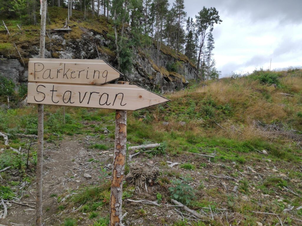
The information about the walk told us where to park our car and that the walk was 3.5 km long and would take us in a circle. We used about one and a half hours which included time to enjoy the walk, take lots of pictures and enjoy the views. We parked at Stavran, near farm buildings.
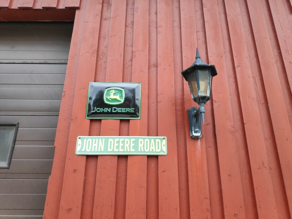
I think the farmer at Stavran uses John Deere tractors.
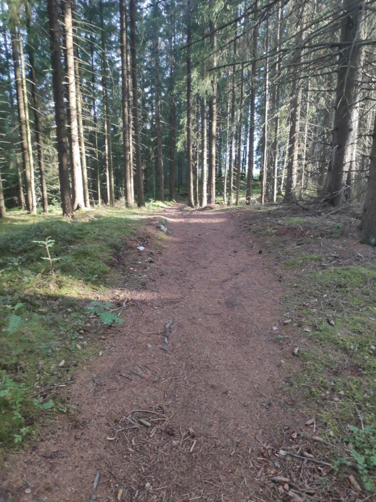
The trail
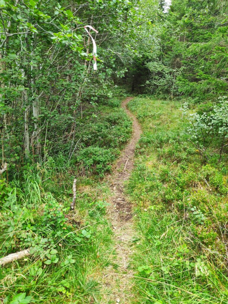
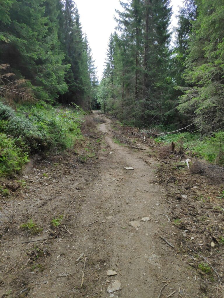
This was a newly marked trail this year and was well marked. There were only a very few places where we wondered where the trail went. There were many trails leading off the main trail, and I discovered that this was because we came back a different way than we went up the hill. (Of course, we were climbing a hill!)
I am going to show you some of the pictures from our walk, but not always in the order that they were taken. There were some very steep climbs, as we climbed up about 100 meters to the check-in point at Åsbrottet. There were pleasant areas in the trees and therefore out of the wind. There were a few areas where my hiking boots got damp, though that could have been mostly dew from the grass, but there were obvious signs that some areas would get quite muddy when it has be raining.
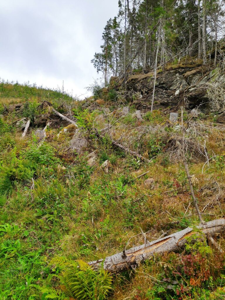
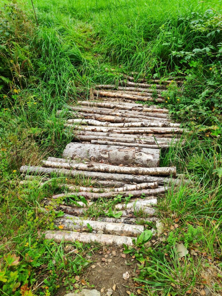
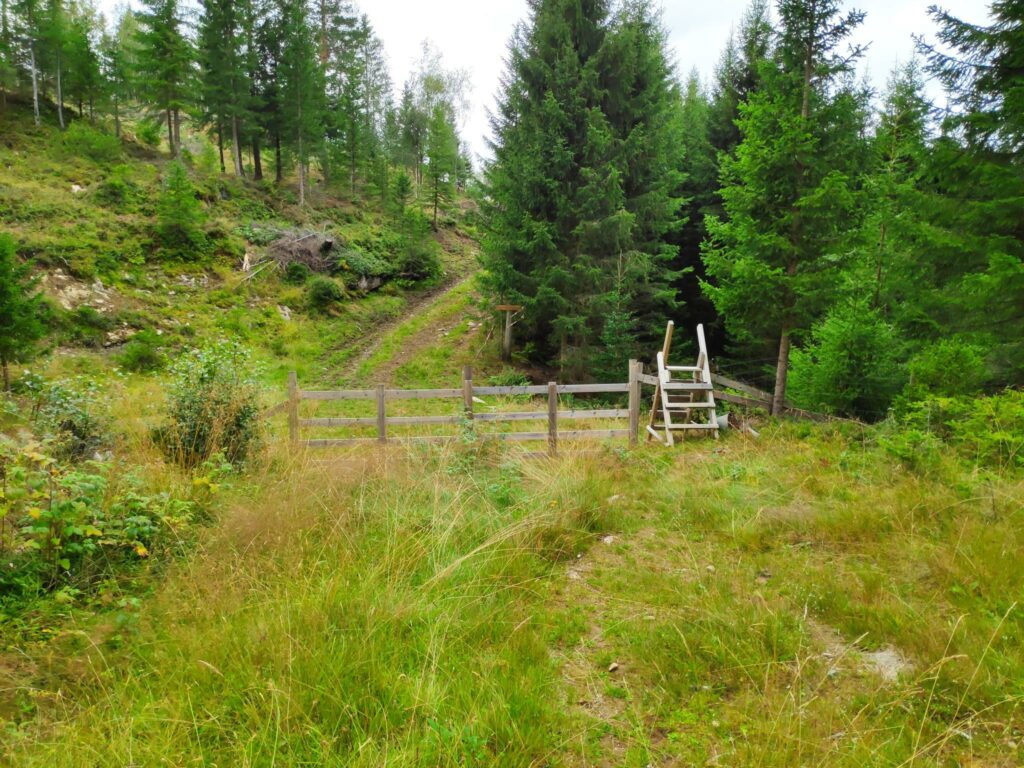
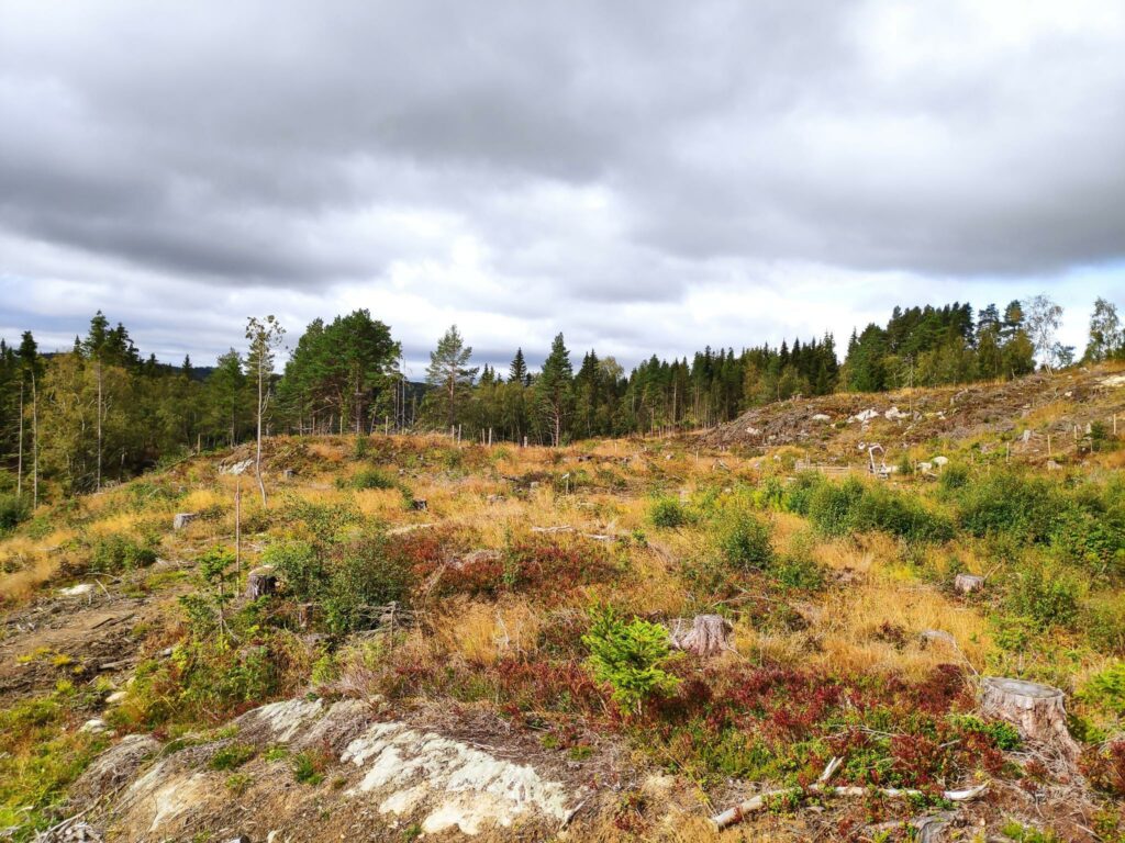
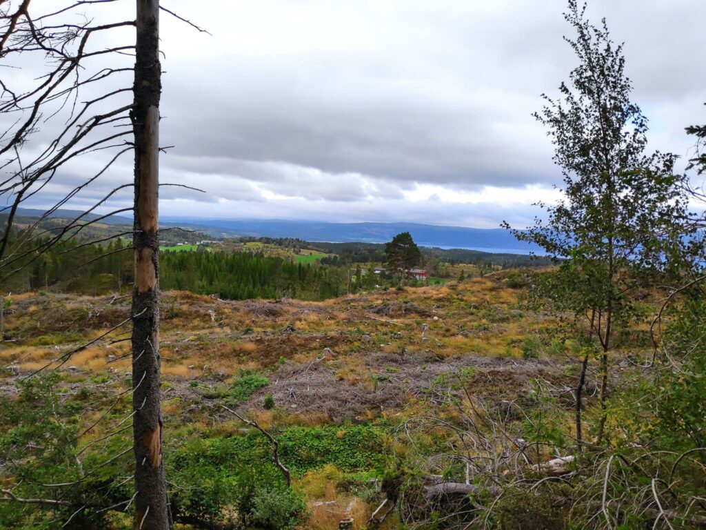
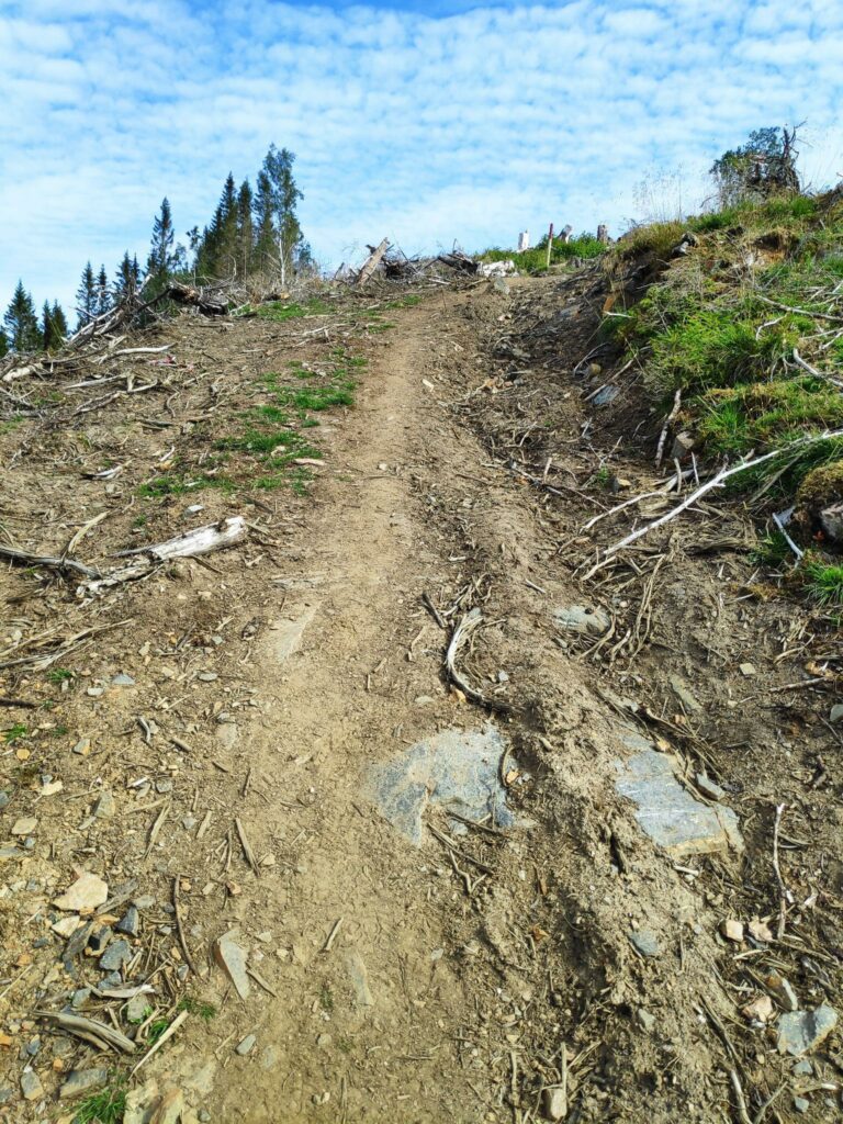
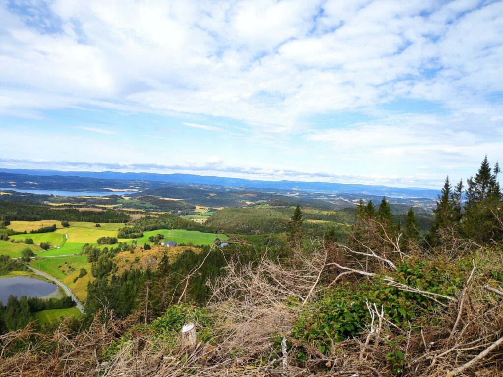
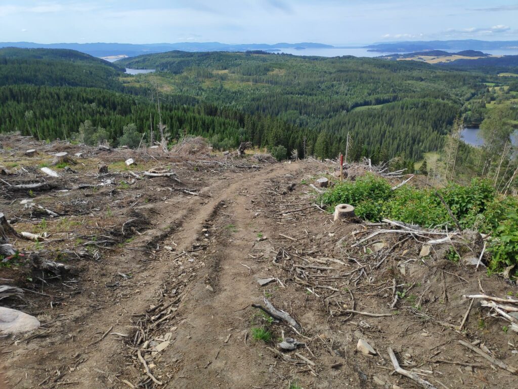
A lot of the walk was in fairly open areas, relatively recently logged. On this section of the trail we had quite a steep climb.Someone (or perhaps many people) had done quite a bit of work to make it a good trail, especially where there were damp or muddy sections.Some parts of the trail were through woodland.Most of the trail was quite easy to follow. This section looked like it had been around for quite a number of years, so not all sections of the trail were new.Twice we had to cross a fence and both times there were very good stiles to cross. The advantage of a stile is that the farmer doesn’t have to worry about hikers leaving gates open and cattle and sheep getting out of their pasture area. My girlfriend said that stiles over fences were quite new in Norway and certainly not very common. On the far side of the fence in the picture there had been large animals grazing, though we didn’t see any today.
The views
I always love walks where we get up high enough that there is a view over the trees. Living in a farming area, there is always the challenge of figuring out which farms one sees in the distance.
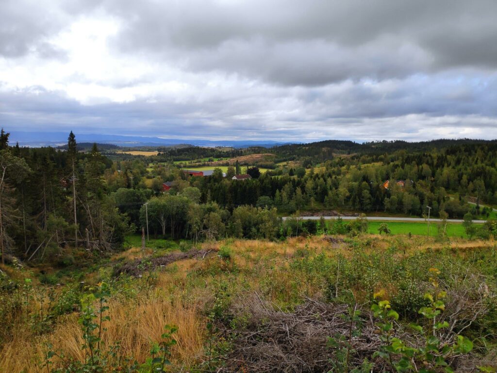
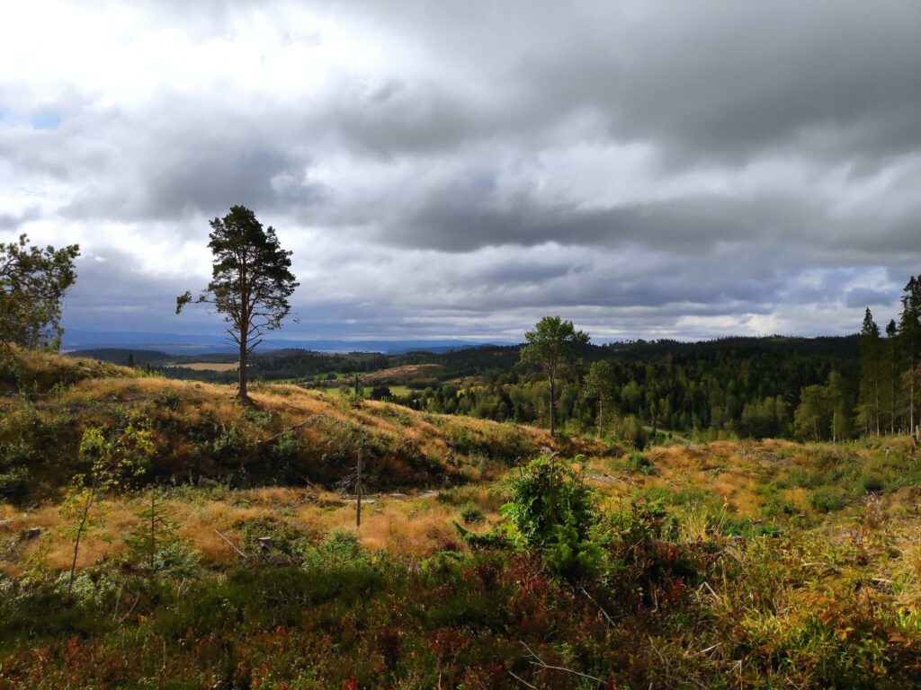
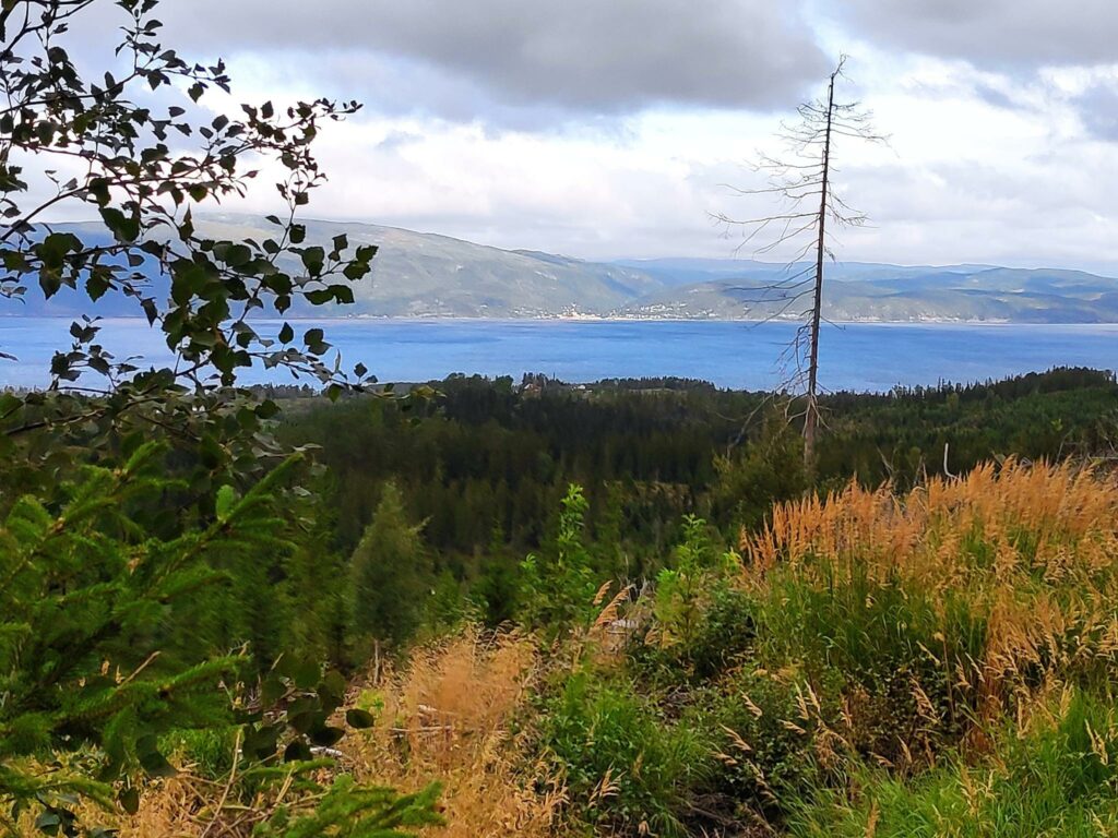
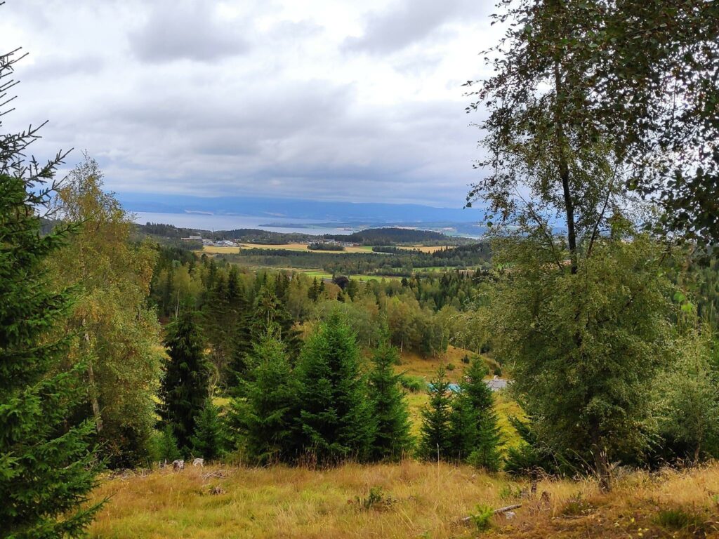
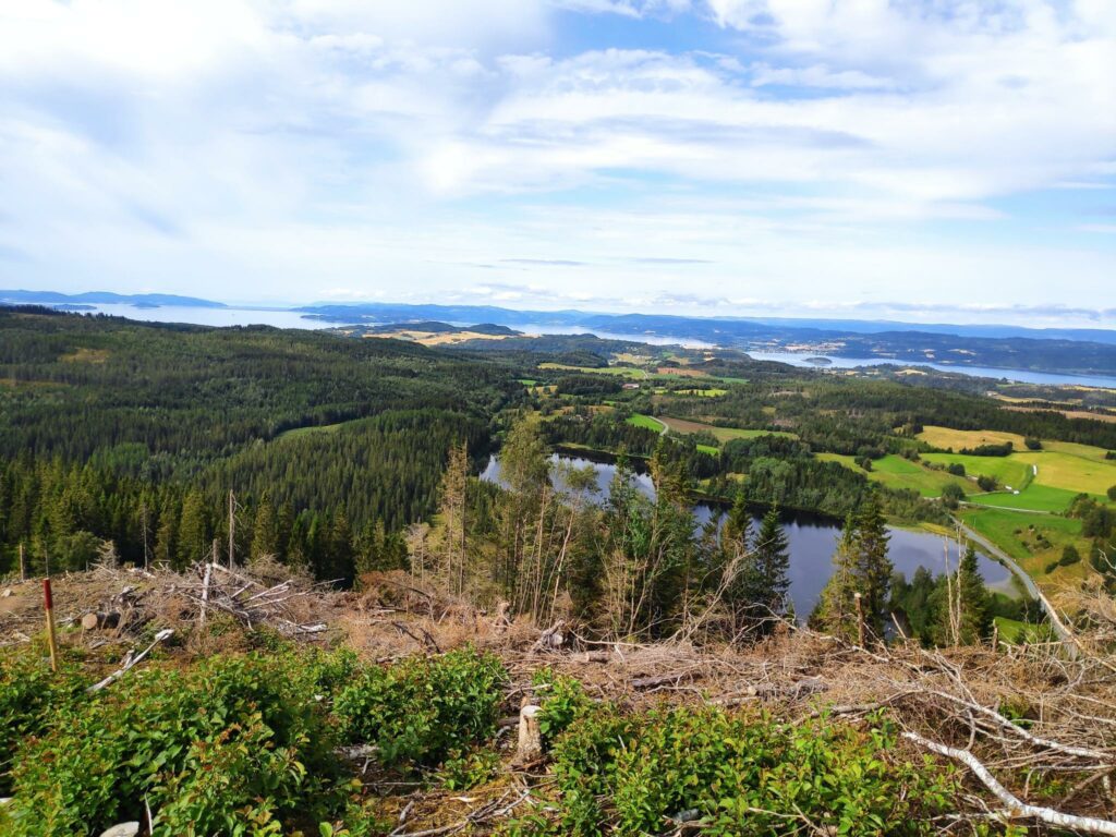
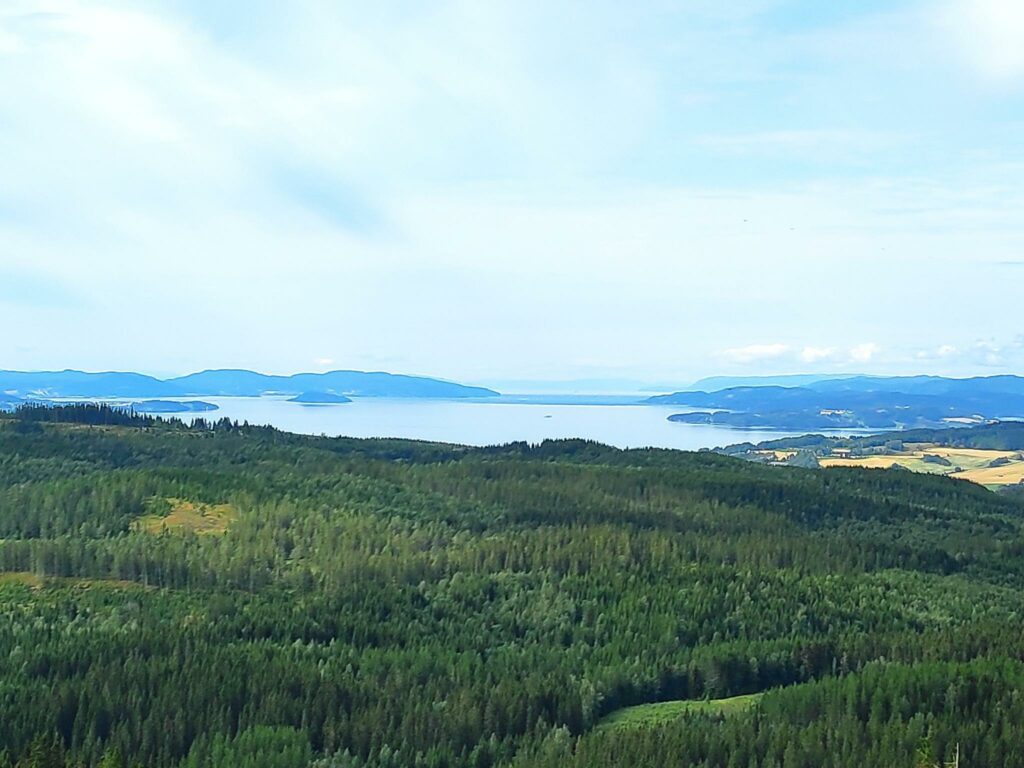
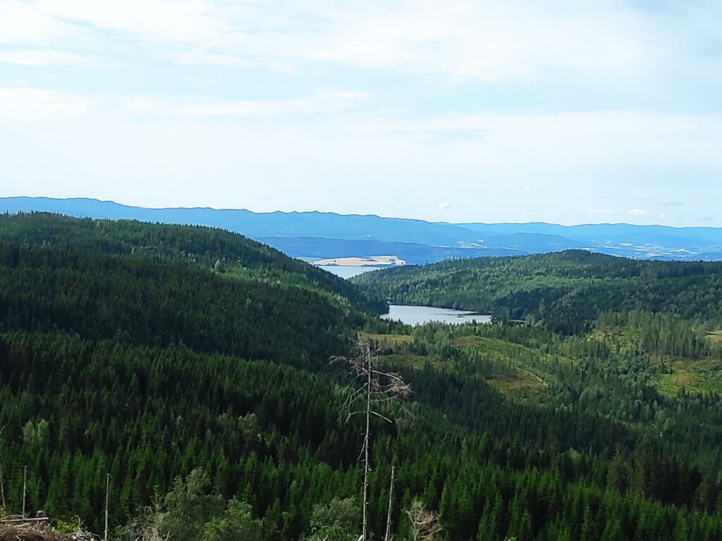
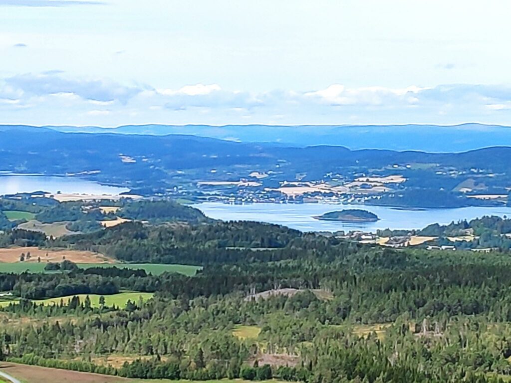
Having started at Stavran and having climbed the first steep section, we could see back to the road, farms in the distance and even farther away would be Levanger.A lot of the area we were walking through was quite open. The sky looked threatening in this picture, but we had no rain on our walk. In some places it was a bit windy, especially when out in the open, or on a hill top.This area had been logged a few years ago, but I’m not sure how long ago. Small plants and trees were starting to grow again. In the background you can see the forest that still exists.Eventually we got up high enough to see northwards towards Beitstad Fjord. The walk was getting very promising at this point.Follafoss on the far side of Beitstad Fjord, taken from Åsbrottet, the highest point of our walk.Looking towards Stokkan with Beitstad Fjord in the background. Notice the signs that tell us what is in that direction. We decided to walk to Farbuhøgda on our way back to Stavran.Looking south towards Trondheim Fjord, Utøy, Ytterøy and Levanger
The signs
When getting around an area one has not been hiking in before, one has to rely on the markings and good signs. On this walk, the signs were new and the different directions were marked at critical points.
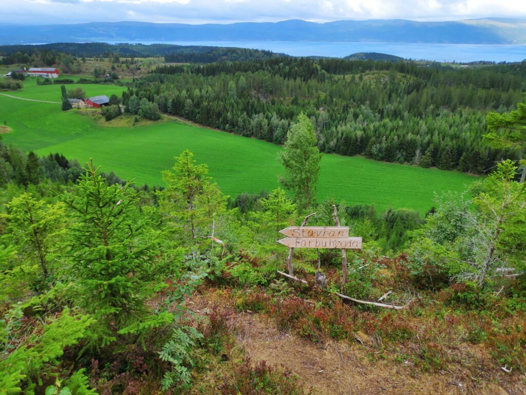
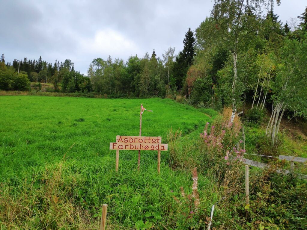
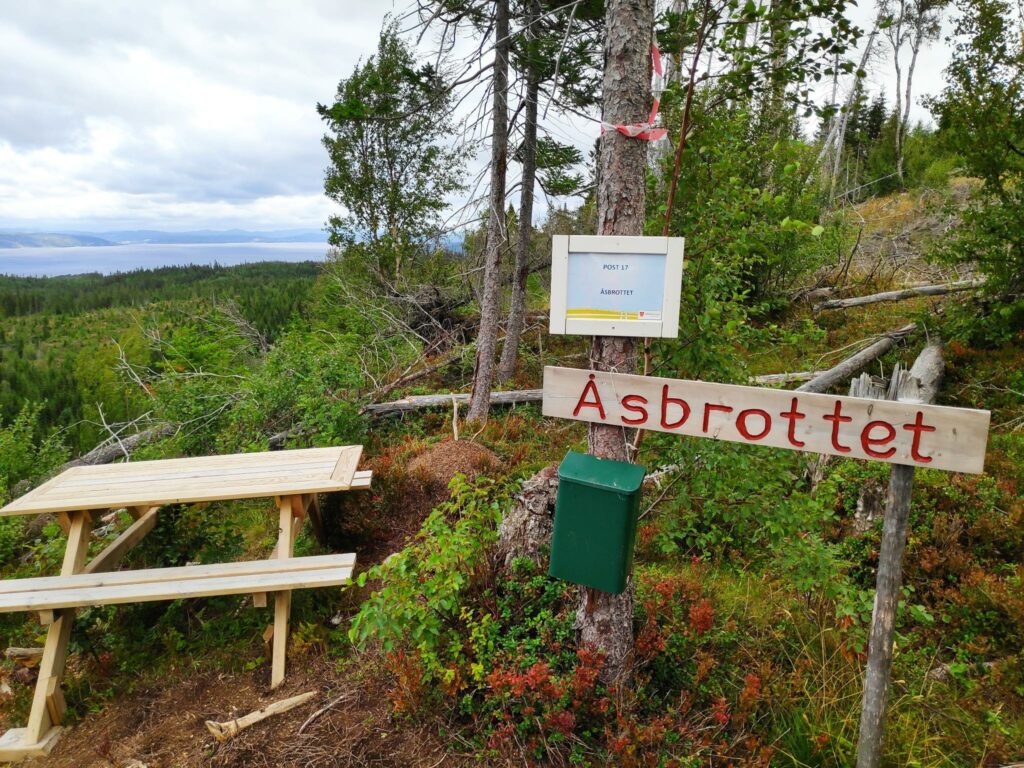
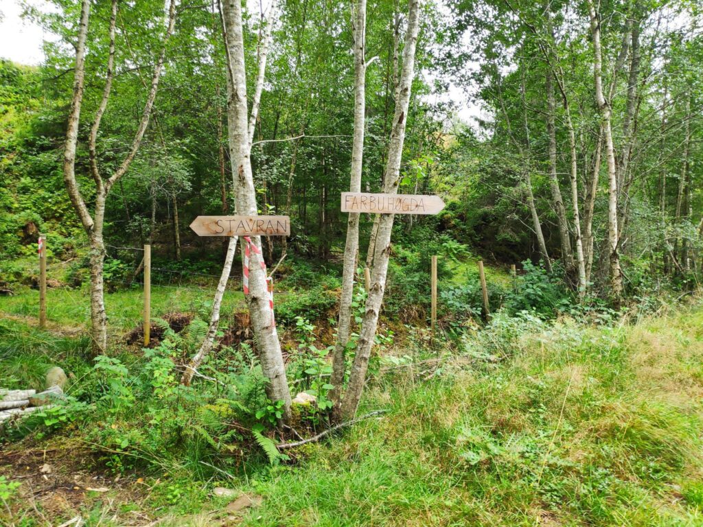
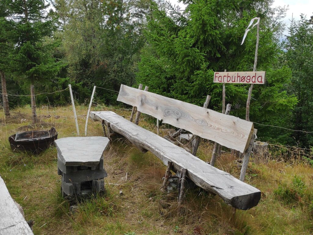
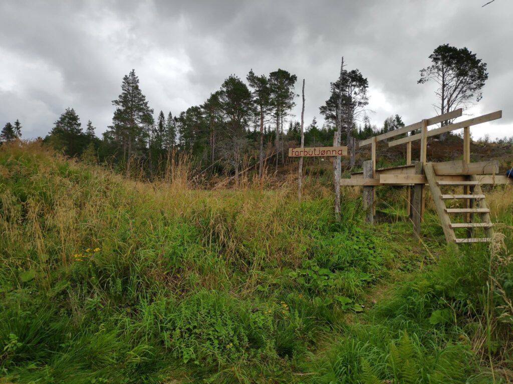
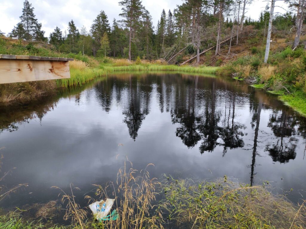
The first sign tells us that there are two places we can get to on this trail, Åsbrottet, which is where we get points for a walk, and Farbuhøgda. (Høgda = high point)Åsbrottet was well marked and this is where we got our points. There was even a table to sit at to enjoy the view. It wasn’t really warm enough to sit today and there was also a wind blowing at the top that, though it kept the insects away, also encouraged us to keep on walking.As always, there are choices. We chose to go to Farbuhøgda, before returning to the car at Stavran. One could have a shorter walk by going directly to Stavran from here.Farbuhøgda had a grill, table and two benches to sit on. There was a fence around it, presumably to keep grazing animals and their excrement away from the picnic area.We came across this diving board into a little tern, Farbutjønna.It wasn’t a very big tern, but it must have been deep enough to dive into. Note the plastic bag in the foreground, which is tied to a rope which could be used by a swimmer to pull themselves out of the tern. The edge of the tern did not look like it was easy to find solid footing.Now it was time to go back to the car, though by following the path in the direction indicated, we walked farther than if we had just gone straight ahead which is where we had come up. It was longer, but not nearly as steep.
We both enjoyed the walk. It was cool enough (14 degrees Celsius) to enjoy the climbs without attracting a lot of insects. The breeze kept us cool and the insects away too. We used about 90 minutes and felt we had had some good exercise. This is a walk I would like to do again, but I have to do it early in the day when I have lots of energy.
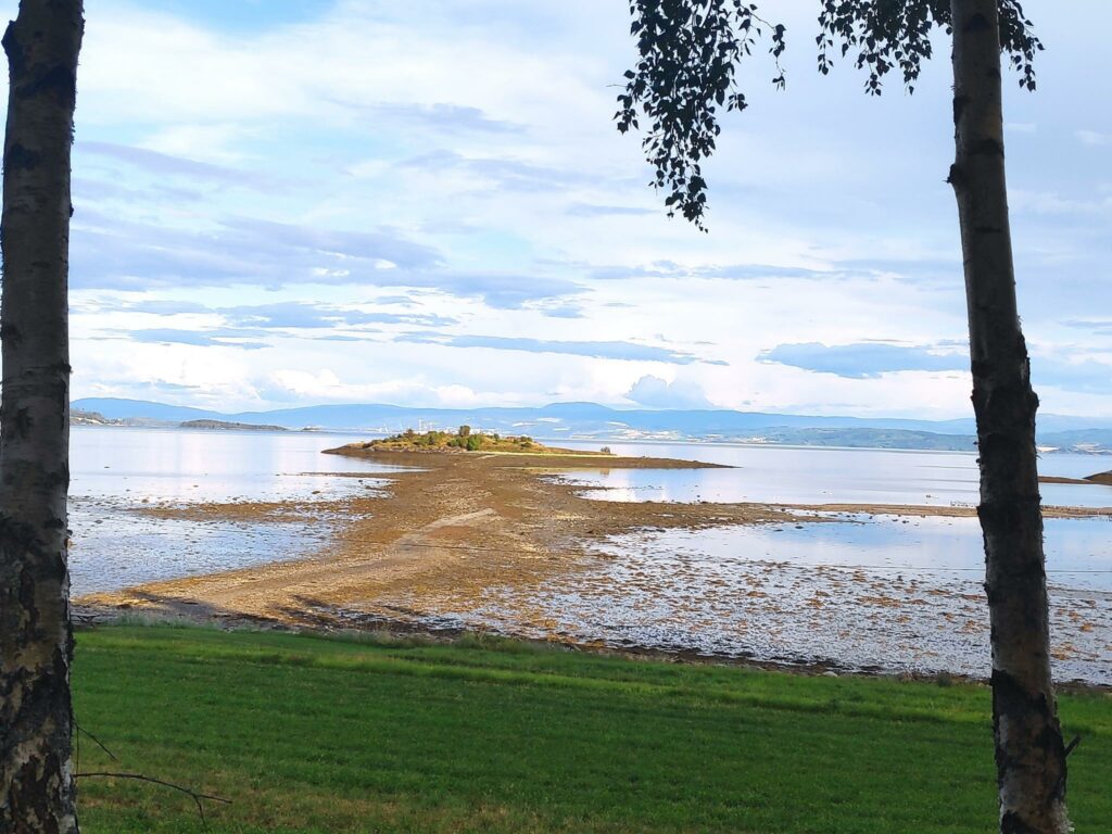
This evening the three of us decided to go for a walk out to an island that can only be reached at low tide. A check of the tide tables yesterday evening indicated that low tide would be just before 8 pm. So we took off from home at 7 pm.
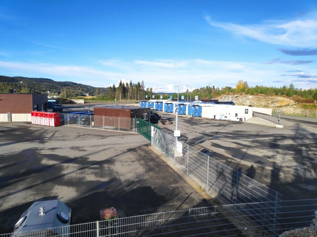
We chose to park near the recycling center in Utøy, which serves the whole municipality of Inderøy.
The recycling center for Inderøy municipality had just closed when we got there. There is parking off to the left for those who want to go for a walk. There is a ramp up to the upper level, so that garbage is thrown into the big blue bins from the top. Examples of what we would sort out is cardboard, metal and impregnated wood. The red bins to the left are for clothing. They are in the open area so accessible at all times for depositing used clothing.
We had about a one and a half kilometer walk to where we wanted to go, mostly downhill, through both open forest that had been recently logged and older forest.
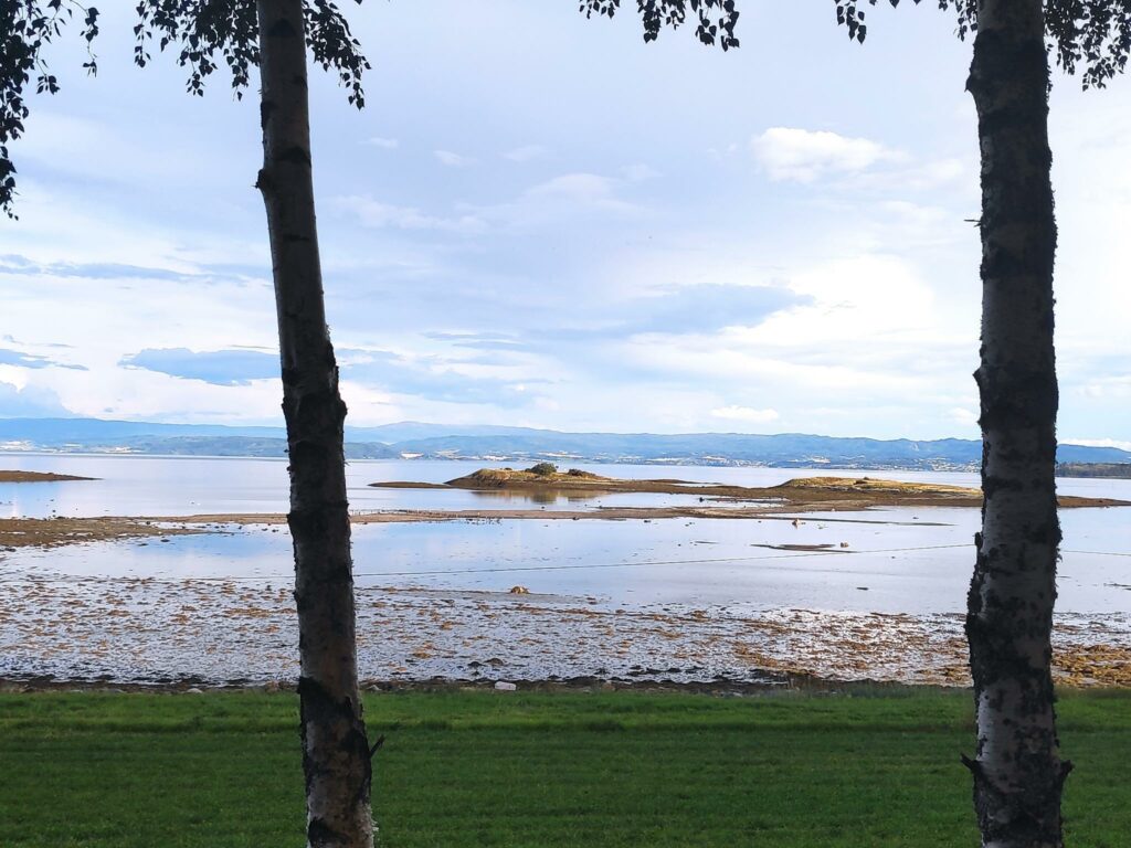
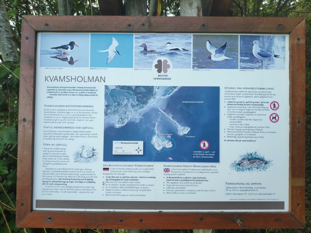
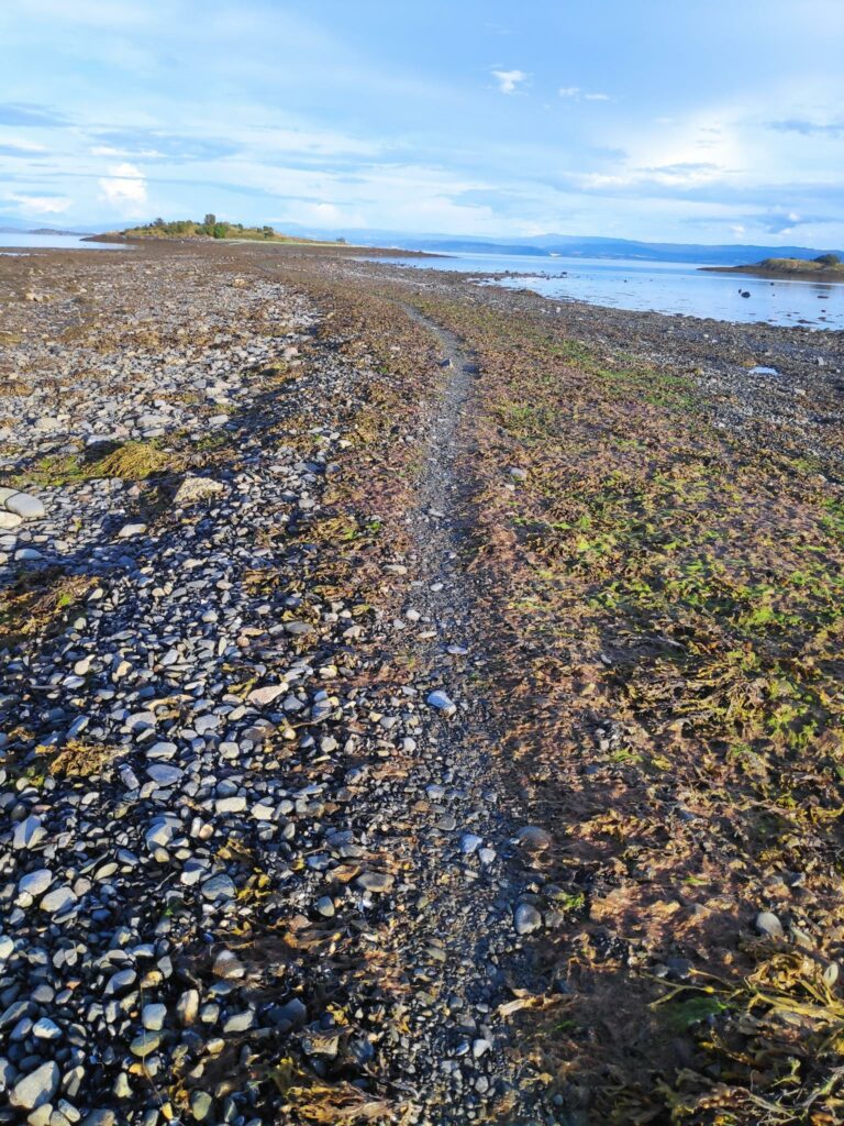
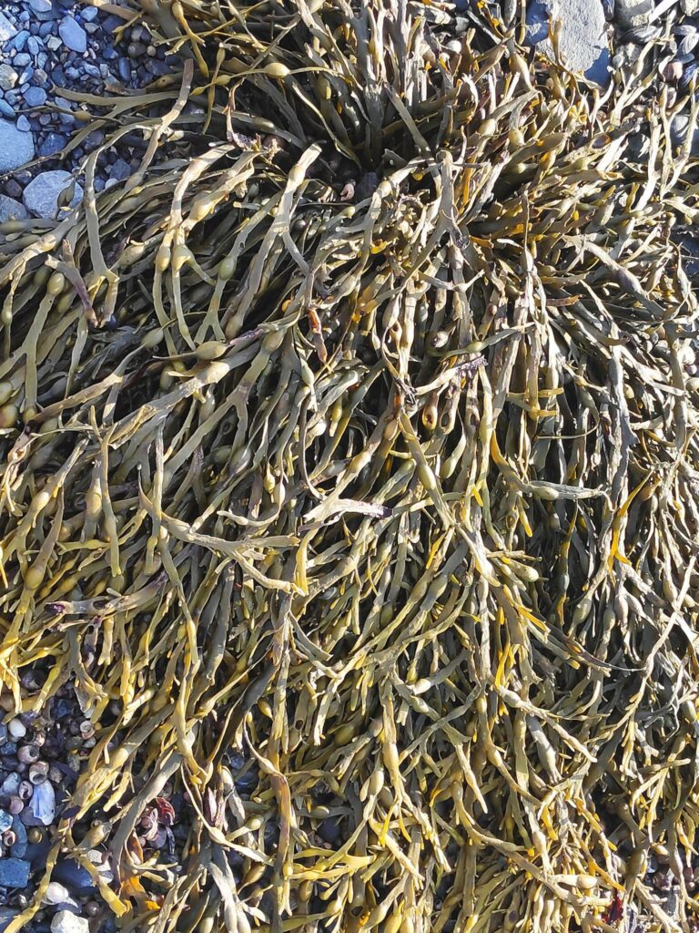
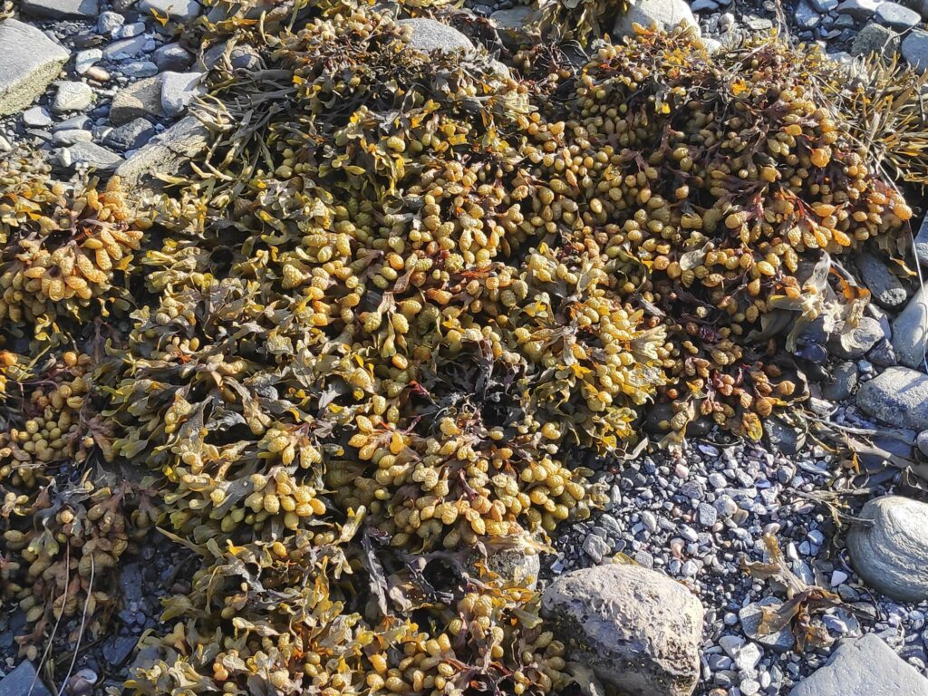
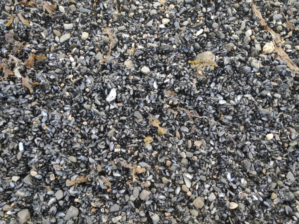
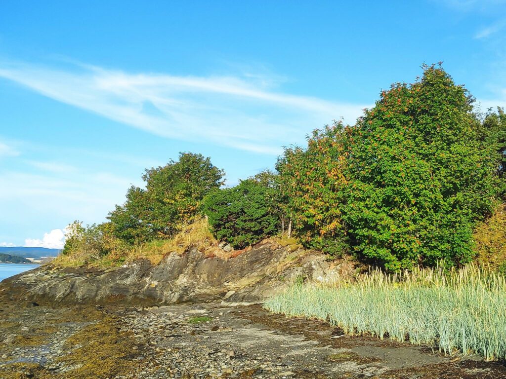
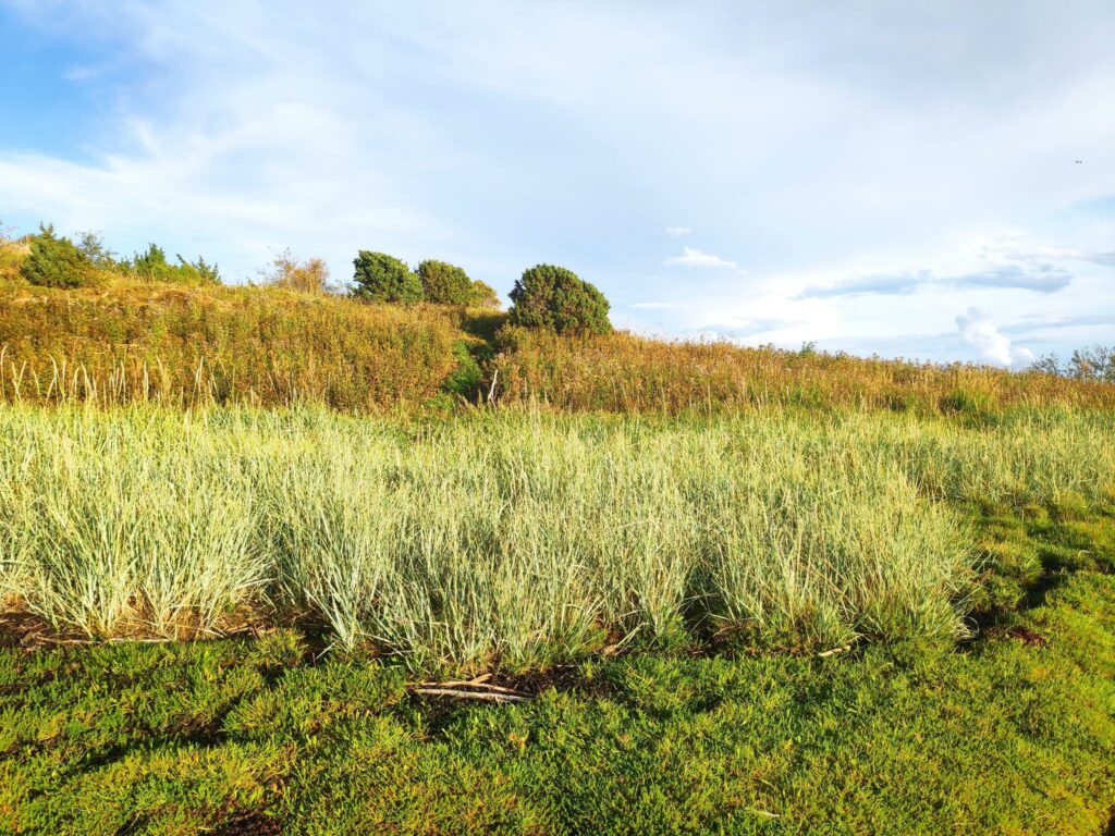
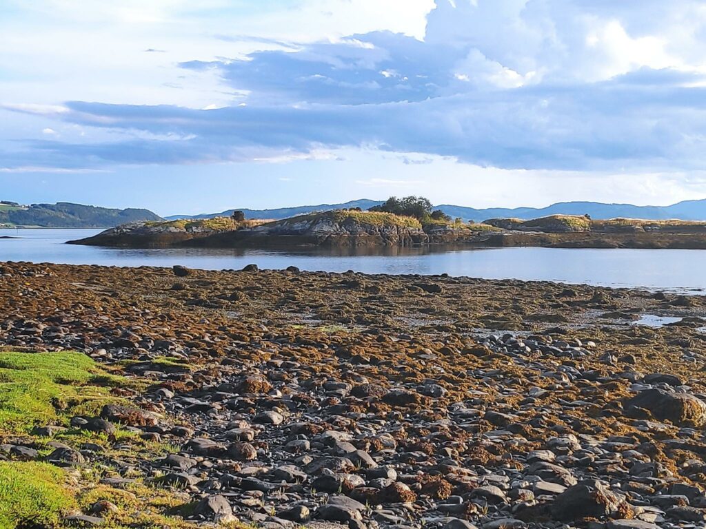
This section of the walk was through old forest. It was cool and pleasant in the forest.We are almost down to sea level and we are going to walk out that causeway to Storholmen, the island you can see in this picture.. This is about as low as the tide goes. It was registered at 47 cm at 19:50 today, the 10th of August 2021.To the right of Storholmen is Kvamsholman, which is really two islands. These two islands are a habitat management area and are reserved for birds, in particular oyster catchers (tjeld), eider ducks (ærfugl) and two types of sea gulls.This information sign of the islands shows how Storholmen has a causeway out to it and Kvamsholmen is reserved for the birds. All the islands are isolated at high tide. The difference between high tide and low tide can be as much as three meters.The path out to Storholmen is easy to follow, though there is quite a bit of seaweed on either side. Some of the seaweed was quite slippery if you stepped on it. It was about 600 meters from the beach out to the island.I’m no expert on seaweed, so I can’t tell you what kind this is.A different kind of seaweed.In some places there were a lot of mussels as well. They would make good food for the sea birds that live here.Storholmen is a large rock in the fjord and is covered by a variety of vegetation, including trees and grasses.StorholmenKvamsholman as seen from Storholmen. Kvamsholman is about 200 meters from Storholmen.
We enjoyed our walk. The temperature was about 20 degrees Celsius, though it felt more when we were walking in the sun. We walked about 2 km each way and we walked the same route back to the car. The return to the car was a bit more strenuous as we now had to climb back up the hill. We were probably walking for about one hour. this is a walk that we take about once a year.
Today’s walk with a girlfriend was to a new place on our list of walks in Inderøy. I wasn’t sure what to expect, but as you will see in the pictures we got a nice surprise. The temperature was about 12 degrees Celsius, which I find a good walking temperature. There was some sunshine but also light cloud in the sky.
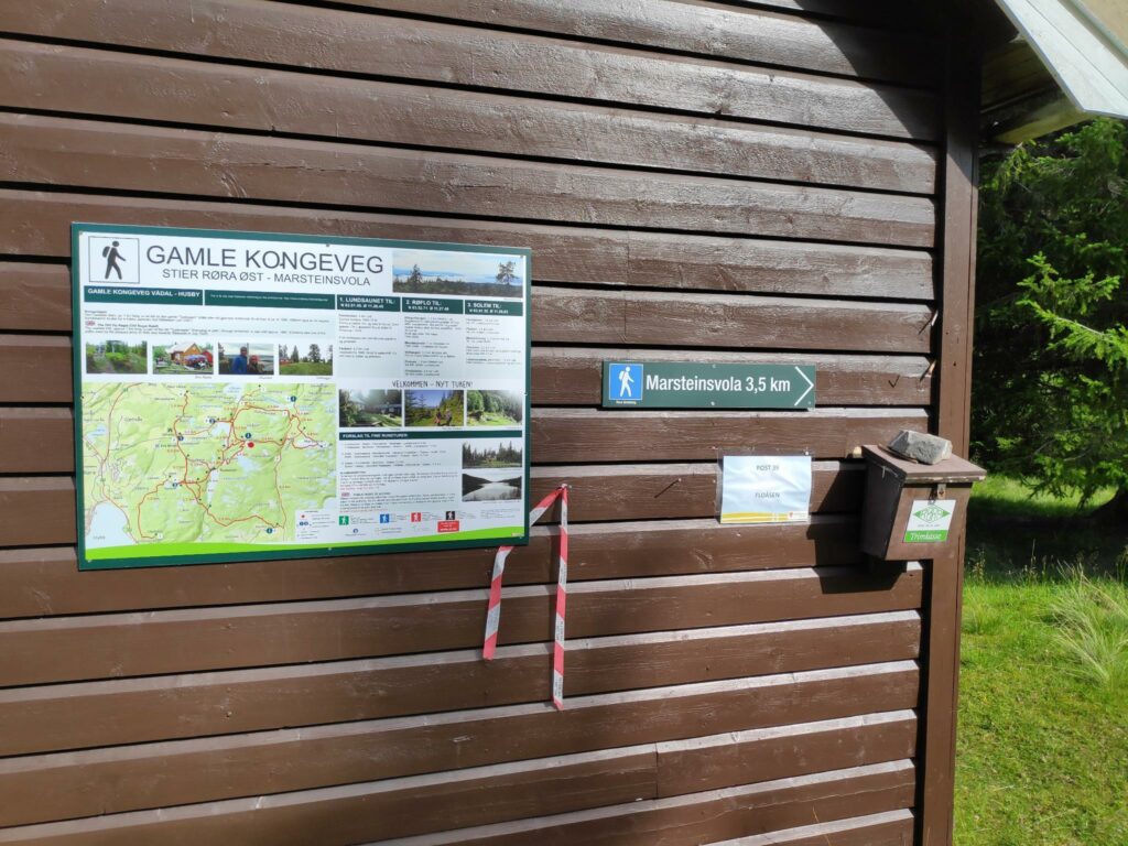
We parked at Røflo Lake which lies at about 188 meters above sea level. First we walked to Floåsen, which I have described in a previous blog (about Marsteinsvola). It is a very steep climb up to the check-in point for the walk, but there is a place to sit down and we both used the toilet that was available there.
You will note that at Floåsen it is 3.5 km to Marsteinsvola which I have written about in a previous blog. We came here to do our first check-in, then headed back the way we had come.
From the parking lot to Floåsen is about 1.5 km. There is no particular view at Floåsen, but it is an open area to sit and relax away from traffic and the noises of civilization. We then returned to the trail, the one we had come along and after about 100 meters we turned off to the find the new place, Aunan.
The app on our telephones told us that Aunan was about 600 meters away, but the app gives the distance in a straight line and doesn’t take into consideration that most trails have a lot of bends in them.
It is now August and there has been quite a lot of people on the trail, It was not difficult to see where we should go. This part of the trail is through forest. The trail had obviously been used by motorized traffic in previous years.As we climbed higher, it was obvious that there had been logging on this hillside recently. The trail was very steep at this point.
As I saw that the hillside had been logged, I realized that we would get some very good views from here. We were now at about 340 meters above sea level and about 160 meters above Røflo Lake. So we have had some good exercise.
This is Røflo Lake from above and our car is parked at the right of the lake, just behind some trees. In the background is more of Inderøy and on the left is Trondheim Fjord looking towards Trondheim.Looking westwards towards Trondheim Fjord and Trondheim in the distance. Levanger is on the left and Inderøy and Mosvik on the right.Leklemsvannet is a lake shared by Inderøy and Verdal. Finnheimen is located at the north end of the lake (see separate blog about Søråsen).Looking north with Steinkjer in the distance.The municipal center of Straumen is on the other side of the water, which is Borgenfjord.Time to go back down the hill to the car which is parked near Røflo Lake.
I enjoyed today’s walk. We walked about 4 km and used about one and a half hours including the pauses we took. This is a walk I would do again as the views are excellent.
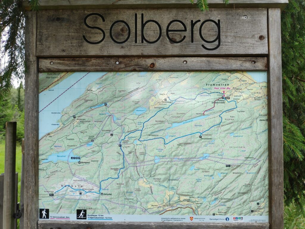
On Saturday, the three of us met a couple at Solberg in Mosvik where we parked our cars and walked up to Vennes Lake.
Parking at Solberg means that we have driven up the hill, past quite a few farms. The blue lines on the map are ski trails in the winter, but we were going to take the red line, a trail up to a long, narrow lake.
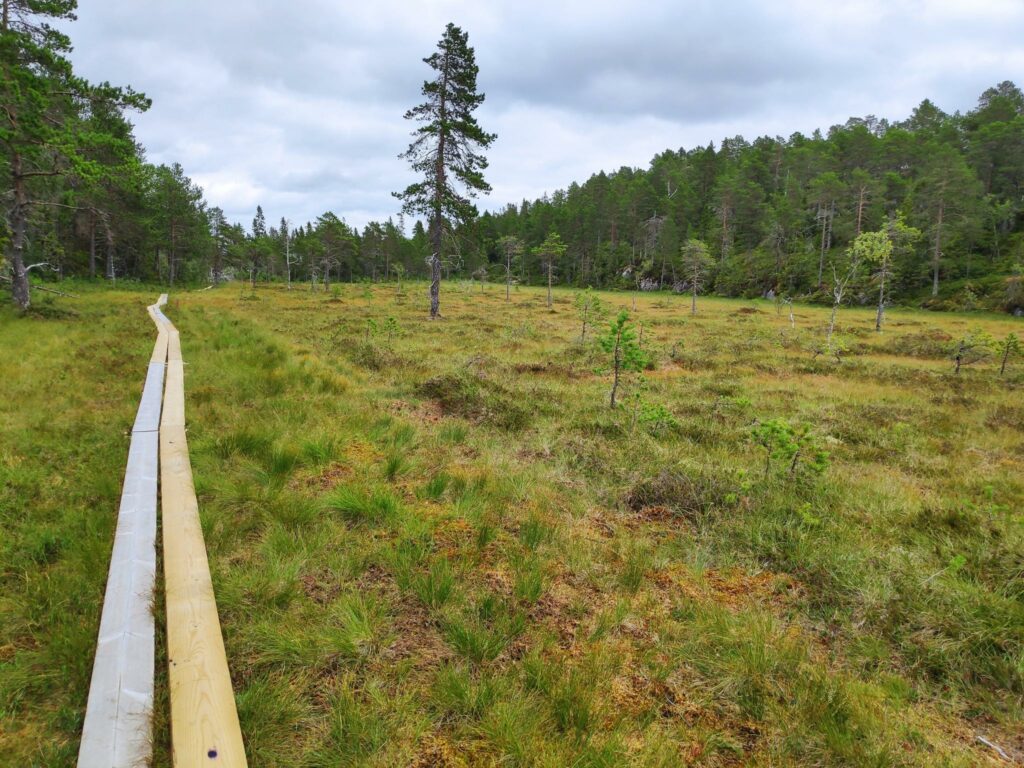
The walk up to the lake takes about 25 minutes and goes through relatively open grazing areas with both sheep and cows. A lot of the walk is across bogs but a lot of planks have been put out and that made the walking very easy. It has also been a relatively dry summer so even if one stepped off the planks, for example, when meeting someone going in the opposite direction, it was not wet at all.
Crossing Naustmyra on planksBeside the map, there is some information about the lake. The lake is about 2.1 km long. There is trout and char in the lake but you have to have a fishing licence for Mosvik to go fishing. You may borrow the boats and the life vests, but please put things back where you got them.
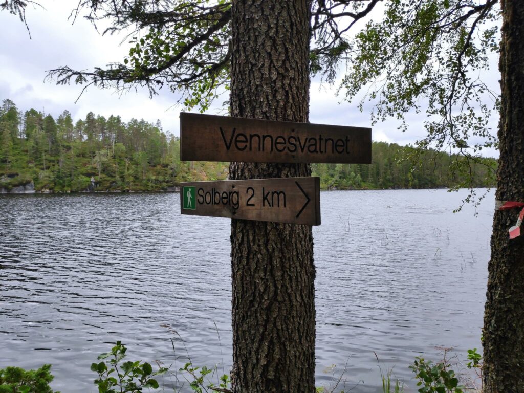
The lake is 208 meters above sea level, but most of the height was driven in the car. There is some uphill walking, but nothing at all steep. It was 2 km from the car to the lake.
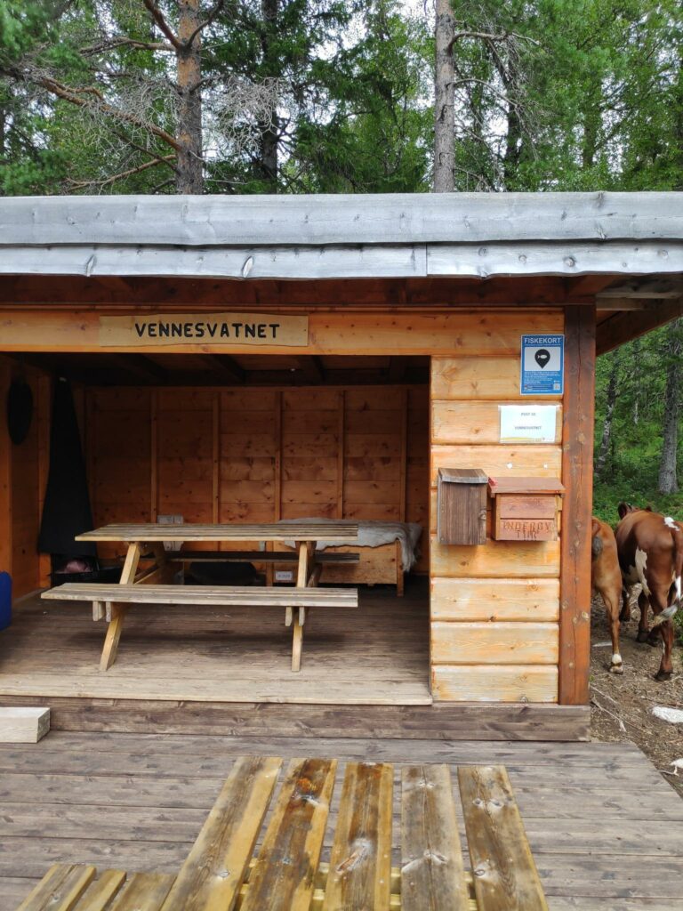
Vennesvatnet is long and narrow. We have walked 2 km from the parking area.The picnic area at the lake.
We were probably at the lake for about an hour. Having others than just ourselves to talk to, made the stay at the lake a bit longer than otherwise. There is a very nice picnic area.
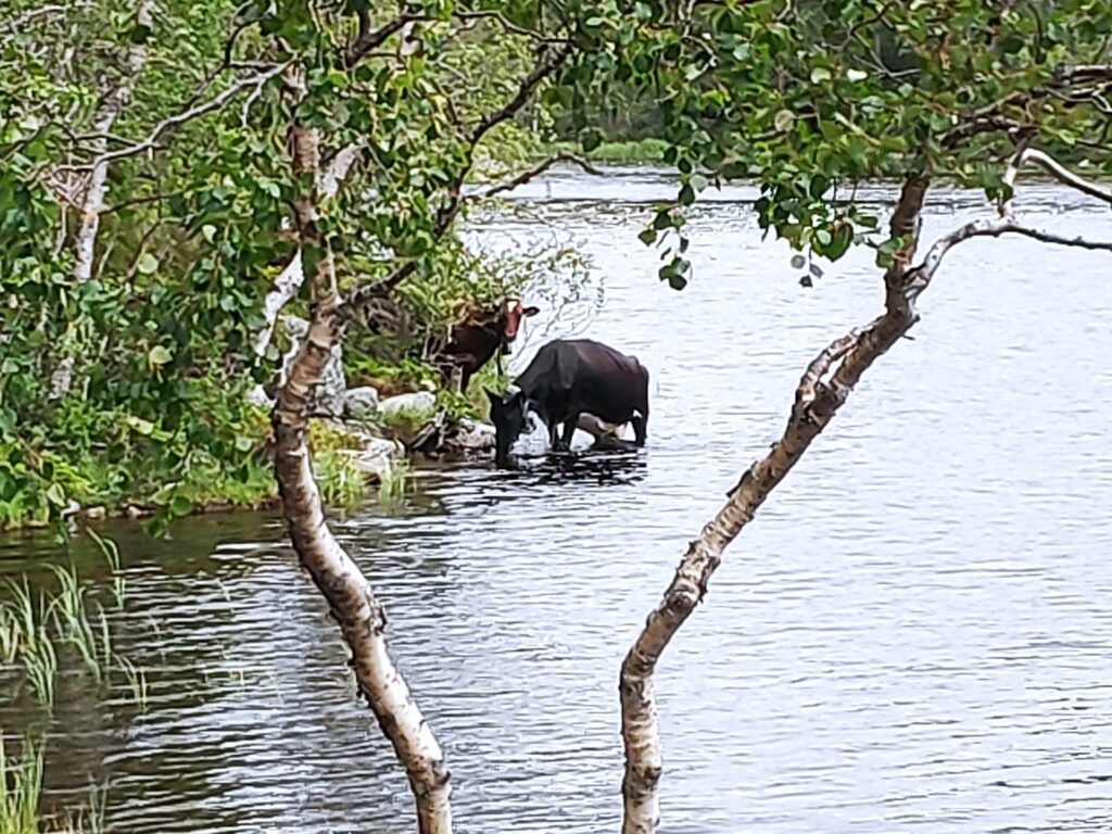
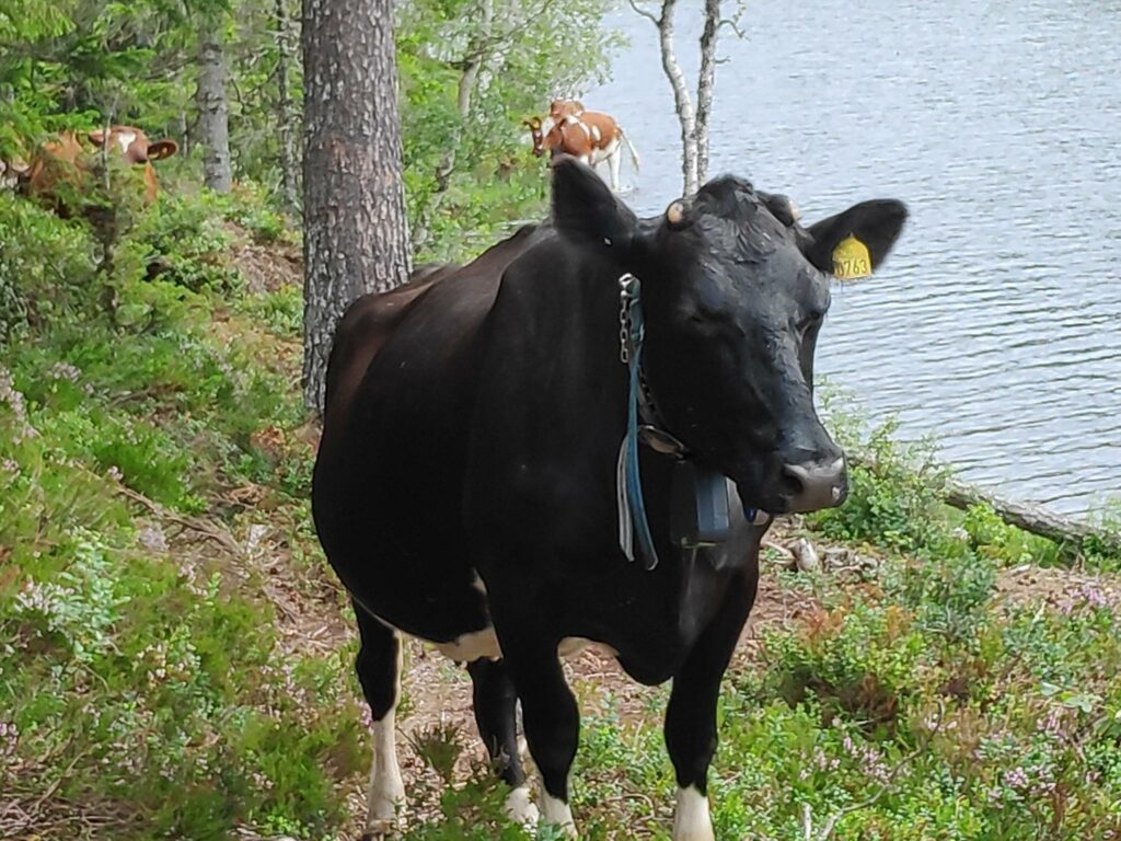
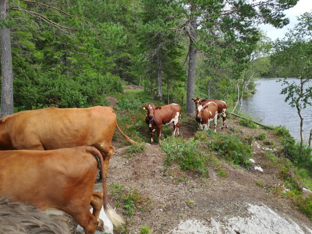
We had some unusual visitors, that seem to come in our direction when they heard voices.
There was one dark cow who lead the group. She even waded through the water to come to where we were. The others followed her.She was very curious and came quite close to us. In the background you can see the brown ones following her lead. There were about six of them altogether.After a few minutes of staring at us, they moved on and we didn’t see them again.
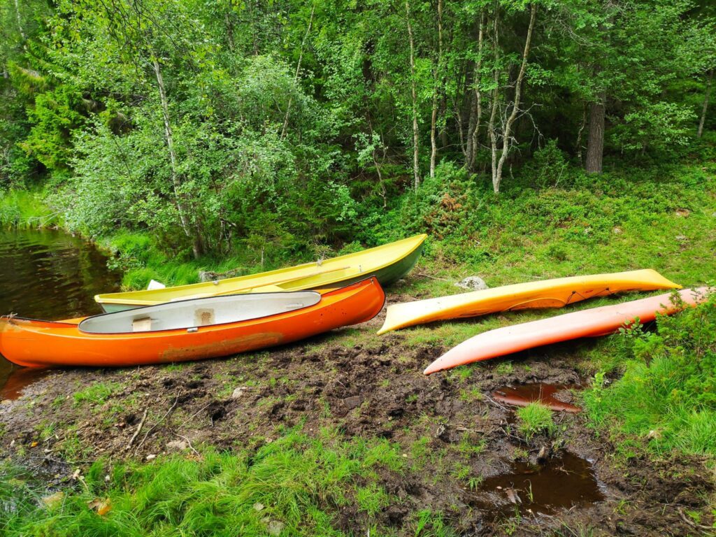
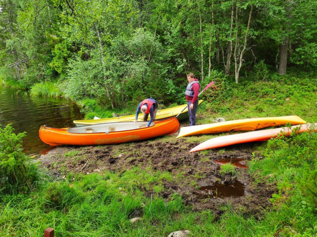
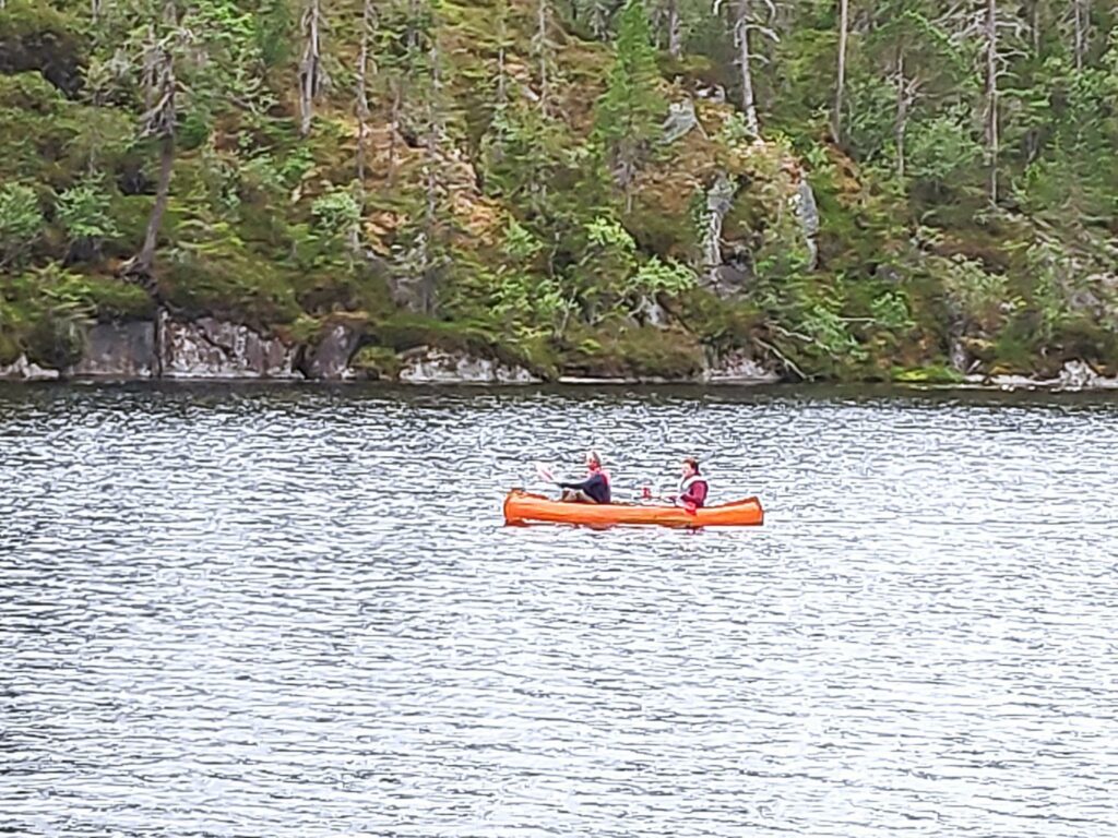
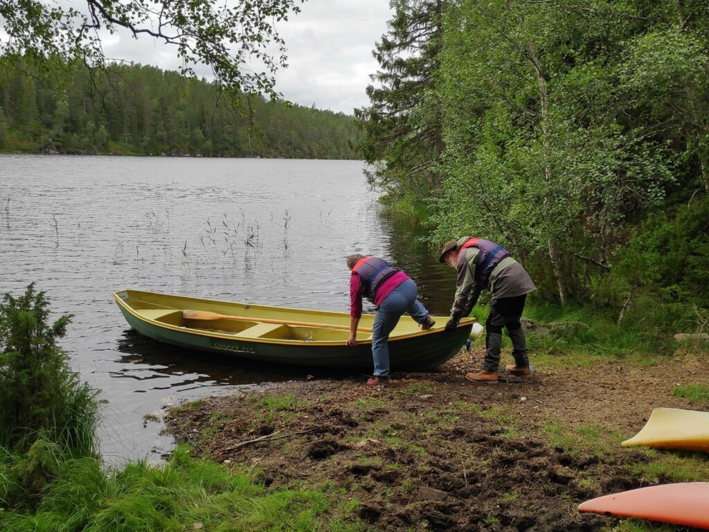
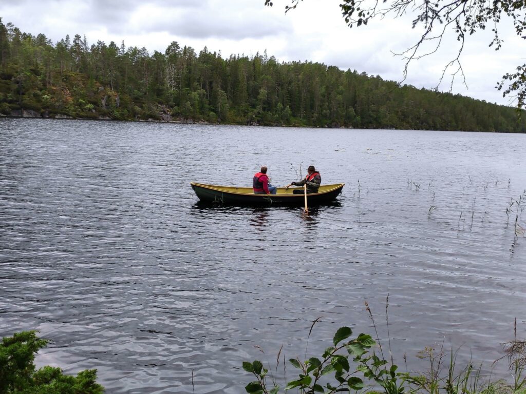
The fun of going to Vennesvatnet is the availability of boats that can be taken out on the lake. We were five people. Two went out in a canoe and two went out in the row boat.
There is one canoe, one row boat and two kayaks available for anyone coming up to the lake.Getting a canoe ready to push into the lake.Two in a canoe.Then two more decided to take out the row boat. I stayed with our backpacks and telephones and took pictures.Two in a row boat.
The walk to Vennesvatnet is not a long walk, but it is a fun place to go to when there is something to do when you get there. Another group of three came after us and two girls took out the two kayaks. So the boats seem to be well used.
On Wednesday, the 28th of July, the three of us got out of the house for the day. We left at 10 am and got home at 7 pm. We drove about 300 km and enjoyed a warm sunny day, mostly in our air-conditioned car. However we did get out of the car several times and a couple of walks were included.
First we drove to the city of Trondheim (a two-hour drive) where a piece of used computer equipment was purchased from a private person. We then used the rest of the time to drive home a different, very indirect way.
Jonsvatnet, Trondheim
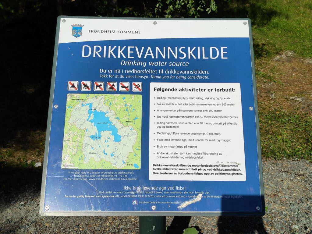
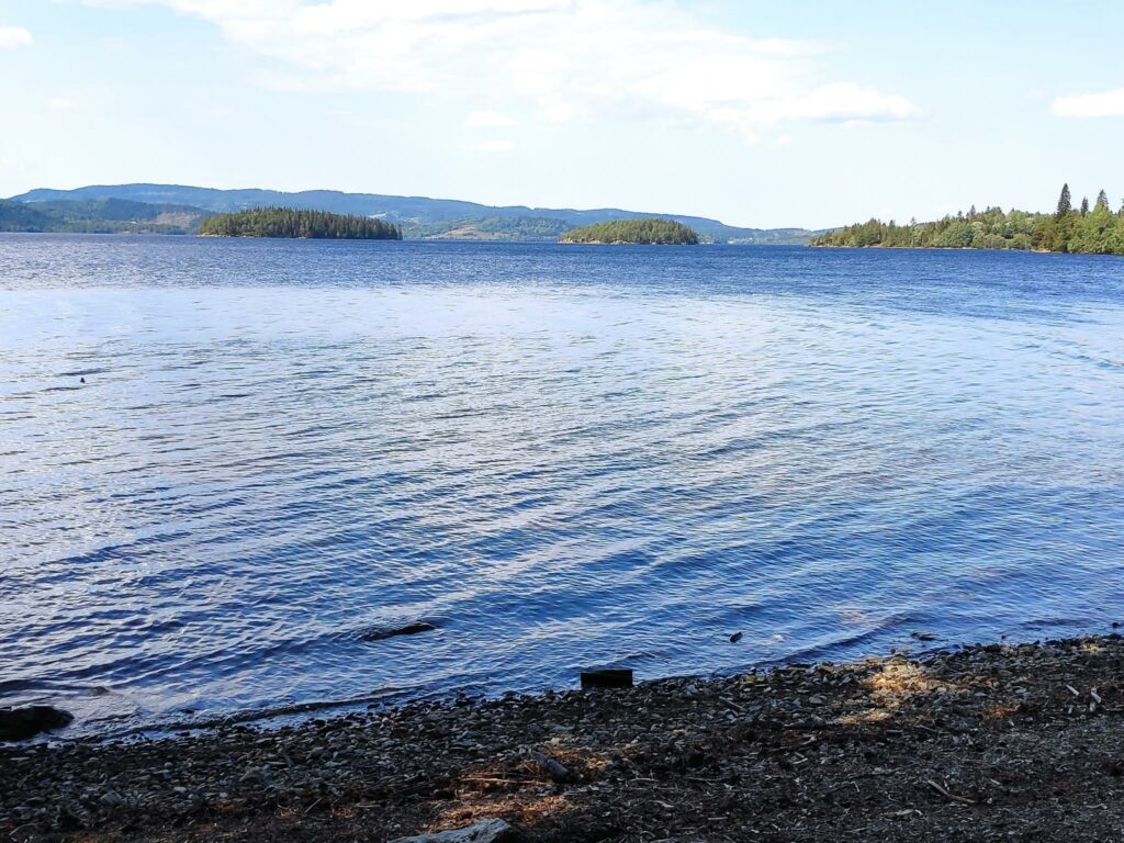
Trondheim is a city of about 205,000 people and is the third most populous city in Norway. It’s main source of drinking water is a lake called Jonsvatnet which is 8 km long and has a maximum width of 4.5 km. It’s surface area is 14.3 square km and its surface elevation is 150 meters above sea level. Maximum depth of the lake is 94.4 meters, and the volume is 505 268 million cubic meters of water. (Source: NVE Atlas). The lake is also used as a source of water for the production of electricity for the city of Trondheim.
Jonsvatnet
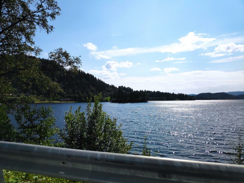
The lake lies in a north-west to south-east direction and we followed the road along the north-east side of the lake. We made one stop on the lake to get out and stretch our legs. The weather was sunny and the temperature was about 26 degrees Celsius. As this lake is a source of drinking water, it was interesting to see the signs posted at this lay-by.
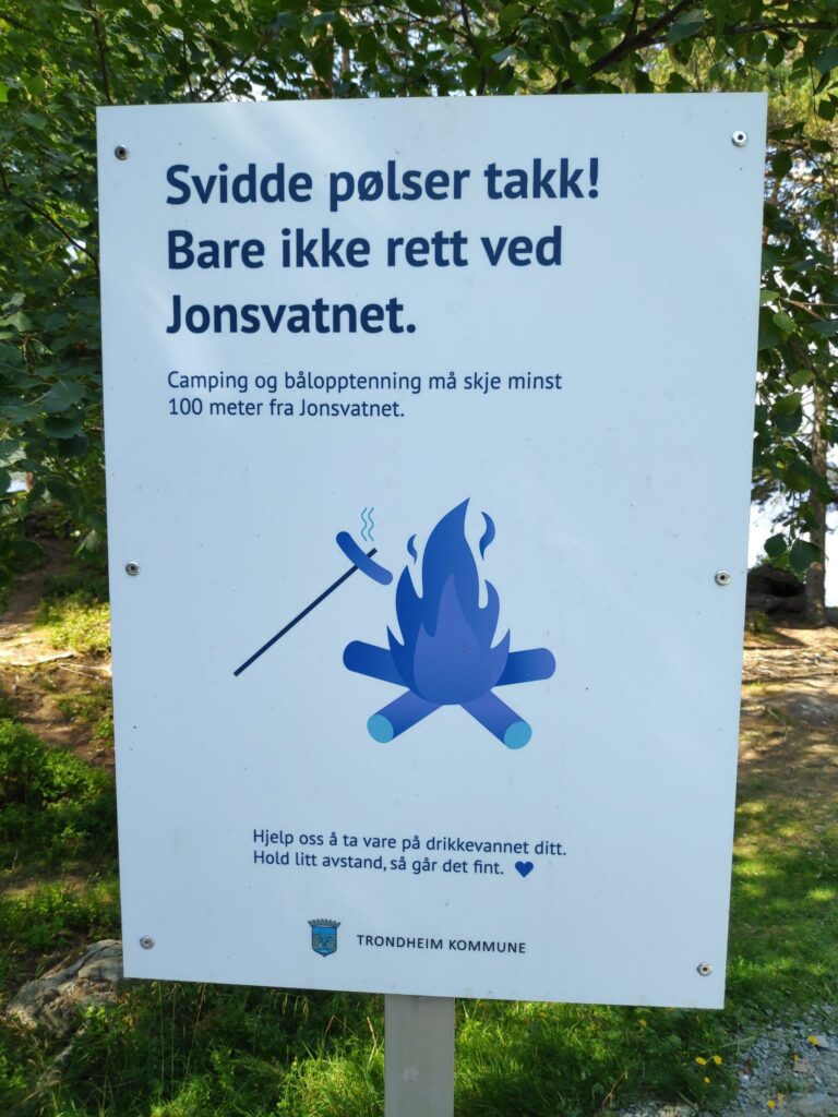
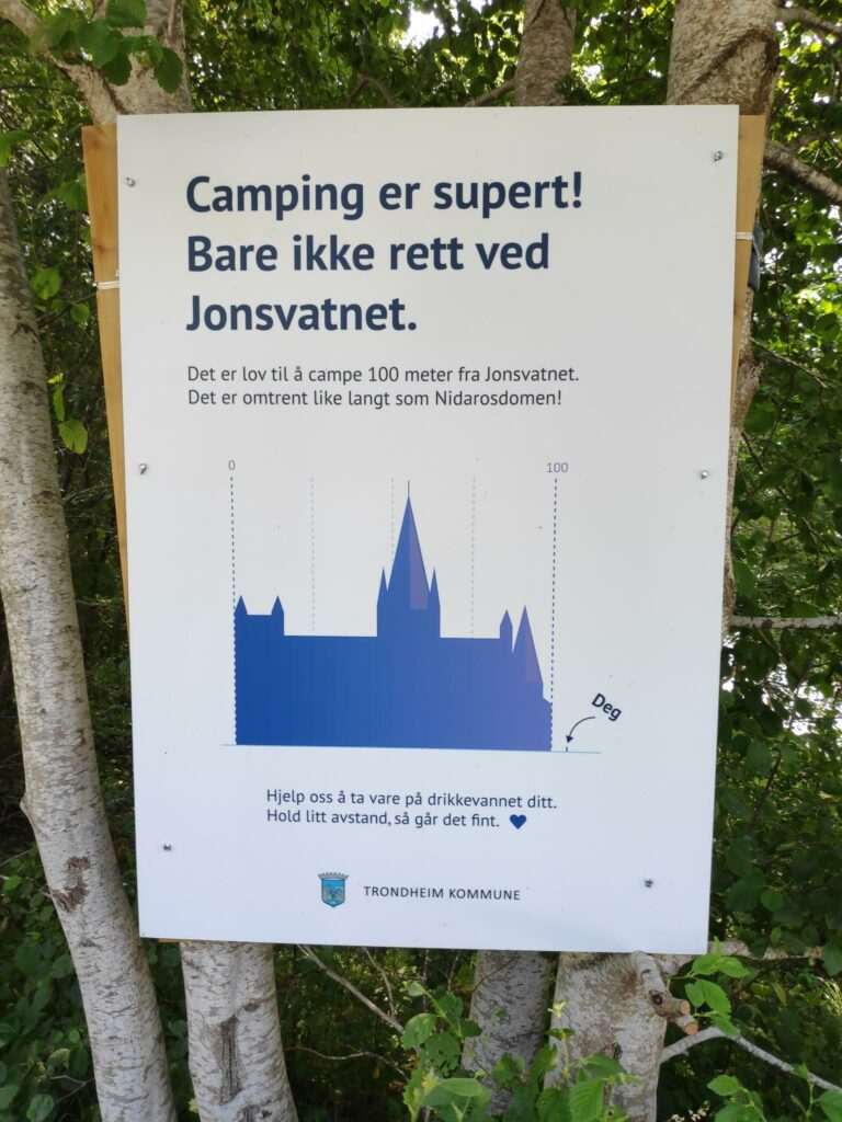
This sign gives a map of the lake and the light-colored area is the area which drains into the lake. There is a list of things that you are not allowed to do such as swimming, using a motorboat, or pitching a tent within 100 meters of the shore.A very good sign: “Burnt hot dogs, thanks, but not right beside the lake. Camping and fires must be at least 100 meters from the lake.”Another good sign: “Camping is great, but not right beside the lake. You must be 100 meters from the lake.” In order to illustrate how far 100 meters is, there is an outline of the cathedral in Trondheim showing that its length is about 100 meters. Deg = you. A person is very small in relation to the cathedral.Jonsvatnet, looking north-west towards the city of Trondheim
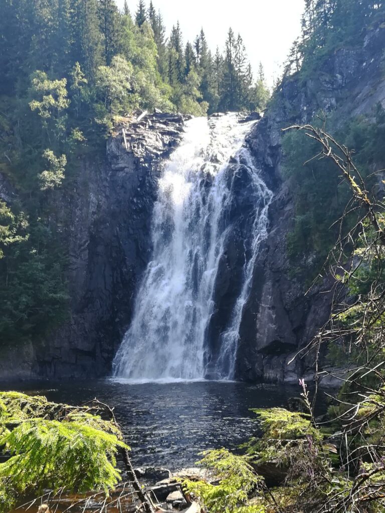
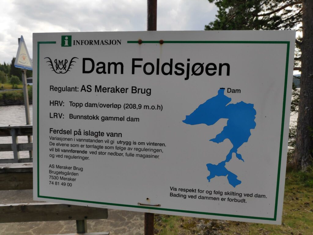
Storfossen
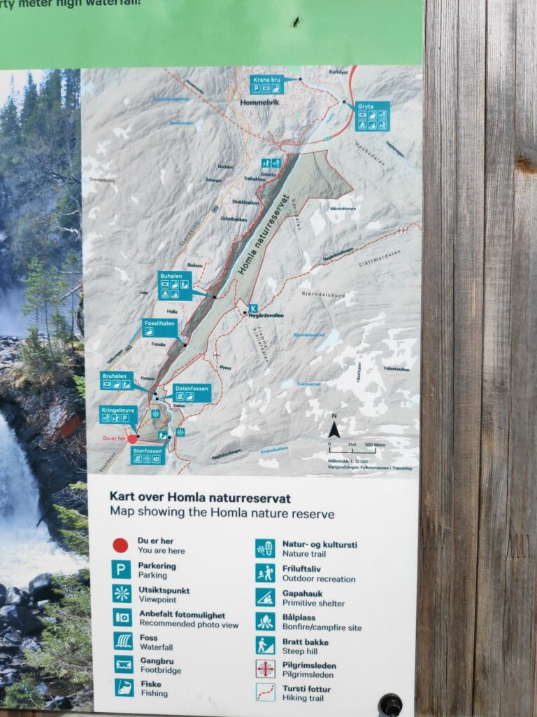
The Homla River, which flows from Fold Lake to Trondheim Fjord, has several waterfalls on it as it descends to the fjord at Hommelvik. We found a parking place for walkers to access one of the waterfalls, Storfossen (literally, the large waterfall) which has a fall height of 40 meters. This waterfall is located in a nature reserve, Homla Naturreservat, which was set aside in 2015, to protect the river’s valley and the nature within the valley.
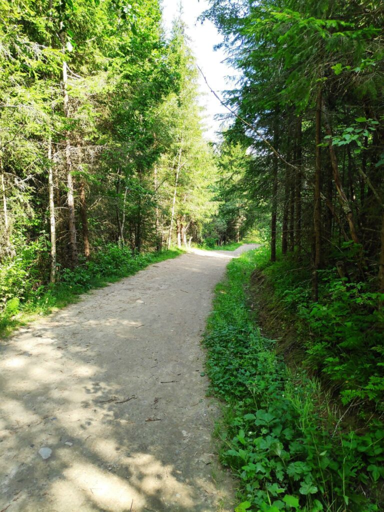
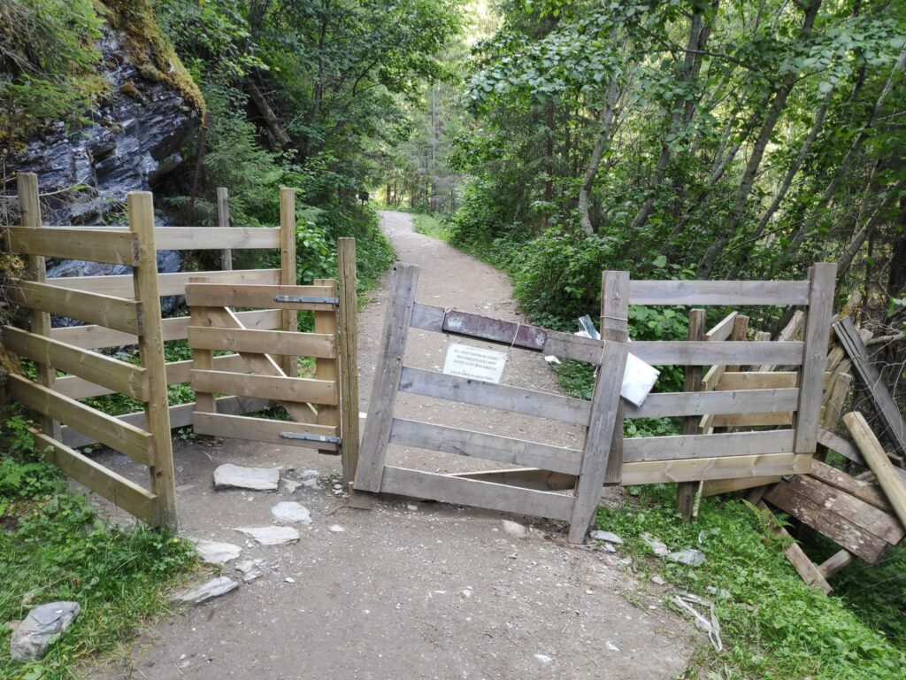
A map of the Homla Nature reserve The first part of the path was wide. It has been very dry and warm lately and the path was very dusty. Even though we were walking mid-week, there were quite a few other people on the trail.There were sheep out and I found this fence intriguing. People are able to easily go through the swing gate at the left. However a sheep that pushed it would not be able to manage the intricate concept that you have to hold the gate open half way, while you slide around it. This was certainly not a gate for the handicapped or very heavy people.
The two older people on the walk, found that it got a bit difficult after a bit, partly because of the heat, but the younger person was able to get to the viewing point of the falls.
Storfossen with a large pool at its base, where people were going swimming on this warm summer day.
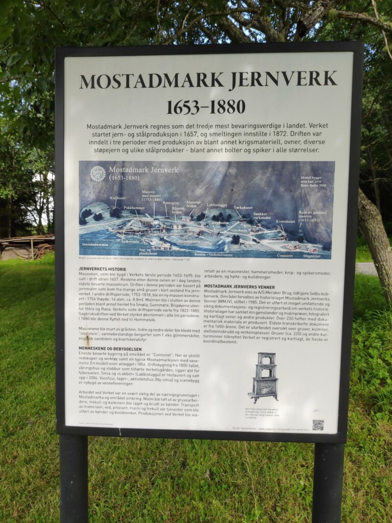
Mostadmarka Jernverk /Iron works
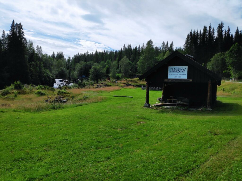
We went back into our car and continued our car trip. The next stop was Mostadmarka Ironworks which existed from 1653 to 1880. Initially the Iron Works would have used iron ore found locally, though in later years it would have had to been brought in from other parts of Norway. They produced iron and steel products including wood-burning ovens, war materials, bolts and nails.
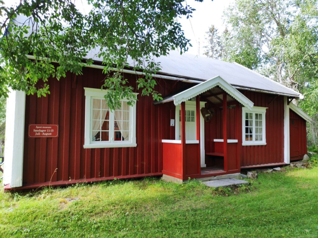
The museum was not open the day we were there, but we were able to wander around the area and peek into windows. More information about the Mostadmark Iron Works can be read here in English.
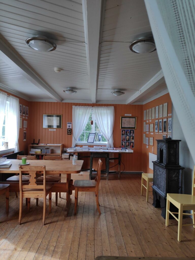
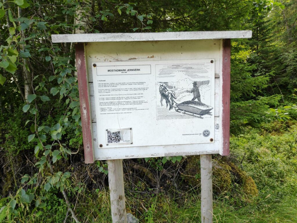
The introduction to the Mostadmarka Iron Works shows a drawing of the different buildings that have been on this site. Very few of the buildings still exist.One building that still exists and has been restored is the “Office”Inside the office building there seemed to be some information available. I would presume that the wood-burning oven to the right would be one that had been made at the iron works.
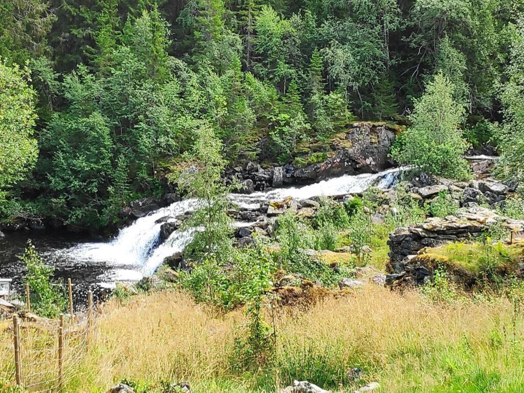
As we walked around the museum area we saw the Homla River, tumbling down the hillside. This would be the same river as falls down Storfossen.
The Homla River would have been dammed about here to provide energy for the iron works.In various places around the museum area, there were information signs which explain how things worked in various periods of the Iron Works. This sign is about delivering charcoal which would have been made by local farmers and how much they got paid for it. Charcoal was essential for getting the heat in the ovens hot enough to make iron and steel.This is a reconstruction of the smithy. Not much of the old iron works was left when the museum was established and volunteers set to work to make an open air museum here.
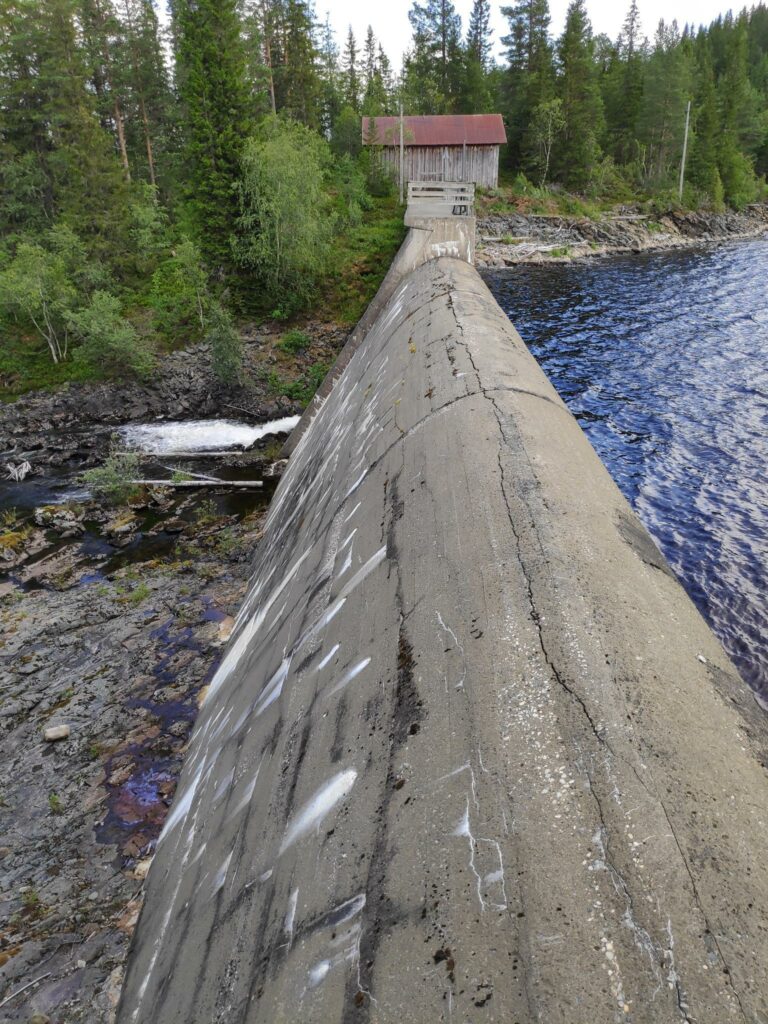
As we walked up the hill behind the museum area we came to a dam and a lake. The dam was built in 1900 and is used to create the lake.
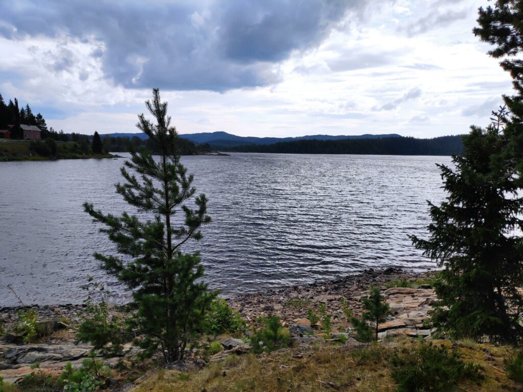
This is where the Homla River starts, with this dam that creates Fold Lake.The top of Fold Lake is 209 meters above sea level. It is quite a large lake and is used for recreation. There were quite a few cabins around the lake.Fold Lake. The picture was taken from the dam.
Selbu
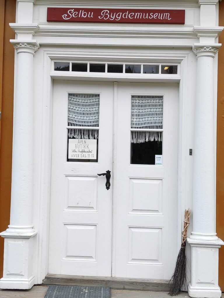
From Fold Lake we drove to Selbustrand where we drove along Selbu Lake to the center of the municipality of Selbu. It was now about 3 pm and time for us to have a meal. The village has a nice center with everything within easy walking distance. We found a restaurant and had two pizzas for dinner. After dinner we walked around and found the old people’s home, the municipal hall, the church and the museum.
Selbu is known for pre-built wooden houses, called Selbuhus, made in local factories and then assembled on-site. We drove by the factory as we were looking for a place to eat.
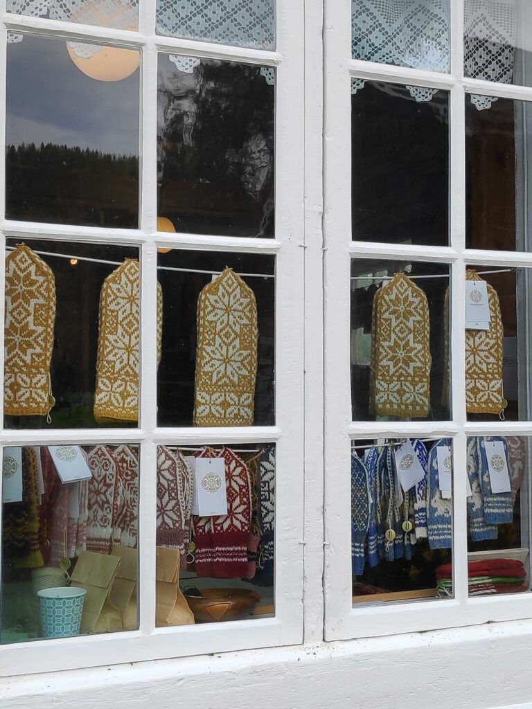
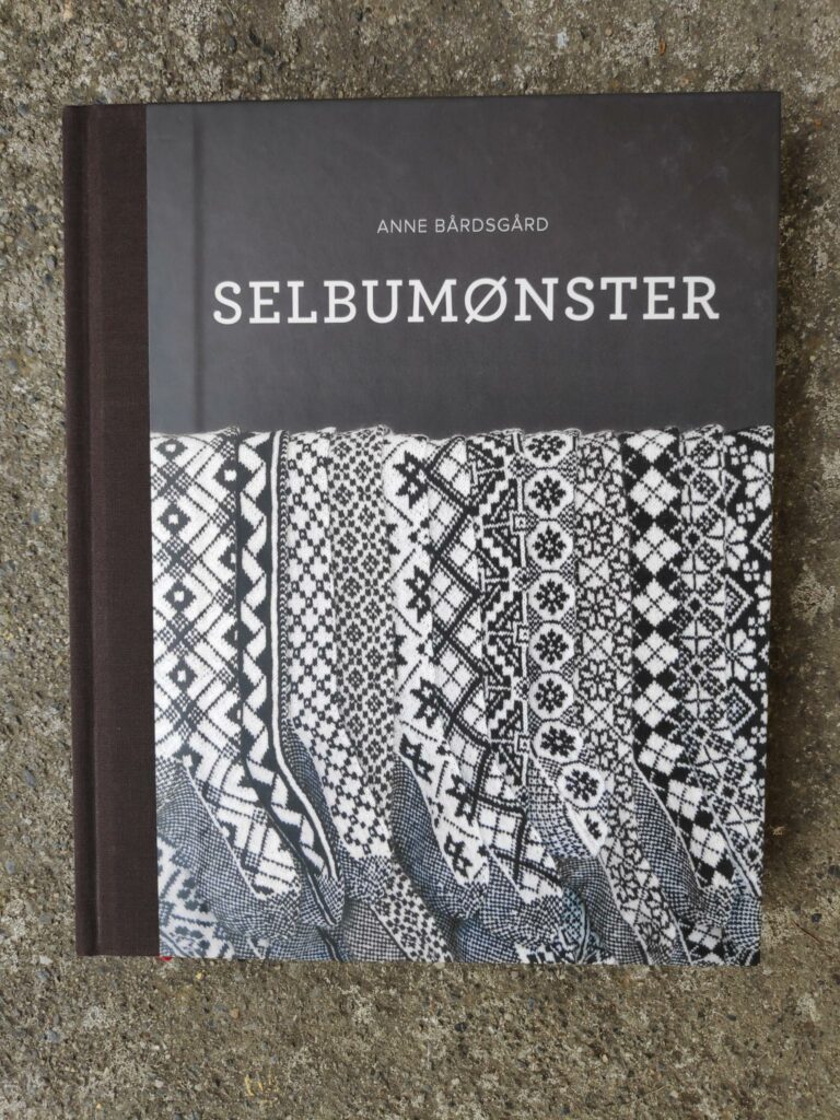
Selbu is also known for its two-color knitting patterns and here I was particularly interested. There was a small store in the local museum and I was fascinated by the displays in the windows.
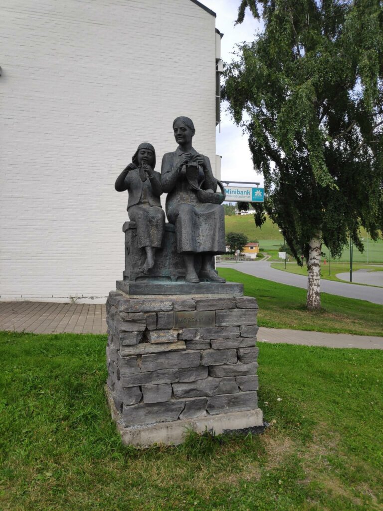
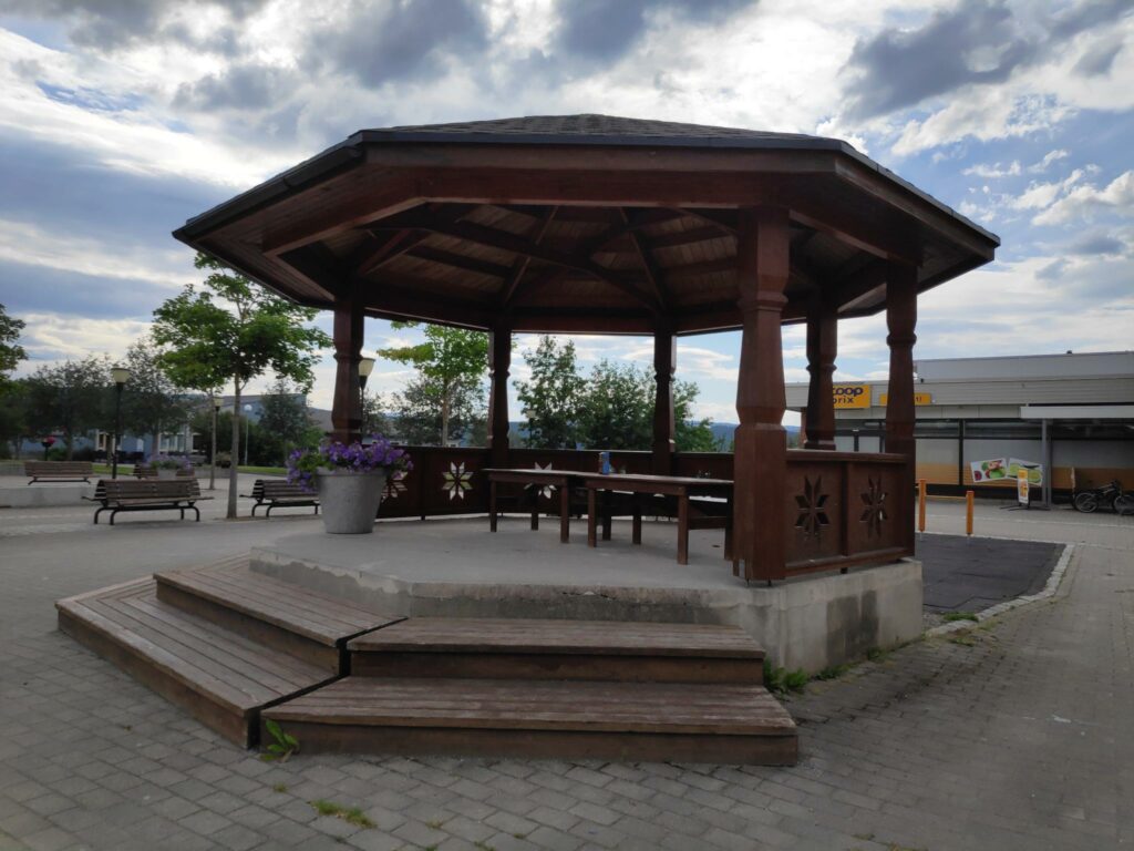
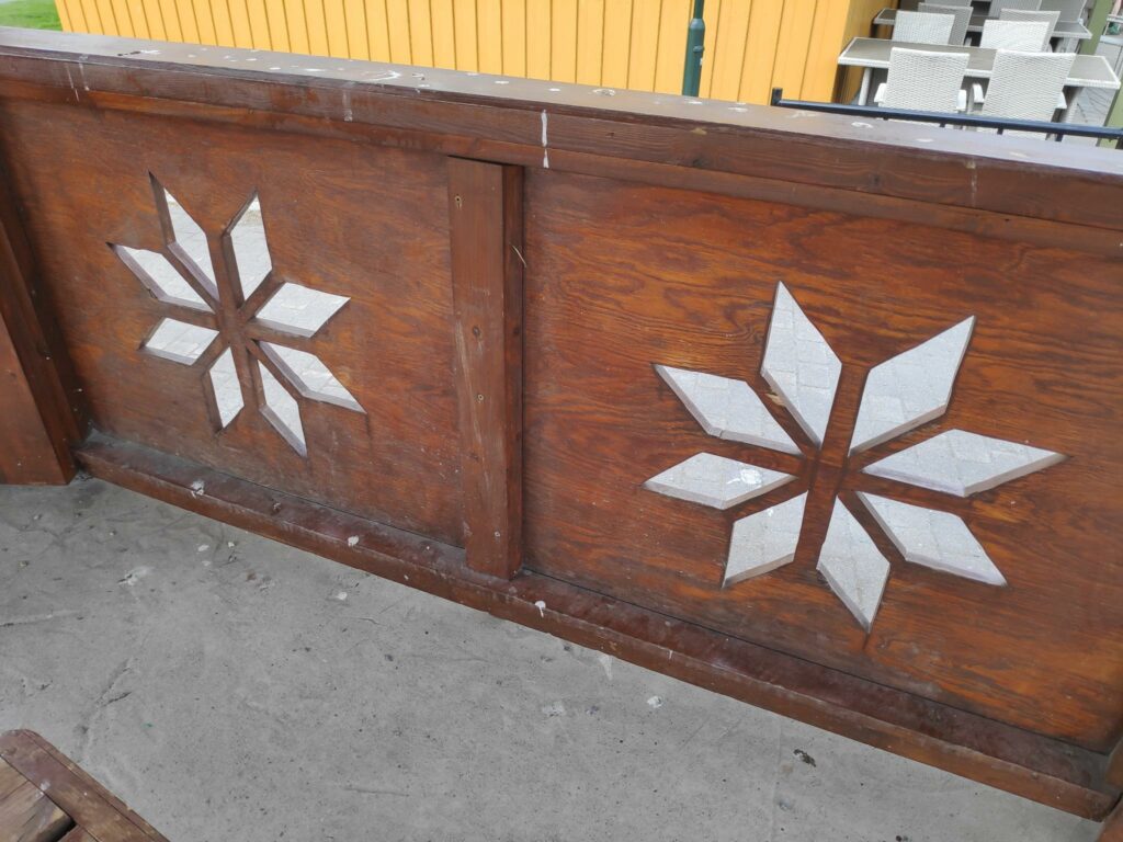
The items here would be knitted by local women. Most of the mittens seen here feature the Selbu rose, in various forms. Woollen mittens made with two colors become very thick and warm.The museum and the store were housed in a large building near the church. We didn’t explore the museum, but I did go into the store and buy a book.The book that I bought at Selbu with hundreds of different patterns that can be used for mittens, socks and sweaters.Knitting was such an important part of the women’s world that a statue was erected showing a mother teaching her daughter to knit.The village center had an interesting pedestrian area. Note the Selbu rose carved into the wall.The Selbu rose was found everywhere here.Even the local savings bank used the Selbu rose as part of its logo.
I have only been able to show you some of the pictures that I took on our trip. It was interesting for us to get away from the house for a day. We were out for nine hours and saw quite a few new places. I am always glad to get home after a lot of driving, but I felt we had had a good day. I hope you have enjoyed seeing some of the things we experienced.