
Inderøy is a municipality, but it is divided into several areas mostly based on the location of the elementary schools. In some cases the areas reflect municipal boundaries from the 1960s or earlier.
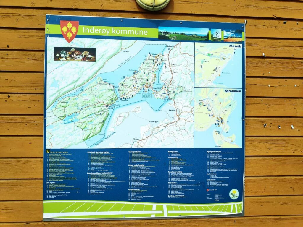
If you look at the shape of Inderøy in the above map, you will see the central part is a large isthmus which is only joined at the top right to the mainland. In fact, the name Inderøy actually means the inner island (in Trondheims Fjord). This isthmus is divided into four main areas – Sandvollan, Straumen, Kjerknesvågen and Utøy. We live in Utøy.
To the left of the isthmus, that is to the west, there are two areas, Mosvik and Framverran which until 2012 were their own municipality. By that time the population had decreased so much that it was no longer viable to provide its own services to its residents. These two areas also have a large number of cabins which are used only part of the year and are not full-time residences.
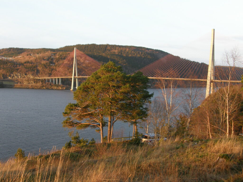
Mosvik and Framverran are joined to Utøy by a large bridge which is over a kilometer in length. The bridge spans Skarnsund which is a very deep trench between the mountains on either side. The trench is over 100 meters deep and is considered a good area for cold-water corals. It is a protected area from 2020.
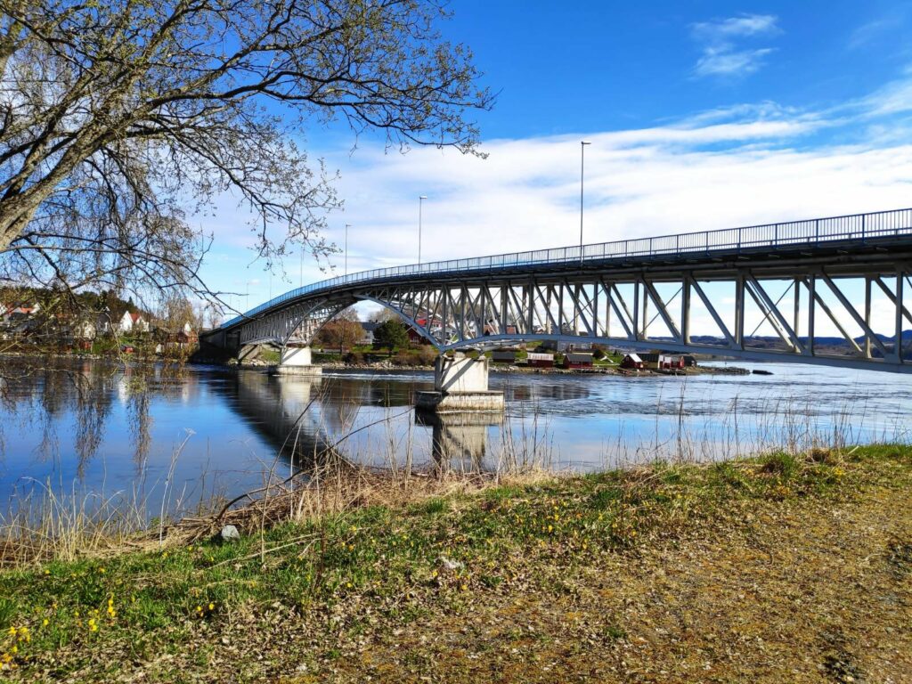
If you look at the map again, you will see there is one last area of the municipality, Røra, which is connected to Straumen by a bridge. Røra is where Inderøy has its one train station.
Sandvollan and Røra were their own municipalities until 1962 when they were joined with Inderøy.
Straumen is the administrative center for the municipality and is also the area which has the shops, the bank, the junior high school, the senior high school, the city hall and the medical center. In recent years there have been a considerable number of apartments built in this area.
As Inderøy is an agricultural municipality, there are a lot of farms and open areas between the subdivisions. There is also some forested areas, particularly in Mosvik. So though I mention specific areas of the municipality, there will also be smaller neighborhoods, such as Småland or Venneshamn. Some of these areas will have their own store, but not all of them do.
At the moment, there are just under 7000 residents in Inderøy. If you want to read more about Inderøy, you could read here in English or here in Norwegian.
One of the reasons I decided to write this short article is that the Inderøy Walks for 2021 began yesterday. There are 42 walks where one gets points when one comes to a check-in place. Some give 10 points, many give 20 or 30 points depending on difficulty and length of walk. The most difficult walks give 40 or 50 points. I don’t do all of the walks any more, but I plan to write blog articles about the ones that I do. I thought it might be interesting for my readers (those who do not live locally) to have a better understanding of the different areas that these walks are in.
This year the list of the walks has been divided into these areas: Mosvik, 6 walks; Framverran, 5 walks; Kjerknesvågen, 5 walks; Utøy, 8 walks; Straumen, 7 walks; Sandvollan, 4 walks and Røra, 7 walks. Most of the walks are away from where people live, so you will be able to see some of the different types of landscapes we have in Inderøy.