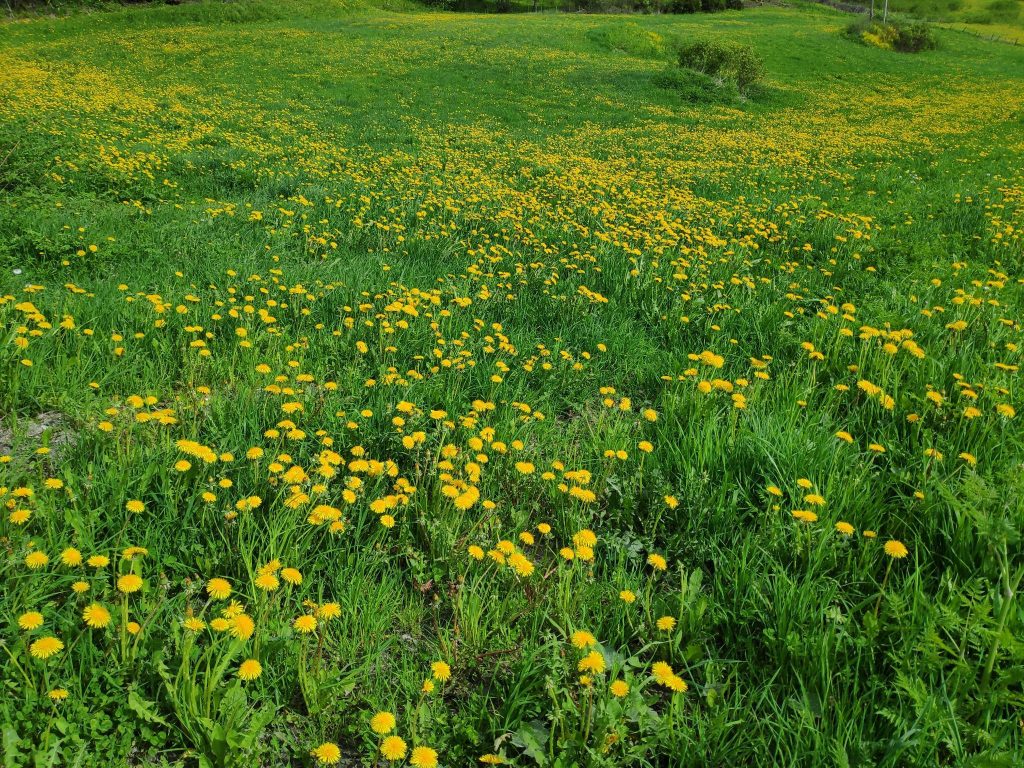
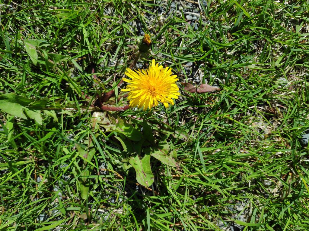
We live in the municipality of Inderøy and its official flower is the dandelion. When one looks at the fields in Inderøy during the second half of May, it can be seen why this flower has been chosen.
A field in Inderøy, picture taken on 25 May 2022.
As an agricultural municipality, there are many fields in Inderøy which are devoted to growing grass to feed animals. These fields are not plowed every year and each year the crop of dandelions in any given field will increase. Then the farmer plows the field and the field becomes primarily green the first summer.
The Latin name for the common dandelion is Taraxacum officinale. In Norwegian it is called løvetann (lion’s tooth). The English name, dandelion, seems to come from the French name for the plant, dent-de-lion, which also means the lion’s tooth.
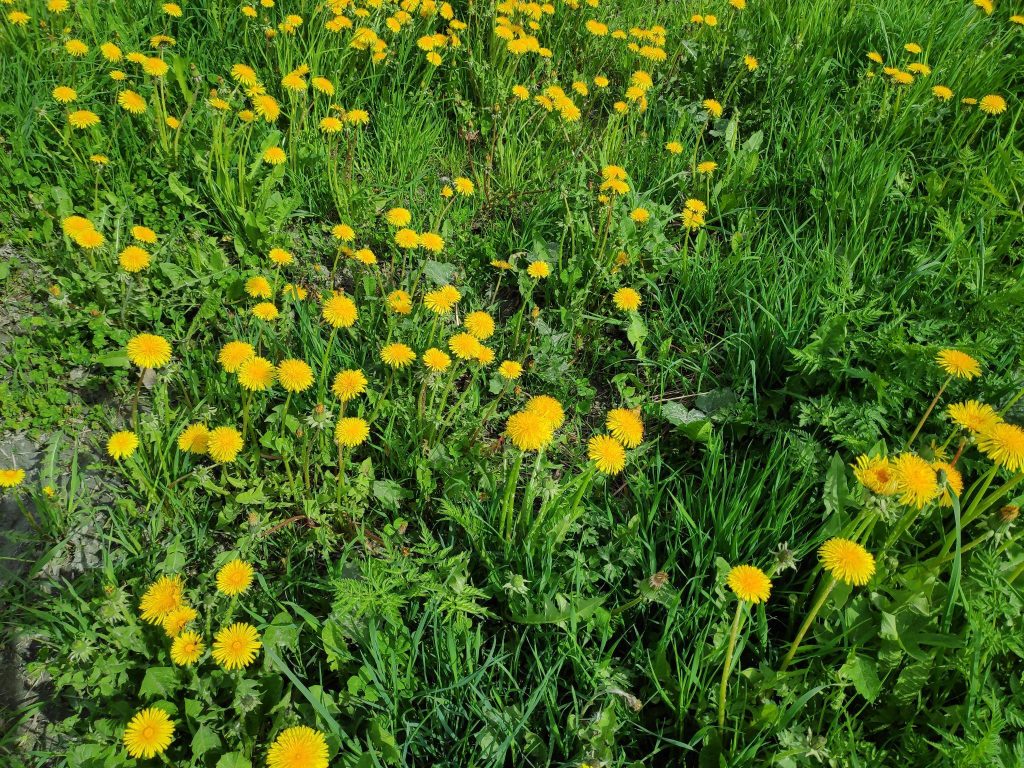
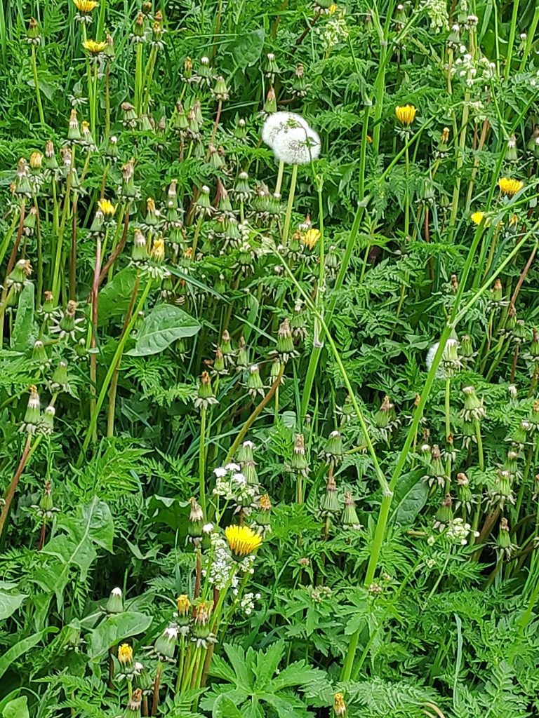
Lots of dandelions in this field and they mostly bloom at the same time.
Here in Norway, the dandelion will have its first flowering in May, or perhaps June at higher altitudes. Where I live, it will be found along the edges of roads as well as in gardens and fields. Beekeepers say that it is an important flower for the bees early in the season. This year there have been comments in the Norwegian press to refrain from cutting one’s lawn and letting wild flowers grow, as the bees need the nourishment.
A group of dandelions growing in a grassy field. Picture taken 27 May 2022.
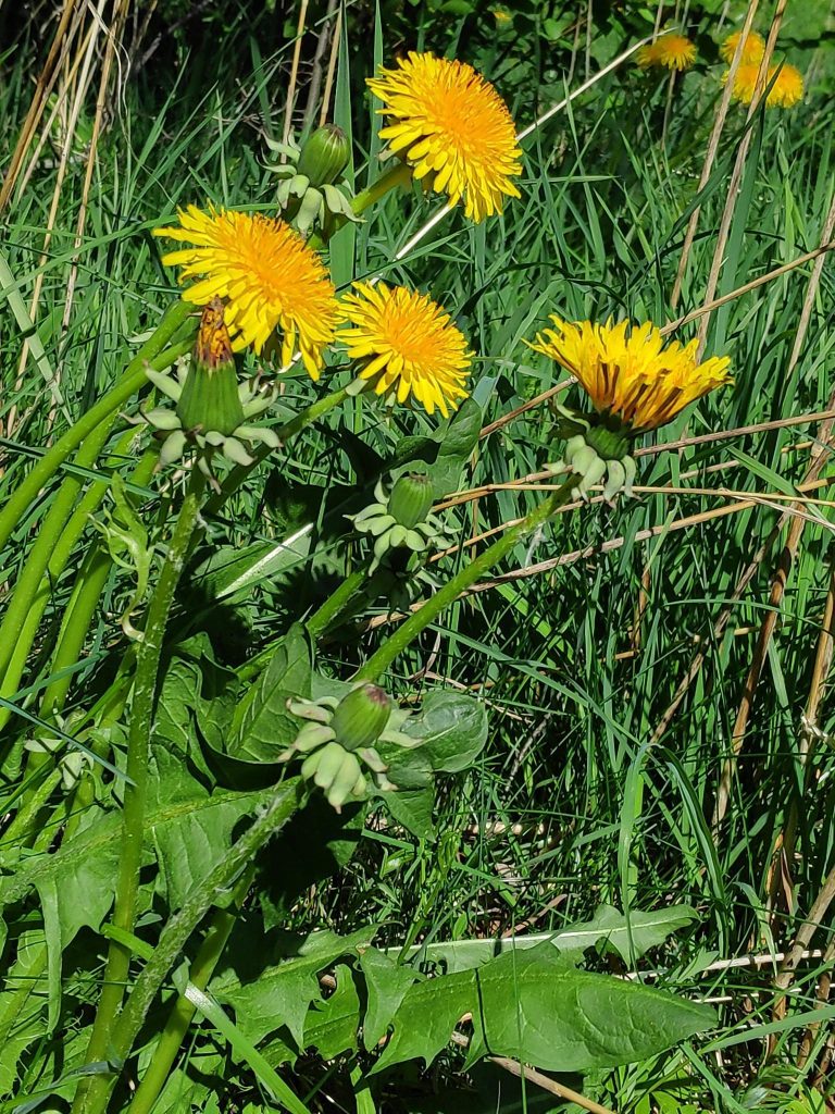
Dandelions have a characteristic yellow flower that opens wide on sunny days and long toothed leaves. When they grow in the open, they are very upright plants. When they grow with other plants, they can grow very tall in the competition for sunlight. They do not have to be pollinated and therefore can produce seeds that have the same genetic information as the parent flower. This means that even without insects, the flowers will go to seed. The flower grows on a hollow stem and the leaves grow separately from the long root. If the leaves and flower are broken off, the plant will regrow from the root.
All parts of the dandelion are edible and provide vitamins A and K, as well as calcium and iron.
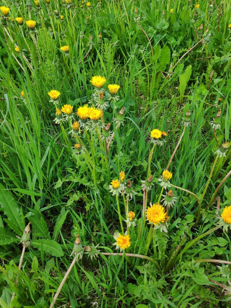
At night, the dandelion closes its flowers. On a cloudy morning, the flowers have not opened completely. Some are closed completely while the seed is formed.If a dandelion grows where the grass is cut, it’s leaves will spread out along the ground instead of growing primarily upright. The flower will come out on a very short stem.Some of the dandelion flowers have become gray and the fluffy seeds will spread in the wind. In this picture we can see that the dandelions on this road bank are almost finished and the next flowering plant (Anthriscus sylvestris / hundekjeks / cow parsley or Queen Anne’s lace) will soon dominate the roadside.
I usually consider the dandelion a weed and will remove as many as possible before they go to seed. However, I do find it an attractive flower and quite understand how it is an important flower for bees.
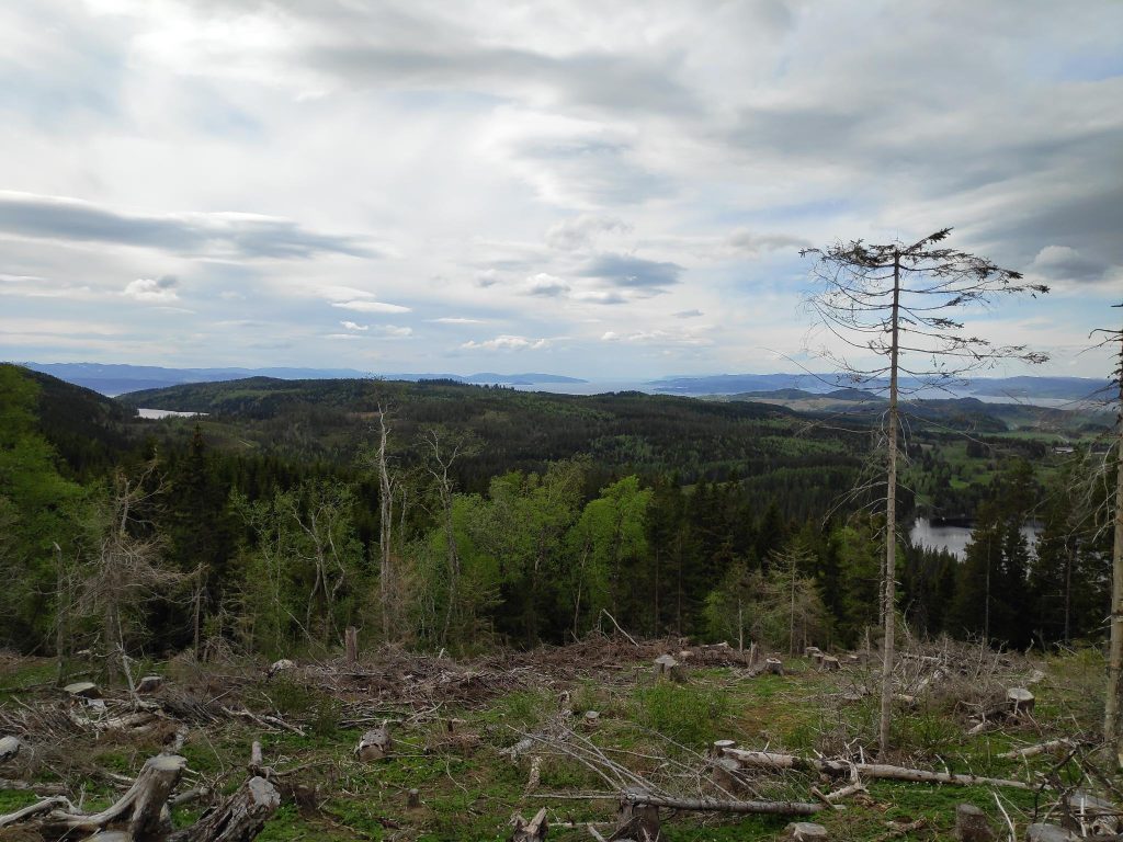
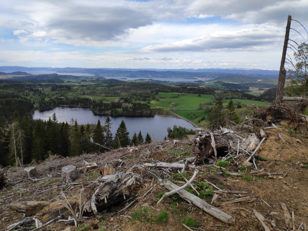
The view from Aunan, looking west. The gap in the distance is Trondheim Fjord with Levanger on the left and Mosvik on the right.
Tuesday, May the 24th, was a Bahá’í holy day, so my husband and I decided to take a walk in the hills at Røra. It is an area we both enjoy walking in. Today’s walk was about 2 hours plus a sandwich break for about 15 minutes. I have been to both Aunan and Floåsen before and if you want to read about the walk taken to Aunan in August 2021, you can read it here.
As we started our walk, I wondered what sort of theme I should have for this blog and my husband suggested “signs”, so that will be the main theme. What sorts of signs do we see while walking in the woods? Some are easy to read, some are directional (i.e. which way to go), some were about the place where we found the sign, some were almost impossible to read, some were official signs, some were hand-made. I think one thing that can be learned from some of these pictures is that signs with writing on them need to be looked after.
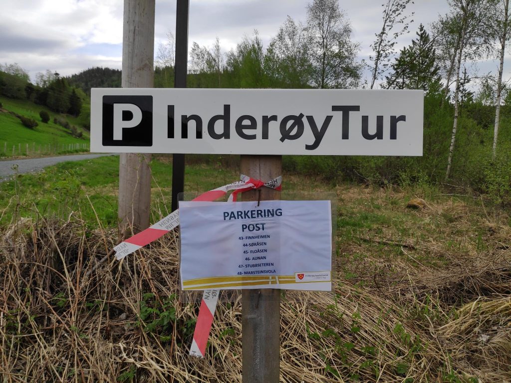
The parking area at Røflo Lake has a sign indicating that one is allowed to park here. There is also a sign showing which posts can be reached from this parking area.
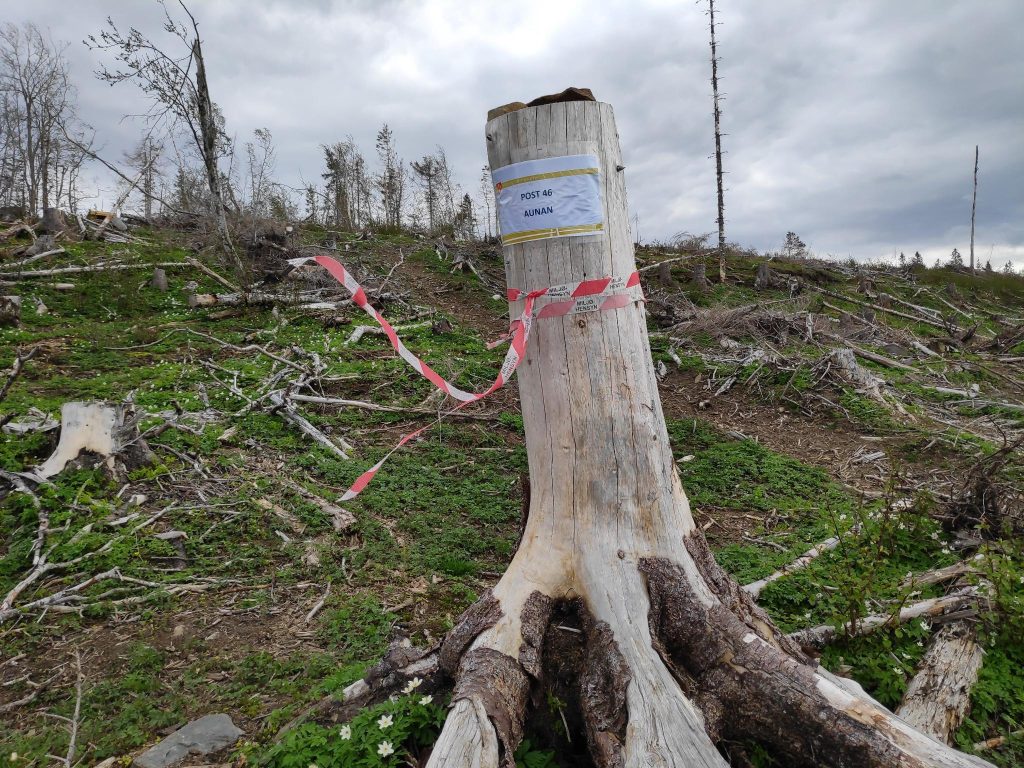
When taking an Inderøy walk, one of the first signs one sees is the indication of where parking is allowed. This year they are wanting people to park in one place and find multiple posts from the same parking spot. From this parking area, one can walk to six different posts depending on how far one wants to walk. We visited two posts, nr. 46 Aunan and nr. 45 Fløåsen.
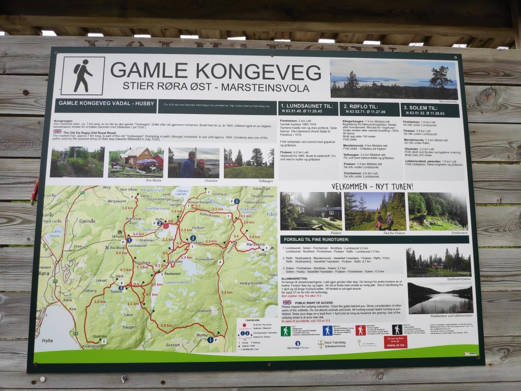
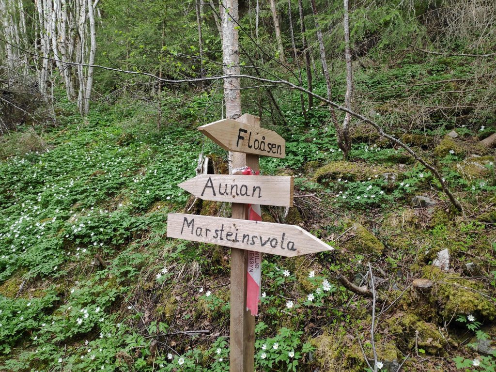
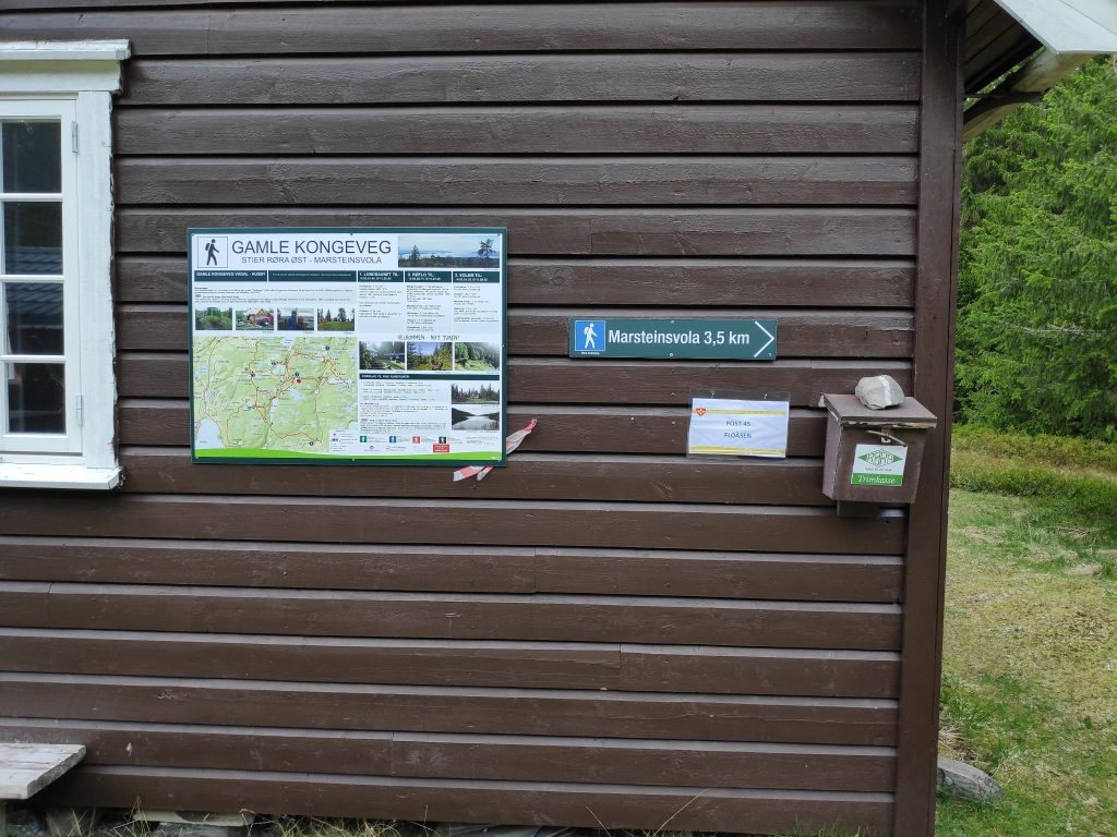
This map covers an area called “The Old King’s Road” and up to Marsteinsvola which is a hilltop at the junction of the municipalities of Steinkjer, Inderøy and Verdal.
One of the things I have learned over the years (at least since having a camera on a smart phone) is to take a picture of the map that is posted at the parking area. One can always look at it if one isn’t sure which trail goes through. The app for the Inderøy Walks has a good map, but not all trails are actually marked on it. Today we were walking on some good trails that didn’t seem to be on the app’s map at all, though the dot that shows us where we actually are indicated that we were going in the correct direction.
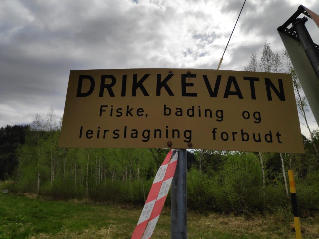
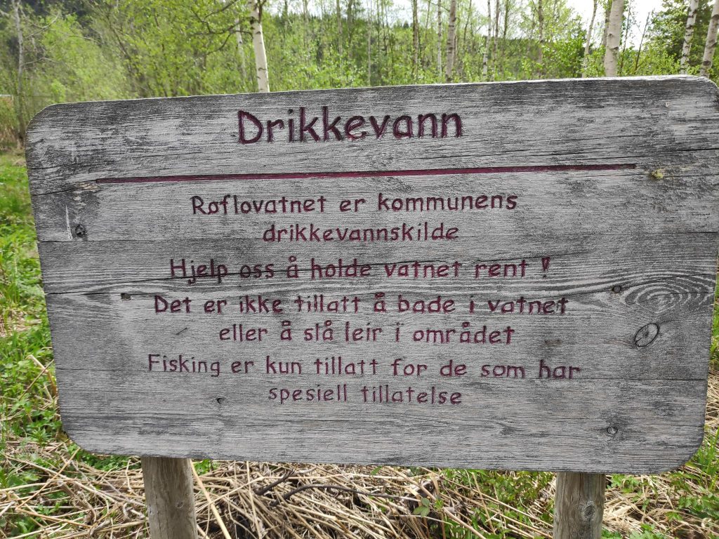
Our walk started at Røflo lake which is the main drinking water source for the municipality of Inderøy. The water is purified before sending it out to the customers which also include a juice factory.
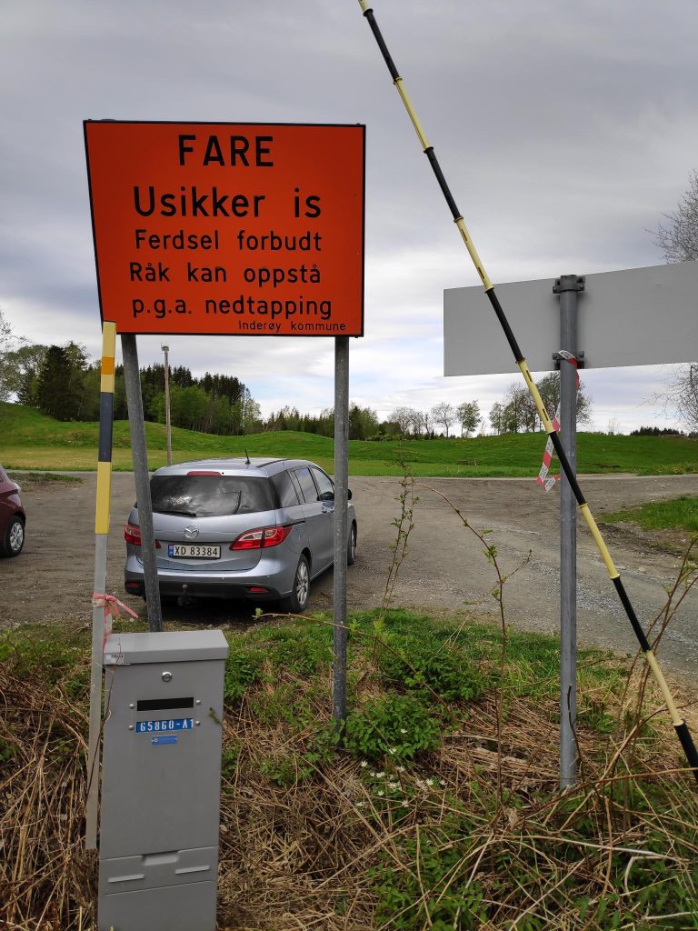
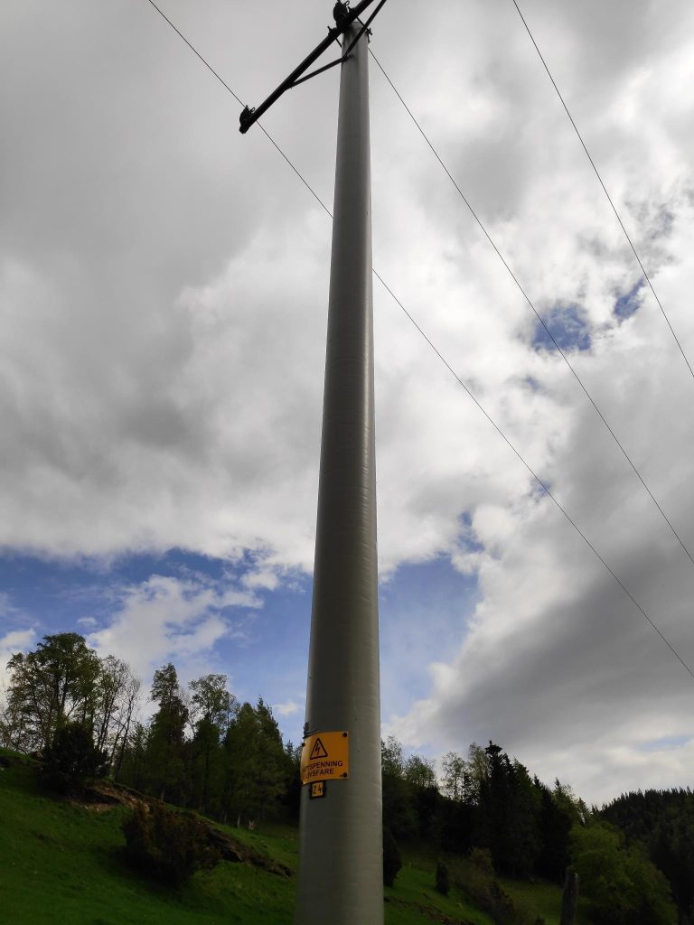
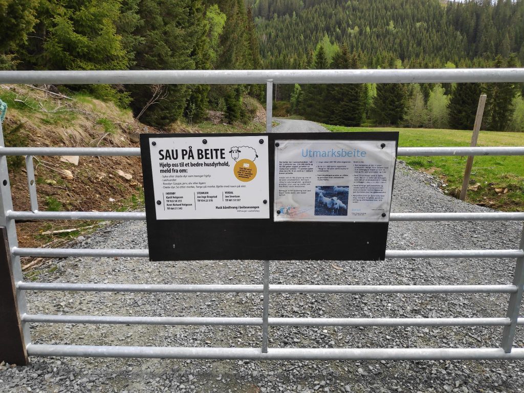
Drinking water – fishing, bathing and camping are forbidden.This is an older sign which has been looked after. It is important to repaint the lettering regularly. Translation: “Røflo Lake is the municipality’s source of drinking water. Help us keep the water clean. It is not allowed to bathe in the water or to camp in the area. Fishing is only allowed for those who have special permission.”Røflo Lake would freeze over in the winter, so it becomes important to have a warning sign. Translation: “Danger: Unsafe ice. Traffic on the ice is forbidden. Openings can occur because of draining.” Notice also the gray box below the sign has a number on it. These gray boxes are usually connected to electricity.Near the parking area, there were a lot of electricity poles which, of course, each have a sign on them warning of the danger. “High voltage, life threatening” plus a number.These two signs indicate that there are grazing sheep on the other side and give information on the purpose of this area as well as contact information if one sees injured animals or other problems. Dogs must be on a leash.
The field closest to the parking area had cows out today. They are usually kept close to the barn for milking. However sheep are sent up into the hills for the summer and are expected to look after themselves. Here there is a fence so that they don’t get out onto the road. We saw the sheep briefly and the lambs are still quite small. We saw two lambs laying on the grass resting and eating the grass that was in reach!
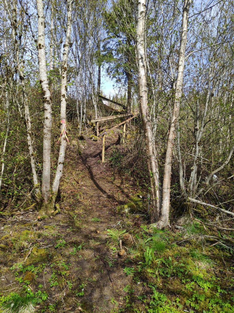
We will cross the road and head up the steep trail on the other side.
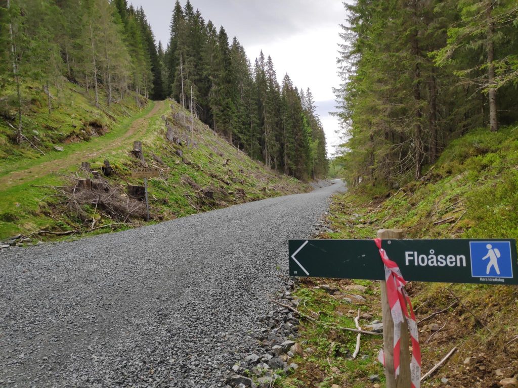
Most of the walks in Inderøy have good signs to indicate how to get places. The sign above shows that we are on a blue trail (not so easy trail, but not too difficult either) taking us to Floåsen. Under the blue man is the name of the organization that is responsible for this trail, Røra Sports Club, and at the extreme lower left hand corner is the number 28. All this type of signs have a number. The red and white tape on the sign indicate that this is a marked trail for this year’s Inderøy Walks.
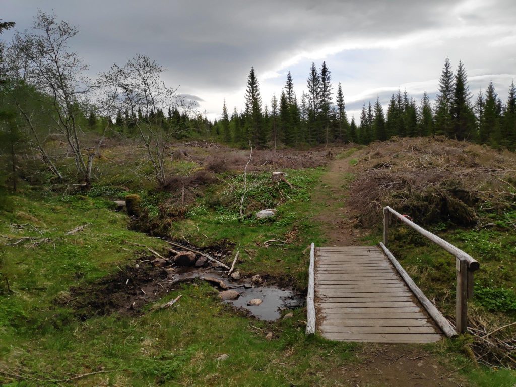
We came to a bridge with a railing, crossing a stream that was very gentle today. Wooden bridges like this can get very slippery in the rain so having a railing on one side is very nice. On this bridge there were also two signs, neither of which were easy to read.
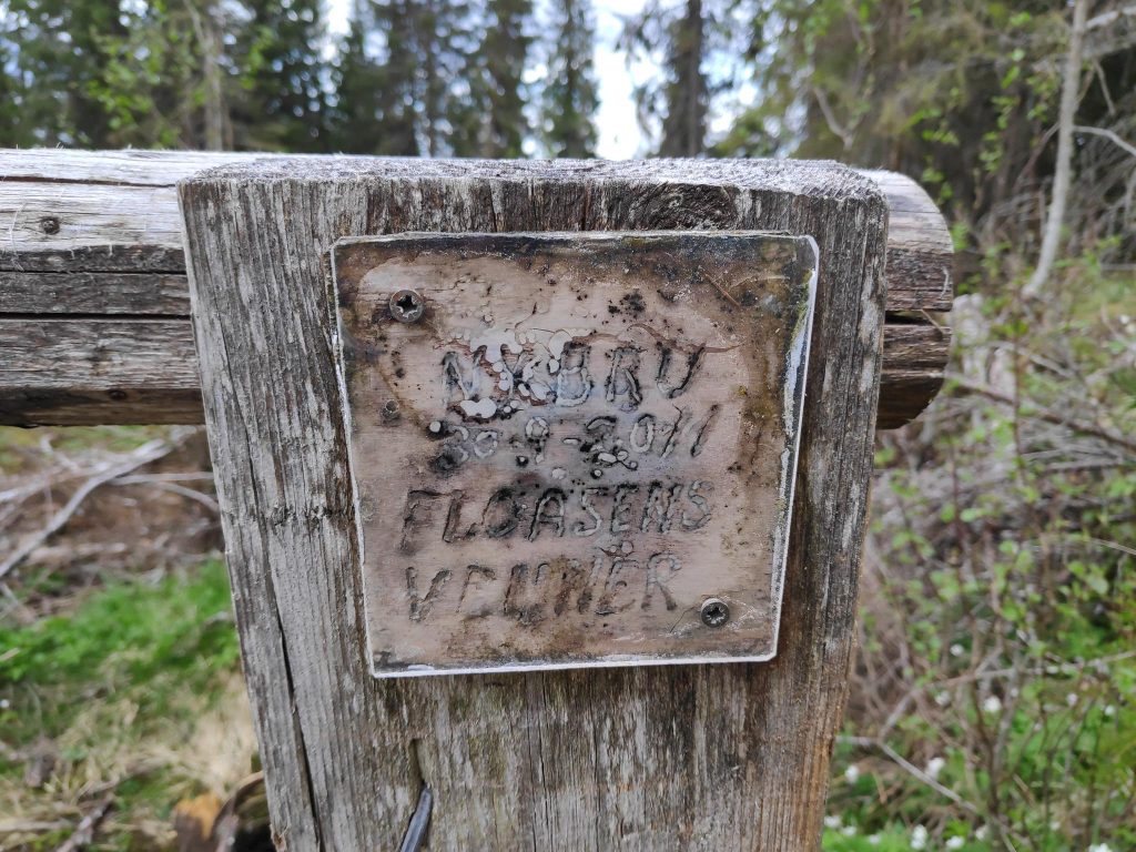
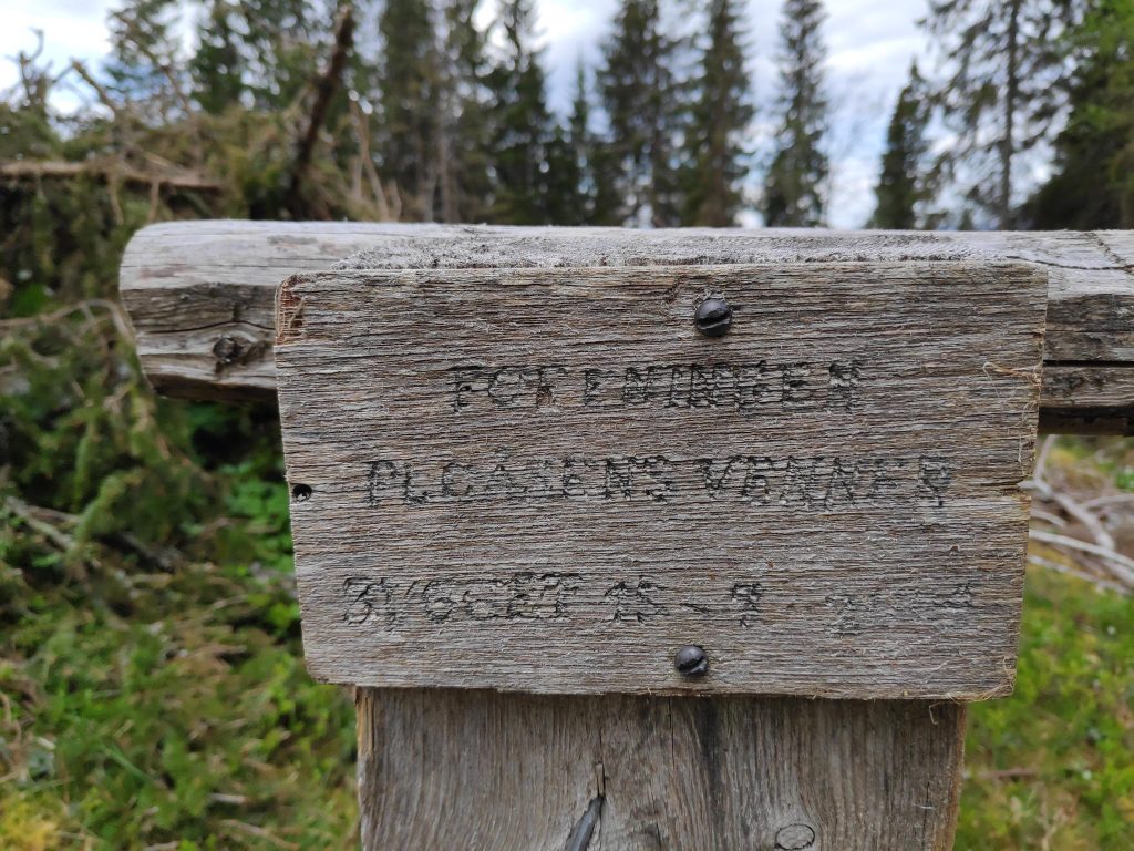
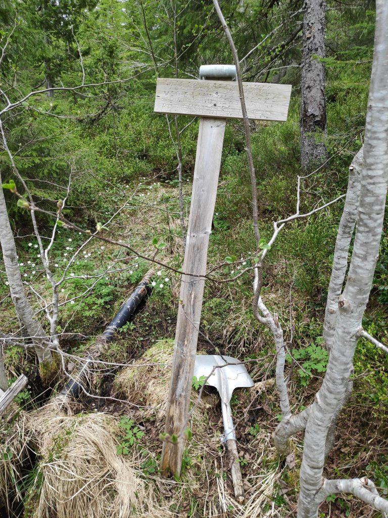
Not all of this sign is easy to read, even though it has a plastic cover on it. There is the name of the bridge (“bru”), a date (30-9-2011) and the name of who put it up (Floåsens Venner = Friends of Floåsen)On the far end of the bridge was a different sign, which also needed a bit of maintenance to be easier to read. I couldn’t read everything on this one, though it also seems to mention “Friends of Floåsen”.I came across this sign that was almost impossible to read, but the text indicated that you could borrow this shovel, but please return it here on your way back.
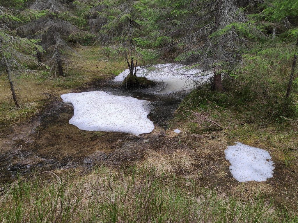
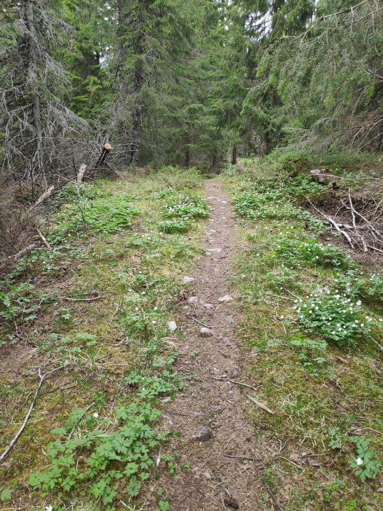
This was the first time that we had gone walking in this area this year. Last year we had gone too early and the trail we had taken was still covered in a lot of snow. So I was curious to see if there was much snow left at all. We’ve had plenty of warm weather and sunshine so I wasn’t expecting too much snow left now.
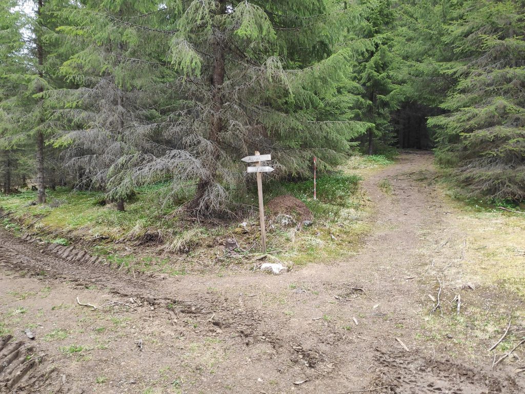
This was the biggest patch of snow that I saw on our walk. It was in a very shady area, under the trees.Aunan to the left and Floåsen to the right.
Aunan is a relatively new place to go to in these hills. It is a hilltop that has been recently logged so that there is a beautiful view looking north and west. These signs have been put up after the more professional signs were erected along the trails. At the distance this picture is taken, it is hard to read what is written, but it was quite clear when one stood closer. We headed off to the left to go to Aunan first. We made a circle tour and came back to this intersection on our way back from Floåsen.
Of course there is a sign where we check-in for the post. This picture shows what a logged area looks like a few years later. There are lots of white anemone blooming, an early spring flower that will cover the ground.The view from Aunan, with Røflo Lake in the foreground and Straumen in the distance. The hills in the far distance are in the municipality of Steinkjer.
On the way up to Aunan I had seen a sign that indicated a path and I suggested to Brock that we take it and explore. He agreed, so we ended up taking the long way round to Floåsen, but along lovely trails through the forest.
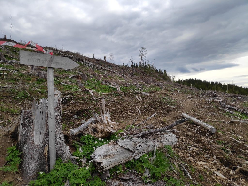
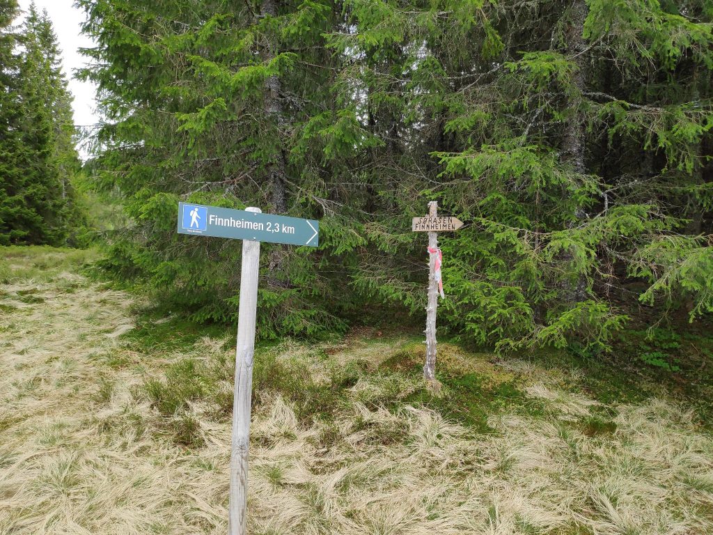
The sign indicates that Marsteinsvola is in that direction, so we take that trail and look for a turn off it to Floåsen.Part of a trail that we hadn’t taken before. It is well used, even though it wasn’t on the map I had.We have come from Aunan. Marsteinsvola is another hilltop, but we won’t go there today. We head off to Floåsen. This next section of the trail we have been on before, on our way back from Marsteinsvola.Floåsen
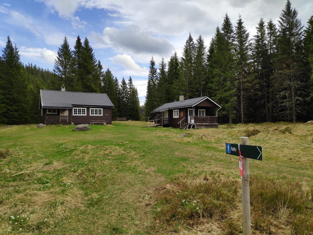
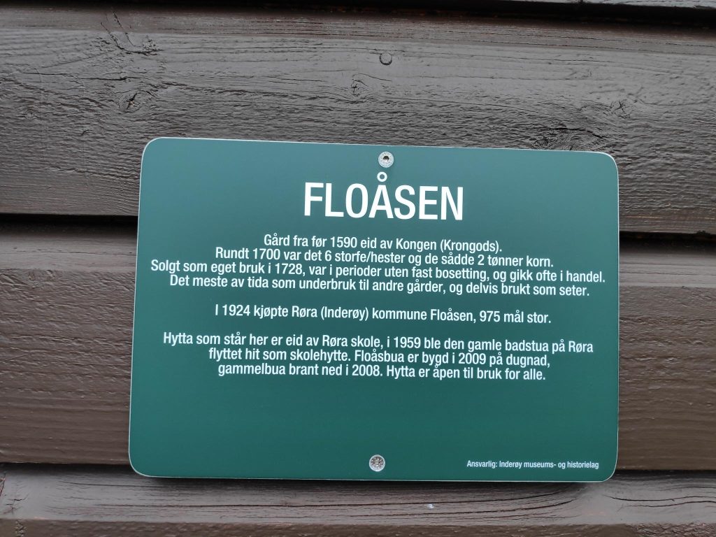
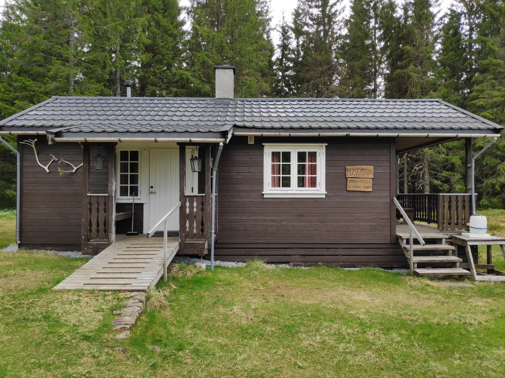
Though there is a lovely view from Aunan, Floåsen is an open area in the middle of the forest. There are two buildings at Floåsen, and there are several signs here. The sign below tells the story of this location. This was originally a farm owned by the King. It was purchased by municipality of Røra in 1924. The cabin that is here is owned by the Røra School.
More signs, a map, a notice that this is a check-in post for Inderøy Walks, and a box put up by the local sports club, with a book inside. You can write your name in the book to indicate that you have been here.The sign says, “Floåsbua, Åpen for alle, Floåsens Venner” Translation: Floås Cabin, open for everyone, Friends of Floåsen The left hand door leads to a toilet and to the right is a room with a small kitchen, where one could take shelter in bad weather. We sat at a picnic table outdoors and ate some sandwiches. Two places we decided not to go to today.
We had now been walking for about one and a half hours, enjoying our time out in nature. There were other places we could have walked to from here, but we agreed that going back to the car was appropriate. Taking the quickest way back it would take about half an hour to the car.
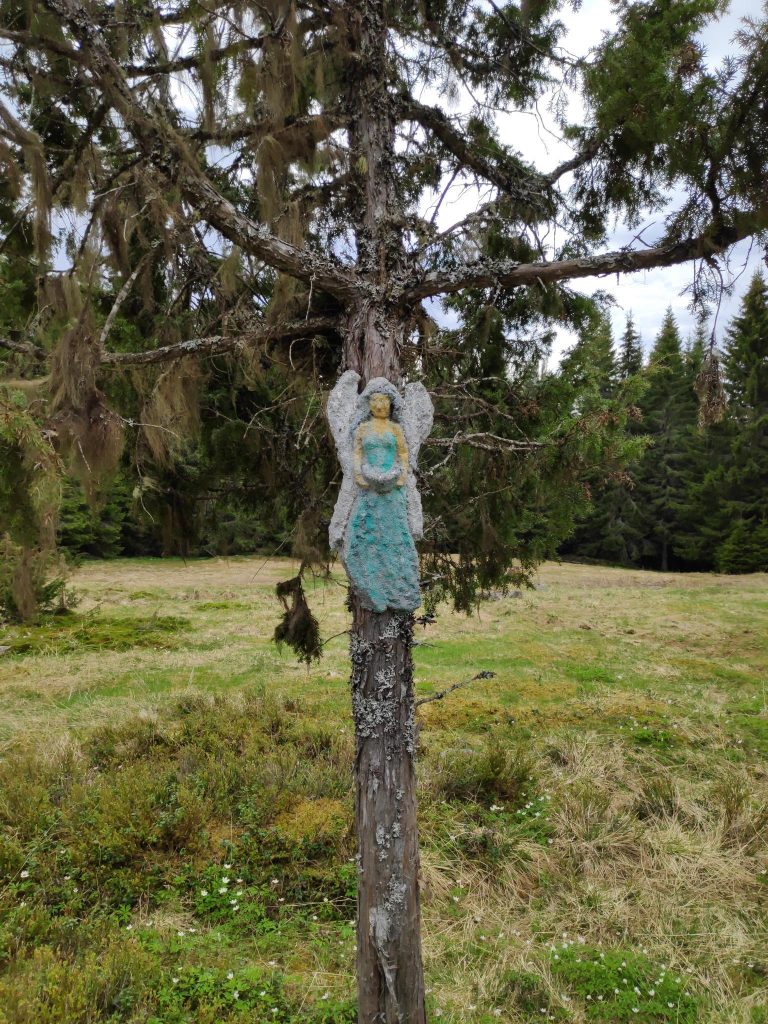
We found this angel hanging in the tree on our way back to the car.
The walk took a little over two hours, in cloudy weather and about 14 degrees Celsius. We were tired by the time we got back to the car, but we want to do walks this long regularly so that we keep in good shape and grow old gracefully. We got to try a different trail we hadn’t been on before and we didn’t get lost.
I hope you have a chance to get out for a walk today. Enjoy nature! They say trees are good for our mental health.
Today, Sunday, the 8th of May, was the first day of the Inderøy Walks for 2022. My husband and I took our first walk today. There were also a lot of other people out walking too. The weather was mostly just cloudy, but we had one rain shower while we were in the forest, so we didn’t get too wet.
This year there are 48 posts and often several can be found on the same walk. We did a circle tour and were able to check in to three posts. We use an app on our phones to check in to posts when we get to them. For several years now, there have been posts that have been accessible to those who use wheelchairs (which also allows access for those with baby buggies or strollers), but this year there are also several posts that are accessible for those who are kayaking. However, I will be traditional and use my two feet. Today, I also borrowed my husband’s second walking stick to see if that was useful. On flat bits, I didn’t like having to carry the stick, but on steep areas it was useful.
We parked at our local recycling center (previously known as the garbage dump) and headed off on an easy walk through relatively open terrain. The trees are just starting to put out their leaves. The walk from the car to Markaplassen was about 600 meters.
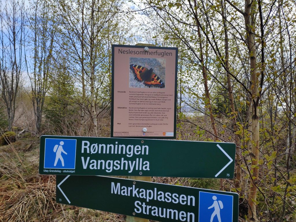
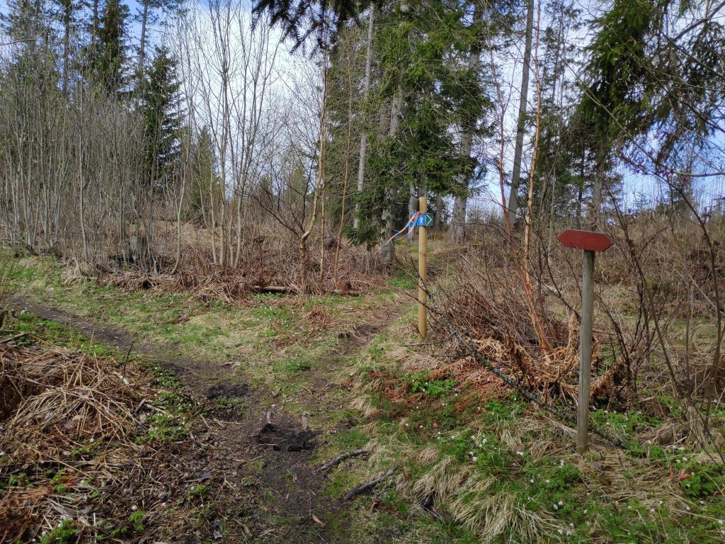
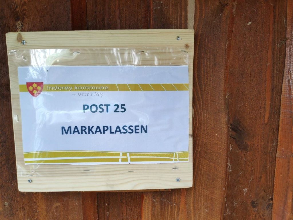
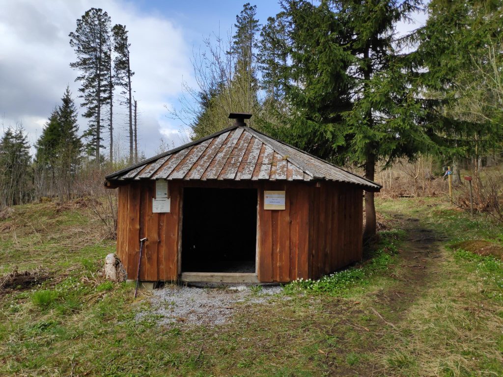
Yes, we could walk to Vangshylla and home from here, but it’s a bit too far for me. Today we chose to go left, towards Markaplassen. There were new information signs along this path, primarily about insects, birds or other animals. The blue hiker on the signs indicate that this is middle difficulty, though the section we did today was quite easy. In spite of recent rain, the ground was not muddy or particularly wet.Here is the trail and the open forest that we were walking through. The trail is marked both with signs and streamers. The red arrows are an older version of the signs. Today they use signs with a hiker on them.Our first post, number 25, for 2022. We got 10 points each for this easy walk.This little shelter at Markaplassen can be used if the weather turns bad. There would be benches inside to sit on. We were still energetic so we continued our walk without sitting down.
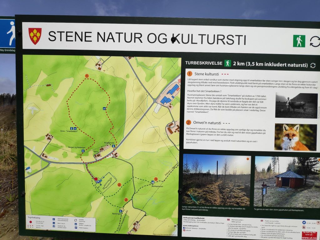
New this year were two posts on the Stene Nature and Culture Path. It is posted as a green trail, which means it is quite easy. It is not a very long trail, but does go around in a circle. We came to the path from the right on the map below and took the trail in a counter-clockwise direction, meeting many people going in the opposite direction.
We came from Markaplassen (labeled 3 on the map, went up to the main car road, crossed over it and followed the red dotted line in a counter-clockwise direction.
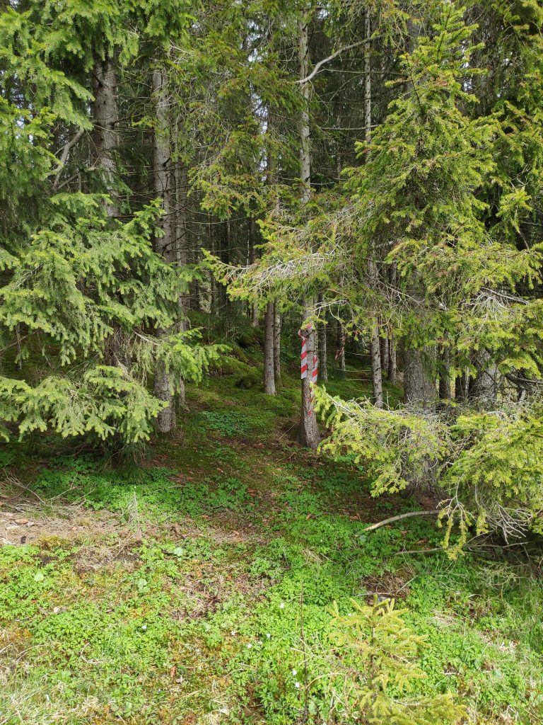
It is always fun trying a new trail. This trail was well marked with streamers, and I’m sure by the end of the summer, it will be very easy to see on the ground as well. However, there were many narrow trails, probably deer trails, in the forest so we had to keep a good eye on the streamers in the trees.
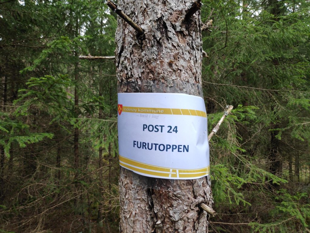
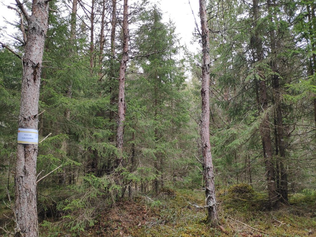
Into the trees we go. We had to keep an eye on the red and white streamers so that we went in the right direction. Most of this trail was in a coniferous forest that has not been logged recently. We climbed quite a bit, so we got good exercise. Our second post of the day, number 24, was called Furutoppen, the Pine Top, Here we got 20 points for our efforts.The forest at Furutoppen.
There was a little bench to sit on while we checked in on our app. We now had been to two posts and gotten 30 points each. Onward ho! We have to get back to the car, so we keep on going. We are enjoying the quiet of the forest, though every now and then we hear the voices of others who are out walking. It is Sunday, so lots of people will be out on the trails today.
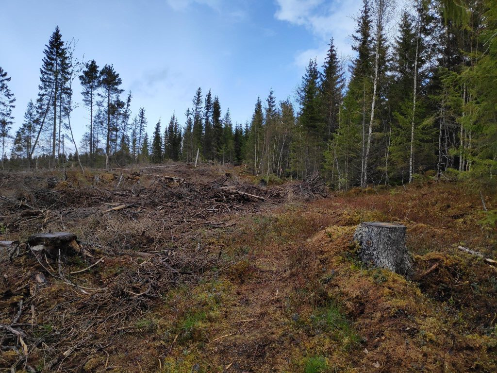
While we were in the forest, there was a short rain shower. By the time it was finished we came out into the open where the forest had been cut down, perhaps a year or two ago. I noticed that small spruce trees had been planted in this logged area.
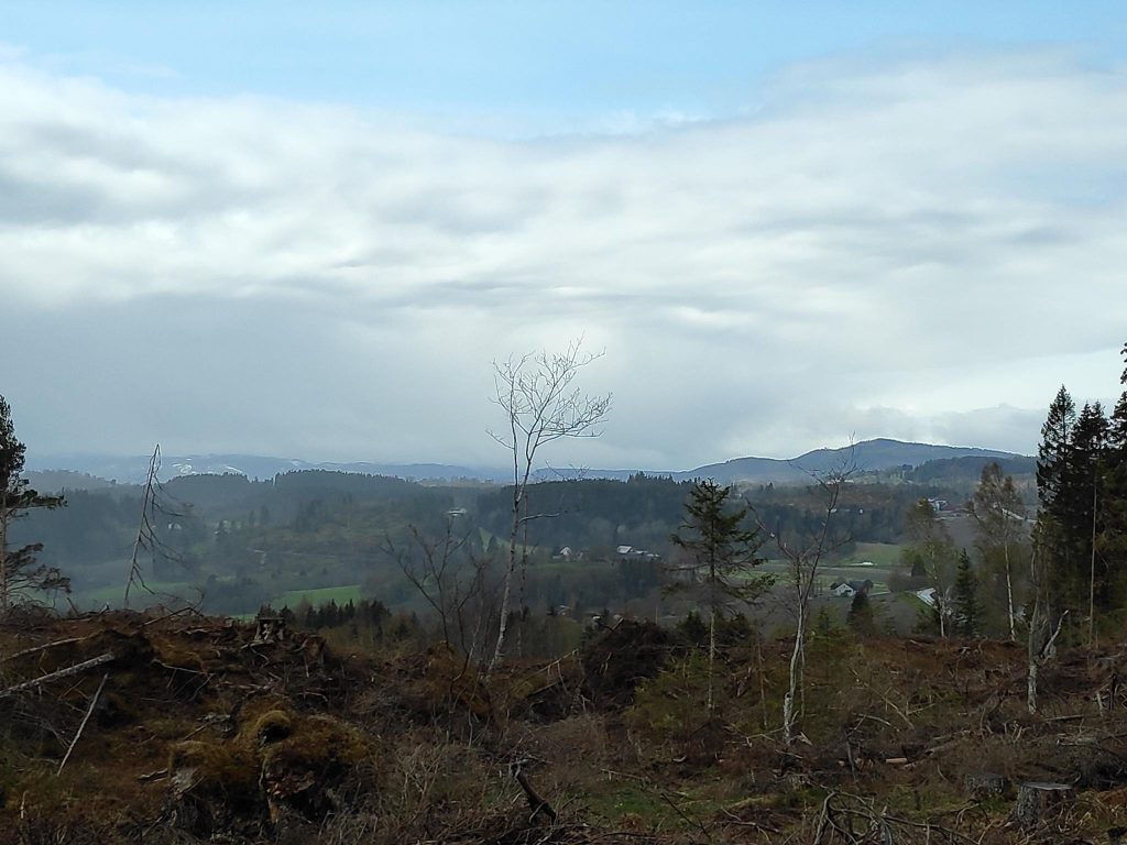
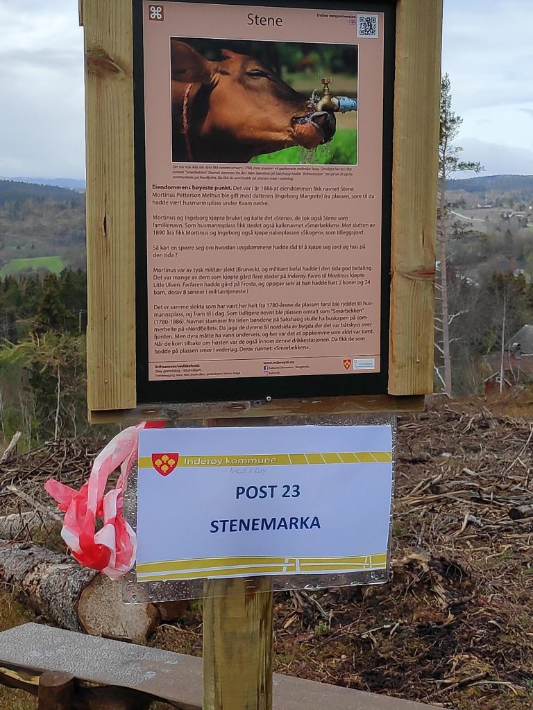
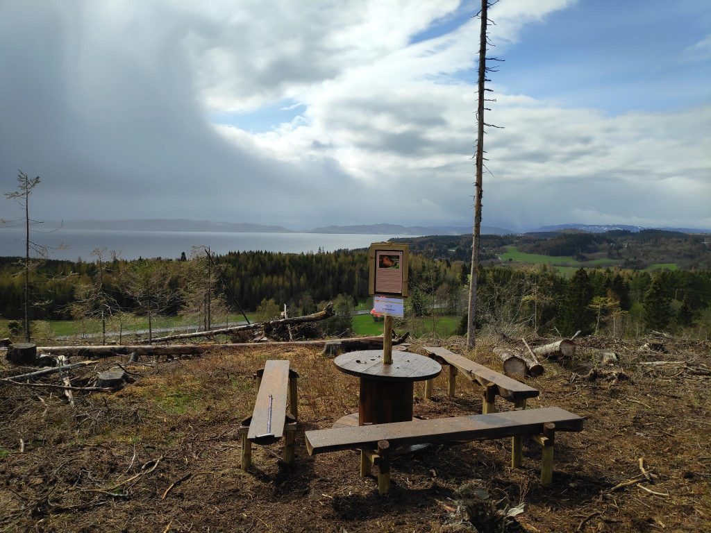
Looking back the way we came. We are going downhill now, and I’m looking back at the forest we have come out of.Suddenly, when we get out into the open, there is a view over the farmland of Utøy. It is just clearing up after a short rain shower.Our third post of the walk, number 23, for which we got 10 points.They have made a nice sitting area here, with a view out over farmland and the fjord. The island of Ytterøy is in the background.Suddenly, the sun has come out again. We’ve just come down this section of the trail and it was very nice to have both a railing to hold onto and a walking stick to help with balance.
We enjoyed our walk today, in spite of the weather not really cooperating at one point. We were prepared for rain and mud, so there was really no problem. We used about one and a half hours on this round trip and we agreed that we would do it again. Though we have to drive to get to the starting point, the parking area is only about ten minutes drive from home.
I hope you get out for a walk today too. Enjoy the nature you have near you.