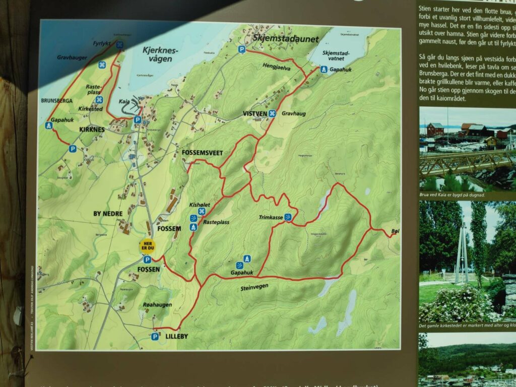
Today was another beautiful sunny day and as it was also a Sunday, we all three went for a walk together. First we drove to Skjemstadaunet where we parked the car near the information board. The walk to the lake is partly through the woods and partly in the open. It is difficult to know how long the walk actually was as I wasn’t watching the time. We perhaps used 20 minutes each way, making the walk about one kilometer.
We took the walk from the P at the top of the map, at Skjemstadaunet, up Hengjaelva to Skjemstad Lake (vatnet = the lake). There are also several other walks available in this area.
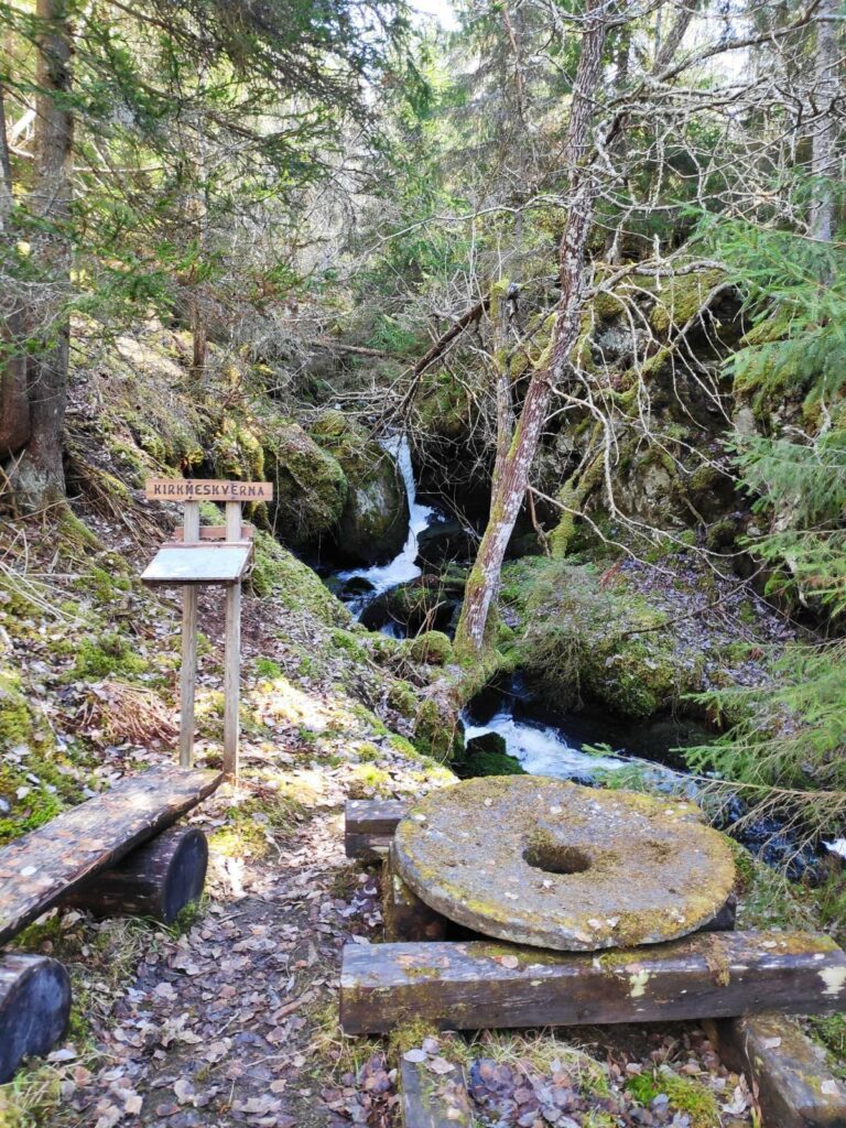
The walk follows the stream that drains the lake. This is a stream that has been used for grinding grain in the past. There were information boards in several place and old grindstones on display as well.
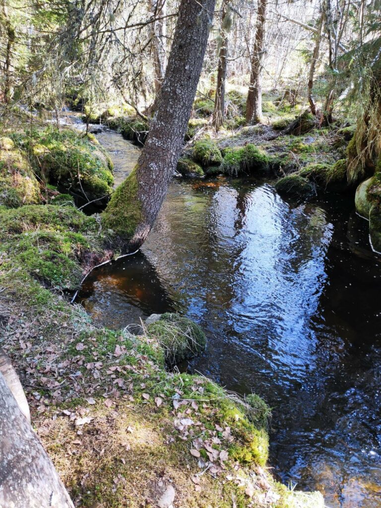
There was a lot of water running downhill and it was quite noisy. It isn’t long since we had the last snowfall, so there is still a lot of meltwater to make its way down to the fjord. Here you can see an old grindstone and an information board.
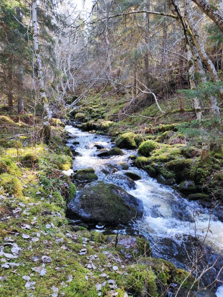
The stream is not very wide, but it was definitely very noisy today with a lot of water flowing quickly downhill.
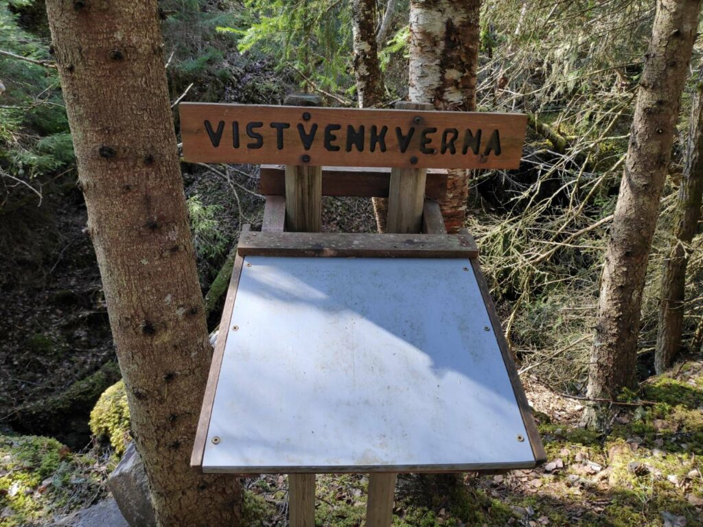
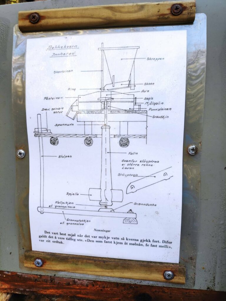
“Kverna” means grinding mill. There were at least three locations along the stream with information about the old processes of grinding flour. The information boards close up when not being read so that they are protected from the weather.
At this information board, there was a diagram of how the grinding mill was actually built up. The comment at the bottom says that one would get the best flour when there was a lot of water so that the grindstone went quickly.
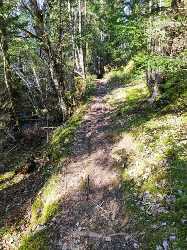
The path we were following was narrow and uneven. In parts it was also quite steep. Being beside a stream it was also quite moist in the air and the moss has been growing well.
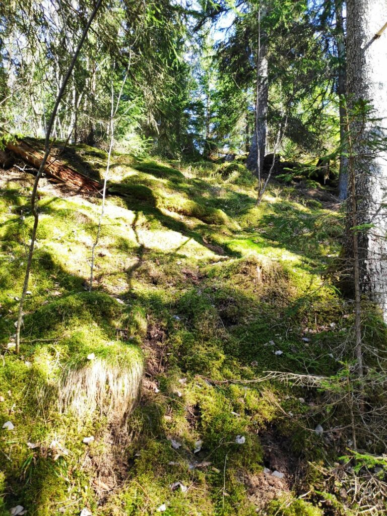
The steep, mossy slope on one side of the trail. There were only a few patches of sunlight along this part of the trail, which was also the steep part of the trail.
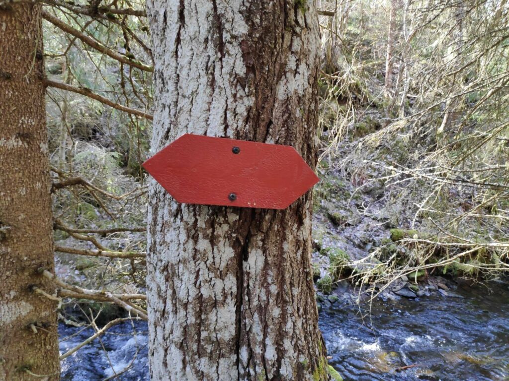
The old-fashioned method of marking trails in Inderøy was using red wooden arrows.
Eventually the slope became less steep and the stream was not flowing so noisily. We are walking up the stream, so going in the opposite direction of the water.
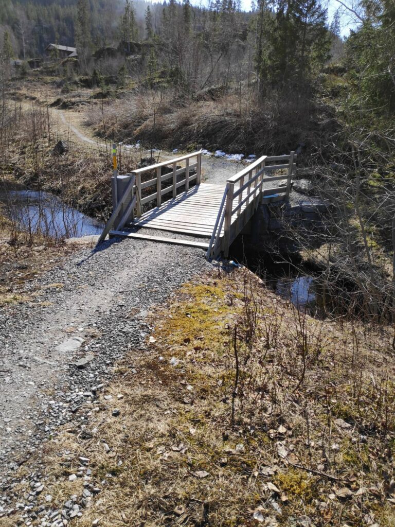
Then we came out into the open, where the forest has been cut back. There was a well-made bridge across the stream.
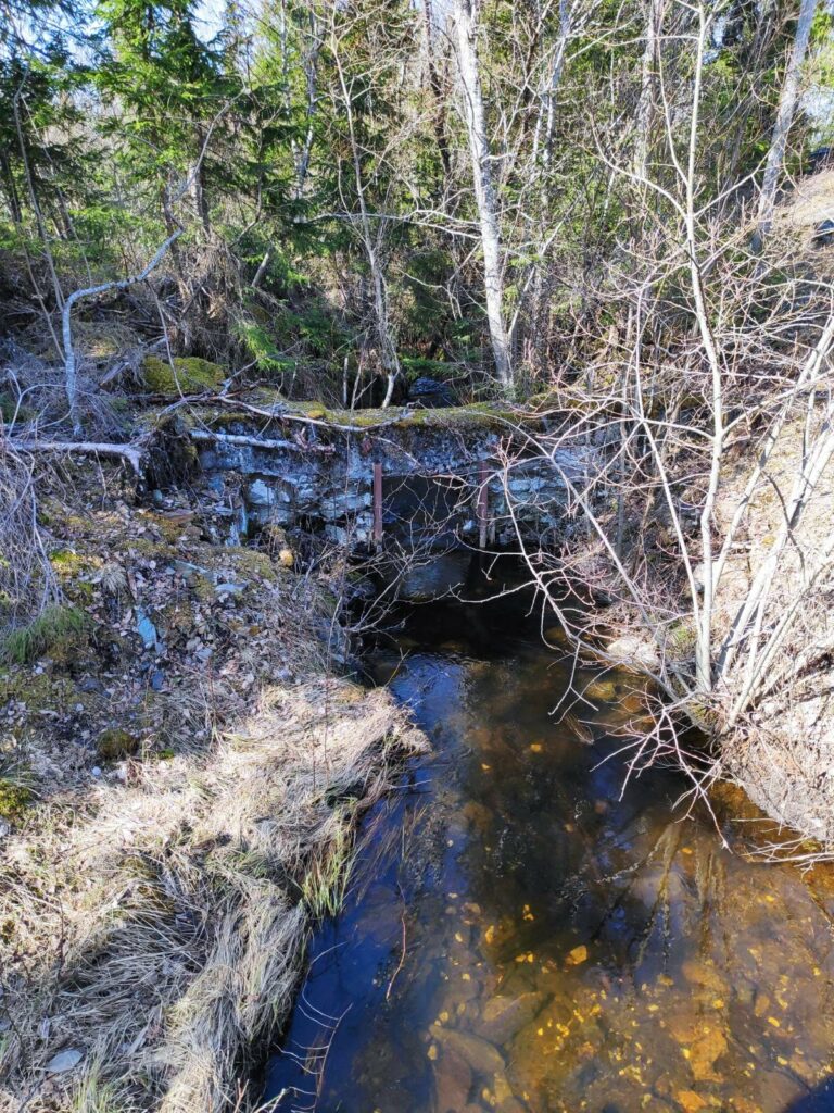
This picture was taken from the bridge and is looking downstream. At some point in the past, a stone wall has been built across the stream, with an opening that probably could be closed so that water was held at the top until one wanted to use the grinding mill.
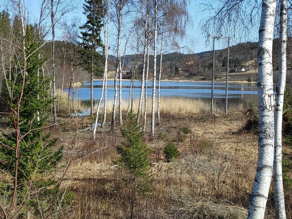
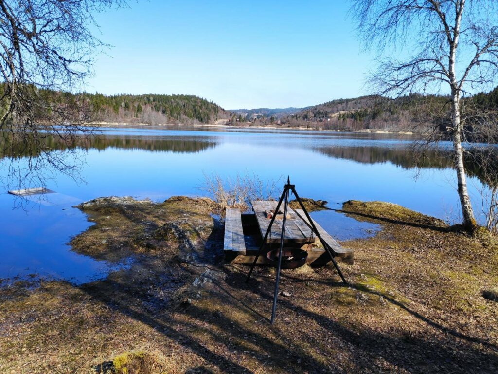
Skjemstad Lake. The area between me and the lake was very wet and mostly part of the stream. The lake is about 800 meters long and 500 meters wide. It was used as a water supply for the area from 1958 to 1996, when the water quality became too poor to be used as drinking water.
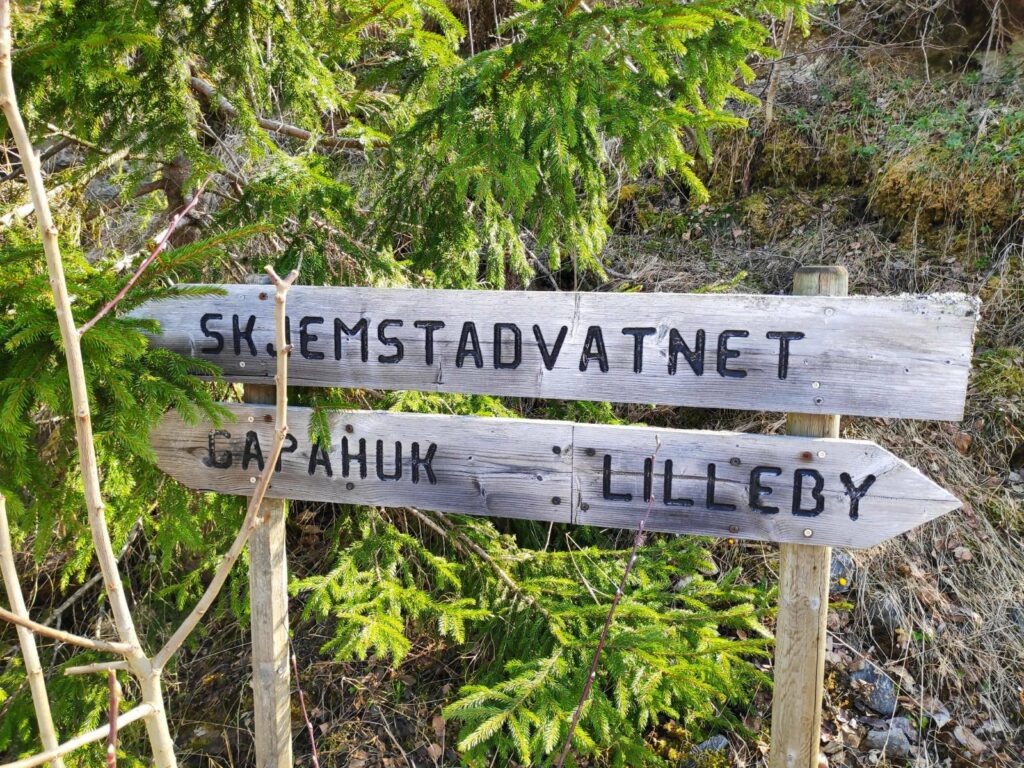
Where do you want to go? Three suggestions are given on these signs. We went left to the gapahuk at Skjemstad Lake.
Picnic bench at Skjemstad Lake. The level of the lake is much higher than I have seen before, which explains how much water was racing down the stream. There would normally be considerably more dry area around the picnic table. Note the boat float on the left side of the picture is more under water than actually usable.
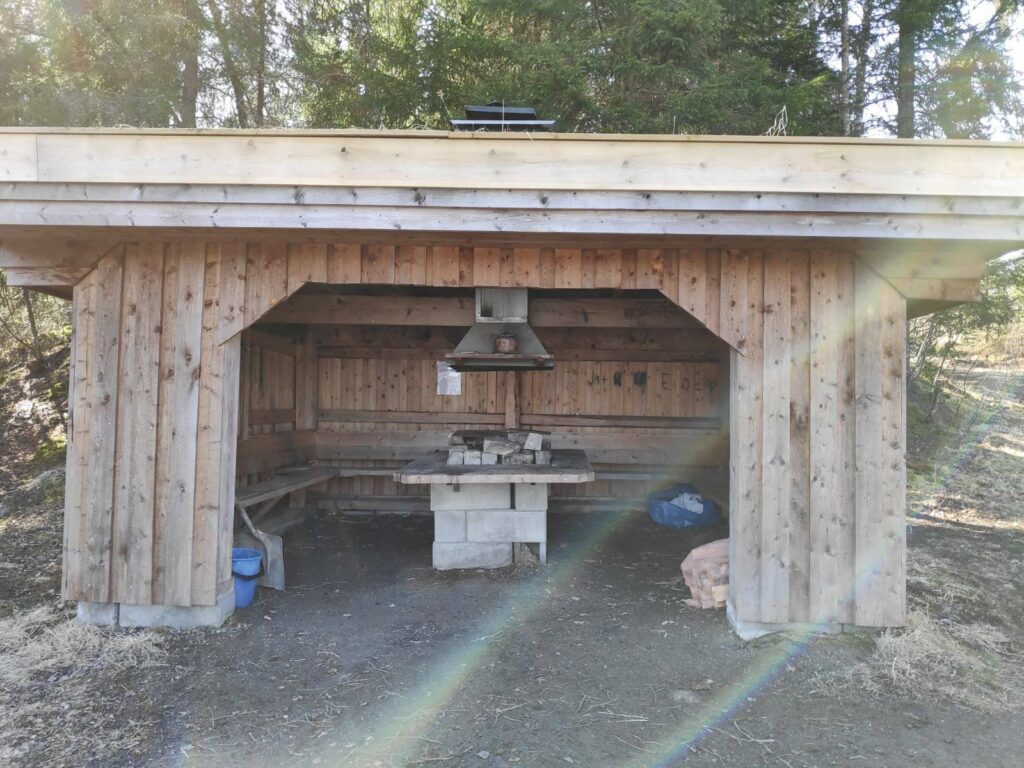
This is what they call a “gapahuk”. There is a roof and three sides, with seating and a place to grill food.
After gazing at the lake for a few minutes, we returned to the car, taking a slightly different route using roads instead of the steep part of the path in the dark woods.
This is a pleasant, though relatively short, walk for a Sunday afternoon. We probably used about 45 minutes for the round trip.