On Sunday the second of May, my husband, my son and I went for our first walk of the season in the hills of Røra in Inderøy. As these lie at a higher elevation than we live at, there could still be snow, if we unlucky. It is a half hour drive to the parking area there and on our way it was snowing, sleeting and hailing. Not very good weather, but we decided to continue driving as it looked better where we were heading. The temperature was above zero so there shouldn’t be any particular build up of snow.
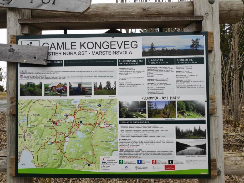
There was a map at the parking area at the beginning of the walk. The red lines are the paths. We are parked near the red dot at “1” and are going to walk to the northern end of a lake called Leklemvatnet, to a place called Finnheimen.
We are going to follow part of the old king’s highway (Gamle Kongeveg), then take off to the east. The trails we are following are well marked, plus I have taken many walks here and learned a bit about the area. It is always wise to have copy of the map on one’s telephone in case one needs to find out where a particular trail goes to and where it meets up with other trails. There was one time my husband and I were out walking and wondered if we could take a different way back to the car, but were unsure if we could take a circle route. We took the safe way back, the way we had come, but found out that we had parked right beside the map and should have had a picture with us so we could check things out when out in the terrain. Yes, we could have taken that other path and gotten back to the car by a different route.
One of the advantages of having a smart phone is how it can used in addition to using it as a phone (which I almost never use). When out walking, I have a map on my phone that will tell me where I am using the GPS system. I’ve always liked maps and learned to read them as a Girl Guide in my teens. Now, the map on my phone will also tell me exactly where I am in relation to what is on the map and show me the direction I am going in. One needs to be aware that one can loose coverage, especially in heavily forested areas or deep ravines. The other use of my phone/device is the camera, which for me is its main use. It is important to make sure one’s phone is charged up before leaving home or suddenly one can be out of battery and no map or camera available.
I’m going to divide this blog up into several sections: the trail, the signs, some history of the area and Finnheimen on the lake.
The trail
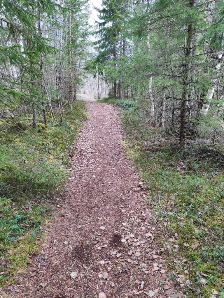
The trail is about 2 km in one direction and we followed the same trail back to the car. Most of the trail is in the woods and there are a couple of steep climbs so that one gets good exercise.
The first section of the trail is wide and easy to walk along, even two abreast.
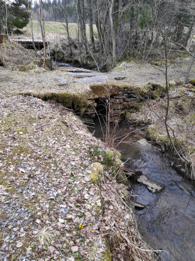
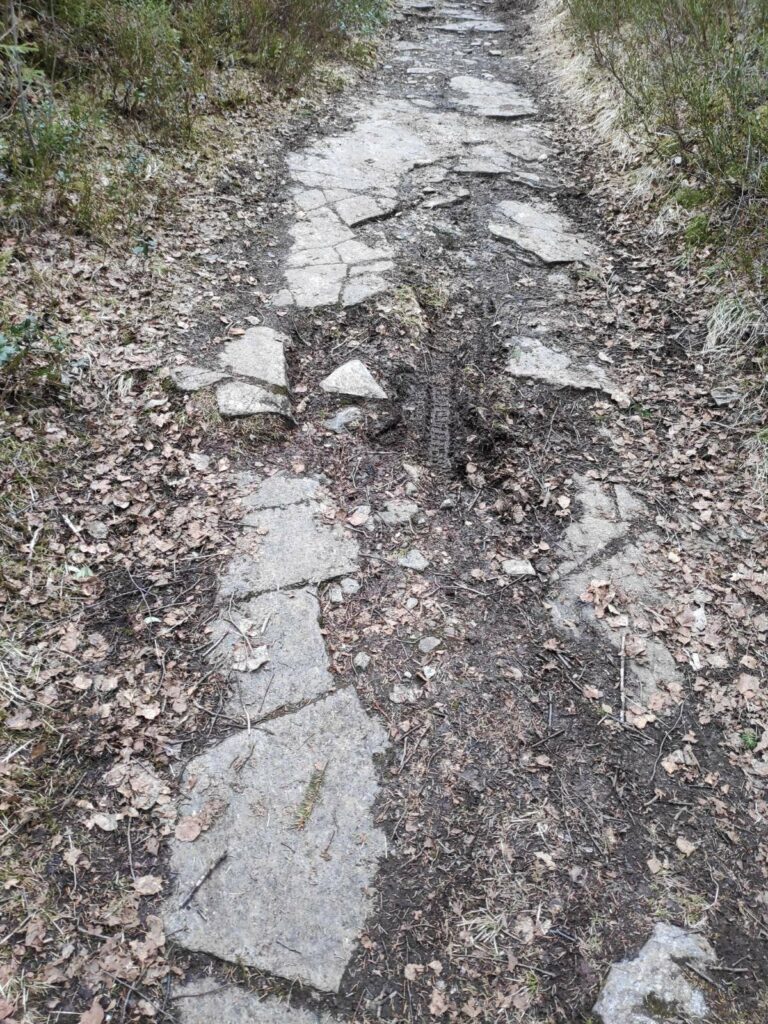
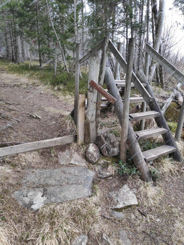
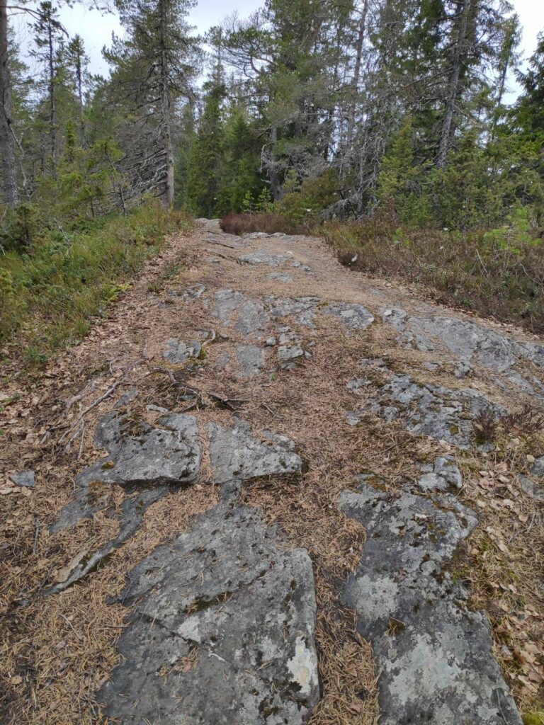
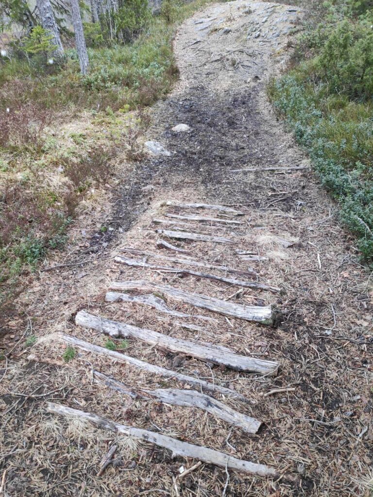
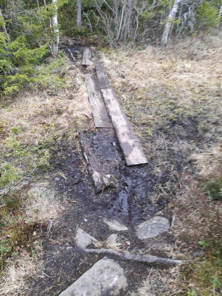
Here the path crossed a stream and the bridge was very large stone slabs on top of a stone foundation. In the background you can see a log bridge for tractors to get into the fields in the background.Some parts of the trail are a combination of mud and solid rock. This is part of the king’s highway, so wide enough to drive a carriage on it.In the summer time there are sheep out on one side of this fence, so a stile has been built so that walkers don’t have to open the gate and thus leave it open. Today there were no sheep out yet, so the gate had been left open.Here the trail was more rock than mud. We have now turned off the king’s highway and are on a different trail.But in between the rocky parts of the trail, logs had been put in the muddy bits. It wasn’t very wet while we were walking today, but it could be quite muddy here when it had been raining a lot.Here it was still muddy as there are swamps on either side of the trail here. Heavy planks have been used to keep walkers out of the mud.
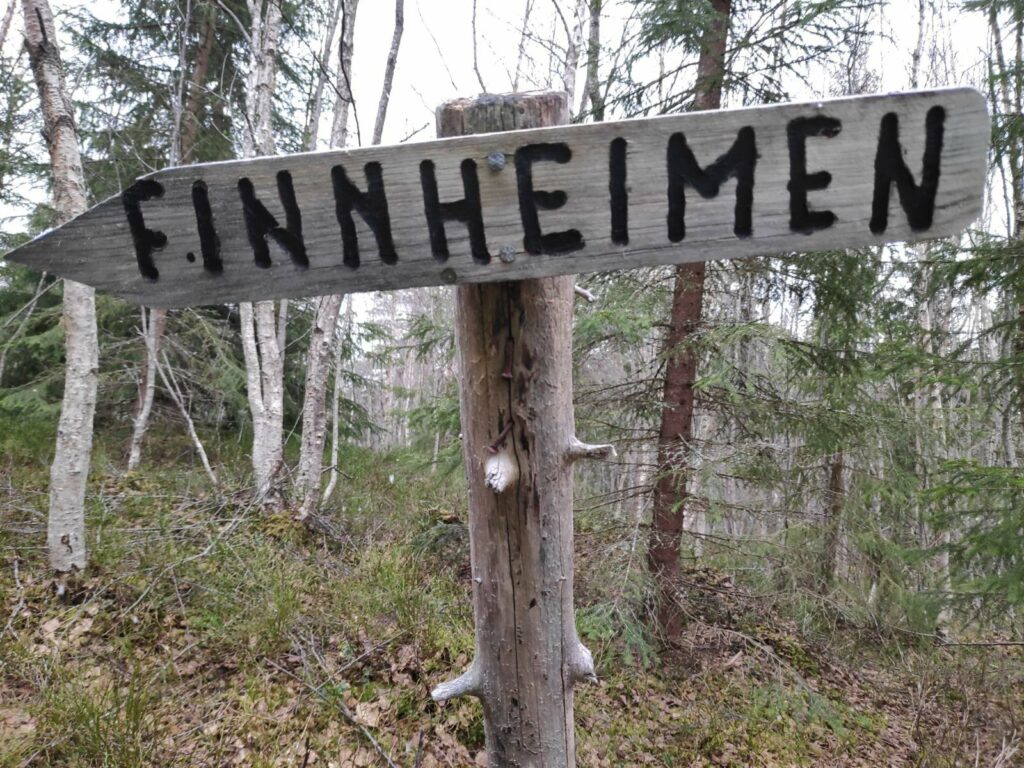
The signs, old and new
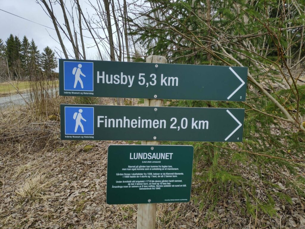
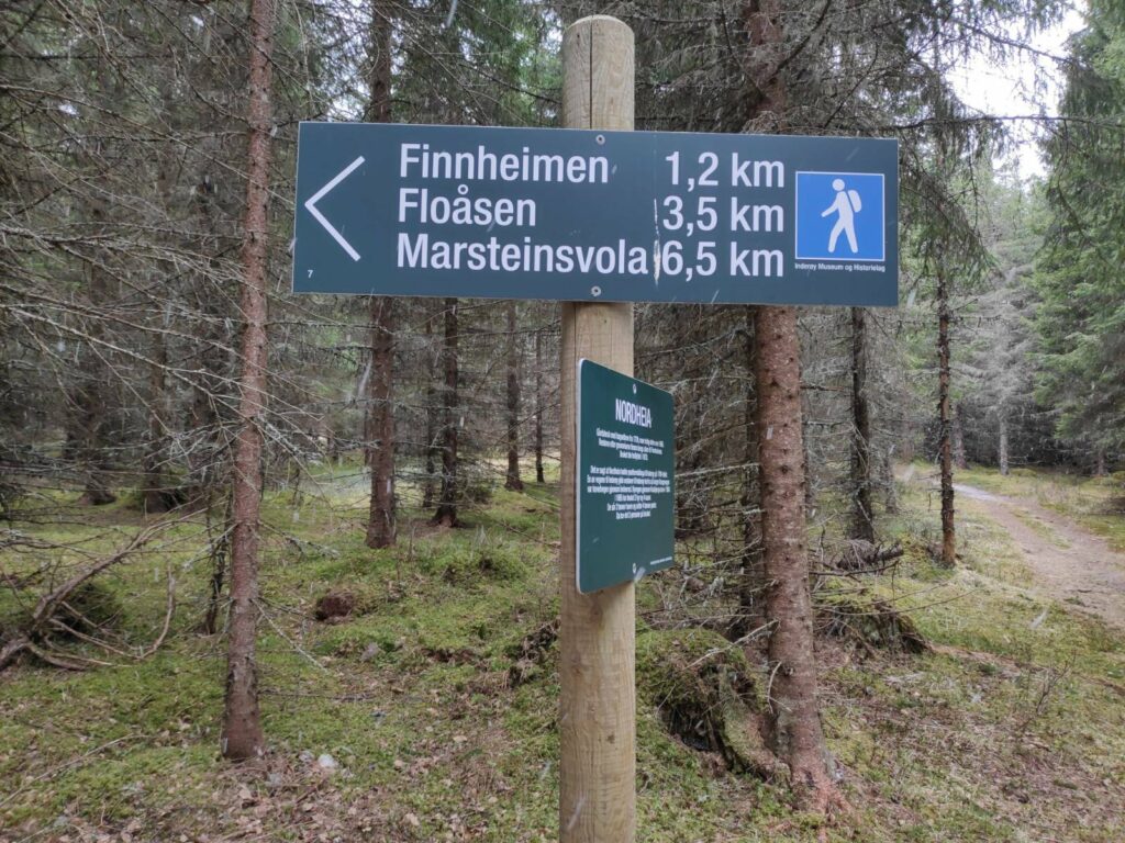
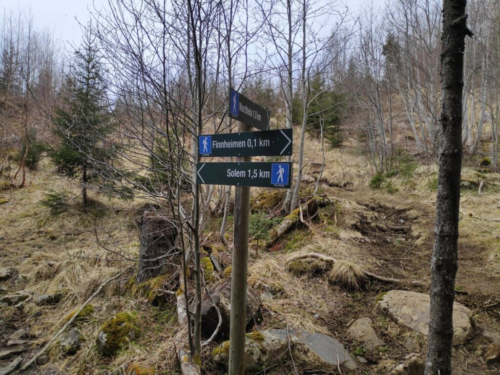
Along this trail there are several different types of signs. First of all there are signs telling you what is in a particular direction and how far it is to walk there. I figure that I walk maximum 4 km an hour on relatively easy trails. So 2 km may take 30 to 40 minutes if the trail is a bit uneven.
The other type of sign gives information about the location one is standing in. All these new signs have been sponsored by the Inderøy Museum and History Association.
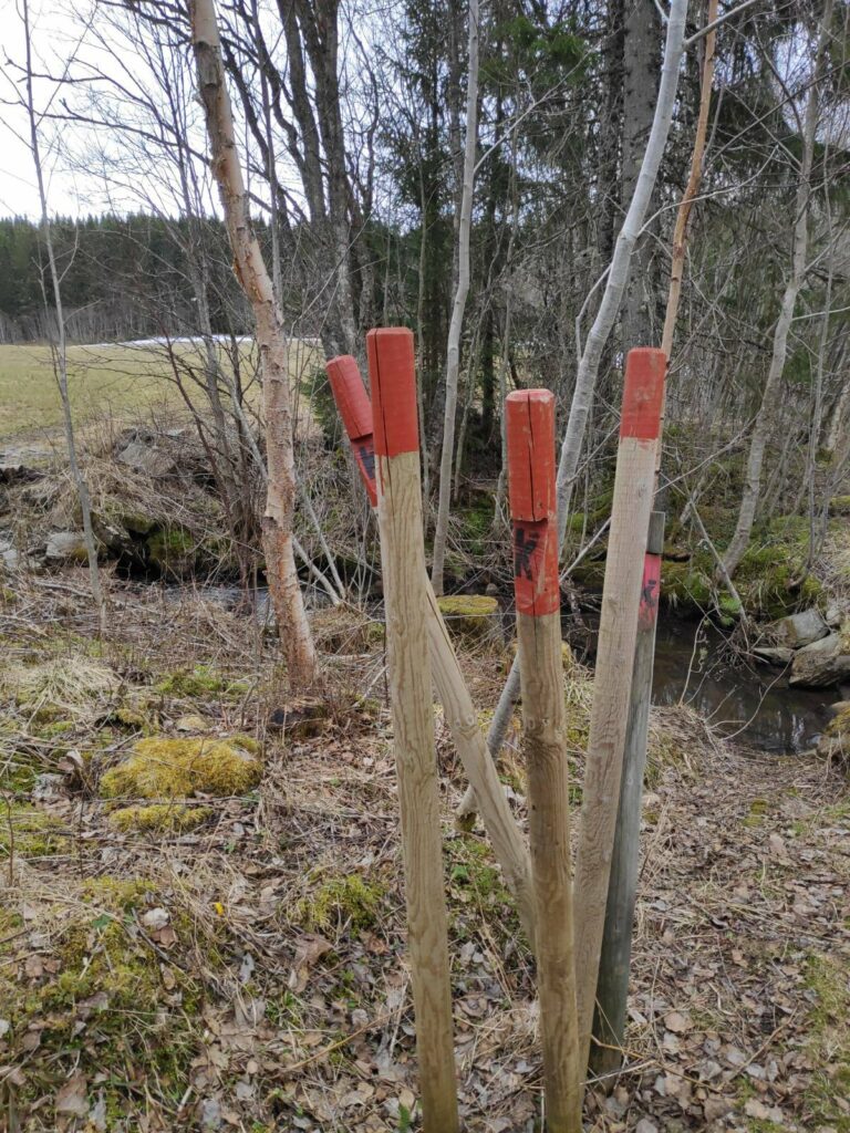
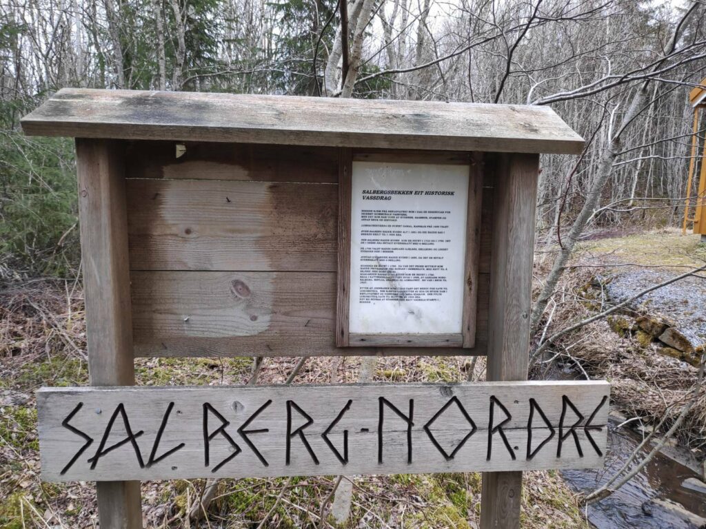
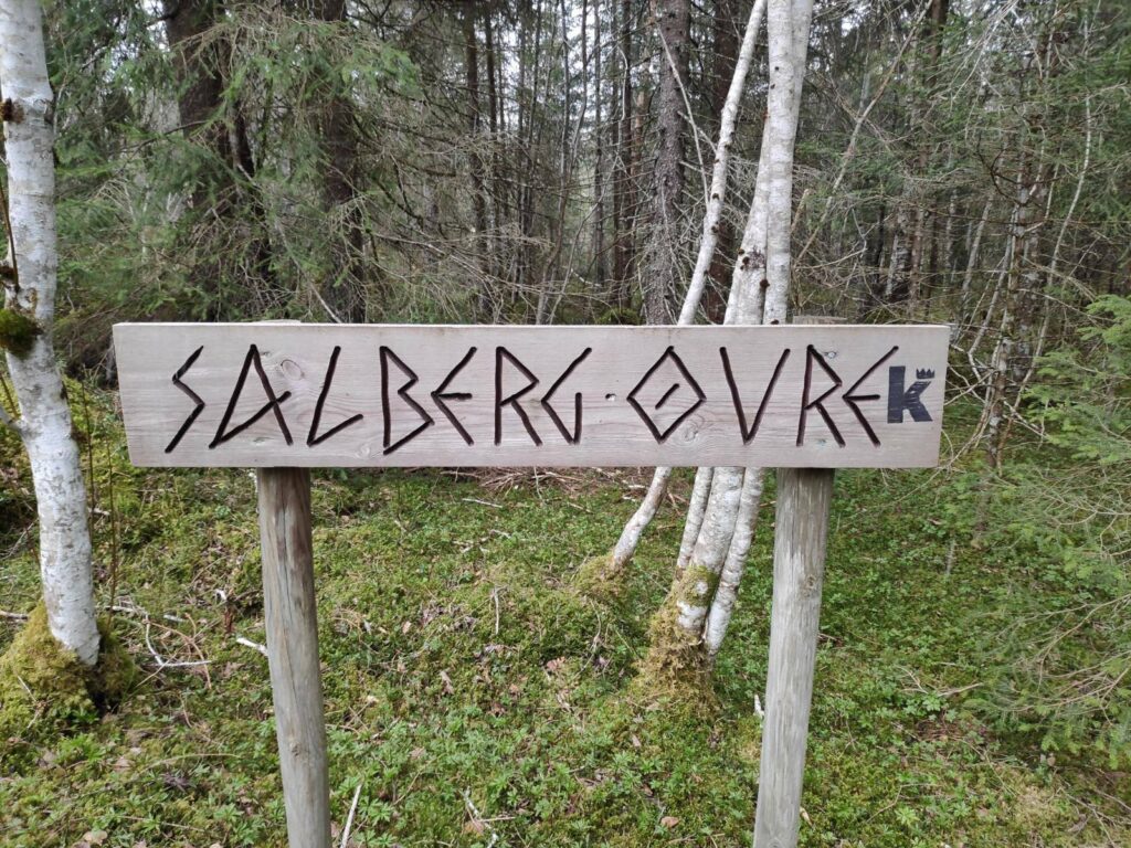
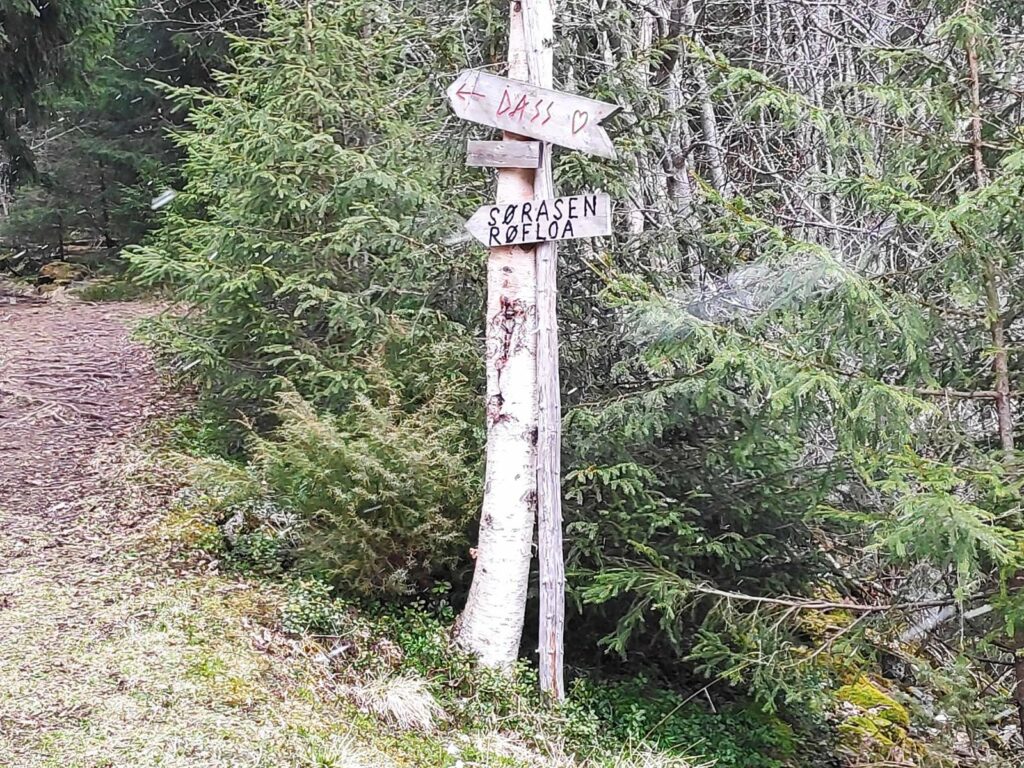
These signs are all at the parking area. and there are signs both to tell one the direction to walk in and information about the place one is at. We are starting from Lundsaunet and heading to Finnheimen, a walk of about 2 km through the woods. Lundsaunet has been a farm since at least 1559, so this area has been settled for at least 500 years.These posts have been used to mark the route. The “K” indicates that it is the king’s highway. The red paint makes the posts stand out, at all seasons. In the winter when snow covered the trail it would be quite important there there were posts that stuck up above the trail so one could see where it went.Salberg Nordre – the north farm at Salberg. This is beside a stream and the information is about the stream which drains the lake which is used for drinking water for Inderøy. In the past the stream has been used for running a sawmill, and once a train line went past farther downhill, the water was used for the steam locomotives.Upper Salberg on the king’s highway.We turn off the king’s highway at this point. You can see the king’s highway to the right and we headed off to the left. There are other places to walk to if you want a much longer walk.An older sign, no longer in use.We are almost there, only 100 meters to go. We have come down the very rough trail this is just to the right of the signs. Note that this is a blue trail, not so difficult, but can be over uneven terrain.Again, older signs. The important one for me was “Dass” with a heart – a toilet. The symbol for toilets in Norway is often a heart, whether it is an outdoor pit stop or an indoor flushing toilet.
History
I have looked at a bit of the history of “kongeveger” (king’s highways) in Norway (source) and it seems that they were built between 1660 and 1814, when Norway was ruled by the Danish kings. Primarily they indicate the main routes from various parts of the country to the city of Christiania (now Oslo). However, this area here is north of Trondheim and thus on the main route from Trondheim to the north of the country. The king’s highways were part of an improvement in the ability of people, especially the king’s employees, to get around the country and these roads would be use for driving carriages on or for sleds in the winter.
With its long coastline, much of the travel between parts of Norway would have been by boat. Therefore this road that we are following on this walk, is much higher than at sea level. There are indications from the information signs along the walk that this would also have been a post road.
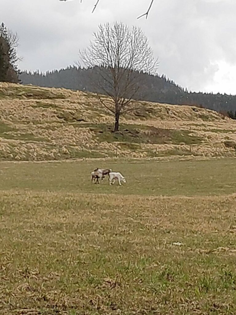
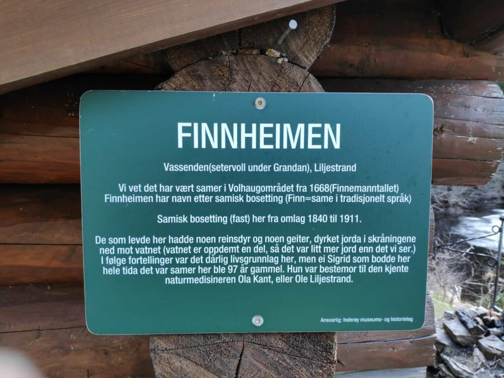
Traditionally, the people who kept reindeer in Norway were often called “Finns”, so the name “Finnheimen” (the home of the Finn) would refer to someone who herded reindeer.
They were in the distance and hard to get a clear picture, but these three animals were reindeer, one of them being all white.
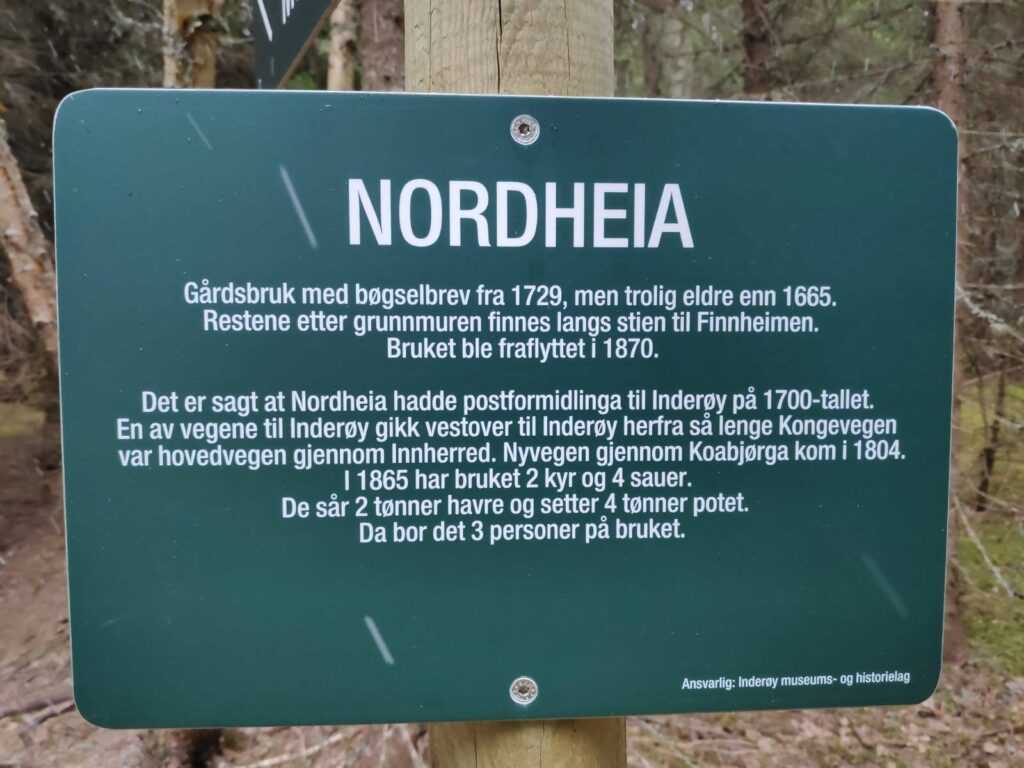
This house was built in 1902 near the mill on the stream. It was later moved to near the train station but was returned to its original location in 2005. It is called “Kvennstu – Eva Moestu”. Its last resident was Eva Moe. Today it is used for meetings and cultural events.Nordheia – This has been a farm from before 1665. The remains of the foundation can be seen along the trail to Finnheimen. The farm was abandoned in 1870. It is said that there was a post house here in the 1700s, serving Inderøy. One of the roads to Inderøy went westwards from here when the king’s highway was the main road through this area (Innherred). The new road at Koa (i.e. near sea level) came in 1804. In 1865, Nordheia had 2 cows and 4 sheep. They sowed 2 barrels of oats and 4 barrels of potatoes. There were three people living on the farm.
Finnheimen and Leklemsvatnet
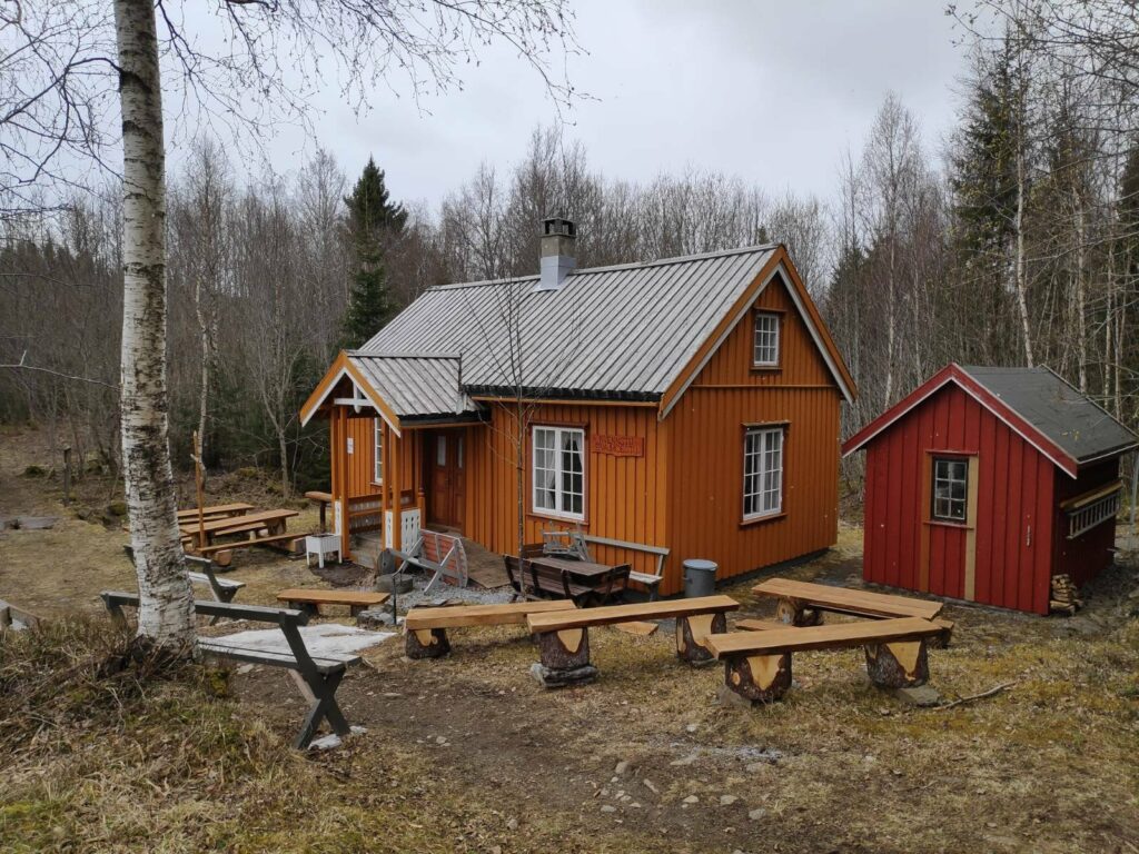
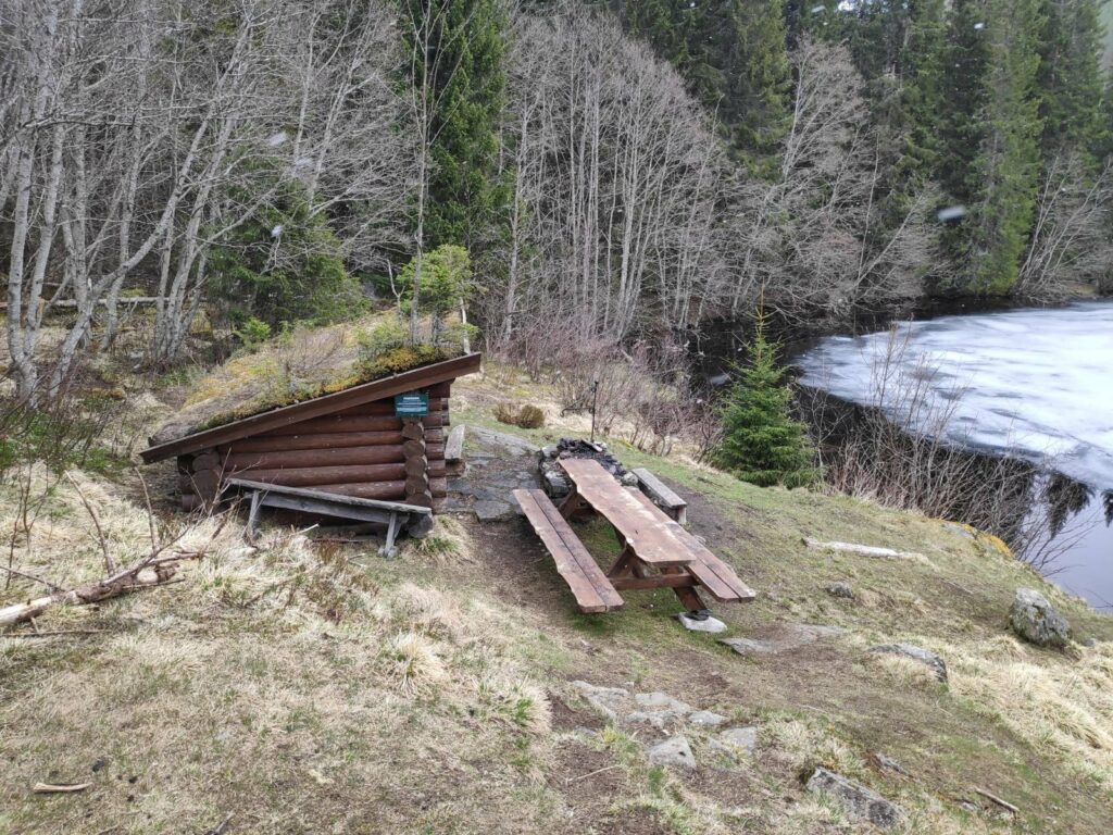
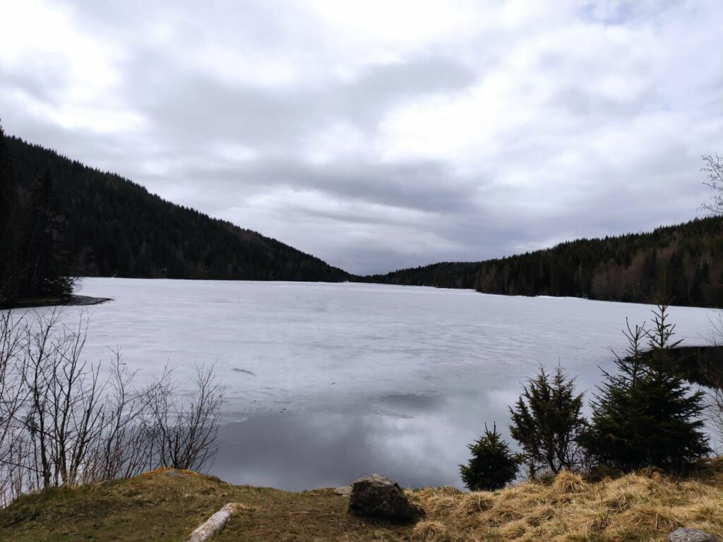
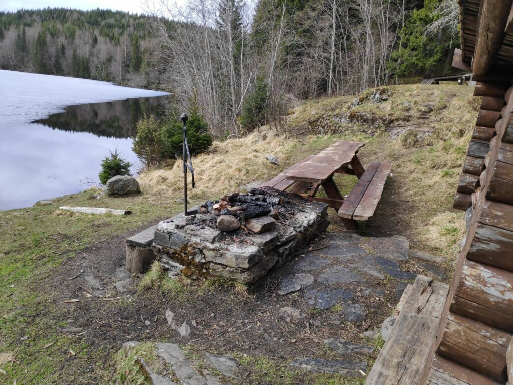
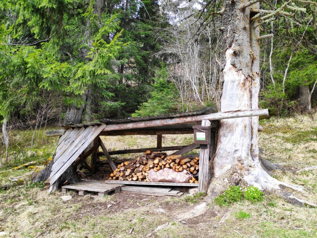
The end of the lake. We know there have been Sami in this area from 1668. There were Sami living here from 1840 to 1911. The people who lived here had some reindeer and some goats, and cultivated the land on the slope down to the lake. The lake is now dammed at the far end so there would have been more cultivated land in the past when the level of the water would have been lower.The goal of our walk – Finnheimen. With a small shelter, picnic tables and a grill place, close to the edge of the lake.Leklems Lake, which is located partly in Inderøy and partly in Verdal. The far end is dammed and I understand that the lake is a secondary water reserve for Verdal. My estimate is that the lake is about 1.5 kilometers long and perhaps 200 meters at its widest. It was still partly frozen on our visit.It is possible to grill food here.Firewood is available and the usual box with a book inside in which to write your name. These books have been less used during the pandemic.
As we walked back to the car, the weather had improved slightly. There was a view over Inderøy with the fjord in the distance.