Yesterday, after a shopping trip to Steinkjer, my husband and I decided to go to a small lake that we like. There is a parking lot, which was empty, and it is a relatively short walk to the lake, about half a kilometer.
The path to the lake is wide enough for two or three to walk abreast and suitable for either wheelchair users or people pushing baby buggies or strollers.
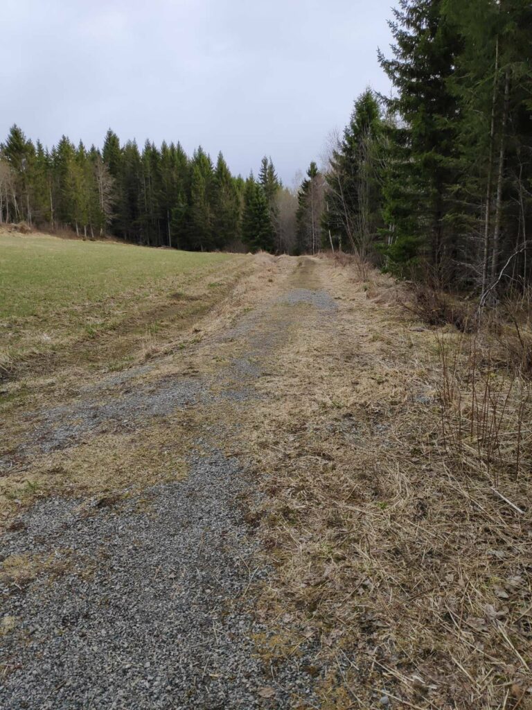
The path to the lake is wide, mostly gravelled and suitable for wheelchairs or baby buggies.
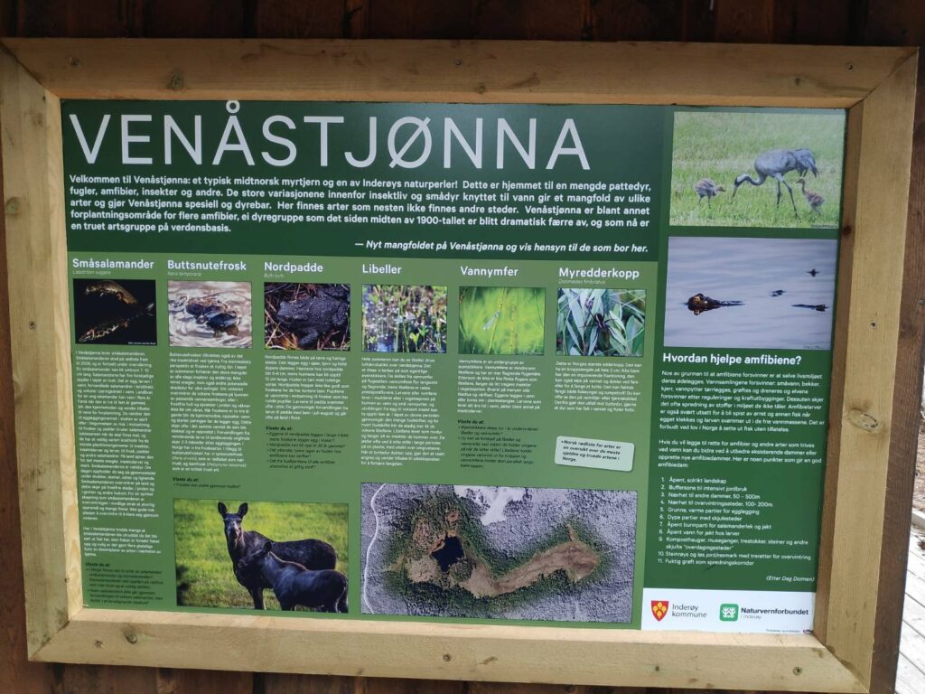
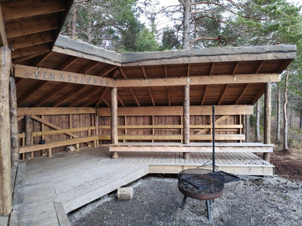
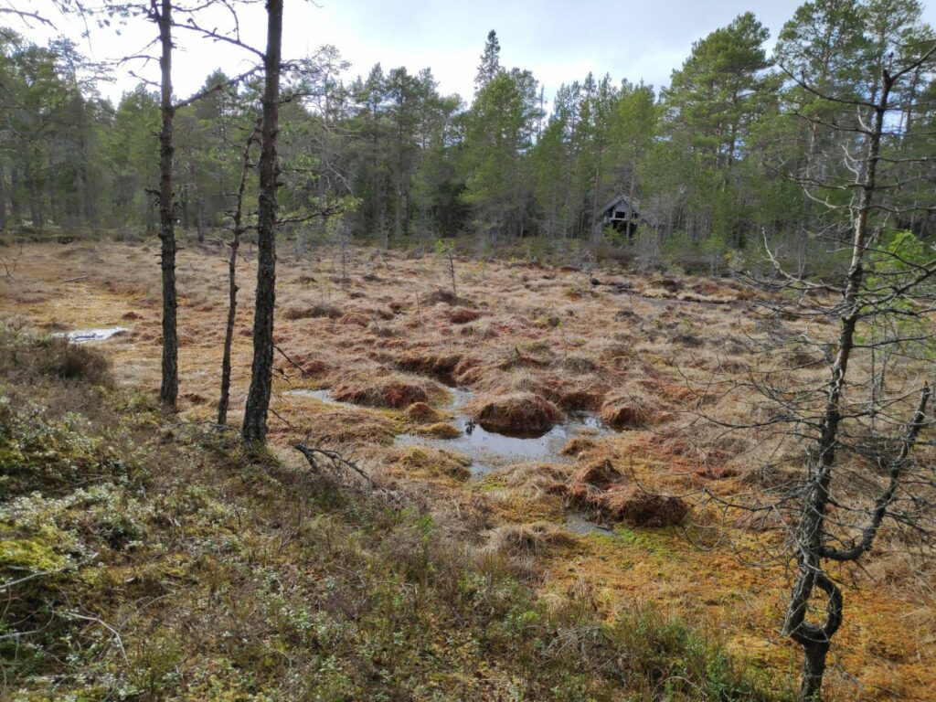
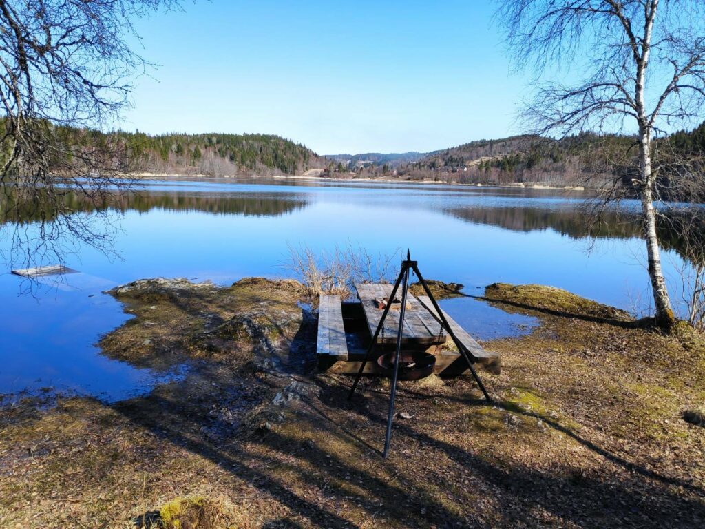
The name of the lake, Venåstjønna, is composed of two Norwegian words. The first word, Venås, is the name of the farm near the lake. The second word, tjønna, means the little lake. Usually this is a fairly small, shallow lake or pond, with very swampy ground around it.
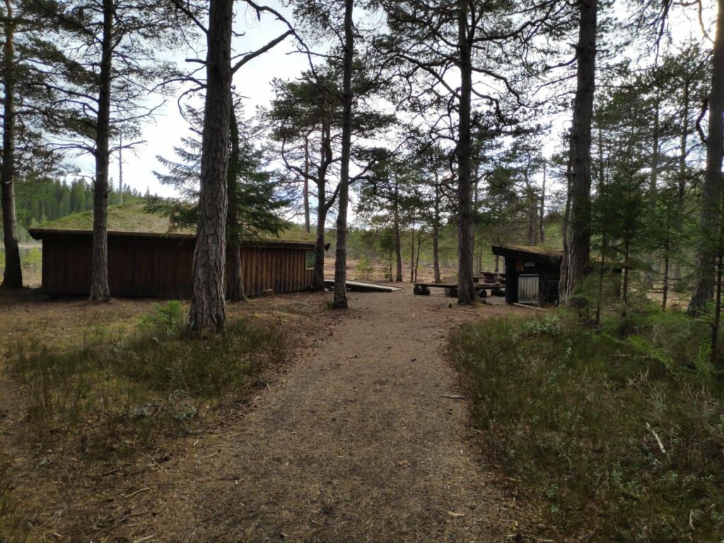
As we got close to the lake, we could see the buildings that have been erected. We were still in the shelter of the trees here, and I didn’t realize at first how much it had started to rain.
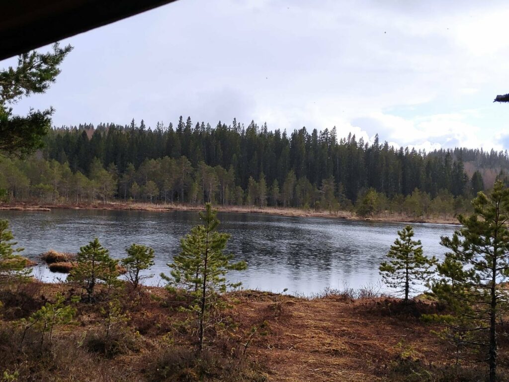
Venåstjønna in the rain
The sign about the lake shows some of the more interesting types of animals and plants found her, including salamanders, frogs, and toads. At the bottom center of the sign is an aerial view of the lake which shows how much is water and how much is swampland around it.
As we approached the lake, it started to rain, quite heavily, even though the sun was shining. It was about 6 pm, so the sun was getting lower in the sky and able to shine under the clouds that were raining on us.
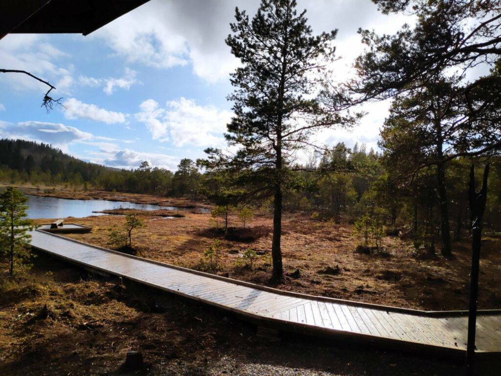
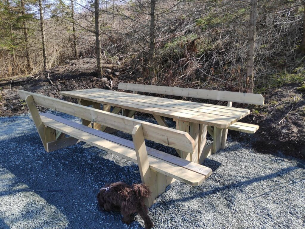
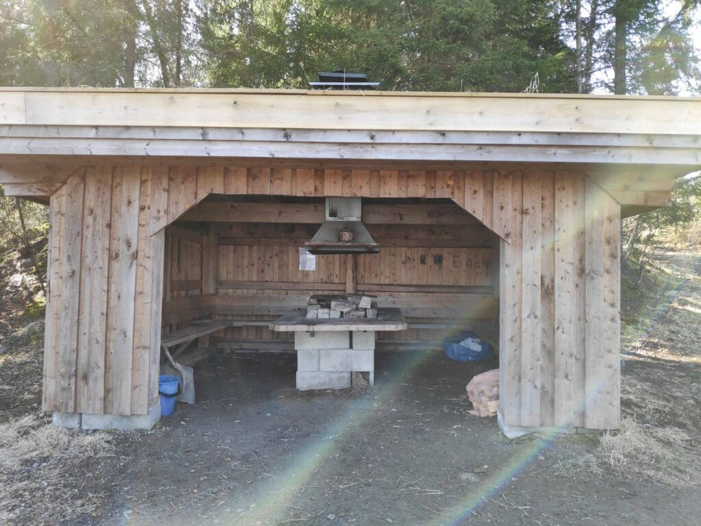
Thankfully, this little wild life area has been developed recently, so there was a place to take shelter. It is very important in swampy areas to limit where people tramp around. It was quite soggy still near the little lake, so the wooden pathway out to the lake is very beneficial to the surrounding area.
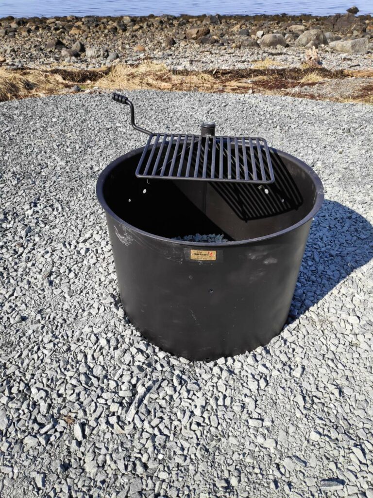
Benches to sit on, a roof to protect people from the rain and a place to grill food or cook coffee. This construction has just recently been added to the facilities at the lake.
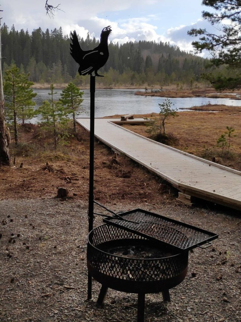
Here you can see the board walk out to the edge of the lake where there is a small bench to sit on while meditating. It was too wet for us to sit out there this time. Note the bird decorating the grill.
Here is the older shelter and grill area.
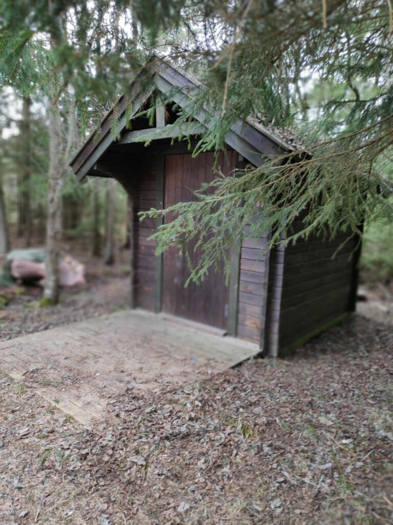
There aren’t many wild areas in Inderøy that offer toilet facilities, but here there was one.
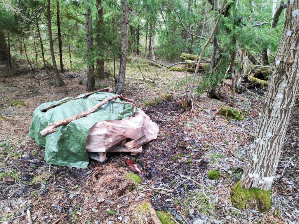
There was even a supply of firewood for those who wanted to grill food.
There are also signs that in previous times there has been peat dug up here. This is quite common in swampy areas in this part of Norway. Today, it was very wet as it has been both raining and snowing in the last month.
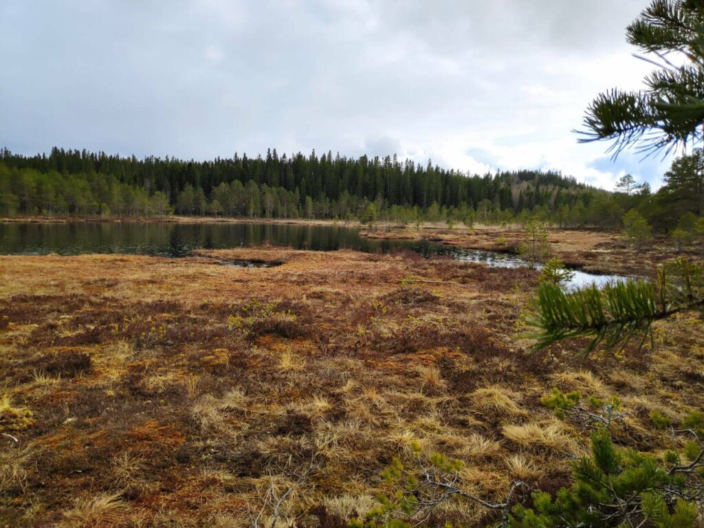
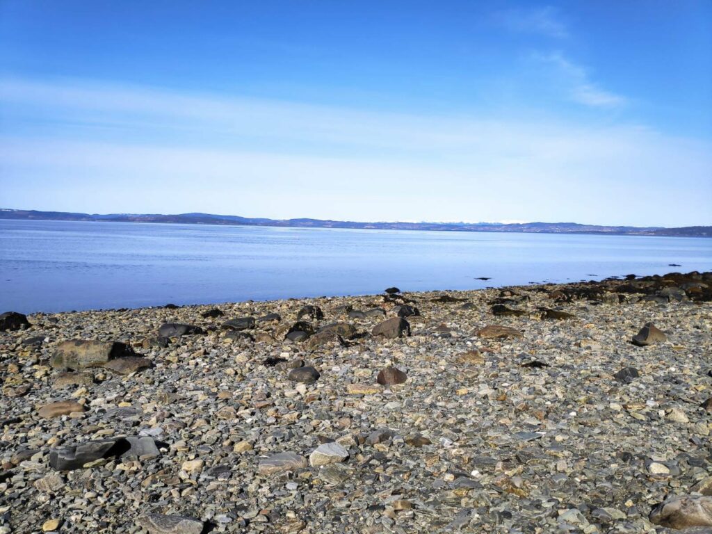
Another view of the lake which shows a lot of the swampland around it.
The rain doesn’t show up in the picture, but you can see that the sun is shining as well.
When it isn’t raining, there are quite a few paths in the area around the lake. Some of them looked a bit muddy on this visit. On this trip we just enjoyed spending a few minutes in the peace and quiet of the lake before heading home.
With a large dump of snow in April, I have been thinking about what are the signs that spring has actually arrived. First of all, I think that the disappearance of the snow is an important sign.
Let’s look at what the definition of spring is for Norway. This excerpt is taken from the Store Norske Leksicon: Vår er er årstiden mellom vinter og sommer, og den perioden av året hvor normal døgnmiddeltemperatur er mellom 0ºC og 10ºC (disse inkludert). Temperaturen stiger gjerne i denne perioden and quoted on www.met.no. Translation: Spring is the season between winter and summer and that part of the year when the normal average day temperature is between 0 degrees C and 10 degrees C, including these temperatures. The temperature is usually rising during this period. Calculation of the average day temperature will differ depending on the number of readings taken during the day. The simplest calculation is the highest temperature is added to the lowest temperature and then divided by two (for example, 10 + 0 = 10, 10/2 = 5)
Another common definition of spring is the time between the spring equinox in March and the summer solstice in June, but this is a bit too general for my way of thinking. I prefer the previous definition which is tied to temperature.
If I look at some weather statistics for areas near here, but measured near sea level, there are very few days in March when the average day temperature is below zero degrees Celsius. By the end of April there should be none. This does not mean that there will not be freezing temperatures at night, but that the temperature rises sufficiently during the day that the average temperature is well above zero.
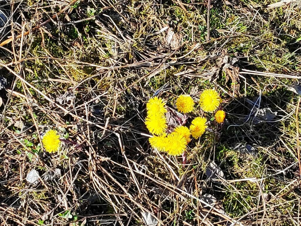
Spring is often thought of as that time of the year when the first flowers come out.
Colt’s foot (Tussilago farfara) is one of the first wild flowers to come out in Norway. It grows along the edges of roads, especially where the snow melts quickly and the sun warms up the earth. Its leaves come out after the flowers are finished.
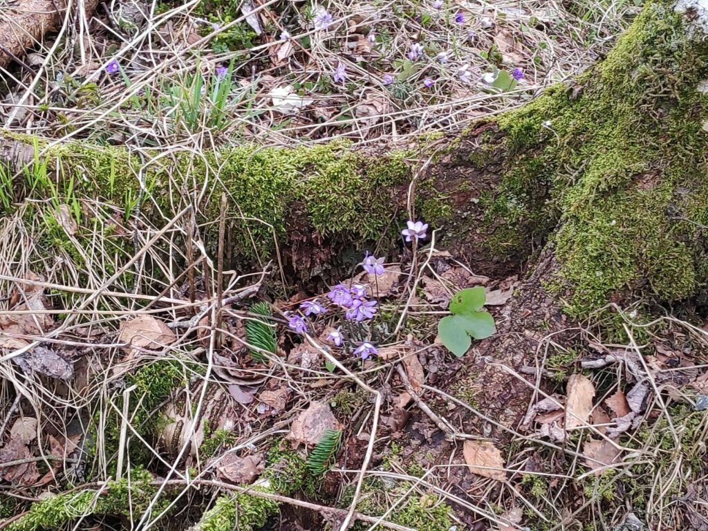
Another early bloom is the anemone Hepatica nobilis, a member of the buttercup family. The leaves are green all year round.
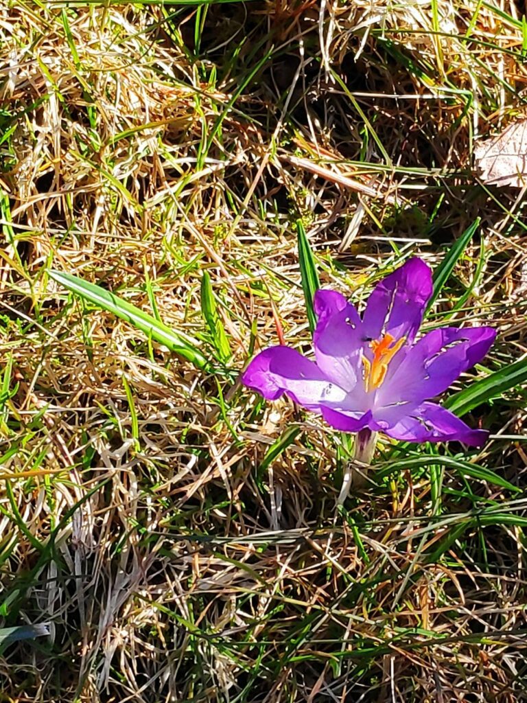
Crocuses are planted and this one is almost finished. Many of the early garden flowers come from bulbs.
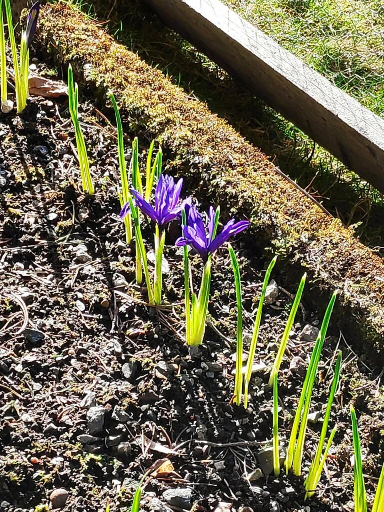
These small irises come out early.
I live in an agricultural area so another sign of spring is the outdoor work of the farmers. They also give us some less pleasant smells as they spread their animal manure on the fields.
Tractors in the fields and on the roads become more common. Note that some of the fields are becoming very green as the grass starts growing again in the warmth and sunshine.
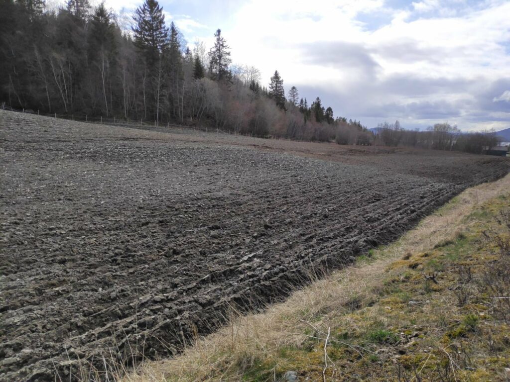
This field has been ploughed. Many of the fields near us are used to grow grass for animal feed, or for letting the animals graze in the summer months. They will not be reseeded every year, but dandelions can be a persistent weed so fields will be ploughed up and reseeded on a regular basis.
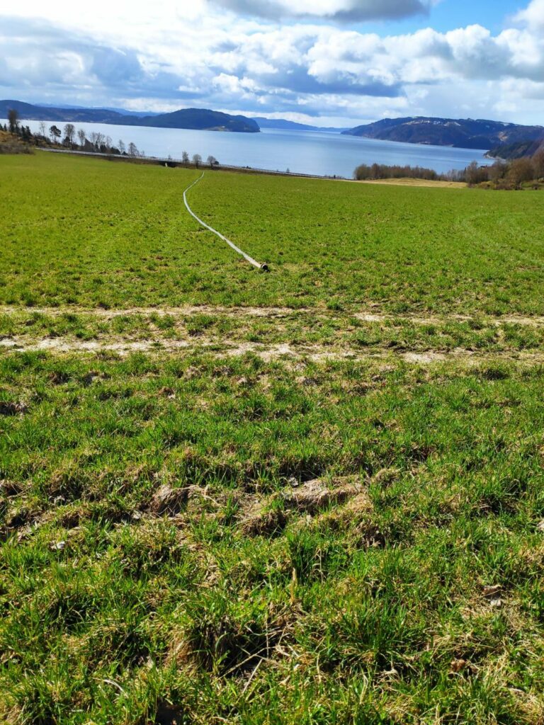
On today’s walk up to get eggs at a neighboring farm, I saw this hose just laying on the field. It is used to spread manure on the fields.
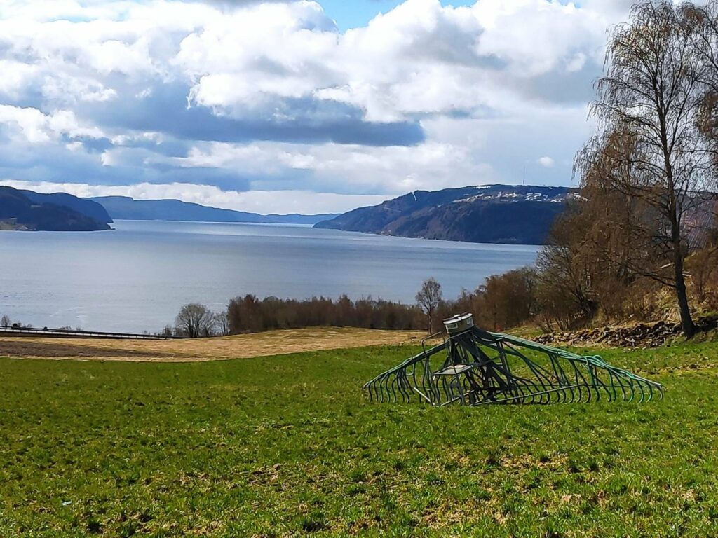
Here is the attachment that the tractor pulls across the fields making sure that the manure goes primarily into the ground. When we first moved here, the manure was sprayed into the air to spread it. What a stink! With this newer method, there is much less smell, but there is still some.
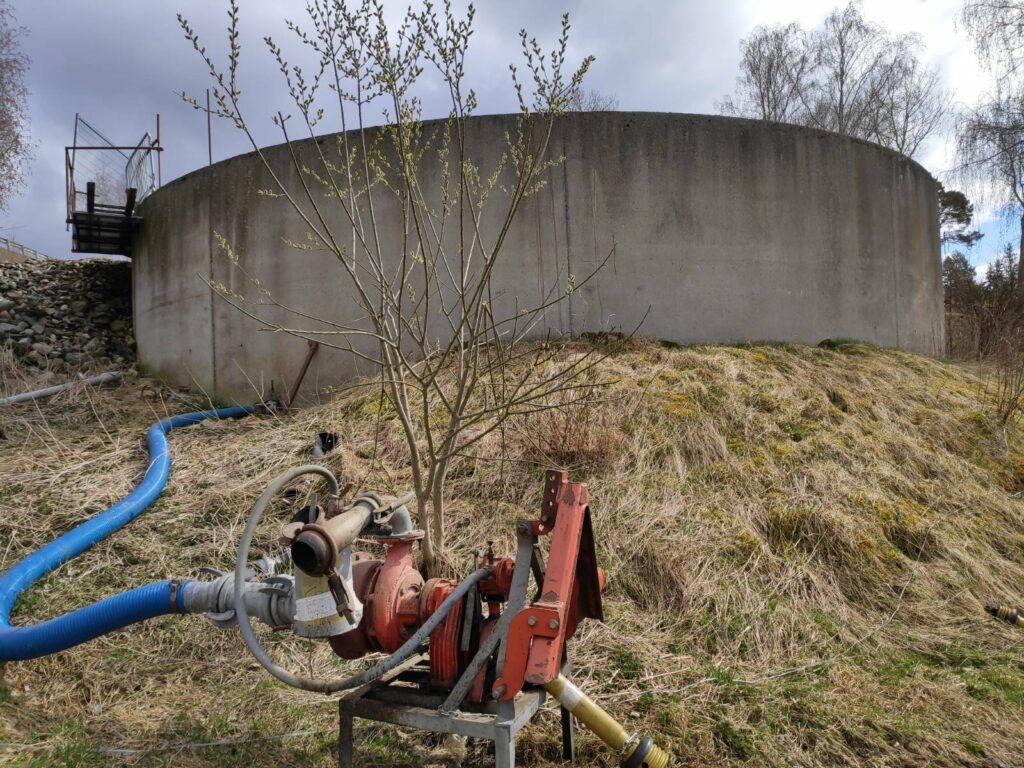
There is the large container for the manure and the pump to get it into the long hoses that are dragged across the fields.
More pleasant signs of spring include the return of birds. We have several species of seagulls that live near us. Some of them are here all winter long, but the noisiest one, Larus canus, loves to follow the tractors around as they plough the fields. They like to soar on the wind and often fly in large groups. Unfortunately, I don’t have any pictures to include about this species.
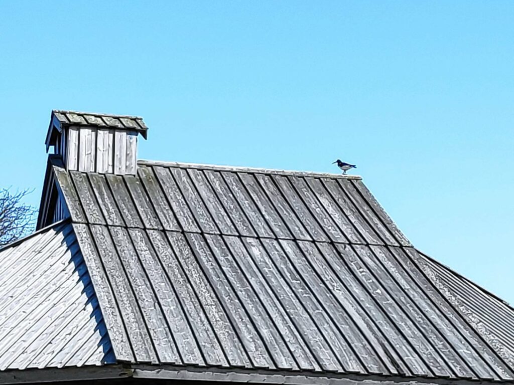
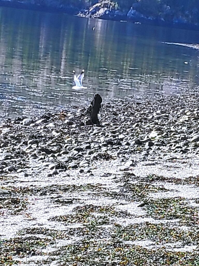
Another common sign of spring is the oyster catcher who likes to feed in the shallows at low tide.
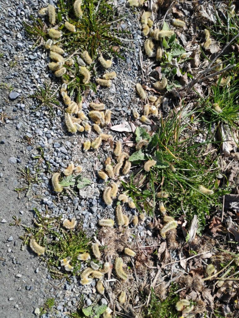
Pussy willows on the ground are a good indication that the willow tree has started its spring routine.
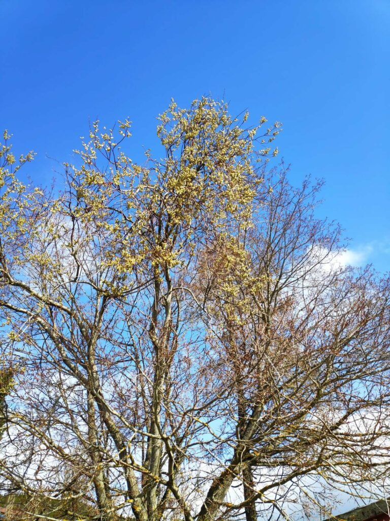
Here is the willow tree itself. It hasn’t lost all of its flowers yet. It is a sign that there will be pollen in the air for the next couple of months. The leaves will come out after the blossoms are finished.
I would like to finish off this blog with a few pictures of plants in my garden. I enjoy going out to see what has started blooming and what has started sprouting .
This columbine is just starting to put out its leaves. The flowers will come out much later.
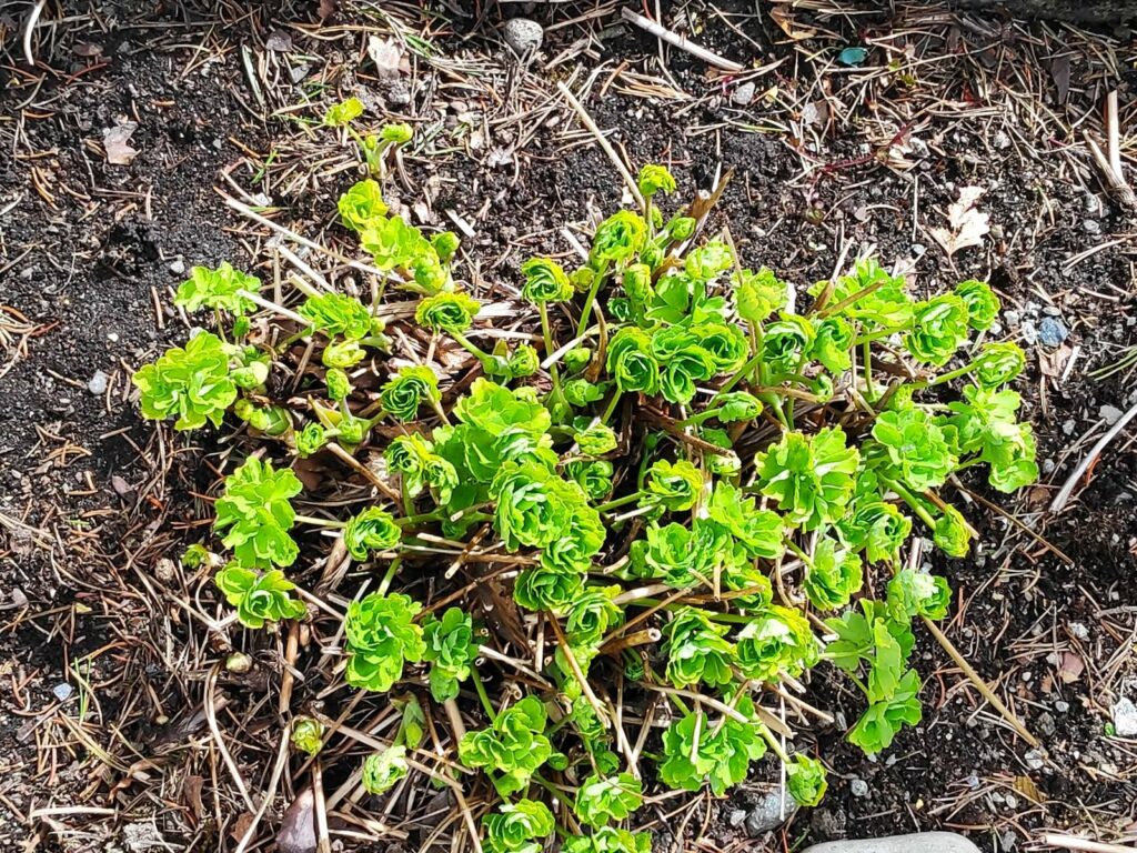
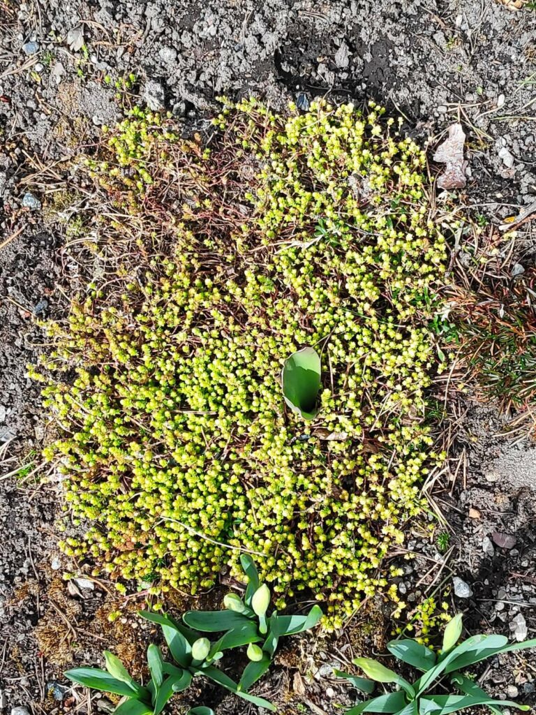
Sedum acre is already blooming and the daffodils won’t be long now. They just need a day or two of sunshine. The one tulip that has come up may not bloom. They are often eaten by the deer that like my garden.
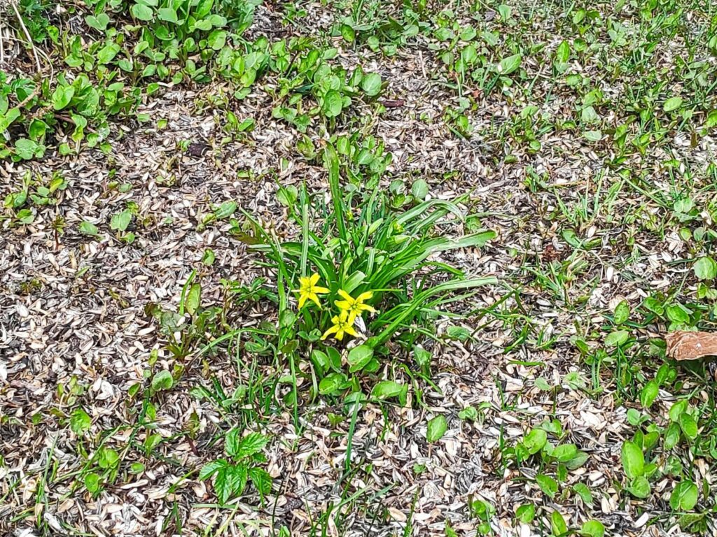
I’m not sure what this one is called, but it is an early bloomer too. It comes up under the rose bush where I put out bird feeders in the winter time. I put out mostly sunflower seeds and you can see the empty seed shells fertilizing the ground.
You may have other signs of spring in your area, but these were the things that I thought of while going on my walk today.
On Monday this week, I met my friend and her two dogs at Skånes in the municipality of Levanger. In Norwegian it is called a “friområde” which translates as a “free area”. This means that it is a public area, owned by the municipality and is free for everyone to use. Skånes is located on the fjord and is mostly treed, though there are open areas where picnic benches and grill places have been set out.
It is not really a beach, though I understand people go swimming here in the hot weather. The tide was very low and it is quite shallow right here. The path we followed took us into the trees.
Looking away from the water, one sees the agricultural land. Though there is a bit of a hill, actually a ridge, it is quite flat in this part of Levanger and there are a lot of farmed fields.
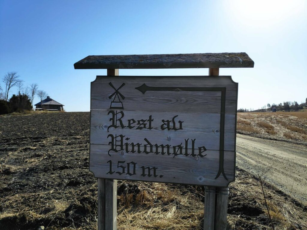
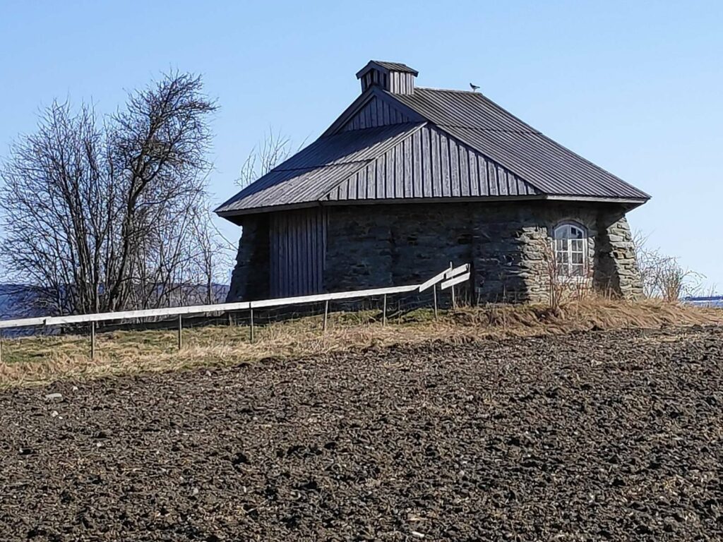
I got here a bit early so I went up to look at the remains of an old windmill, which can be seen on the left in the picture.
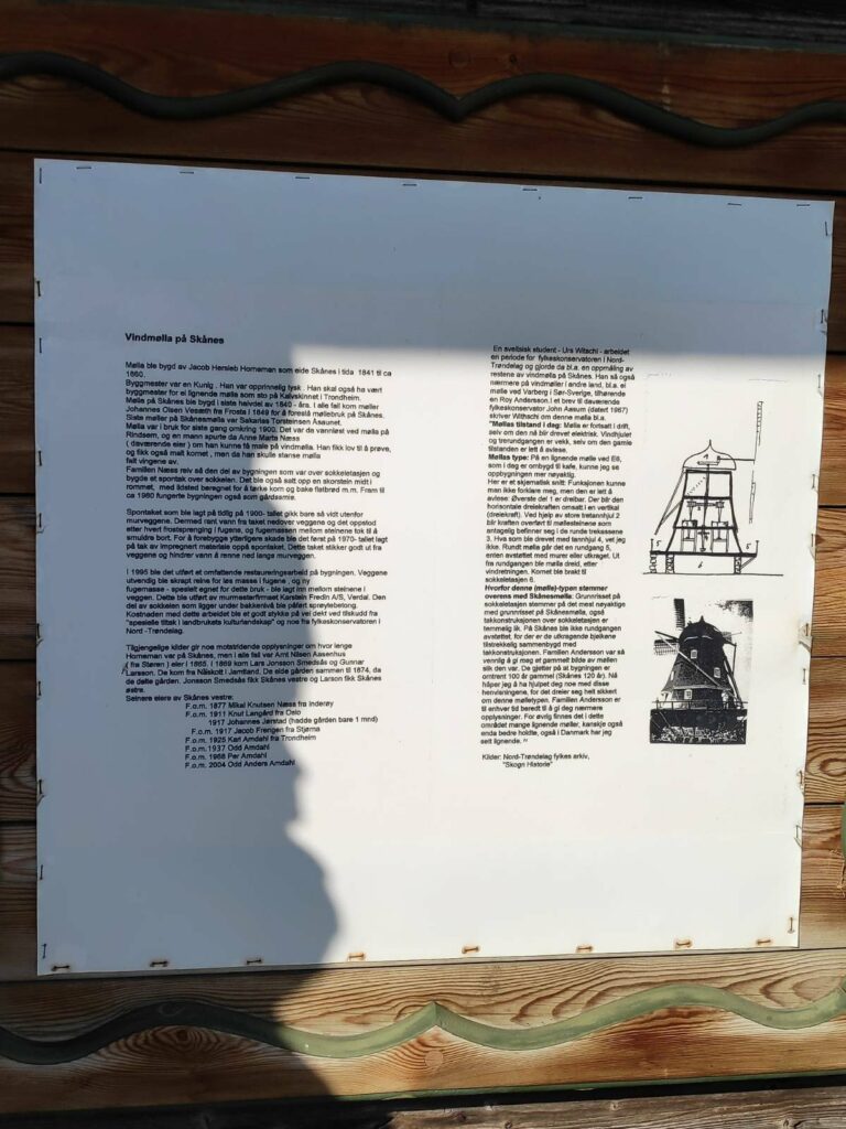
The windmill was built about 1849 and in use for grinding grain until about 1900. Then the wings fell off and the top of the building was removed and a roof put over the base of the windmill. It was used as a smithy until about 1960. In 1995 extensive repairs were made.
The building as it stands now. One has to walk across a field to get to it, but it is not open to the public.
The bird on the roof is an oystercatcher, a bird which is quite common in coastal areas of Norway. It is a wader and would find its food on the beach areas at low tide. It has a very distinctive sound that it makes, and can be quite noisy, especially when defending its nest. This one seemed to have a nest nearby, though I didn’t see the nest. The oystercatcher goes south in the winter and its return is always a sign of spring.
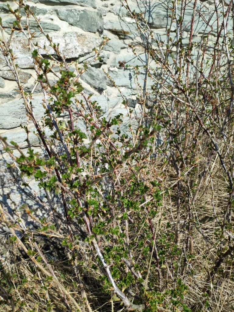
Close to the wall of the windmill, there were even leaves coming out on the bushes. Grass is starting to grow here now, but the trees have not put out their leaves yet.
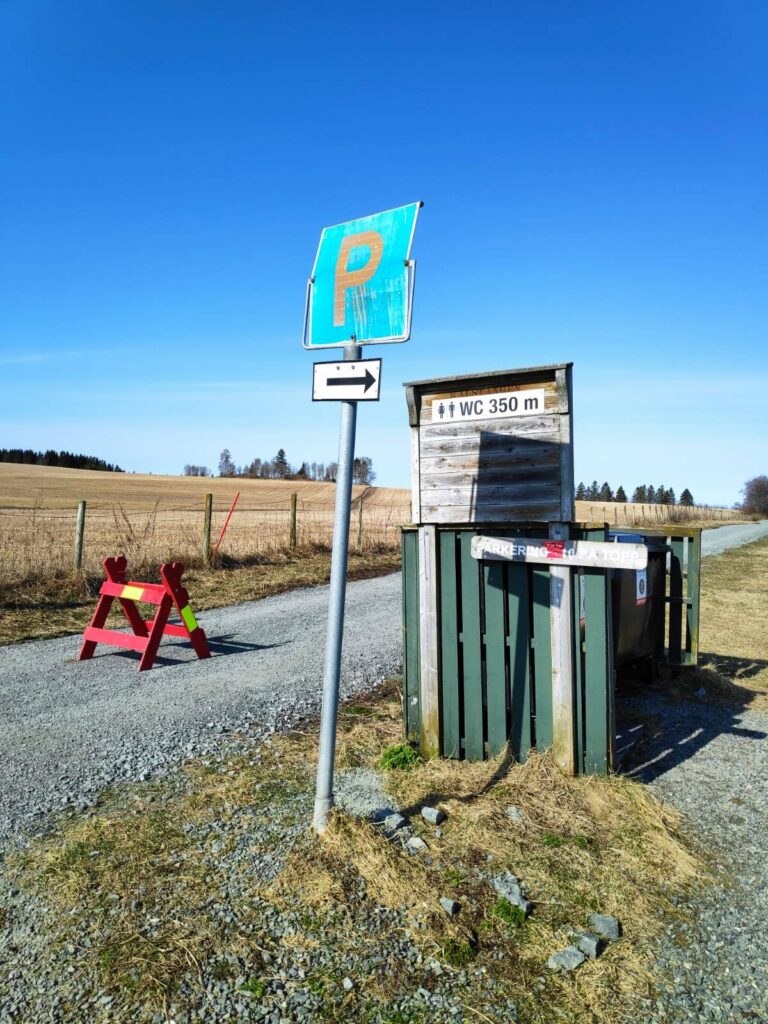
At the entrance to the park, there were quite a few signs. P = parking and there is space for 20-30 cars. There is a toilet in 350 meters along the path. It is not a water closet, even though they use the abbreviation WC in Norwegian. It is a pit toilet with seat, toilet paper and hand sanitizer. We will follow the path past the red barrier which is needed to prevent people from driving along what is meant to be a path, not a road.
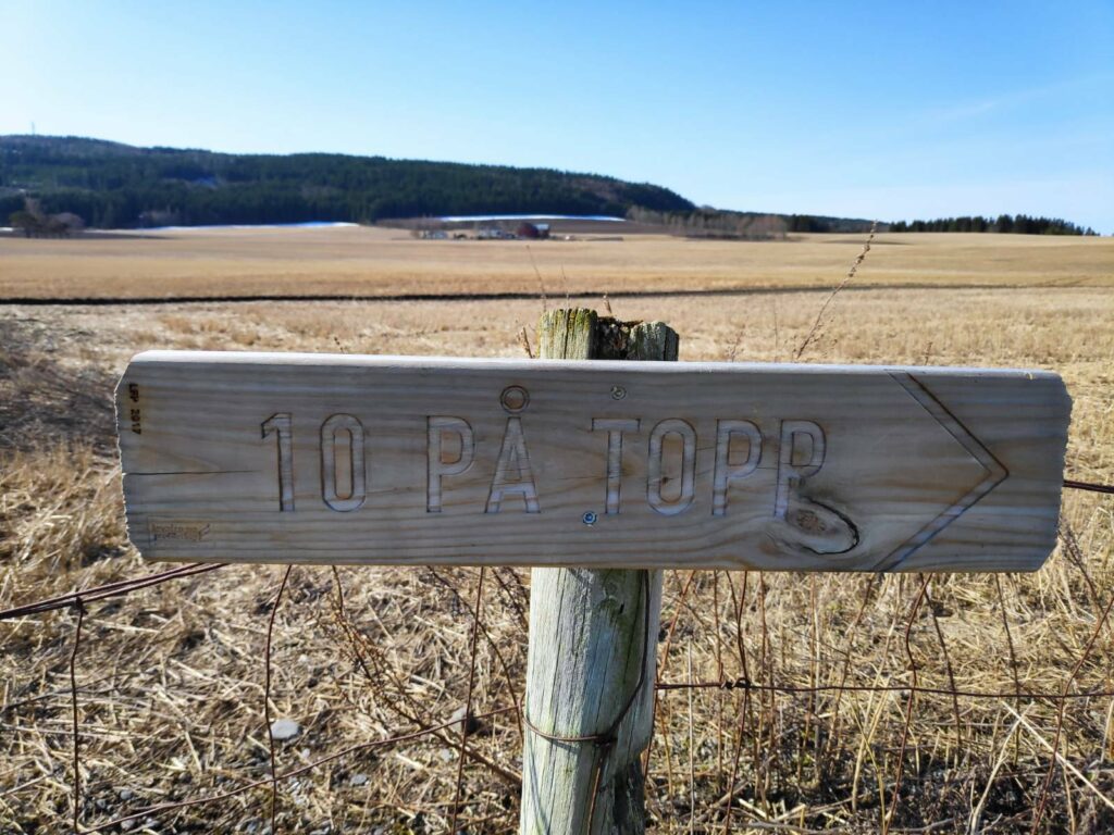
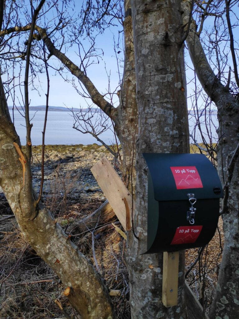
It is very common in Norway for every municipality to have places to walk to. The term “10 på topp” literally means that there are 10 high points that can be walked to. I was very surprised to find this sign here, where the path basically goes along the water. Where was the top/peak?
Inside this metal box, fastened to a tree, there would be a book to write your name in. I was very surprised that it was called “10 på Topp” with the drawing of mountain tops. We are maybe 10 meters from the water’s edge and maybe two meters above sea level! There was no “top” here, in my opinion. I think the phrase is used in the sense that people are being encouraged to get out into nature.
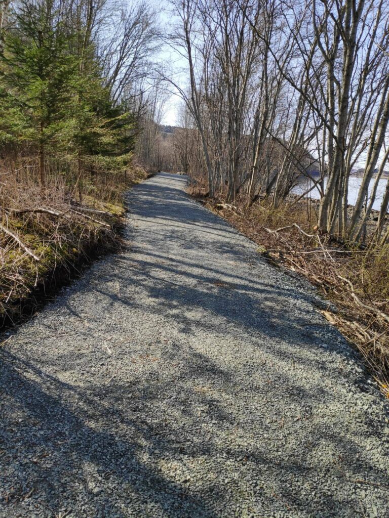
We walked for perhaps 20 minutes, more ambling than a brisk walk as the dogs made several stops to sniff. Since the last time I had been here, they have fixed up the path to a much higher standard. People using wheelchairs would be able to come along this path. There has also been extensive clearing on both sides of the path.
In several places, there were picnic benches put out. This one looks brand new and would easily sit 4 or 5 people on each side, if one didn’t have to sit one meter apart because of the pandemic.
In a different location we came across this brand new grill that had been put out. It had never been used, so it must have been put out just before we came. It had been nice all weekend, so I’m sure it would have been used if it had been put out on Friday.
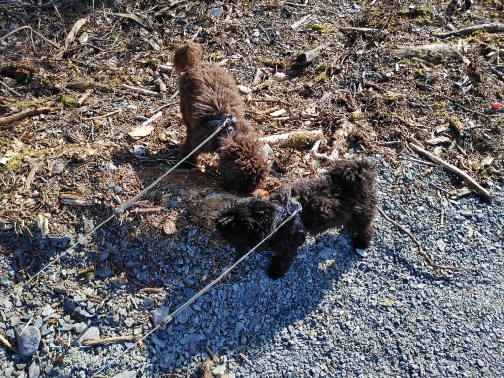
Two of my walking companions, Trine on the left is brown and Trixie on the right is darker, older and slightly smaller.
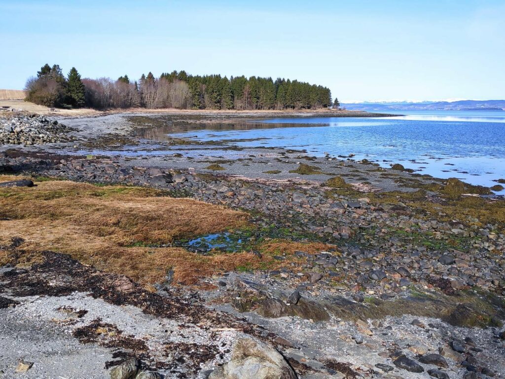
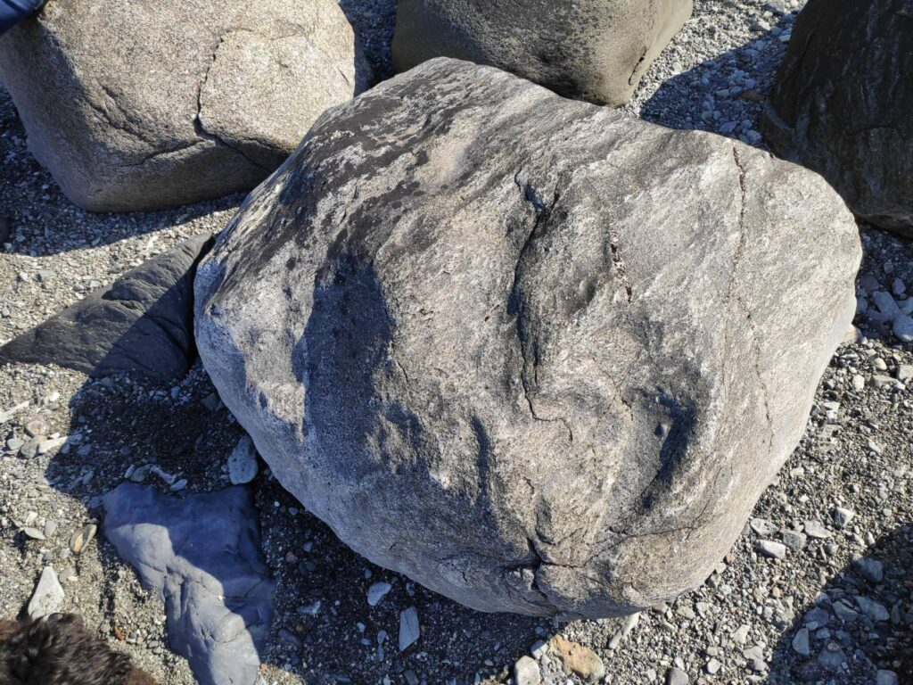
Eventually we found on open spot on the beach which was both in the sun and out of the wind. This is the rock that I sat on. We sat for an hour chatting before returning to our cars.
The view from my rock, looking towards home. The tide was low but had started to come in slightly.
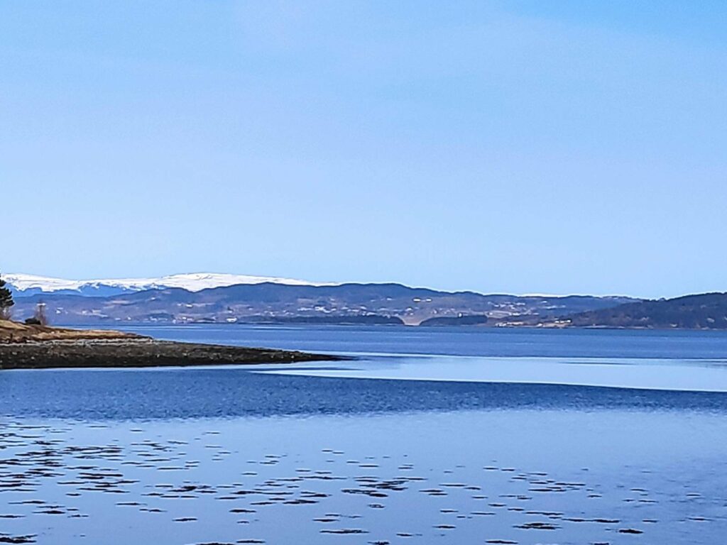
It is very difficult to take pictures of the landscape in the distance. Because of perspective, everything becomes just a thin line in the picture. I have driven about 40 km, around the end of Trondheimsfjord to this beach. However, from the right angle, one can see the towers of Skarnsund Bridge. There is an island between me and home, but the distance in a straight line would be about 15 km. What we can see with the naked eye, does not always show up in the picture.
This picture shows various levels of depth. First is a small point in the park that I’m in. Then there are some tree-covered small islands, then the main part of Inderøy with housing and farms located quite high on the hillside. In the far distance are mountains still covered in snow. They are in the municipality of Steinkjer and across another fjord on the other side of Inderøy, probably about 40 km in a straight line.
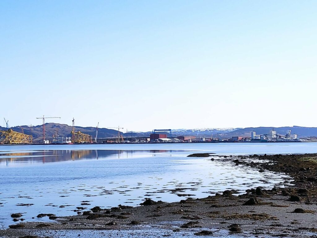
This picture was taken from the parking lot and is looking north-east towards the industrial area of Verdal (the municipality between Inderøy and Levanger). On the left are yellow-painted steel supports for oil rigs in the North Sea. To the right is a limestone processing plant.
This is a park that I come to frequently as my girlfriend lives nearby. However on this visit, I got there about 15 minutes before her, so had ample time to take pictures of the area before we met up. It had been several weeks since we had seen each other, so we had no problems filling in two hours chatting, both while walking and while sitting on the beach.
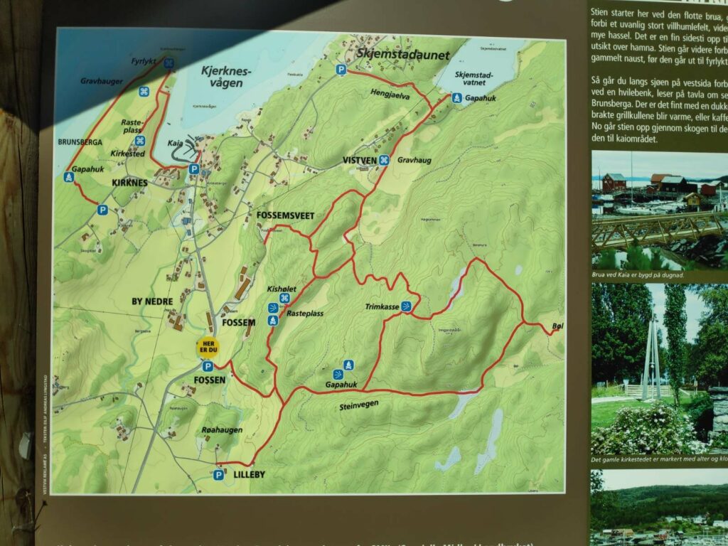
Today was another beautiful sunny day and as it was also a Sunday, we all three went for a walk together. First we drove to Skjemstadaunet where we parked the car near the information board. The walk to the lake is partly through the woods and partly in the open. It is difficult to know how long the walk actually was as I wasn’t watching the time. We perhaps used 20 minutes each way, making the walk about one kilometer.
We took the walk from the P at the top of the map, at Skjemstadaunet, up Hengjaelva to Skjemstad Lake (vatnet = the lake). There are also several other walks available in this area.
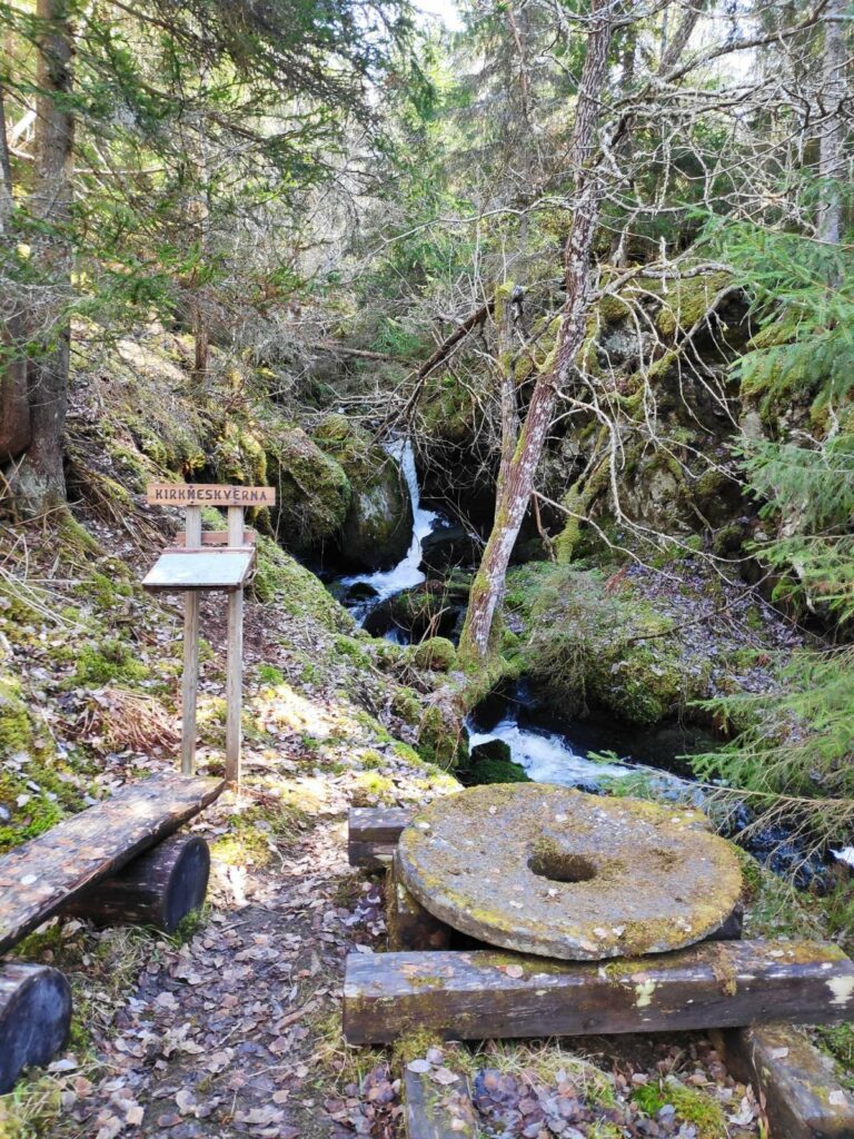
The walk follows the stream that drains the lake. This is a stream that has been used for grinding grain in the past. There were information boards in several place and old grindstones on display as well.
There was a lot of water running downhill and it was quite noisy. It isn’t long since we had the last snowfall, so there is still a lot of meltwater to make its way down to the fjord. Here you can see an old grindstone and an information board.
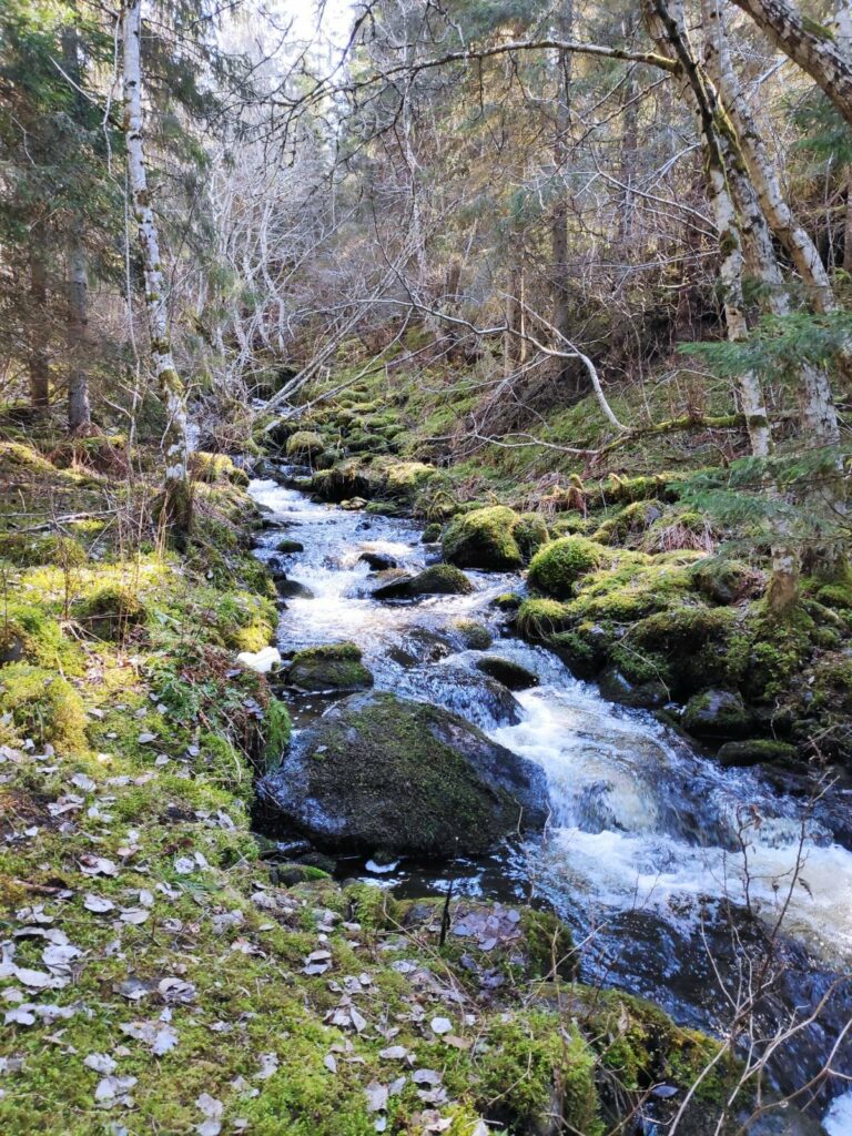
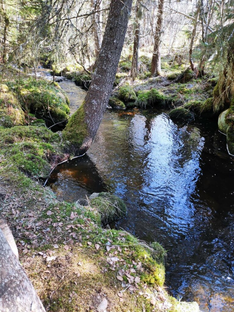
The stream is not very wide, but it was definitely very noisy today with a lot of water flowing quickly downhill.
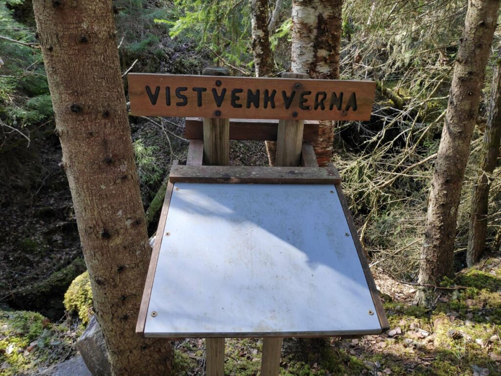
“Kverna” means grinding mill. There were at least three locations along the stream with information about the old processes of grinding flour. The information boards close up when not being read so that they are protected from the weather.
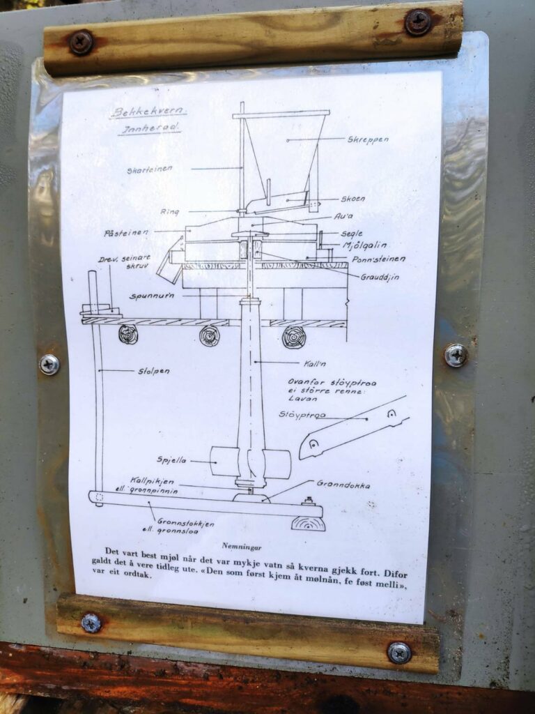
At this information board, there was a diagram of how the grinding mill was actually built up. The comment at the bottom says that one would get the best flour when there was a lot of water so that the grindstone went quickly.
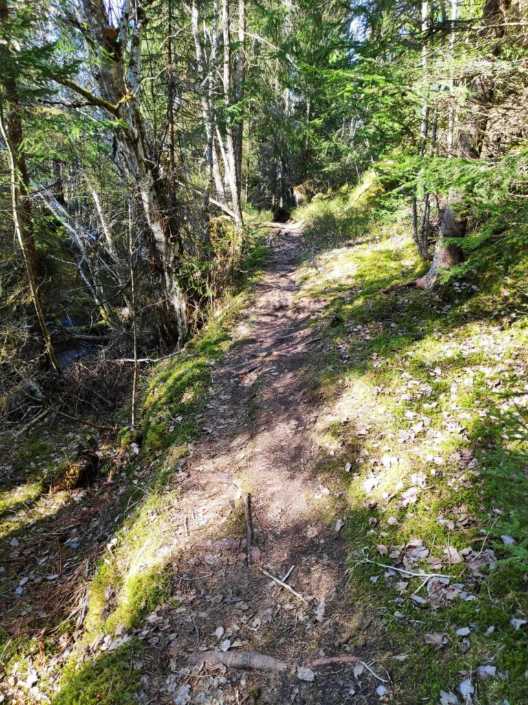
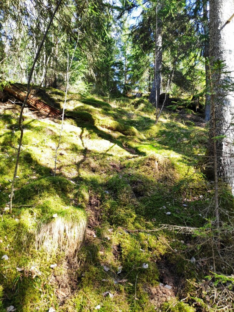
The path we were following was narrow and uneven. In parts it was also quite steep. Being beside a stream it was also quite moist in the air and the moss has been growing well.
The steep, mossy slope on one side of the trail. There were only a few patches of sunlight along this part of the trail, which was also the steep part of the trail.
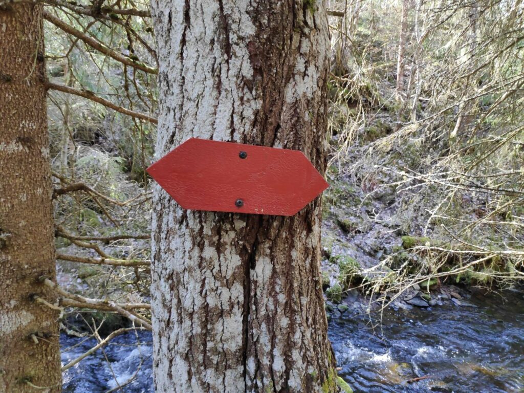
The old-fashioned method of marking trails in Inderøy was using red wooden arrows.
Eventually the slope became less steep and the stream was not flowing so noisily. We are walking up the stream, so going in the opposite direction of the water.
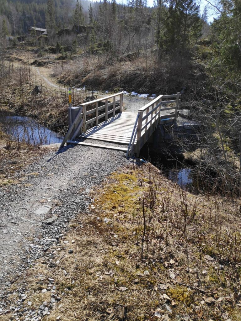
Then we came out into the open, where the forest has been cut back. There was a well-made bridge across the stream.
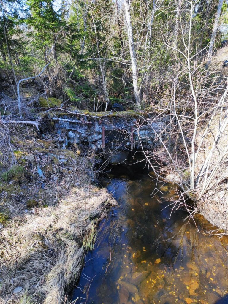
This picture was taken from the bridge and is looking downstream. At some point in the past, a stone wall has been built across the stream, with an opening that probably could be closed so that water was held at the top until one wanted to use the grinding mill.
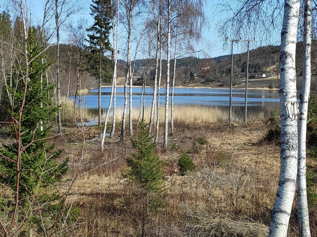
Skjemstad Lake. The area between me and the lake was very wet and mostly part of the stream. The lake is about 800 meters long and 500 meters wide. It was used as a water supply for the area from 1958 to 1996, when the water quality became too poor to be used as drinking water.
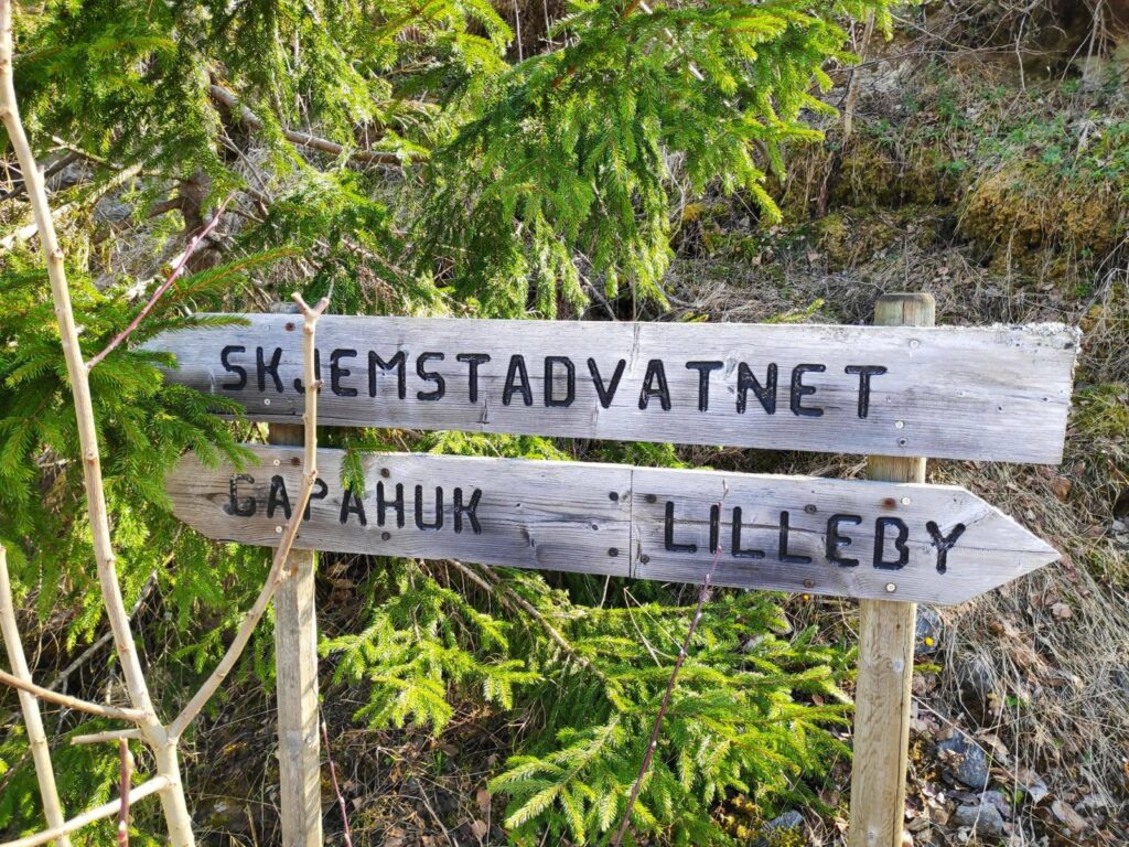
Where do you want to go? Three suggestions are given on these signs. We went left to the gapahuk at Skjemstad Lake.
Picnic bench at Skjemstad Lake. The level of the lake is much higher than I have seen before, which explains how much water was racing down the stream. There would normally be considerably more dry area around the picnic table. Note the boat float on the left side of the picture is more under water than actually usable.
This is what they call a “gapahuk”. There is a roof and three sides, with seating and a place to grill food.
After gazing at the lake for a few minutes, we returned to the car, taking a slightly different route using roads instead of the steep part of the path in the dark woods.
This is a pleasant, though relatively short, walk for a Sunday afternoon. We probably used about 45 minutes for the round trip.
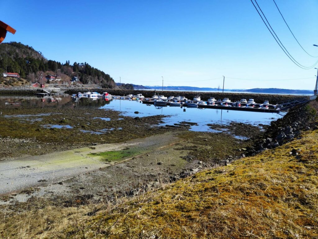
Today was a beautiful sunny day, eventually getting up to over 20 degrees Celsius sitting in the sun. But during the morning, my son and I took a walk in Mosvik, starting at the small boat harbor.
The small boat harbor in Mosvik is very well protected. Today while I was out walking it was very low tide. This was not the time to launch your boat from the ramp that is visible in the lower left of the picture.
There is a very small exit from the boat harbor, which makes the harbor very protected no matter which way the wind is blowing from. However at very low tides, it might be a bit awkward to manoeuvre the boat.
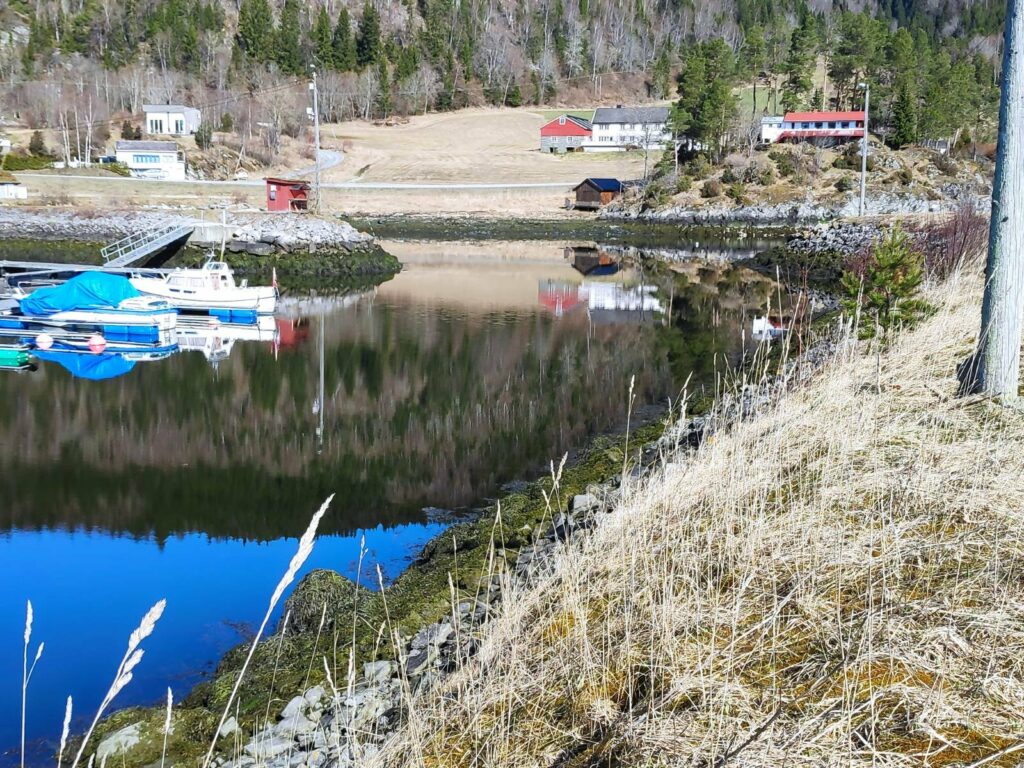
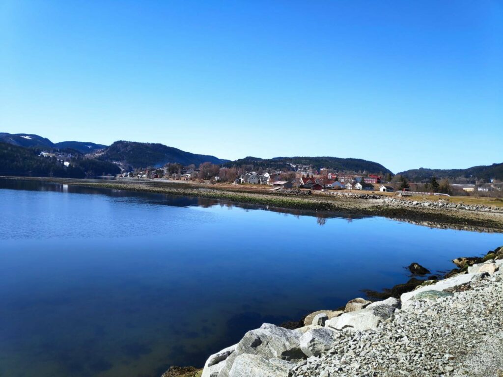
When we first moved to Vangshylla 32 years ago, Mosvik was its own municipality, but in 2012 it became part of Inderøy, having been its own municipality since 1901. There is a school, a kindergarten, a training center, a fuel pump and a food store in the village. It also has a new old-people’s home which was just completed this last winter. The village of Mosvik is 8 km from where we live and so we are there regularly. Today my son and I agreed that we wanted to be primarily in the sunshine so we chose a walk that took us along the fjord, then up into the housing area before heading back to the car.
It was very interesting that we came at a very low tide today, as one can see what is normally covered by water. Low tide this morning was at 9:19 and these pictures were taken between 10:30 and 11:30, so the tide was already coming in.
We walked along the water’s edge, past most of the houses that you see in this picture before heading up a slight hill.
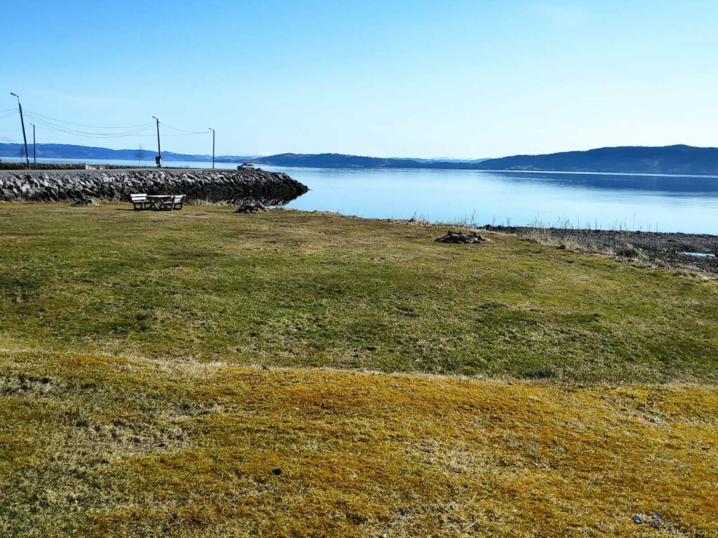
Between the road we were walking along and the water, there were several areas with picnic tables and places to be outdoors when the weather was nice.
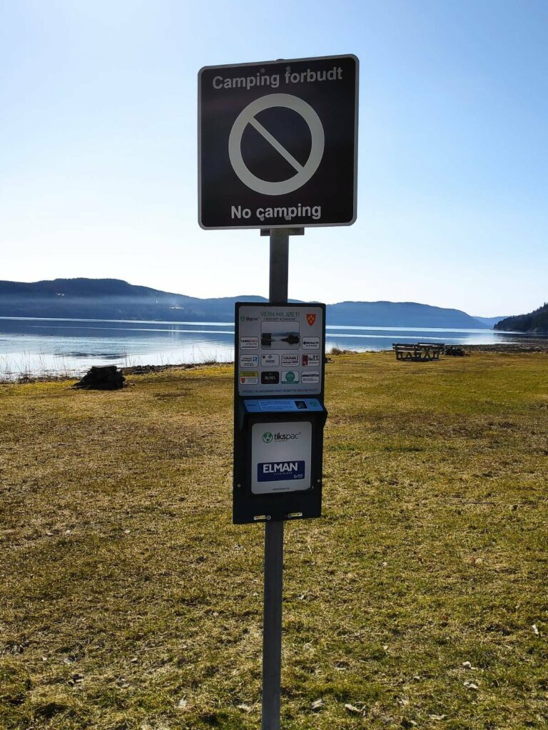
However, there are restrictions and these areas are not to be used for camping. They are for daytime use only.
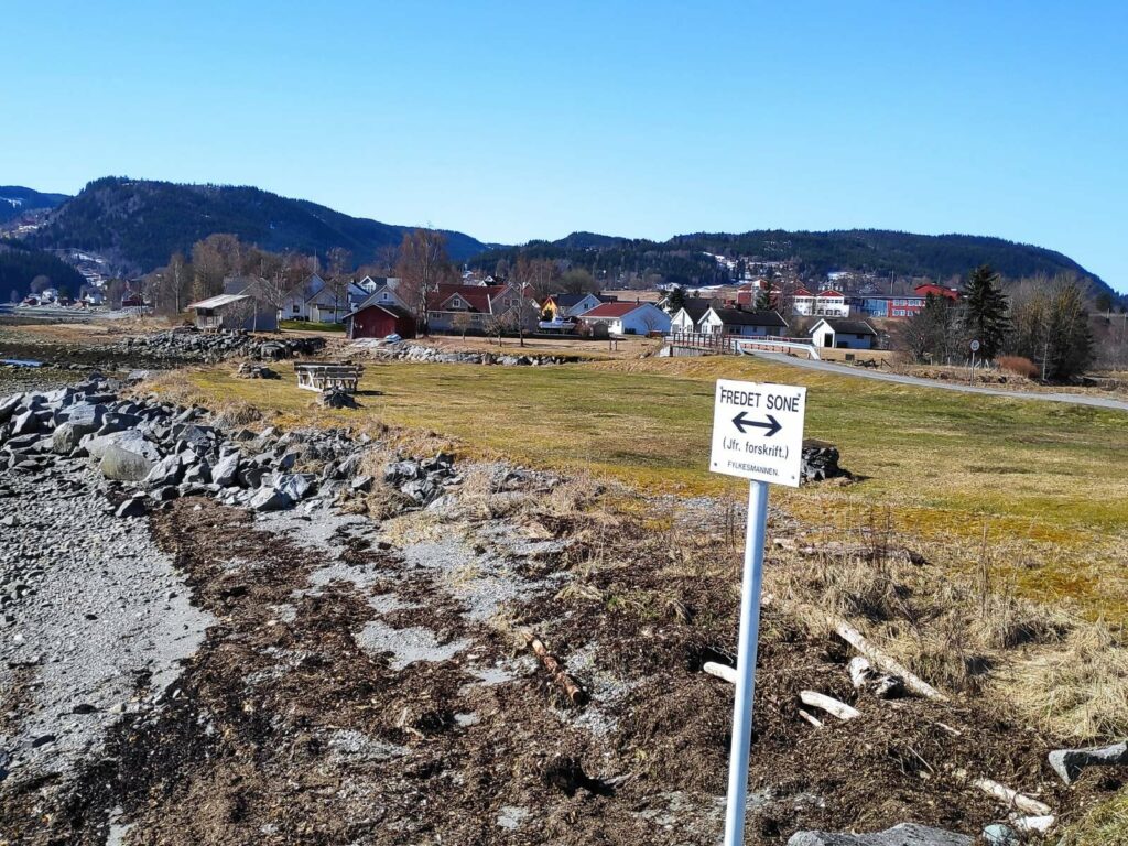
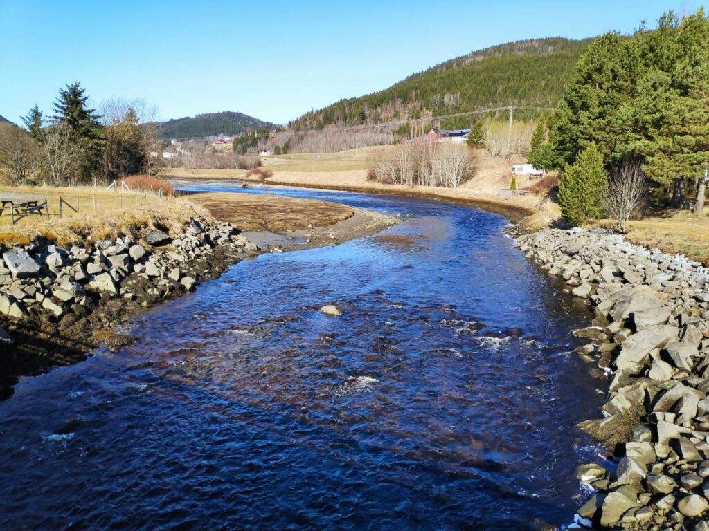
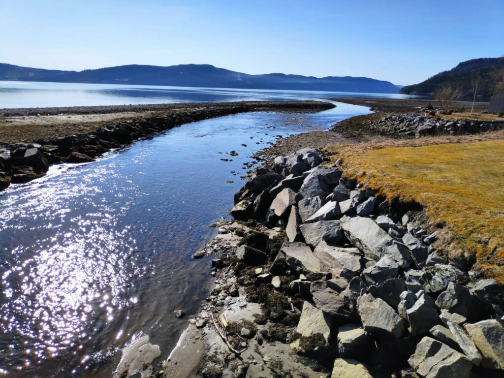
“Fredet sone” = means that this area belongs to the birds. Notice the road that we walked along at the upper right of the picture. It leads to a small bridge over the stream and on to the center of the villlage.
This stream has collected run-off water from the hills and flows out to the sea here. Note that this part of the stream is tidal.
Looking the other way from the same bridge, one can see the channel that the stream has cut for itself. At high tide, the bank on the left would be mostly covered.
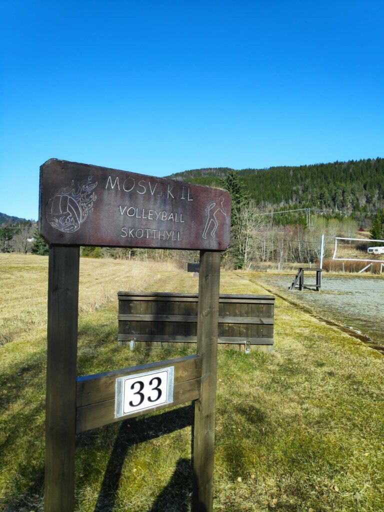
A playing field for sandvolleyball lies beside an area for playing “skothyll”, which is an old throwing game which seems to be most popular in Trøndelag in Norway (this is what the region where we live is called) . Note that the playing field even has been given an address number, 33, so that emergency services can find it on their GPS.
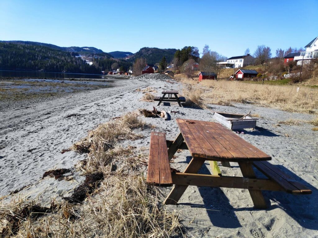
Another picnic area. A local resident that we stopped to chat to said that this was a very popular swimming beach. When the tide comes in over the warmed up sand, the water is very pleasant for swimming in the summer months.
One of the local residents took off just as I was trying to get his picture.
All roads are now named and buildings are given number addresses. This is primarily to aid emergency services finding locations, but it also helps people figure out where they are and how to get where they are going. Having addresses is useful when using GPS systems.
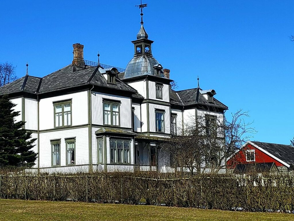
At this point we left the road going along the water and headed up a small hill to the residential area. Traditionally, Mosvik was one large wooded property owned by one family. This large property still exists, but, today, in addition, there are some small farms and a residential and small business area. The farm has beef production, grains and forestry as its main sources of income.
The main farm in Mosvik is called Vinje Bruk, and the owners have a rather large house which was built in the 1890s.
Mosvik Church lies just a few meters from Vinje Bruk and was built in 1884.
From here the walk was downhill, past the school and down to the water again.
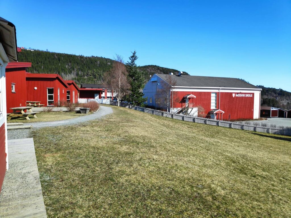
The kindergarten is in the left-hand building and the elementary school on the right.
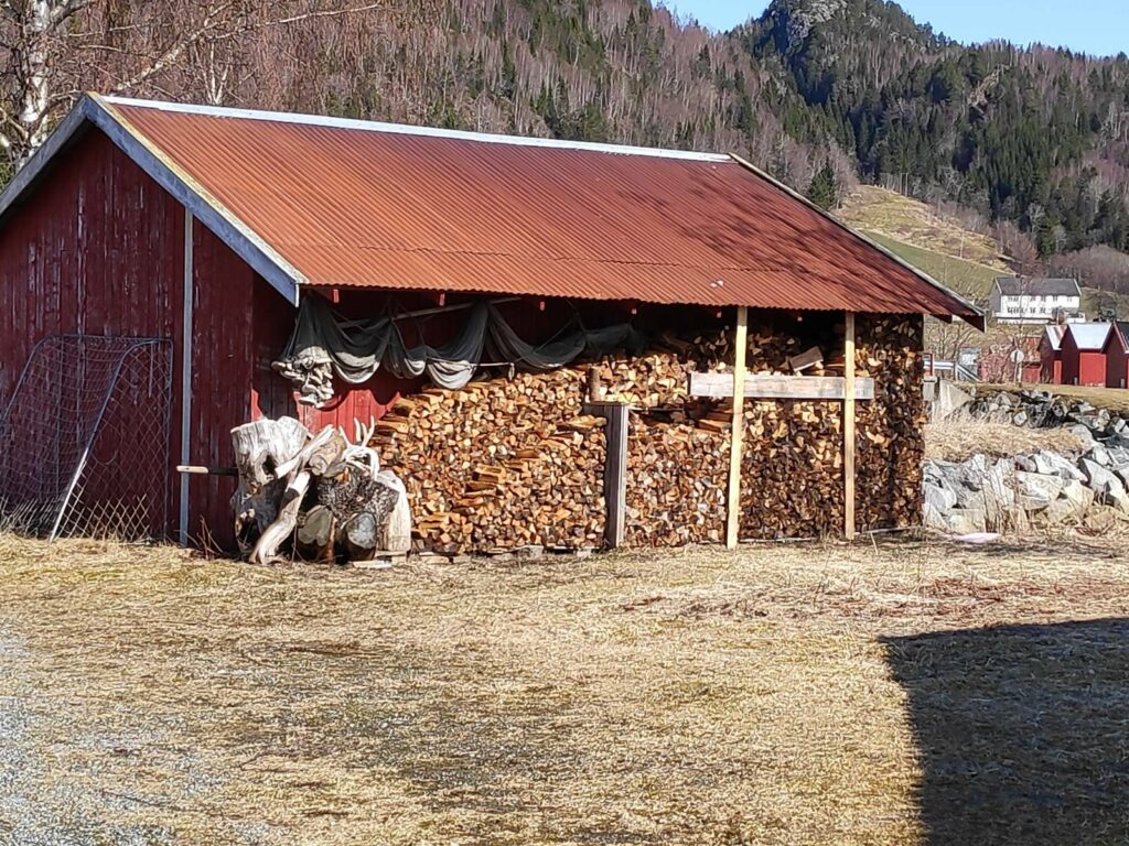
When you turn around and take the same road back again, you see different things. Here there was firewood stacked for drying and for use next winter as well as fishing nets under the eaves.
There aren’t many wildflowers blooming yet, but colt’s foot (Tussilago farfara) was everywhere. The sun brings out the bright yellow flowers. This plant has a very large leaf which comes out after the flowers are finished.
The last time I took this walk, I was with a girlfriend and we got soaked in a rain shower. Today it was beautiful. This is a walk I will do again. It takes about an hour to do a circle tour and there are several alternative routes one can take, especially through the residential area.
Today my walking season started and I have decided to resume blogging about some of the walks that I take. I’m not really a writer, but I enjoy taking pictures and sharing them with my readers. Sometimes I take pictures while walking uphill as that gives me a reason to stop on the hill and catch my breath. Other times I see things that I think are very Norwegian, meaning that I did not come across the custom until I moved to Norway, though that doesn’t mean that the custom doesn’t exist elsewhere. I will try to explain why I am including the pictures that I include. I usually take a lot more pictures than end up in the blog. For example, today I took about 40 pictures, using my smart phone and I am sharing 12 of them.
The weather today was grey, meaning that it was cloudy the whole time, but there was no precipitation while I was walking. I had worn a bright yellow rain jacket as it keeps me visible, as well as protecting me from the wind and the rain. The temperature was about 4 degrees Celsius during my walk, so I had several layers on. On this particular walk, there is a 20-25 minute climb uphill at the start, so I warmed up quickly and soon had my sweater off, but I left the jacket on. In the woods, I didn’t notice the wind, but towards the end of the walk when I was out in the open, it was good to have the jacket on to protect me from the wind.
The purpose of the walk was primarily to fill in about an hour and a half while my husband had some things to do in Straumen. We both had appointments at shortly after 1 pm for our Covid-19 vaccine, so I had a deadline as to when to arrive. I got dropped off about 3.5 km from Straumen, then I walked up the hill, perpendicular to the car road, then eventually headed off in the same direction as the car road, then went down the hill just before Straumen. I spent time in the woods, well away from car traffic and other noises. I enjoy walks like that.
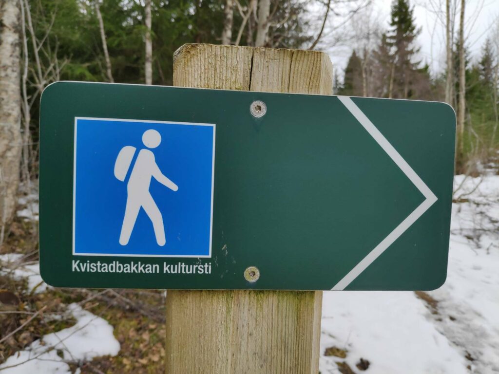
A lot of the trail that I was following is part of the Kvistadbakkan Culture Path. It is labelled as blue difficulty, which means that it is uneven terrain and can be steep in some parts. I would consider it a walk that would give me some serious exercise, but not a difficult trail to follow.
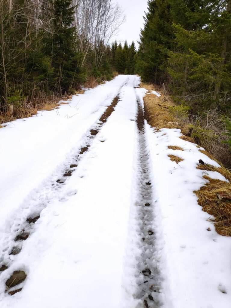
A lot of the trail that I was following was either tractor road or well-used footpath. Last weekend we had received a 20 cm snowfall, so I was prepared for snow on the trail. I have done this route before and was confident in my usage of time as well as knowing where to turn. This is an area with a lot of trails. Many people go for walks here and many will take their dogs for walks here too.
This is what much of the trail looked like today. The recent snowfall has not melted completely in higher areas, but is melting quickly when it is warm enough. Sunshine hastens the melting process, but in the woods, many areas may not get much sunshine. Today there was no sunshine while I was walking.
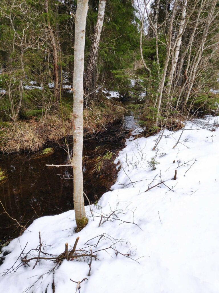
There was a stream along part of the trail and it was busy taking away the melt water.
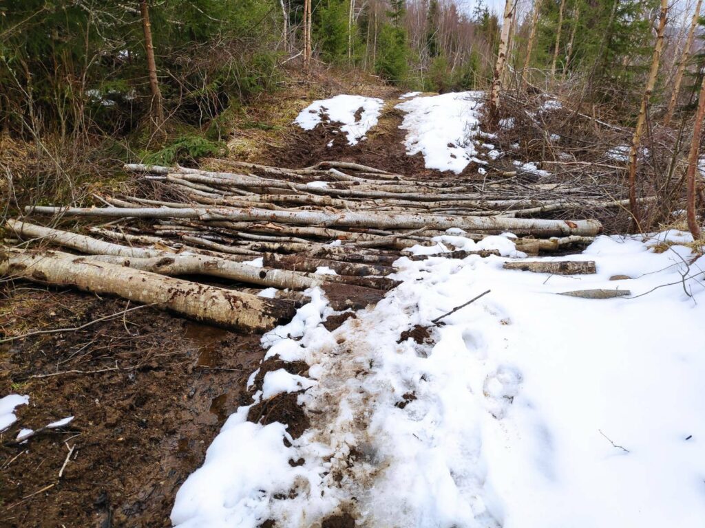
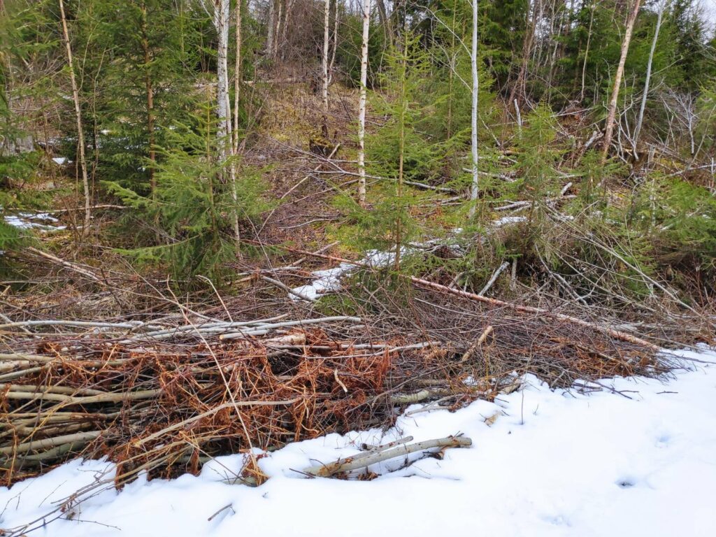
The path got quite muddy in parts and I came across all these trees lying across the tractor road. These had been placed there very deliberately. Underneath is a particularly muddy section where a small stream crosses the road. Putting down trees in this fashion will allow people to cross the muddy area and will also prevent wheeled vehicles, such as tractors or ATVs from sinking into the mud. You can see from the trail on the snow how muddy everyone’s feet had become on this section of the trail.
It was also obvious that someone had been at work clearing up along the trail, cutting back the trees that were growing close to the trail. By letting in more light, the trail will dry up more quickly after rain and it also lets the users get a better view.
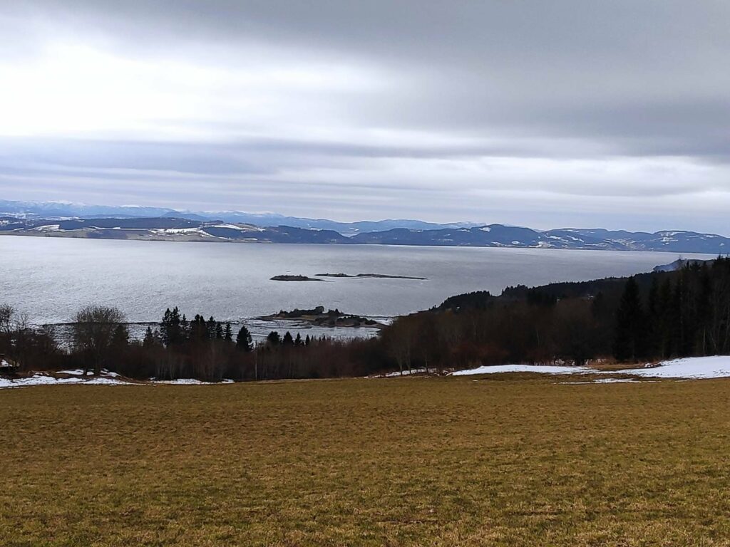
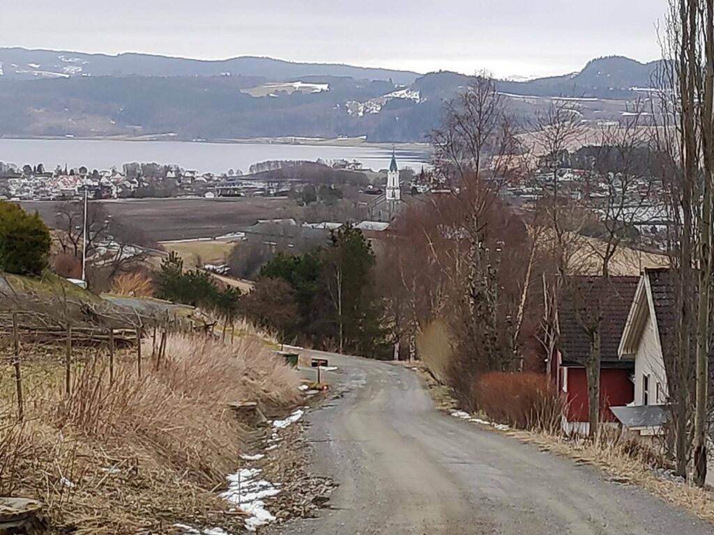
Eventually, I came out into the open again and could see out over Trondheim Fjord. The small islands (Kvamsholmen) are accessible at very low tides, but today the tide was coming in and about three-quarters of the way to high tide. The large island in the background is Ytterøy and in the far distance are the hills of Levanger. The field is mostly bare of snow, but snow is still lying around the edges where not much sun reaches.
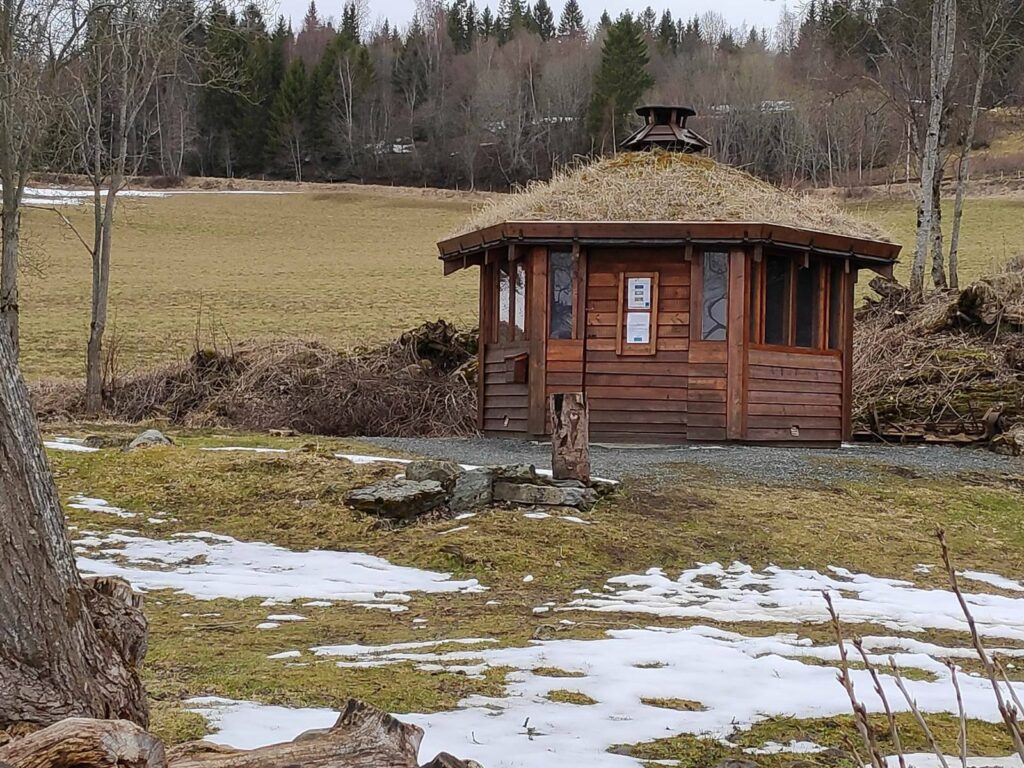
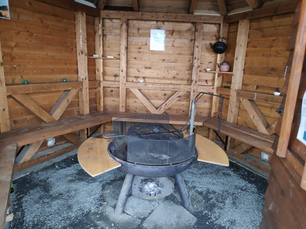
I came along the tractor road at the higher end of the field in this picture and saw this small construction and made my way to it. It was called a Grill Cabin. I do not remember seeing it before, so I presume it was constructed last summer.
Inside there was seating around five of the six sides of the little cabin, and in the center there was a place to light a fire and grill food. I took the chance to sit down for a few minutes and eat the sandwich that I had brought with me.
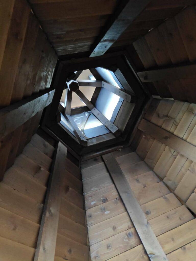
The ceiling has been built so that the smoke from the fire can get out.
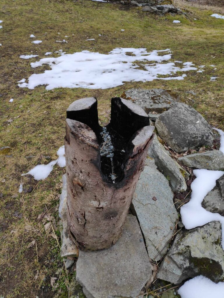
Outside the little cabin, was a stump of wood that is used to boil coffee. A fire is lighted in the center of the stump and the coffee pot (you can see one in the previous picture, hanging on the wall) fits snuggly over the fire. The four slots in the stump allow air to get to the fire, which slowly consumes the stump.
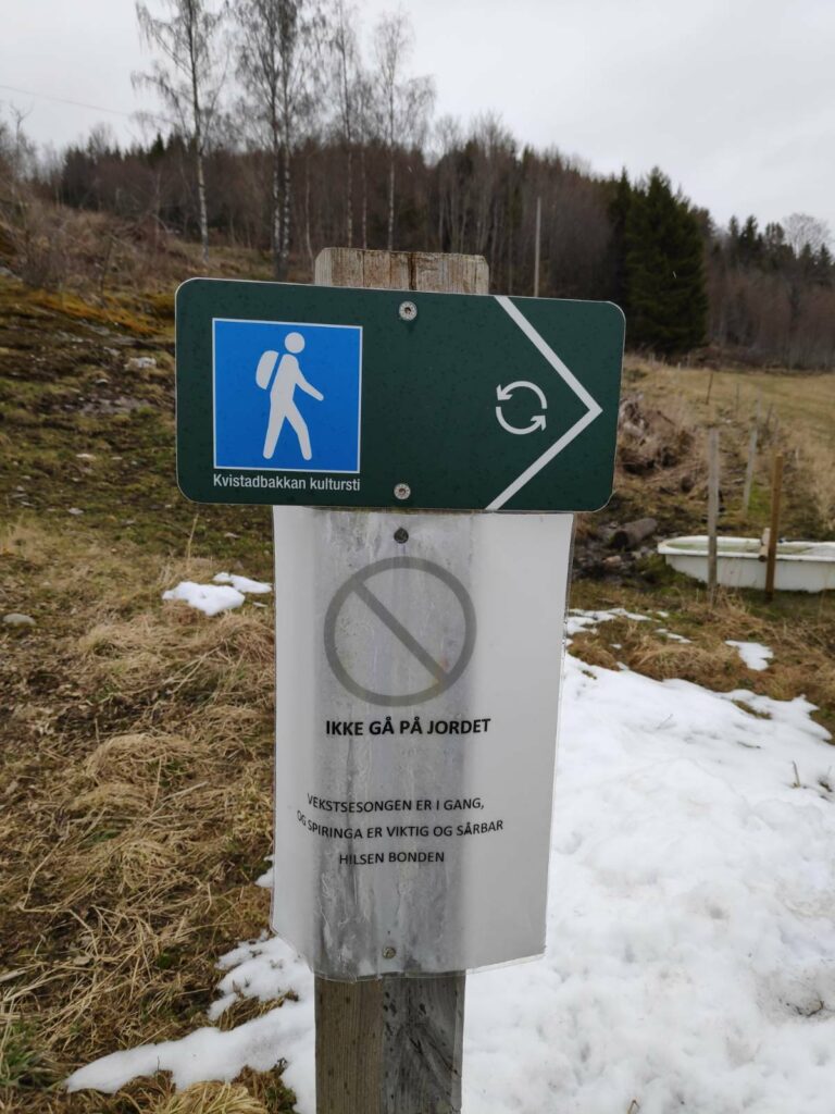
Translation of the sign: ” Do not walk on the field. The growing season has started and sprouting is important and sensitive. Greetings, the Farmer”. The fields are not green yet, but the early spring days are important for the growth of the grass on the fields. In Inderøy, many farmers will have cattle grazing the fields in the summer, or the grass will be cut to provide feed during the winter season.
Now it was just to walk down the hill and get to the store (to buy a few small food items) and city hall (where we would get vaccinated). There wasn’t much snow left at lower elevations.
This was a one-way walk, requiring that I got dropped off at one place and picked up at another. I used about one and a half hours between being dropped off and getting to the store. By road it is probably about 3.5 km, but I will have walked at least 6-7 km by going through the forest. It is a walk I will do again, when it is suitable.