“Storlia” means “big hill” and so the reason for doing this walk is for the views from the top. One drives part way up the hill and then walks the rest of the way on a trail that is quite steep at times. We were three walking together and everyone was walking at different speeds on the steepest bits. I stop quite often to make sure my heart beat gets back to normal before continuing.
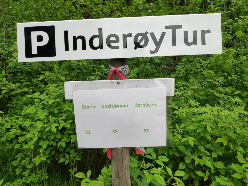
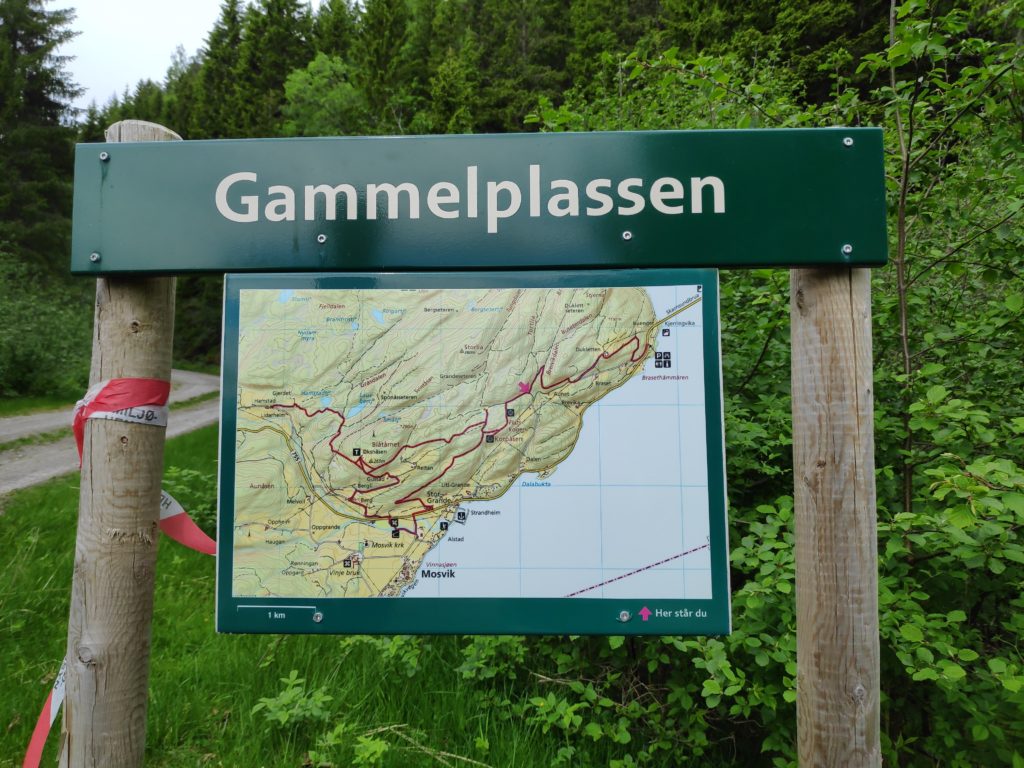
From the parking place at Gammelplassen (“the old place”), there are three walks available. This blog is about Storlia. A later blog will come about Korpåsen.There is the usual map of the area. It can be a good idea to have a picture of the map on one’s smartphone so you can check where trails go. The app we use to check-in to posts also comes with a map that shows the trails.
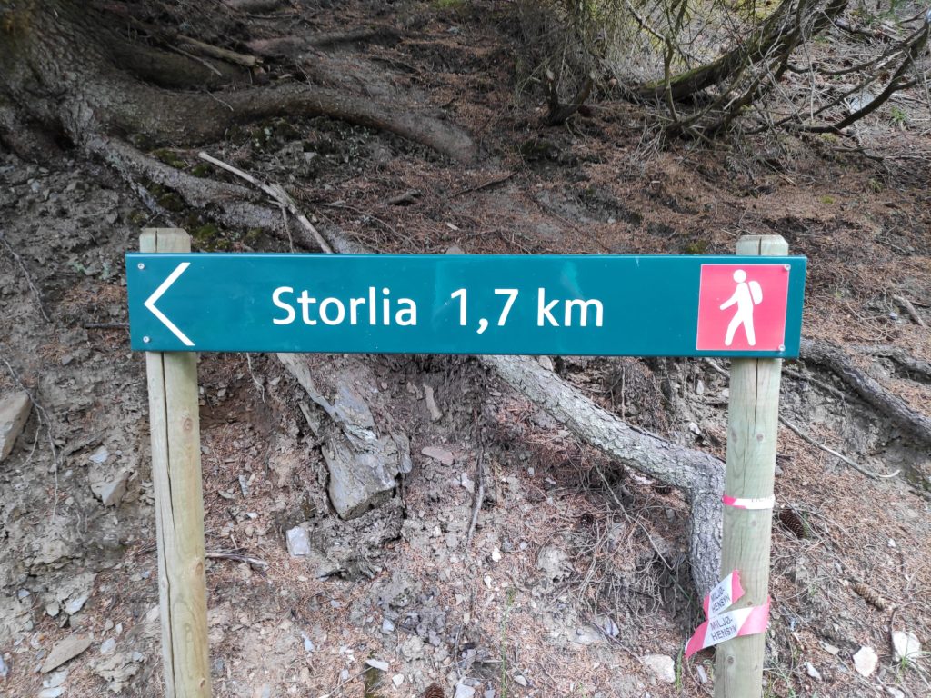
Storlia, according to the map, is 380 meters above sea level, and we have parked at about 140 meters above sea level, giving us still a climb of about 240 meters.
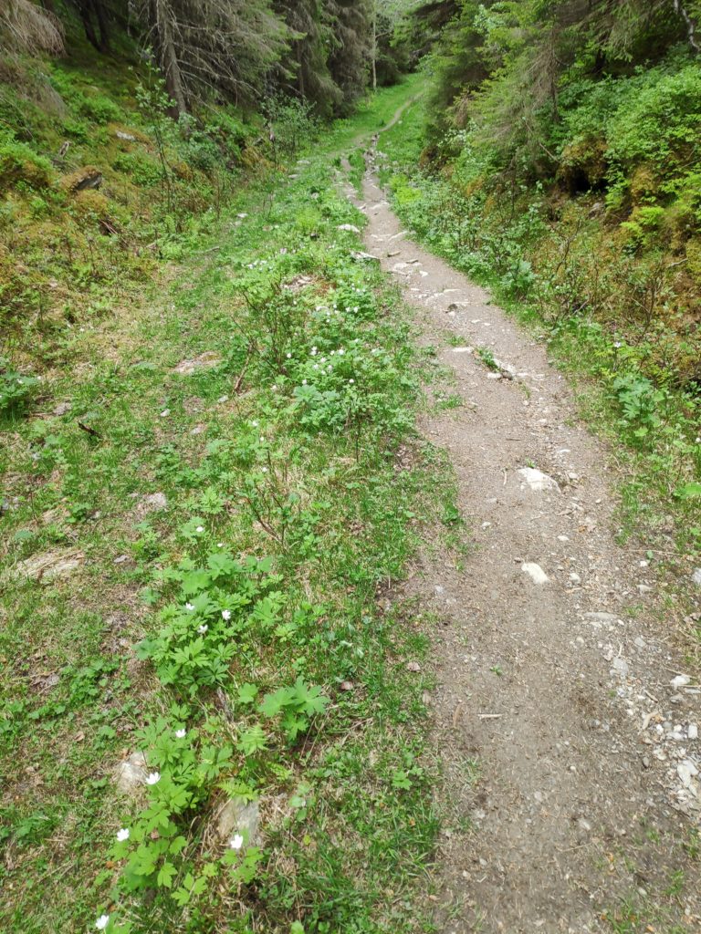
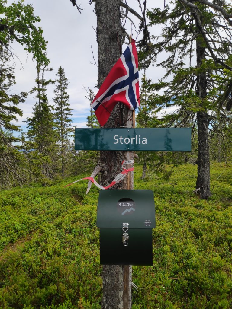
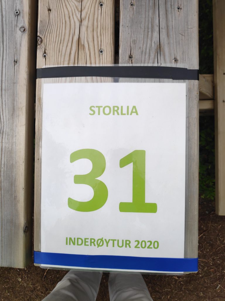
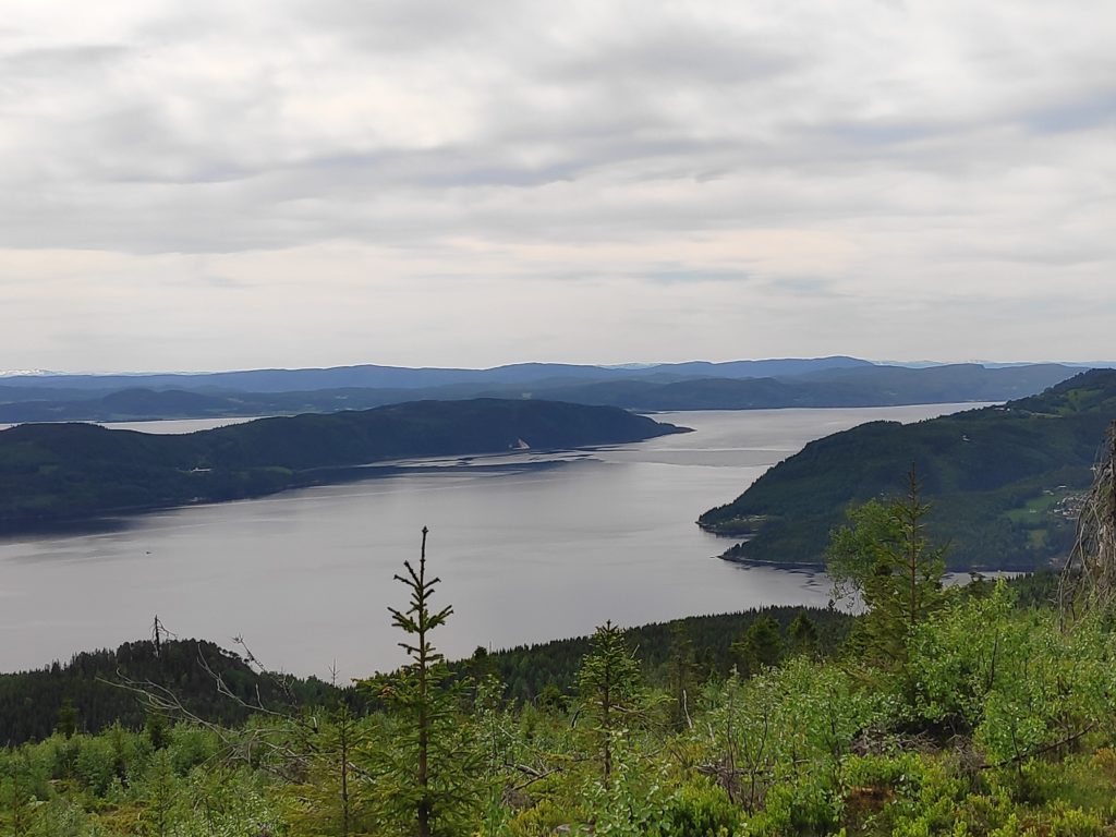
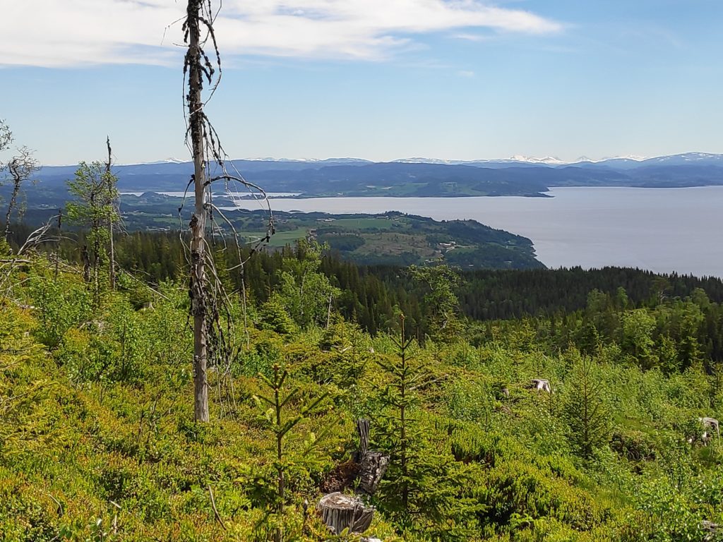
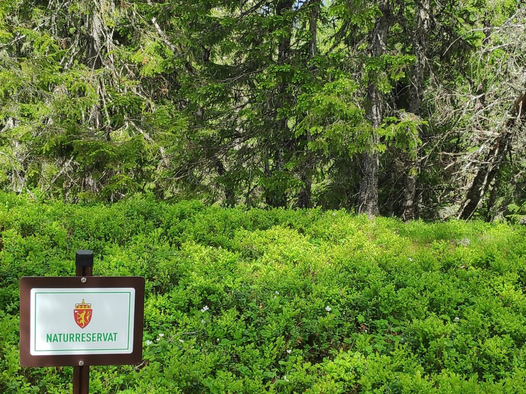
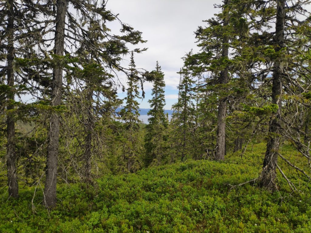
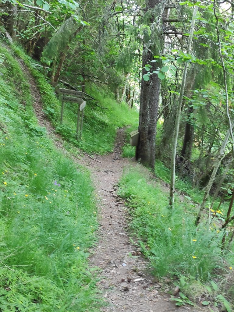
This is a red trail, meaning that it is difficult. Uphill getting there and downhill back to the car.The trail, looking downhill. Pauses to take photos are a necessity for me. We made it to the top. There was even a Norwegian flag to welcome us. In the box is a book to write your name in. Not everyone uses an app on their smartphone to check-in with.On the picnic table at the top, there was a notice for those who use the app.The view looking south-west, with Ytterøy (an island) on the left, Norviksund straight ahead. All the water is considered Trondheim Fjord.Looking south-east towards where we live, though our house is not visible. In the background is Verdal and even father behind, the mountains with snow on them would be in Sweden. At the check-in point, we are at the edge of Skavdal Nature Reserve, which is to protect an old spruce forest and boreal rain forest. Skavdalen Nature Reserve, looking north-east towards Beitstad Fjord.
This is a walk I can do from home, but today I joined a friend and got a ride to the public parking place which makes the walk considerably shorter. The weather was warm already at 9 am, so it was nice to not have to do all of the climb to the starting point in the hot sunshine.
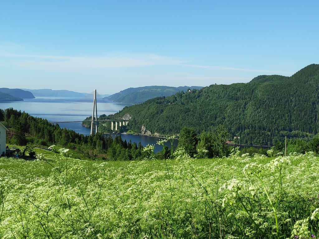
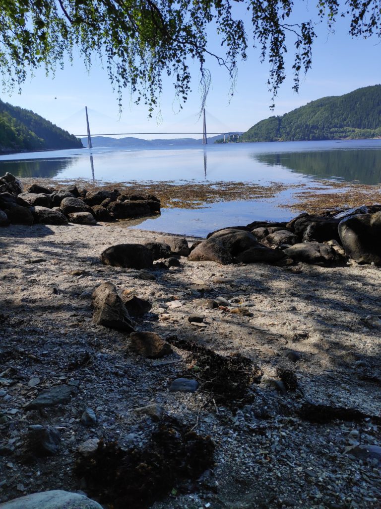
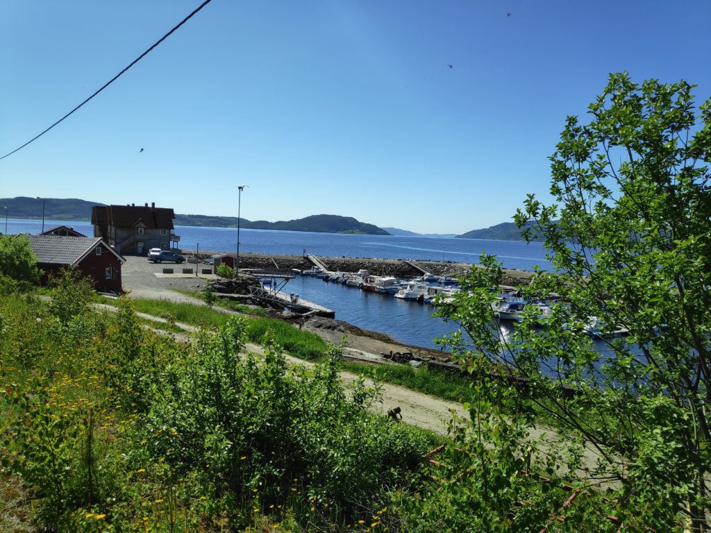
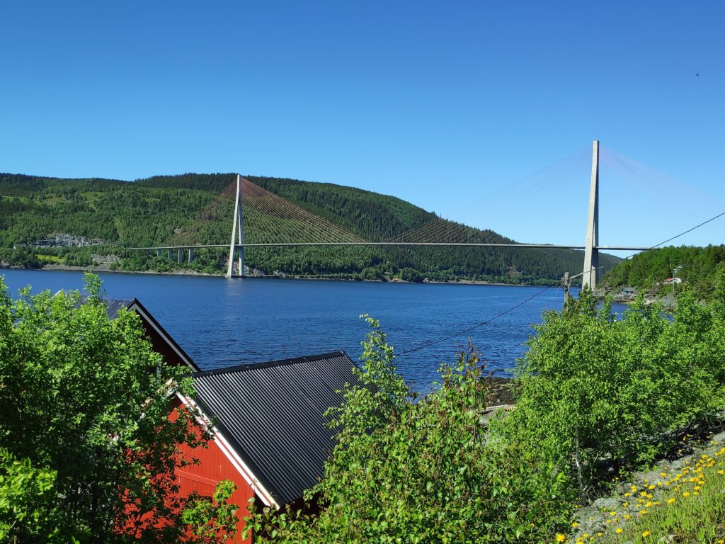
Skarnsund Bridge from the path to Ørdal Nature Reserve.
The first part of the walk goes around some farm fields and we could see Skarnsund Bridge. Note that we are considerably higher than the level of the bridge. Nice weather and a good view from here.
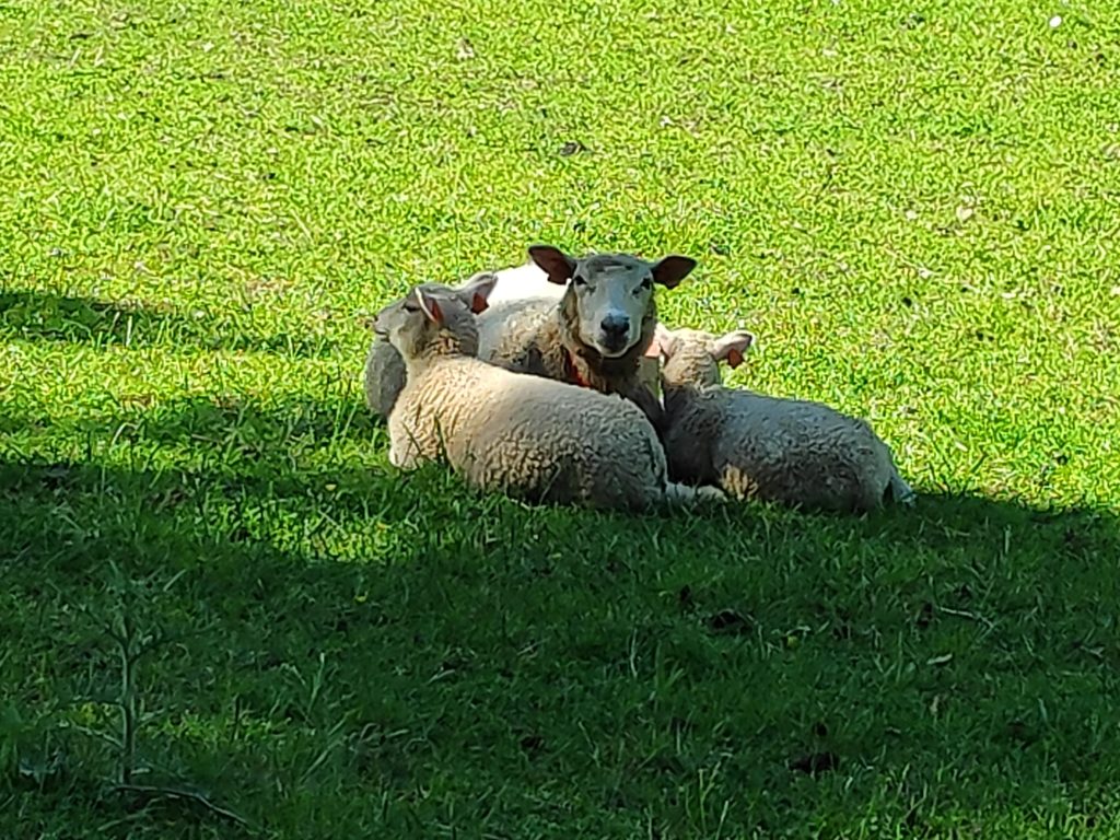
Ørdal is a farm perched on the edge of Skarnsund. Some of its residents were out in the fields as we passed by. When walking by, one has to be careful not to get between mother and babies, and one should also be careful about where one puts one’s feet. The mothers have bells on them so one can hear them at a distance They usually move away when people approach.
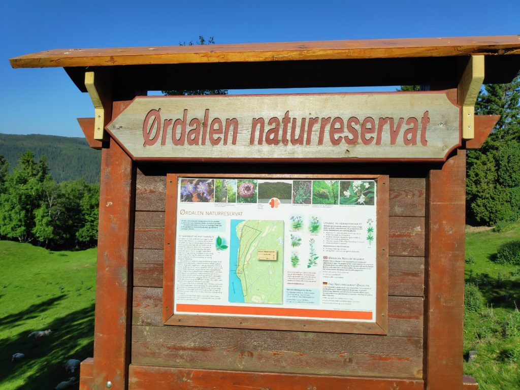
Mother with two lambs who would be at most two months old, perhaps younger.There is the usual sign that gives information about the area.
Ørdal Nature Reserve was established in 1992 and its purpose is to preserve a coniferous forest area which is only slightly affected by human activity. It also has a distinctive flora. The area is on a very steep hillside on Skarnsund. The area is shown on the map on the sign.
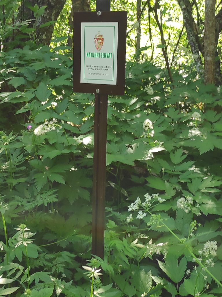
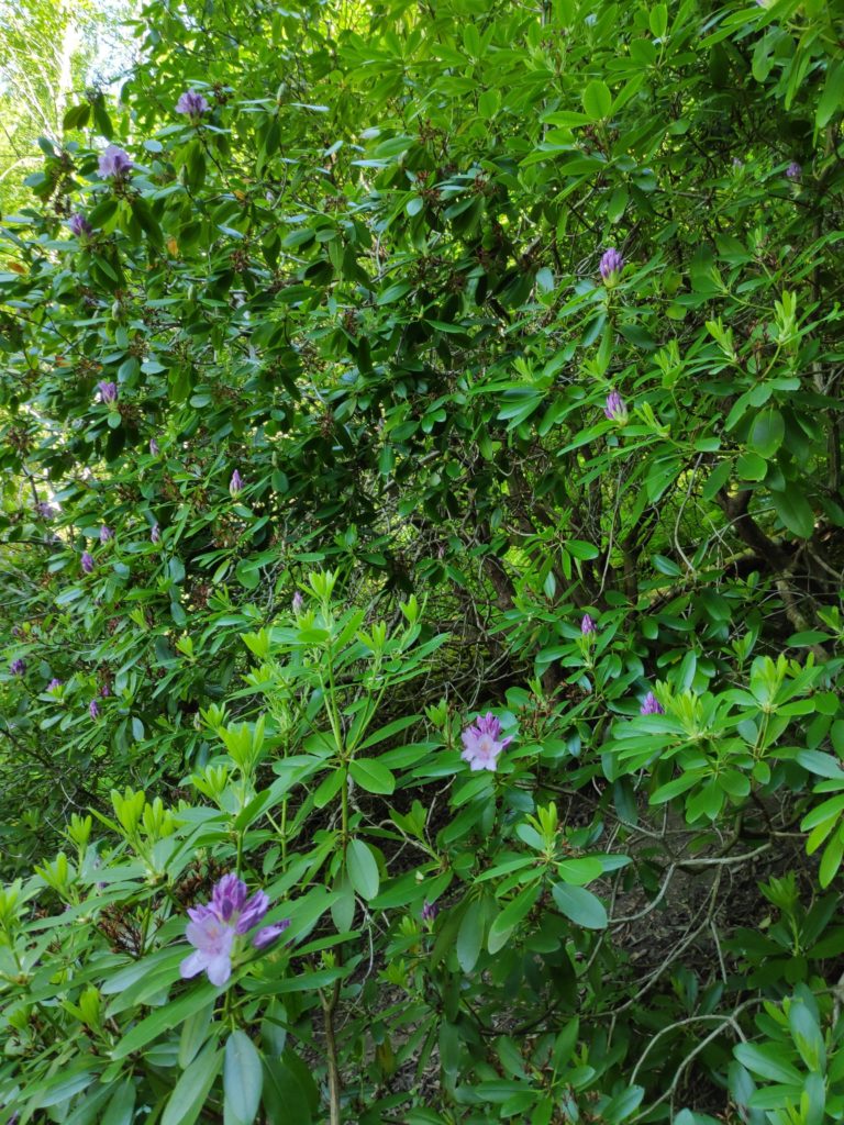
As one enters the nature reserve there is a sign to indicate that. The sheep are not in the nature reserve. One has to go through a gate and the reserve is fenced to prevent the sheep from entering.Rhododendron in bloom
Among one of the interesting plants that is found in this forest, is a very large rhododendron. The reason for doing the walk at this time of year is to see it in bloom. Some years it has an enormous amount of blooms on it. I felt that this year, it has, just like the one in my garden which is not by any means the same size, very few blooms, but lots of new growth.
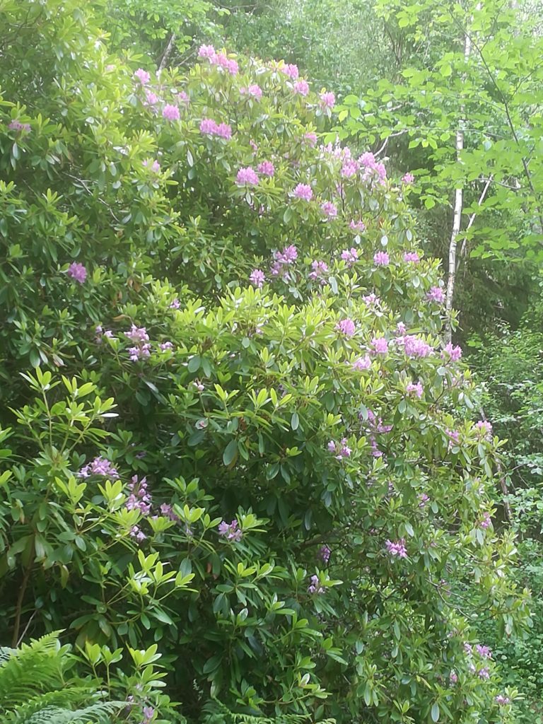
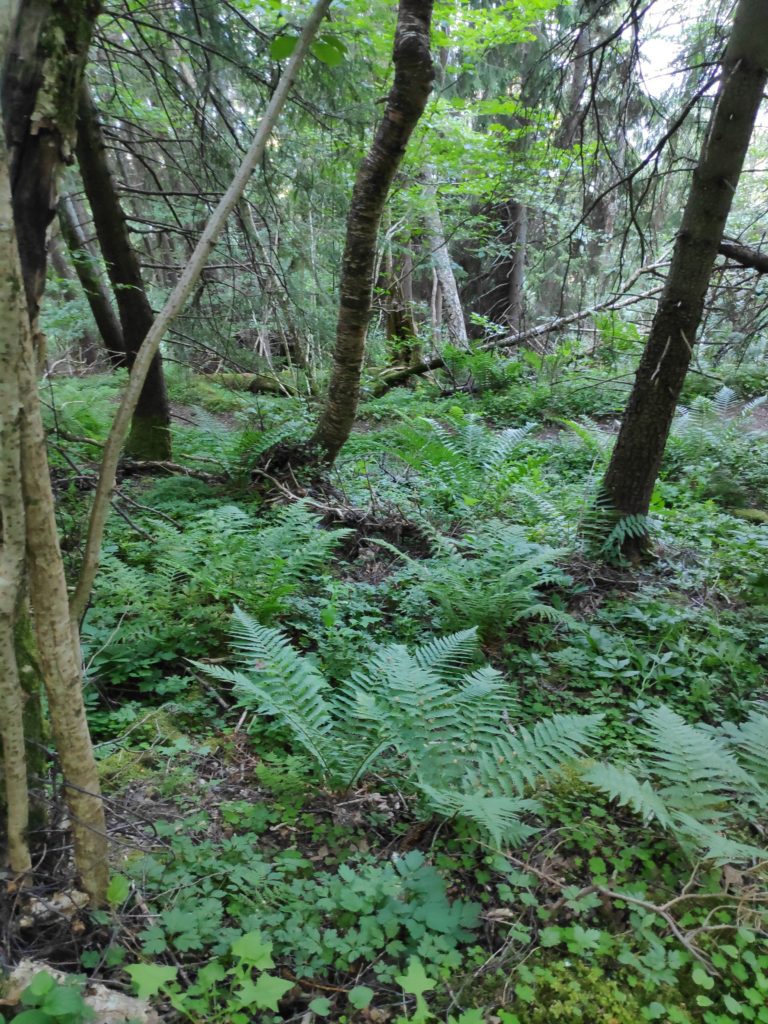
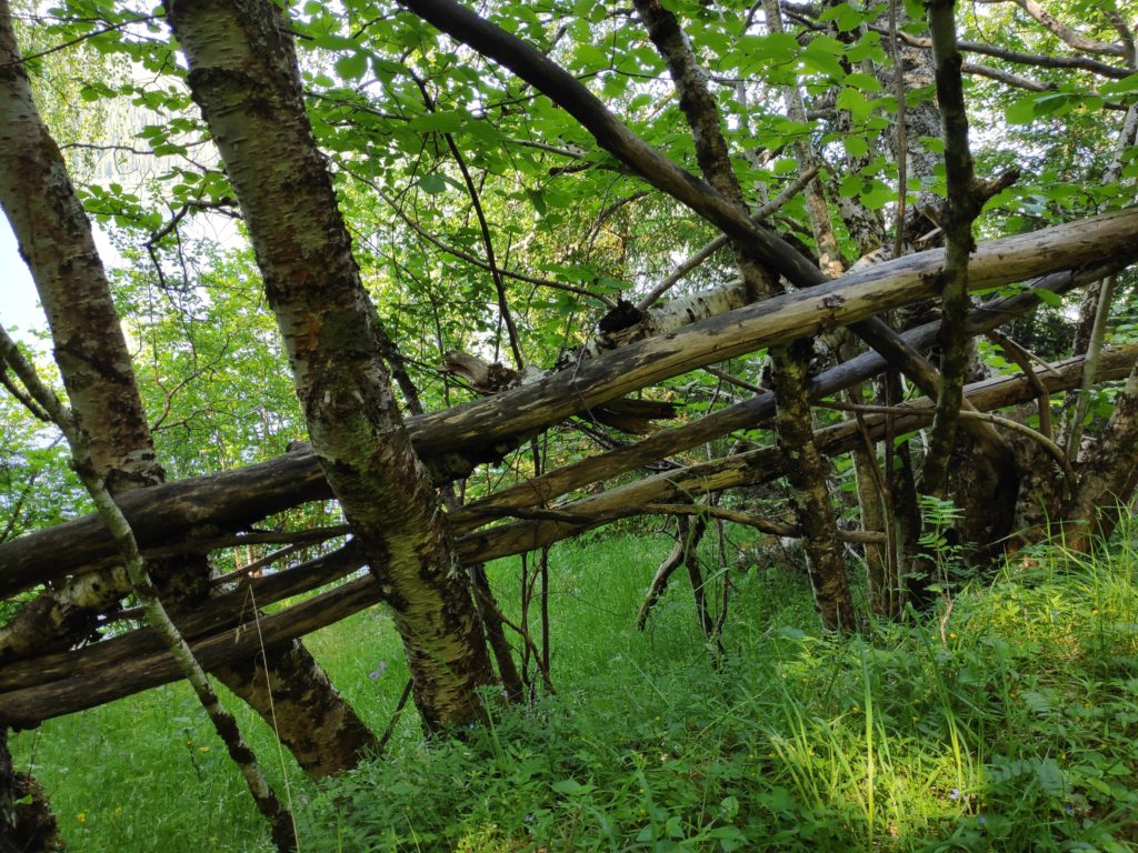
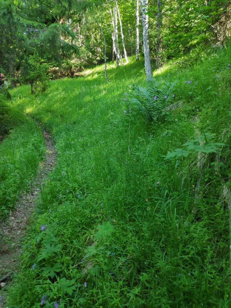
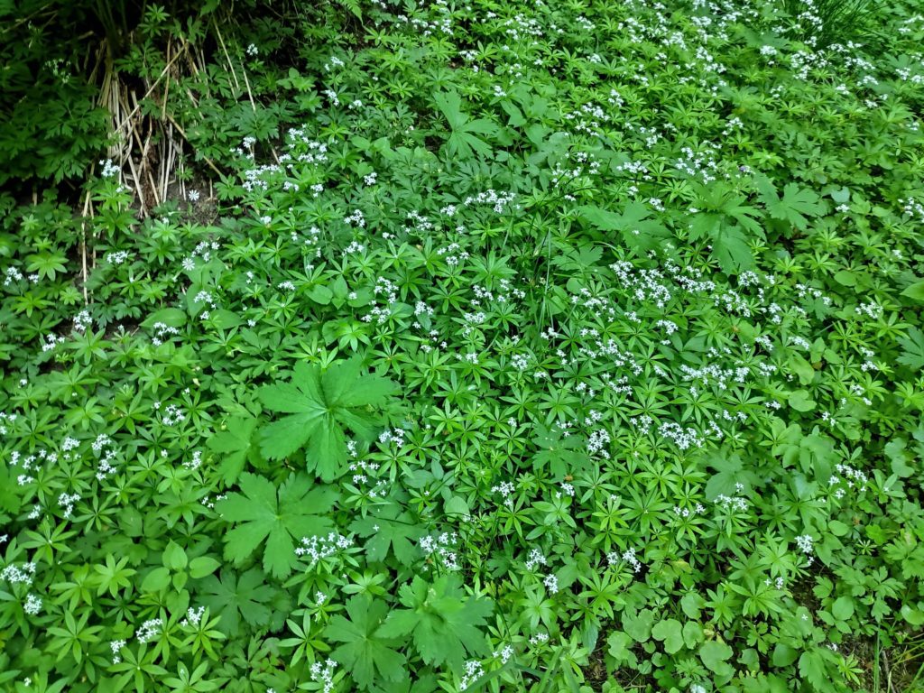
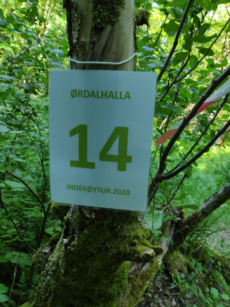
Picture taken 26 June 2018. Two years ago there was a much richer blooming. This also shows the immense size of the bush.Even in the woods there can be many directions to go. Downhill, i.e. straight ahead, leads down to the fjord, which is where we went today. The path that goes off to the right in the picture goes along the hillside, to where there are several cabins and a road that would take you to civilization. The path that goes uphill to the left, leads to the remains of a human dwelling from a century or more ago. Also note the box on the tree in which there is a book to write one’s name in.We walked down to the fjord where we rested and drank water. We had done the easy part of the walk so far, mostly downhill. Now we just had to climb back up to the level of the sign for the nature reserve and the level of where the car was parked.Undergrowth under the tall trees.It seemed like nature was making a bit of a fence so that walkers did not fall down the steep slope.The path is easy to follow and there is lush vegetation in the shade of the trees. I often take pictures when climbing up the steep slopes. It’s a good excuse to stop for a minute or two and get my heart slowed down.Galium odoratum. The Norwegian name is myske and the English name is sweet-scented bedstraw or woodruff. It grows where there is very little light and covers the ground.The check-in point – 40 points for this more challenging walk.
The nature trail that starts in Vangshylla goes all the way to Straumen. What can be driven in a car in 12 km, will be 19 km if you decide to walk along the trail. I have never done the whole trail all at once, but I have done most of the trail, in easier portions.
Vangshylla used to have a ferry in order to cross to Mosvik. Now it is mostly a small boat harbor and there is a building where you can rent accomodation or a small fishing boat. There are about 30 cabins in the area and about 10 houses with full-time residents.In 1991, the ferry was replaced by a bridge that spans Skarnsund. The bridge is just over one kilometer long. We moved to Vangshylla in 1988, just as they were starting to build the bridge.
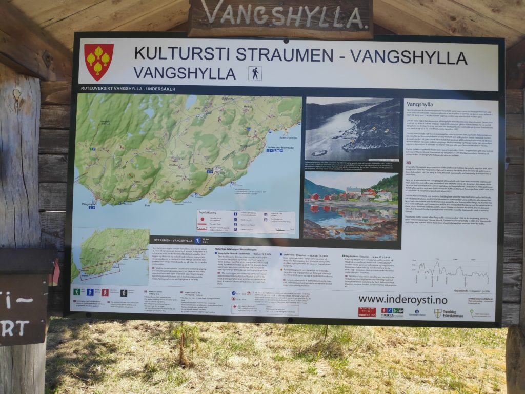
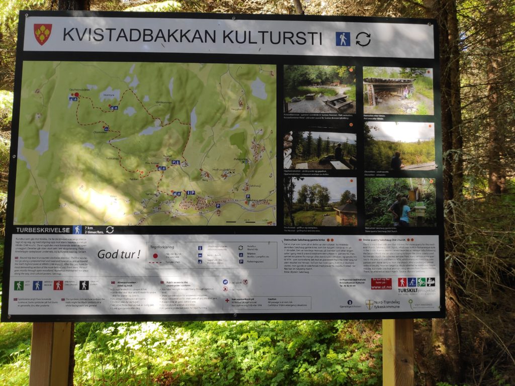
As usual, there is an information board, with a map and some information about things along the trail.
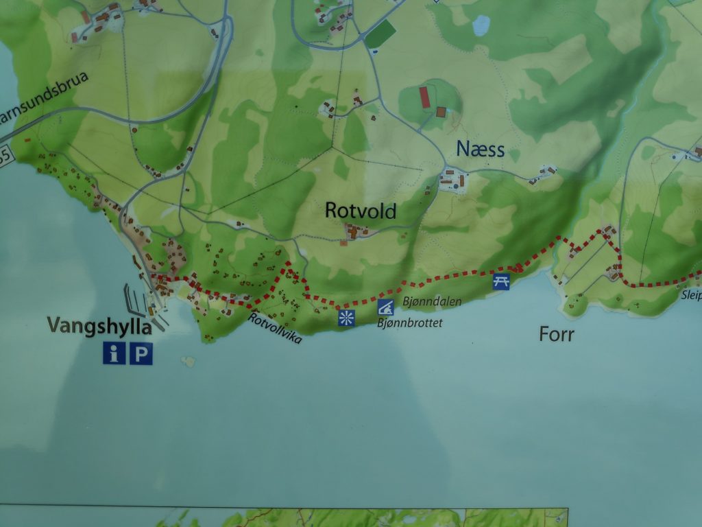
The information board at Vangshylla about the culture trail from Vangshylla to Straumen.
The term “culture trail” (kultursti) indicates that there will be information along the trail, either about the animals or plants that are there, or human buildings that are still there or used to be there. There can be information about how the place got its name. The idea is that you are supposed to learn something as you walk along the trail.
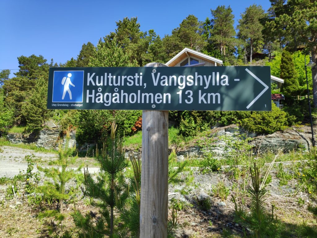
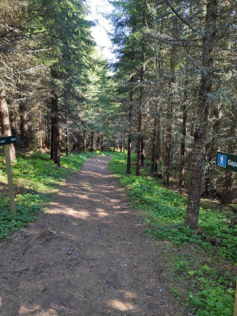
This sign is at the beginning of the trail and you can just see a cabin behind the sign. The main part of the trail is 13 km, but since this sign was made an additional 6 km have been added at the Straumen end of the trail.
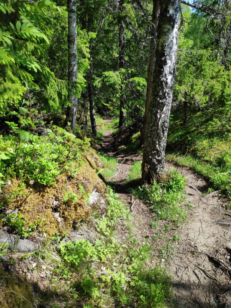
When starting at Vangshylla, the trail first follows a road that goes both to full-time dwellings and cabins that are only occasionally lived in. The trail is considered to be of medium difficulty.
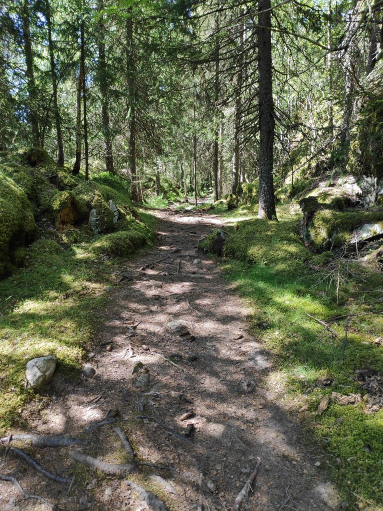
This picture was taken a while ago, after a rain shower, and before the trees had their leaves out.Much of the trail goes through the woods and is pleasantly shady on a warm June day. Notice that the trail is well-used and the tree roots make the surface very uneven.This shows a close-up of the map showing the section from Vangshylla to Forr. I usually walk to Bjønnbrøttet which this year is a check-in point for Inderøy walks. The red dotted line is the trail and the small black squares are the houses or cabins. There are quite a few cabins in this area, in the woods and overlooking the fjord.The trail can be quite steep at times. Here it goes quite steeply down into a ravine.
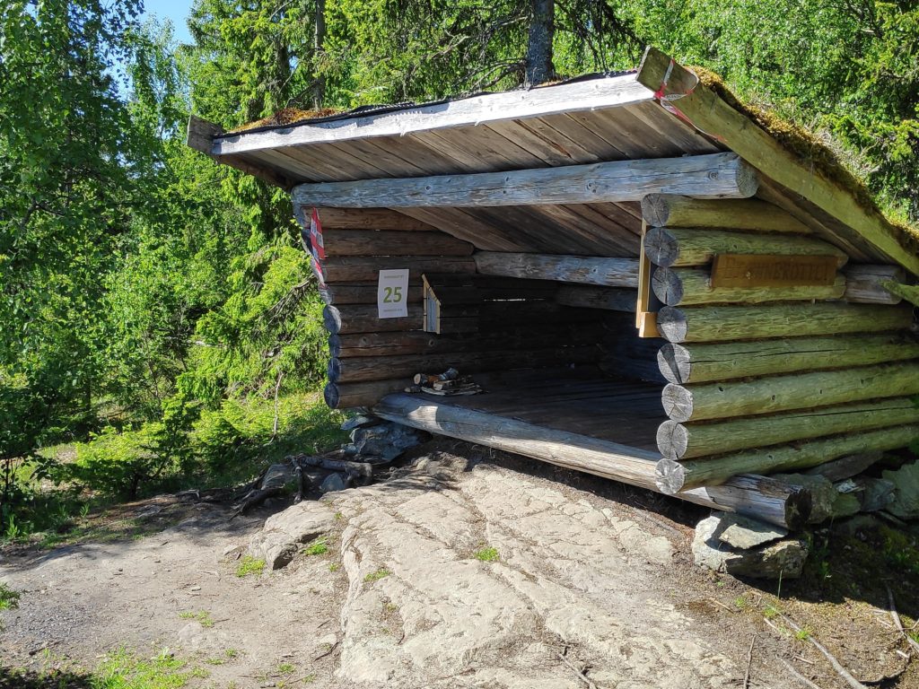
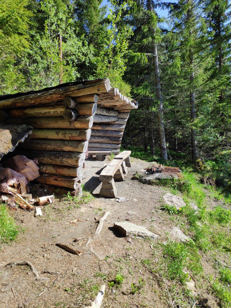
The goal for today’s walk was a shelter that has been there for many years. I have been taking this walk for most of the thirty years that we have lived here. Things have changed during this time, but I continue to enjoy the walk that is partially through these shady woods.
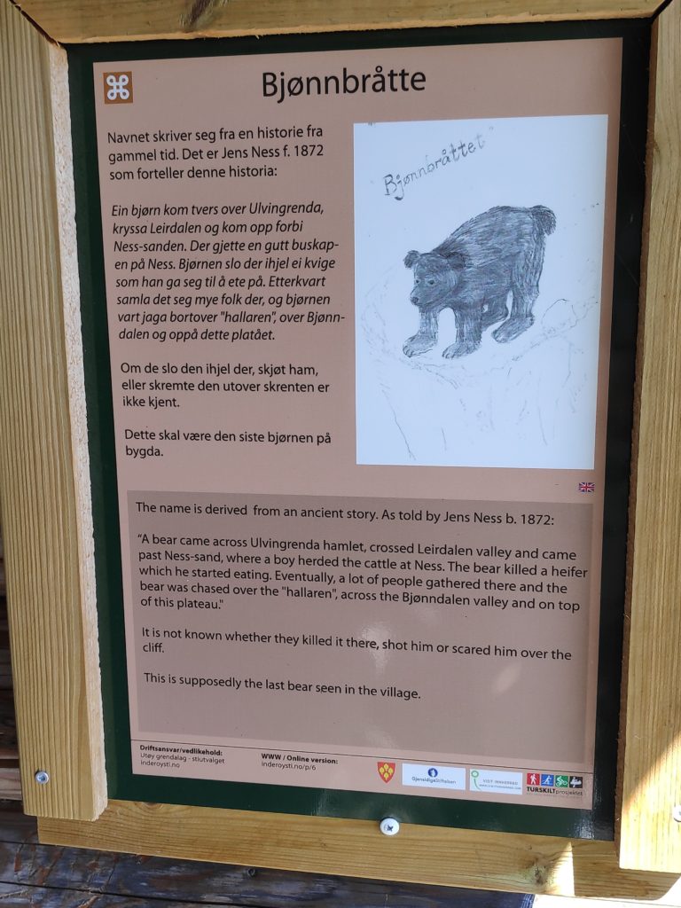
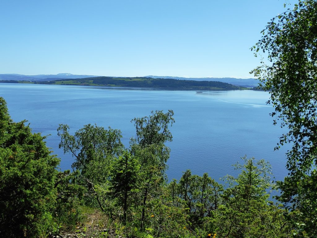
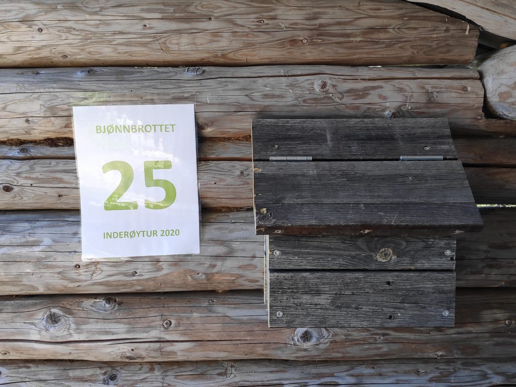
The shelter for post 25, the goal of today’s walk.This sign inside the little shelter explains how the place got it’s name. The story is in both Norwegian and English.The view from the shelter, looking across Trondheim Fjord, towards Ytterøy, which is in Levanger municipality.The sign indicates which post one can check-in to here, and the dark box has a book in which you can write your name. The book is out all year and some people like to count how many times they visit this location.
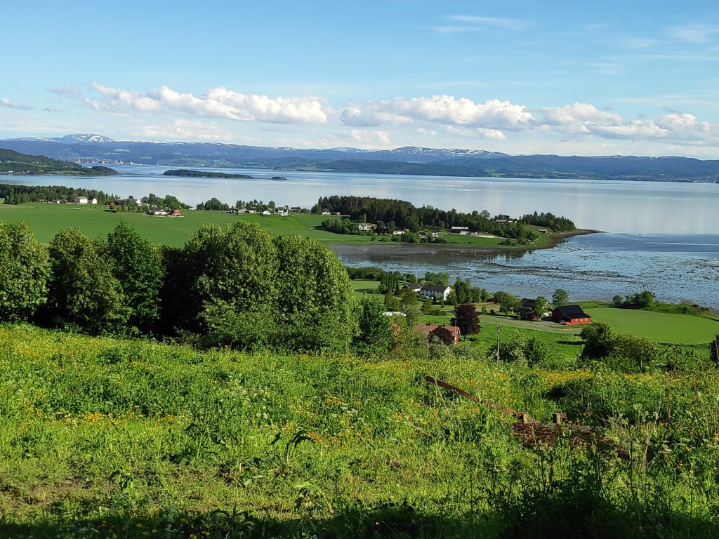
Today’s walk started from the main road to Straumen and was basically uphill the whole way. We started with some fantastic views over Trondheim Fjord toward Verdal and Levanger. We picked a nice evening for our walk, between about 16:30 and 18:00. The temperature was about 17 degrees C.
View from Volan, looking over Sundnesnesset towards Verdal and Levanger. There is now very little snow left on the mountains in the distance.
Though the first bit of the walk follows the road to a farm, we were soon in the trees, so that even though we were climbing uphill, it wasn’t too warm.
This part of the path was very pleasant to walk along and we could walk at least two abreast. You can also see some of the signposts on the trail, indicating that this is a blue trail, which means it is of medium difficulty.
Near the top of the trail there was a map which indicated all of the main trails in this part of the municipality. We chose to just head back the way we came as we wanted to get back to our car, but there are lots of possibilities of taking round trips through the woods, especially for those living in the area.
Map of the trails in this part of Inderøy. We walked up from the farm named Volan.
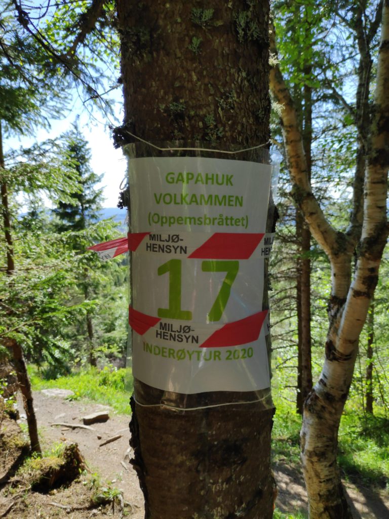
The goal of our walk was a “gapahuk”, which is a little shelter, often built with a view and usually made out of wood. There will be a roof of some sort. They can be very small or quite large. This one had a little iron stove in it and a place to have a fire. It was nice to sit down for a few minutes on the benches and rest after our climb up the hill.
Gapahuk at Volkammen or Oppemmsbråttet
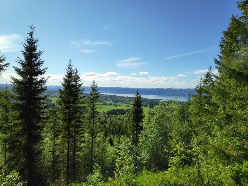
The view was nice too as we had come over the top of a hill (“kammen”) and were looking in a different direction and seeing a different fjord. The word “bråttet”, in the name Oppemsbråttet, means that there is a cliff and very steep downhill.
View from the shelter, looking northwest towards Beitstad Fjord.The sign to say we had reached a post for the Inderøy walks.
Being thankful for what I have is actually easy for me. Being aware of what I actually have to be thankful for, can be more challenging. What we have, we take for granted.
I like to thank people for the small services that they do for me, whether it is washing the dishes, or driving me somewhere. I also like to thank people that go for walks with me.
Most important is to actually be thankful for all the little things each day and not get upset when life isn’t perfect and there are things that go wrong. What I need to practice is noticing what I have to be thankful for.
I hope you can find several things to be thankful for.