Inderøy Walks 2024

InderøyTur = Inderøy Walk

General information

This is the 19th year in a row that Inderøy Walks have been arranged. This is a cooperation among many local organizations including sports clubs, the municipality and many volunteers. Inderøy has a lot of walking trails and only some of them are marked as Inderøy Walks. In 2024, there are 50 posts. 14 of them are suitable for those with reduced abilities to get around. As in previous years, it is possible to park the car and go for longer walks where one can check in to more than one post. (Rough translation from Norwegian of the introduction on the website).

Information printed in our local newspaper, on Friday, the 10th of May, the day before the competition official opens.

In the local newspaper, the municipality has been divided into seven areas, so that there are several walks available in each area. We live in the area called Utøy. Our local newspaper printed a list of the 50 posts. Those in red are accessible for those using a wheelchair or pushing a stroller. Those in blue are walks accessible to an elementary school.

Today, the 11th of May, was the first day of the Inderøy Walks 2024 and the competition is open until the 2nd of November. I don’t really want to compete with others, but I enjoy having the app on my phone and different places to go walking to and explore. For me, it is mostly about getting somewhere interesting, perhaps somewhere I haven’t been to before, and getting a reward for getting there. I never have the goal of trying to get every post, but I do try to get to some from each area of the municipality.

Saturday’s Walk

As it was forecast for rain later in the day, I decided to go as soon as I was up for the day, shortly after 6 am. It was nice walking weather, partly sunny, no wind and about 9 degrees. I chose to go to the two posts that are easiest to get to from home without driving.

General information about the cultural path (kultursti) between Vangshylla and Straumen, as well as some specific information about Vangshylla, including an aerial photo from 1953.

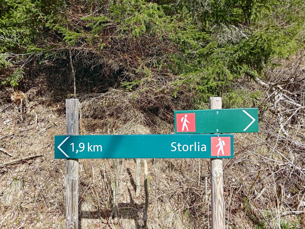
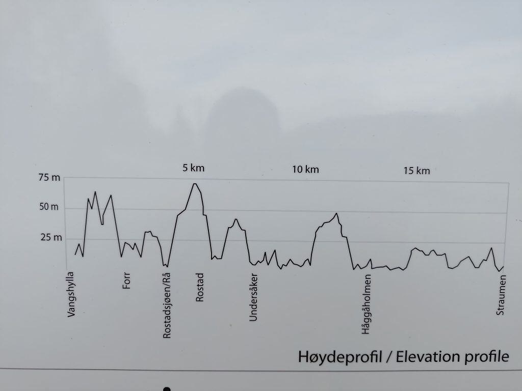
The walk I went on is part of the municipal cultural walk from Vangshylla to Straumen which is about 20 km along this path through the woods, though the driving distance is about 12 km. I only went a short part of the whole walk and then returned partly the same way.

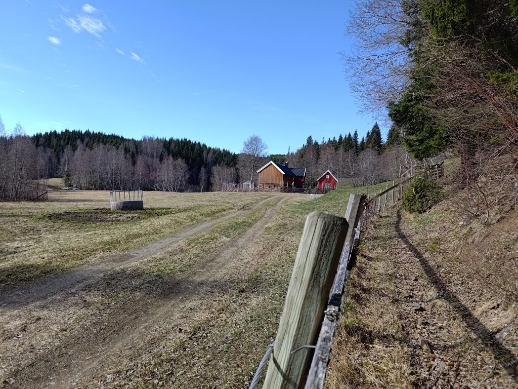
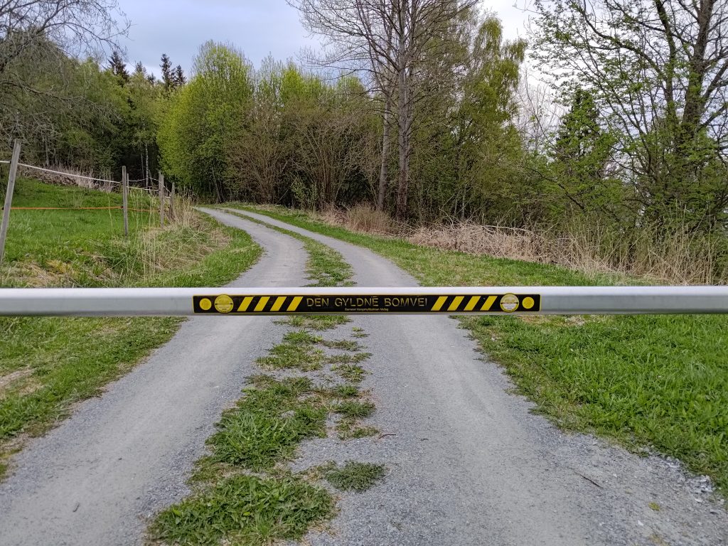
We live in an area that has a lot of leisure cabins, mostly used during the summer months. So I often use other paths than if one started at the parking area at Vangshylla. The first part of the walk for me is along a dirt road that leads to one year-round dwelling, one farm and a restricted-access road.

This is called “The Golden Toll Road”, but is really just a private road that only the cabin owners have driving access to. There is no problem walking around the barrier.
Welcome to Vangshyllbakkan road cooperative. The barrier is to always be closed. Parking is only allowed in marked places and is forbidden on the roadway. Vehicles without a visible parking wafer can be towed away at the owner’s expense. Driving with a heavy load or heavy machinery needs to have special permission. (“Vangshyllbakkan” is the name of the road.)

We have lived in our house for over 35 years and during that time I have walked these trails many times and seen many changes. Often after the winter, there can have been damage in the woods, both from loggers and from storms. I had been along part of the trail once before this spring, but not the whole way to Høghalleren.

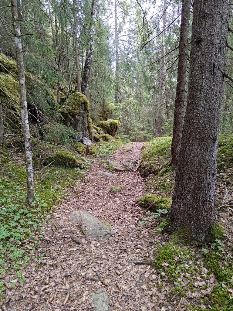
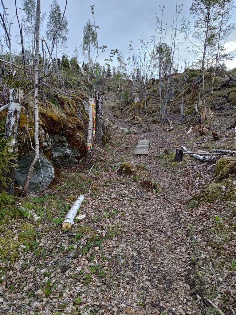
Once I was away from the cabins, the trail went into the woods with various types of trees, but primarily spruce, birch and rowan, as well as hazel, willow and pine. The trail goes down at this point and one has to walk carefully. It is quite easy to see the trail as it is well used.

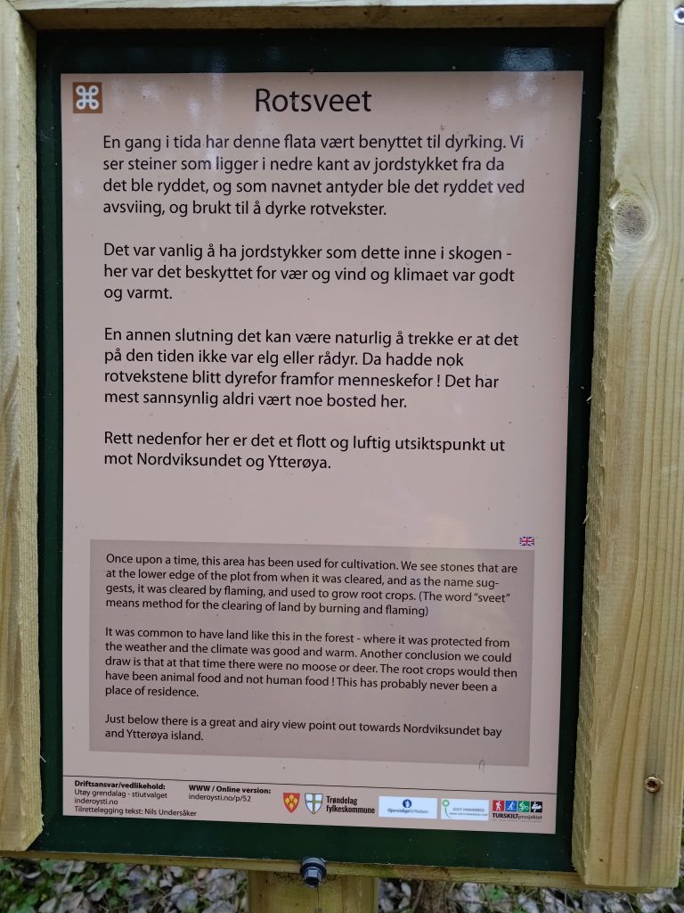
As mentioned, this trail is a “cultural” trail and there are a lot of information signs along the way. They have been printed in Norwegian and English. Most of them give historical information about what the area has been used for.

The view from “Rosveet”, looking towards the island of Ytterøy. Don’t get too close to the edge as there is a sharp drop down to the water.
This is called a “gapahuk” in Norwegian and is a very small shelter, usually made from logs. The white sign shows that I have come to post 19, so I checked in. There is also a book in the box on the wall which I wrote my name in.

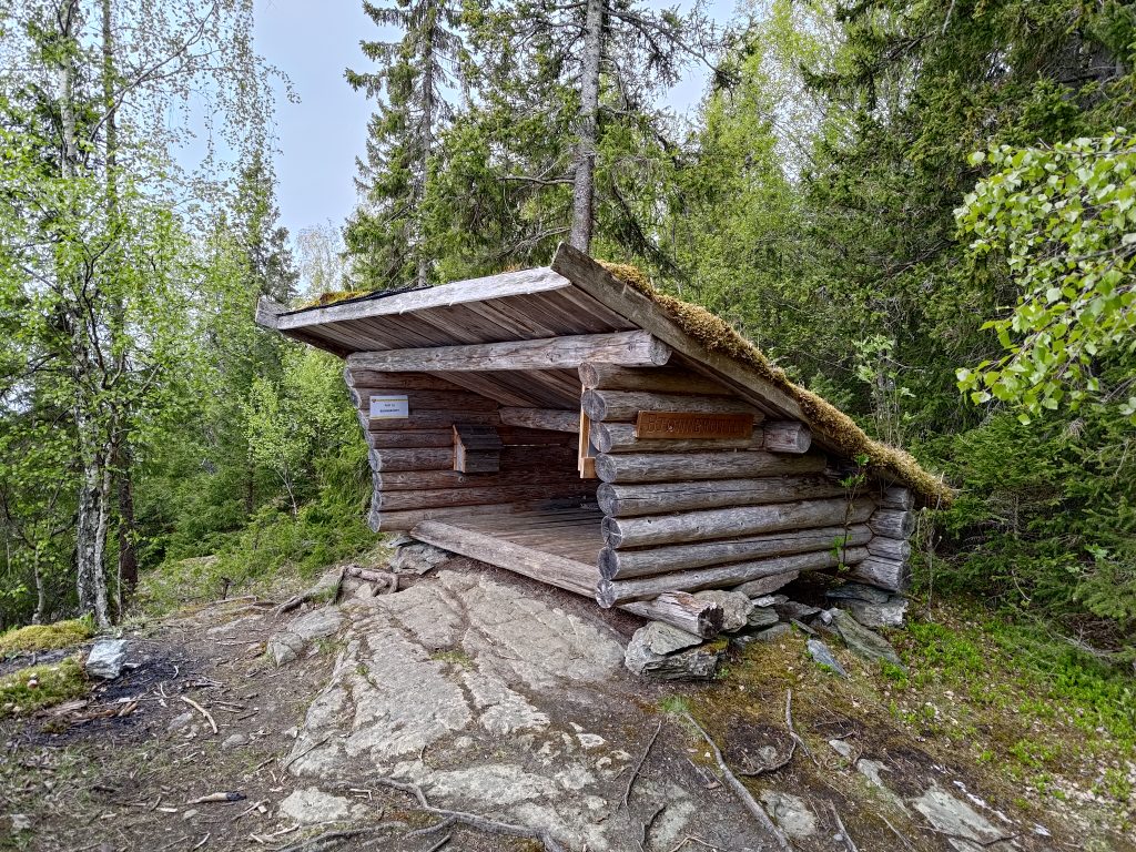
I got to the first post at Bjørnbrottet (Bear Cliff) about 20 minutes after leaving home, but I wanted to continue on and visit one more post. What surprised me as I continued on was the changes since I had been here last summer.

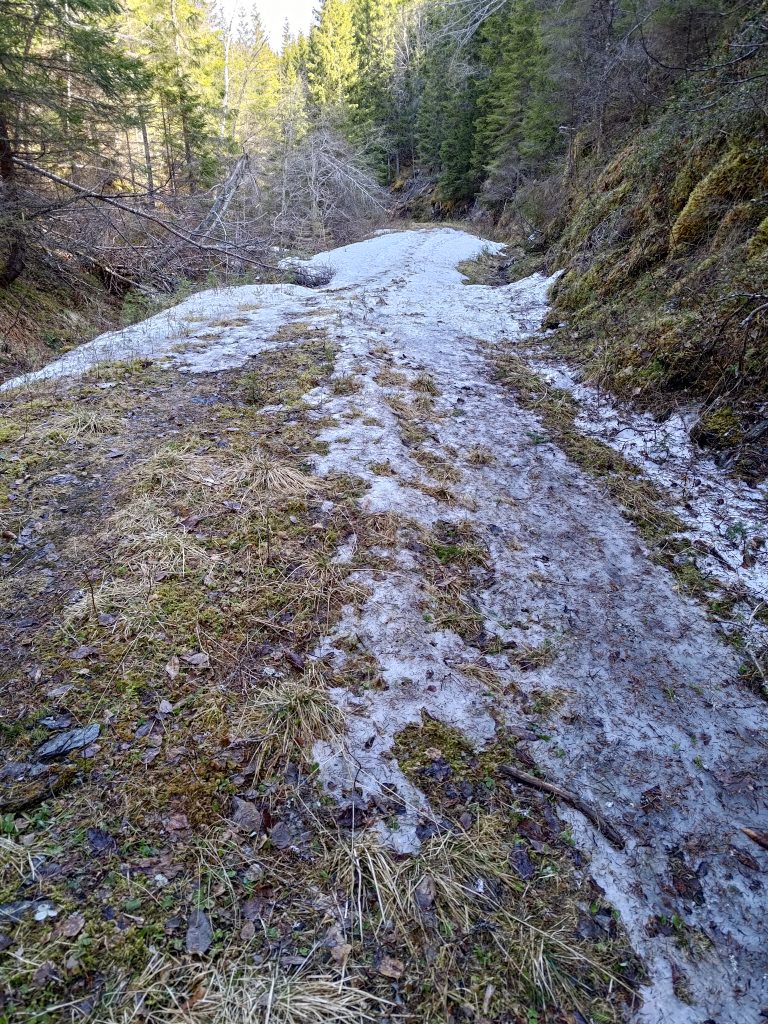
But first I had to go down a very steep section of the trail. Where the trail seems to end, it actually goes down quite a steep slope.

This was on the information sign at Vangshylla and shows the changes in elevation along the trail. I am walking along the trail from the left and go the the first three peaks before “Forr”. Forr is basically at sea level.
Looking back up the trail I had just come down. It’s a bit narrow.

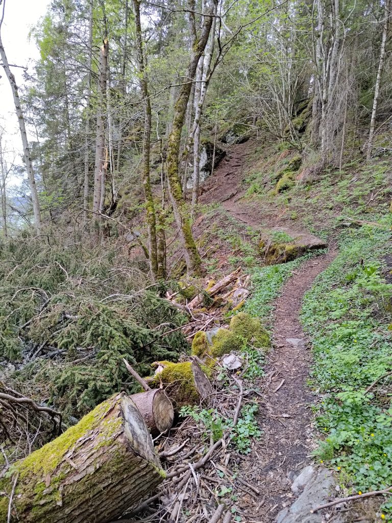
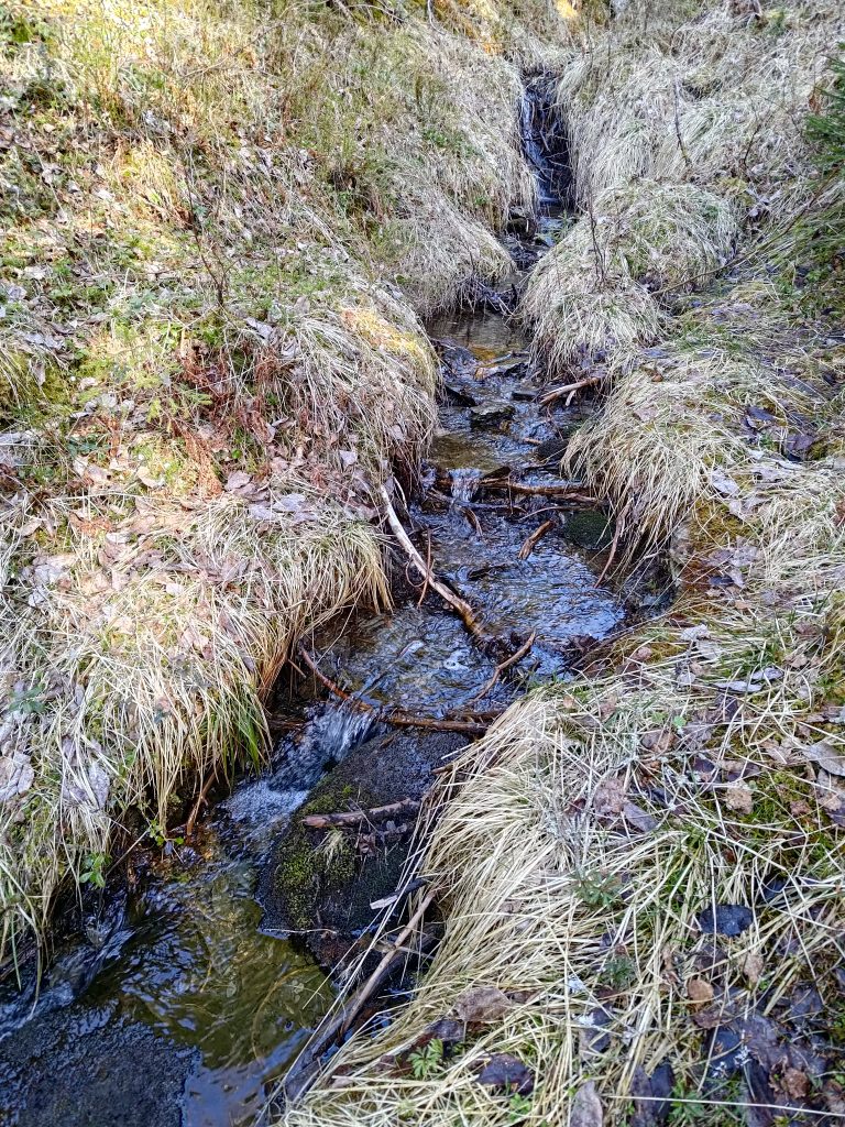
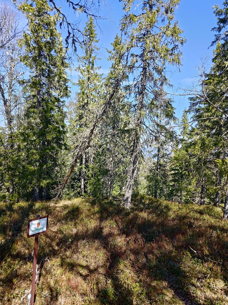
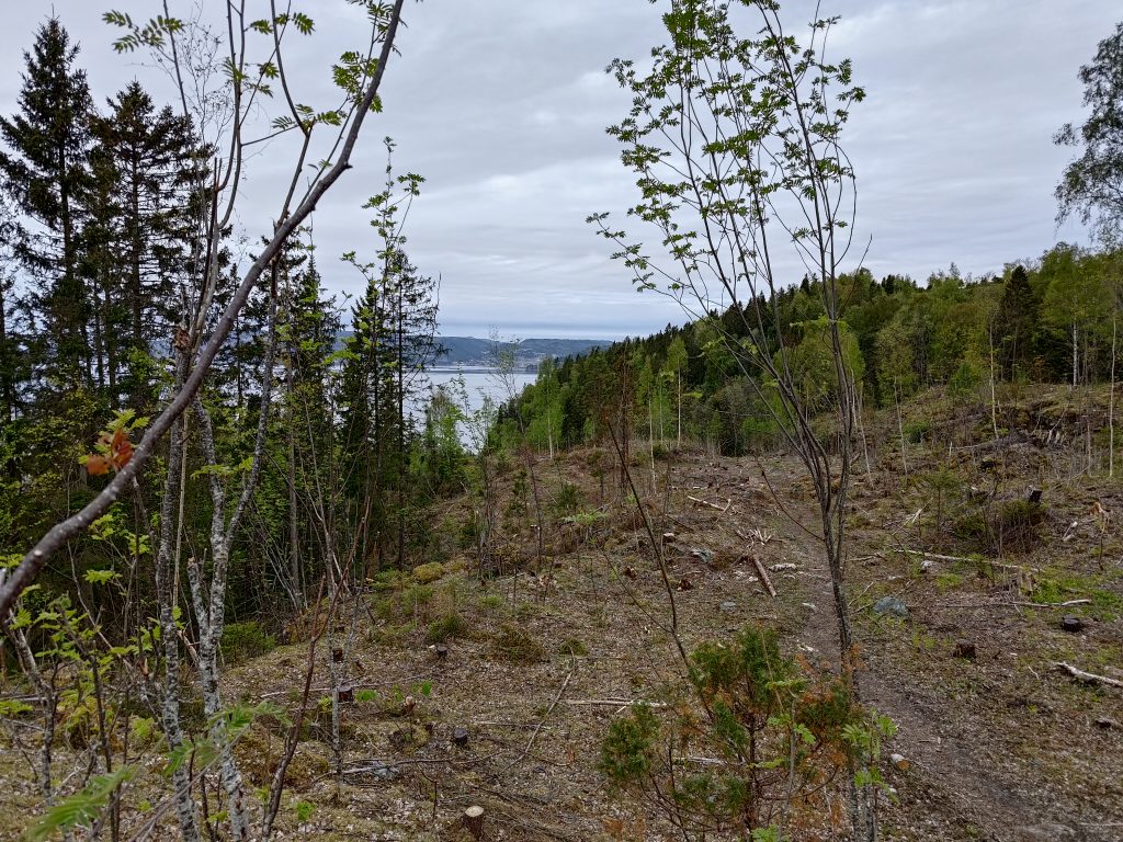
From this point on, I started noticing quite a few changes. Even in the picture above you can see how there are a lot of branches on the left hand side of the picture. There had been a very large tree that had toppled over in a bad storm during the winter and it had been cut up a bit to clear the pathway. Spruce trees have very shallow roots and are very susceptible to being blown over with their roots in the air. I continued on, crossing a small stream and came out into an area that was much more open than the last time that I had walked here, sometime last summer. All this land will be privately owned, so access to the trail has to be agreed on with the landowners.

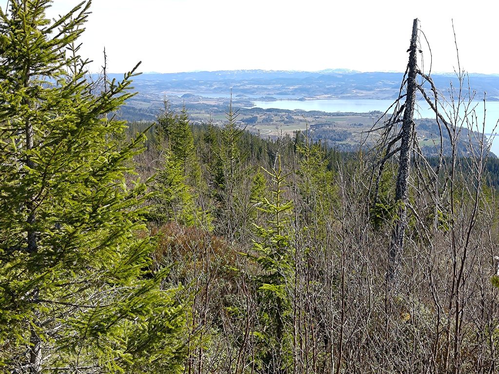
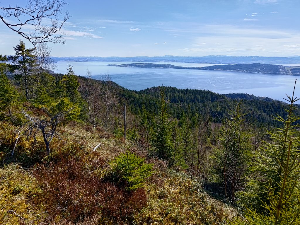
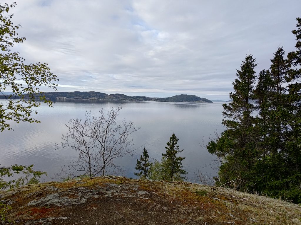
When we first went walking here 35 years ago, this was a densely forested area. It was logged after several years, so the forest that was growing here was probably only about 30 years old. Once again it has been logged, though it definitely gave some gorgeous views out over the water.

Loggers have been at work here and the trail is seen going over a very open area. This is a fairly flat area, so not too difficult to log. To the left in the picture, the slope gets very steep and the old trees have been left. The trees would mostly have been quite small, so are perhaps going to be used for either firewood or the central heating system in Straumen.
Back into the old forest and one can see that trees have broken in the wind, or been knocked over by another tree.
This tree had suffered in the winter’s storm.

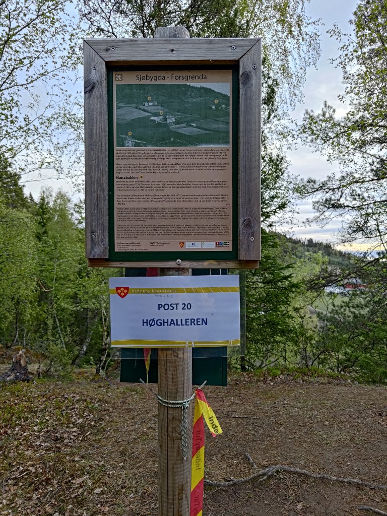
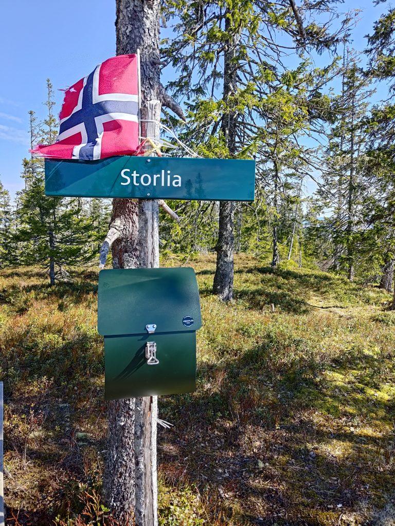
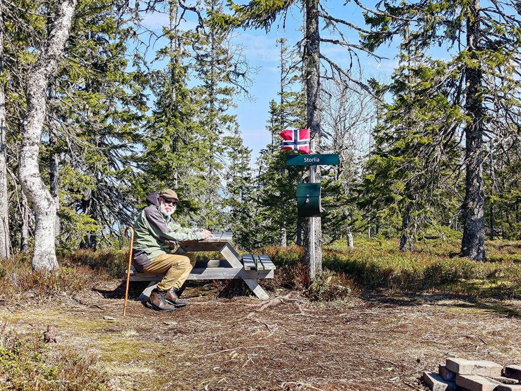
I reached my second post, no 20, at Høghalleren, about 20 minutes after the first post. I had spent a bit of time taking photos along the way. There is a picnic bench here to take a rest, and the mailbox on the back side of this post has a book in it to write one’s name. The view is very nice from here.

The cliff goes very steeply down here, so I’m very careful to not go too close to the edge. The tide was low when I was here. This view is taken looking southeast, with the island of Ytterøy first and Verdal in the background.

Even though I was walking on my own, I really enjoyed having a walk early in the morning. I used about one hour and twenty minutes for the whole walk, but I stopped quite a bit to take pictures. I took about 45 pictures on the walk and you have seen only some of them. I will be doing this walk several times over the next few months and I need to remember that I enjoy early morning walks. As predicted, it started to rain later in the day, so I was out in the best part of the day.

I plan to go on more of the Inderøy Walks in the coming weeks and hope to be able to share my experiences with my readers.

Storlia on the 1st of May, 2024

May in Norway is full of holidays and the first of May is the European Labor Day. Stores are closed and even though we are retired, it was nice to have a day-off household chores. In addition, the weather was sunny and promising to be warm, up to 20 degrees in the afternoon. So my husband and I decided to use the early part of the day for a longer walk and chose to climb the hill in Mosvik that we see from our house. It’s called “Storlia”, the big hill. The car is parked at about 130 meters above sea level and we get to about 380 meters above sea level, so it’s a bit of a climb. It’s good exercise and the views are beautiful on a sunny day.

View from partway up Storlia, looking southwest through Nordviksundet.

As usual, I started by taking a map of the area. We parked at Gammelplassen (the old place), which is marked with a red arrow on the map below. There are a lot of trails on these hillsides. Many of the trails would have originally been logging roads. Some are still wide enough for two people to walk abreast. Other trails are quite overgrown. The red line on the map shows some of the major trails that are marked. But there are dotted black lines that are also good trails that can be followed.

The map at Gammelplassen
Gammelplassen

Gammelplassen is large enough to hold several cars. When we arrived we were the only car there, however when we came back to our car, there was one other car there. Notice the signpost on the right hand side of the picture. That is showing you the direction of Skarnsund Bridge if you are walking. It’s a nice walk and I have done it several times from home, but today we wanted to climb a hill. Gammelplassen is about 2.3 km from the bridge.

The road going uphill from Gammelplassen

The first part of our walk, which is actually climbing uphill for about an hour, is along this dirt road which leads to a small farm. At this point you can see that the marked “red” trail from the map takes off to the left. We are going straight ahead. These trails are marked with red hikers, indicating that the trail is of some difficulty. In other words, uneven and often steep terrain.

Only 1.9 km to go, but it will take us about an hour as it is a steep climb.
The small farm at the end of the road. I have seen cattle grazing here, but the gates were all open. It’s too early in the year for animals to be outside grazing as the grass is just starting to grow. The buildings are probably used as a leisure cabin and the fields rented out to the nearest farmer.
One of the steeper sections of the trail, with my walking companion a few meters ahead of me. He goes faster than me uphill.

We could hear a lot of birds talking to each other. I’m not very good at recognizing the birds from their sounds. However, I heard the sound of water near the trail. It’s not long since we have had rain, so there was a fair bit of water in the stream. In addition there is probably still some snow to melt.

A small stream along the trail
This section of the trail was still covered in snow and ice and was tricky to walk along.

It is always tricky to know when the trails will be free of snow. We could feel the temperature change as we came into this section of the trail that probably gets very little sunshine. It felt like the temperature dropped three or four degrees. In the sunshine it was lovely and warm, but the snow itself would also make the temperature drop. We managed it fine, but when we came to a second section of snow that was much longer, we almost turned back to wait for another day. But then I saw a very small trail, possibly human, but definitely used by deer or moose. We decided to try it and see where it went.

The trail may not look like much, but we decided to try it and so avoid a trail with a lot of snow on it.

It was interesting to try this trail which would its way around the hillside, slowly climbing. I had hoped that it would come out onto the main trail. A check on the map on my phone, which tells me where I am, said that we were going roughly in the right direction, but that we need to head upwards. So we did, climbing up steep slopes, that were partly covered with trees, partly open with grasses and heather. After a lot of work, but not impossibly difficult, we did actually reach the main path.

This picture was taken from our scramble up the hillside. You can see how the slope is mostly open but with some trees. It has probably been logged within the last twenty years. Ground cover was mostly heather and moss of various varieties. Trees were irregularly spaced so probably seeded by nature.

Thinking back on our scramble up the hillside, it was rather fun. We’ve done this sort of thing before and we both enjoy it. However, it is the sort of slope that is much easier to go up than to go down. So I said we had to take the main path down, in spite of the sections of snow and ice on them.

We made it to the top and were able to write our names in the book in the mail box. It’s always fun to come to places like this and find a Norwegian flag flying in the breeze.
There’s a picnic table to relax on while having a snack and enjoy the view. We were alone until we were about to leave when a man and his dog arrived.

We had a good break at the top. A bottle of water and two cookies each gave us the energy to find our way downhill to the car. I took a lot more pictures, of course, after all, the reason I like to come to the top is to look at the view.

Skavdalen Nature Reserve

To the northeast of the summit of Storlia is a nature reserve. This area has been made into a reserve because of the very old growth forest. Most hillsides near us have been logged every 60 to 100 years, so the trees are not really that old. You can see in this picture how the trees here are not very young and there is a lot of lichen on them. This nature reserve is on a north-facing slope, so will be very moist. It stretches from the top of the hill almost down to sea level.

Looking from Storlia eastwards to the peninsula of Inderøy. The snow-topped mountains in the distance would be in Verdal or Levanger. Deciduous trees do not have their leaves out yet, but with warm that can change quickly.
A beautiful day, looking southeast, across the island of Ytterøy to Verdal and Levanger.

The walk back to the car took a little less time than the uphill climb. But crossing patches of snow and ice also slowed our time as there was little crust on the snow, so one was suddenly in a hole, or one’s feet were sliding on the ice that had formed. We used about one and a quarter hours up the hill and about one hour down again. In all, we were walking for almost two and a half hours. Good exercise on a beautiful sunny day. But I may wait another month or so before doing it again, just to make sure all the snow has disappeared.