Easter in Norway, 2022

Though Easter is a moveable Christian holiday marking the death of Jesus Christ, in Norway this is a national holiday that no longer has anything to do with Christianity. Though Christians may attend church services, most people just see it as a nice break from work or school. Most people will have a five-day weekend and it is traditionally the time to either go to the mountains and have one last skiing trip, or head to the cabin near a fjord and get it ready for the summer season.

Thursday, Friday, Sunday and Monday are all days that are holy days and therefore most people will have the time off, unless they have a job that has to be manned 24 hours a day and seven days a week, like the police, hospitals and other health care services. Schools take the whole week off, so that children and students get ten days free. Stores are open on Saturday, but will often close a bit early so that the workers can also have extra free time. For example, my local grocery store has standard opening hours from 7 am to 11 pm but on the Saturday before Easter Sunday they will close at 4 pm.

I’ve never been keen on skiing, but getting into the woods and up a mountain have always been things I like to do. For me, this year, this is the week that my walking season has begun in earnest. Yesterday I took a one-and-a-half hour walk with my son and we covered about 5 km. However, I took no pictures yesterday so I won’t write more about that walk except to say that I really enjoyed it and I wanted to do more.

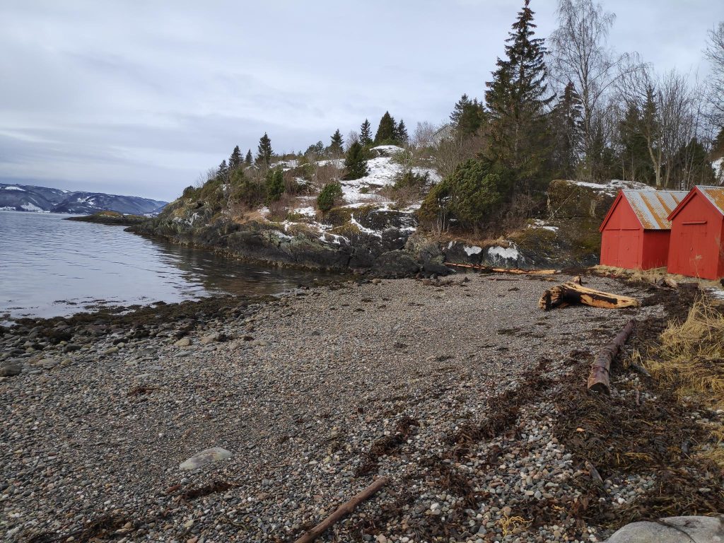
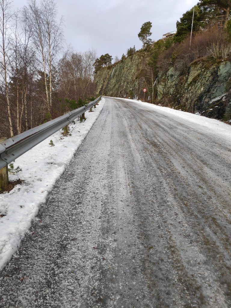
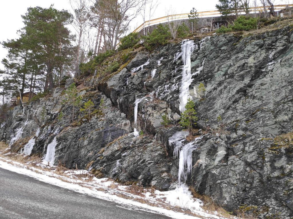
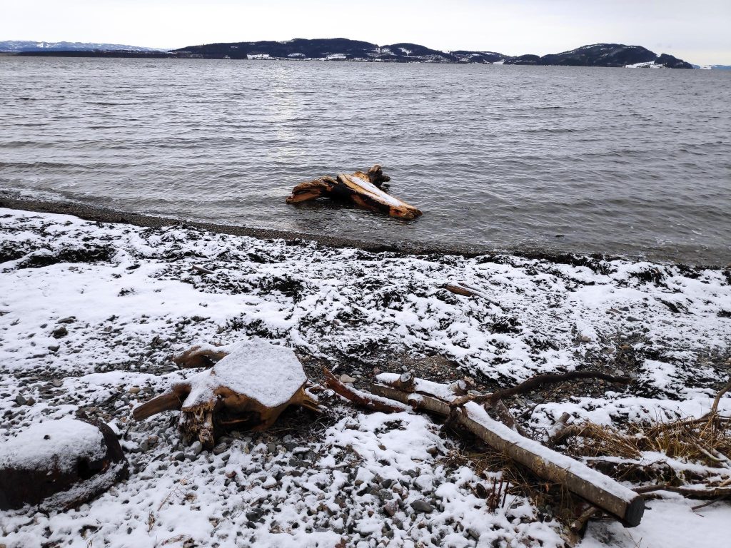
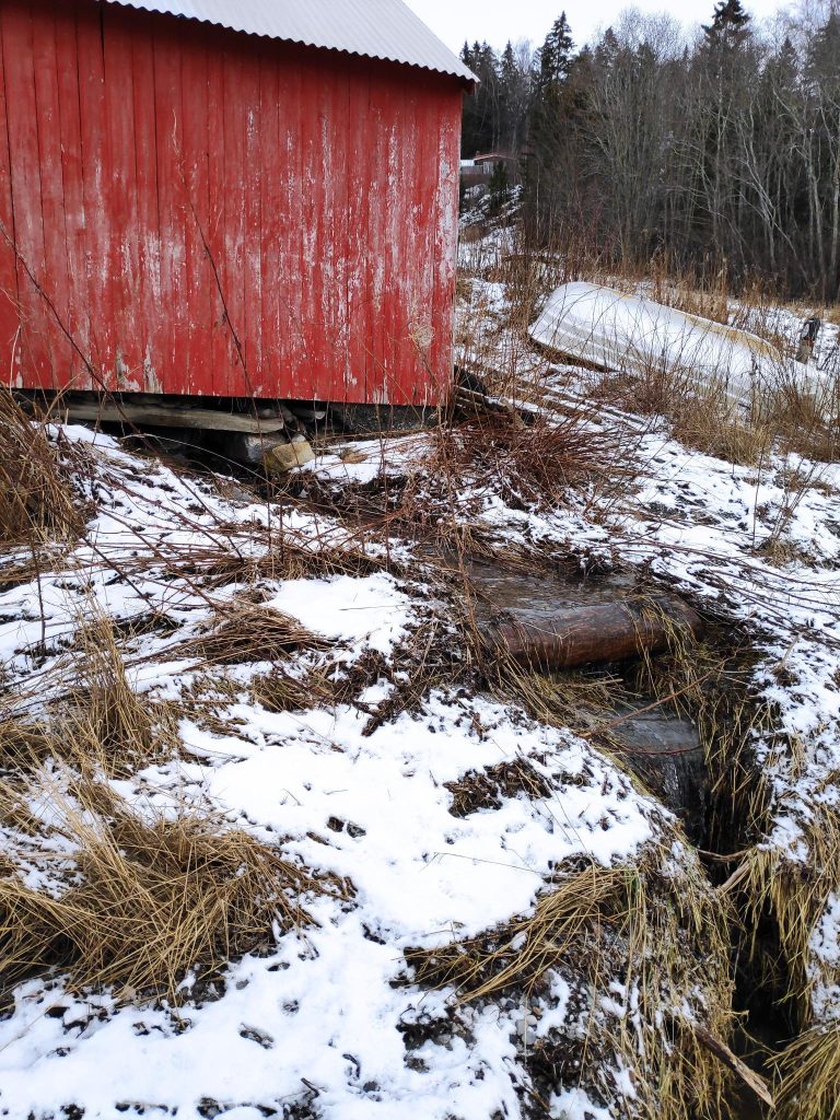
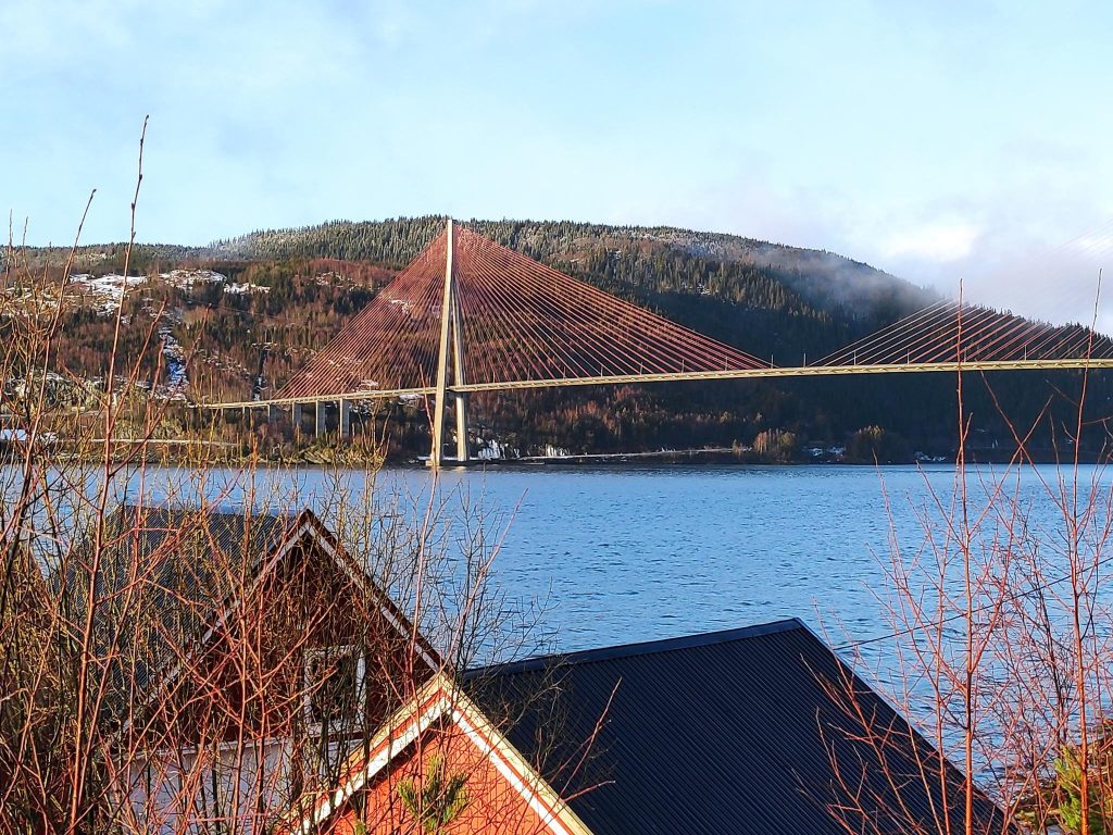
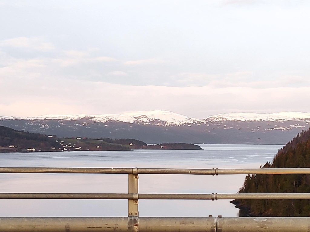
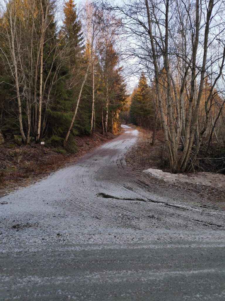
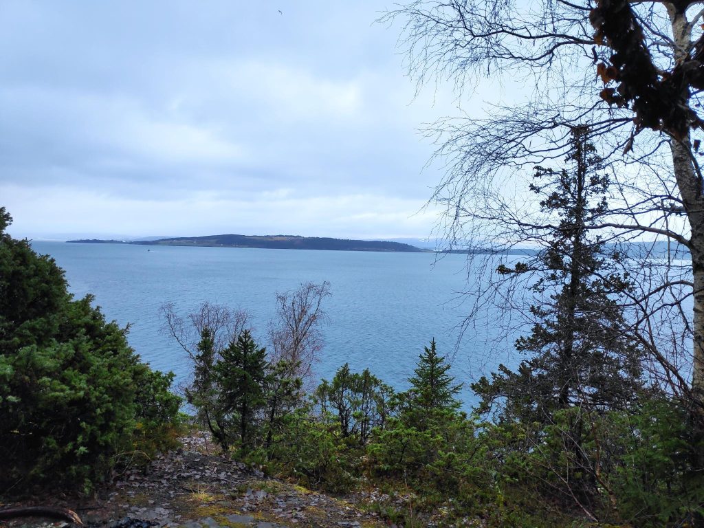
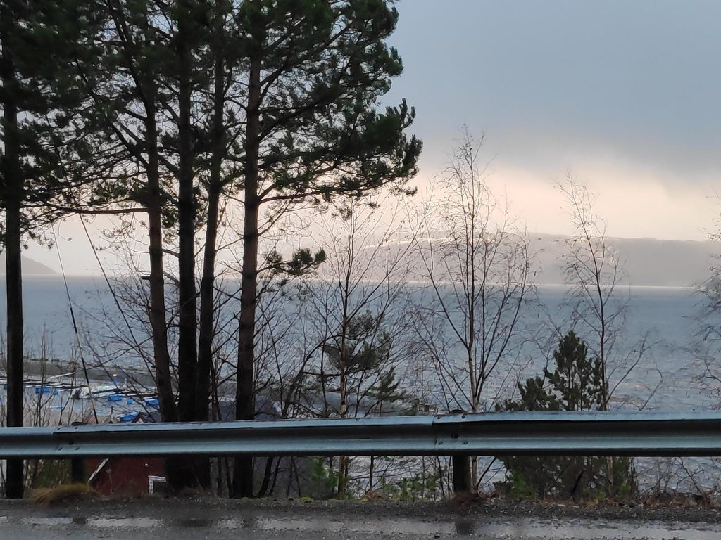
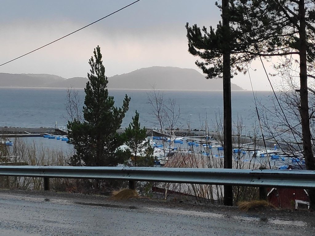
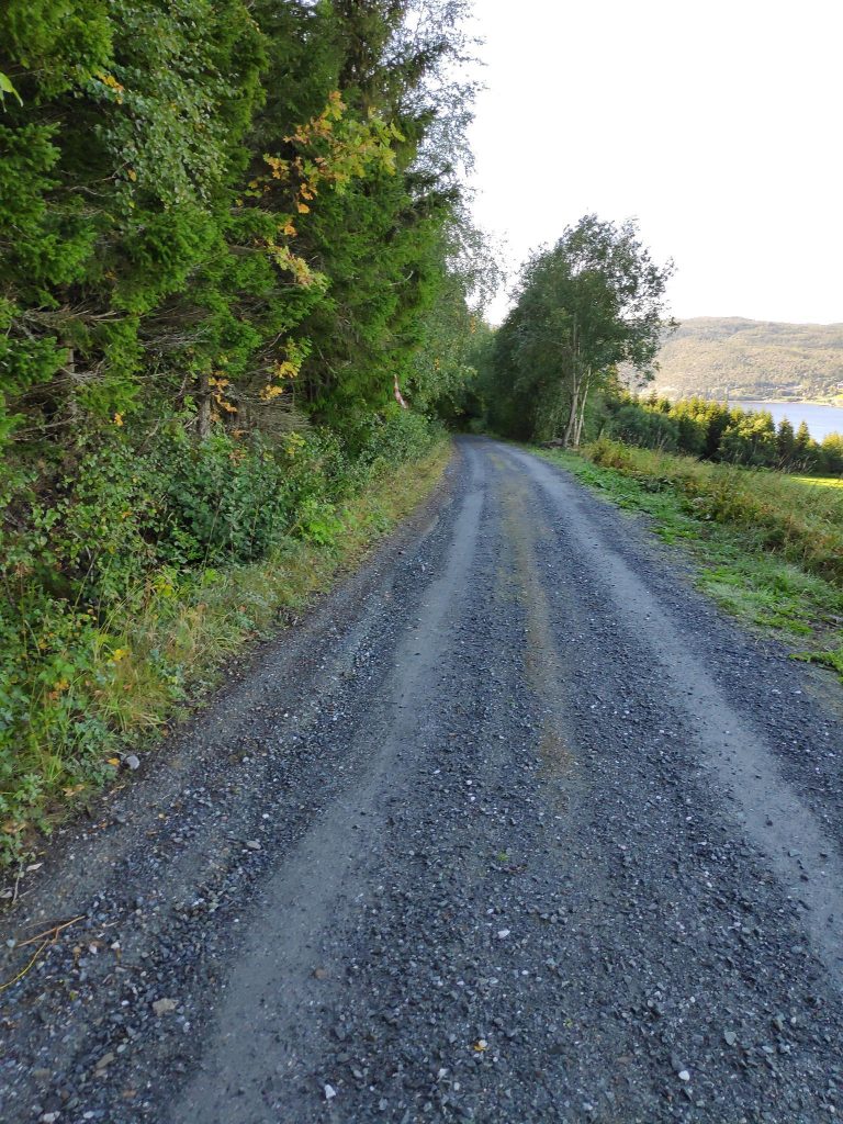
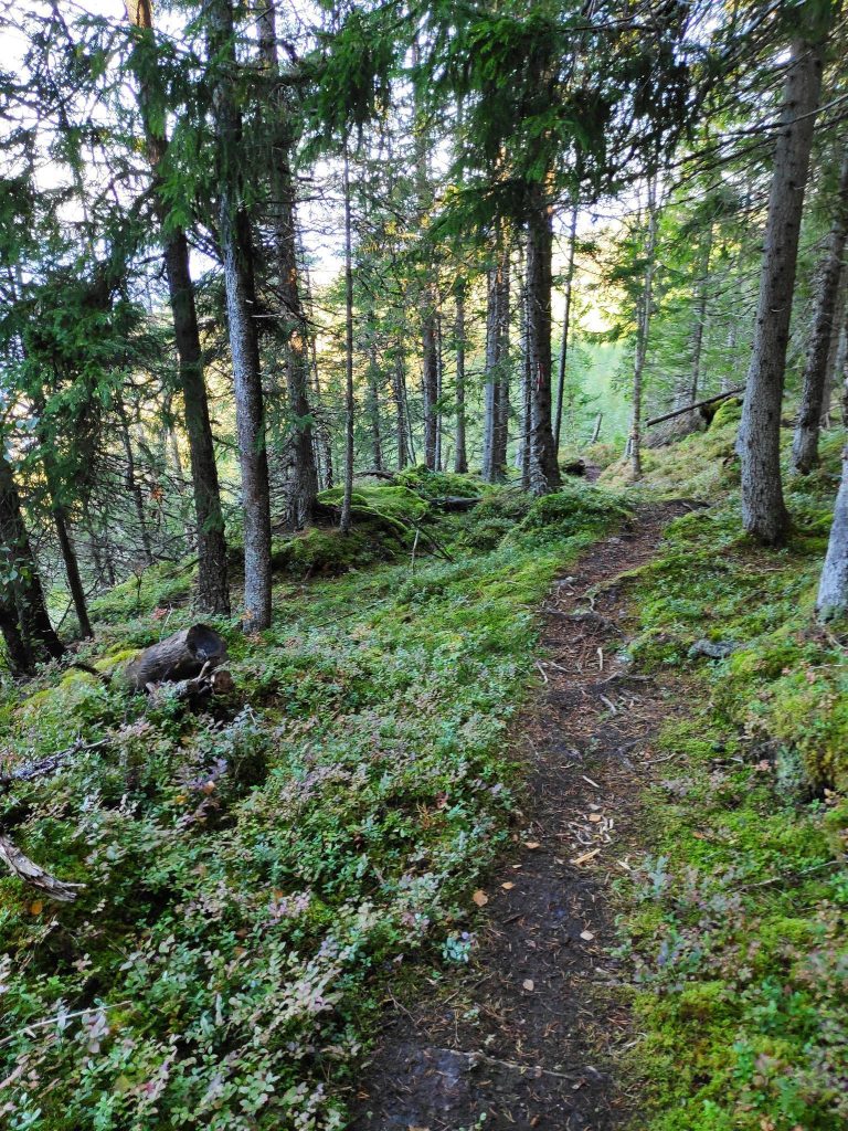
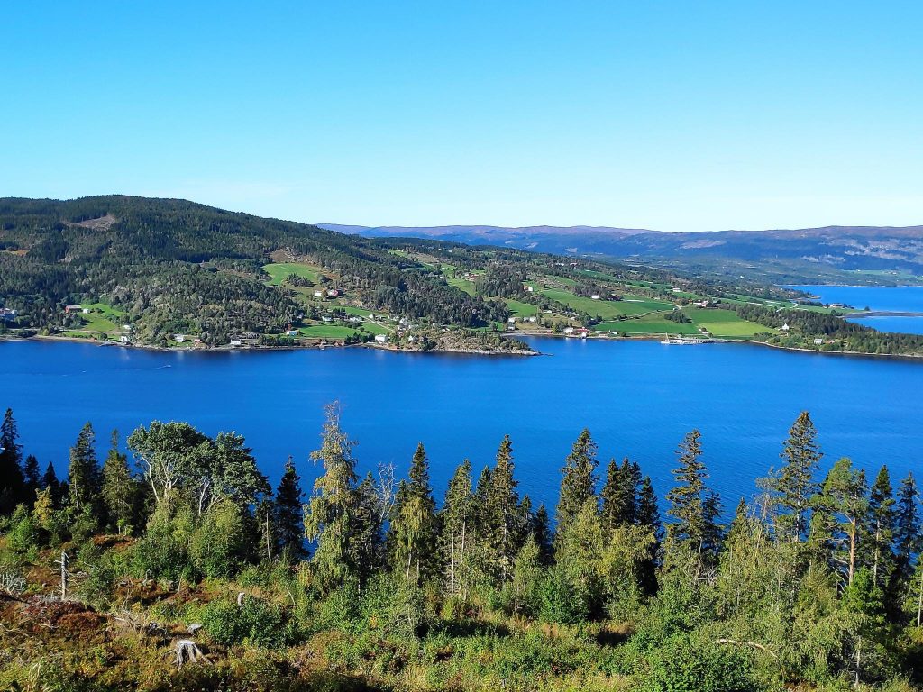
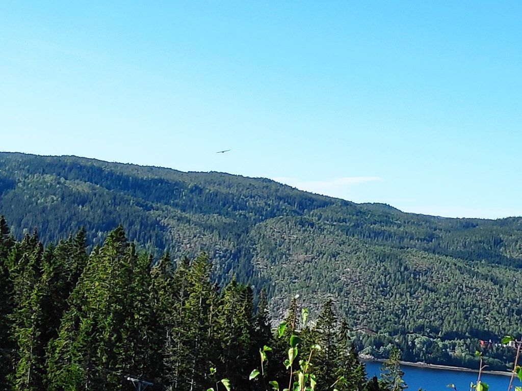
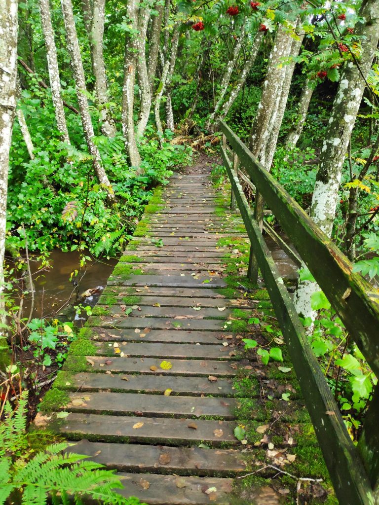
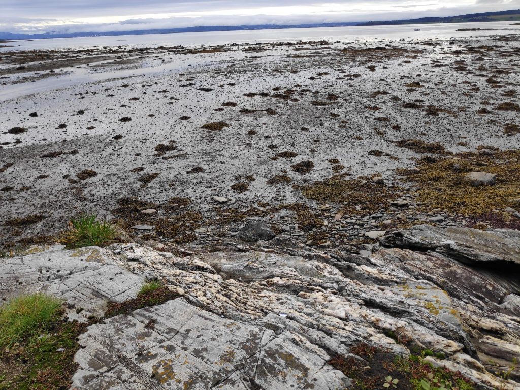
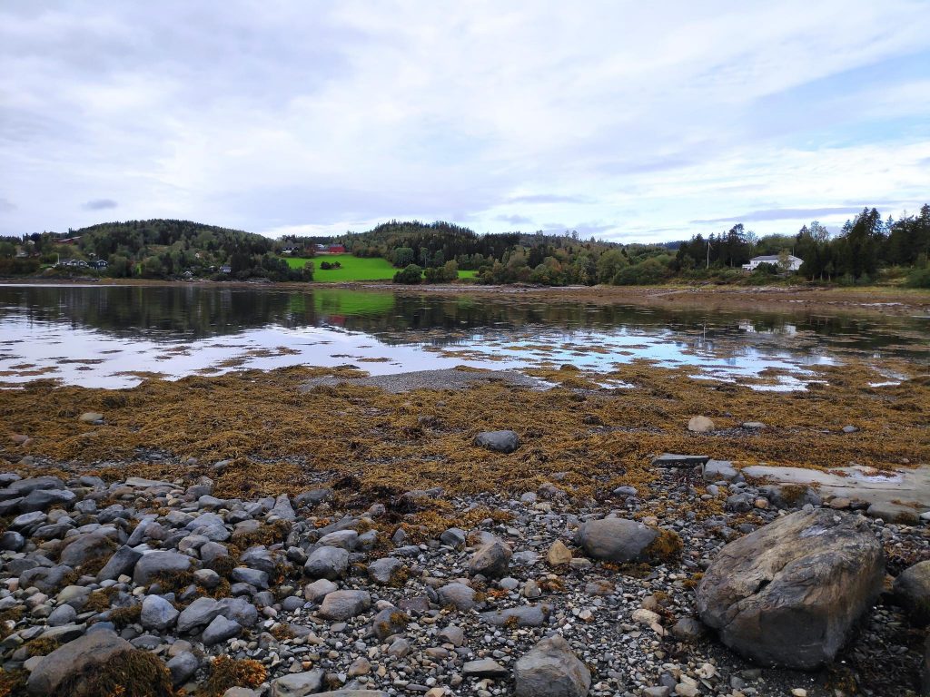
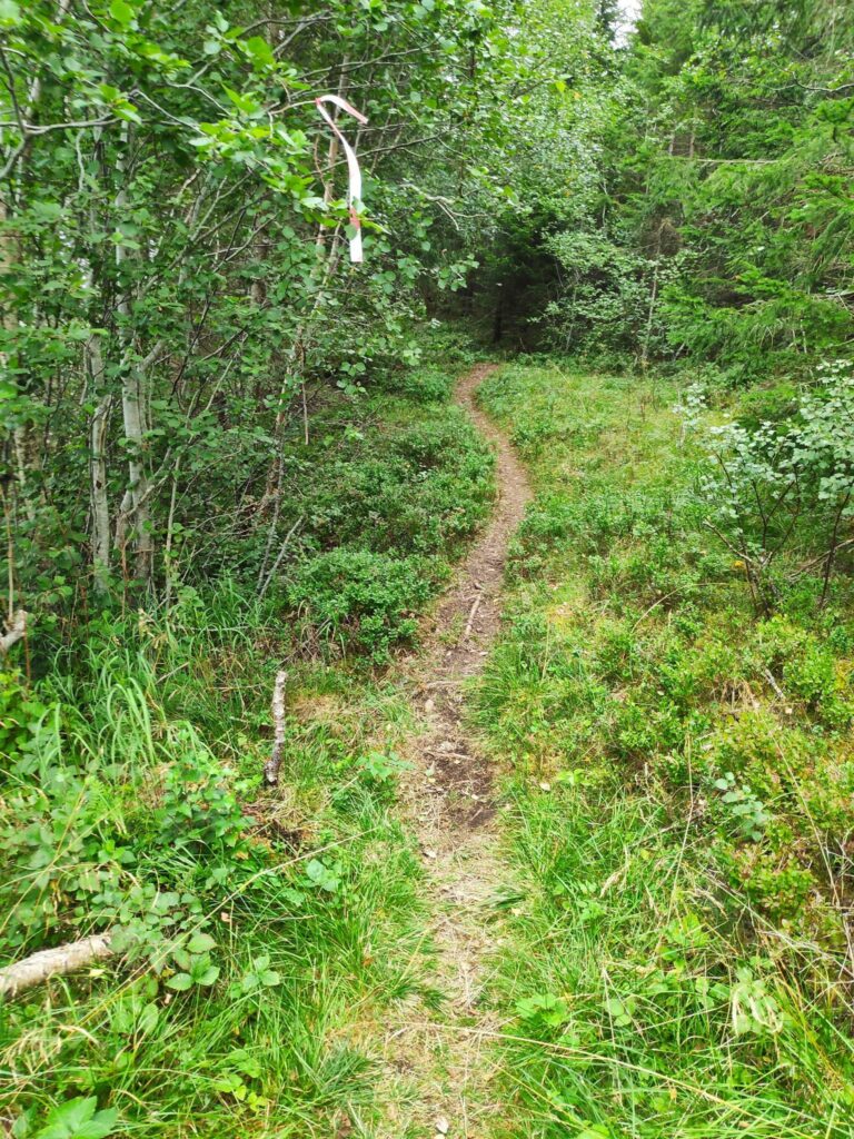
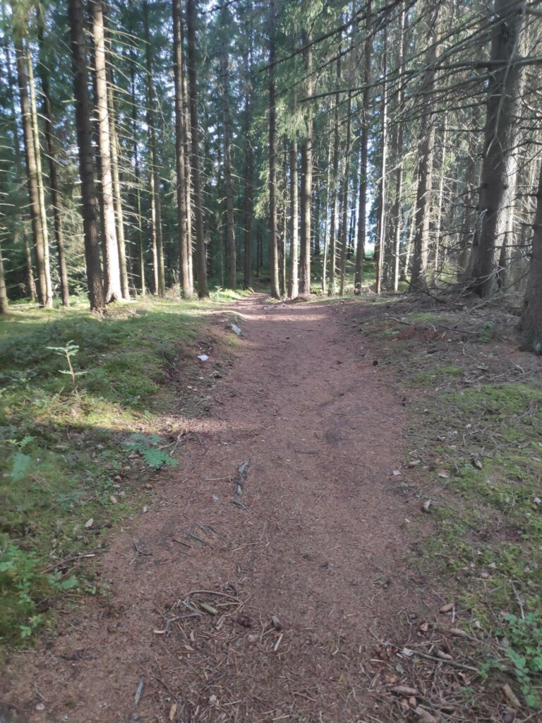
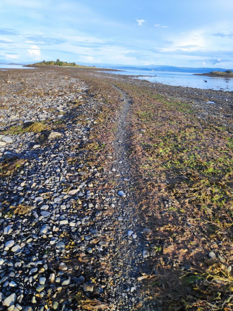
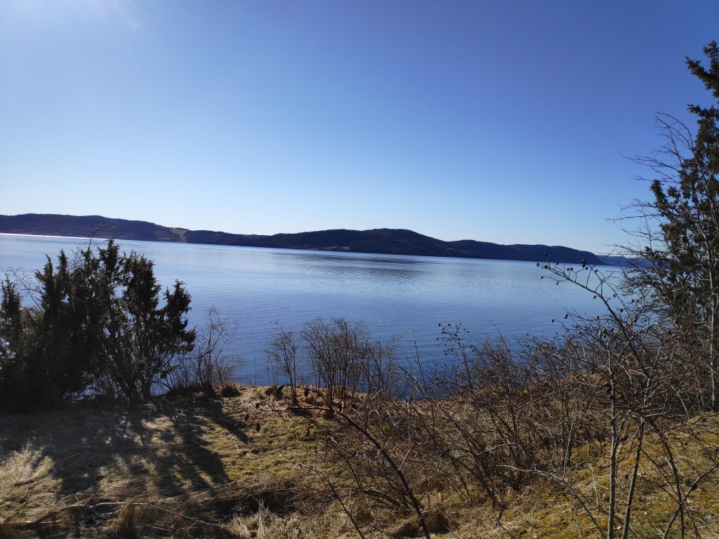
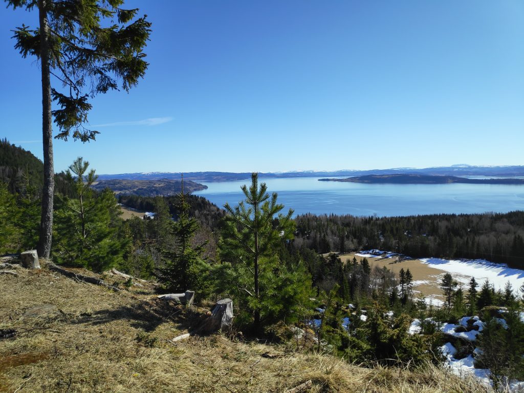
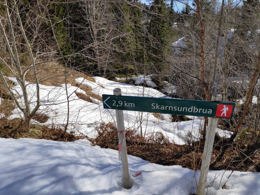
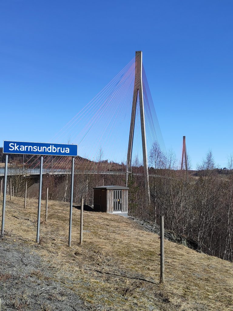
Today was again a bright sunny day. There was frost when I got up, but as the sun climbed higher in the sky, the air temperature warmed up considerably. While my son and my husband headed off for a day-trip in the car, I got a ride to a drop-off point that is about 5 km from home. I walk up and along a back road that brings me to Skarnsund Bridge, cross the bridge and walk through the woods to home again. It is only on the bridge that I have to listen to the noise of cars. Today I used two and a half hours, so probably walked almost 8 km.

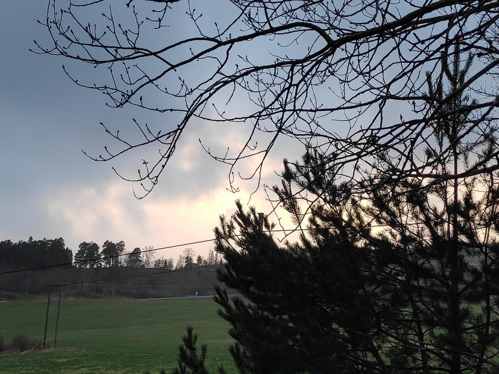
The typical Easter weather that everyone wants is a sunny day, with heat in the sunshine. Today was a good day for fulfilling that dream weather.

Dream weather for an Easter walk – sunshine and no wind. Too bad the photographer couldn’t hold the camera parallel to the horizon. We can blame it on sun in her eyes, or perhaps just carelessness.

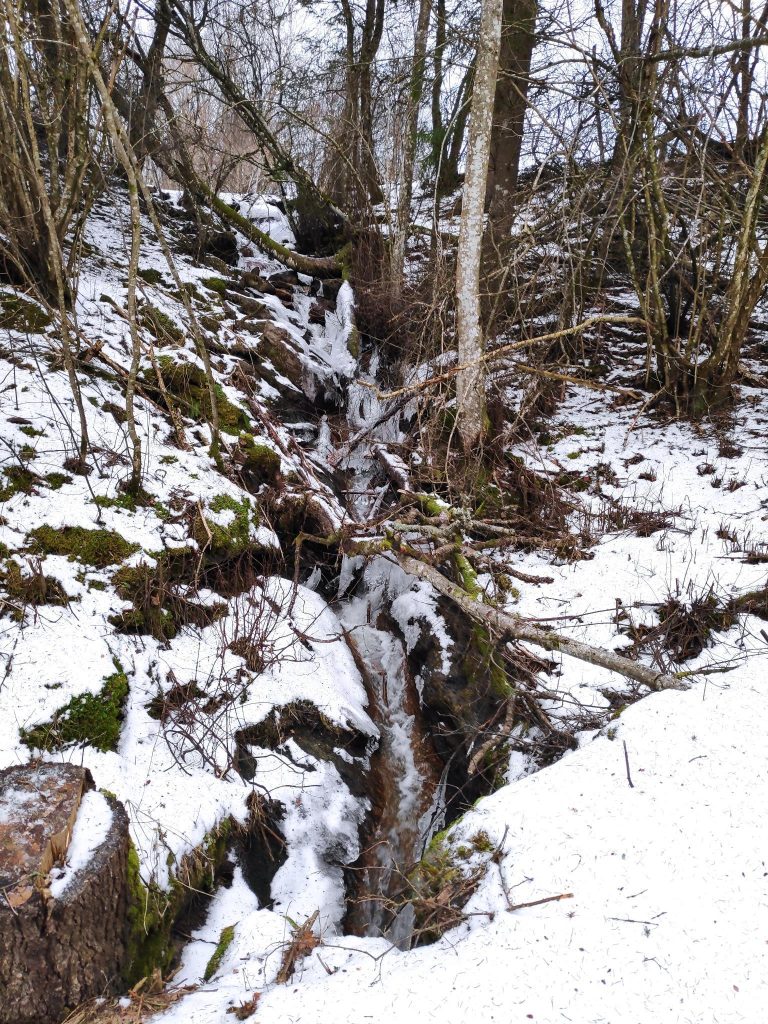
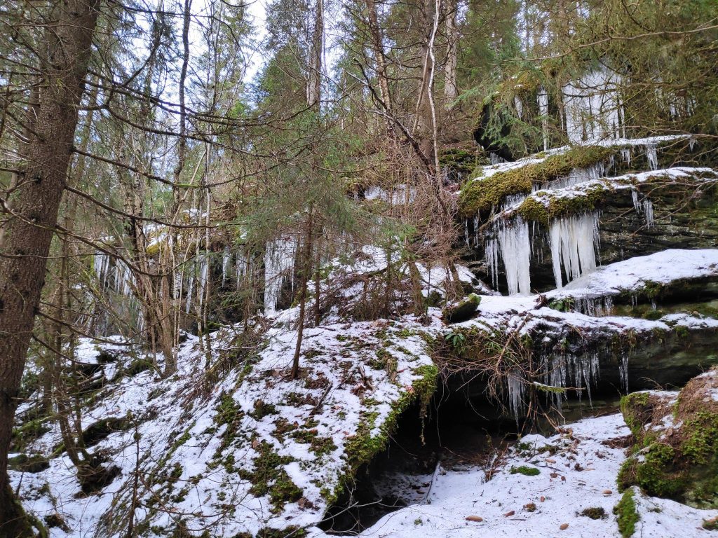
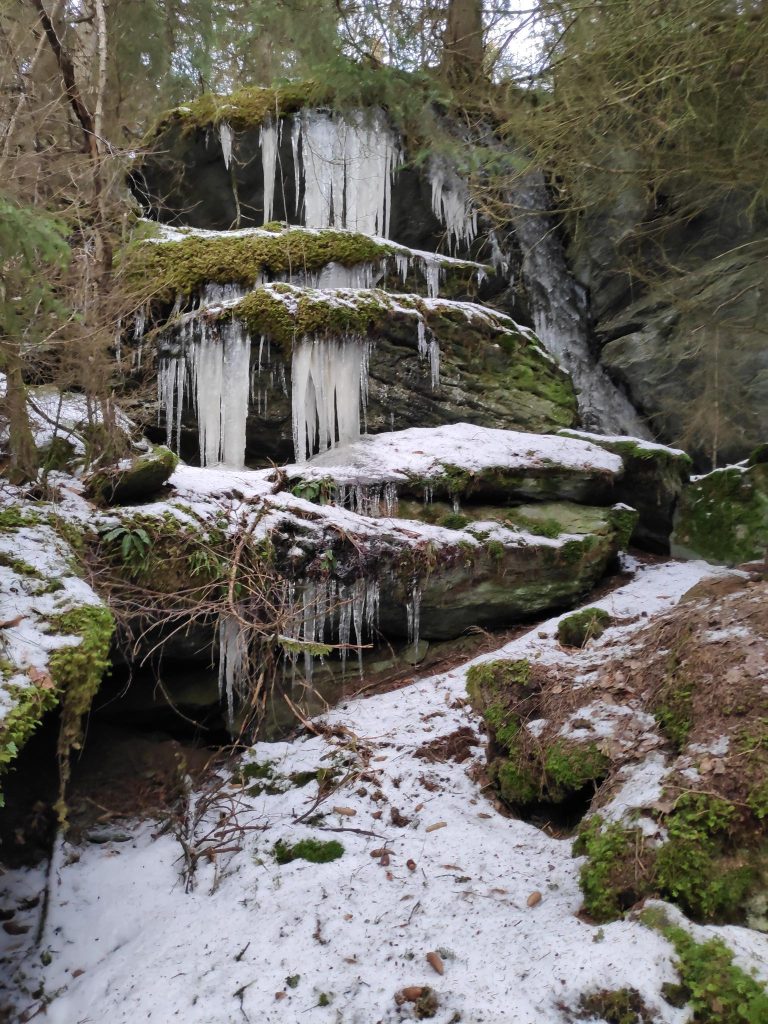
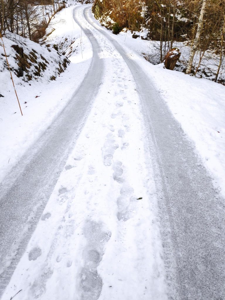
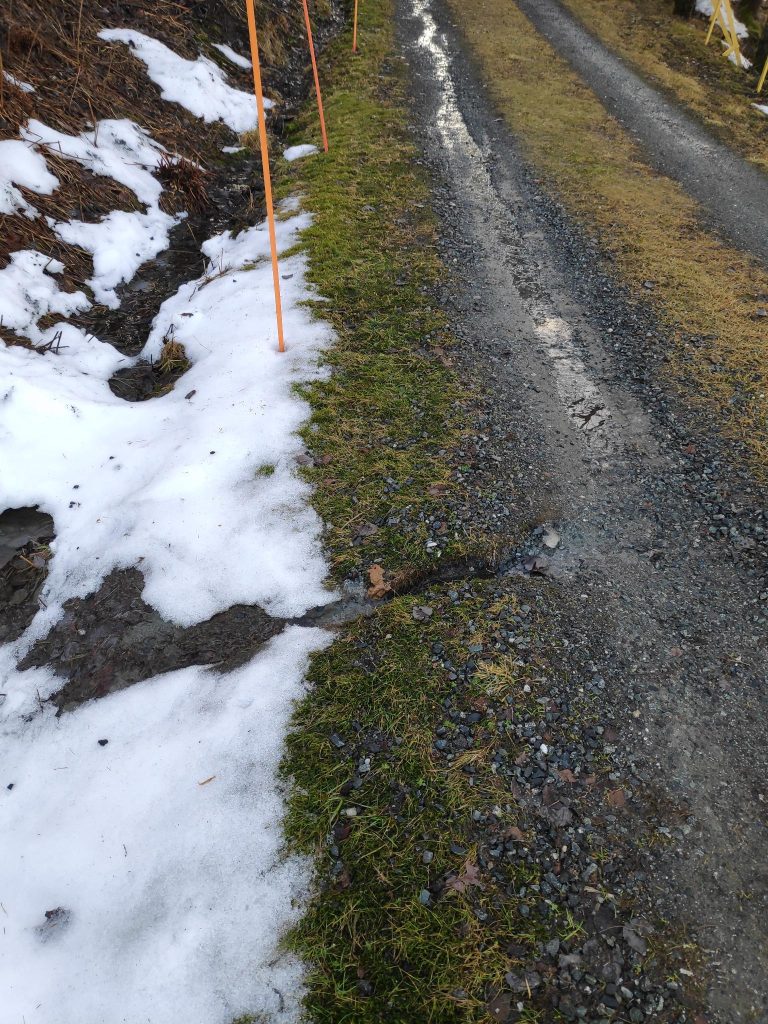
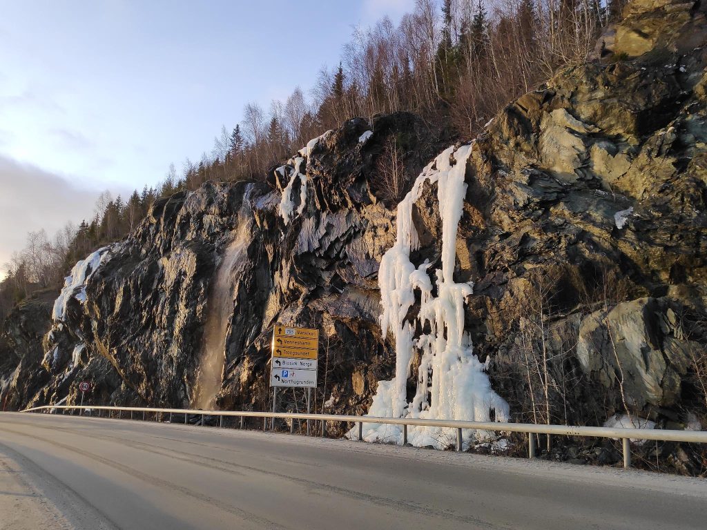
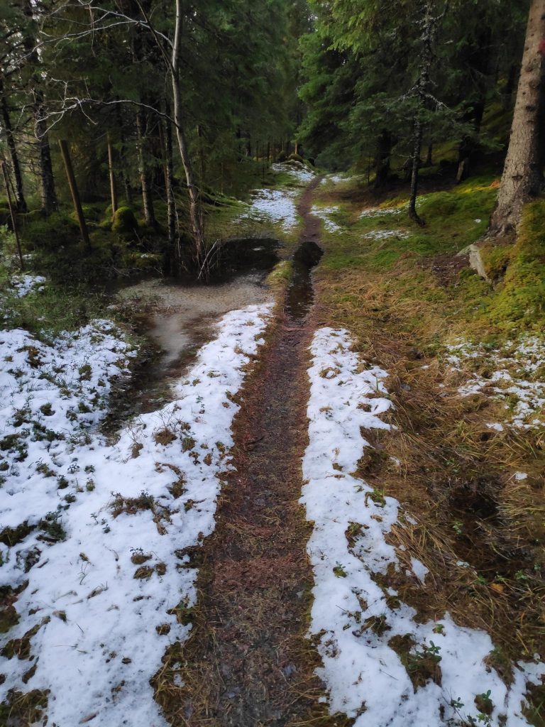
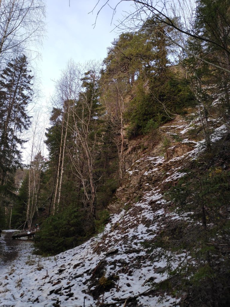
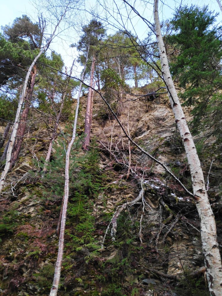
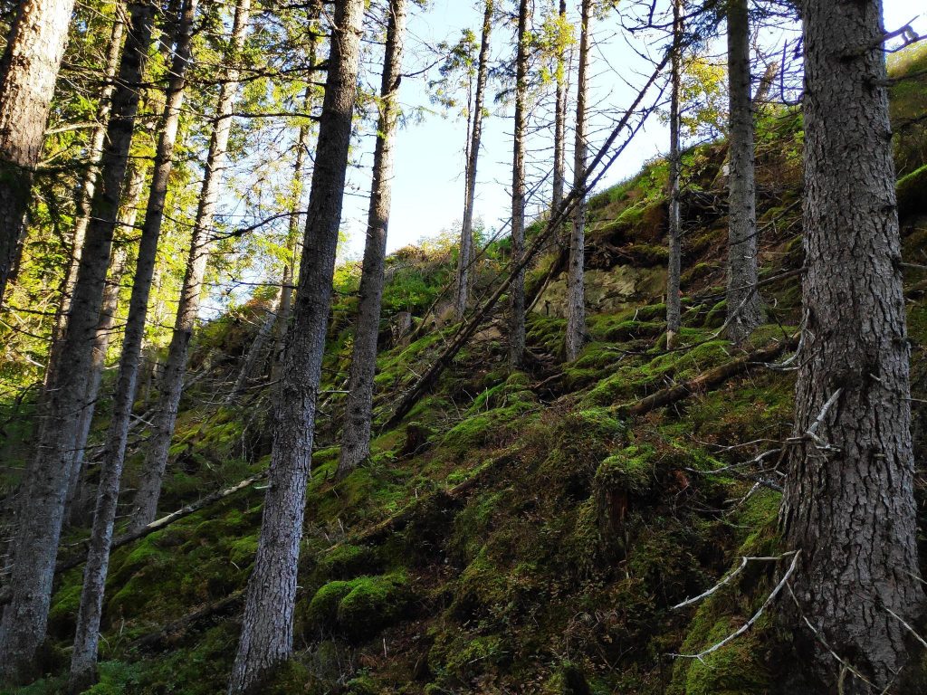
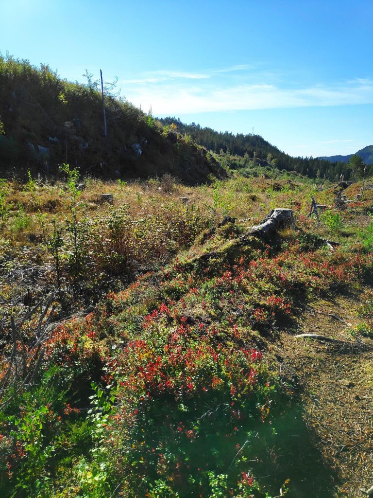
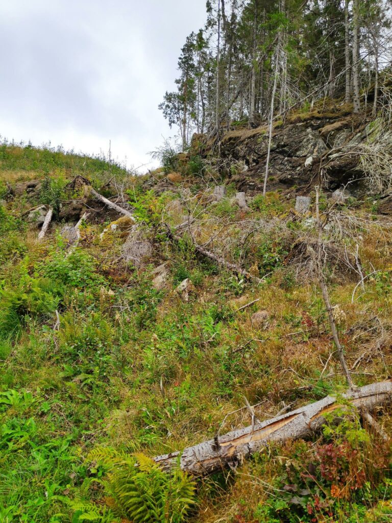
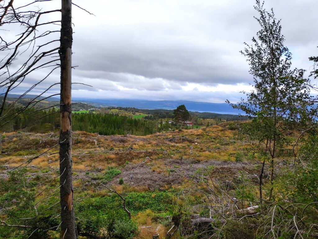
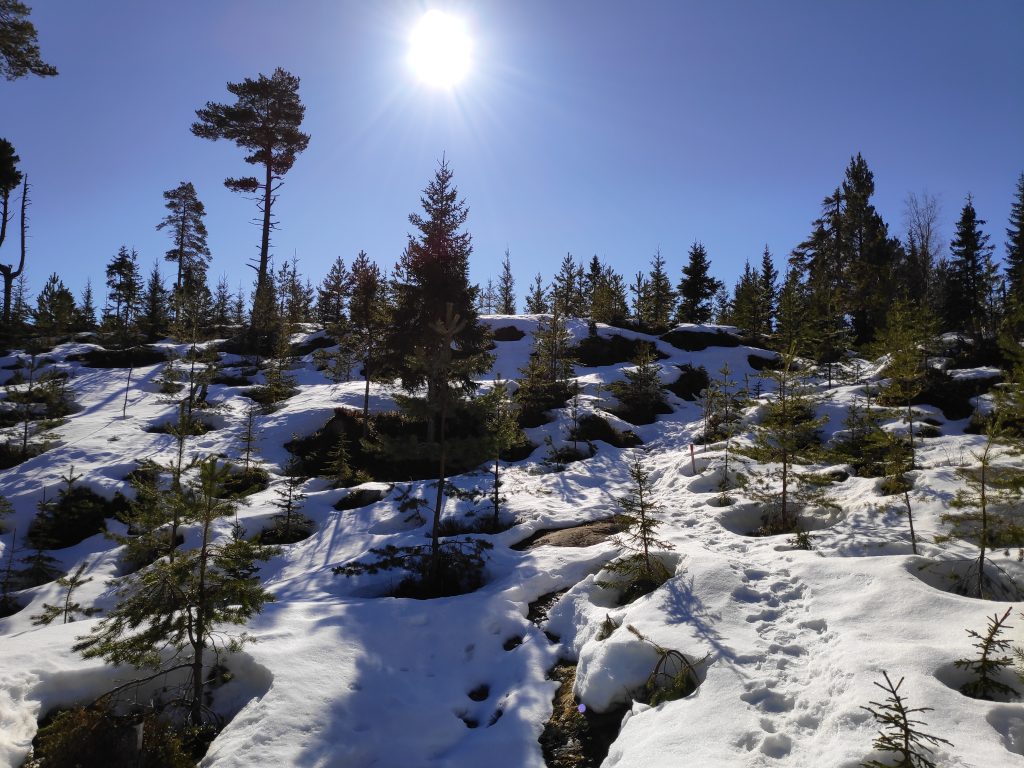
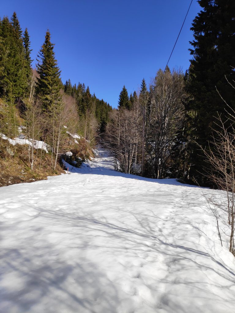
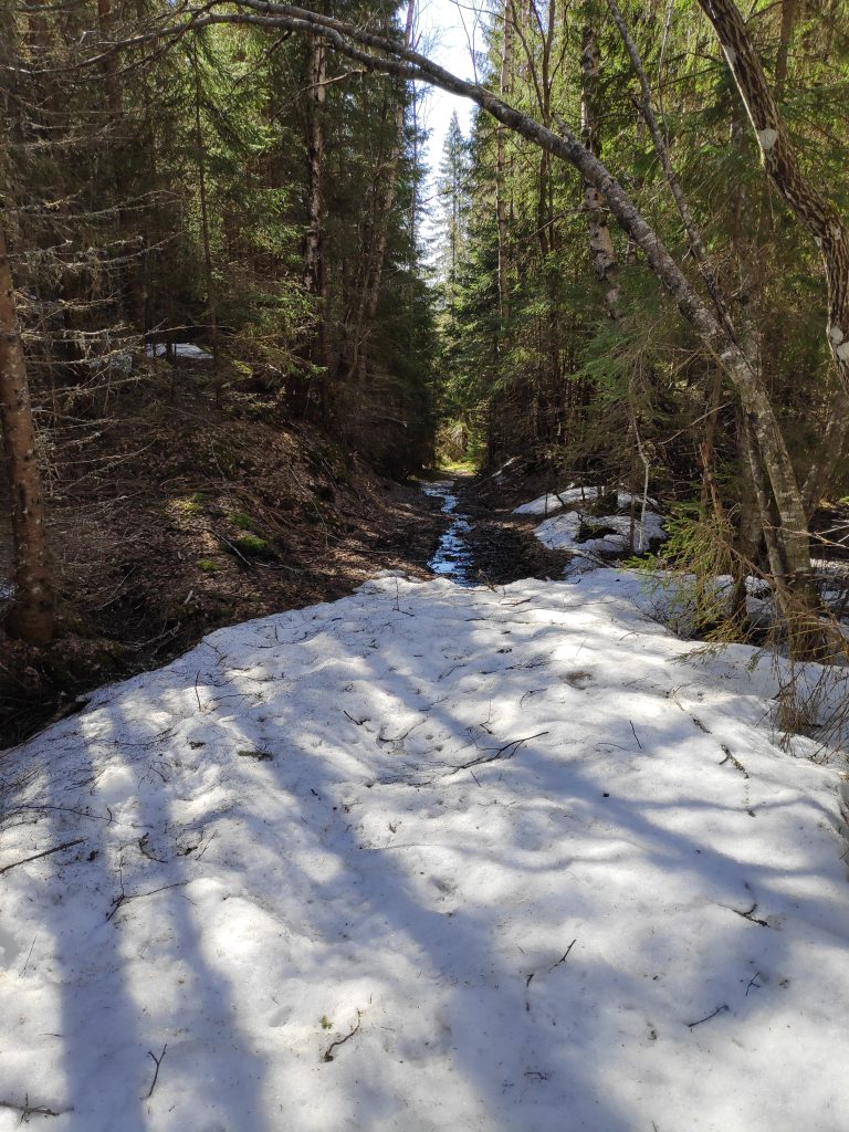
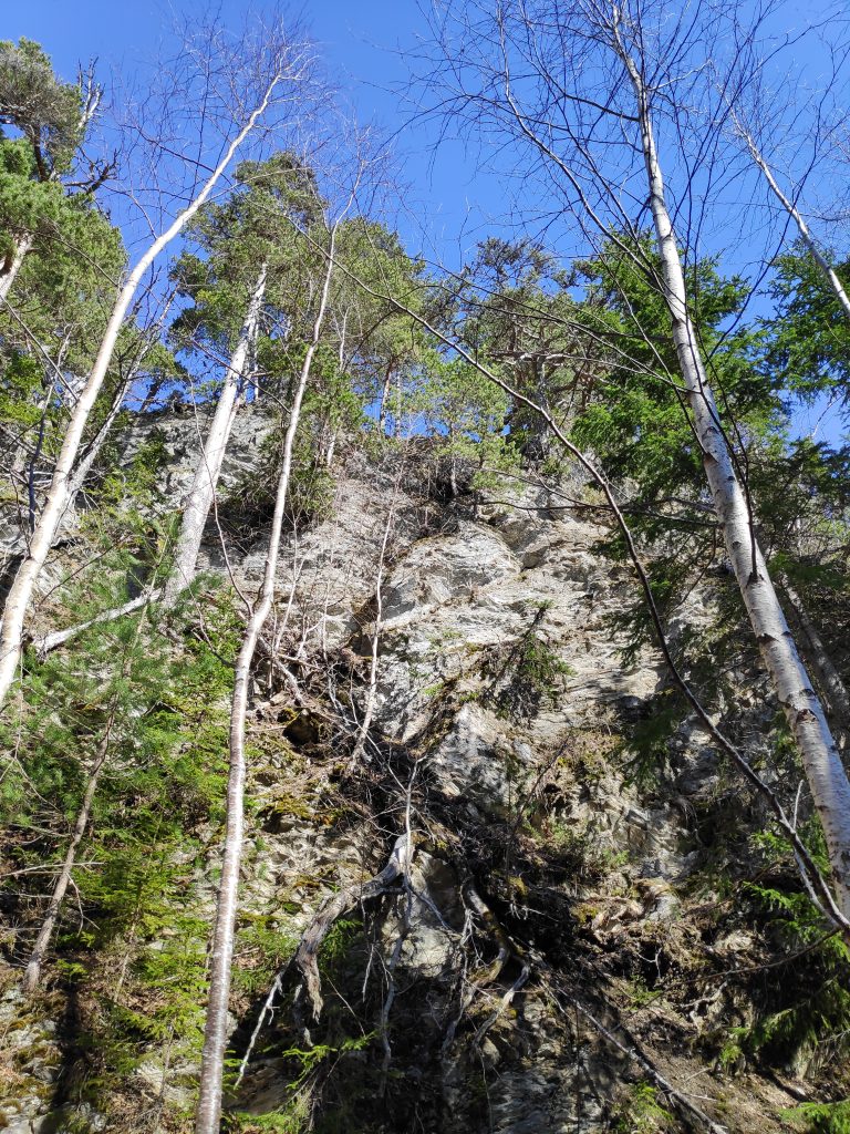
Though the snow is gone in low-lying areas, I was prepared for snow as I climbed up the hill. Mosvik gets a lot more precipitation than we get at Vangshylla. I quite often notice it raining or snowing in Mosvik and we don’t get anything. We also got a lot of precipitation in March this year, often as snow in higher elevations. Several storms would also have blown the snow, causing drifts in open areas in the woods.

Dalavegen in Mosvik is a back road with only a few houses on it, but it is kept open all winter long. However there are a lot of trees preventing the sun from melting the snow in the ditches. The higher I climbed up, the more snow there was. I use about 20 minutes to walk up this road as it is a steady uphill climb.
The snow was melting and there was lots of water in all of the streams that I saw. This little waterfall captured my attention as a bent tree gives the water a nice edge to fall over.

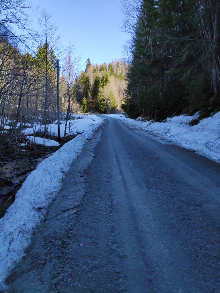
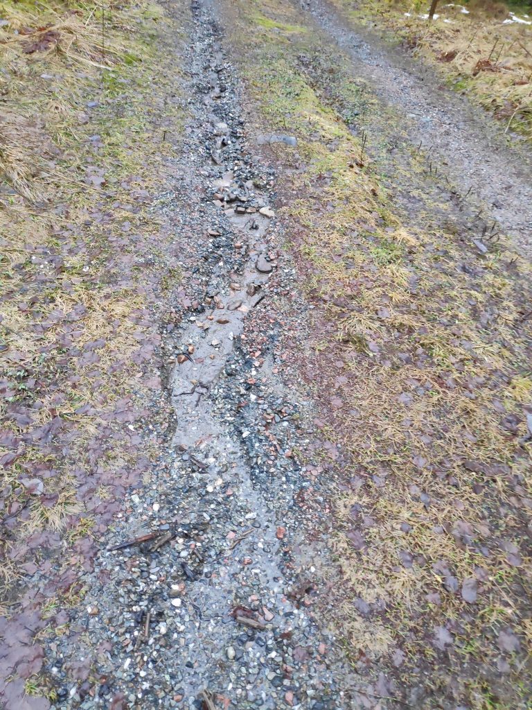
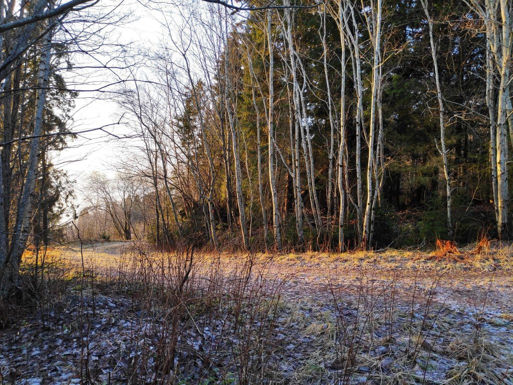
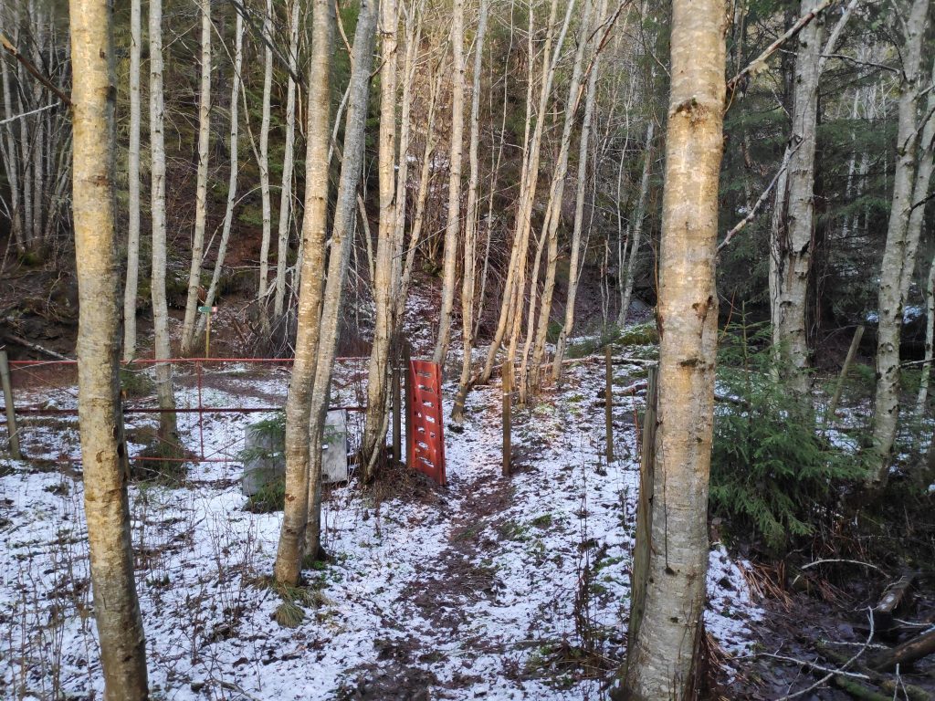
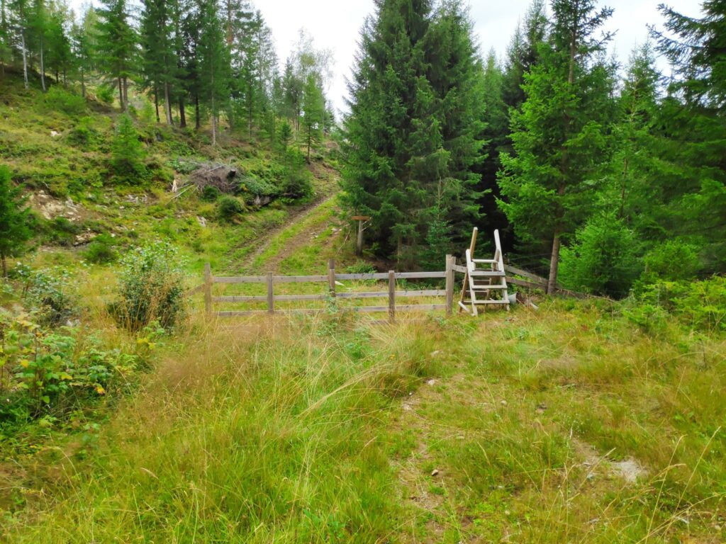
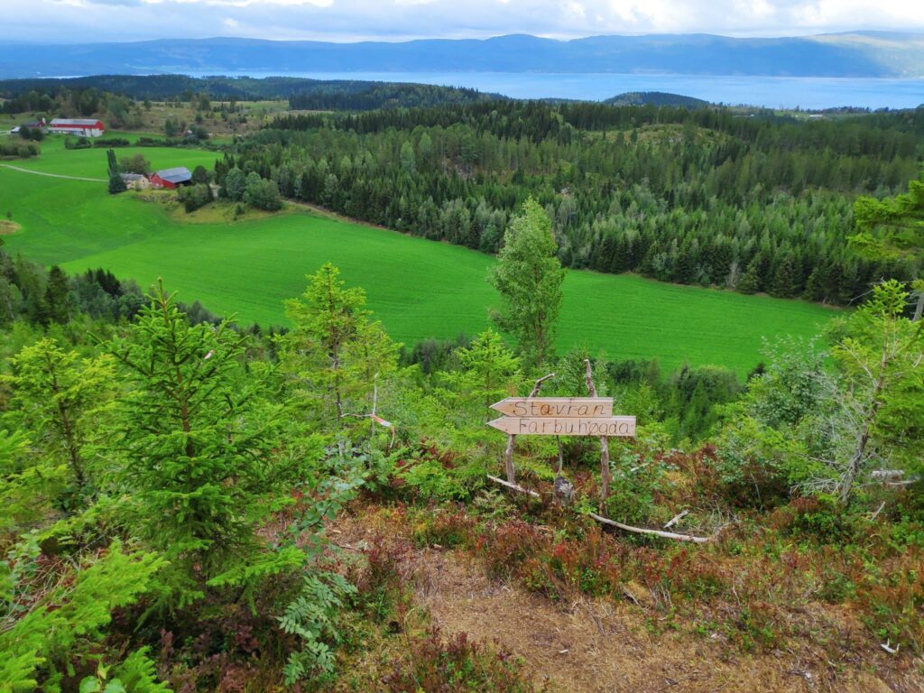
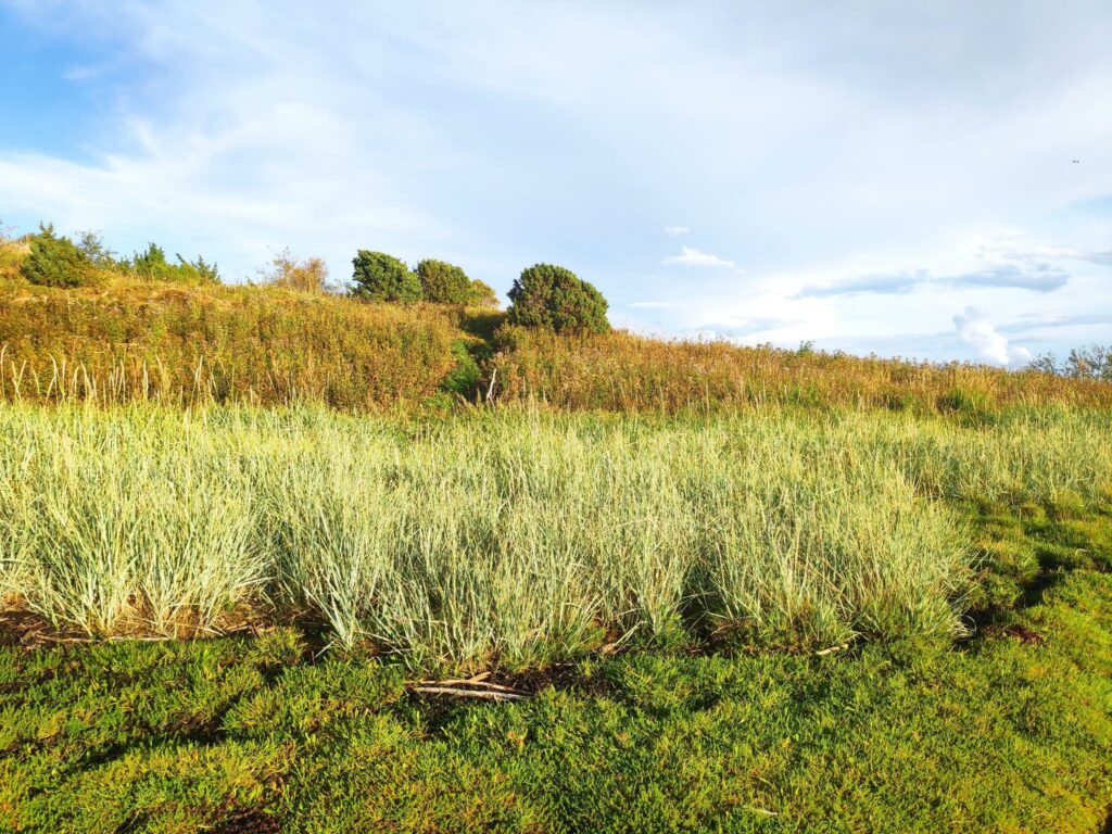
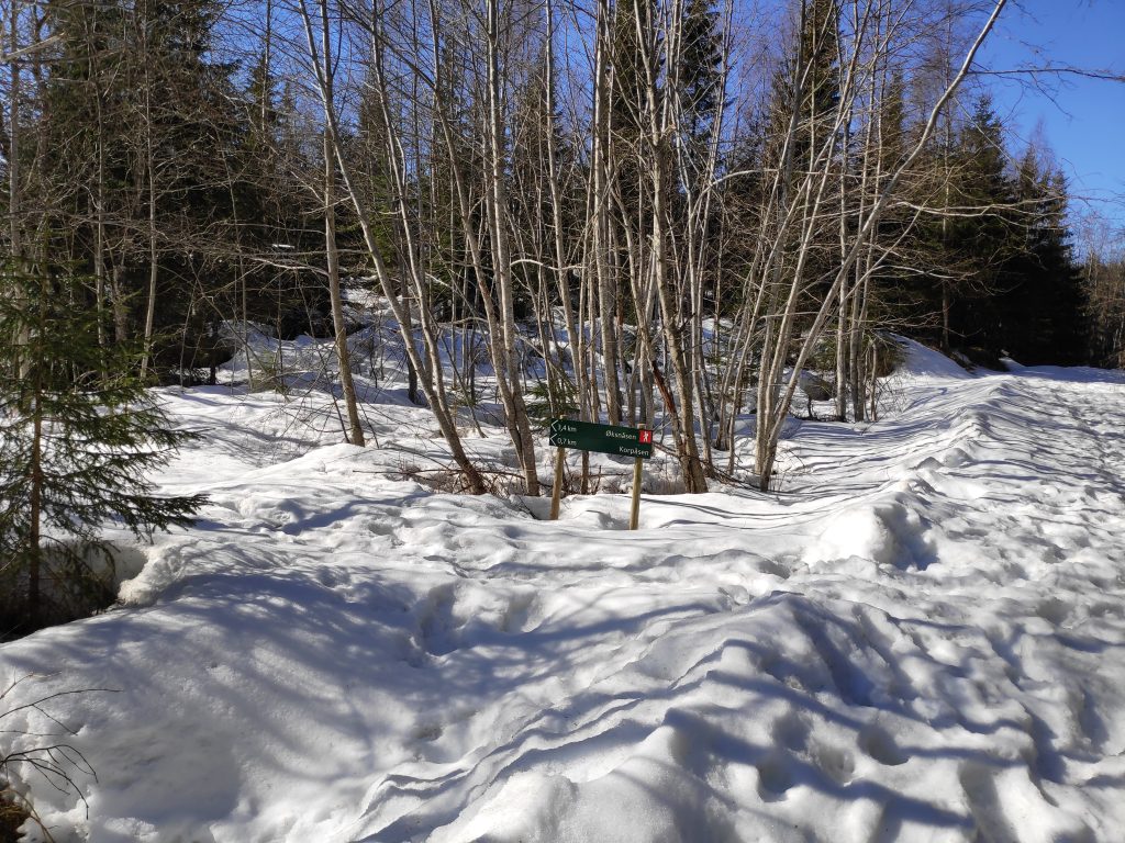
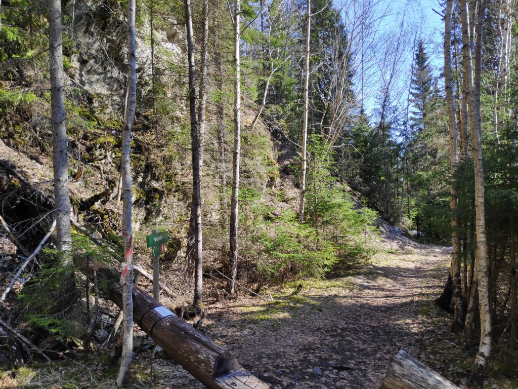
When I got to a farm called Setervang, the road divides and continues eastwards towards Skarnsund Bridge or heads north then west to reach another farm which I think is only used as a summer house. This road is not always suitable for driving, even in the summer as it can have quite deep ruts. It is not plowed or kept open in the winter. In the summer there is a gate to keep the sheep away from farm fields.

There was still quite a bit of snow on this back road, one that is not kept open in the winter months. However there were lots of tracks from people walking up the road. This is a popular walking area in the summer.
There were a few challenges where trees had stopped standing and were lying down for a rest. Someone had come by with a saw and made an opening for people to get through.

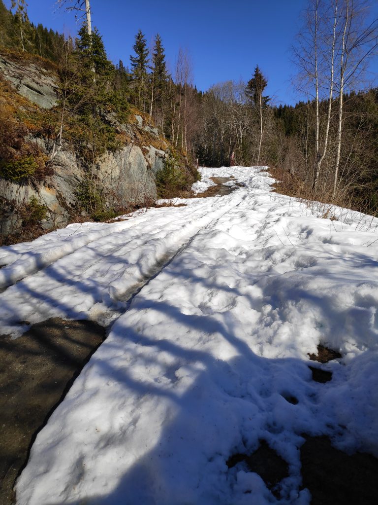
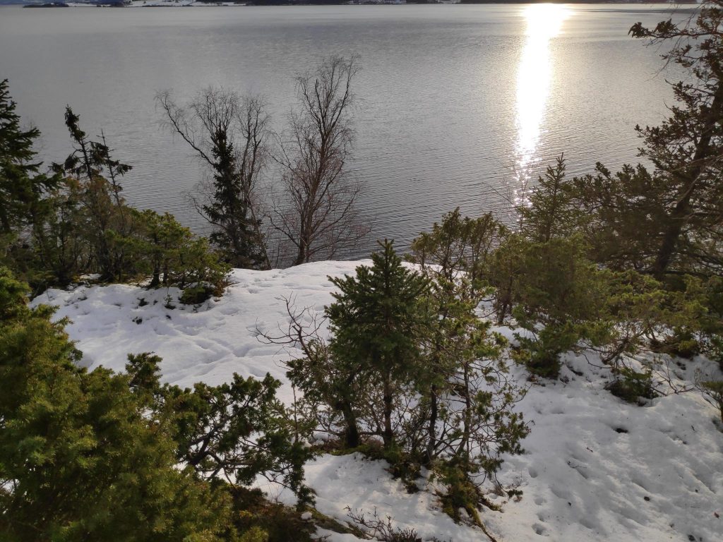
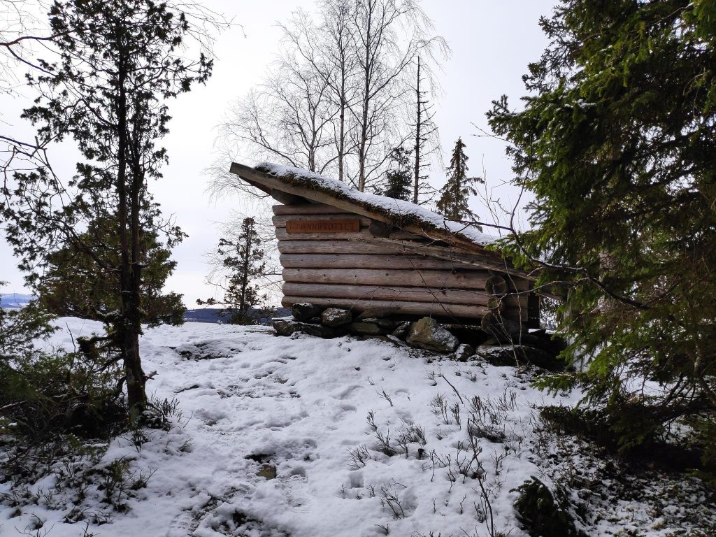
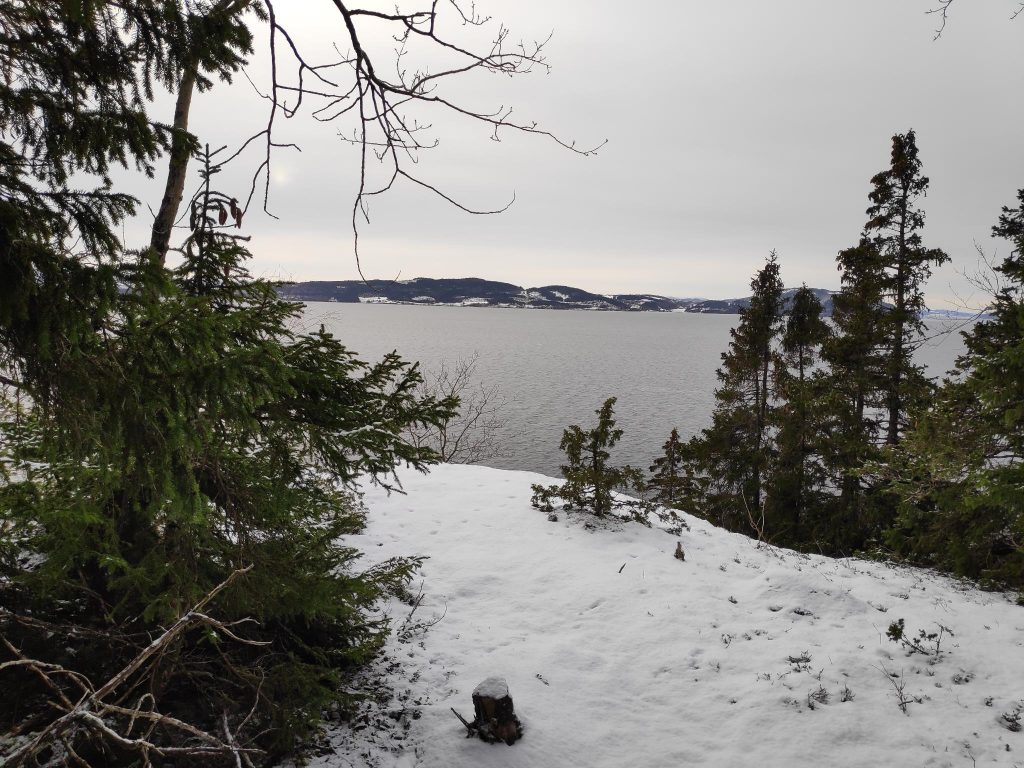
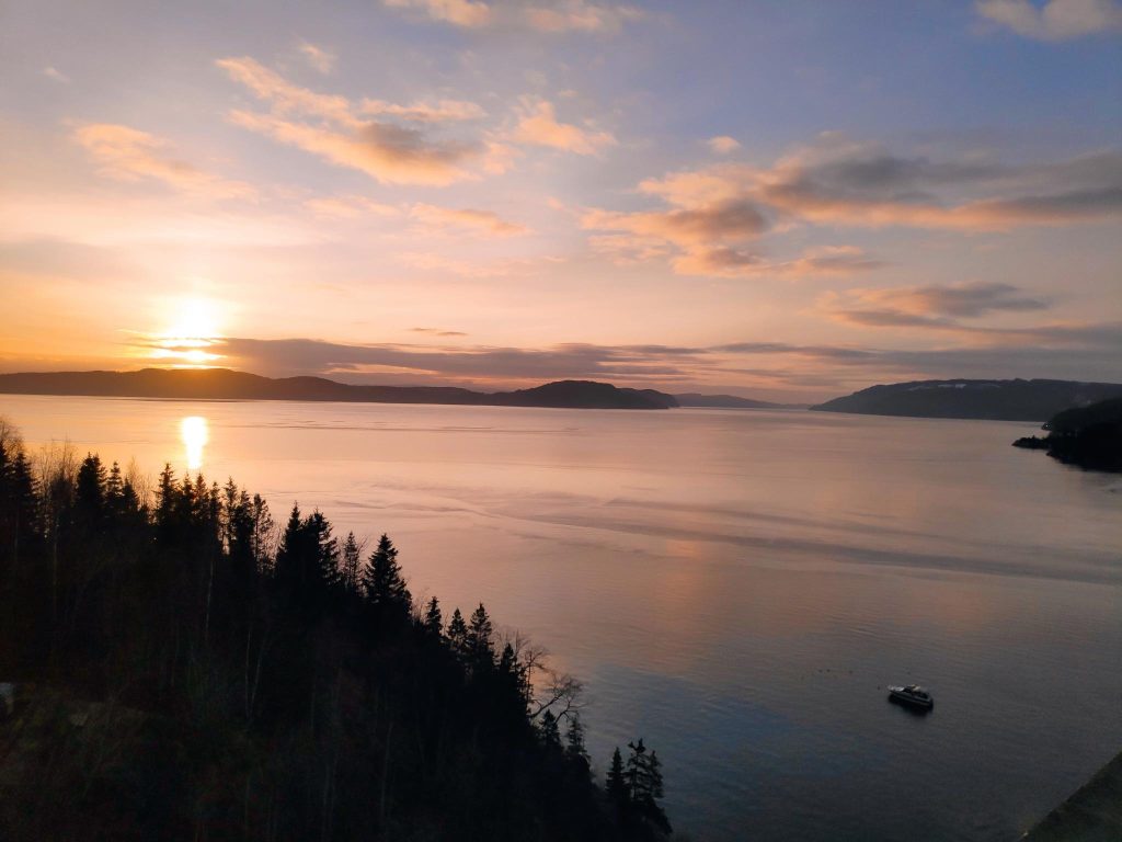
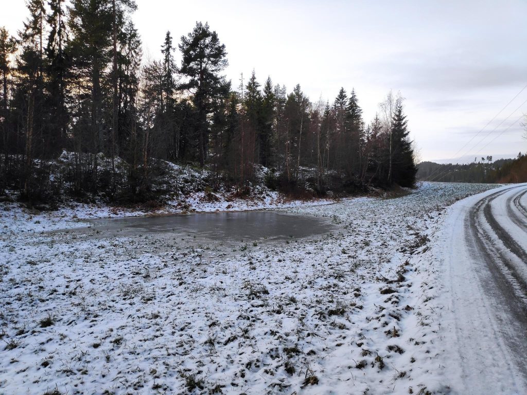
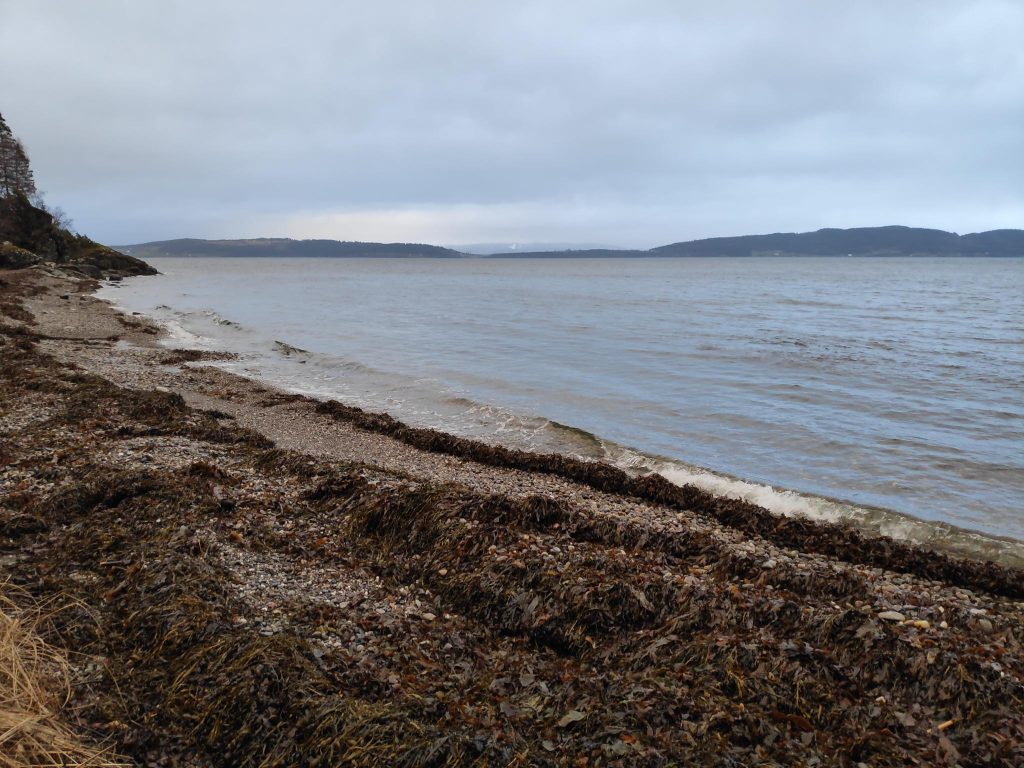
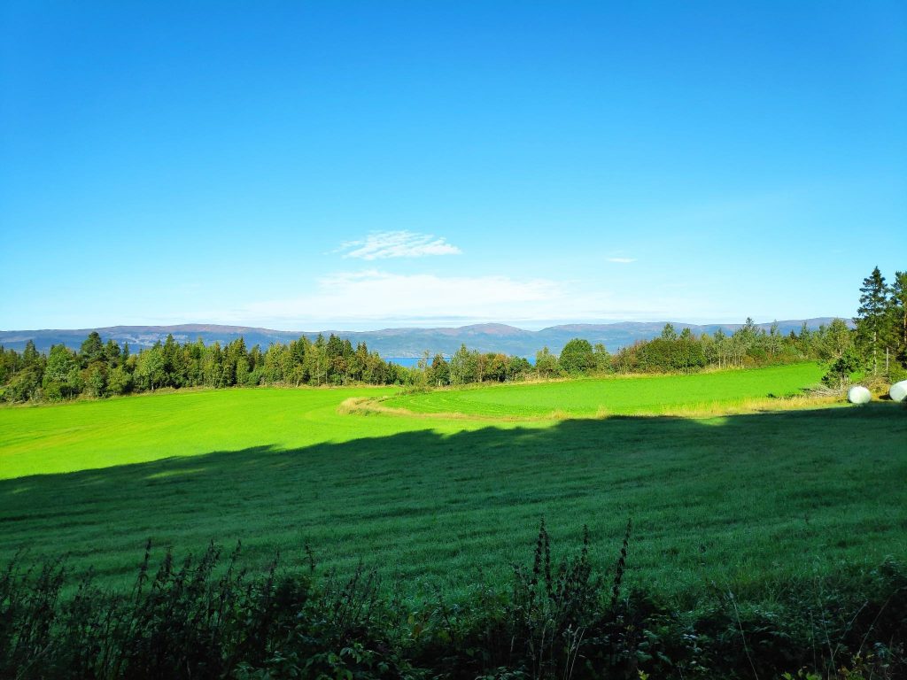
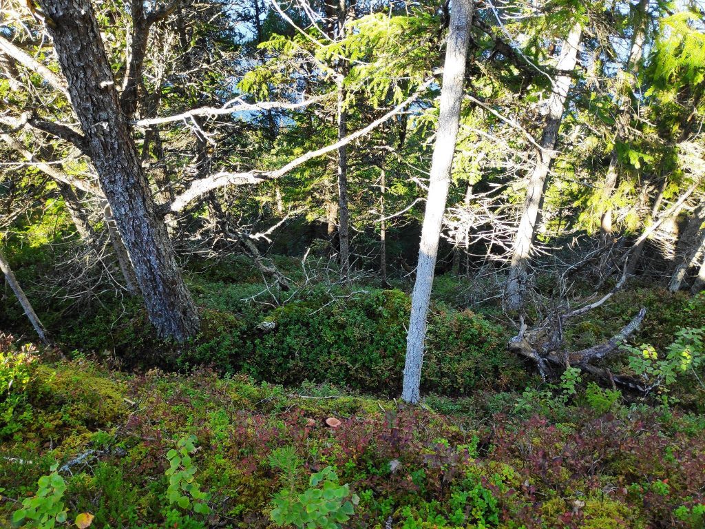
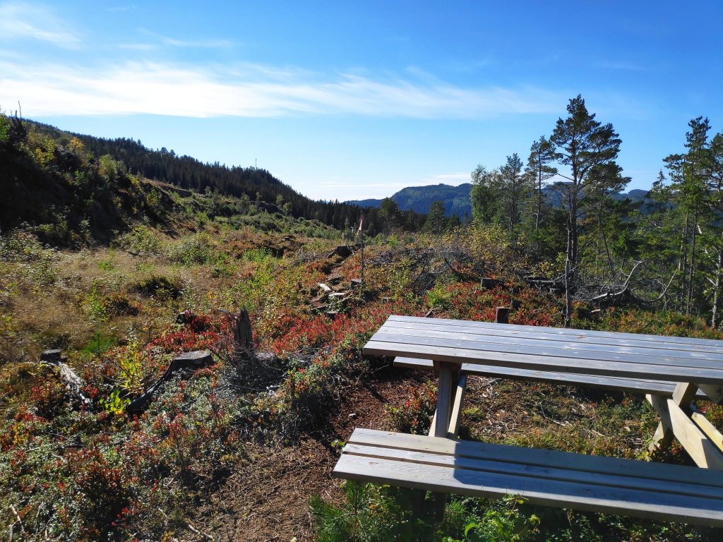
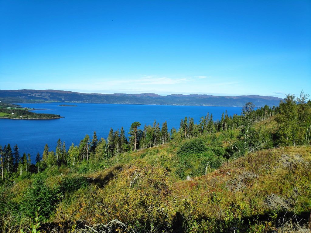
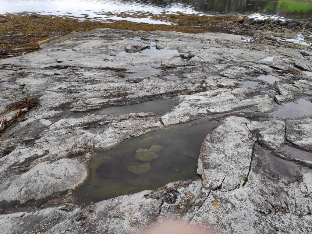
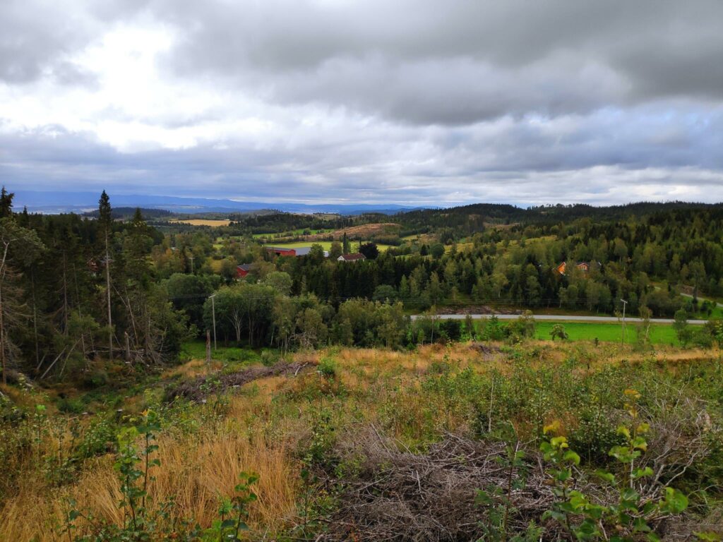
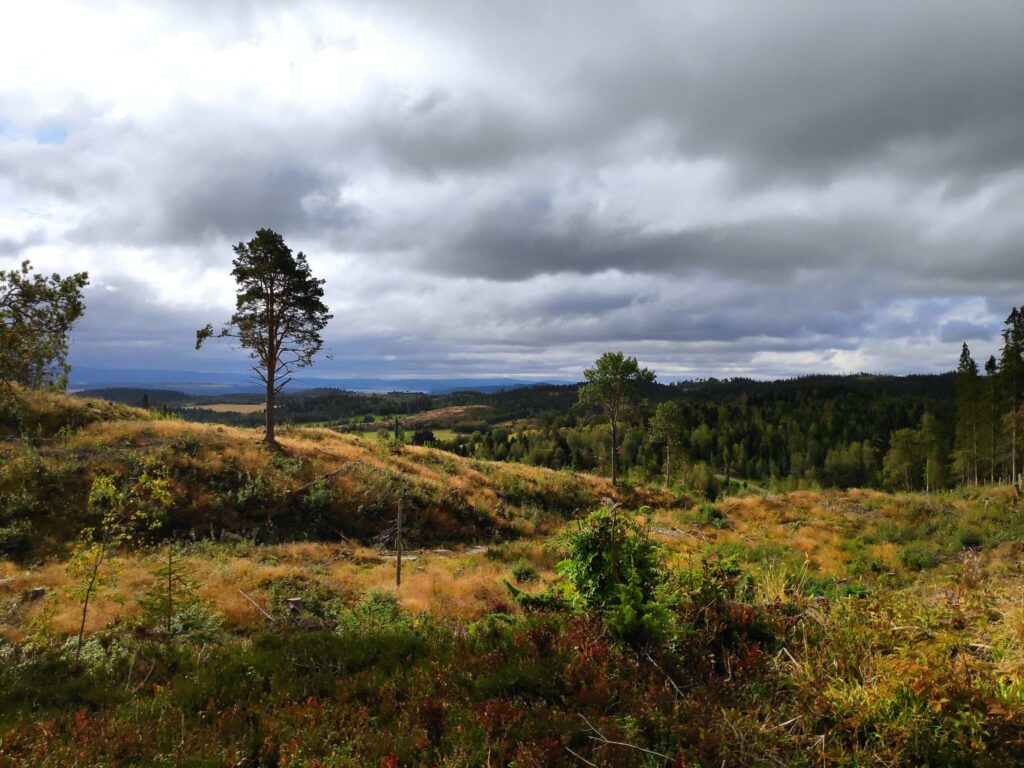
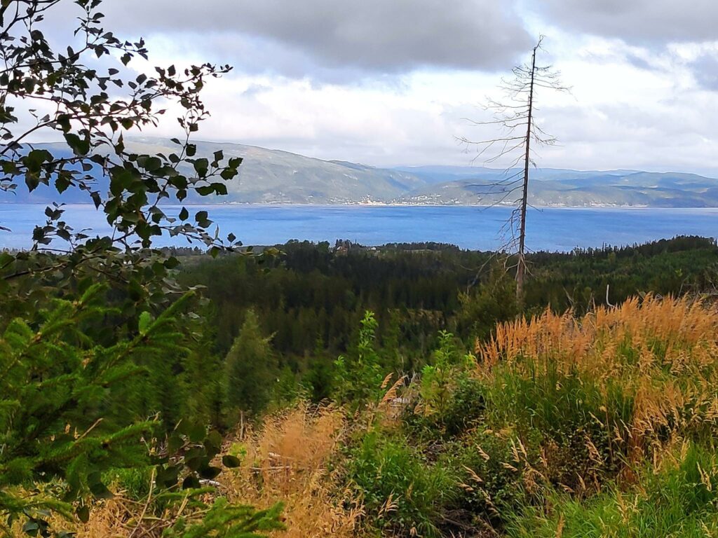
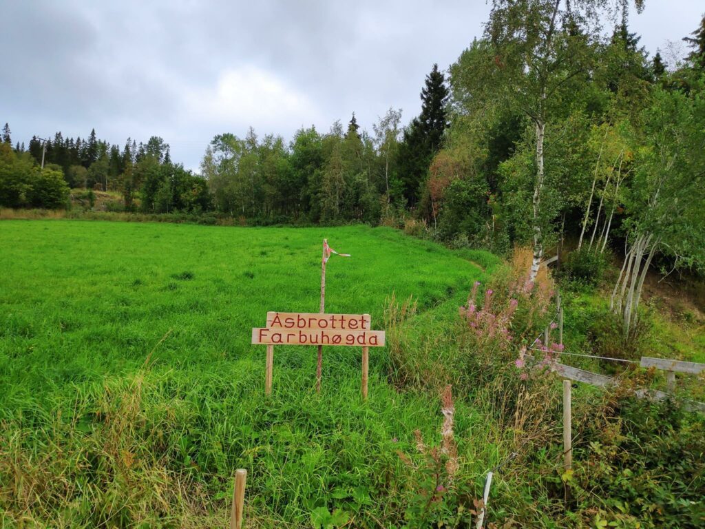
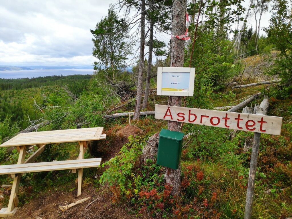
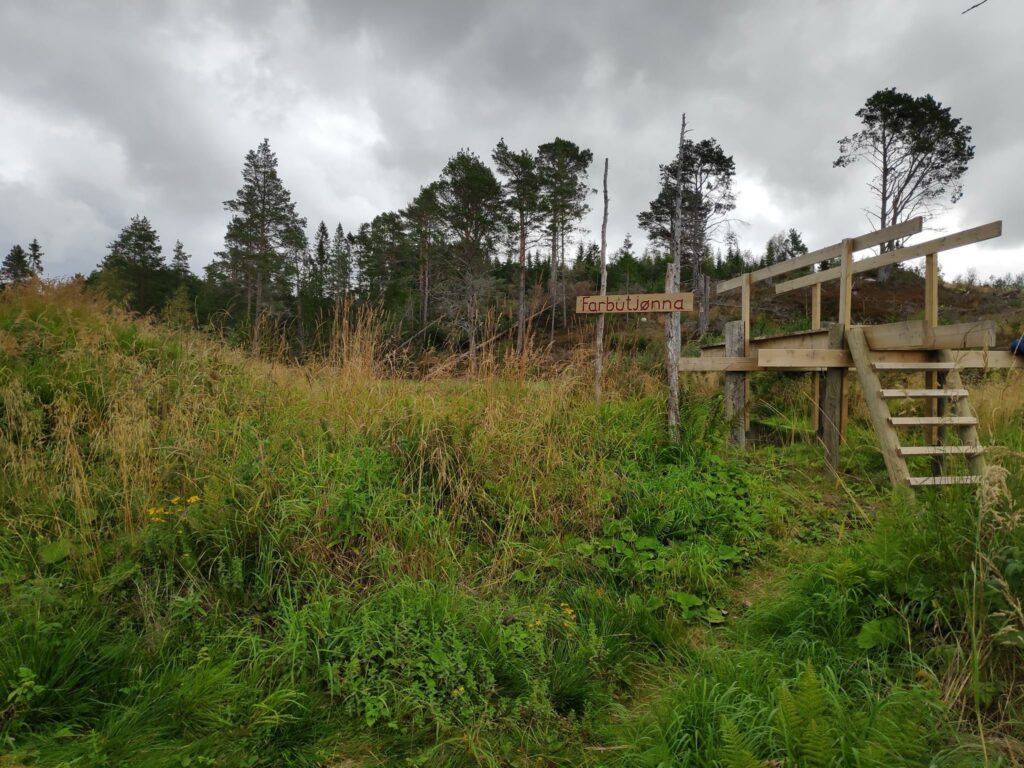
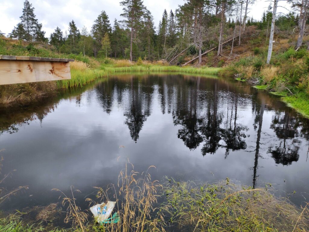
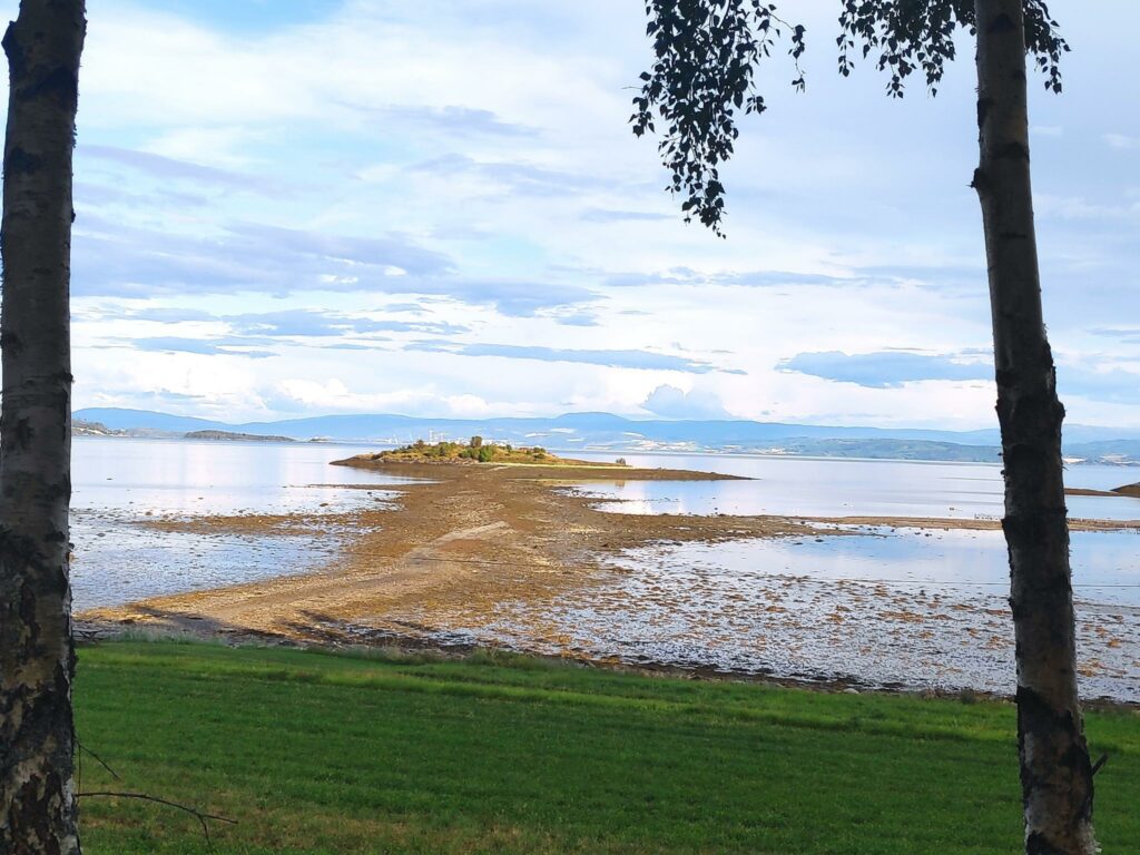
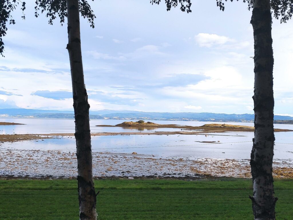
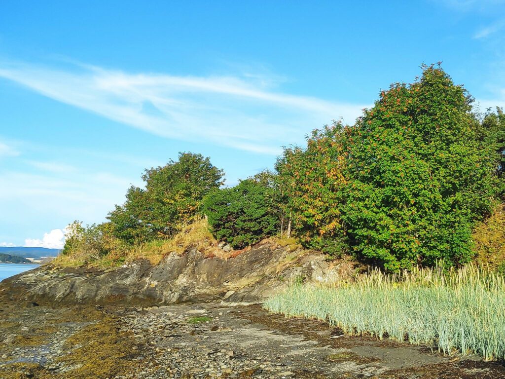
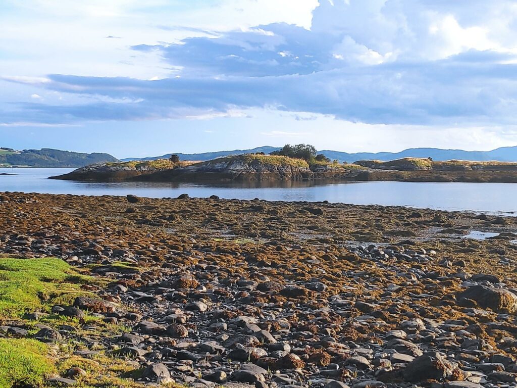
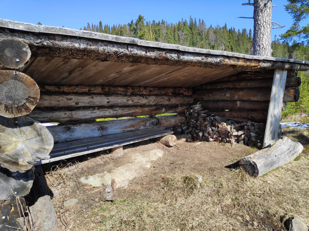
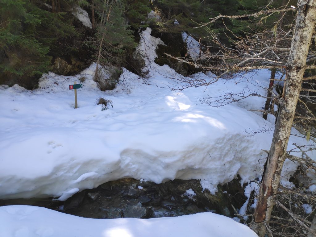
The main reason I had decided to come up this rather snow-covered road was to get to a viewpoint where I could see out over the fjord. There are several that can be accessed from this road, but I decided to neither go to Storlia nor Korpsåsen, both of which are lovely walks, in the summer. By the time I had gotten to this point, I did not want to go much farther across snow. I was on my own and had to be careful that I didn’t twist my ankle or otherwise injure myself. So I decided on a place that I knew about which was closer than either of those places.

I took a left turn here but I’m not going to go as far as Korpsåsen, which is 700 meters according to the signpost, but I always feel is about twice that distance.
Maybe a hundred meters from the snow-covered road, then turn left at the top of this hill.
A viewpoint with a shelter, at the edge of a cliff.
The shelter
The view, looking east towards Vangshylla and Verdal. The island of Ytterøy is also visible. This was the reason to trudge through the snow. I stopped her for a few minutes to just enjoy the sunshine and being able to see a long way. Though it doesn’t show up well in this picture, there are snow-covered mountains in the distance.

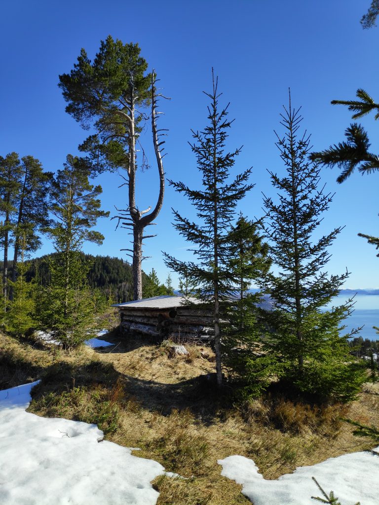
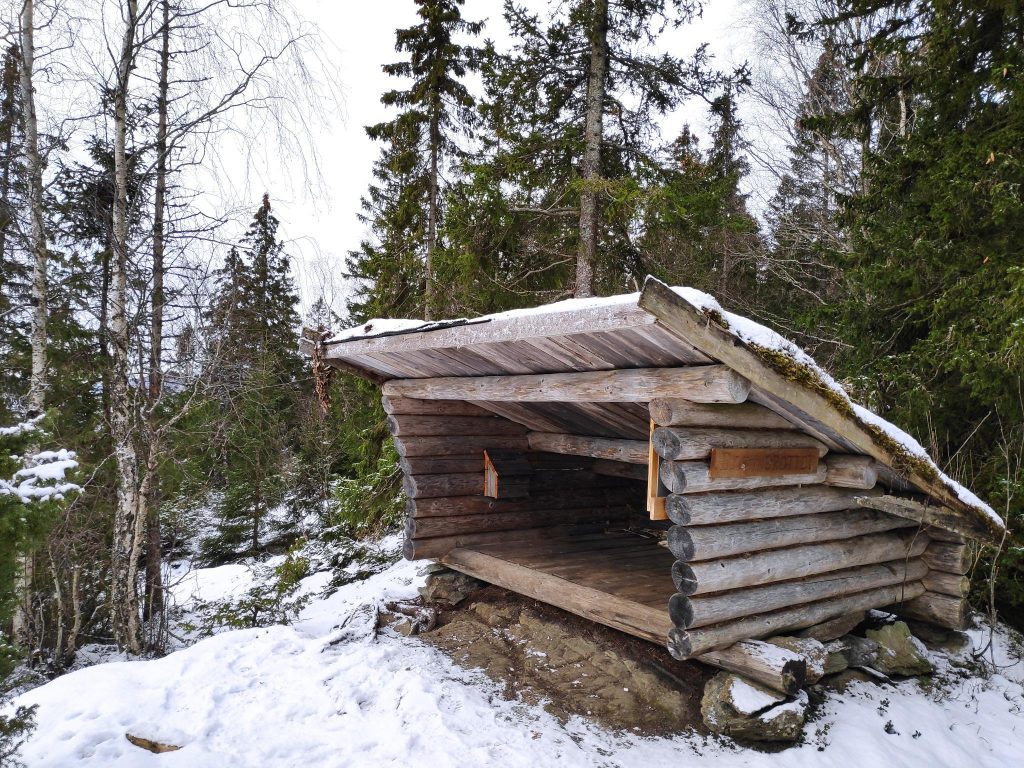
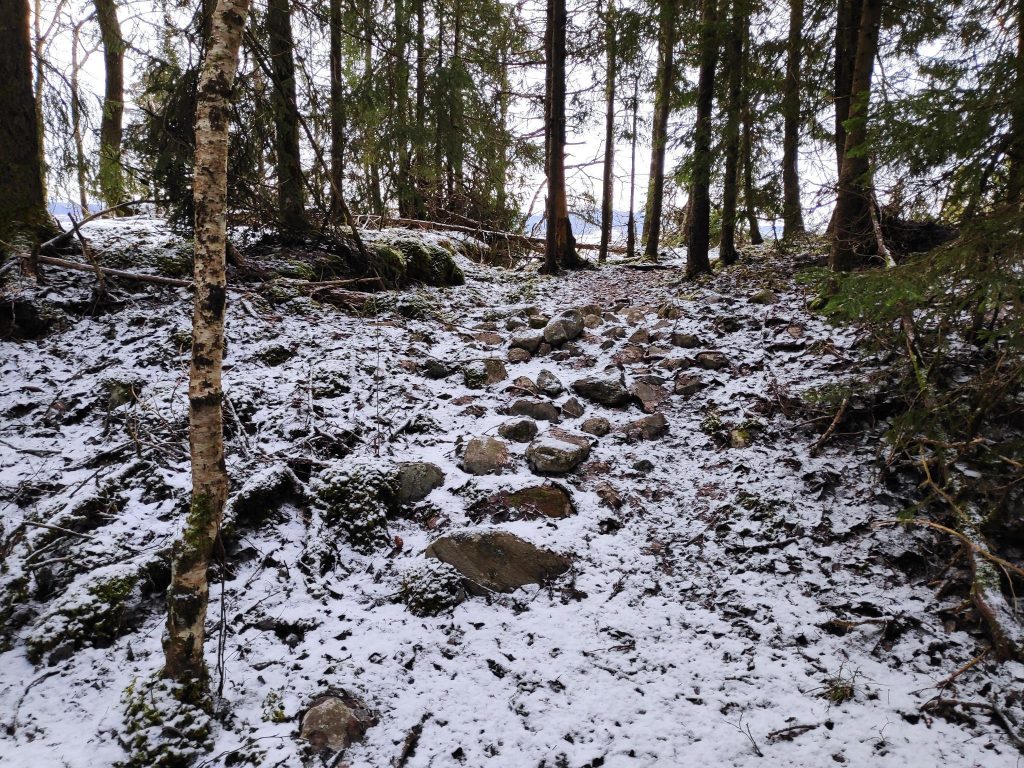
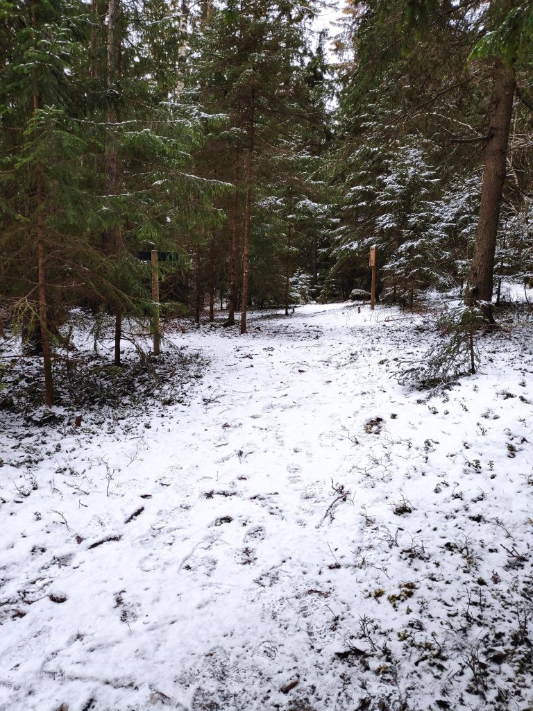
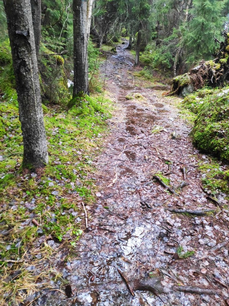
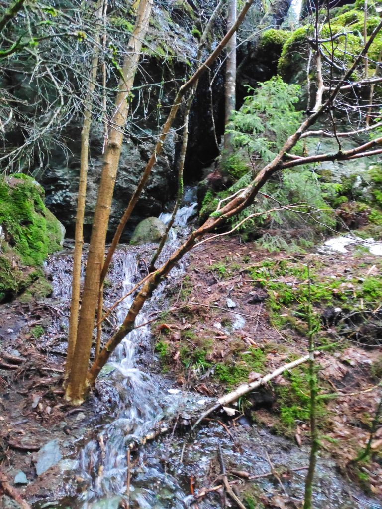
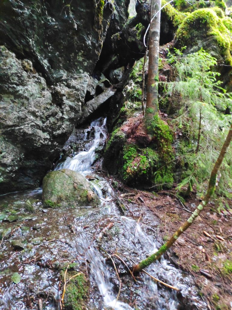
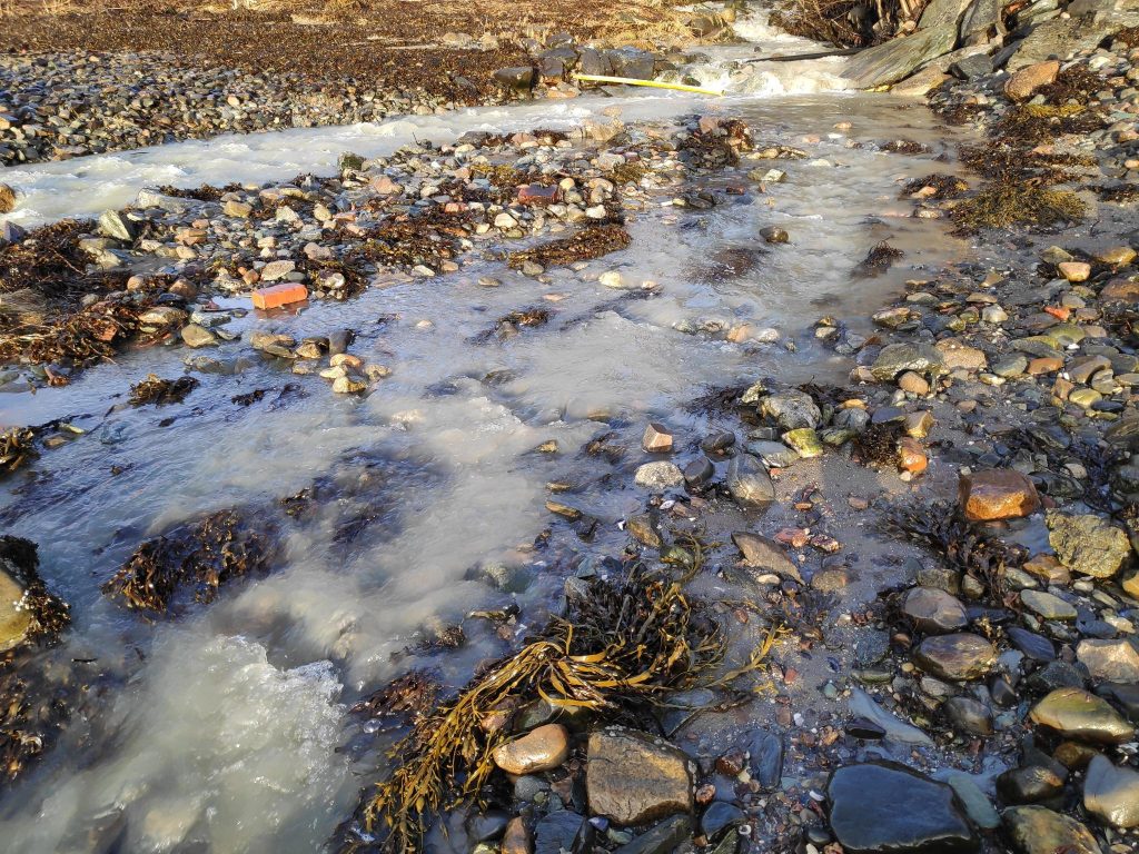
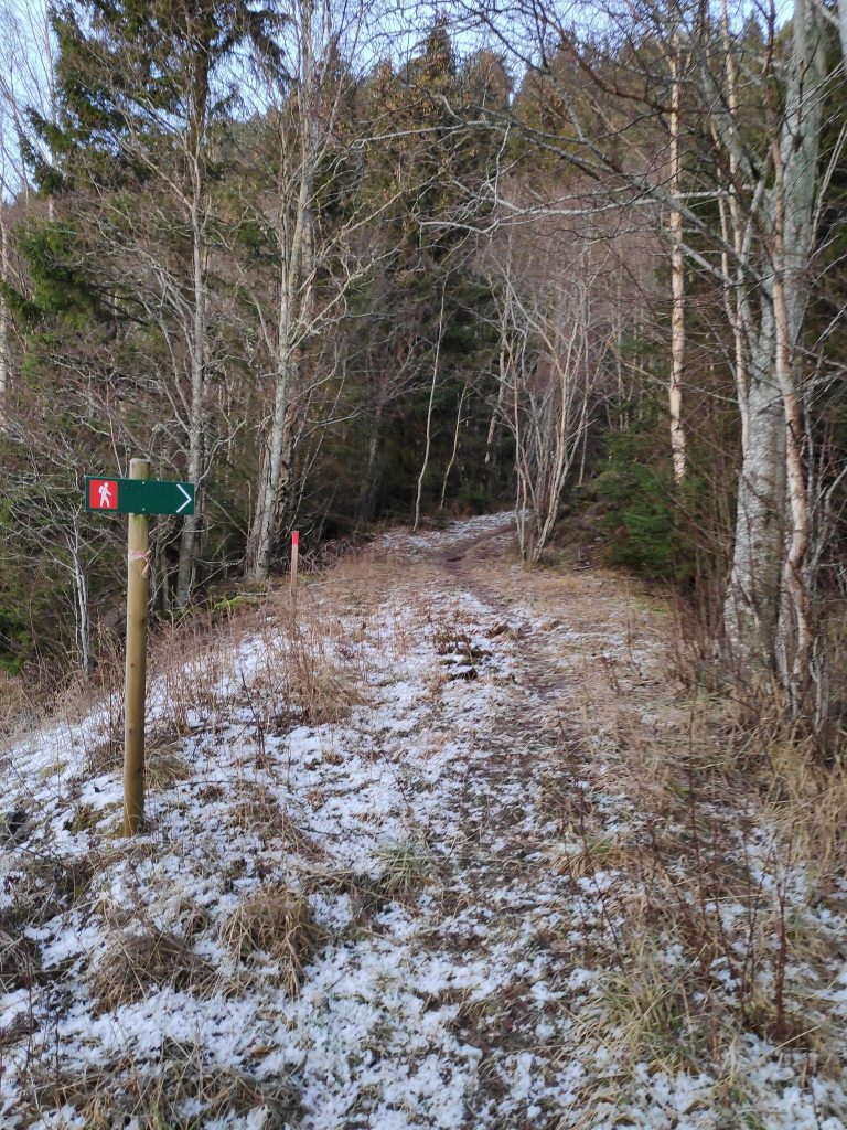
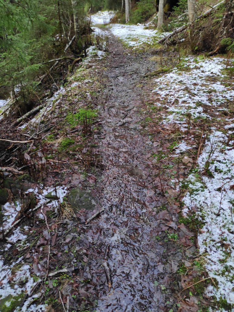
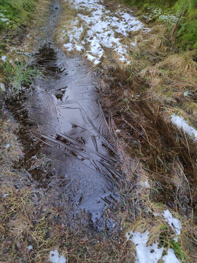
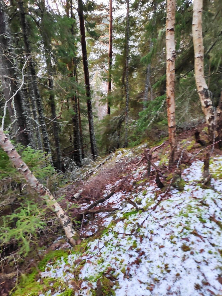
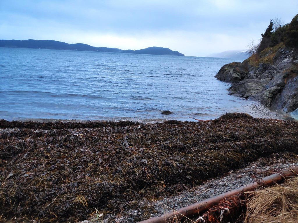
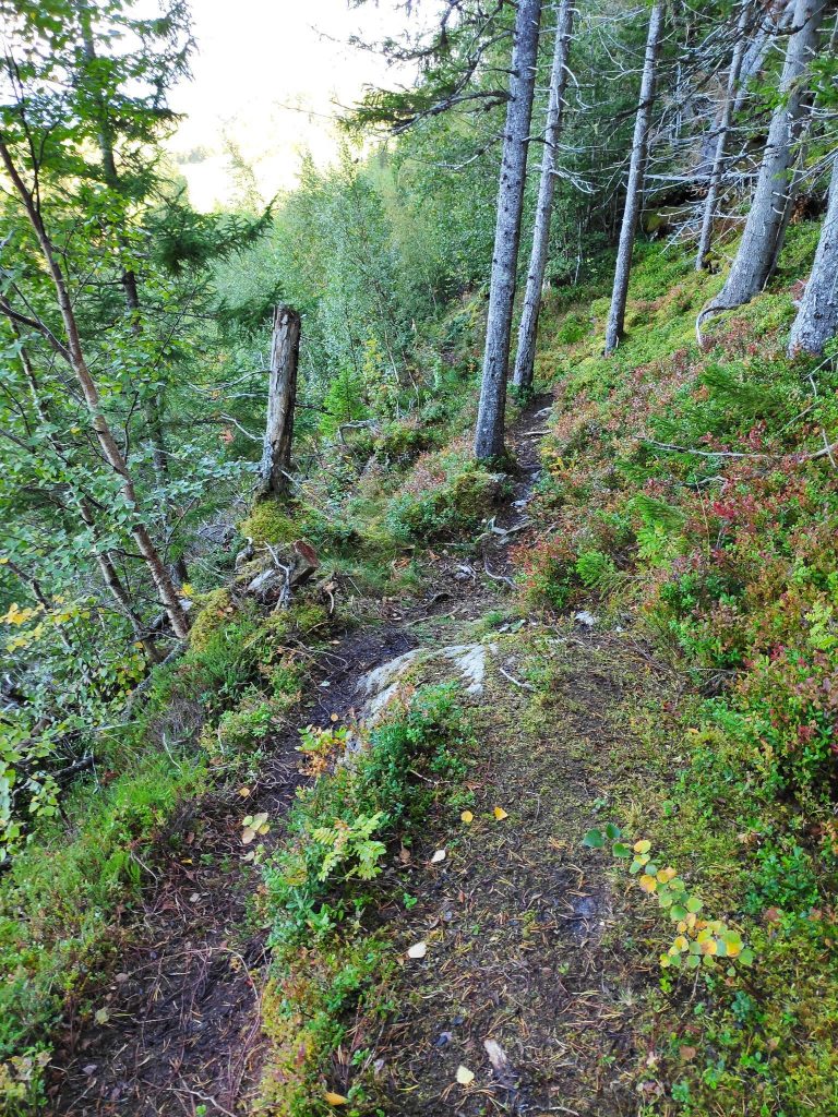
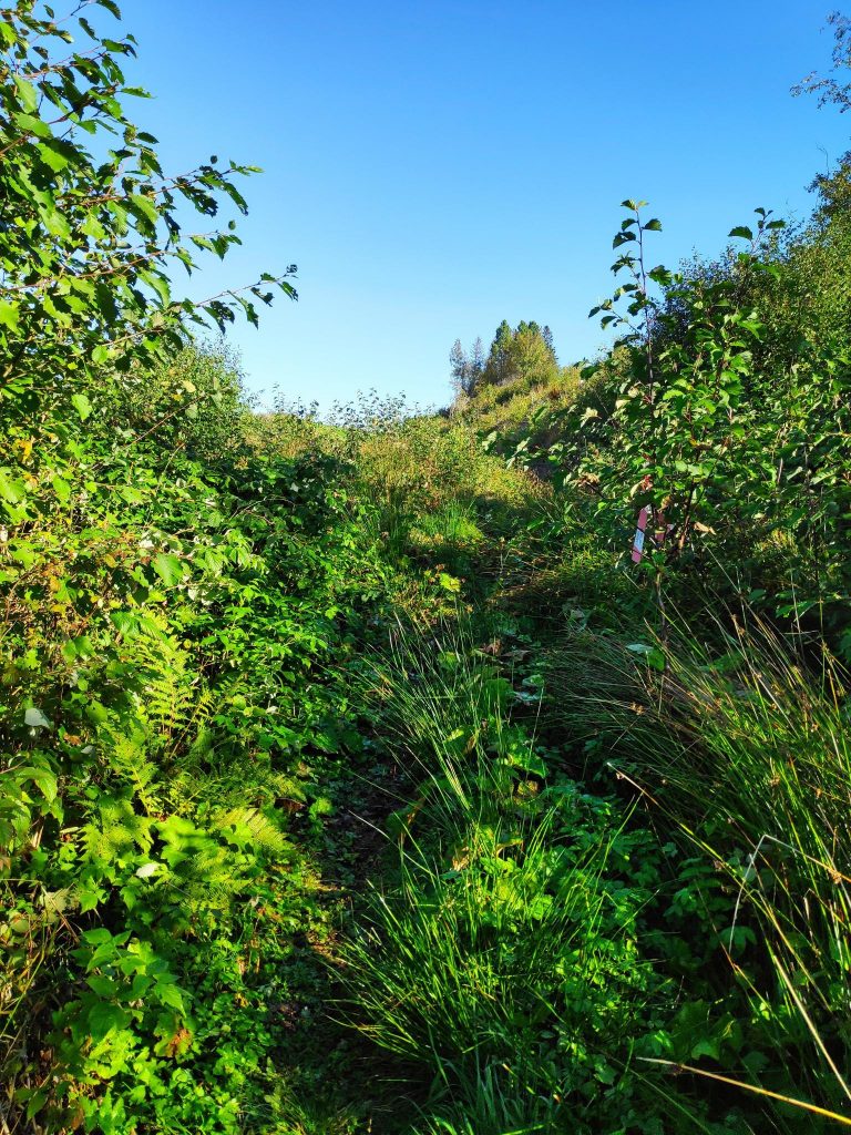
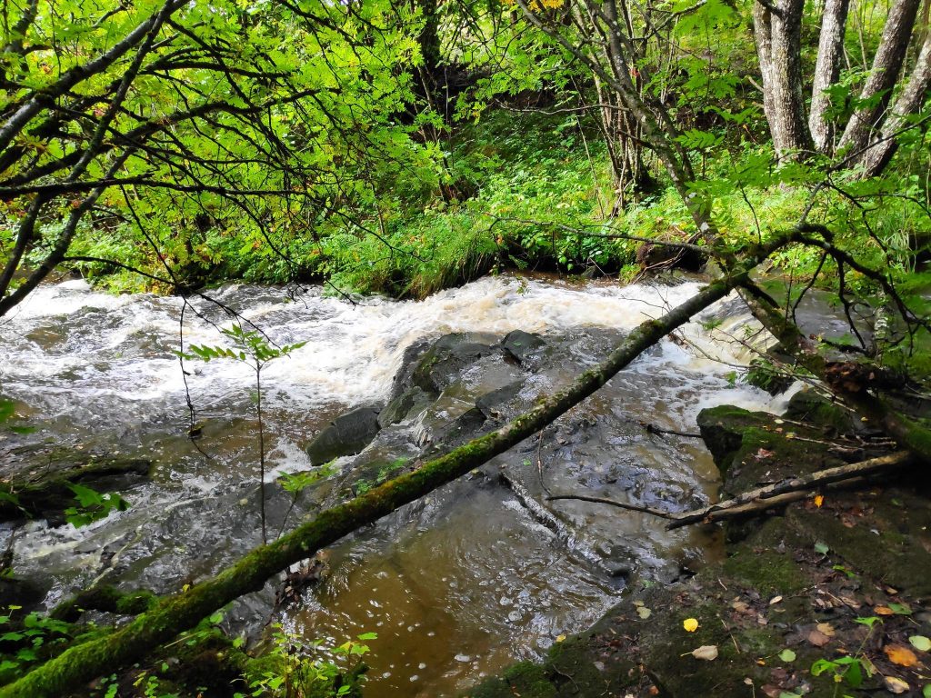
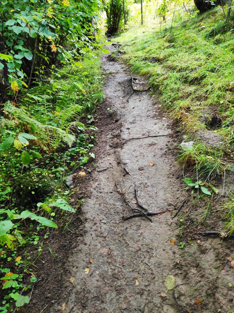
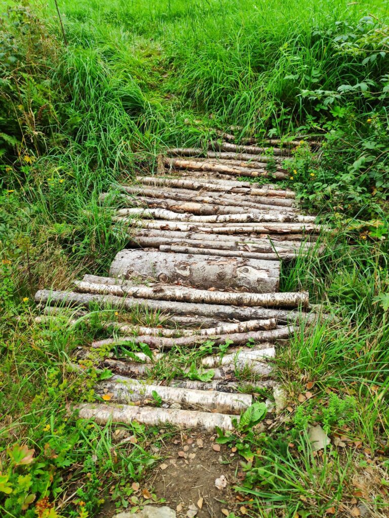
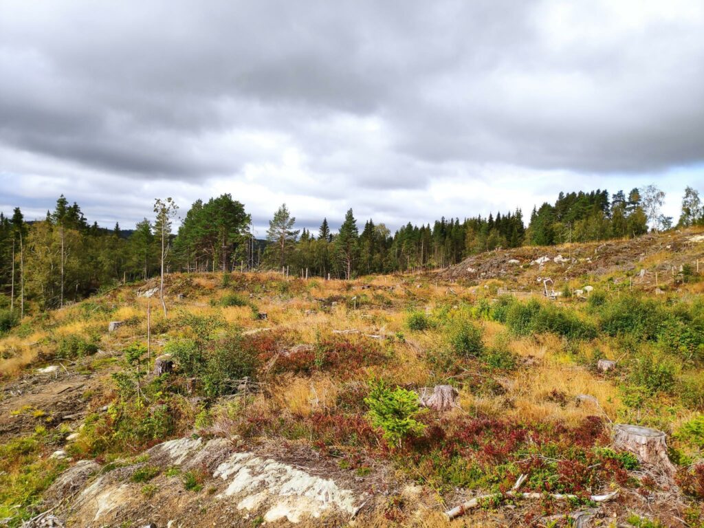
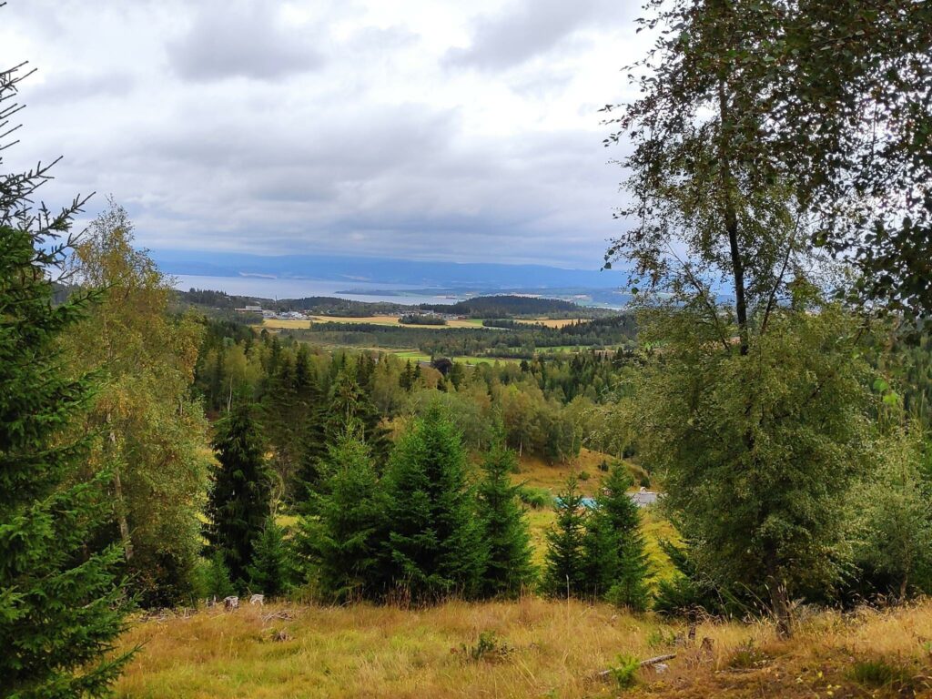
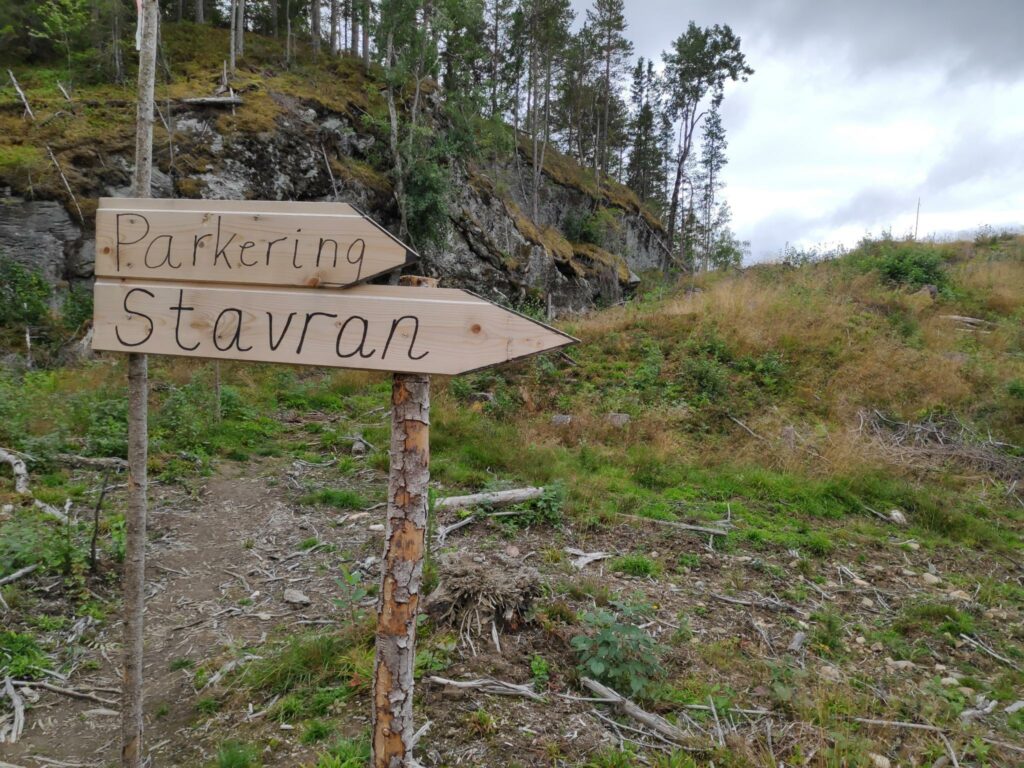
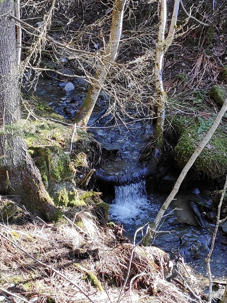
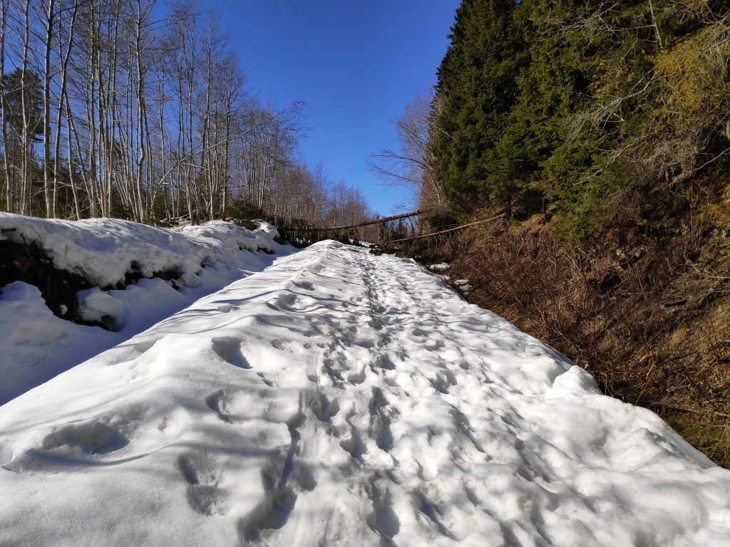
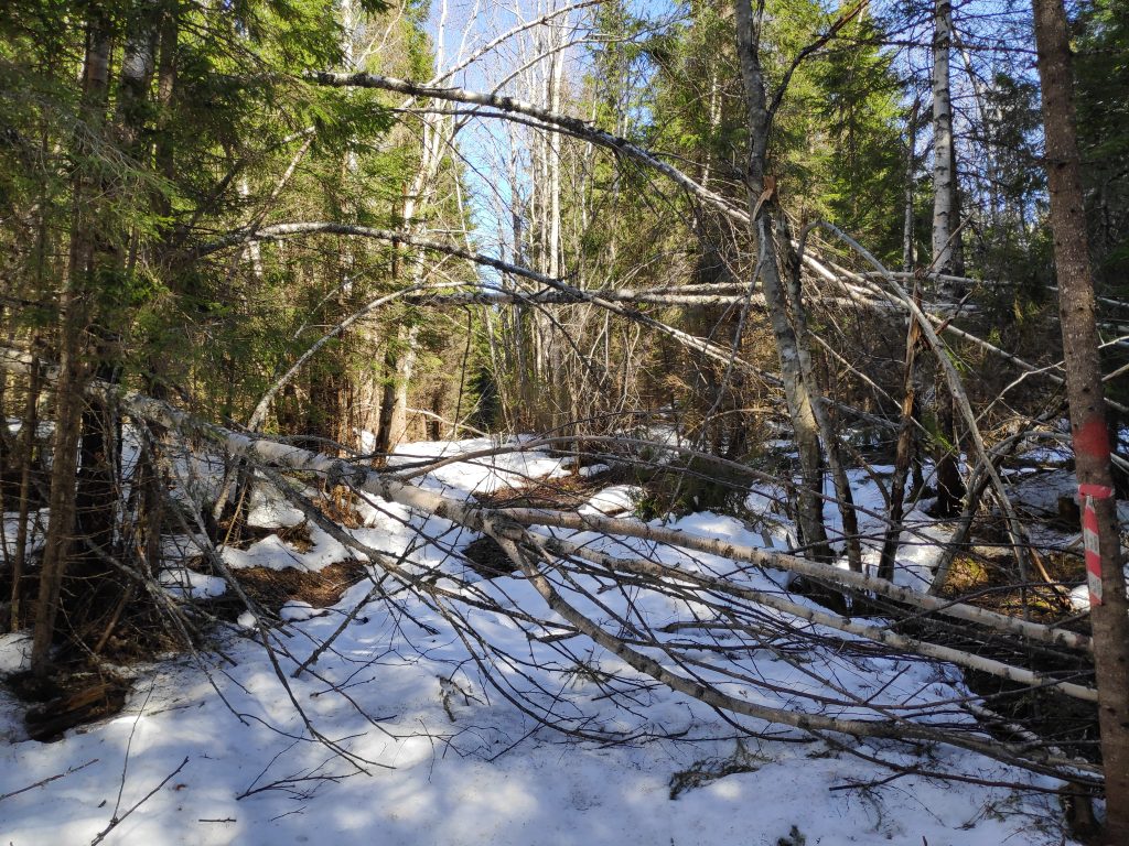
After enjoying the view, I went back to Gammelplassen, where in the summer you can park a car and headed off towards Skarnsund Bridge and home. However, there was a lot of snow on the trail, trees that had blown over, and a stream to cross before I got onto the section of the trail that was mostly free of snow.

Gammelplassen – no parking available at the moment. Come back in a month or two. But I’m not the first one to cross on foot. There were both human and animal footprints.
I’m on my way home, but first I have to get to the bridge. I’ve used about an hour so far.
Colt’s foot (in Norwegian, hestehov) is one of the first flowers to come up in the spring. The flower comes out first and then large leaves grow throughout the summer. These fellows had plenty of water and were eager to get on with their lives. They were not going to wait for the snow to disappear.
The trail continues on the other side of the stream. I followed the footprints and found a good crossing point. There was quite a bit of water in the stream, heading down to the fjord.
Here too there were all sorts of lazy trees who couldn’t stay standing. Some of the trees were more difficult to get around, over or under than others.
Finally, the trail becomes more bare than snow-covered, though the first part was quite wet.
Furufjellet (the pine mountain), the goal of the walking trip, about an hour and a half from the start of my walk, and about 50 minutes from home. As I suspected, there was little snow on this part of the hillside.
Looking up from the previous picture. There are pine trees at the top of this cliff.

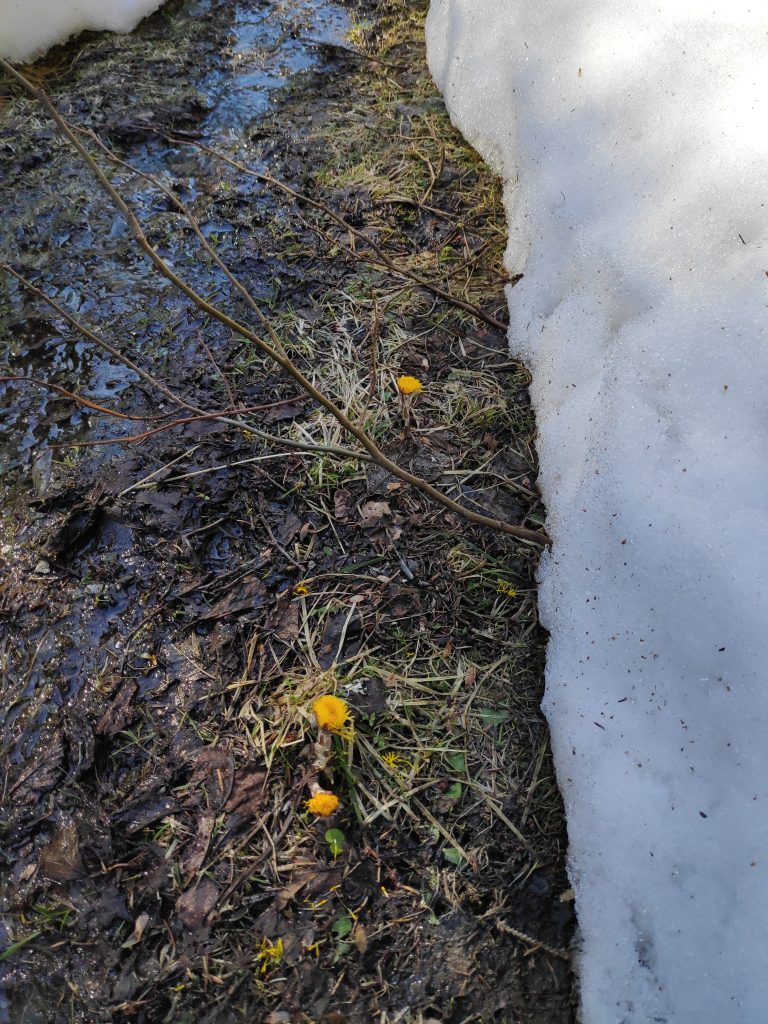
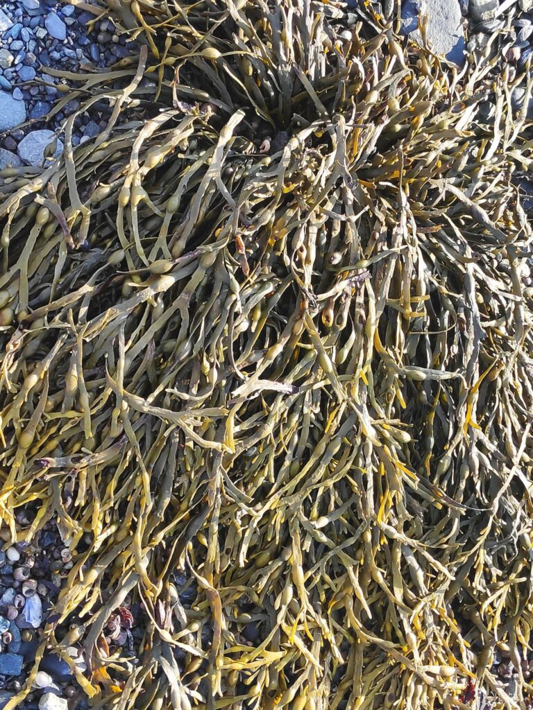
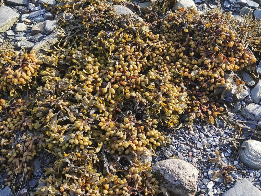
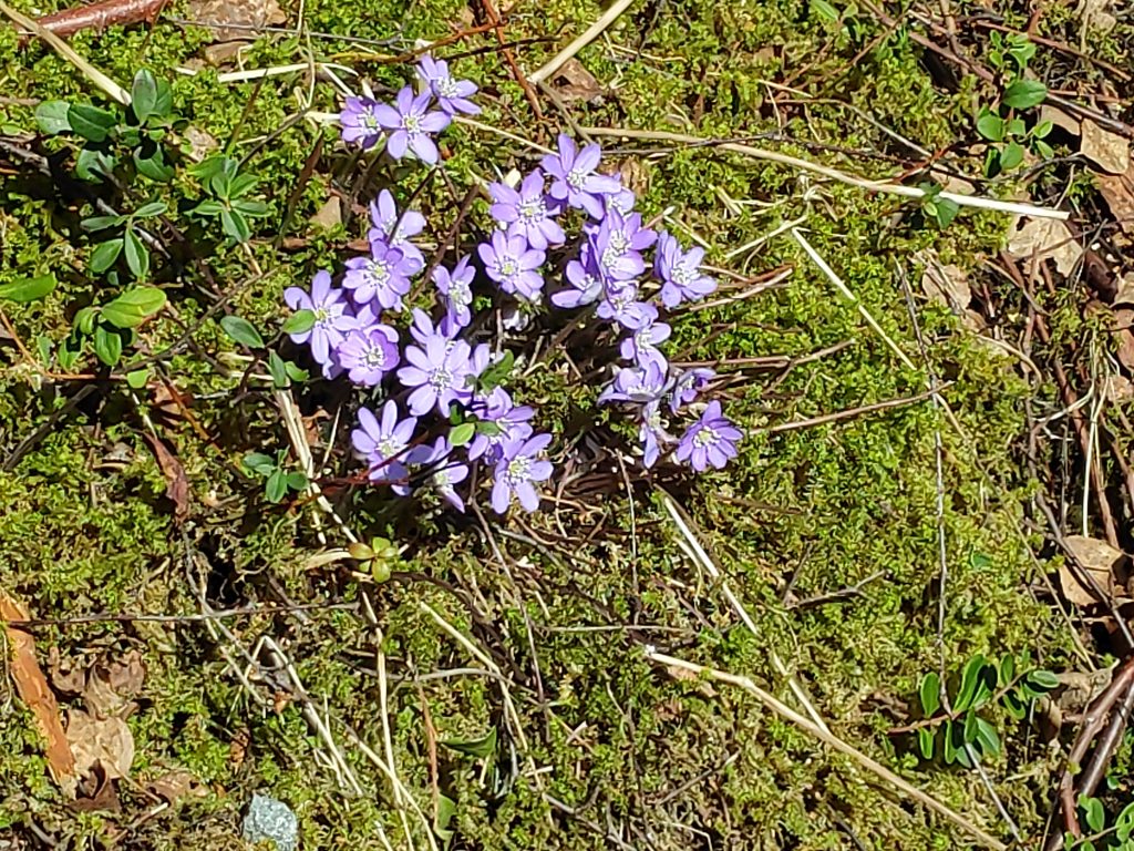
I often like to look at the flowers that are growing in different places, but in the middle of April there are still very few wild flowers out. I’ll have to wait until May before more come out. At this point there are a few that have to get their blooms out before the leaves come out on the deciduous trees. Colt’s foot (hestehov in Norwegian) is usually the first one and at lower elevations there are now numerous blooms along the sides of the road. Another plant, hepatica nobilis, (blåveis in Norwegian), anemone hepatica or liverwort in English, is very characteristic for Inderøy municipality.

This picture was taken on a sunny slope facing south. Anemone hepatica likes dry and calcium-rich soil. We have this on our lot and it is quite common throughout Inderøy.
I’m back to the bridge. One kilometer across the bridge and about half a kilometer to home on the other side.

This was my first long walk of the year, using about two and a half hours, without any breaks except to take pictures. I was tired when I got home, but not as much as I had expected. Getting out into nature, away from cars and people, helps me charge up my batteries and keep me in a good frame of mind.

I am planning to do other walks and perhaps there will be blogs about them. Most of the walks that I can do easily from home I have already written about, so no promises about how often new blogs will come out. From about the middle of May, the municipality of Inderøy has a series of walks which I am hoping to participate in this year too.

Have you been out for a walk in nature recently? Is this the weekend for you to get away for an hour or two? Enjoy your walk.

February Walk – Ice

As the walks that I take at this time of year tend to follow the same few trails or roads, I look for different themes for taking my pictures as I walk. Today I noticed ice in different types of locations.

January 2022 was the month of storms in Norway, though we didn’t feel all of them where we live. The Norwegian Meteorological Institute summed up the month of January with very high levels of bad weather warnings (see the article in Norwegian here), about twice as many as a year ago. There was a storm somewhere in Norway on 26 of the 31 days in January, with 82 yellow warnings, 12 orange warnings (more serious) and 2 red, extreme warnings. Why were there so many storms in January in Norway? There was a high pressure area sitting over Great Britain, so they got the sunshine. The storms coming in off the Atlantic Ocean went around Great Britain and came to Norway.

I usually think of January as the month that it warms up a bit and the snow disappears. This year we got that, but we also got several storms that brought more snow, or heavy rain. The last week of January saw more snow. February tends to be, in my opinion, more stable weather, meaning that there are fewer storms and more sunnier weather, though it can be quite cold and very often a lot of ice.

Today the temperature was about +2 degrees Celsius and no wind when I was out walking. The sun shone intermittently, but the day felt bright. But the last few days has given us changeable weather, sometimes snow, sometimes rain, but always the temperature has been about zero degrees, so that the rain does not get rid of much of the snow. That means that we have had perfect conditions for creating ice, especially where one drives or where one walks.

Running water creates ice and this stream was no exception. This is the same stream that a few weeks ago was causing flooding on the field at the top. The stream is fed under the cultivated field through a large pipe. Here the stream tumbles down a ravine, causing ice to form along its path.
In the woods, running water can also cause icicles to form. Here was a long series of icicles.
As I got closer to the icicles, I noticed the rock formations as well. Here there were several layers of rock, with large spaces between them. Above there are farm fields. Some of the water seems to be flowing in the stream I had found a week ago, but most of the water just seemed to drip over the edge of the rocks. Note that there is a lot of moss on the rocks indicating that these rocks are wet all year long.
The sun came out as I was writing my name in the tour book at the lean-to. I checked the map on my telephone and it told me that I was about 80 meters above sea level. I make sure I don’t go near the edge at this time of the year. I do not want to slide down a cliff face.
A week ago, I had seen a large tree stump at the water’s edge at the beach. Was it still there, I wondered? So I walked down to the beach and sure enough, it was stranded near the high water level on the beach. Today the tide was much lower. We can have up to four meters difference between high tide and low tide.
Back to ice and the conditions of the roads. This is a private gravel road that leads to five homes and many cabins. Icy! I was glad that I was wearing cleats under my shoes. I was also very careful where I walked. At the lowest point of this section of road, the stream goes under the road through a large pipe.
Even the municipal road that leads to the quay at Vangshylla was very, very icy, though a bit of sand had been put down to allow cars better traction on the ice. Walking along the edge of the road, it was very icy. I was glad to be walking uphill, not downhill.
As I walked up the road, I again saw icicles forming where water drains off the cliff and freezes as it falls.
The yellow fence at the top of the cliff shows our property. Here, too, ice forms as water is draining away and then freezing.

As it was several days since I had been out for a walk, I dawdled a bit, watching where I was walking and was out for about an hour and a half. It was good to get fresh air and let my eyes focus on things far away, and not just look at a computer screen or my knitting.

I hope you too have had a good walk this weekend.

January Walk – Checking in

Today is the last day of January and finally the weather was pleasant enough to go for a walk in the woods. We’ve been having snow, rain and sleet, but today there was little wind and light cloud so I was tempted out for a walk.

I like to have a goal for my walk, somewhere I turn around, though I don’t have to go back the same way that I came. In Trøndelag, Norway, there is a tradition of having a mailbox, possibly fastened to a tree, in which there is a book in which to write your name. These “turkasser” (tour boxes) are usually put out by the local sports club to encourage people to get out walking. They would normally be some distance from a car road, so that you are required to walk there. The books in the boxes usually last several years and one writes the date one comes, and one’s name. Some people like to add the time of day, comments about the weather and even the dog’s name. In the one that I visit most, I often write the accumulated times I have visited the place during the current calendar year.

Bjønnbråtte

The approach to the gapahuk/lean-to at Bjønnbråtte. Note the sloping roof. This one has grass on the roof. The open side faces the water and the view.

One of the most common walks that I take is to a place called “Bjønnbråtte”. Here there is a gapahuk, a primitive lean-to. It is a type of shelter, usually open on one side. This one would sit about three adults at the opening and you have to watch that you don’t hit your head when you stand up again. A Norwegian gapahuk, or lean-to, comes in many sizes and can be large enough to sit ten to fifteen people inside, or small like this one. We have lived here for 32 years and this one has been here all of the years we have lived here.

There is enough height to sit at the front. Today it was dry, but the last time I came here, snow had blown into it so I was not able to sit down. On the inside of the far wall, there is a box in which a book is stored. The box keeps the book dry. The lean-to is made out of logs and planks and sits on a foundation of mountain rock and large stones. The roof is covered with sod.

During the summer months, this is a check-in place for Inderøy Walks, but I also use it as a check-in place and turn-around place in the winter. Having a check-in place makes a good goal for a walk, and I find that it gives me the feeling of having gotten somewhere. Living in the country, walking to a store or other municipal facility is not possible.

The tour box has been opened and the book taken out to write my name in it. Today was the fourth time I have visited this spot in 2022. When we first came here, the book that was used at the time was just kept in a plastic bag to protect it from the weather. A couple of years ago my husband decided to make something more weather-proof and the result was the current box made out of used terrace boards.
The information sign inside the gapahuk/lean-to.

Why is this place called “Bjønnbråtte”? The Norwegian word, “bjønn” means a bear. So the sign gives the story of a bear, as retold by Jens Ness who was born in 1872. “A bear came across Ulvingrenda hamlet, crossed Leirdalen valley and came past Ness-sand, where a boy herded cattle at Ness. The bear killed a heifer which he started eating. Eventually, a lot of people gathered there and the bear was chased over the “halleren”, across the Bjønndalen valley and on top of this plateau.” It is not known whether they killed it there, shot him or scared him over the cliff. This is supposedly the last bear seen in the village.

Inside the lean-to, there is also a sign warming about forest fire danger. Between the 15th of April and the 15th of September it is forbidden to light fires. The telephone number for reporting fires is also given.

Rotsveet

After reaching my goal and writing my name in the book, I turned around and headed home. The first part of the trail I have to just retrace my steps, but I stopped to read one of the information signs along the way.

Norwegian at the top and English in small print at the bottom. You can also read all the signs for this walk between Vangshylla and Straumen at https://www.inderoysti.no/kart-og-tavler/.

(English translation of the sign) Once upon a time, this area has been used for cultivation. We see stones that are at the lower edge of the plot from when it was cleared, and as the name suggests, it was cleared by flaming, and used to grow root crops. (The word “sveet” means method for the clearing of land by burning and flaming.)

It was common to have land like this in the forest – where it was protected from the weather and the climate was good and warm. Another conclusion we could draw is that at that time there were no moose or deer. The root crops would then have been animal food and not human food. This has probably never been a place of residence.

Just below there is a great and airy view point out towards Norviksundet and Ytterøy island.

The stones that are mentioned in the text. There is a viewpoint straight ahead, on the edge of a cliff.
The viewpoint, looking towards the island of Ytterøya. I didn’t go too close to the edge when it was snowy and possibly icy. There is a sheer drop down many meters to the fjord.
You can just see the sign on the right of the path. It is relatively flat here, so one can see why it might have been cultivated at one time. The viewpoint over the fjord is off to the left from where I am standing.

The beach at Rotvollvika

To make my walk a round trip and to give myself two more uphill stretches, I often walk down towards the fjord. Today I caught sight of something unusual for our local beaches, but probably a result of the recent storms. Where I grew up in British Columbia, beaches were often littered with logs that had gotten loose from log booms. There are no log booms in the area here so there is very little driftwood on beaches.

The tide was relatively high when I came by. Seeing a floating stump in the water is unusual here. One can also see a smaller stump higher up the beach and some branches that have been put on the beach by either a higher tide or waves.
Looking eastwards along the beach, one can just see the piles of seaweed, deposited on the beach at high tide. Now is it covered by snow and ice. In the foreground there is a stream.
This stream has always fascinated me as it flows under the red boat house at the left.

I was probably out for an hour on my walk today and it was good to get outdoors and get both fresh air and exercise. I hope you get out for a walk today too.

January Walk – Weather

When I walk on my own, I often write blogs in my head, but they don’t all make it onto the computer. Today I was thinking about the weather and how I have always been fascinated by it.

When I went out for an hour’s walk today, it wasn’t raining when I left the house, but I knew it could. After several days of rain, I knew the ground would be soggy and wet, so I dressed in rain gear including gumboots. Gumboots mean that I don’t have to worry about the puddles on the paths in the woods.

The weather affects us all, and I often will check the weather forecast on my phone several times in the day, either to decide when to go out for a walk, what type of walk I will get and whether to stay indoors. I also use it to plan activities for later in the week. A heavy snowfall reduces how much I am willing to drive. Rain after freezing temperatures will make roads very slippery and dangerous. A promise of sunshine will improve my humor and get me outside quicker. Cold days are good days to bake and use the oven to add heat to the house. Warm days mean that I cook less and put less heat into the house from cooking. At this time of year, January, I think more about rain, snow and ice, than about it being too warm.

Again we have had quite a bit snow that has melted with the rain. When walking on paths in the woods, this means that the paths often become streams.

The path in the woods today was also serving as a stream. Water runs downhill to about the middle of the picture, from both the foreground and the background. The water drains off from the puddle in the middle of the picture, off to the right and on down the hillside to the fjord.
I tried following the water upstream to see where it was coming from and found a small waterfall.
Wherever the water was coming from, it was definitely going downhill.

There are many times when running water creates a problem, both for the environment and for humans and animals. Running water has considerable force and can damage things. Flooding can be a result when there is more water than the water channel will hold. With the climate changing all over the world, flooding is becoming more of a problem, especially where people have built their homes on a natural flood plain (the area that a river needs to have when there is more than normal amounts of water in it).

One of the effects of running water is to wash away the sand and small pebbles in the ruts of gravel roads. This road leads to three cabins but the rain and melting snow, on a slope, have washed away some of the gravel and sand.
To avoid this kind of erosion on driveways and gravel roads, it is important to lead the water away from the ruts. Here on our own driveway, I have cut into the side of the gravel so that the water can run into the ditch on the left. It seems to be working well this winter.

On my walk today, the streams (as well as the pathways) were full of water.

A local stream as it comes out of the woods and crosses the beach at low tide. My intention had been to cross the stream on the beach, but the water was flowing so quickly and I would have to have put my feet on uncertain ground, that I changed my mind and crossed the stream where it went in a large pipe under the road.
As you can see in this picture, there is at least one channel on the beach where the water is flowing very quickly and I was uncertain as to how deep the water was.

Eventually the sun came out, about the time I came out of the woods and down onto the beach. I was able to push back my hood and enjoy a bit of sunshine. The last bit of my walk is all uphill, so it went slowly as I was enjoying being outside, in the fresh air and the sunshine.

As I was thinking even more about weather, I noticed that while I had been experiencing rain, on the far side of the sound, and at higher levels, there had been snow on the tree tops.

On the far side of Skarnsund, there was a dusting of snow on the trees at the top of the hill. On the open fields of the farm at Duklett, there was still plenty of snow that had not melted, even though at sea level there was very little snow left.

Once home again, I decided to look and see what books we actually have about the weather and I found three (though there could be more that I didn’t find) from different time periods.

I found the subtitle of this book, published in 1960, very interesting – calling meteorology a young science.
This Norwegian book about weather forecasting was published in 1982 and is a translation of a German book published in 1977.
Published in 2005, this appears to be a translation of a book originally published in English in Australia. This book, titled, “The Weather” claims to be a “visual guide to meteorology” and has a lot of good pictures that illustrate the weather phenomenon discussed.

Today, it is easy to look up information about the weather on the internet, so I doubt if I would buy another book about the weather. How we get our weather information, both locally, or internationally, has improved immensely in the last ten years. The weather forecast that I can get on my telephone or computer will show when precipitation is expected, what the temperature mostly likely will be, wind direction and air pressure. The forecast for the next 24 hours is usually reasonably accurate. Bad storms are given a lot of publicity in news media so one can be prepared.

Today I was relatively lucky with the weather. I got out of the house while it wasn’t raining. Most of the rain came while I was in the woods, in the relative shelter of the trees. Once I was out at the beach, the sun came out. I managed to get out in one of the short breaks in the rain. At the moment of writing, it is raining again, almost constantly.

I hope you can get outdoors today too, no matter what the weather.

Another December Walk – Furufjellet

Inspired by my walk yesterday, I set off for another walk today. Today’s walk was longer, an hour each way. The weather was also nicer today, with the sun shining and no precipitation while I was out walking. The temperature was about zero degrees Celsius, but I had warm winter clothes on and kept toasty warm. Much of the walk is uphill, so I generate a lot of heat when walking.

Today’s walk had four sections to it, each quite different walking. The first section is through the woods, then I cross Skarnsund Bridge which has a lot of vehicle traffic on it, then up a gravel (and icy) road, then into the woods again. The return is exactly the same route, but mostly downhill. I started shortly after 11 am and got home two hours later, not even completely exhausted.

Through the woods to the bridge

The first section of the walk is about 10 minutes of walking, first along a gravel road that gives access to about twelve cabins. I noticed immediately that one large tree had been cut down and remembered the day that I had heard the sound of a motor saw. At the end of the gravel road, there is a path that leads up to route 755 which crosses Skarnsund Bridge. We had frost in the night, so I had to be careful where I was walking and avoid icy patches. But after all the rain the last week, the streams were still running briskly, taking run-off water down to the fjord.

There is a small stream beside the road to several cabins.

Skarnsund Bridge

I don’t walk across the bridge nearly as much as I used to because there is much more traffic on it now and it can be a bit noisy. However, when I am on my own and not trying to hold a conversation with anyone, the noise doesn’t bother me nearly as much. One can notice the vibrations of a heavily loaded dump truck and large trucks can create quite a breeze as they whizz by at 80 km an hour. Today, there were both trucks and buses passing me, as well as cars.

The nice thing about the walk across the bridge is the views in several directions – back towards home, up the sound to mountains with snow cover, to the south where the sun is a bit above the horizon and out the fjord towards Trondheim.

Vangshylla as seen from Skarnsund Bridge. This picture also shows how little light there is here in the middle of the day (photo taken at 11:25), even when the sun is trying to shine.
Looking north from Skarnsund Bridge with Framverran on the left and the mountains of Sela in the background.
Looking south-west from Skarnsund Bridge with the sun just clearing the island of Ytterøy.
As I approach the Mosvik side of the bridge, I see both remnants of the ice that builds up on the hillside and a stream of freely flowing water. The temperature was about zero degrees Celsius, but water was running freely in many places.

Gravel road

At this time of year, gravel roads can be a bit of a challenge as they can be very icy, especially in the ruts of the car traffic. The one I took today has very little traffic, which is why I like to walk along it. It is also uphill so I get a lot of good exercise, both for my limbs and my heart and lungs.

This gravel road leads to some farms, some homes and some cabins. There is not a lot of traffic on it, so it is a nice road to walk along. Today there was one car that drove past me. The road has been sanded so I was careful to walk where it had been sanded. This road gives good exercise as I walk uphill for about half a kilometer.
A road not taken. The photo shows how the frost settles on the ground in open areas, but less so under trees.
Another road not taken.
I don’t imagine that this field gets much sunshine at this time of year. With lots of rain recently, rain water had collected and was now starting to freeze over. I am now high enough up that snow has fallen yesterday instead of rain. I am at about 120 meters over sea level at this point.

In the woods

This section of the walk is in a quiet section of forest on a steep slope. In the summer months, sheep can be found grazing here. Today the gate in the fence was open as the sheep have either been sent to the slaughter house or are in the barn for the winter months.

Now I’m off the road and into the woods again.
The gate is open so there are no sheep out at this time of year. In the summer one must keep gates closed so that grazing animals stay where they are supposed to be.
This part of the trail is not particularly steep. It seems to be well used, either by people or wild animals. Though there is some snow where there are openings in the trees, it was also quite soggy and damp..
This section of the trail was being used by a small stream.
One section of the trail that had puddles also showed that the temperature was right on freezing, with a thin sliver of ice on the water.
On either side of the trail, the hillside is steep. Looking up.
Looking down.
This point of the trail, called Furufjellet, the Pine Mountain, was the goal of today’s walk. At the top of the cliff are some pine trees. Pine trees often grow where the soil is very poor. Much of the forest around here is actually spruce or birch trees.
I don’t have the best camera for taking close-ups of birds. Can you see the woodpecker sitting on a branch? He was busy pecking away as I watched him. We regularly have woodpeckers that come to our bird feeding station, so it was nice to see one out in the woods.

I really enjoyed my walk today. Even with two hours of walking, I wasn’t exhausted, so I guess I’m in better shape than I think I’m in. When the sun shines during at least part of my walk, my spirits are lifted and I feel much better. As I got home again, the sky clouded over and there was less sunshine. At the time of writing this blog in the evening, we have started to get more snow.

Enjoy your walk today!

A December Walk

Going for walks in December can be difficult for me. I actually don’t mind being out in the rain or the snow, but I dislike the wind. The problem is getting out of the house. Once I am outside with the appropriate clothes on, I enjoy being out in nature and the temperature is not very important.

The other challenge with getting out for walks in December is the short window for daylight in which to go for walks out in nature, away from houses and lighting. For example, today, the 19th of December, two days before the winter solstice, sunrise was at 10.03 and sunset was at 14.22. When it is cloudy, it doesn’t seem very bright outside at sunrise or sunset. When looking outside from a brightly lit house, it seems darker than it actually is, once you are outside.

Weather-wise, December this year has been very varied. At the beginning of the month, we had quite cold temperatures, down to -12 degrees Celsius. We had snow on the ground and sunshine during the few hours of daylight. Then about the 13th of the month, it warmed up to +8 degrees Celsius and started to rain a lot. The snow disappeared. The ground is soggy. Paths in the woods are small streams or large puddles.

Today I went for about an hour’s walk starting at 11:30. I took a walk that goes both on dirt roads, paved roads and forest trail. I put on rain trousers and rain jacket. Toque and mitts were also put on. I wore winter walking boots that kept my feet dry in spite of the soggy ground. I enjoyed myself as it is quite a while since I have been out for a walk in the woods.

My goal was to get to Bjønnbråtte, which is on a cliff top. First I follow some gravel roads which are very easy walking. As I climbed up the hill, it was noticeable that it had been trying to snow, rather than rain, as I got higher up. There wasn’t much, but the temperature must have been close to freezing point and I had to be careful that I didn’t slip.

Once I got into the woods, the trail was not only damp, but the stream was following it and there were large puddles to pick my way around. The walk to Bjønnbråtte is about 20 minutes from home.

Picture taken at 11:52, from Bjønnbråtte, looking towards Ytterøy. This is the end point of one of my favourite walks. This point is on a cliff that goes straight down to the water.

Today I decided to walk home via Sysvedalen and Vangshylla. At the bottom of Sysvedalen is a very small beach, used mostly for pulling small boats up on land to be stored there when not in use. It is a pebble beach, not sand. What attracted my attention today was the amount of seaweed that had been washed up on the beach. It has been quite stormy lately and today I was there at about high tide. Looking up the data about high tide, it was highest, at 307 cm, at about 11:50 which is quite a high tide for us. It was a full moon last night, which gives us quite high tides.

Looking south-west from the beach at Rotvollvika. Picture taken at 12:05, shortly after high tide. In the background is Ytterøy.
Looking south-east from the same beach at Rotvollvika. This picture was also taken at 12:05.
Taken from the road down to Vangshylla at 12:15. It was raining at the time and I was fascinated by the light in the sky.
Taken from the road to Vangshylla at 12:15. Note the light in the sky and the ramps to the boats in the small boat harbour. It is high tide and you don’t have to walk very much downhill to get to the boats.
As I continued on uphill, the sky to the north had the most light. This was caused by a break in the clouds though it was still raining where I was. The picture was taken at 12:21.

Once I was home again, I was glad that I had gone outside. I often wonder why I don’t get out more, as I really enjoy myself, even if it is raining. The weather forecast is for snow again, perhaps even tonight. I’ll just have to see what it is like tomorrow and make an effort to get outside again.

I hope you, my readers, are getting out for fresh air and exercise regularly. Don’t put it off, no matter the weather. Just find a terrain that suits you, dress for the weather and away you go. Remember the Scandinavian expression: “There is no such thing as bad weather”, but you do have to dress appropriately for the weather that you have.

Noremsbråttet, Utøy

Today’s walk with a girlfriend took us to a place neither of us had been to before. It took a bit to find the parking spot and we then started off from the car in the wrong direction, which just gave us a little bit more exercise.

The parking spot for two posts was well-marked once we were there. We will only do post 18 today. Post 19, a large rhododendron is best done at the end of May or June, when it is blooming. You will find that I have written a blog about it in 2020. http://trish.mclellan.no/2020/06/17/inderoy-walk-ordal-nature-reserve/
The information board gave information about the Ørdal Nature Reserve which includes the famous rhododendron. We did not walk into the nature reserve but ended up just before the boundary into it. Looking at the map on the board, we are walking at the top end of the map.

The Norwegian word “bråttet” or “brottet” refers, I think, to an area that has been recently cleared of trees. These two spellings would be pronounced similarly, depending on one’s dialect. These terms have been used on the names of two walks this summer, both of which take the walker to a high point with a view as there are almost no tall trees in the way.

We were lucky today with a morning with sunshine, though the temperature was about 10 degrees Celsius in the shade. When we got to higher elevations and were in the sun, I was walking in just a t-shirt.

The first part of the walk was along a gravel road. We were walking downhill at the beginning of the walk, which means you get a bit of an uphill climb just before getting back to the car.
We were walking in the shade so it was cool. We could also hear the farmer out cutting his grass and we had actually seen him when leaving the car.
But we didn’t walk that far downhill before we came across signs telling us to head into the woods. Another time I would like to go the whole way to the Rhododendron, just to see how to get to Noremsbråttet from the other side of the hill. My telephone tells me that at home, Noremsbråttet is only 3 km away, though that would be in a straight line and trails never go in straight lines.

The walk, as usual, took us up and down slopes. Though on the trip to Noremsbråttet it was primarily uphill, we both experienced that there were uphill sections on the way back to the car as well. The area we were walking in today is on the side of the hill on the east side of Skarnsund where the slopes are quite steep.

Here is an example of the trail we were following. It is narrow and in places it was quite damp. We had a lot of rain last week and most nights there is quite a bit of dew. This picture is taken looking back from where we came.
Though the trail was easy to follow and was marked well, it was not a very well-worn path. This trail is a bit out of the way, even for people living in Inderøy. Most of the human traffic would be in May or June when the rhododendron was blooming. By September, there are signs that many plants are getting ready for the winter ahead.
Looking up the slope, you can see how steep it is on this side of the hill.
Looking downhill the slope looks even steeper. But at this point along the trail there were lots of trees clinging to the side of the hill.
We were now up high enough to get a bit of a view, but there were still quite a few trees obstructing the view. Here we see Framverran on the west side of Skarnsund.
I knew that there were two trails to the rhododendron and this was the divide. We took the upper trail (“øvre sti”). The lower trail (“nedre sti”) to the right looked very unused and overgrown.
Then suddenly we came out into the open and got some sunshine. Here you can see that the blueberry plants are going red and loosing their leaves. There were still lingon berries (“tyttebær”) to be found. Now it felt like there was a bit more level ground and the path continued straight ahead and we stayed in this open area the rest of the way to our goal.
Then we climbed a bit more.
We came across a picnic table. It looked quite new, but this wasn’t our goal. We still had to cross another few hundred meters and on another rise we found our goal. The dark band of trees in the distance would be primarily spruce trees and I think that they would be in Ørdal Nature Reserve. We didn’t go that far on this walk.
We made it! Another 30 points on our app. My friend and I walk about the same amount so it is fun to find out how many points she has. She is a little ahead of me at the moment.
The view was spectacular. We are looking across to Framverran on the Mosvik side of Skarnsund.
Looking northwards to the hills of Steinkjer. No snow yet, but those hills will be some of the first ones to get snow in our area.
The highlight of the pause at Noremsbråttet was watching the eagle soaring in circles and almost never having to move his wings. I didn’t feel that there was any wind where we were, but the steep slopes will give up-drafts that allow birds to soar. It was very difficult to get a good picture of the eagle as he was just too far away. At one point he came a bit closer to us, and a small flock of small birds hastily moved from one group of trees to another group considerable farther away from the eagle.

This is a walk that I would recommend. There are steep bits where one needs to hold on, but they are quite short. The view at the top is beautiful on a sunny day. There was a picnic table to sit at while taking a pause before heading back. We used about half an hour each way, so about an hour’s walking.

Kvamsholmen to Undersåker Bay

On the 10th of August we went for a walk to the island called Storholmen. Today we again parked at the Recycling Center in Utøy and walked the same path down to the fjord as we had on the previous walk to Storholmen (see the previous blog here). But instead of walking out to the island we continued along the path towards Undersåker.

Storholmen is on the left, still just attached to land and the other islands are now isolated. It was an incoming tide, so the causeway out to Storholmen had much less above the water on our return trip to the car than had been the case on our outward walk.

As you can see from this picture, the sky was quite cloudy. Though we usually go for our weekend walk on Sundays, we chose Saturday this week as the weather forecast was better for Saturday morning. I noticed that just as we arrived home again, it started to rain so it was good that we weren’t out any longer or any later in the day. The temperature was about 12 degrees Celsius, which I find a nice temperature for walking. There was no wind, not even down by the water.

It didn’t take us long to come out of the woods and follow a road towards the honey farm at Kvamsholmen. One of my son’s classmates grew up here, but the farm has now been taken over by Tonje Kvam.

This sign is in both Norwegian and English and explains the life cycle of a bee, who lives approximately 40 days. In the summer there can be up to 70 000 bees in a hive.
We passed one house, or perhaps it is a cabin/summer house, and this pair of jeans was left out in the garden. I don’t think I would want to wear them again.
Undersåker Bay – My daughter was friends with the girls that grew up on one of the Undersåker farms. The tide is out. We walked around this bay, crossed a stream and sat down at a picnic table on a rocky outcrop just to the left of the center of the picture.

We came to a stream that drains several hamlets in Utøy and the stream seemed to have different names depending on which farm it is closest too. The sign below explains that the stream has been used for various purposes over the centuries: in 1620 it was used to power a stream grinder; there was a sawmill in the 19th century and a cement foundry in 1930 which used sand from the beach as well as the water from the stream.

I reacted to the name on the sign, “Storfossen”, the great waterfall. Yes, we have had a lot of rain this week so there was a lot of water in the stream and it definitely was noisy as it journeyed down to the fjord. But I didn’t think it was so very large.
Though I wasn’t able to measure the height of the falls, it seemed like about one or two meters at the most. After a week of rain, there was certainly lots of water in the stream.
The wooden bridge felt quite slippery, but thankfully there was a railing to hold onto. The bridge is under the trees so it probably never dries out. There was certainly a lot of moss growing on it.
A week of wet weather also made the paths a bit muddy. It was narrow here so I felt I had to walk quite cautiously.
Suddenly I came out into the open and we were at our goal for our walk for today – Undersåker Bay.
There was a picnic table to sit at while we took a well-deserved pause. The tide was out. Low tide had been at 9:12 about two hours before this picture was taken. So the water had already begun to rise.

The walk back to the car was just to turn around and go the same way back. We did make one little detour to a picnic place to see what the site offered.

In the background is the farm Kvamsholmen, and we decided to see what the “rasteplass” or picnic site had to offer.
At first I thought these buildings might be boathouses, but they did not have easy access to the water, except at high tide. A boat would have to be carried down to the water. As my son explained, the building would be used for storage of things needed for a day down at the water’s edge, a grill, chairs, perhaps a table, and a small boat that could be carried by two people to the water’s edge. They all looked relatively new and in good condition.
Undersåker Bay from a different angle. The goal of our walk had been on the far side of the bay, between the green fields on the left and the white house on the right.
There were some interesting rock formations here as well.
On our way back to the car, I noticed this older building. I notice the combination of stone foundations and wooden piles. The lower edges of the siding were showing signs of having been around for a while. I went around to the side of the building.
The side of the building was open and I could see what was been stored inside, though I couldn’t put names to much.
But then I found a sign about the building, that is probably from 1850-1910, so well over a hundred years old.

We had a good walk and used about 2 hours from leaving the car to getting back to it. But this also include a sit-down pause at Undersåker Bay and exploring a bit at Kvamsholmen farm. Because the car is parked at a higher elevation, the best exercise on the walk is getting back up the hill at the end of the walk. We were lucky with the weather and that made the walk all the more enjoyable.

Åsbrottet, Utøy

Today, my girlfriend and I went for our usual Wednesday walk and we chose a walk we had not taken before. The walk up to Åsbrottet was a new Inderøy walk this year and neither of us had taken it before. I enjoyed the walk and we had some surprises along the way.

The information about the walk told us where to park our car and that the walk was 3.5 km long and would take us in a circle. We used about one and a half hours which included time to enjoy the walk, take lots of pictures and enjoy the views. We parked at Stavran, near farm buildings.

I think the farmer at Stavran uses John Deere tractors.

The trail

This was a newly marked trail this year and was well marked. There were only a very few places where we wondered where the trail went. There were many trails leading off the main trail, and I discovered that this was because we came back a different way than we went up the hill. (Of course, we were climbing a hill!)

I am going to show you some of the pictures from our walk, but not always in the order that they were taken. There were some very steep climbs, as we climbed up about 100 meters to the check-in point at Åsbrottet. There were pleasant areas in the trees and therefore out of the wind. There were a few areas where my hiking boots got damp, though that could have been mostly dew from the grass, but there were obvious signs that some areas would get quite muddy when it has be raining.

A lot of the walk was in fairly open areas, relatively recently logged. On this section of the trail we had quite a steep climb.
Someone (or perhaps many people) had done quite a bit of work to make it a good trail, especially where there were damp or muddy sections.
Some parts of the trail were through woodland.
Most of the trail was quite easy to follow. This section looked like it had been around for quite a number of years, so not all sections of the trail were new.
Twice we had to cross a fence and both times there were very good stiles to cross. The advantage of a stile is that the farmer doesn’t have to worry about hikers leaving gates open and cattle and sheep getting out of their pasture area. My girlfriend said that stiles over fences were quite new in Norway and certainly not very common. On the far side of the fence in the picture there had been large animals grazing, though we didn’t see any today.

The views

I always love walks where we get up high enough that there is a view over the trees. Living in a farming area, there is always the challenge of figuring out which farms one sees in the distance.

Having started at Stavran and having climbed the first steep section, we could see back to the road, farms in the distance and even farther away would be Levanger.
A lot of the area we were walking through was quite open. The sky looked threatening in this picture, but we had no rain on our walk. In some places it was a bit windy, especially when out in the open, or on a hill top.
This area had been logged a few years ago, but I’m not sure how long ago. Small plants and trees were starting to grow again. In the background you can see the forest that still exists.
Eventually we got up high enough to see northwards towards Beitstad Fjord. The walk was getting very promising at this point.
Follafoss on the far side of Beitstad Fjord, taken from Åsbrottet, the highest point of our walk.
Looking towards Stokkan with Beitstad Fjord in the background. Notice the signs that tell us what is in that direction. We decided to walk to Farbuhøgda on our way back to Stavran.
Looking south towards Trondheim Fjord, Utøy, Ytterøy and Levanger

The signs

When getting around an area one has not been hiking in before, one has to rely on the markings and good signs. On this walk, the signs were new and the different directions were marked at critical points.

The first sign tells us that there are two places we can get to on this trail, Åsbrottet, which is where we get points for a walk, and Farbuhøgda. (Høgda = high point)
Åsbrottet was well marked and this is where we got our points. There was even a table to sit at to enjoy the view. It wasn’t really warm enough to sit today and there was also a wind blowing at the top that, though it kept the insects away, also encouraged us to keep on walking.
As always, there are choices. We chose to go to Farbuhøgda, before returning to the car at Stavran. One could have a shorter walk by going directly to Stavran from here.
Farbuhøgda had a grill, table and two benches to sit on. There was a fence around it, presumably to keep grazing animals and their excrement away from the picnic area.
We came across this diving board into a little tern, Farbutjønna.
It wasn’t a very big tern, but it must have been deep enough to dive into. Note the plastic bag in the foreground, which is tied to a rope which could be used by a swimmer to pull themselves out of the tern. The edge of the tern did not look like it was easy to find solid footing.
Now it was time to go back to the car, though by following the path in the direction indicated, we walked farther than if we had just gone straight ahead which is where we had come up. It was longer, but not nearly as steep.

We both enjoyed the walk. It was cool enough (14 degrees Celsius) to enjoy the climbs without attracting a lot of insects. The breeze kept us cool and the insects away too. We used about 90 minutes and felt we had had some good exercise. This is a walk I would like to do again, but I have to do it early in the day when I have lots of energy.

Storholmen, Utøy

This evening the three of us decided to go for a walk out to an island that can only be reached at low tide. A check of the tide tables yesterday evening indicated that low tide would be just before 8 pm. So we took off from home at 7 pm.

We chose to park near the recycling center in Utøy, which serves the whole municipality of Inderøy.

The recycling center for Inderøy municipality had just closed when we got there. There is parking off to the left for those who want to go for a walk. There is a ramp up to the upper level, so that garbage is thrown into the big blue bins from the top. Examples of what we would sort out is cardboard, metal and impregnated wood. The red bins to the left are for clothing. They are in the open area so accessible at all times for depositing used clothing.

We had about a one and a half kilometer walk to where we wanted to go, mostly downhill, through both open forest that had been recently logged and older forest.

This section of the walk was through old forest. It was cool and pleasant in the forest.
We are almost down to sea level and we are going to walk out that causeway to Storholmen, the island you can see in this picture.. This is about as low as the tide goes. It was registered at 47 cm at 19:50 today, the 10th of August 2021.
To the right of Storholmen is Kvamsholman, which is really two islands. These two islands are a habitat management area and are reserved for birds, in particular oyster catchers (tjeld), eider ducks (ærfugl) and two types of sea gulls.
This information sign of the islands shows how Storholmen has a causeway out to it and Kvamsholmen is reserved for the birds. All the islands are isolated at high tide. The difference between high tide and low tide can be as much as three meters.
The path out to Storholmen is easy to follow, though there is quite a bit of seaweed on either side. Some of the seaweed was quite slippery if you stepped on it. It was about 600 meters from the beach out to the island.
I’m no expert on seaweed, so I can’t tell you what kind this is.
A different kind of seaweed.
In some places there were a lot of mussels as well. They would make good food for the sea birds that live here.
Storholmen is a large rock in the fjord and is covered by a variety of vegetation, including trees and grasses.
Storholmen
Kvamsholman as seen from Storholmen. Kvamsholman is about 200 meters from Storholmen.

We enjoyed our walk. The temperature was about 20 degrees Celsius, though it felt more when we were walking in the sun. We walked about 2 km each way and we walked the same route back to the car. The return to the car was a bit more strenuous as we now had to climb back up the hill. We were probably walking for about one hour. this is a walk that we take about once a year.