
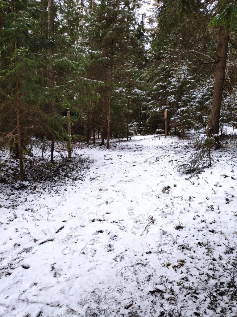
Today is the last day of January and finally the weather was pleasant enough to go for a walk in the woods. We’ve been having snow, rain and sleet, but today there was little wind and light cloud so I was tempted out for a walk.
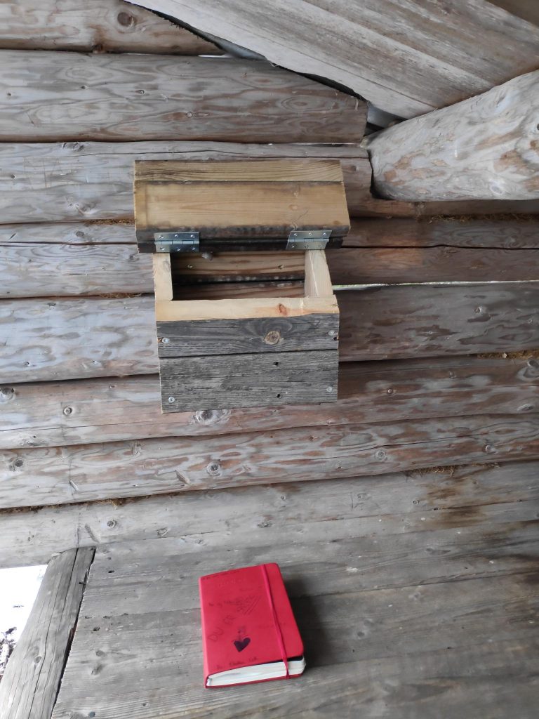
I like to have a goal for my walk, somewhere I turn around, though I don’t have to go back the same way that I came. In Trøndelag, Norway, there is a tradition of having a mailbox, possibly fastened to a tree, in which there is a book in which to write your name. These “turkasser” (tour boxes) are usually put out by the local sports club to encourage people to get out walking. They would normally be some distance from a car road, so that you are required to walk there. The books in the boxes usually last several years and one writes the date one comes, and one’s name. Some people like to add the time of day, comments about the weather and even the dog’s name. In the one that I visit most, I often write the accumulated times I have visited the place during the current calendar year.
Bjønnbråtte
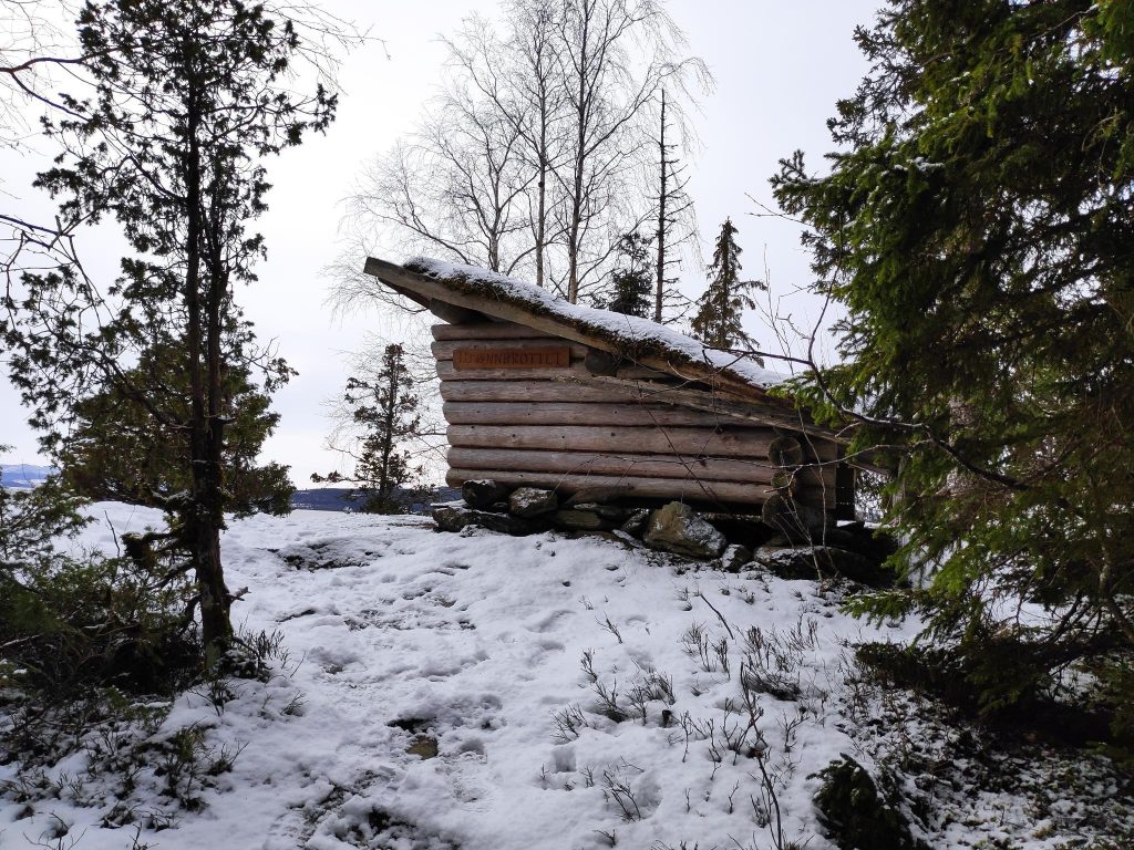
One of the most common walks that I take is to a place called “Bjønnbråtte”. Here there is a gapahuk, a primitive lean-to. It is a type of shelter, usually open on one side. This one would sit about three adults at the opening and you have to watch that you don’t hit your head when you stand up again. A Norwegian gapahuk, or lean-to, comes in many sizes and can be large enough to sit ten to fifteen people inside, or small like this one. We have lived here for 32 years and this one has been here all of the years we have lived here.
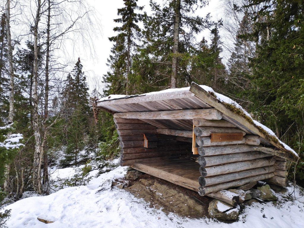
During the summer months, this is a check-in place for Inderøy Walks, but I also use it as a check-in place and turn-around place in the winter. Having a check-in place makes a good goal for a walk, and I find that it gives me the feeling of having gotten somewhere. Living in the country, walking to a store or other municipal facility is not possible.
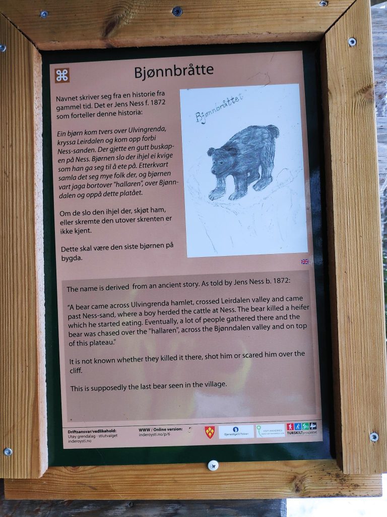
Why is this place called “Bjønnbråtte”? The Norwegian word, “bjønn” means a bear. So the sign gives the story of a bear, as retold by Jens Ness who was born in 1872. “A bear came across Ulvingrenda hamlet, crossed Leirdalen valley and came past Ness-sand, where a boy herded cattle at Ness. The bear killed a heifer which he started eating. Eventually, a lot of people gathered there and the bear was chased over the “halleren”, across the Bjønndalen valley and on top of this plateau.” It is not known whether they killed it there, shot him or scared him over the cliff. This is supposedly the last bear seen in the village.
Rotsveet
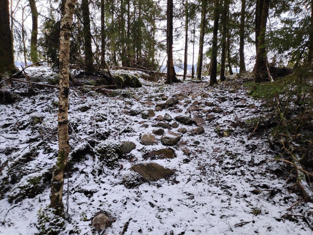
After reaching my goal and writing my name in the book, I turned around and headed home. The first part of the trail I have to just retrace my steps, but I stopped to read one of the information signs along the way.
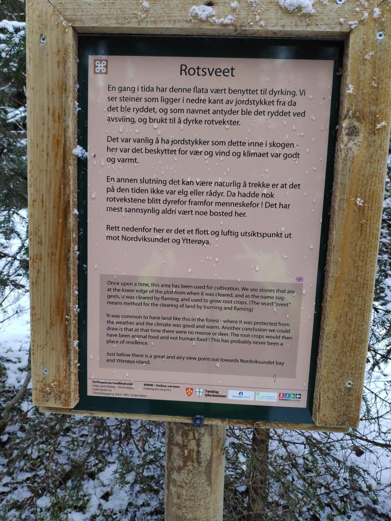
(English translation of the sign) Once upon a time, this area has been used for cultivation. We see stones that are at the lower edge of the plot from when it was cleared, and as the name suggests, it was cleared by flaming, and used to grow root crops. (The word “sveet” means method for the clearing of land by burning and flaming.)
It was common to have land like this in the forest – where it was protected from the weather and the climate was good and warm. Another conclusion we could draw is that at that time there were no moose or deer. The root crops would then have been animal food and not human food. This has probably never been a place of residence.
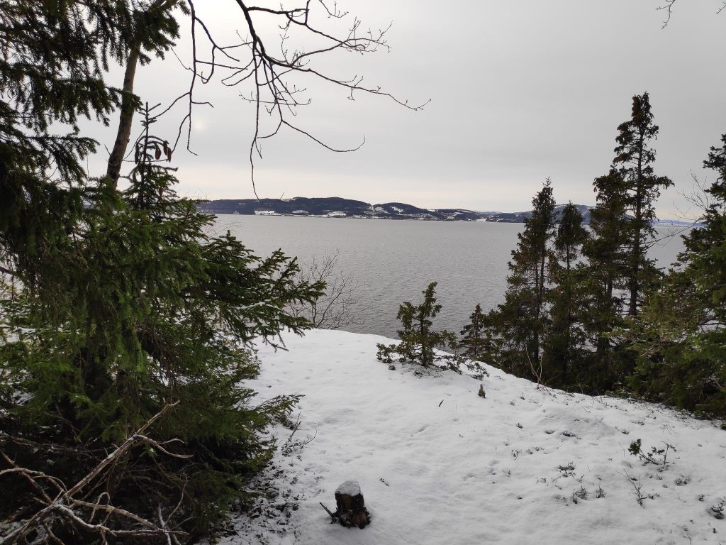
Just below there is a great and airy view point out towards Norviksundet and Ytterøy island.
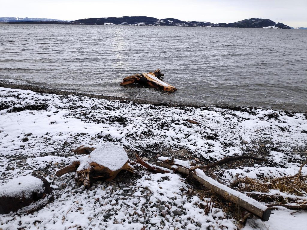
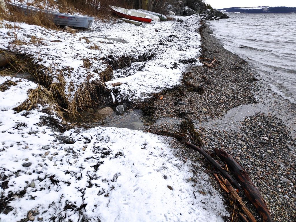
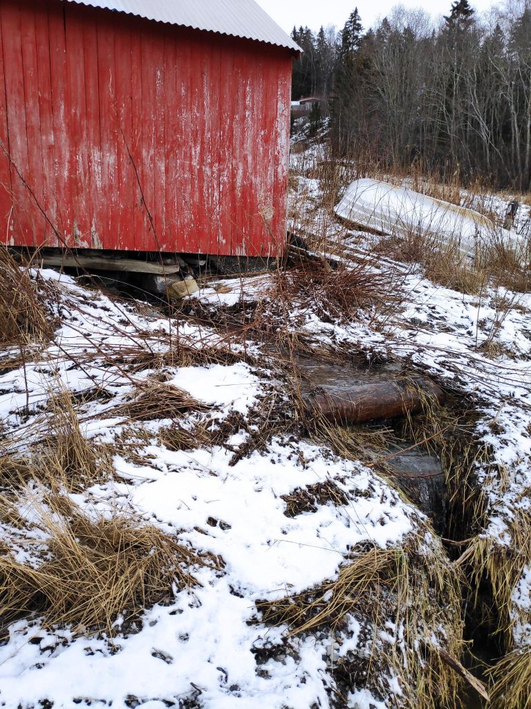
The beach at Rotvollvika
To make my walk a round trip and to give myself two more uphill stretches, I often walk down towards the fjord. Today I caught sight of something unusual for our local beaches, but probably a result of the recent storms. Where I grew up in British Columbia, beaches were often littered with logs that had gotten loose from log booms. There are no log booms in the area here so there is very little driftwood on beaches.
I was probably out for an hour on my walk today and it was good to get outdoors and get both fresh air and exercise. I hope you get out for a walk today too.
Så fin ei fortelling om turtradisjoner på Inderøy!
Ha en fin dag.
Hilsen Inger J