
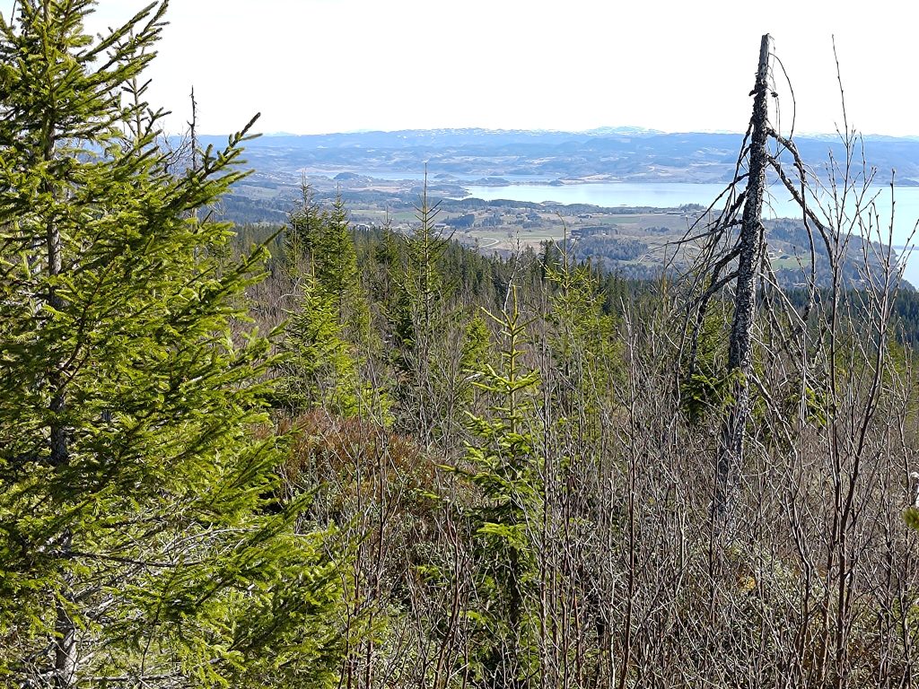
May in Norway is full of holidays and the first of May is the European Labor Day. Stores are closed and even though we are retired, it was nice to have a day-off household chores. In addition, the weather was sunny and promising to be warm, up to 20 degrees in the afternoon. So my husband and I decided to use the early part of the day for a longer walk and chose to climb the hill in Mosvik that we see from our house. It’s called “Storlia”, the big hill. The car is parked at about 130 meters above sea level and we get to about 380 meters above sea level, so it’s a bit of a climb. It’s good exercise and the views are beautiful on a sunny day.

As usual, I started by taking a map of the area. We parked at Gammelplassen (the old place), which is marked with a red arrow on the map below. There are a lot of trails on these hillsides. Many of the trails would have originally been logging roads. Some are still wide enough for two people to walk abreast. Other trails are quite overgrown. The red line on the map shows some of the major trails that are marked. But there are dotted black lines that are also good trails that can be followed.


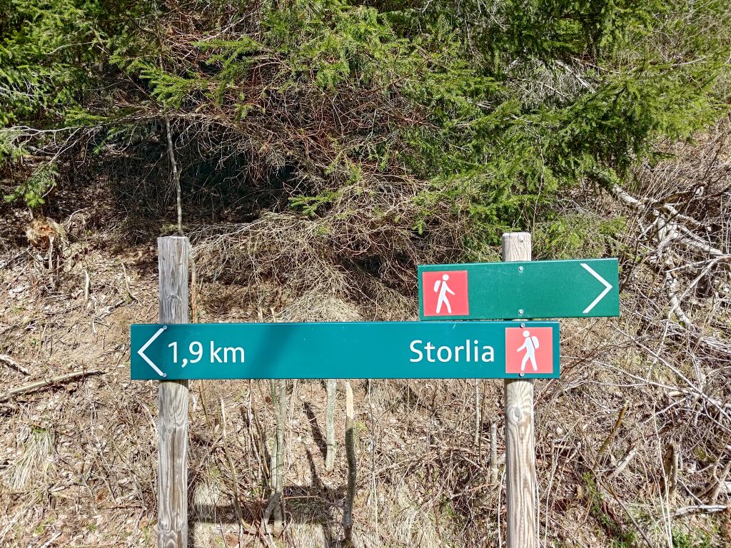
Gammelplassen is large enough to hold several cars. When we arrived we were the only car there, however when we came back to our car, there was one other car there. Notice the signpost on the right hand side of the picture. That is showing you the direction of Skarnsund Bridge if you are walking. It’s a nice walk and I have done it several times from home, but today we wanted to climb a hill. Gammelplassen is about 2.3 km from the bridge.

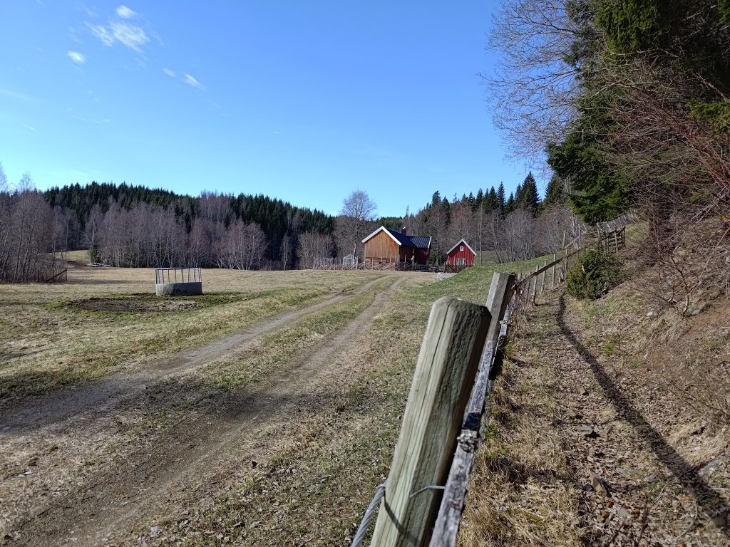
The first part of our walk, which is actually climbing uphill for about an hour, is along this dirt road which leads to a small farm. At this point you can see that the marked “red” trail from the map takes off to the left. We are going straight ahead. These trails are marked with red hikers, indicating that the trail is of some difficulty. In other words, uneven and often steep terrain.

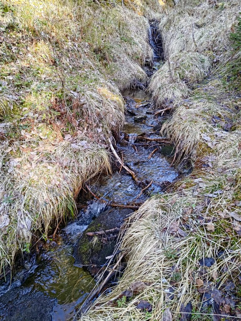
We could hear a lot of birds talking to each other. I’m not very good at recognizing the birds from their sounds. However, I heard the sound of water near the trail. It’s not long since we have had rain, so there was a fair bit of water in the stream. In addition there is probably still some snow to melt.
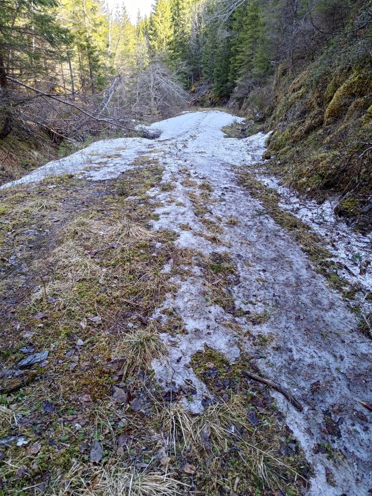
It is always tricky to know when the trails will be free of snow. We could feel the temperature change as we came into this section of the trail that probably gets very little sunshine. It felt like the temperature dropped three or four degrees. In the sunshine it was lovely and warm, but the snow itself would also make the temperature drop. We managed it fine, but when we came to a second section of snow that was much longer, we almost turned back to wait for another day. But then I saw a very small trail, possibly human, but definitely used by deer or moose. We decided to try it and see where it went.

It was interesting to try this trail which would its way around the hillside, slowly climbing. I had hoped that it would come out onto the main trail. A check on the map on my phone, which tells me where I am, said that we were going roughly in the right direction, but that we need to head upwards. So we did, climbing up steep slopes, that were partly covered with trees, partly open with grasses and heather. After a lot of work, but not impossibly difficult, we did actually reach the main path.

Thinking back on our scramble up the hillside, it was rather fun. We’ve done this sort of thing before and we both enjoy it. However, it is the sort of slope that is much easier to go up than to go down. So I said we had to take the main path down, in spite of the sections of snow and ice on them.
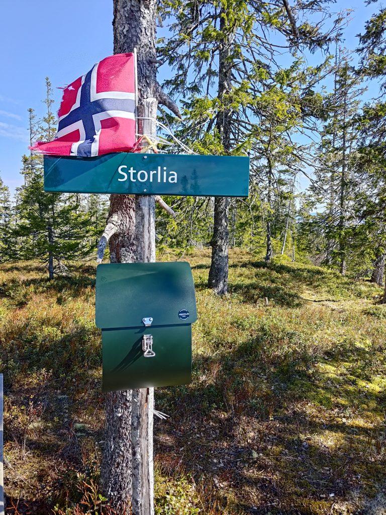
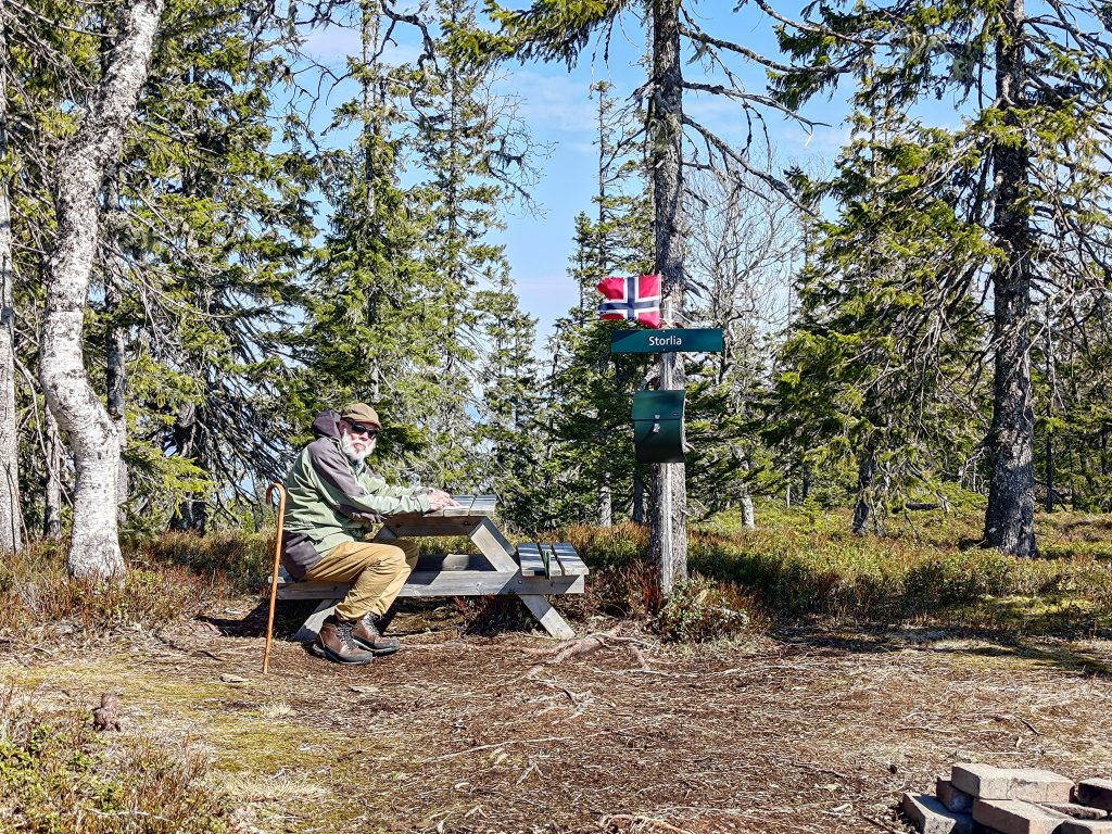
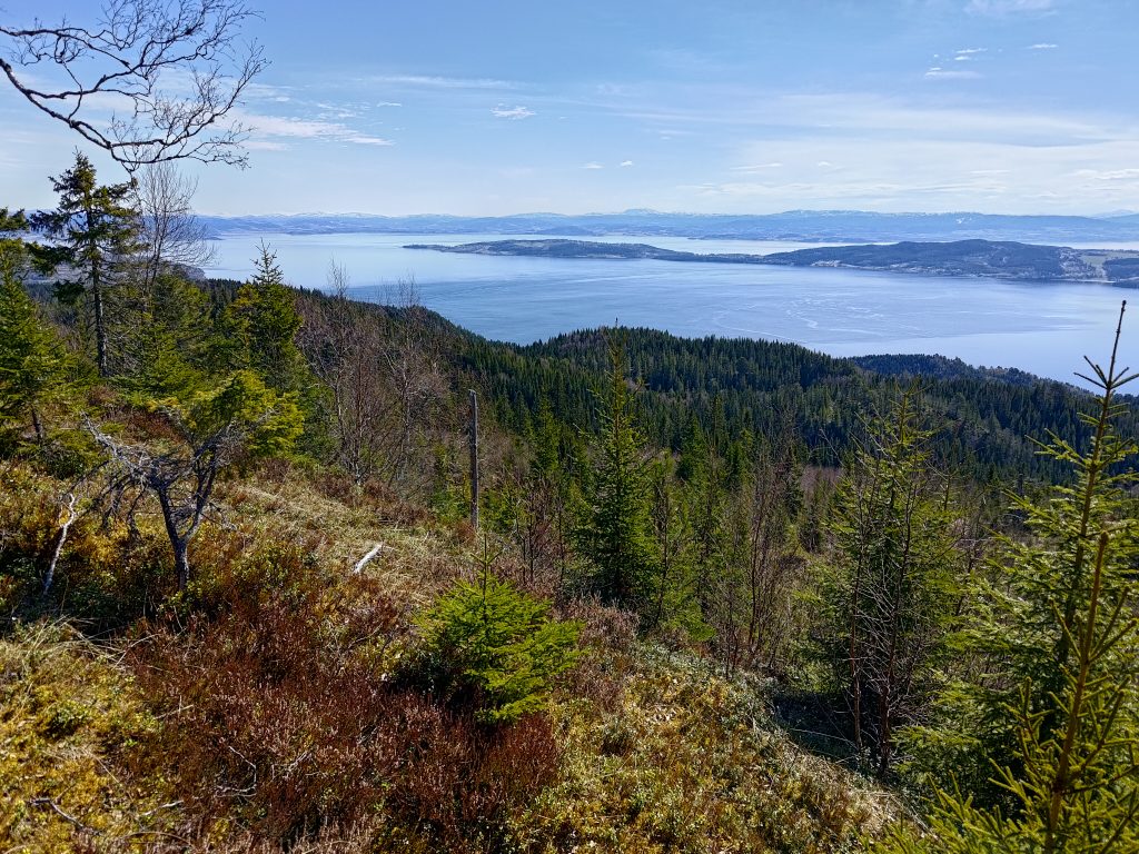
We had a good break at the top. A bottle of water and two cookies each gave us the energy to find our way downhill to the car. I took a lot more pictures, of course, after all, the reason I like to come to the top is to look at the view.
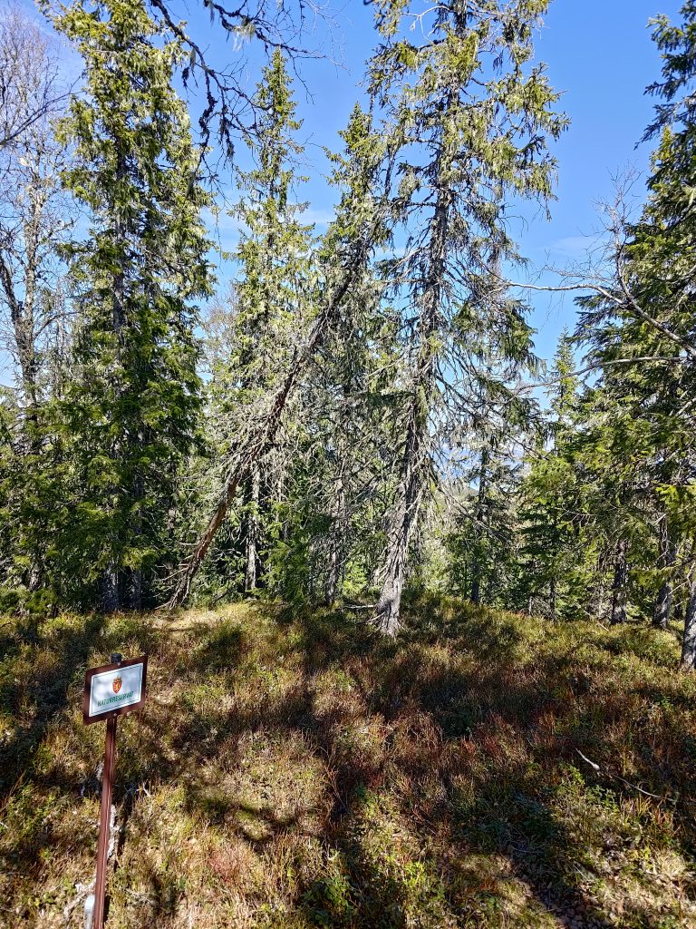
To the northeast of the summit of Storlia is a nature reserve. This area has been made into a reserve because of the very old growth forest. Most hillsides near us have been logged every 60 to 100 years, so the trees are not really that old. You can see in this picture how the trees here are not very young and there is a lot of lichen on them. This nature reserve is on a north-facing slope, so will be very moist. It stretches from the top of the hill almost down to sea level.
The walk back to the car took a little less time than the uphill climb. But crossing patches of snow and ice also slowed our time as there was little crust on the snow, so one was suddenly in a hole, or one’s feet were sliding on the ice that had formed. We used about one and a quarter hours up the hill and about one hour down again. In all, we were walking for almost two and a half hours. Good exercise on a beautiful sunny day. But I may wait another month or so before doing it again, just to make sure all the snow has disappeared.
I remember going on this walk together. It’s a nice one.
I couldn’t help it … of all the pix, the “little stream” one shouted, “Time to go trout fishing.” Obviously not in that rivulet, but cold clear running water brings the desire to life!