Today’s walk started from home at about 11:30. We have a very short period of daylight at this time of year and as today was sunny, it was important to get out in the sunshine. My husband and son were my walking companions today and our goal was a small beach on the east side of Skarnsund.
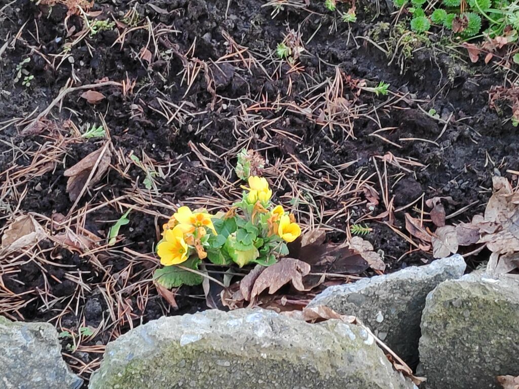
As we walked down our driveway, I saw the first “spring” flowers blooming. I normally buy primroses in January in a store, so these plants are used to blooming in the middle of winter. This plant got moved last summer to a new location and it seems to have done very well to be blooming in December. They often will continue to bloom under the snow.
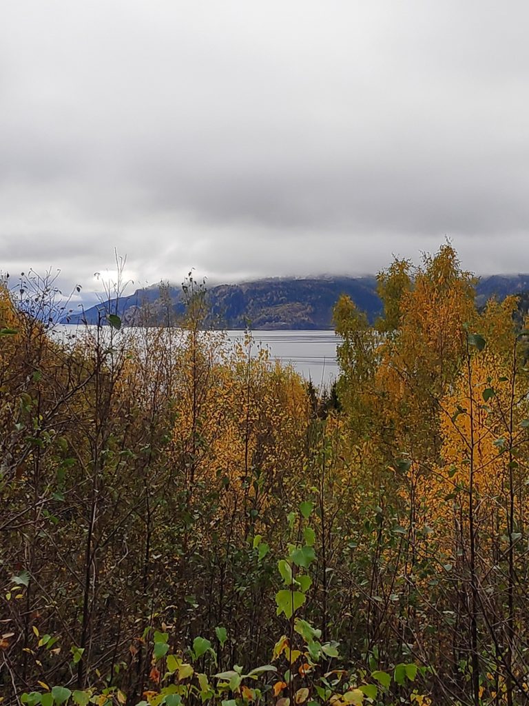
Our walk continued across farm fields, around the neighbouring farm and across another field. We have no snow on the ground and the temperature today was about 7 degrees Celsius.
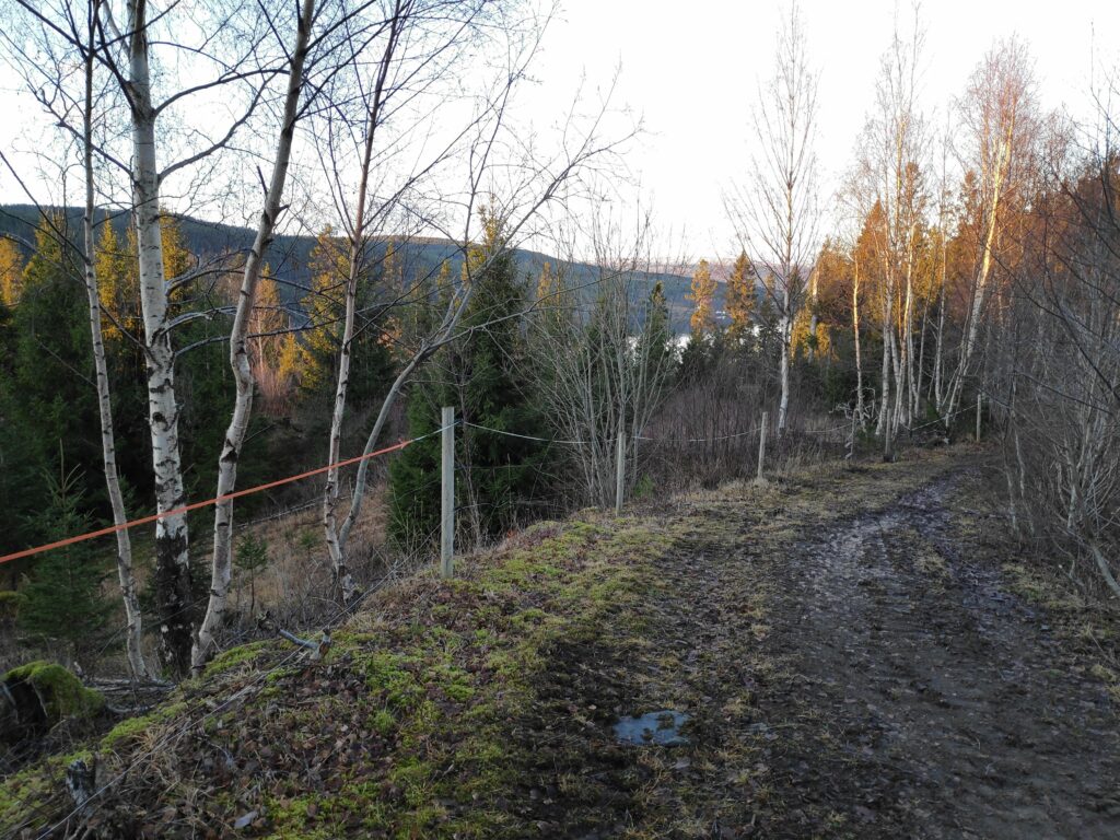
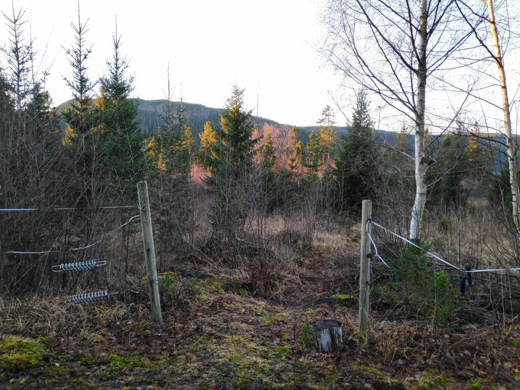
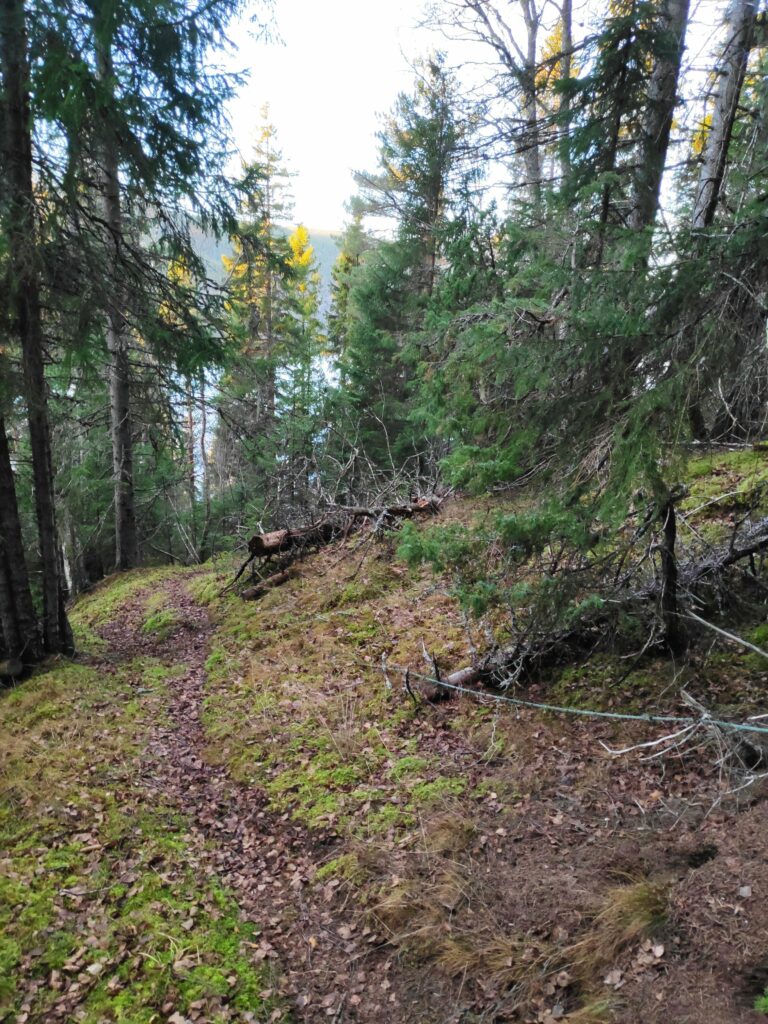
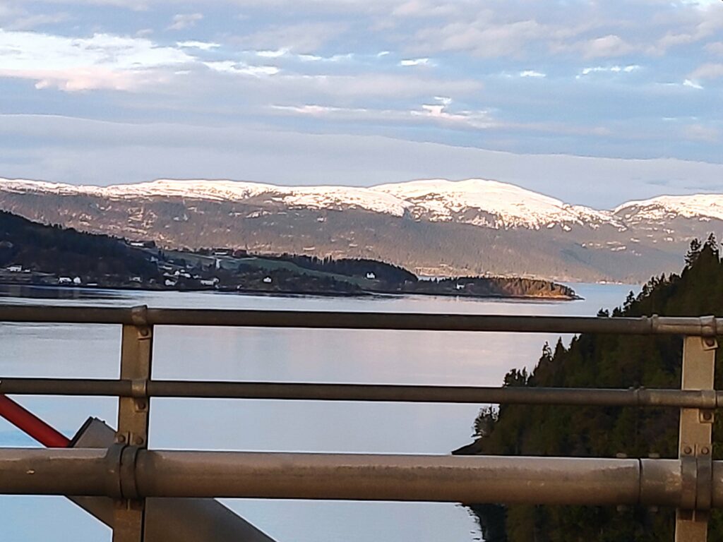
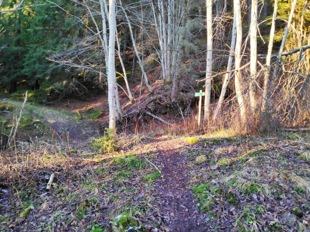
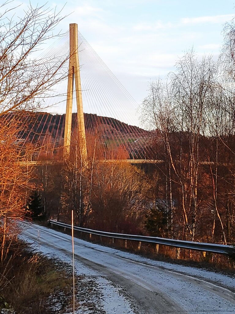
Here we are following a tractor road along the hillside. There were icy bits and it was very rough as the farmer’s cows have been out grazing in this direction. Skarnsund is just visible to our left and in the distance.When one sees the viewing platform in the woods, it is time to look for an opening in the fence as the trail goes down past the viewing platform The hill in the background is on the other side of Skarnsund. You would need to cross the bridge to get to it.The hole in the fence which can be blocked off in the summer when there are animals out grazing. In the winter the gap is usually left open.
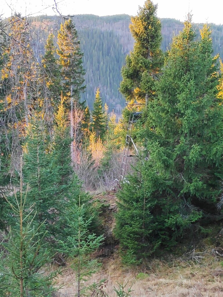
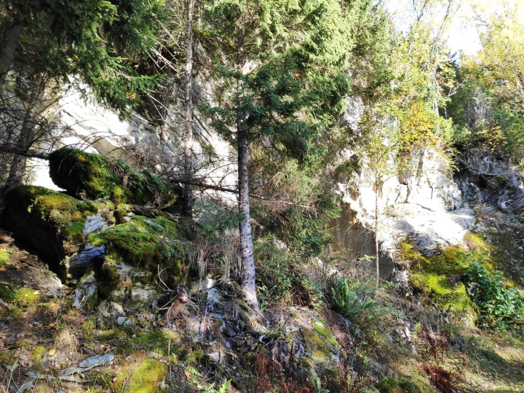
The slope down to the water is quite steep and one needs to walk carefully. I prefer to do it now when I am with others, in case of mishap. There are other trails in the woods here, most of them would be made by the deer. This area has not been logged recently, so it is nice old forest.
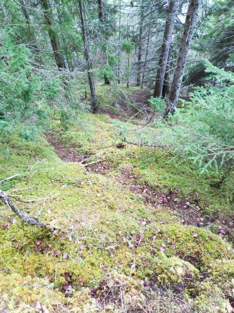
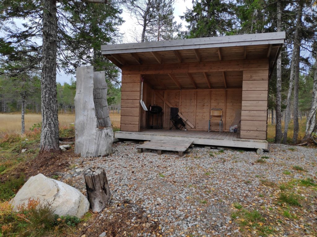
Here is the trail we are following which will take us down to two cabins and a beach. Note the green rope on the right which is a guide line down the slope. It is mostly just laying on the ground, sometimes covered in vegetation and not necessarily safe to grab, but it does show that you are on the right trail.
At this time of year, there are a lot of dead leaves on the path, which can make it slippery. However, there was no ice on the path as we are under the trees. It is hard to take pictures that show how steep the slopes are here, but one does not want to wander off the trail.
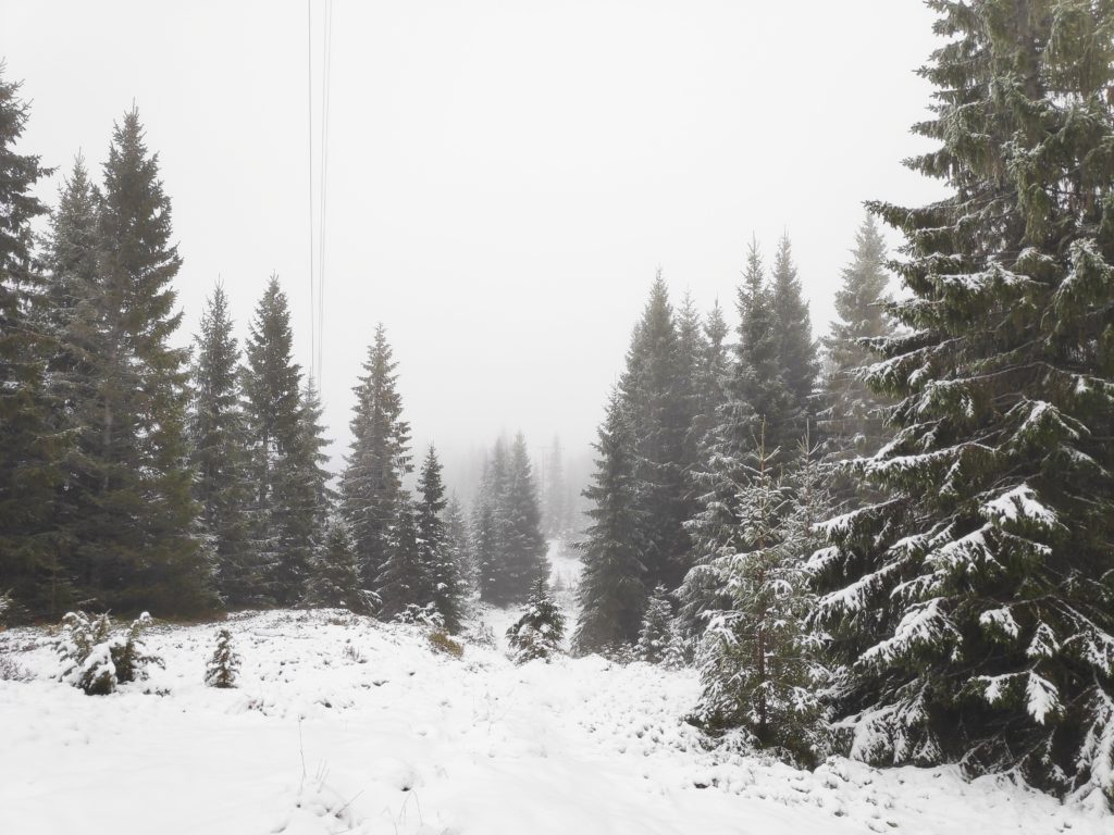
A deer trail taking off from the main trail we are following. We live in a temperate rain forest with primarily spruce trees. Where the trees stand tight together, little light gets to the floor of the forest so very little else grows. Here there are mosses and lichens under the trees.
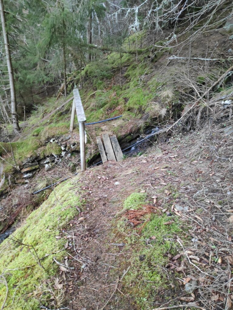
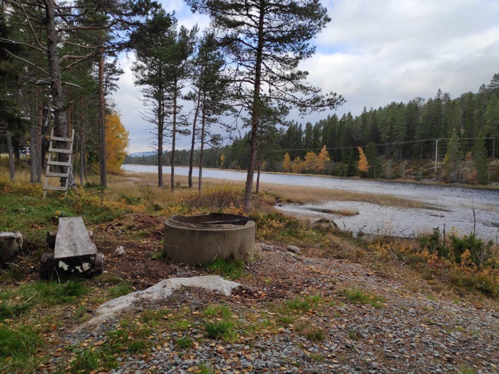
Eventually we came to the stream that drains this hillside. There is even a little bridge to help cross it and a sturdy handrail.
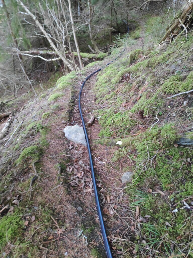
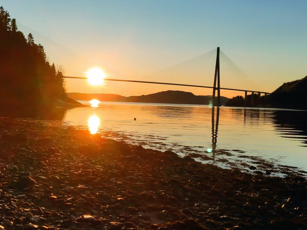
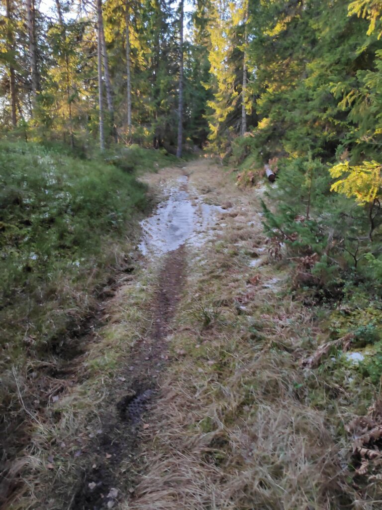
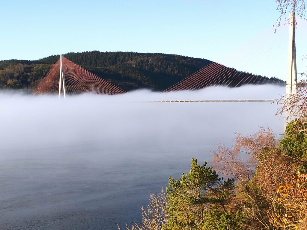
A small stream tumbles downhill. There are also two waterlines that will take water from the stream to the cabins below.We continued to follow the trail that now also had a waterline on it. This is a very common sight in the cabin areas around here. The lines may freeze in the winter, but people mostly use their cabins in the summer half of the year.Skarnsund Bridge from the north east. This photo was taken at 12:14, so approximately when the sun is at its highest in the sky for today.
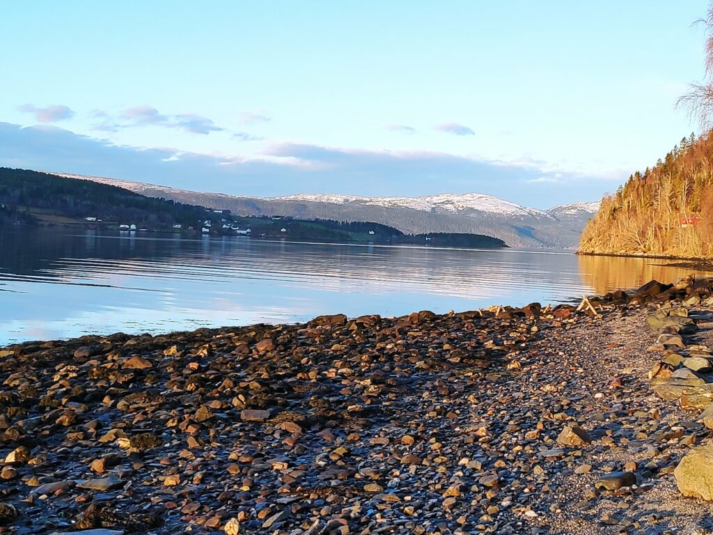
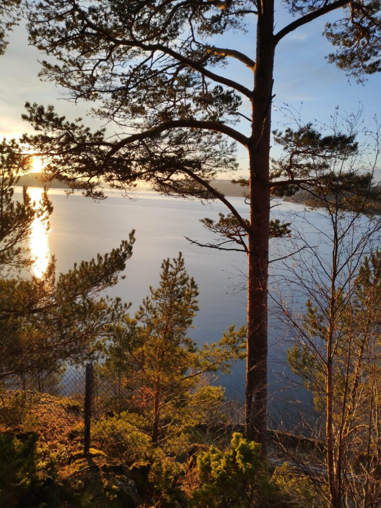
It was lovely to just be on the beach for a while. The sun was shining and there was no wind. The water was calm. There was snow on distant hills, but nothing close by. We were also far enough away from the bridge that the noise of the traffic was almost not heard. There were no fishermen out today. Everyone here is busy getting ready for Christmas celebrations.
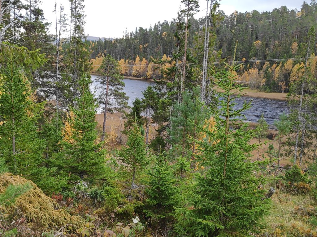
Looking north. One’s location in relation to hillsides will decide if you get sunshine or not at this time of year. We live on the right side to get sunshine. The housing area on the other side of Skarnsund is Framverran.
The beach is not sandy at all, but in relation to many places along Skarnsund, there is a place to walk for a couple of hundred meters before the next impassable section of rock comes. At high tide, most of this beach would disappear under water. We were there when the tide was about halfway between low tide (at 9:17 and 122 cm) and high tide (at 15:36 and 290 cm), so an incoming tide.
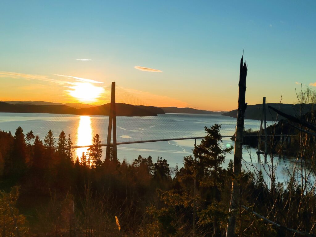
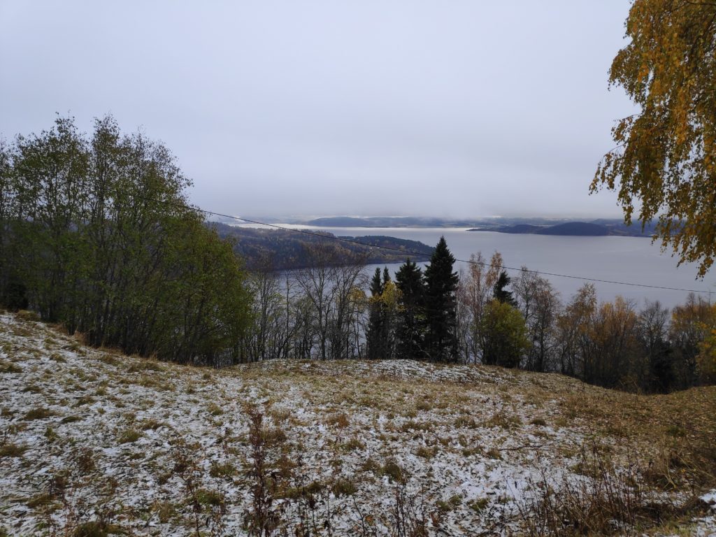
A view of the bridge on our way back home, from the part of the trail that is possibly at the highest elevation. A check on the map on my cellphone tells me that we are at about 140 meters above sea level. It’s been a glorious sunny day.
I don’t take this walk very often, but today was a good day to do it. Sunshine, no wind, plus degrees in the air and two good companions. We used a little more than an hour and a half on our walk.
Today’s walk took about 2 hours and one of my goals was to get some sunshine. In December, sunshine is a precious commodity and though our house gets some in the afternoon, the days are short. By heading outside, I was hoping to get fresh air, exercise and some sunshine on my face. All goals were achieved and as I walked, I thought about how important light is in December.
The first photo was taken at 11:40 and the last one at 13:17. Today, the 6th of December, sunrise was at 9:42 and sunset at 14:30.
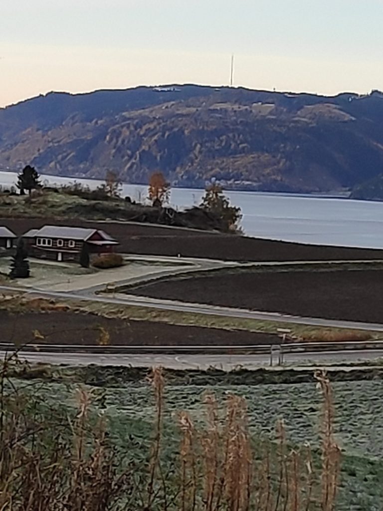
This picture was taken at 11:43 from Skarnsund Bridge. At this point the clouds are obscuring the sun so that I’m not actually in the sunshine. Note how low the sun is in the sky and though it was moving from east to west, it didn’t get any higher in the sky. Sunshine in December gives very yellow and orange tones to what it shines on, whether it is cloud or nature.The mountains to the north of us are now covered in snow and the sun shining on them made me think about how location is so important to how much sunshine a place gets, though cloud cover also plays a role.
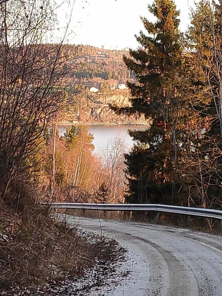
In Norway, it is interesting to see how the coastline has been settled. The north side of a fjord will get more sunshine than the south side and therefore will have more farms and villages. As you look at the picture above, the peninsula sticking out into the water gets a lot less sunshine than the mountain tops in the background at this time of year. Height above sea level will also affect how much sunshine a place gets, especially in winter. Getting higher up, there will be less land between the sun and where you are. As I crossed Skarnsund Bridge and climbed up a side road on the other side, it was noticeable that houses higher up got more sunshine than those lower down.
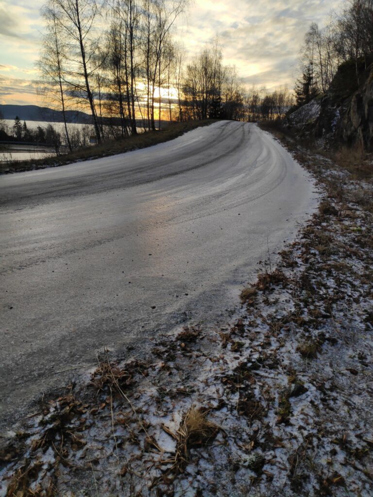
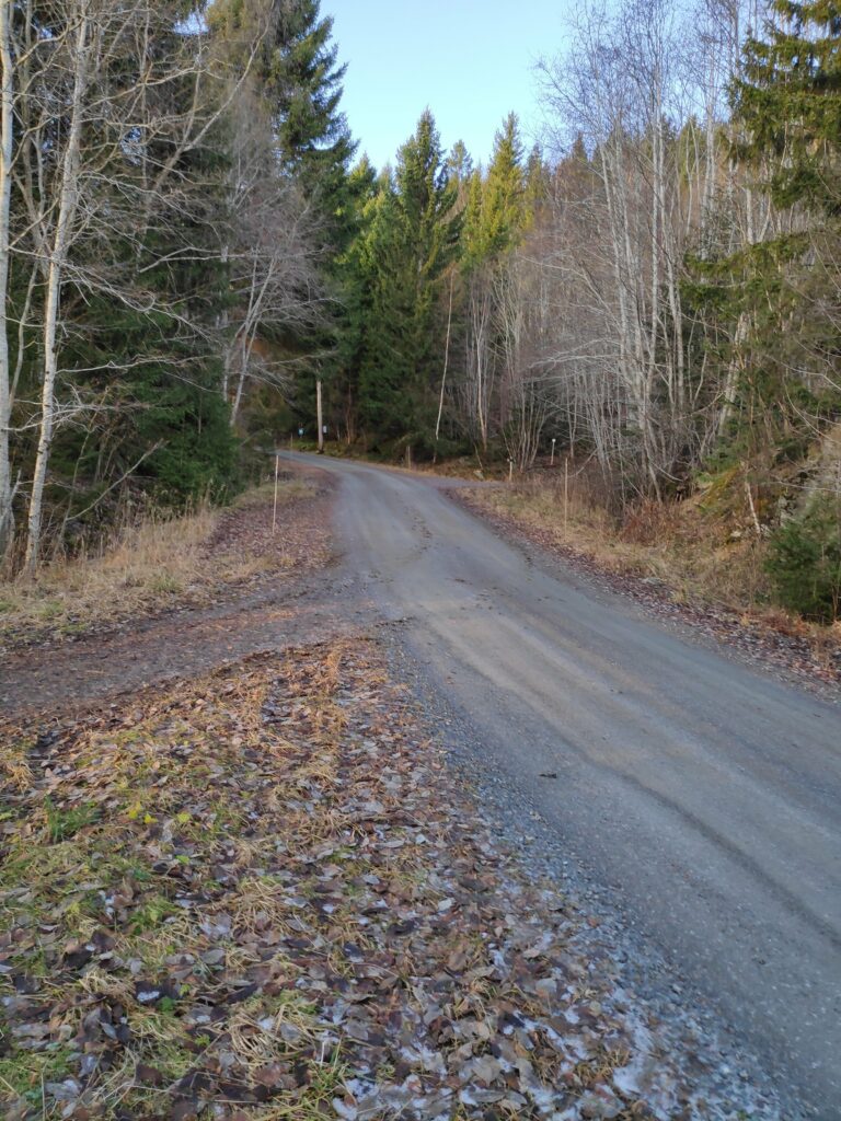
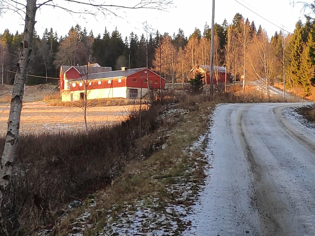
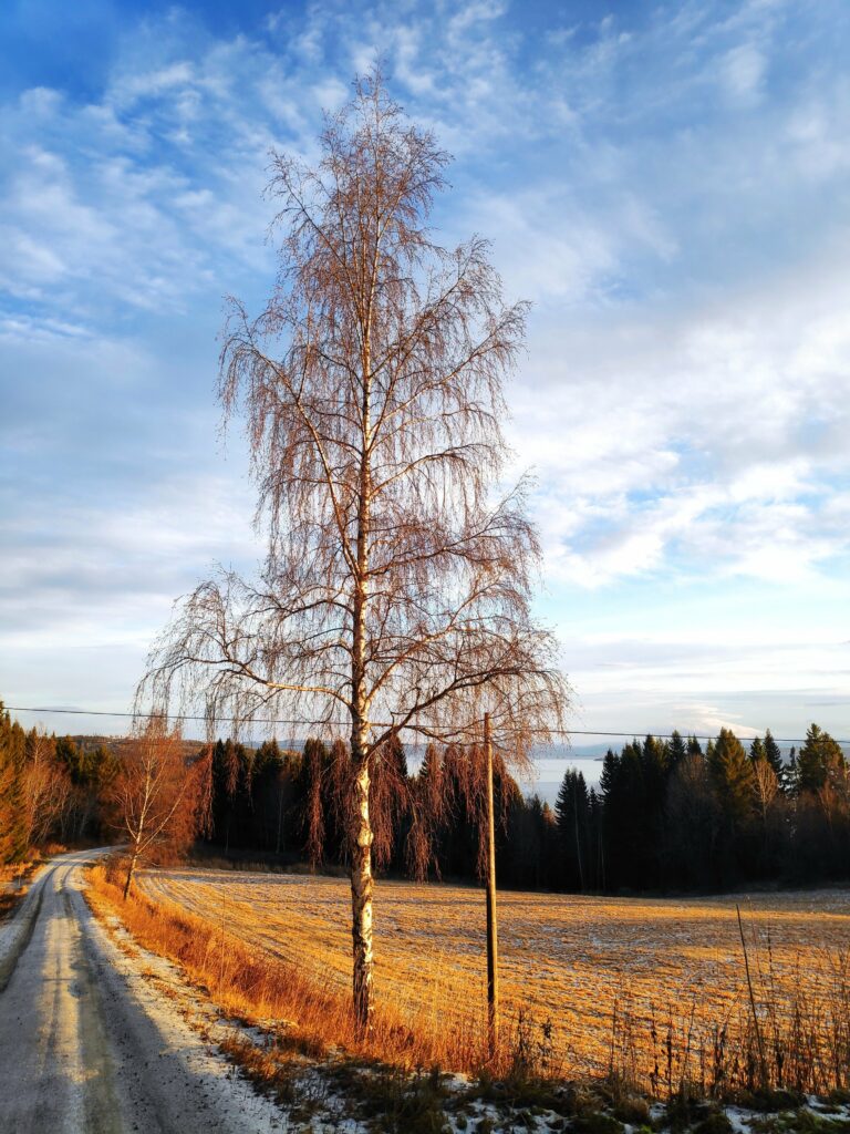
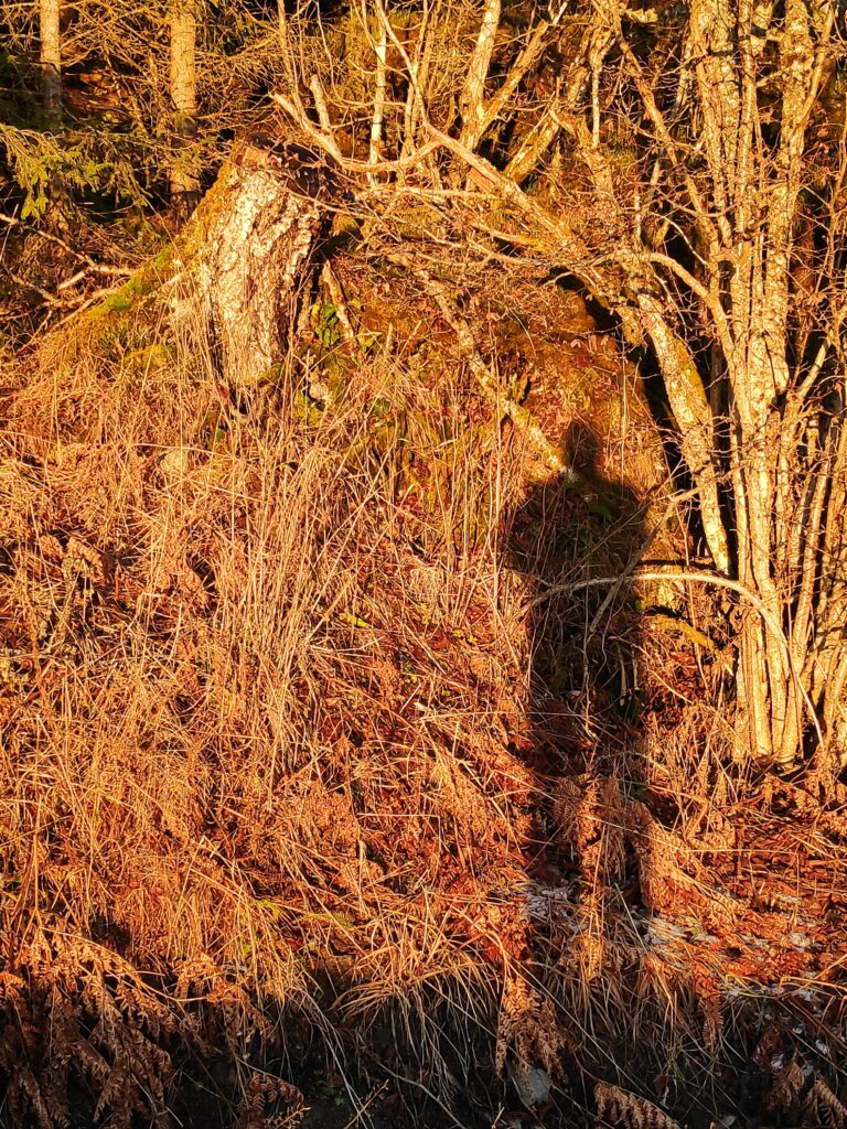
Walking today had its challenges. A few days ago, it rained on frozen ground and since then, there has been a thin layer of ice on road surfaces that are not often driven on. The side of the road can be even icier, so I had to be careful where I walked. This side road was sanded and doesn’t have much traffic, so I was able to walk in the middle of the road where it was sanded and had no problems walking, either up the hill or down again.There was a lot less ice on the road as I climbed up the hill, especially where the road was mostly under the trees. With much less ice, the walking was easier.This farm is getting a dose of sunshine. An open field between the house, farm buildings and the direction of the sun, allows the buildings to get some sunshine when the sun is not obscured by clouds.This solitary birch tree was bathed in sunshine.Yes, I got a dose of sunshine too, as my shadow proves.
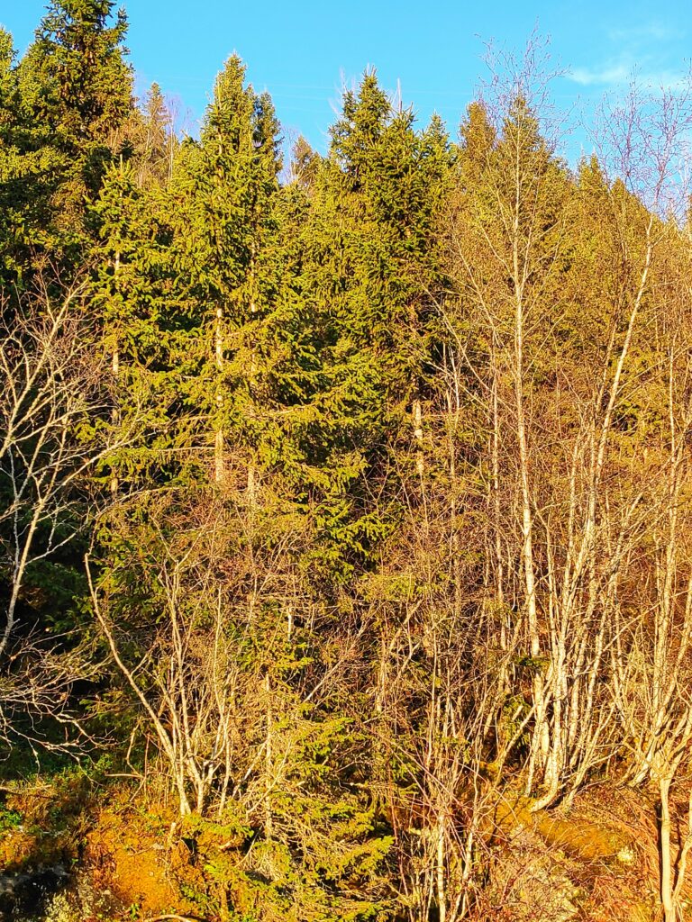
I notice how the sunshine changes the colours of the things around us. Without sunshine, December tends to be a month of grey and white, with just a few dabs of blue and green. But when the sun shines on something, the colours turn more vibrant. Coniferous trees become very green and the sky was very blue where there weren’t any clouds. The brown grass and trees without leaves turn yellow and orange.
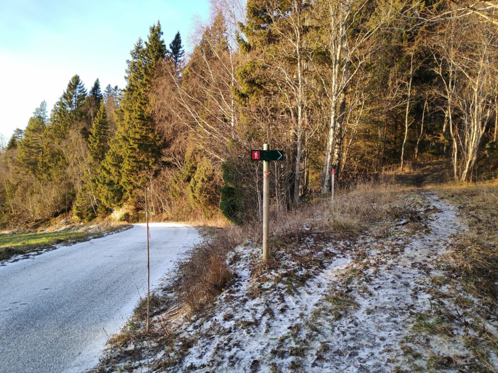
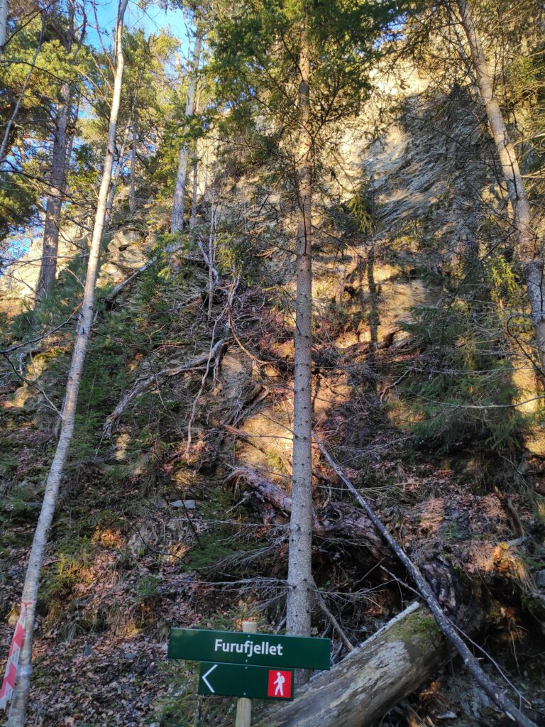
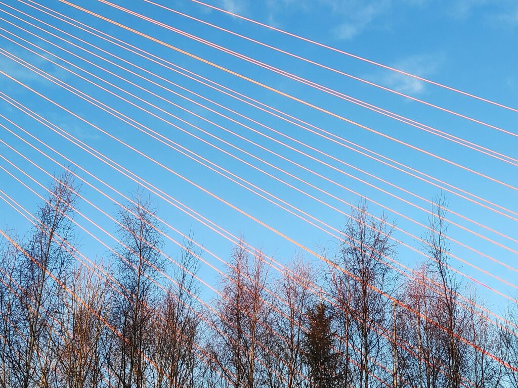
The coniferous trees are still green, but the deciduous trees show up as very yellow now that they have lost their leaves. The forest where I am walking is a mixture of both coniferous and deciduous trees.Finally, I came to the pathway I was aiming for. This path, though labelled with a red man, meaning that it was a difficult path, was much easier walking than on the roadway. Under the trees there was almost no ice or frost.I love this sort of a walk, into the forest and along a well-trodden pathway. At this time of year, it is quite quiet. I didn’t meet anyone else. Car traffic cannot be heard. There were no birds twittering in the trees. But patches of sunshine filtered through the trees.In an open patch along the trail, the puddle in the swampy part of the path has frozen. There was ice in only one small section of the pathway.The goal of my walk has been reached, Furufjellet (Pine Mountain), which was reflecting the sunshine as I had suspected it would.I turned around and started walking home again and now Vangshylla was bathed in sunshine.Skarnsund Bridge was also being bathed in sunlight. The concrete towers and the wires glowed in the sunshine.The wires of the bridge are painted red, so they showed up very well against the blue sky.Home again, and still an hour until sunset.
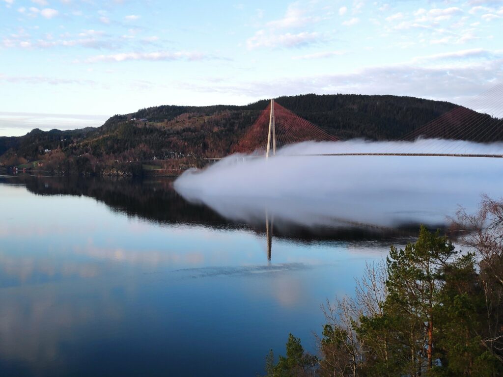
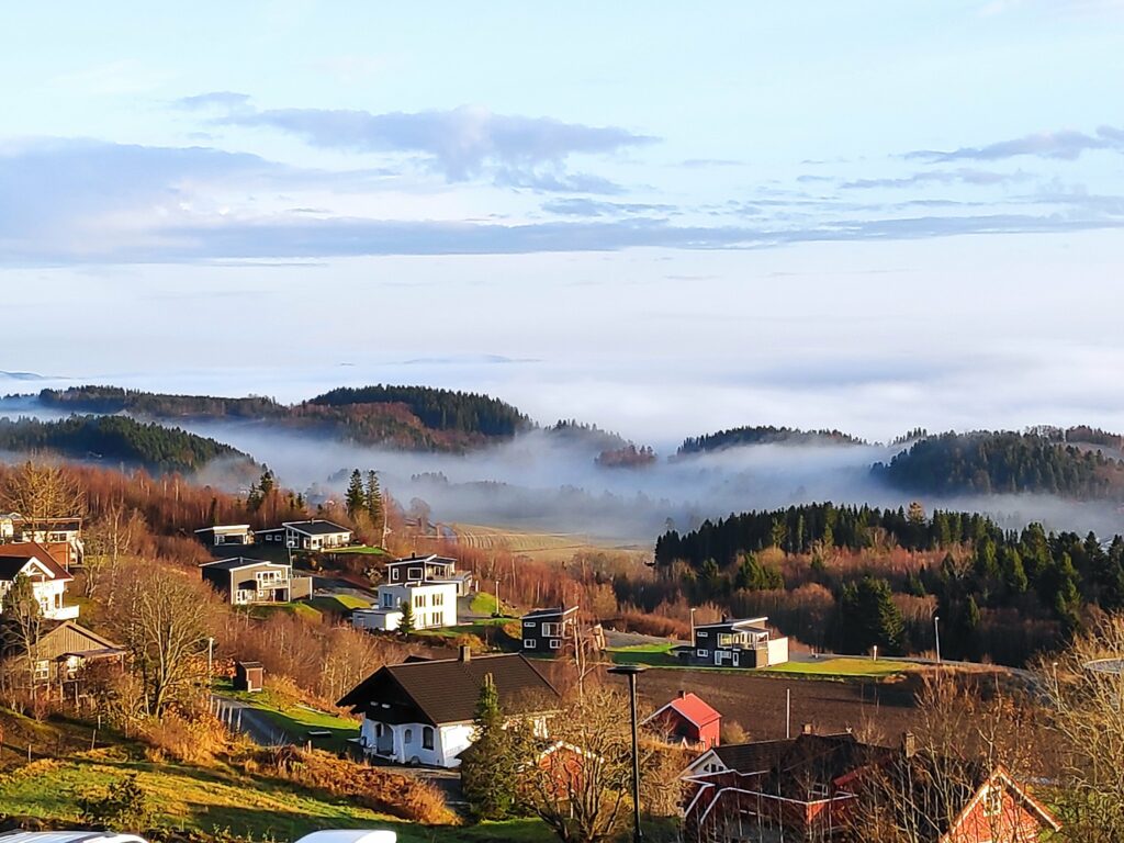
Wednesday is my usual day to go for a walk with a girlfriend. The weather forecast was for sunshine so I was looking forward to today’s walk. As I went out to the car, I noticed fog rolling across the water, coming out of Skarnsund. As I stood watching for a few minutes, the fog rapidly moved out over Trondheim Fjord.
Picture taken at 9:38 looking towards Skarnsund Bridge.
I had agreed to meet my friend at her house in Straumen and I was anxious to see where there was fog and where there wasn’t fog. As I had hoped, the fog was mostly on the water and if we walked uphill, we would be in the sunshine.
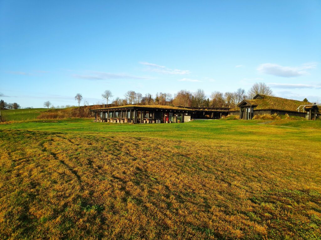
We choose to walk up to Øyna, a hotel and restaurant located near the top of a hill in Straumen. (See their website for more information about them. You can also get information about them in English here.)
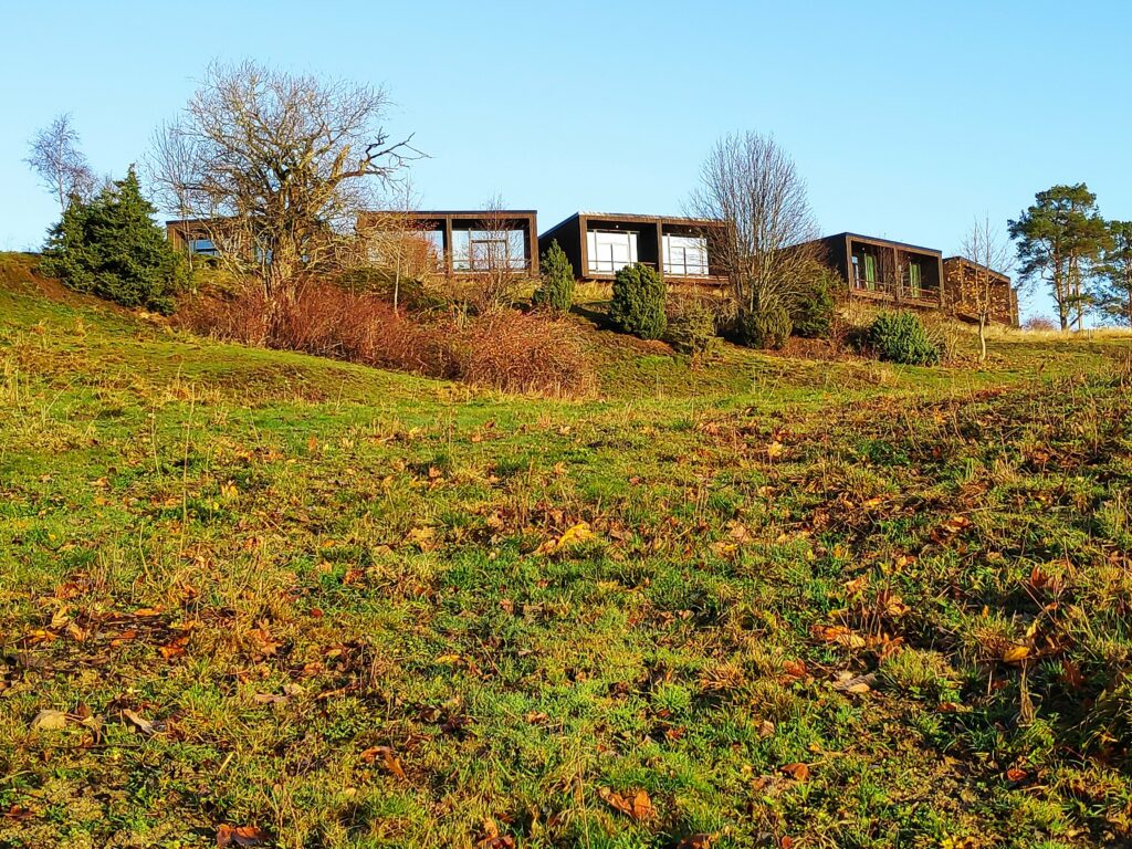
Øyna, a commercial enterprise having hotel accommodation and a restaurant serving locally produced food. It lies at the top of a hill and lies low in the terrain.The newest hotel units also lie low in the landscape but each room has a beautiful view over Straumen, Trondheim Fjord and the surrounding area.
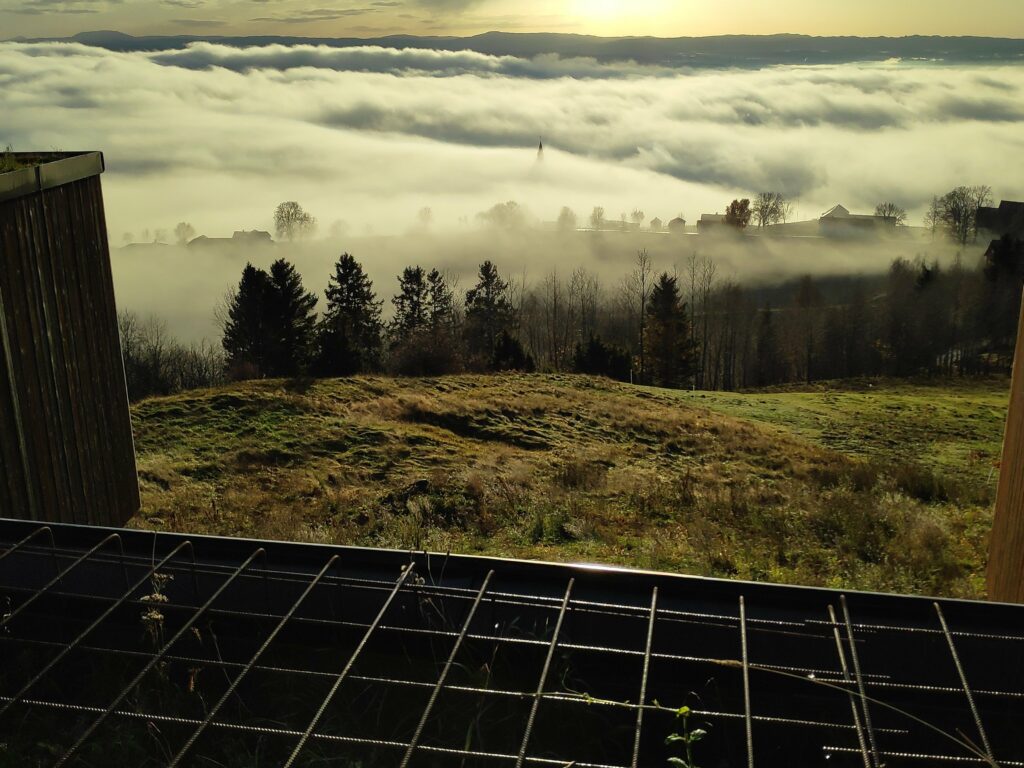
Even on a foggy day, the views from here were good though, of course, not as good as on a sunny day. In the picture below you can just see the top of the spire of Sakshaug Church, sticking up from the fog. This picture is taken looking between two of the new units of the hotel, so this is the sort of view there would be from the hotel rooms themselves.
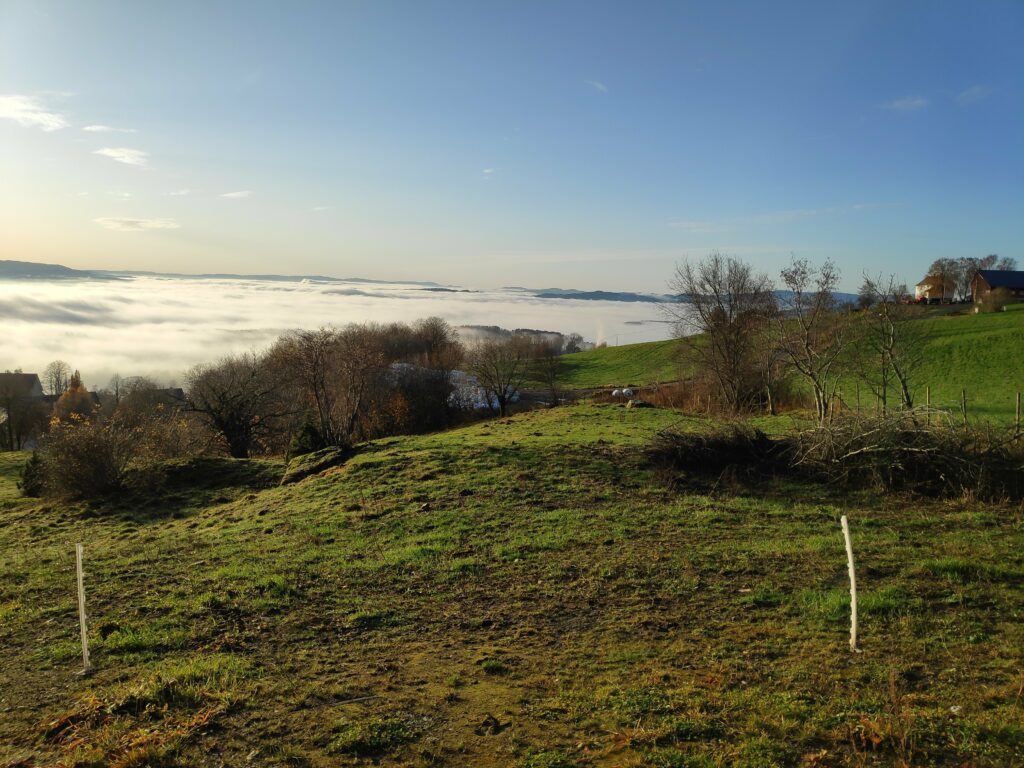
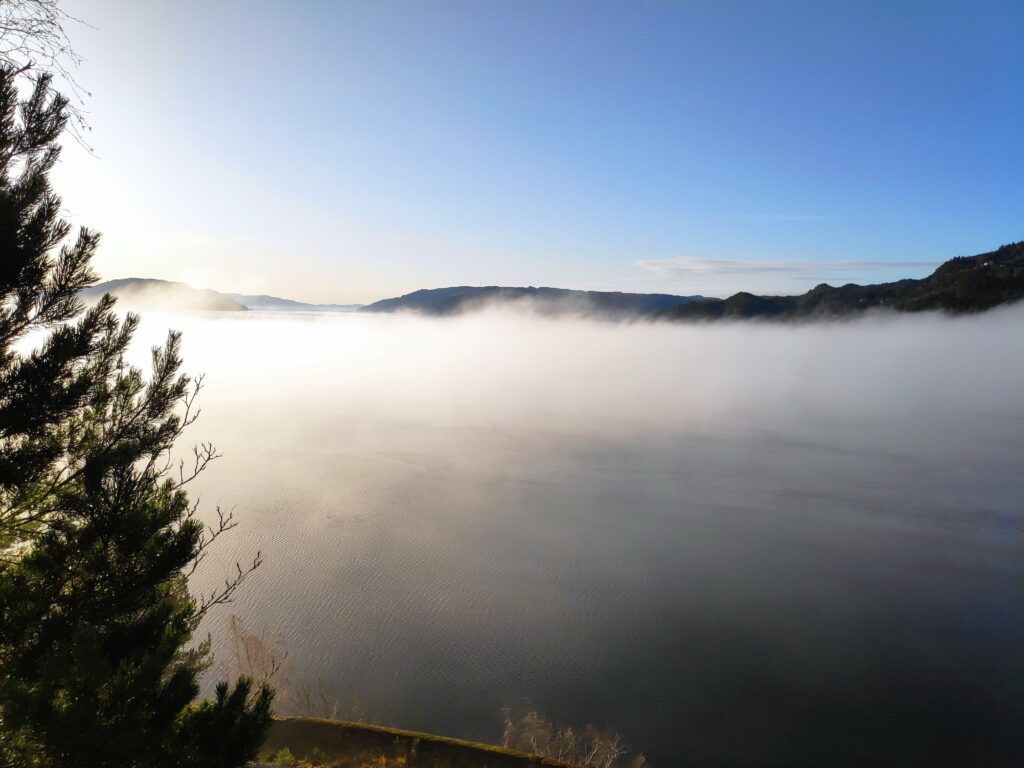
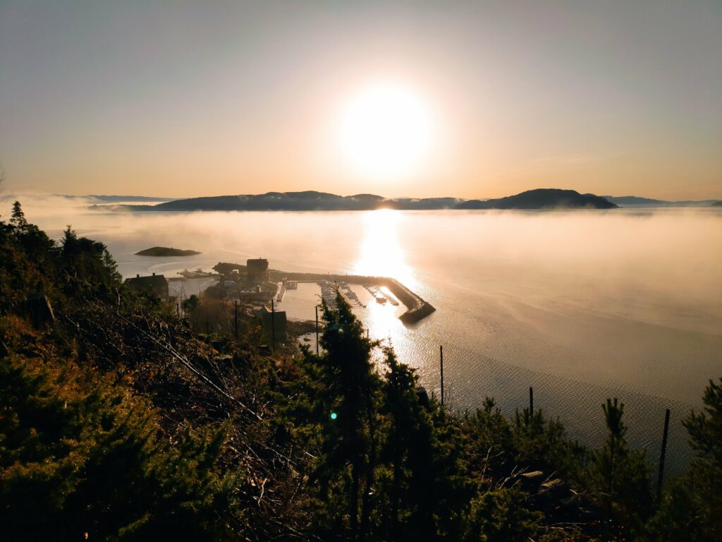
Looking down the hill from Øyna towards Straumen, most of which is hidden in the fog. In the background are the hills of Levanger.Looking westwards towards Trondheim. We are now high enough above the fog to get an interesting picture of how the fog covers the fjord. Where you see white, it should be mostly fjord underneath the fog.I always find it interesting how patchy fog can be, especially when looking at it from above. Here I am looking eastwards towards two of the housing areas of Straumen. Not everybody has sunshine.Back home and this picture was taken at 12:00. There is more fog on Skarnsund, but it is still lying low over the water.The fog is wispy over the water, but not rising particularly high above the water, so I am still in the sunshine.Looking towards Ytterøy with the small boat harbour at Vangshylla in the center. The sun is low in the sky, even at noon.
I had a most enjoyable walk, including a good climb up the hill in Straumen, an exploration of an area I hadn’t seen for several years, and lots of sunshine. We used about 75 minutes on our walk today.
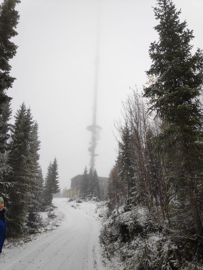
It is now October and winter weather is around the corner. My friend and I had looked up at the tall mast last week and agreed to walk up to it, if the weather permitted. The weather wasn’t that great, but we did the walk anyway.
I’ve been trying to find information about the mast but the information I have found is a bit limited. The building is located at 401 meters above sea level. The mast is a transmitter for several Norwegian television and radio stations and was built in 1973. (https://en.wikipedia.org/wiki/Skavlen_Transmitter )
The hill in the distance, covered in cloud, is where the mast should be visible on a clear day.
We drove along Fv 192, towards Saltvikhavn in Mosvik, drove about 1.5 km past the turn to Salvikhavn and found a parking spot on the side of the road. After all, we wanted the uphill walk for the exercise. We parked about 2 km from the mast at an elevation of about 200 meters above sea level. The temperature was about 3 degrees Celsius and there had been snow at higher elevations in the night. There was some slush on the road, much of which is a gravel road. Thankfully my friend had already changed to winter tires on her car.
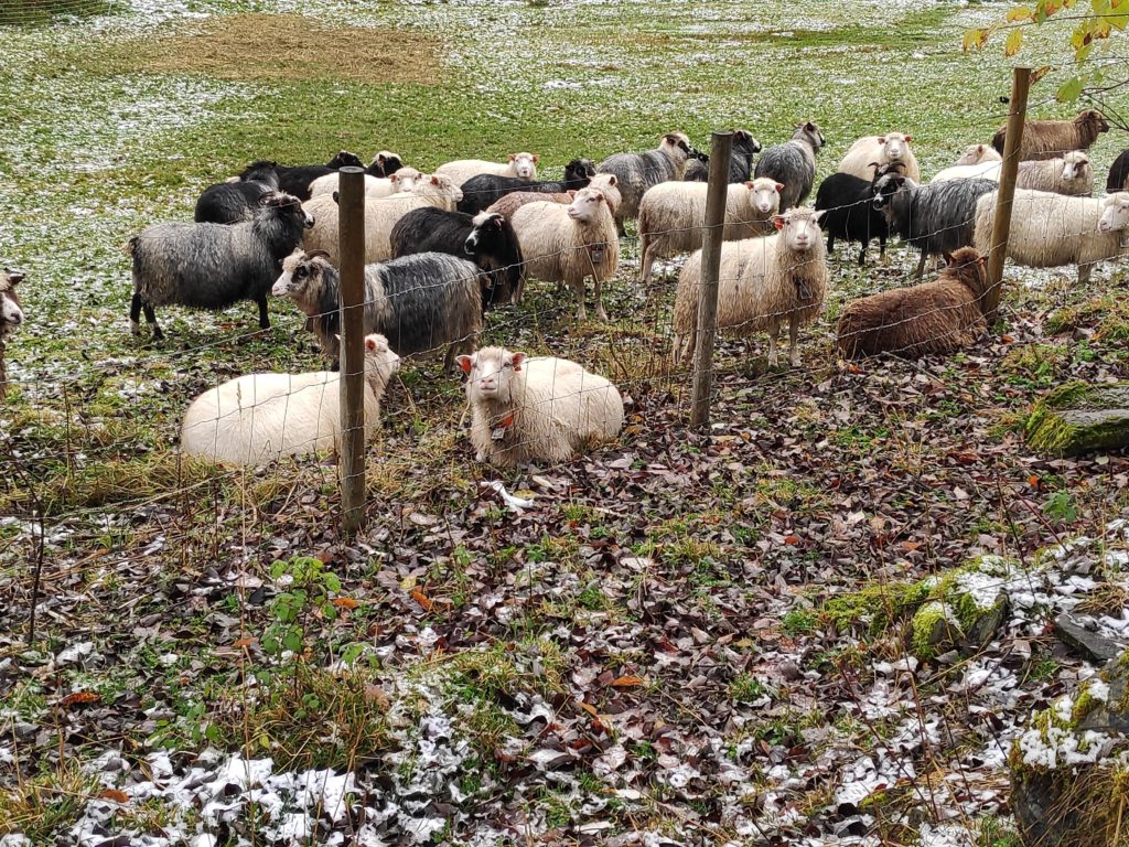
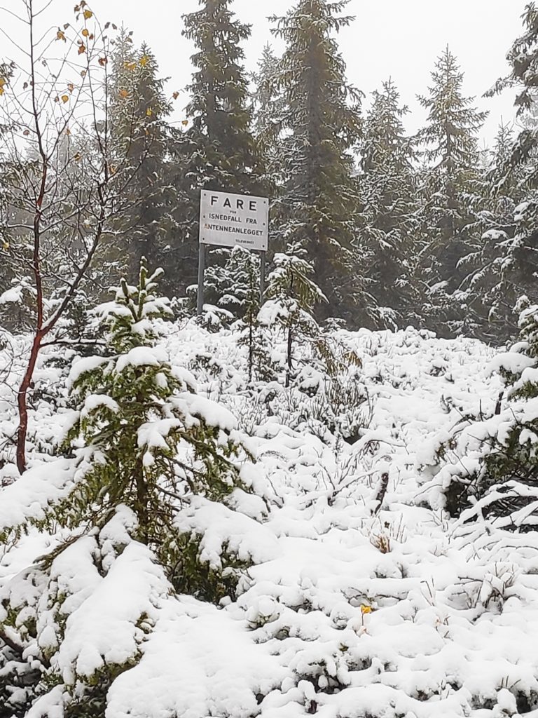
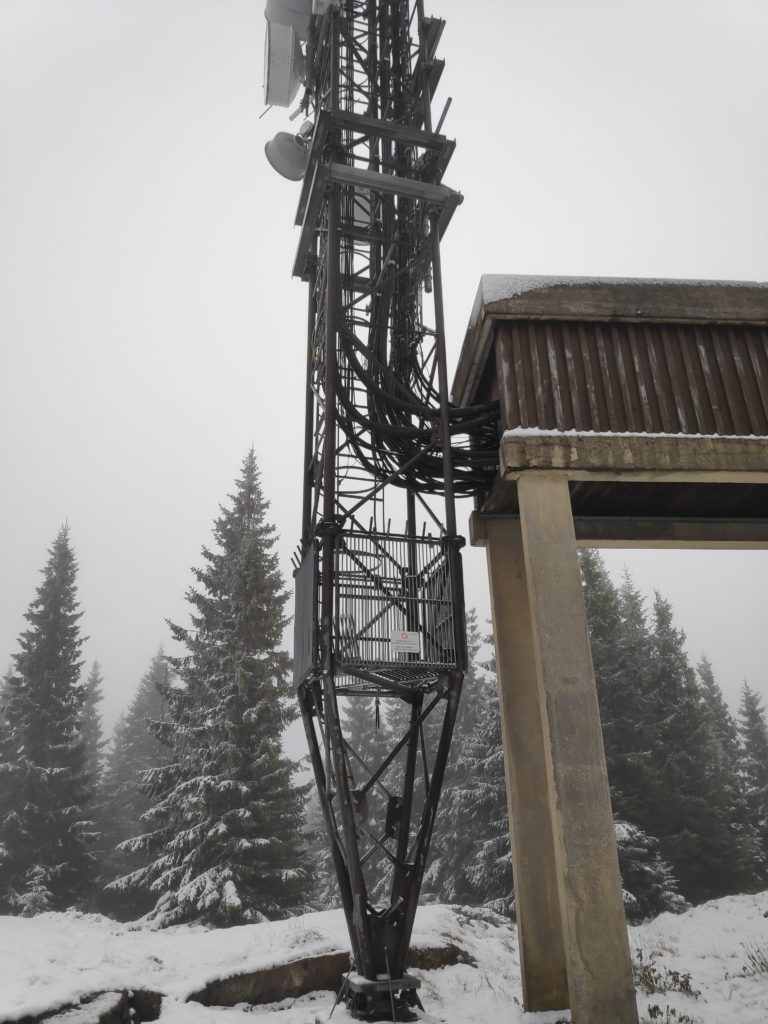
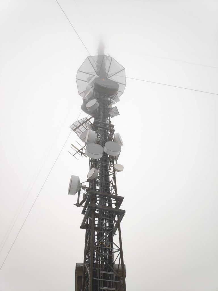
As we started our walk up the hill it was obvious that the views today would be very limited. Cloud cover was low, but there was no precipitation while we were walking. The closest spit of land is Ytterøy, an island. In the distance is Levanger.The first part of the road leads around a farm. As we walked uphill, the sheep were being moved into a different field. They all seem to have their winter coats on and they had on different colours. The darker ones had horns.As we walked uphill, there was more and more snow. It was a bit slippery under foot. But we weren’t the first ones up the hill today. We saw one vehicle drive up and there were tracks of several vehicles in the new snow.I asked my friend what she thought the purpose of the sign was and her comment was that when there is a large amount of snow in the winter, the road needs to be marked. They may not plough the road all winter, but it would have to be usable by snow scooter. There were lots of other trails off the road, often with tracks from an ATV. “Danger – ice falls from antenna” – we must be getting nearer our goal. Notice how much snow there is now. Height above sea level makes a big difference. At lower elevations the precipitation would be rain. We have now climbed about 200 meters in elevation.Finally, the goal of our walk, though the top of the mast disappeared into the cloud cover. I was surprised at how large a building was connected to the mast.There were three vehicles outside the building, doors were open and people were obviously at work. Here is where the cables come out of the building and head up into the mast.There was certainly a lot of different equipment on the mast and I couldn’t see all the way to the top because of the cloud cover.I’m not sure if the view would be much more interesting in clear weather. Though one sees the mast in clear weather from afar, standing on the ground at the bottom of it, it looks like there are a lot of trees around it.
Though I enjoyed the walk, I would definitely recommend doing the walk when the weather is clearer. I plan to do the walk again next year, in the summer months of the year. The walk was a little over 2 km each way and we used a little over an hour.
A few days later I was able to take this photo of the mast, taken from the other side of Skarnsund. Though it shows up well for the naked eye, I had problems getting the mast to show up in a picture, even when I zoomed in a lot.
I have zoomed in a lot to take this picture, which means it became very grainy.
Today was a pleasant autumn day, with no wind or rain. I went for a walk with a friend. We meet most Wednesdays and enjoy walks in various parts of Inderøy.
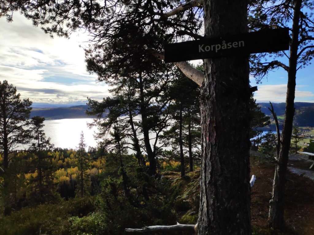
She parked her car near the school in Mosvik and we walked around the farm called Stor-Grande and were soon in the woods. Though we started off heading towards one particular check-in place, we ended up changing our minds and going to Korpåsen which has a beautiful view. We used about an hour and a half on today’s walk.
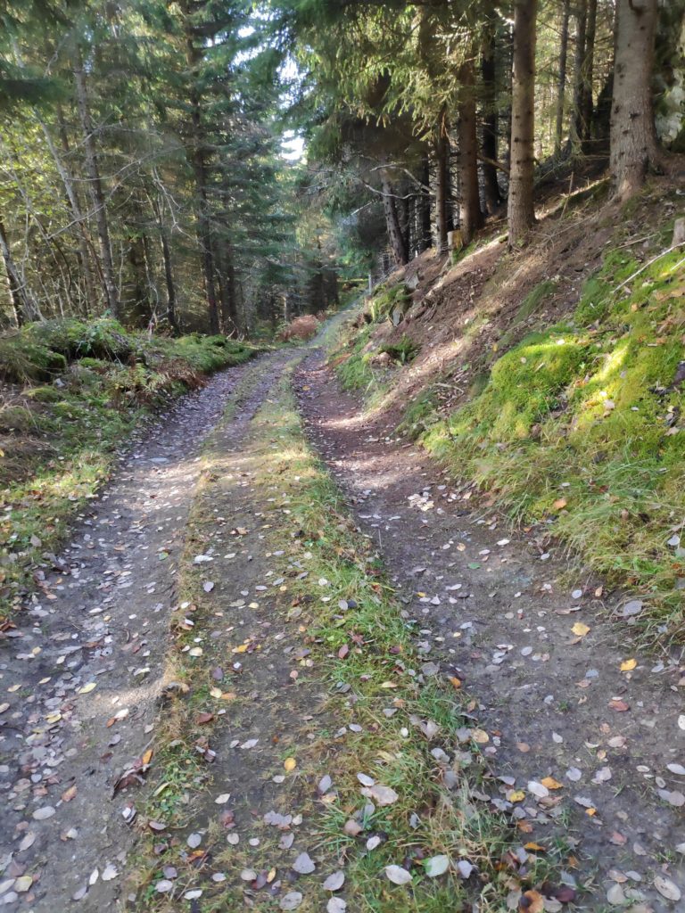
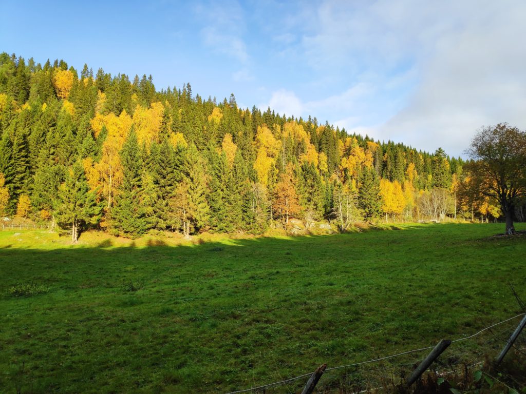
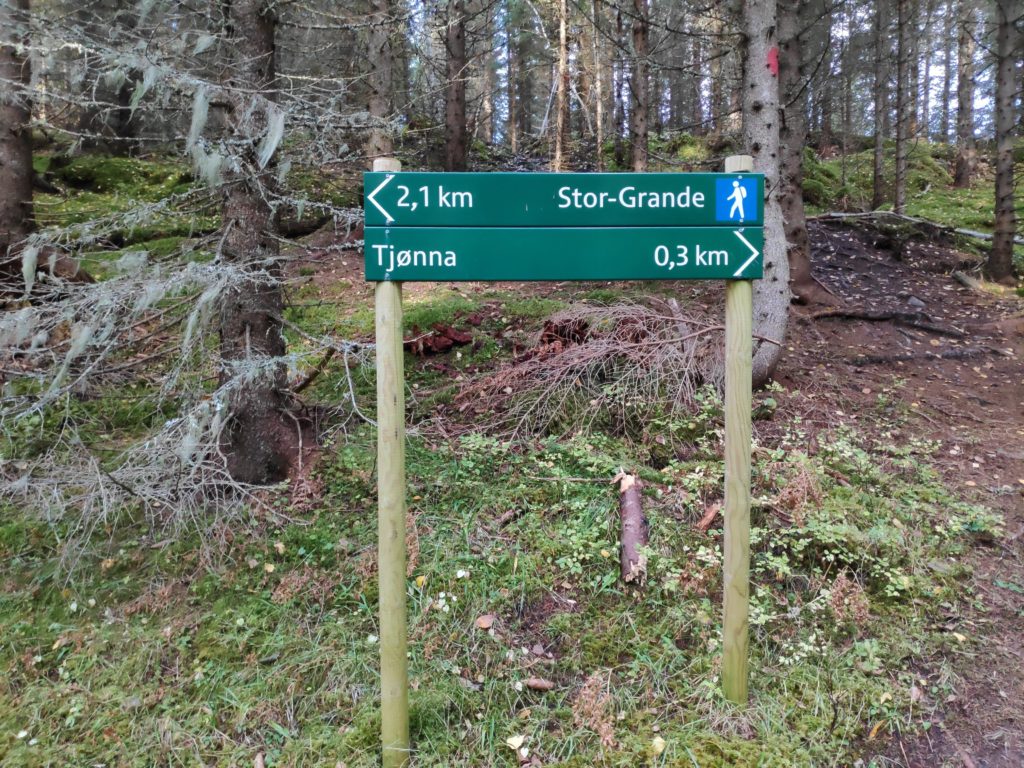
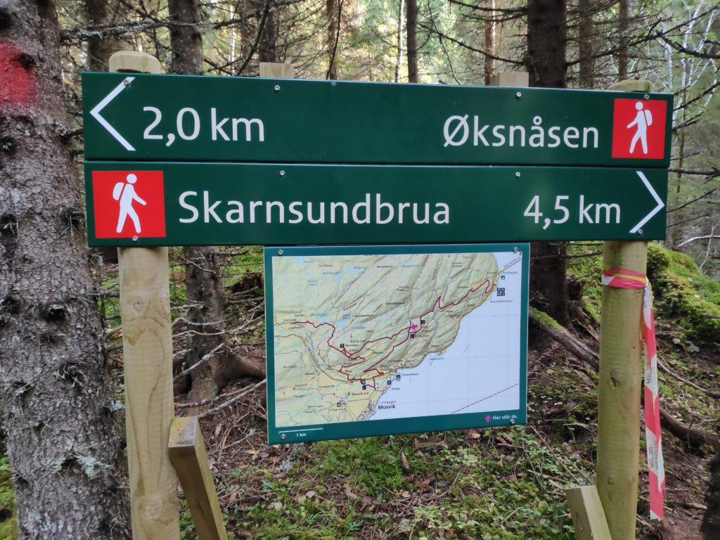
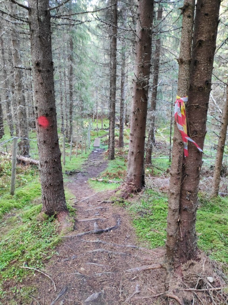
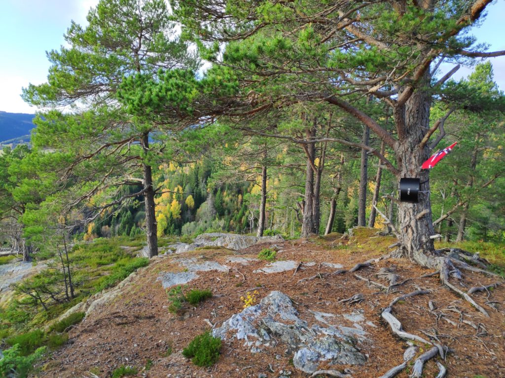
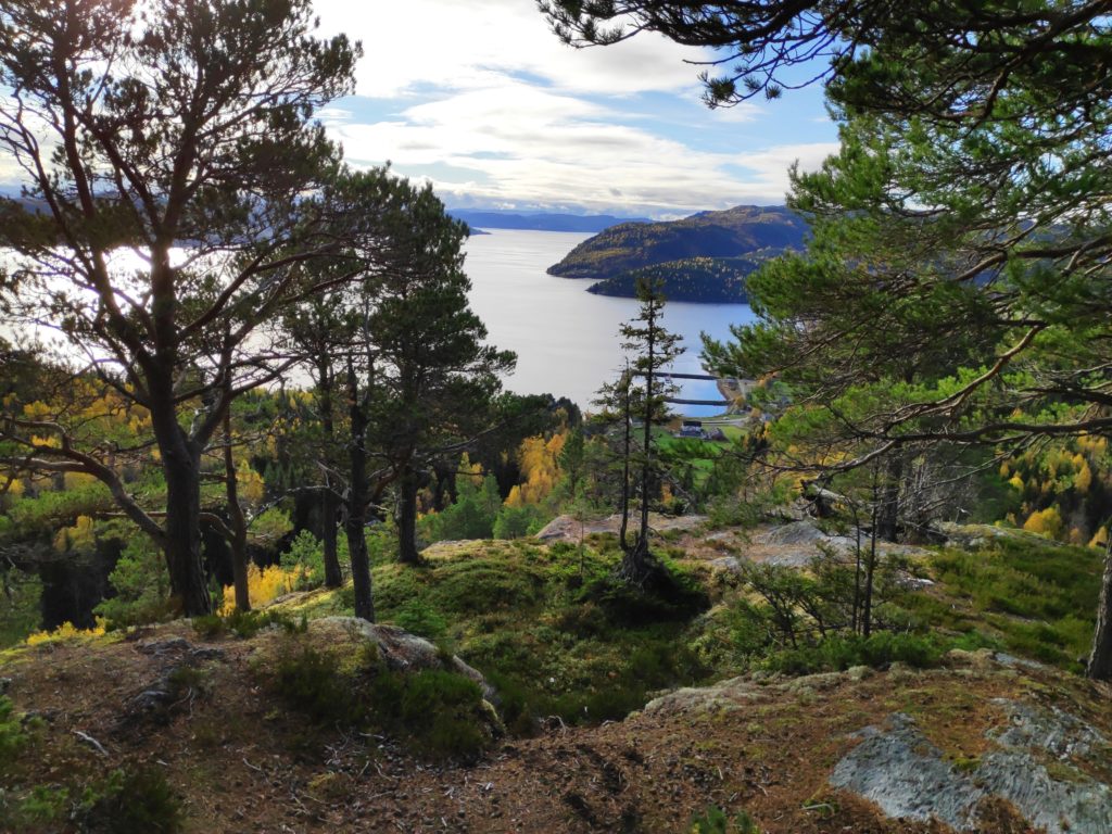
A lot of the walk was along a tractor road. It was steady uphill, but not steep.Though the tractor road was easy to walk along, the terrain went up very steeply and down very steeply on either side of the road. This wasn’t an area to walk off the road.The tractor road was in good condition and obviously used. We came to an open field where the sun was shining on the trees turning yellow.We had come from Stor-Grande, a blue trail, meaning that it was easy walking. So far we had walked 2.1 km. To the right in the picture one can see the trail that goes towards Øksnåsen.In the middle of the woods we came to this sign with a map of the area. We took the trail towards Skarnsundbrua. Now we were on a more difficult walk.Now the trail became narrower and slightly more challenging, with roots in the path and in places large rocks to climb up. Here you can also see a small wooden bridge across a stream. Note the red and white streamer on the tree on the right which is the modern method of marking trails. On the tree to the left is a round patch of red paint which is the older method of marking trails in the woods.Somebody has made visitors welcome by putting up a sign telling the visitor what the name of the place is. From here there is a view over Trondheim Fjord and the center of Mosvik.There was even a flag flying today. The box on the tree has a book one can write one’s name in.The view looking westwards towards Trondheim.The view looking eastwards towards Verdal.
Today the temperature was about 9 degrees Celsius, so we didn’t sit long at the top. There was just a bit of a breeze and after climbing uphill we cooled down quite quickly. Soon we were walking again and heading down the hill to the car. It was a very pleasant outing with a good friend. This is a recommended walk, with many variations if one wanted to take an even longer walk. See the map in the picture above for suggestions on a round trip in the area. We walked back down the hill the same way we had gone up.
I enjoyed today’s walk in the October weather. There was a bit of a wind, the leaves are turning yellow, gold and red and being blown in the wind. It was cloudy, so not so very bright, but no rain either. Today’s walk took about one hour. My two walking companions today were my husband and my son.
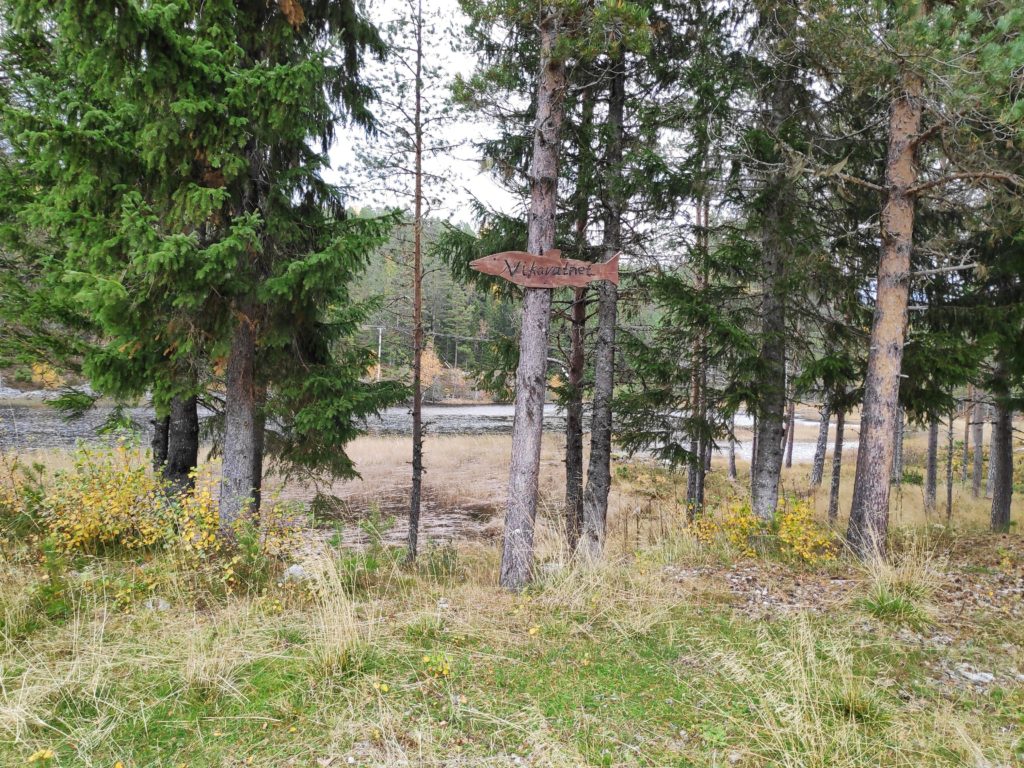
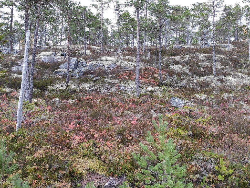
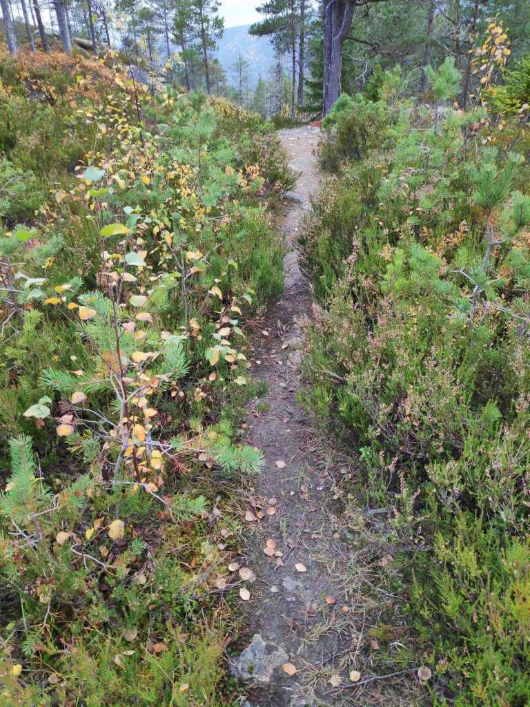
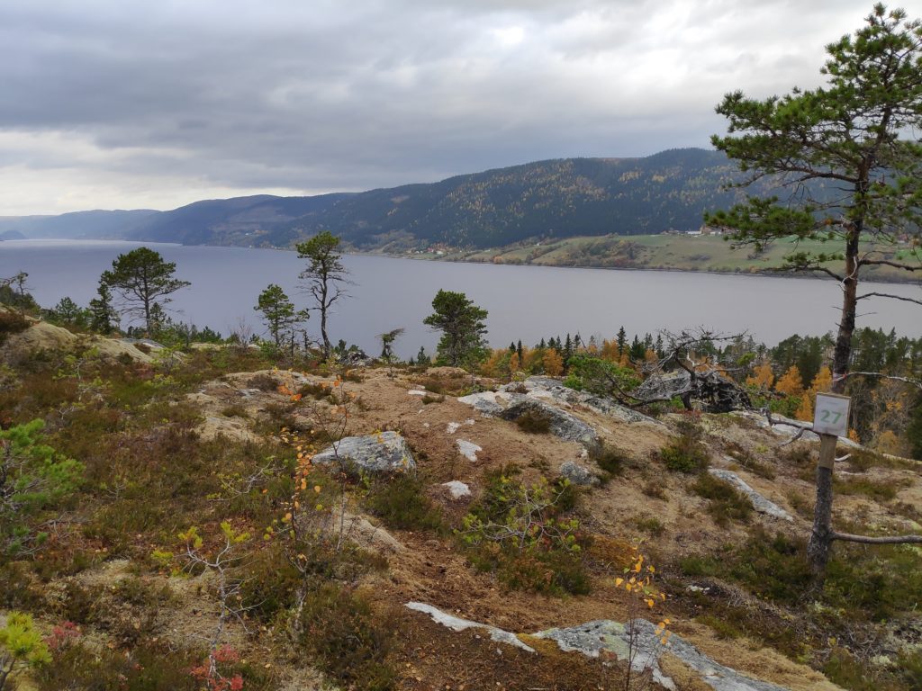
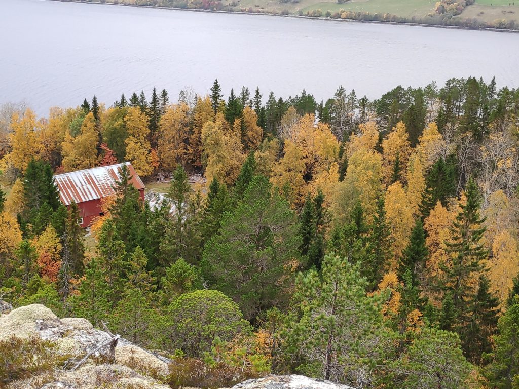
The start of the walk is at Vikavatnet where there is ample parking for cars.At the parking area there is also a small open hut for seeking shelter from the wind and the rain. Inside was a grill and outside another grill area.View of Vikavatnet from the picnic area. We then walked to the far end of the lake and up the hill on the other side.Most of the walk is on a gravel surface and wide enough for three people to walk comfortably. This walk is also advertised as suitable for wheelchairs.The road climbs gently up on the north side of the lake. Most of the deciduous trees have started to change colour. The dark green trees will be mostly pine or spruce.The soil here seems to be very poor, as it was mostly moss and lichens and the few trees were pine. Blueberry and similar low plants were turning red.Eventually we were on a slightly narrower path with muddy bits. We were able to check in to the walk on the app at the end of the road, in consideration for wheelchair users. This trail would eventually go down to an uninhabited farm.The goal of the walk, post 27, is this outcrop of rock facing onto Verrasundet, here looking westwards toward Trongsundet. As can be seen in the picture, the morning was overcast but the temperature was about 14 degrees Celsius.Here is where there has been a farm in the past and the trail would continue on down to it. There appear to be some fields that are still in use. I am standing on a steep cliff.Looking eastwards along Verrasundet, towards Follafoss.We are on the wrong side, i.e. the south side of the fjord, the north side of the slope, for agriculture. In the background, one can see the row of farms on the other side of the fjord, There the farms would receive adequate sunshine for agriculture. This is very typical of Norwegian fjords that run east to west.
This walk is suitable for anyone. One could park closer to the gravel road than we did, but there were few cars on the asphalted road along the lake. There were no steep climbs and few muddy areas.
It’s over two months since I last wrote a blog, but the summertime is not a time for me to write. Now that we have come to September, I am hoping to get back to writing regularly. I have taken many walks over the summer, so you will get to know some of the other places in Inderøy.
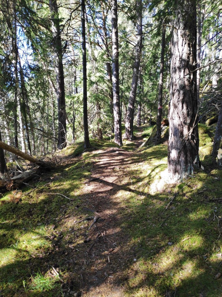
I have a friend that I walk with regularly and today’s walk was a new one for both of us. The starting point is a designated parking area beside the main road between Skarnsund Bridge and Mosvik. The given information indicates that the walk is about 2 km and that one can go around in a circle. We used about 45 minutes on our walk, so we walked more than 2 km. We followed the trail around in a circle and also took one side trail that we decided wasn’t going to take us back to where the car was parked. There were a lot of trails, though I imagine many of the trails are made by the deer and the moose and only some of them have been improved by humans.
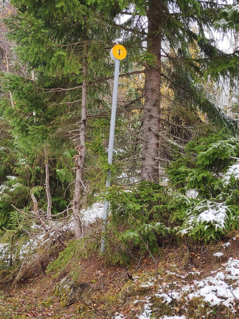
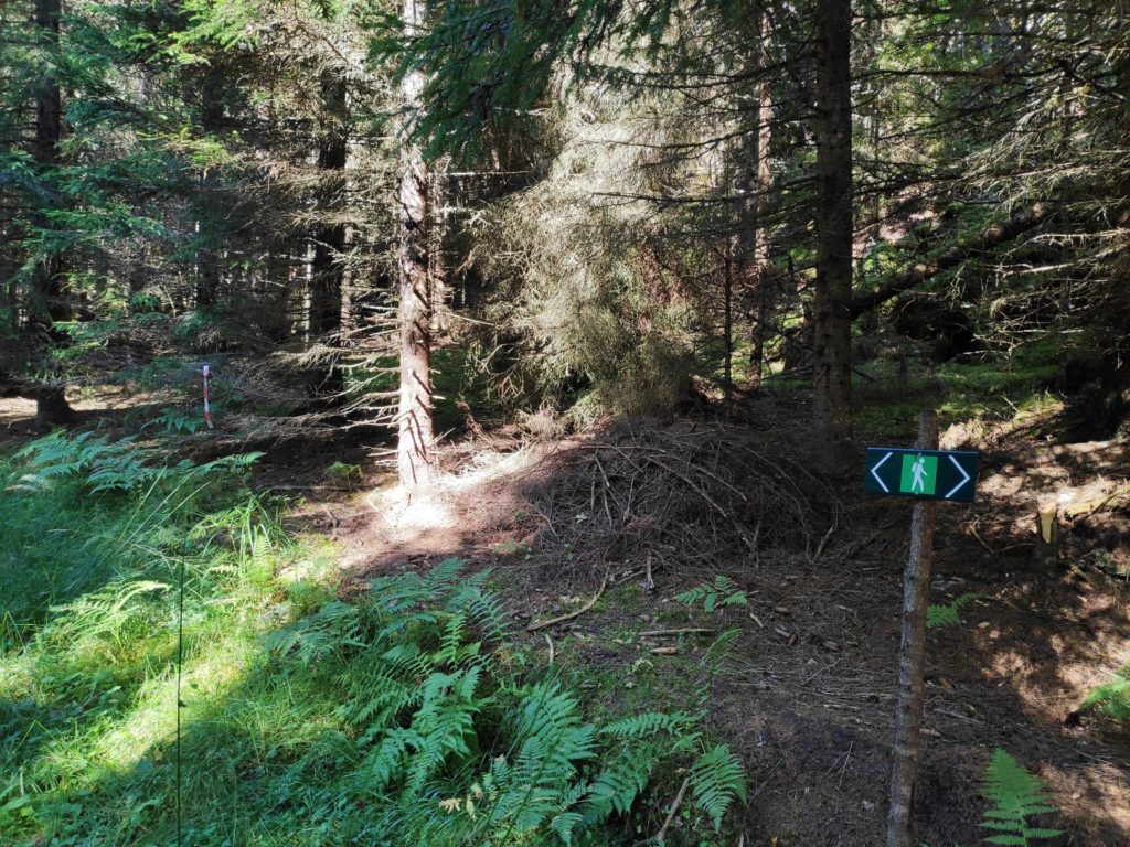
Green man means an easy walk.
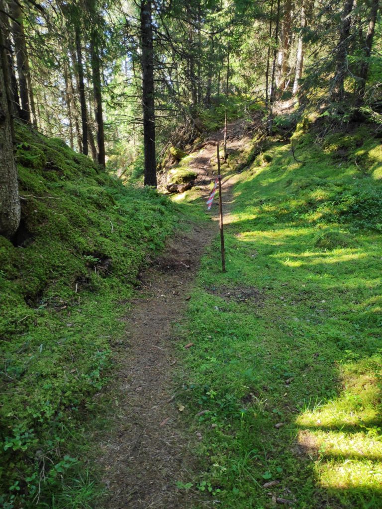
The first bit of the trail is quite steep, but it is all under the trees and once one is up about 25-30 meters above sea level, then the rest of the trail is gently up and down. The post itself is about 50 meters above sea level, according to the map I was using.
It was a nice sunny day, but we were not too warm as almost all of the walk was in the shady forest. The trail is easy to see and there are markers (red and white) to show which trail to take when there is a choice.
The trail was dry and there were no muddy or swampy sections.
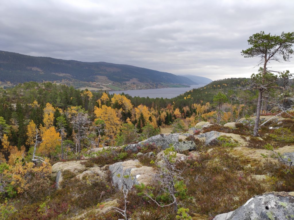
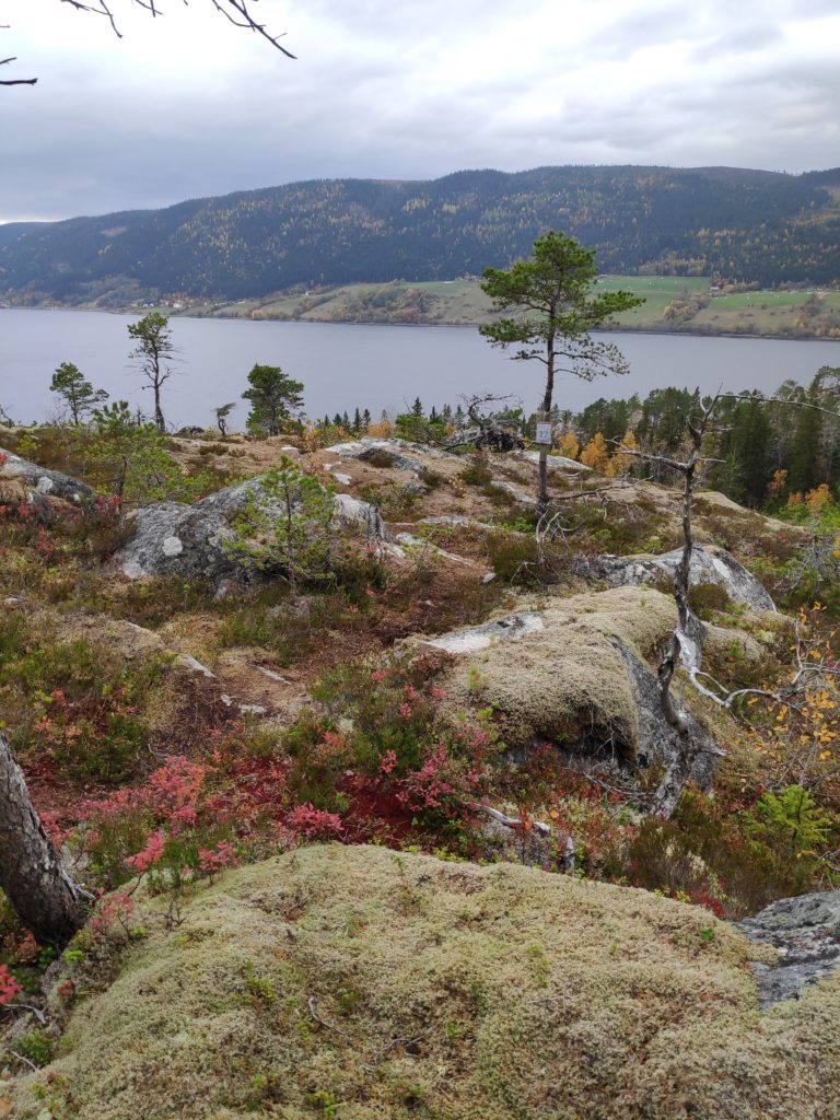
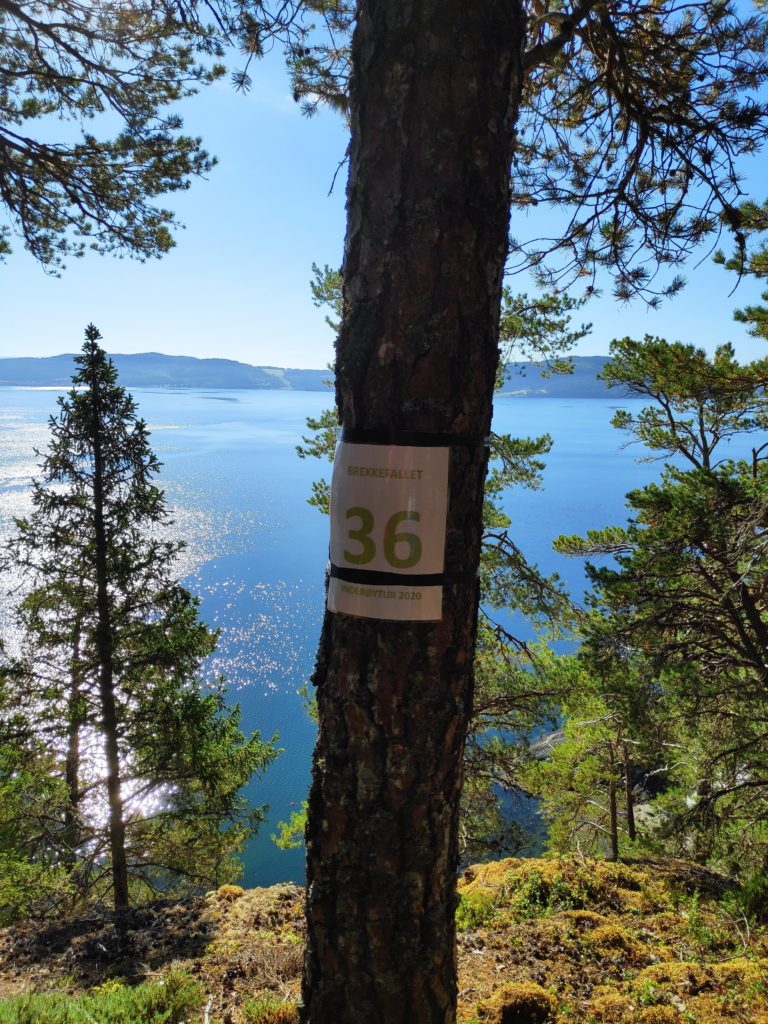
As usual there was a sign to say when one had reached the check-in point. I like best the walks that lead to a viewpoint even though the walk itself is in the forest. It was very steep down at this point and we approached the viewpoint from the trail that was back from the edge of the cliff. In the background of the picture is the island of Ytterøy.
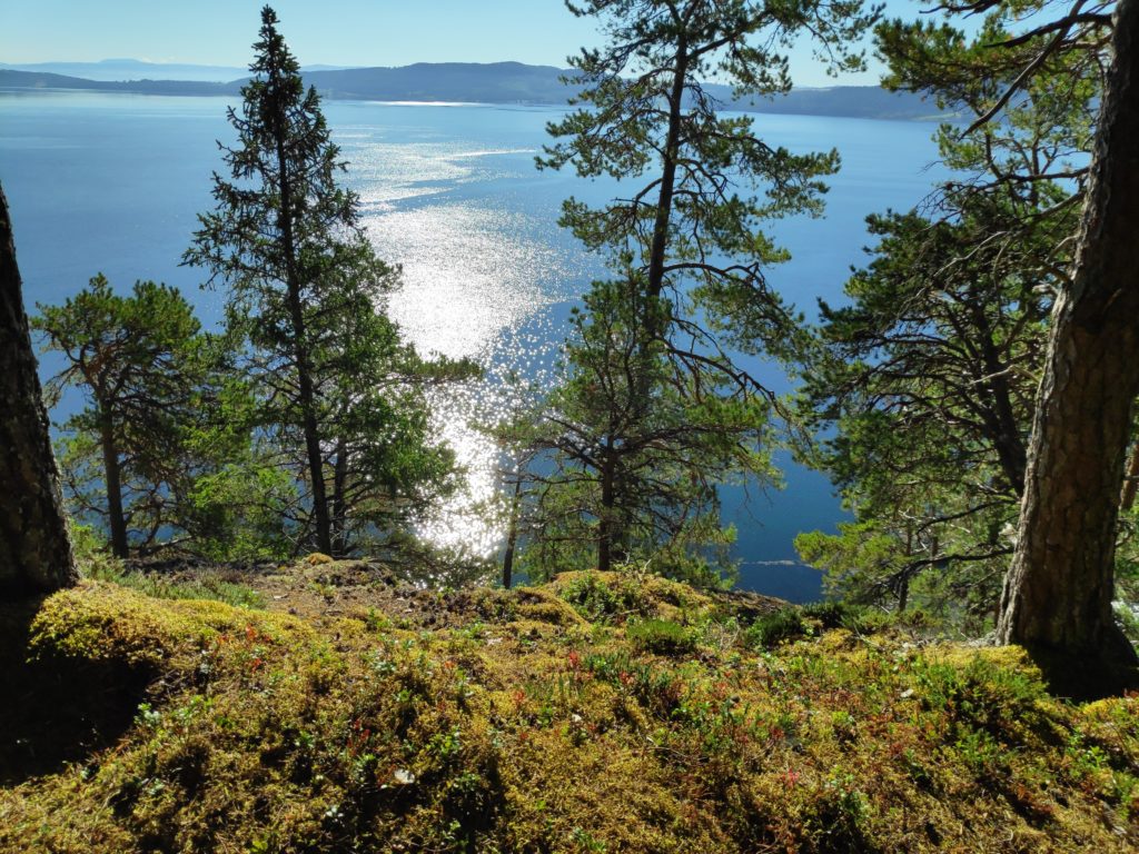
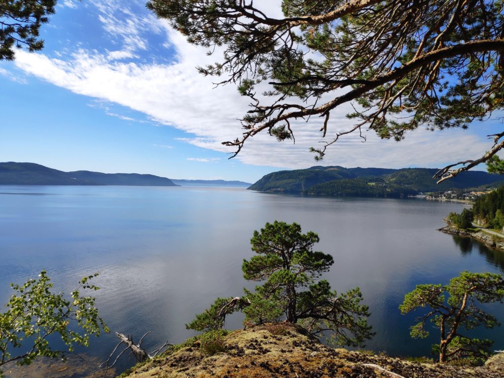
We found more than one viewpoint. Here we are looking across Trondheim Fjord to Ytterøy.Looking south-west out Trondheim Fjord with Ytterøy on the left, Frosta straight ahead and Mosvik on the right. The narrow bit straight ahead is called Norviksundet and it separates Ytterøy from Mosvik.
This is a recommended walk. The steep bit gives one good exercise for the heart and lungs when going up, and the knees when going down. It would not be recommended when it has been raining heavily as the steep bit could be slippery. However, most of the trail is not steep and very enjoyable walking through an older forest.