Though Easter is a moveable Christian holiday marking the death of Jesus Christ, in Norway this is a national holiday that no longer has anything to do with Christianity. Though Christians may attend church services, most people just see it as a nice break from work or school. Most people will have a five-day weekend and it is traditionally the time to either go to the mountains and have one last skiing trip, or head to the cabin near a fjord and get it ready for the summer season.
Thursday, Friday, Sunday and Monday are all days that are holy days and therefore most people will have the time off, unless they have a job that has to be manned 24 hours a day and seven days a week, like the police, hospitals and other health care services. Schools take the whole week off, so that children and students get ten days free. Stores are open on Saturday, but will often close a bit early so that the workers can also have extra free time. For example, my local grocery store has standard opening hours from 7 am to 11 pm but on the Saturday before Easter Sunday they will close at 4 pm.
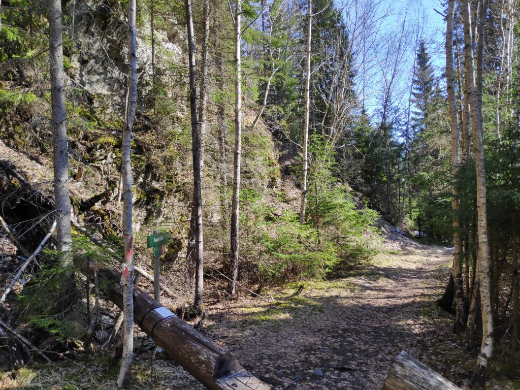
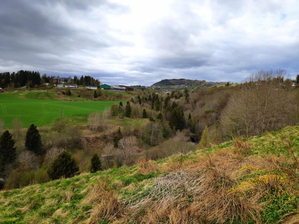
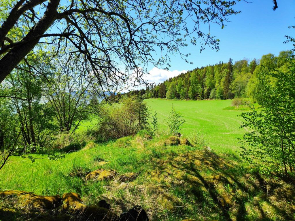
I’ve never been keen on skiing, but getting into the woods and up a mountain have always been things I like to do. For me, this year, this is the week that my walking season has begun in earnest. Yesterday I took a one-and-a-half hour walk with my son and we covered about 5 km. However, I took no pictures yesterday so I won’t write more about that walk except to say that I really enjoyed it and I wanted to do more.
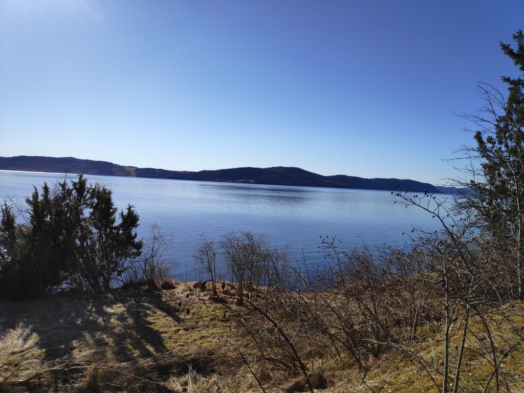
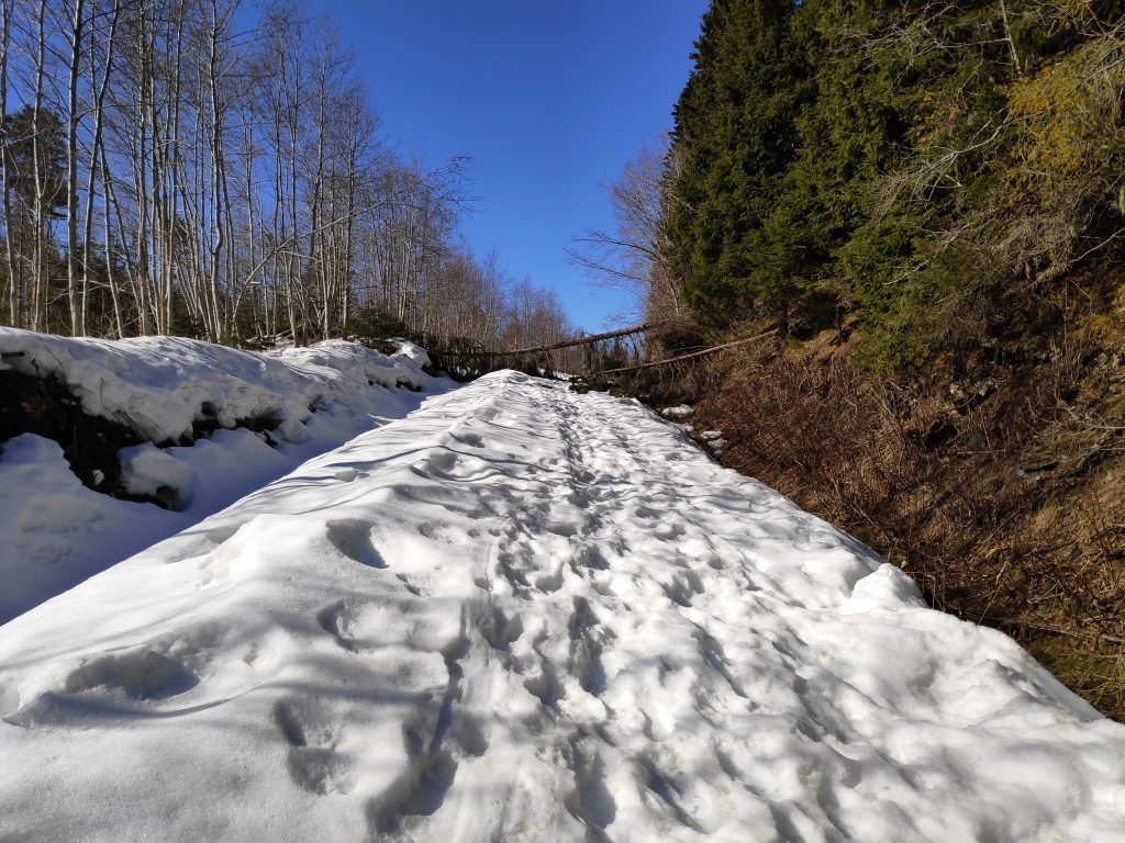
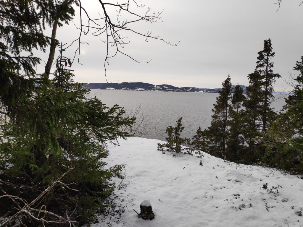
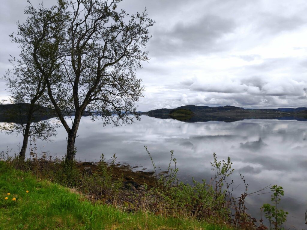
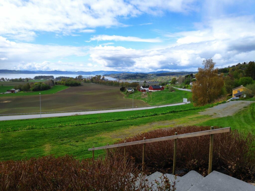
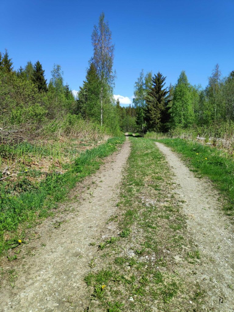
Today was again a bright sunny day. There was frost when I got up, but as the sun climbed higher in the sky, the air temperature warmed up considerably. While my son and my husband headed off for a day-trip in the car, I got a ride to a drop-off point that is about 5 km from home. I walk up and along a back road that brings me to Skarnsund Bridge, cross the bridge and walk through the woods to home again. It is only on the bridge that I have to listen to the noise of cars. Today I used two and a half hours, so probably walked almost 8 km.
The typical Easter weather that everyone wants is a sunny day, with heat in the sunshine. Today was a good day for fulfilling that dream weather.
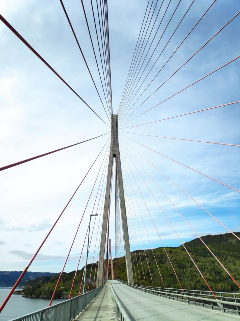
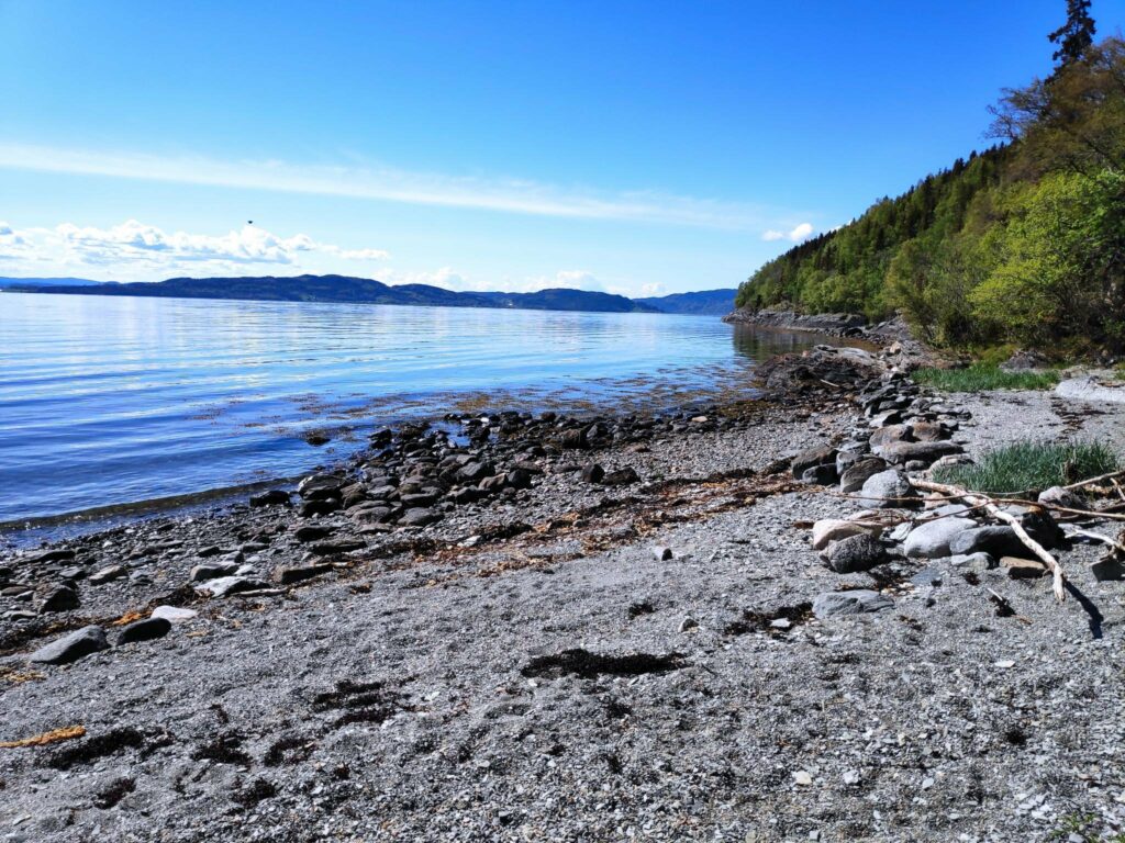
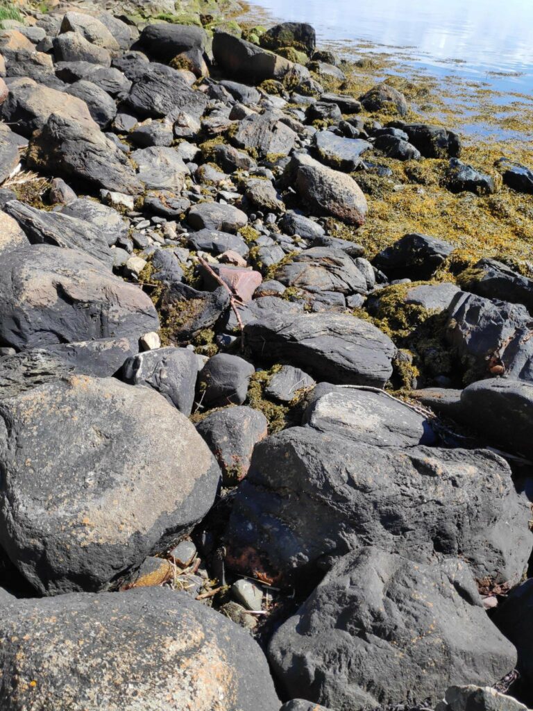
Dream weather for an Easter walk – sunshine and no wind. Too bad the photographer couldn’t hold the camera parallel to the horizon. We can blame it on sun in her eyes, or perhaps just carelessness.
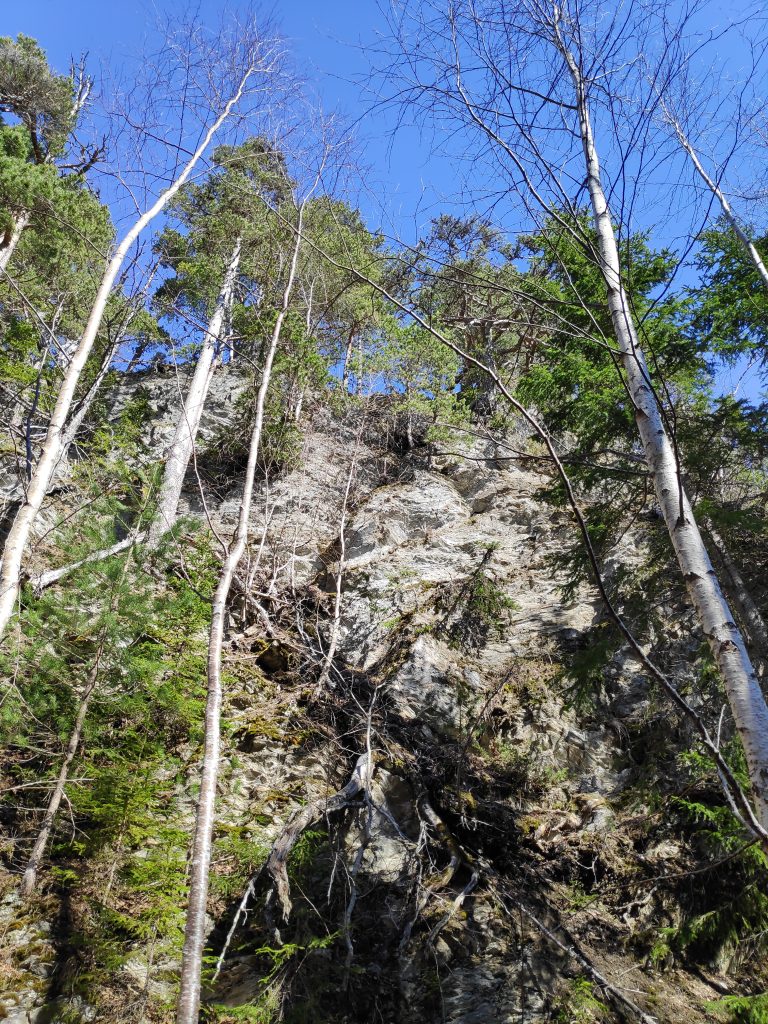
Though the snow is gone in low-lying areas, I was prepared for snow as I climbed up the hill. Mosvik gets a lot more precipitation than we get at Vangshylla. I quite often notice it raining or snowing in Mosvik and we don’t get anything. We also got a lot of precipitation in March this year, often as snow in higher elevations. Several storms would also have blown the snow, causing drifts in open areas in the woods.
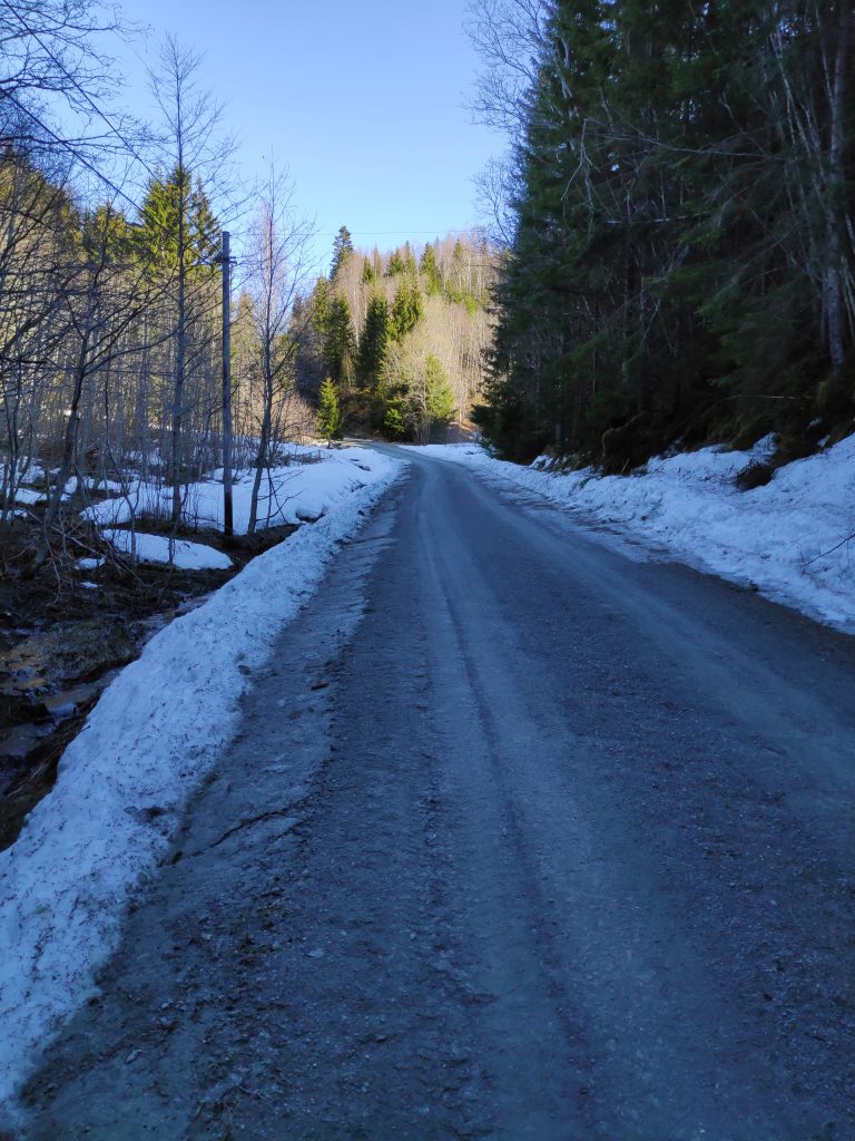
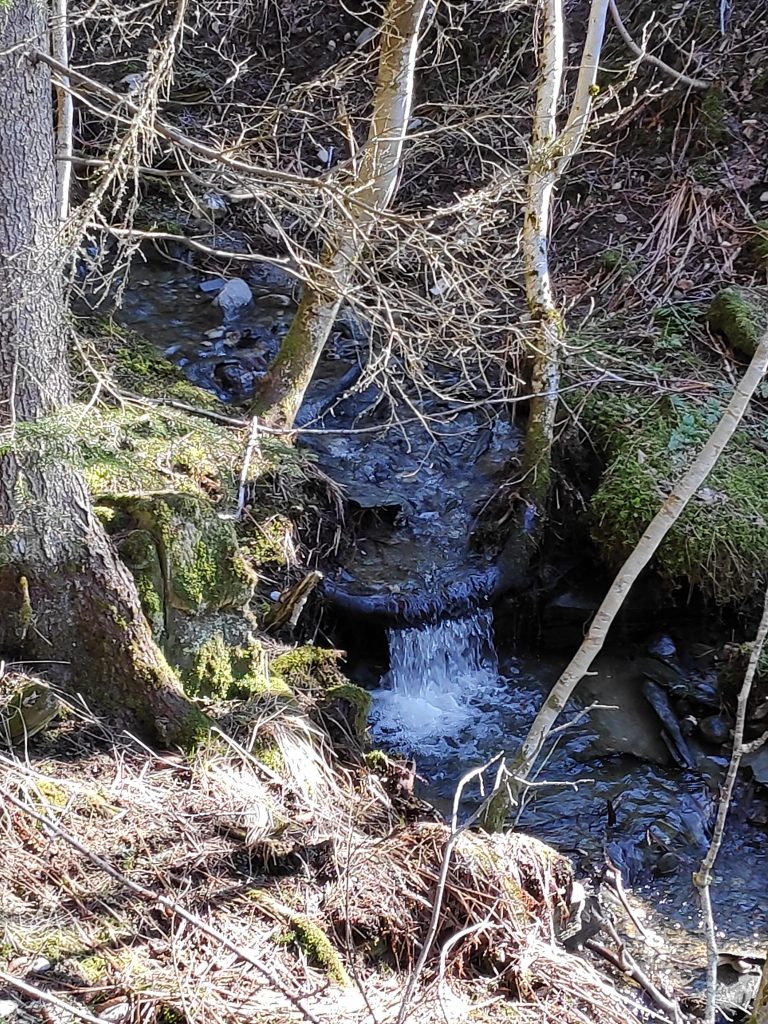
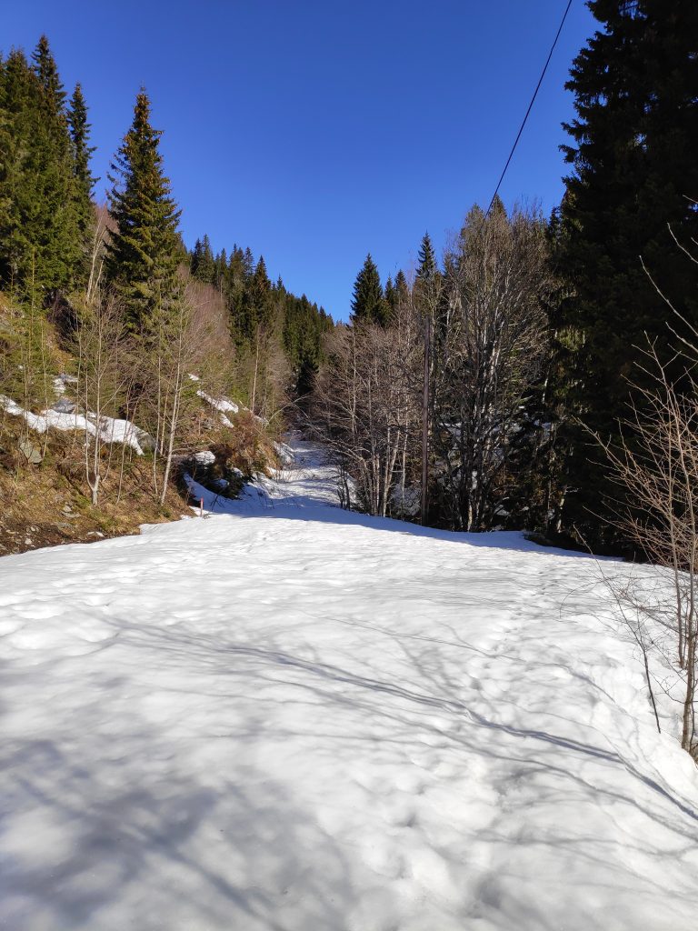
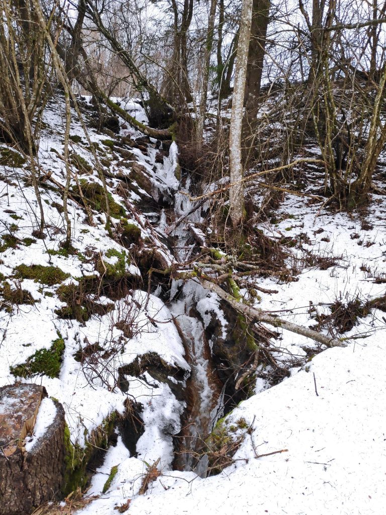
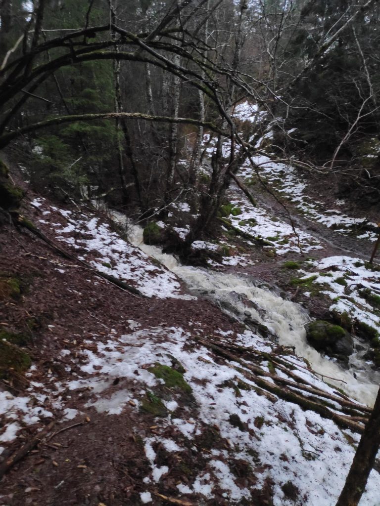
Dalavegen in Mosvik is a back road with only a few houses on it, but it is kept open all winter long. However there are a lot of trees preventing the sun from melting the snow in the ditches. The higher I climbed up, the more snow there was. I use about 20 minutes to walk up this road as it is a steady uphill climb.The snow was melting and there was lots of water in all of the streams that I saw. This little waterfall captured my attention as a bent tree gives the water a nice edge to fall over.
When I got to a farm called Setervang, the road divides and continues eastwards towards Skarnsund Bridge or heads north then west to reach another farm which I think is only used as a summer house. This road is not always suitable for driving, even in the summer as it can have quite deep ruts. It is not plowed or kept open in the winter. In the summer there is a gate to keep the sheep away from farm fields.
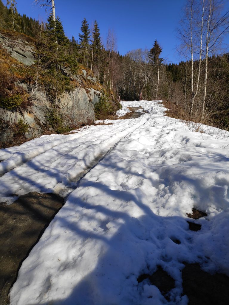
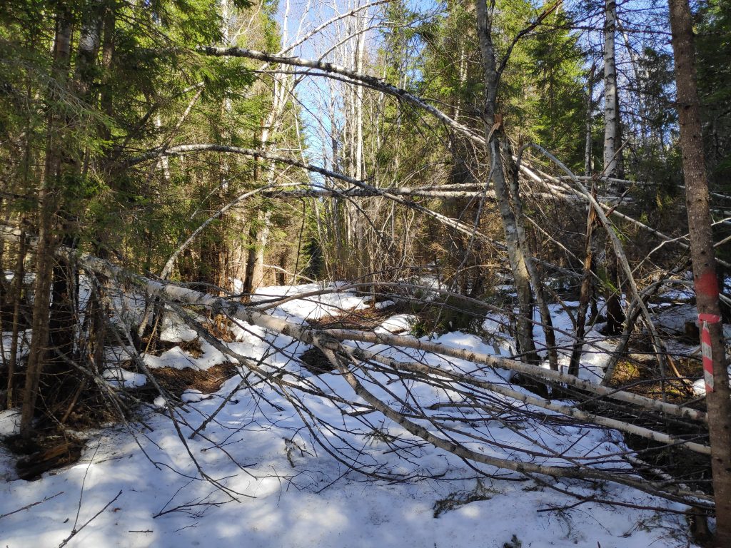
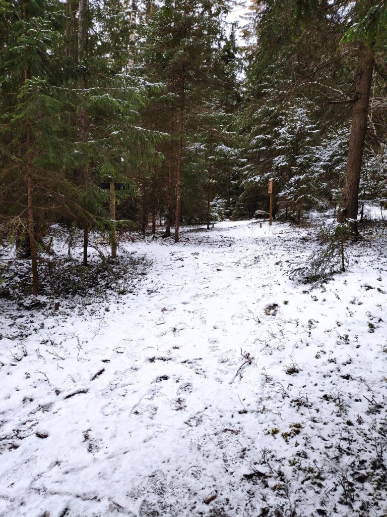
There was still quite a bit of snow on this back road, one that is not kept open in the winter months. However there were lots of tracks from people walking up the road. This is a popular walking area in the summer.There were a few challenges where trees had stopped standing and were lying down for a rest. Someone had come by with a saw and made an opening for people to get through.
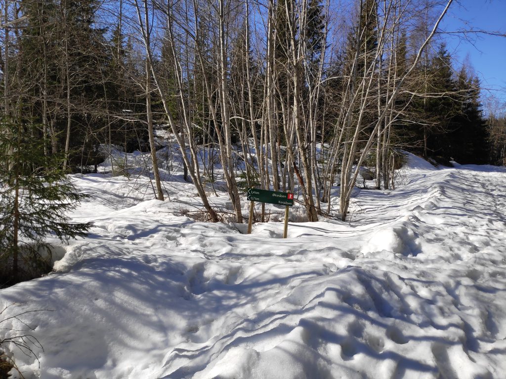
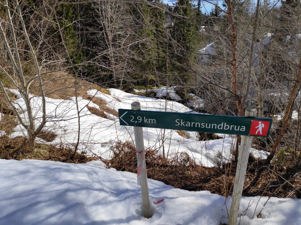
The main reason I had decided to come up this rather snow-covered road was to get to a viewpoint where I could see out over the fjord. There are several that can be accessed from this road, but I decided to neither go to Storlia nor Korpsåsen, both of which are lovely walks, in the summer. By the time I had gotten to this point, I did not want to go much farther across snow. I was on my own and had to be careful that I didn’t twist my ankle or otherwise injure myself. So I decided on a place that I knew about which was closer than either of those places.
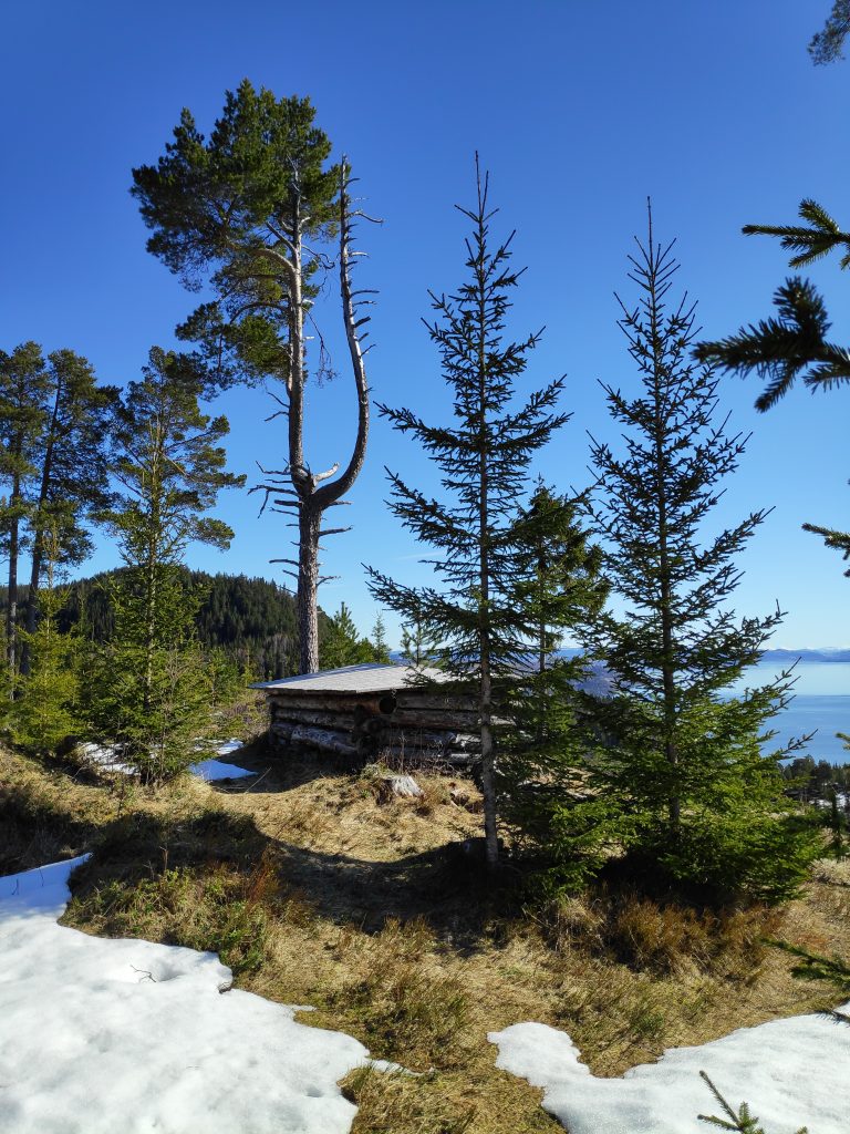
I took a left turn here but I’m not going to go as far as Korpsåsen, which is 700 meters according to the signpost, but I always feel is about twice that distance.Maybe a hundred meters from the snow-covered road, then turn left at the top of this hill.A viewpoint with a shelter, at the edge of a cliff.The shelterThe view, looking east towards Vangshylla and Verdal. The island of Ytterøy is also visible. This was the reason to trudge through the snow. I stopped her for a few minutes to just enjoy the sunshine and being able to see a long way. Though it doesn’t show up well in this picture, there are snow-covered mountains in the distance.
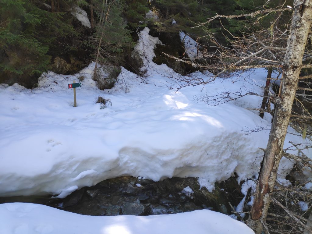
After enjoying the view, I went back to Gammelplassen, where in the summer you can park a car and headed off towards Skarnsund Bridge and home. However, there was a lot of snow on the trail, trees that had blown over, and a stream to cross before I got onto the section of the trail that was mostly free of snow.
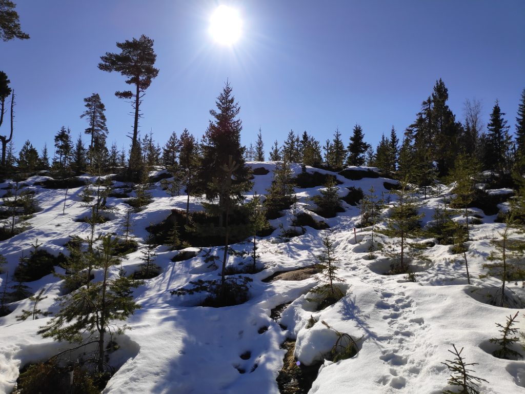
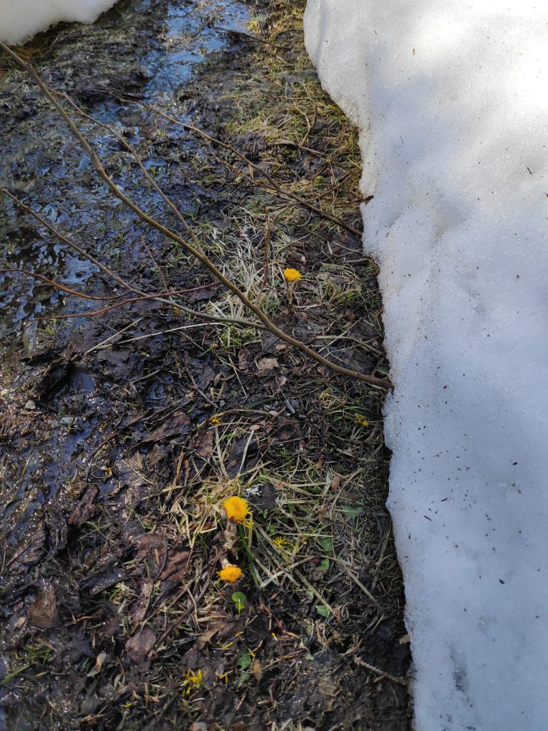
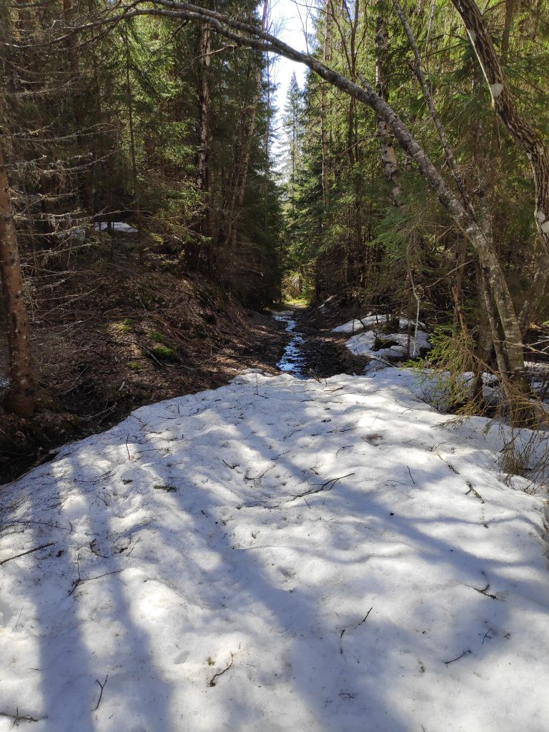
Gammelplassen – no parking available at the moment. Come back in a month or two. But I’m not the first one to cross on foot. There were both human and animal footprints.I’m on my way home, but first I have to get to the bridge. I’ve used about an hour so far.Colt’s foot (in Norwegian, hestehov) is one of the first flowers to come up in the spring. The flower comes out first and then large leaves grow throughout the summer. These fellows had plenty of water and were eager to get on with their lives. They were not going to wait for the snow to disappear.The trail continues on the other side of the stream. I followed the footprints and found a good crossing point. There was quite a bit of water in the stream, heading down to the fjord.Here too there were all sorts of lazy trees who couldn’t stay standing. Some of the trees were more difficult to get around, over or under than others.Finally, the trail becomes more bare than snow-covered, though the first part was quite wet.Furufjellet (the pine mountain), the goal of the walking trip, about an hour and a half from the start of my walk, and about 50 minutes from home. As I suspected, there was little snow on this part of the hillside.Looking up from the previous picture. There are pine trees at the top of this cliff.
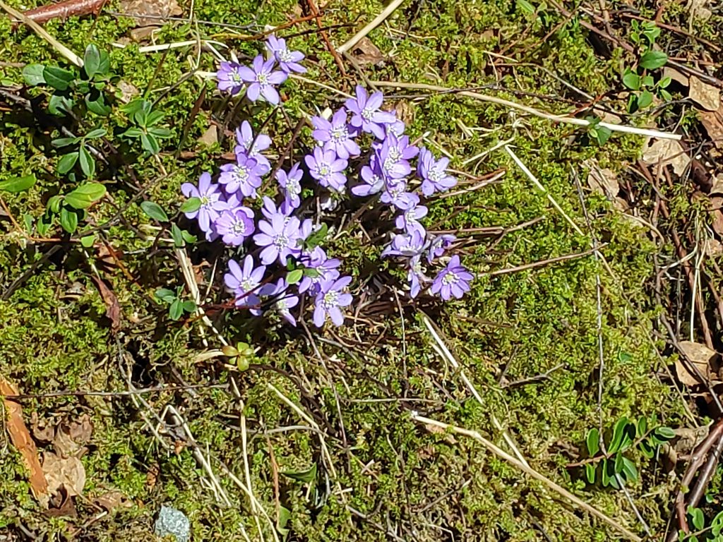
I often like to look at the flowers that are growing in different places, but in the middle of April there are still very few wild flowers out. I’ll have to wait until May before more come out. At this point there are a few that have to get their blooms out before the leaves come out on the deciduous trees. Colt’s foot (hestehov in Norwegian) is usually the first one and at lower elevations there are now numerous blooms along the sides of the road. Another plant, hepatica nobilis, (blåveis in Norwegian), anemone hepatica or liverwort in English, is very characteristic for Inderøy municipality.
This picture was taken on a sunny slope facing south. Anemone hepatica likes dry and calcium-rich soil. We have this on our lot and it is quite common throughout Inderøy.I’m back to the bridge. One kilometer across the bridge and about half a kilometer to home on the other side.
This was my first long walk of the year, using about two and a half hours, without any breaks except to take pictures. I was tired when I got home, but not as much as I had expected. Getting out into nature, away from cars and people, helps me charge up my batteries and keep me in a good frame of mind.
I am planning to do other walks and perhaps there will be blogs about them. Most of the walks that I can do easily from home I have already written about, so no promises about how often new blogs will come out. From about the middle of May, the municipality of Inderøy has a series of walks which I am hoping to participate in this year too.
Have you been out for a walk in nature recently? Is this the weekend for you to get away for an hour or two? Enjoy your walk.
As the walks that I take at this time of year tend to follow the same few trails or roads, I look for different themes for taking my pictures as I walk. Today I noticed ice in different types of locations.
January 2022 was the month of storms in Norway, though we didn’t feel all of them where we live. The Norwegian Meteorological Institute summed up the month of January with very high levels of bad weather warnings (see the article in Norwegian here), about twice as many as a year ago. There was a storm somewhere in Norway on 26 of the 31 days in January, with 82 yellow warnings, 12 orange warnings (more serious) and 2 red, extreme warnings. Why were there so many storms in January in Norway? There was a high pressure area sitting over Great Britain, so they got the sunshine. The storms coming in off the Atlantic Ocean went around Great Britain and came to Norway.
I usually think of January as the month that it warms up a bit and the snow disappears. This year we got that, but we also got several storms that brought more snow, or heavy rain. The last week of January saw more snow. February tends to be, in my opinion, more stable weather, meaning that there are fewer storms and more sunnier weather, though it can be quite cold and very often a lot of ice.
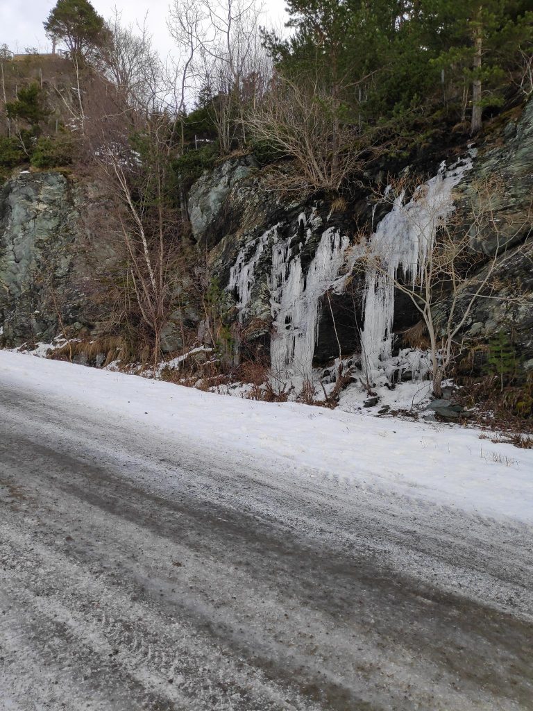
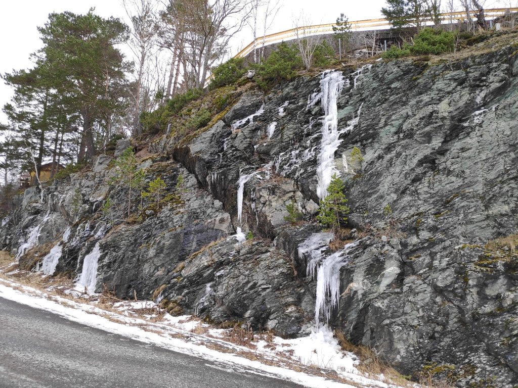
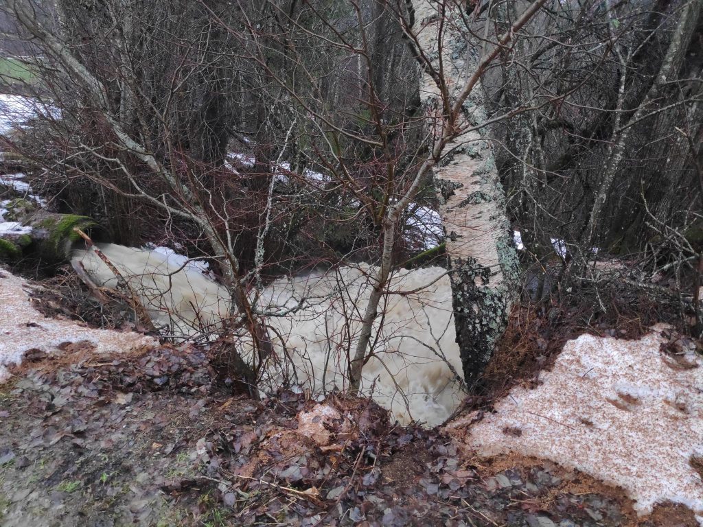
Today the temperature was about +2 degrees Celsius and no wind when I was out walking. The sun shone intermittently, but the day felt bright. But the last few days has given us changeable weather, sometimes snow, sometimes rain, but always the temperature has been about zero degrees, so that the rain does not get rid of much of the snow. That means that we have had perfect conditions for creating ice, especially where one drives or where one walks.
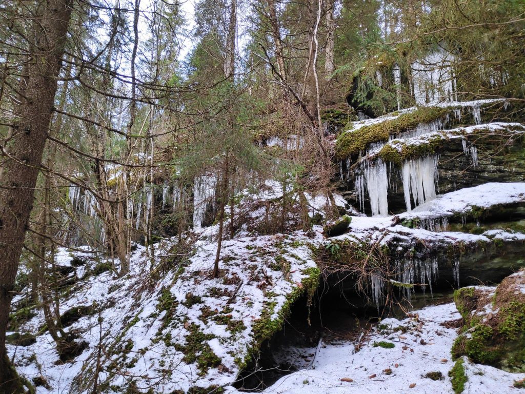
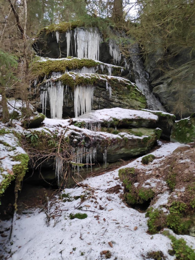
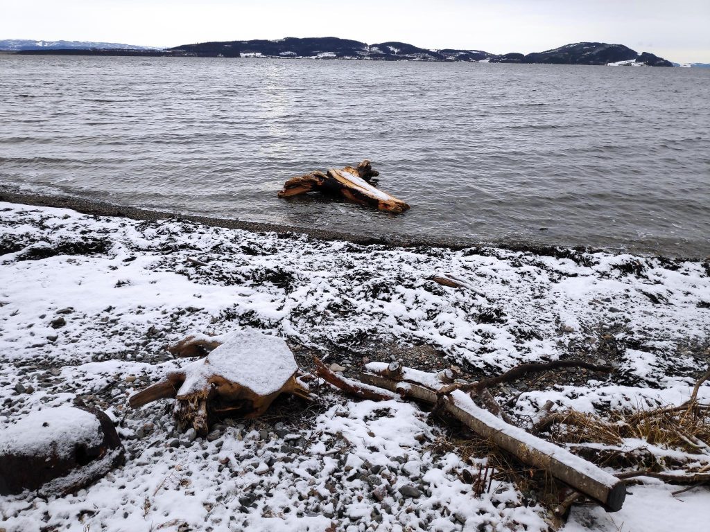
Running water creates ice and this stream was no exception. This is the same stream that a few weeks ago was causing flooding on the field at the top. The stream is fed under the cultivated field through a large pipe. Here the stream tumbles down a ravine, causing ice to form along its path.In the woods, running water can also cause icicles to form. Here was a long series of icicles.As I got closer to the icicles, I noticed the rock formations as well. Here there were several layers of rock, with large spaces between them. Above there are farm fields. Some of the water seems to be flowing in the stream I had found a week ago, but most of the water just seemed to drip over the edge of the rocks. Note that there is a lot of moss on the rocks indicating that these rocks are wet all year long.The sun came out as I was writing my name in the tour book at the lean-to. I checked the map on my telephone and it told me that I was about 80 meters above sea level. I make sure I don’t go near the edge at this time of the year. I do not want to slide down a cliff face.A week ago, I had seen a large tree stump at the water’s edge at the beach. Was it still there, I wondered? So I walked down to the beach and sure enough, it was stranded near the high water level on the beach. Today the tide was much lower. We can have up to four meters difference between high tide and low tide.Back to ice and the conditions of the roads. This is a private gravel road that leads to five homes and many cabins. Icy! I was glad that I was wearing cleats under my shoes. I was also very careful where I walked. At the lowest point of this section of road, the stream goes under the road through a large pipe.Even the municipal road that leads to the quay at Vangshylla was very, very icy, though a bit of sand had been put down to allow cars better traction on the ice. Walking along the edge of the road, it was very icy. I was glad to be walking uphill, not downhill.As I walked up the road, I again saw icicles forming where water drains off the cliff and freezes as it falls.The yellow fence at the top of the cliff shows our property. Here, too, ice forms as water is draining away and then freezing.
As it was several days since I had been out for a walk, I dawdled a bit, watching where I was walking and was out for about an hour and a half. It was good to get fresh air and let my eyes focus on things far away, and not just look at a computer screen or my knitting.
Today is the last day of January and finally the weather was pleasant enough to go for a walk in the woods. We’ve been having snow, rain and sleet, but today there was little wind and light cloud so I was tempted out for a walk.
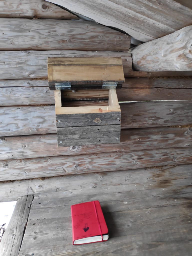
I like to have a goal for my walk, somewhere I turn around, though I don’t have to go back the same way that I came. In Trøndelag, Norway, there is a tradition of having a mailbox, possibly fastened to a tree, in which there is a book in which to write your name. These “turkasser” (tour boxes) are usually put out by the local sports club to encourage people to get out walking. They would normally be some distance from a car road, so that you are required to walk there. The books in the boxes usually last several years and one writes the date one comes, and one’s name. Some people like to add the time of day, comments about the weather and even the dog’s name. In the one that I visit most, I often write the accumulated times I have visited the place during the current calendar year.
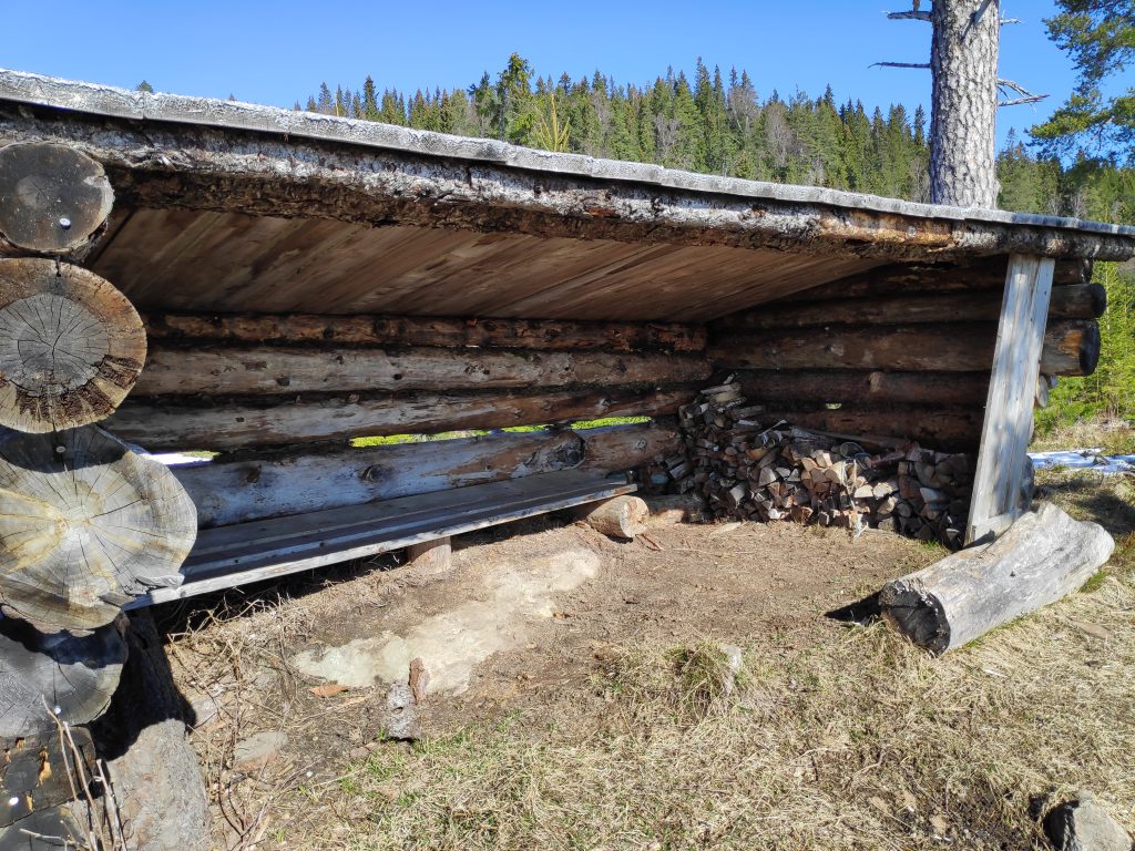
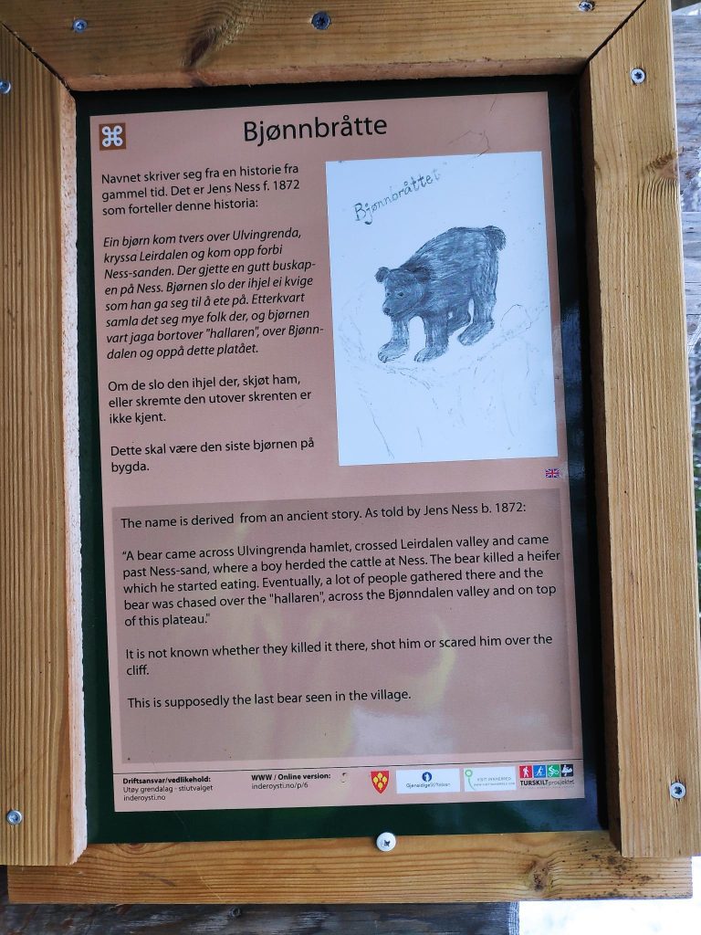
Bjønnbråtte
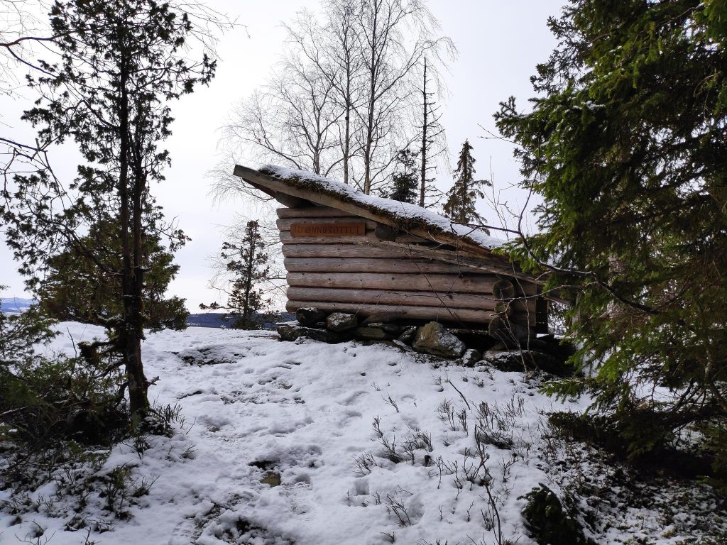
The approach to the gapahuk/lean-to at Bjønnbråtte. Note the sloping roof. This one has grass on the roof. The open side faces the water and the view.
One of the most common walks that I take is to a place called “Bjønnbråtte”. Here there is a gapahuk, a primitive lean-to. It is a type of shelter, usually open on one side. This one would sit about three adults at the opening and you have to watch that you don’t hit your head when you stand up again. A Norwegian gapahuk, or lean-to, comes in many sizes and can be large enough to sit ten to fifteen people inside, or small like this one. We have lived here for 32 years and this one has been here all of the years we have lived here.
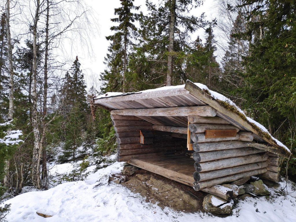
There is enough height to sit at the front. Today it was dry, but the last time I came here, snow had blown into it so I was not able to sit down. On the inside of the far wall, there is a box in which a book is stored. The box keeps the book dry. The lean-to is made out of logs and planks and sits on a foundation of mountain rock and large stones. The roof is covered with sod.
During the summer months, this is a check-in place for Inderøy Walks, but I also use it as a check-in place and turn-around place in the winter. Having a check-in place makes a good goal for a walk, and I find that it gives me the feeling of having gotten somewhere. Living in the country, walking to a store or other municipal facility is not possible.
The tour box has been opened and the book taken out to write my name in it. Today was the fourth time I have visited this spot in 2022. When we first came here, the book that was used at the time was just kept in a plastic bag to protect it from the weather. A couple of years ago my husband decided to make something more weather-proof and the result was the current box made out of used terrace boards.The information sign inside the gapahuk/lean-to.
Why is this place called “Bjønnbråtte”? The Norwegian word, “bjønn” means a bear. So the sign gives the story of a bear, as retold by Jens Ness who was born in 1872. “A bear came across Ulvingrenda hamlet, crossed Leirdalen valley and came past Ness-sand, where a boy herded cattle at Ness. The bear killed a heifer which he started eating. Eventually, a lot of people gathered there and the bear was chased over the “halleren”, across the Bjønndalen valley and on top of this plateau.” It is not known whether they killed it there, shot him or scared him over the cliff. This is supposedly the last bear seen in the village.
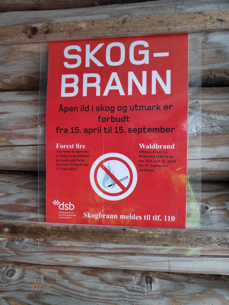
Inside the lean-to, there is also a sign warming about forest fire danger. Between the 15th of April and the 15th of September it is forbidden to light fires. The telephone number for reporting fires is also given.
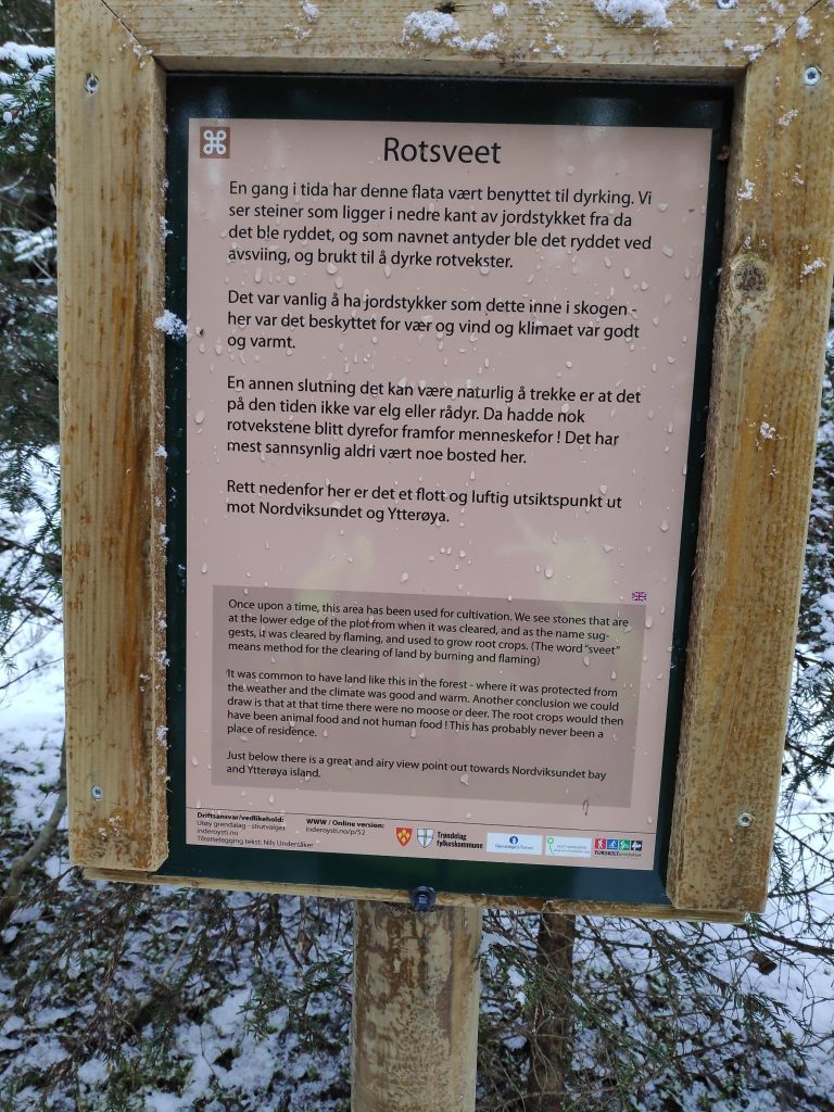
Rotsveet
After reaching my goal and writing my name in the book, I turned around and headed home. The first part of the trail I have to just retrace my steps, but I stopped to read one of the information signs along the way.
Norwegian at the top and English in small print at the bottom. You can also read all the signs for this walk between Vangshylla and Straumen at https://www.inderoysti.no/kart-og-tavler/.
(English translation of the sign) Once upon a time, this area has been used for cultivation. We see stones that are at the lower edge of the plot from when it was cleared, and as the name suggests, it was cleared by flaming, and used to grow root crops. (The word “sveet” means method for the clearing of land by burning and flaming.)
It was common to have land like this in the forest – where it was protected from the weather and the climate was good and warm. Another conclusion we could draw is that at that time there were no moose or deer. The root crops would then have been animal food and not human food. This has probably never been a place of residence.
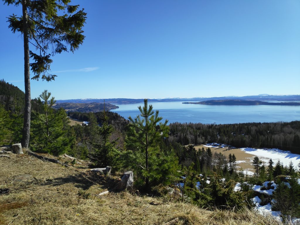
Just below there is a great and airy view point out towards Norviksundet and Ytterøy island.
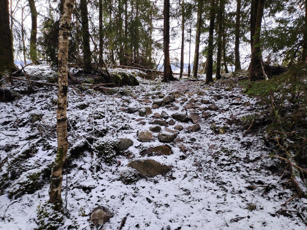
The stones that are mentioned in the text. There is a viewpoint straight ahead, on the edge of a cliff.The viewpoint, looking towards the island of Ytterøya. I didn’t go too close to the edge when it was snowy and possibly icy. There is a sheer drop down many meters to the fjord.You can just see the sign on the right of the path. It is relatively flat here, so one can see why it might have been cultivated at one time. The viewpoint over the fjord is off to the left from where I am standing.
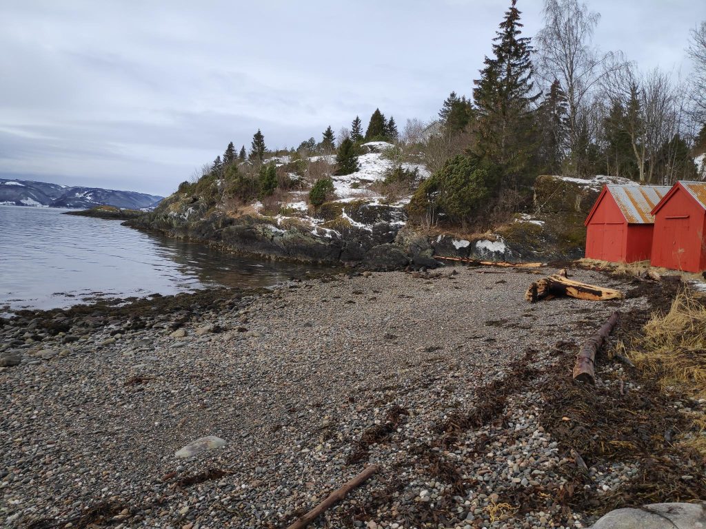
The beach at Rotvollvika
To make my walk a round trip and to give myself two more uphill stretches, I often walk down towards the fjord. Today I caught sight of something unusual for our local beaches, but probably a result of the recent storms. Where I grew up in British Columbia, beaches were often littered with logs that had gotten loose from log booms. There are no log booms in the area here so there is very little driftwood on beaches.
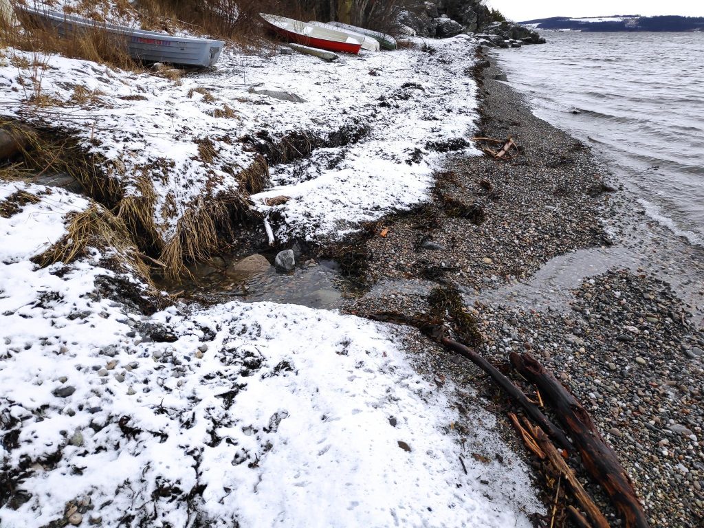
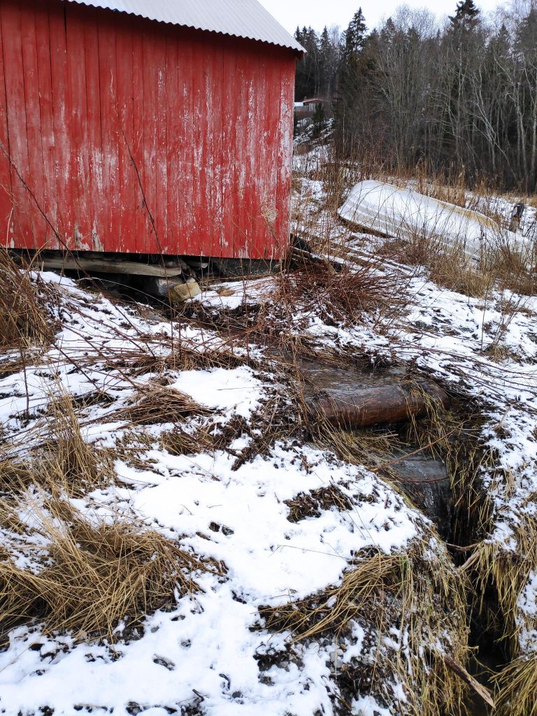
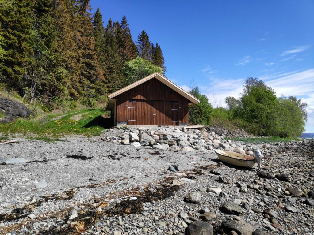
The tide was relatively high when I came by. Seeing a floating stump in the water is unusual here. One can also see a smaller stump higher up the beach and some branches that have been put on the beach by either a higher tide or waves.Looking eastwards along the beach, one can just see the piles of seaweed, deposited on the beach at high tide. Now is it covered by snow and ice. In the foreground there is a stream.This stream has always fascinated me as it flows under the red boat house at the left.
I was probably out for an hour on my walk today and it was good to get outdoors and get both fresh air and exercise. I hope you get out for a walk today too.
After a day of heavy rain and not getting outside at all, I decided to go for a walk today and see if there was any damage nearby.
This storm is bad enough that it has received a name, “Gyda” and it is affecting a large portion of Norway from the mountain passes in the south to northern Norway. Roads through mountain passes are closed, airlines have cancelled flights, ferries in vulnerable locations have been cancelled, roads are closed due to flooding or landslides and basements have been flooded. In some locations people have been evacuated from their houses as rivers have gone over their banks. At the time of writing this blog, the storm is not over and it is expected to continue to rain at least until tomorrow, but I think the worst is over for us, at least as far as water levels are concerned.
We live on a rocky hillside and though there is a stream not far away, it is on the other side of a small hilltop so even when it floods it does not come our way. We almost always get a mild period in January, when the snow melts. If rain comes at the same time, and the ground is still frozen, the melting snow and the rain water only run across the surface and can not sink into the ground.
We got snow on the 24th of December and we have had several snowfalls since then. There have been nice stable winter temperatures and the snow has piled up.
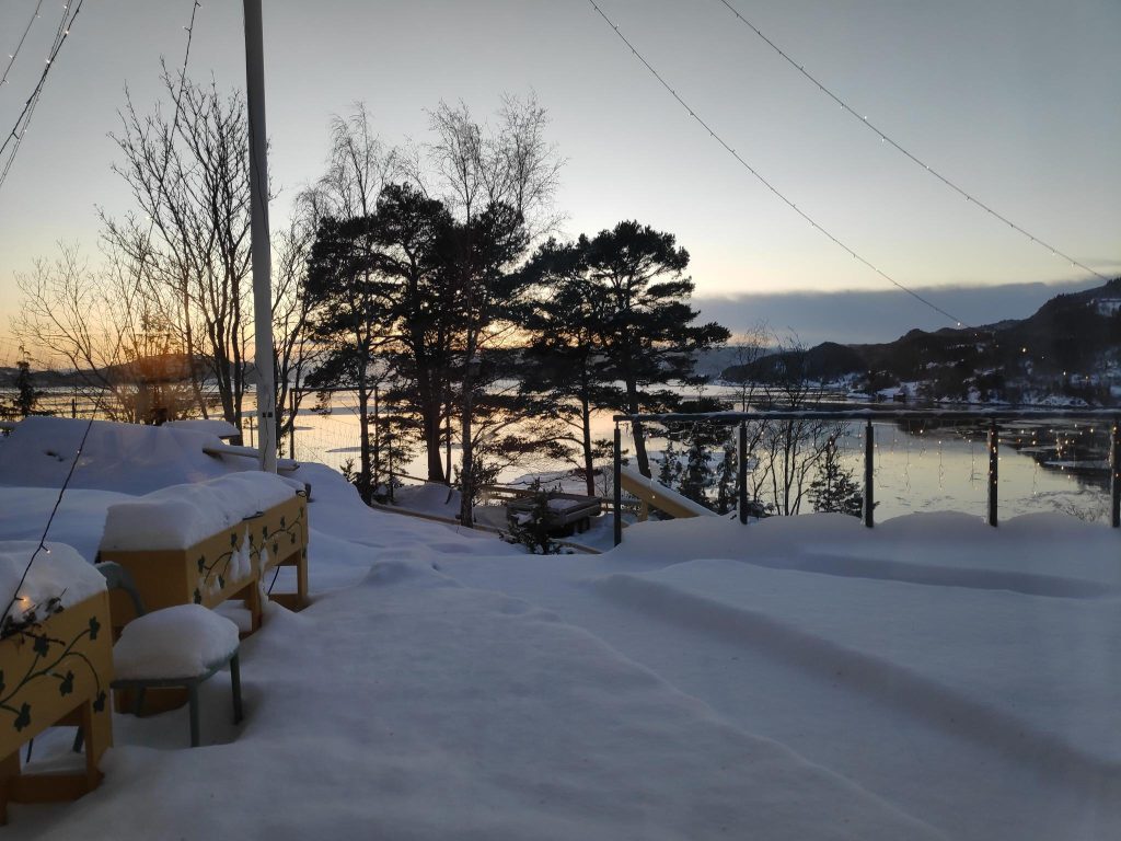
The accumulated snow on our terrace. This picture was taken on 5 January 2022 at 3 pm, just after sunset.
When I got up on Wednesday, the 12th of January, it had already started to rain and it rained almost constantly all of Wednesday. The temperature eventually rose to about 8 degrees Celsius. With the warm temperatures, as well as the rain it didn’t take long for the snow to disappear. As you can see in the picture above, there was about 20 cm of accumulated snow when the rain started.
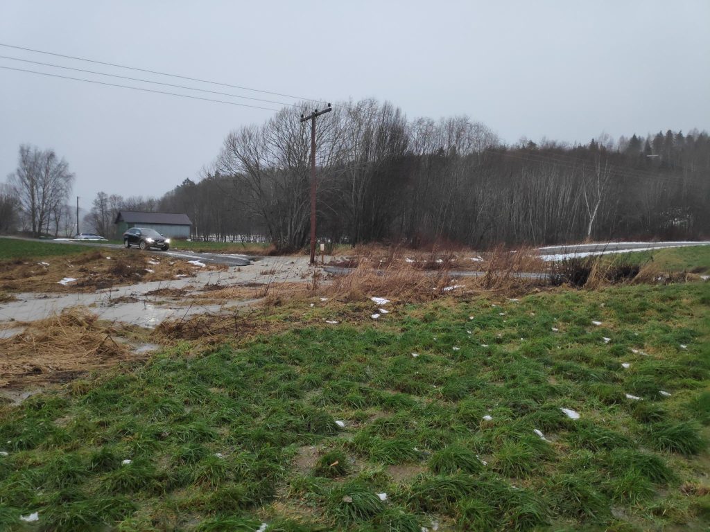
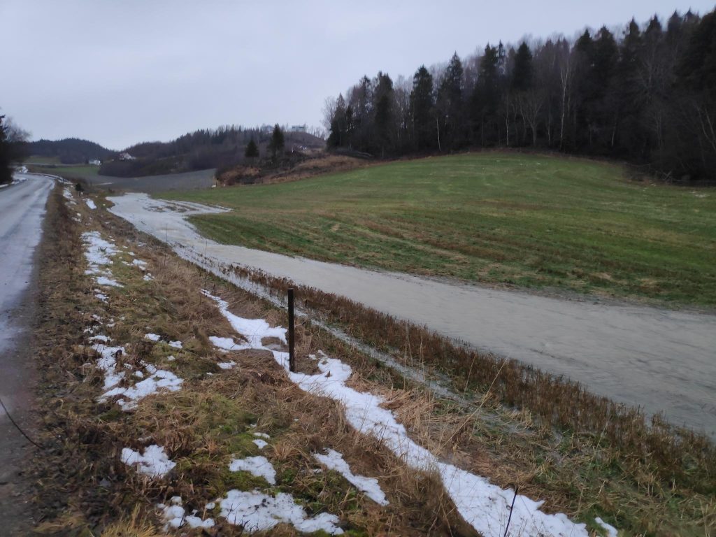
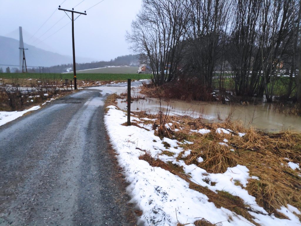
We live in an area with a lot of cabins and few residents. I decided on my walk to see what was the status of the area. As I went on my usual walk towards the woods, along a road that goes to some of the cabins, I noticed two cars driving partway along this road and then backing up. Oh, oh. Something must be wrong. As I continue along the road I notice that the water has been much higher and crossed the road, instead of flowing under it.
This car stopped, then backed up and disappeared. You will notice that there is a slight dip in the road at this point. You can see the water pouring across the road. There is an intersection here and there is one road that comes towards me and one that goes off up the hill. In the picture, both roads will be heading off to the right in the picture.
Let’s have a look at what has happened. We live in an agricultural area with farm fields. When the snow melts, or it rains a lot, the water will run to the lowest lying area and continue on downhill until it gets to the fjord. At some point in the past, the farmers owning these fields have put in drainage pipes and the stream has been put underground. This allows the farmer to have more cultivated land. Unfortunately, when the ground is frozen, melting snow water and rain can not go down to the pipes, but instead flow across the field.
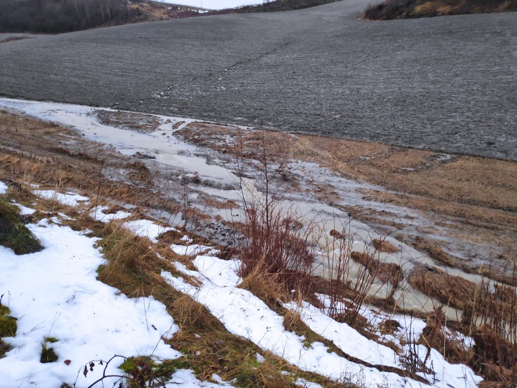
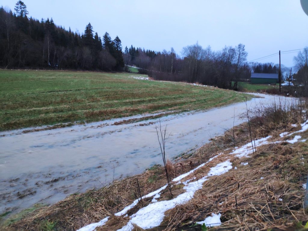
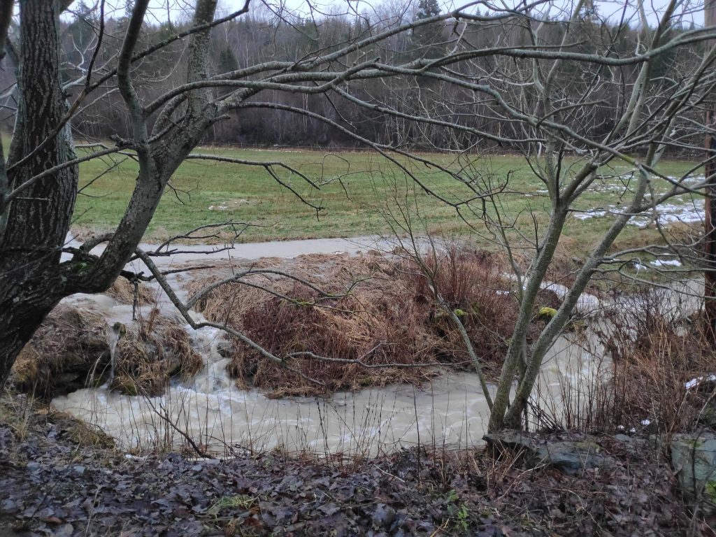
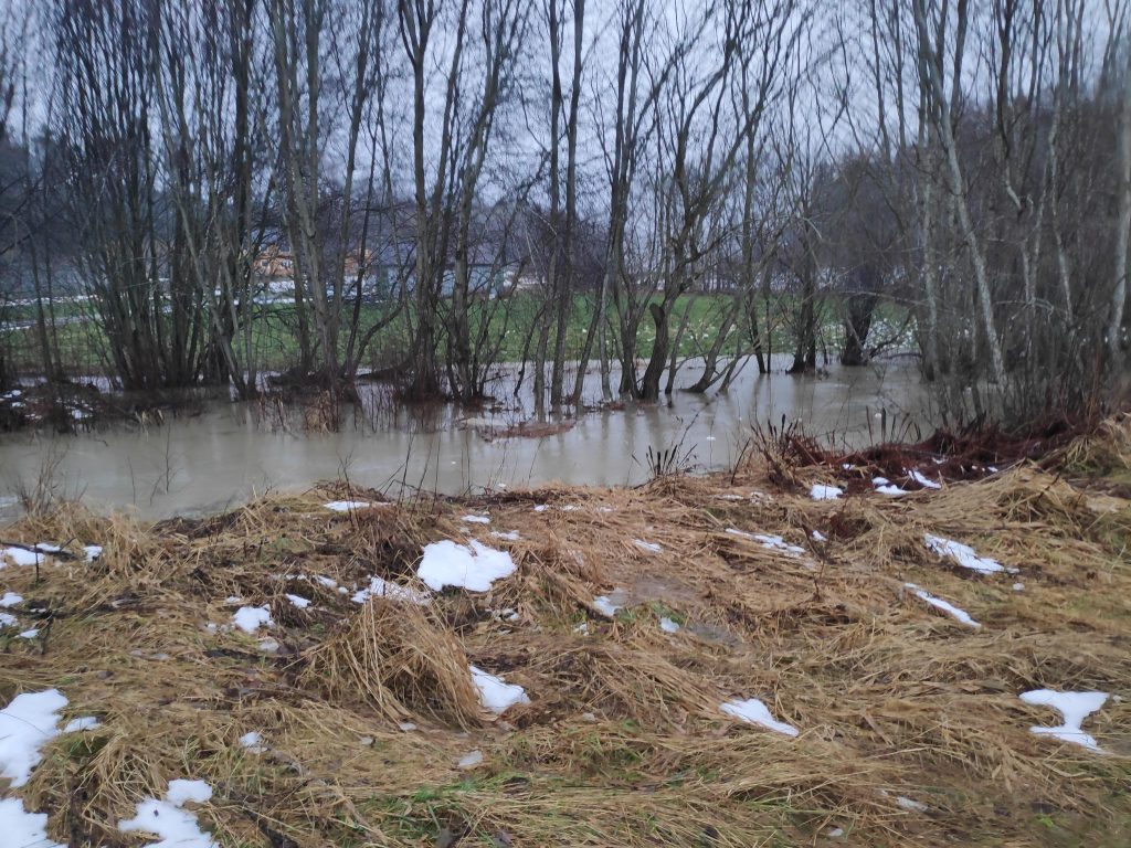
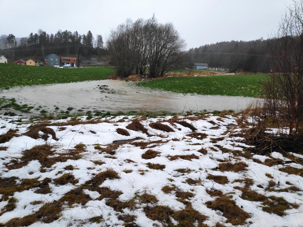
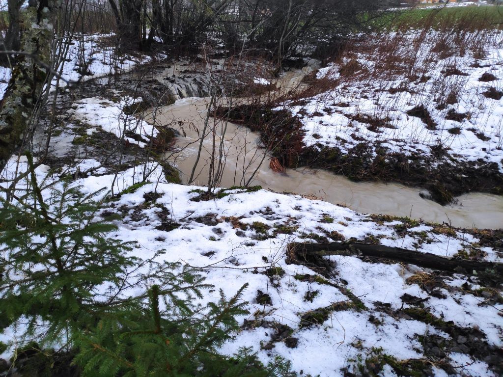
Here the water is starting to collect, at the bottom of a ploughed field. Note that where the stream is flowing, the ground has not been ploughed. This will be deliberate. Probably once a year, most likely in January, this flooding will occur. At this point, the stream is supposed to be underground, but as has happened before, when the ground is frozen, snow melt and rainwater run across the surface. There was quite a flow of water, and from various signs in other places, the water level was already retreating a bit. There isn’t much snow left, so there is just the rain water now.Looking back the way I have come. There is not normally a stream here, even when it is raining.Here is where the water running across the field joins the stream as it comes out of a pipe (the pipe is difficult to see but at the left in the picture). The water was flowing quite quickly. The stream heads off to the right, makes a few bends and has quite a few trees along it.Here, the small stream has more water than it can hold and has flooded its banks. No major problem here as there is plenty of room for the water to spread out.But the stream is supposed to go under the road here, into a pipe that takes it under the field as well. The pipe did not have the capacity to carry all of the water, so it started flowing across the road. The water flows from right to left in the picture. On my way back, I saw a tractor had crossed the stream, on the road, so it wasn’t that deep, but far too deep for an ordinary car. I went across the field on the left and was able to avoid the stream.Here the stream has spread out and following its old pathway. In the rainy season, this little section is often very soggy. I’ve never seen such a large pool of flowing water here before. When the children were small, there was sometimes a patch of ice here that they could skate on.Normally this channel is dry as the water would go through a pipe. But the old stream bed is still there and the stream can use it when necessary.Here is it quite obvious that water flows were much higher before I came. You can just see the stream on the right. There has been some damage to the road here, but not very much.The pipe on the left is carrying the water that has come under the field. The water was flowing very quickly and there was also water coming through a pipe, at about the center of the picture, from the stream in the picture above.
I continued on my walk, with the intent of going through the woods. The path was very soggy, but I had gumboots on, so my feet stayed dry. It was raining lightly, but I had rain trousers and jacket on, with a hood pulled up, so it was pleasant to be out in the fresh air. My walk usually takes me up the hill, then around some cabins, then downhill almost to the fjord before climbing uphill again. However, today I did not make the round trip, but ended up going back the way I came. There is a second stream that needs to be crossed twice and I decided not to cross it today.
My turning around point. In the summer, this small stream can be very dry, but today it was full. Usually, it is easy to cross, even when there is water in it, but today the water was flowing so quickly that I decided not to take a chance. If I lost my footing, I would get very wet. In addition, the path that goes down the hill on the other side was also a stream, so the walking there would not be pleasant at all.
I enjoyed my walk, in fact, these pictures were taken on two different walks, one at about 11 am and one at about 2.30 pm. Plus degrees, fresh air (even though it was wet) and something to take pictures of, made both of my walks very pleasant. In addition, I saw that there was no major damage even though car access to the cabin areas was a bit restricted.
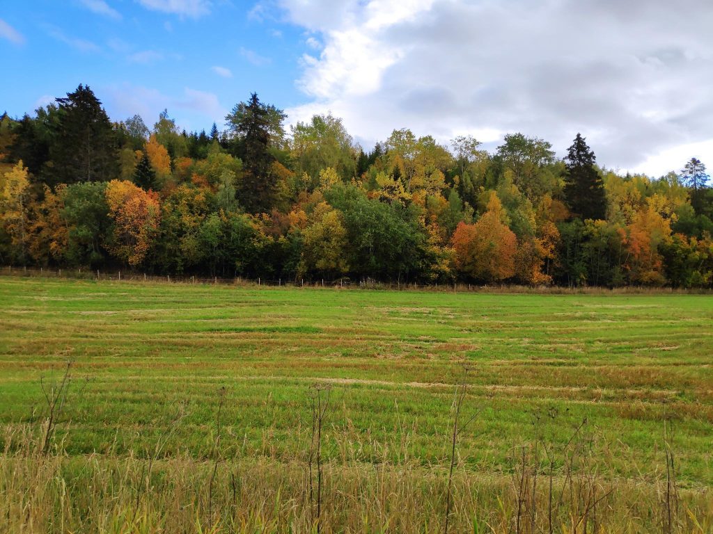
A while ago my daughter asked me if the trees here were starting to change colour yet and though the answer at the time (about the middle of September) was “no”, this blog is an answer to her question. The pictures were taken on the 1st of October, 2021, either on our own lot or on my walk up to a local dairy to buy milk.
I love the different seasons we have where we live. There are four distinct seasons and each has its own characteristics. Fall, or autumn, is when the nights get cooler, some of the trees loose their leaves and most flowers have gone to seed. Where we live there are often storms with a lot of wind and rain. There is also less and less daylight each day until we get to the winter solstice. Geese are flying south and other migratory birds disappear for a few months.
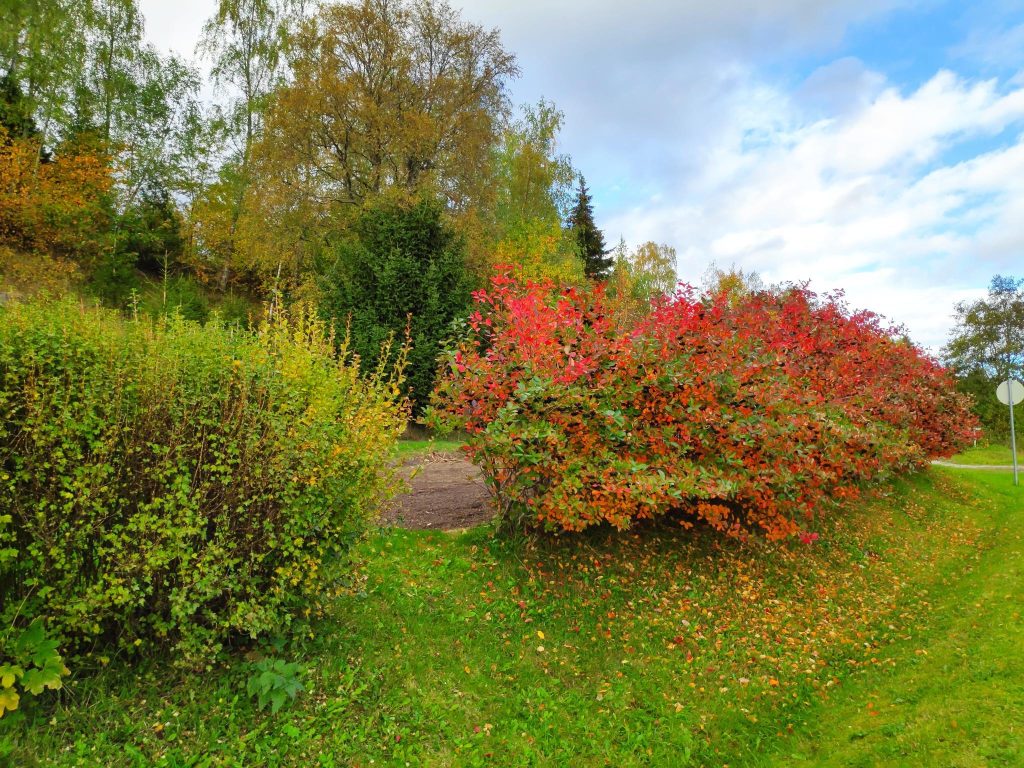
Some bushes have a lot of colour to them. The leaves on these ones turn red and there are black berries. I think this bush is aronia, or black chokeberry.
Meteoriologists in Norway have their own definition of fall: “Når døgnmiddeltemperaturen er mellom 0 og 10 grader og temperaturtendensen er fallende gjennom perioden, da er det høst, sier klimaforsker Stein Kristiansen ved Meteorologisk institutt.” (source) – “When the average daily temperature is between 0 and 10 degrees Celsius, and the temperatures are generally falling, then it is fall/autumn, says climate researcher Stein Kristiansen from The Norwegian Meteorological Institute (website).
This year we have not been below 4 degrees Celsius at night and daytime temperatures have been between 10 and 15 degrees Celsius. I think the amount of daylight affects trees too. Many smaller plants die off once their seeds have been made. If we have a very dry summer, I notice that the birch trees will lose leaves even in July or August to save water.
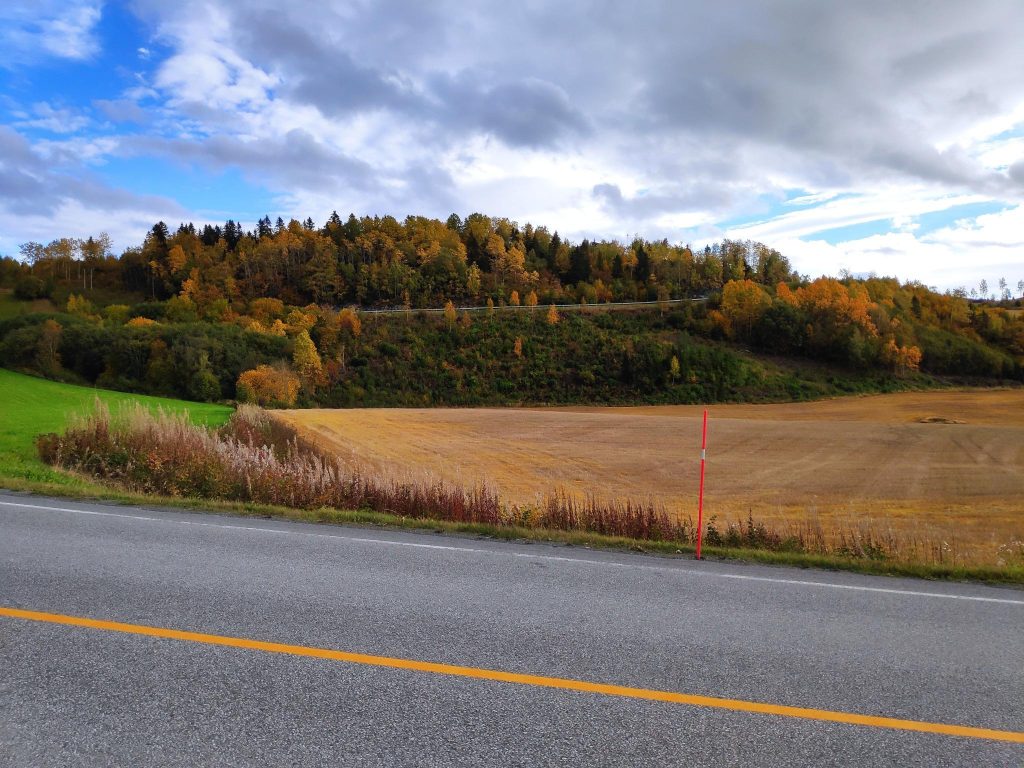
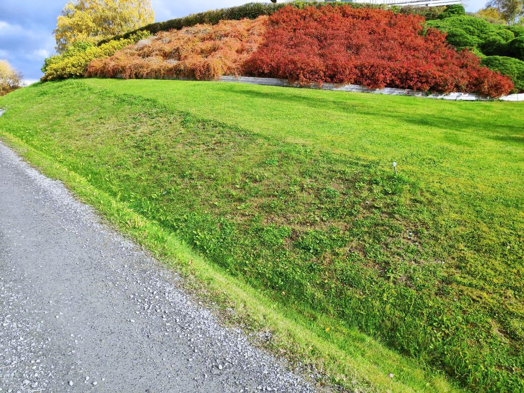
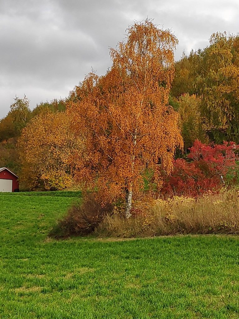
Some of the fields are still green, but where the grains have been harvested the field is now a yellowish brown. Our woods are a combination of deciduous trees (which lose their leaves) and coniferous trees (which retain needles all winter, though they also shed some of their needles at this time of year). Also notice the red stick at the side of the road. It serves a dual purpose: first to tell drivers at night where the edge of the road is and second, to tell those who plough the snow in the winter where the edge of the road is.These bushes lay close to the ground, but the house owner has chosen four types of bushes that each give a different colour to the slope at this time of year.Trees that stand alone, like this birch tree, can often have more vivid colours.Grasses that are not cut, turn yellow as the seeds mature. The green fields are grass fields that are cut to provide fodder for cows and they will stay green all winter, or until ploughed.
However, I was also surprised to see some flowers still blooming.
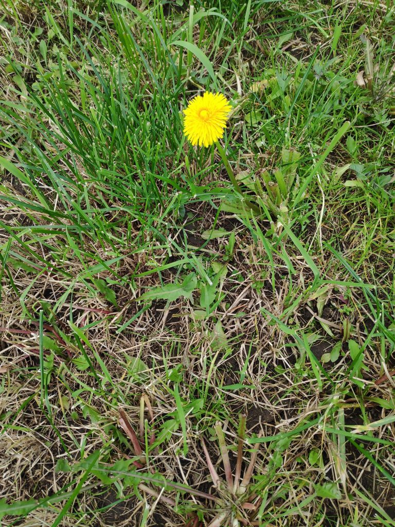
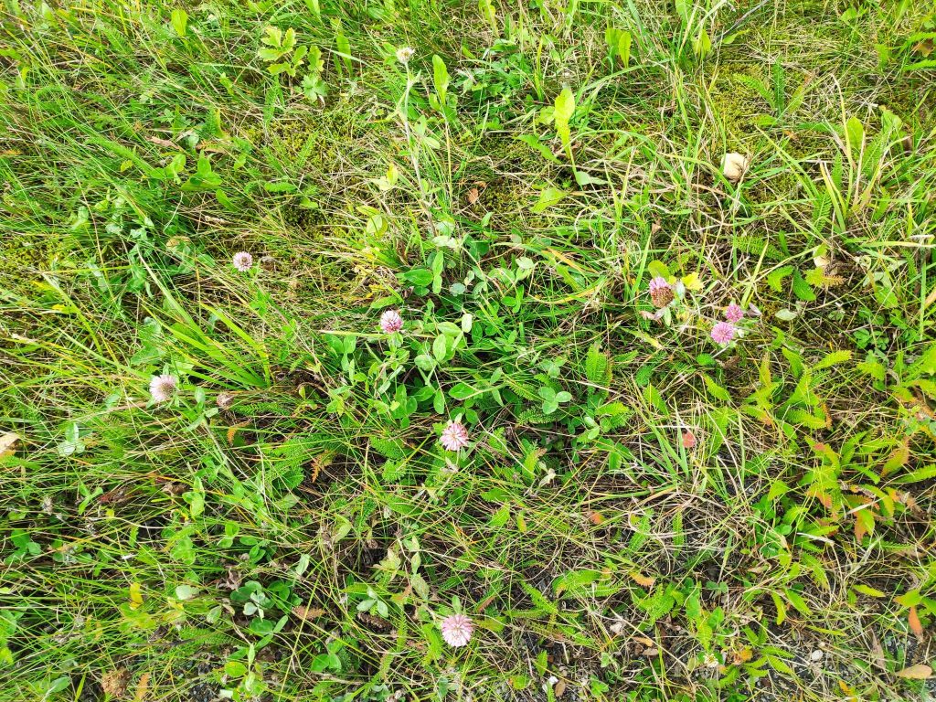
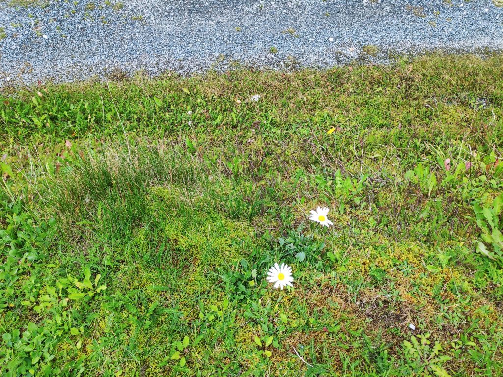
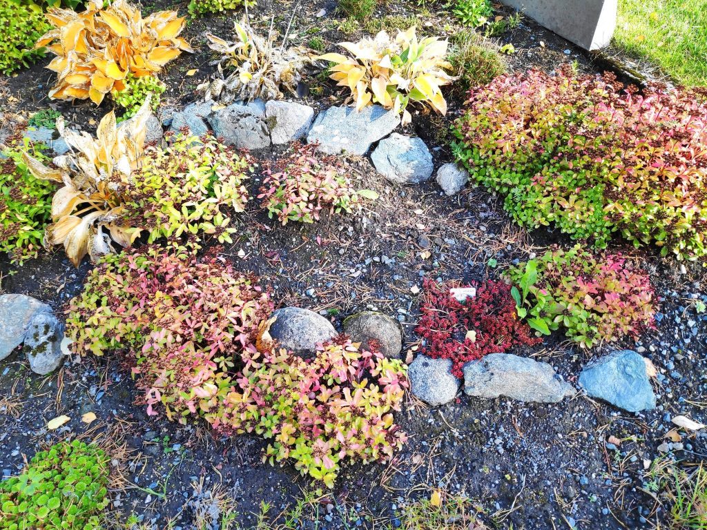
A dandelion was having a second blooming.Red clover was still blooming along the side of the road.Achillea millefolium. This is very common here, especially along roads. It is called common yarrow in English and ryllik in Norwegian.Two late blooming daisies.In my own garden, plants are also turning various colours as their lifetimes are over. The ones you see here are all perennials and most of them will come up from the roots next spring.Last of all, we think of the fall season as the time of year that the leaves fall off the trees. In this area of our yard, the trees have already gotten a good start at getting rid of their leaves and giving the gardener something to do.
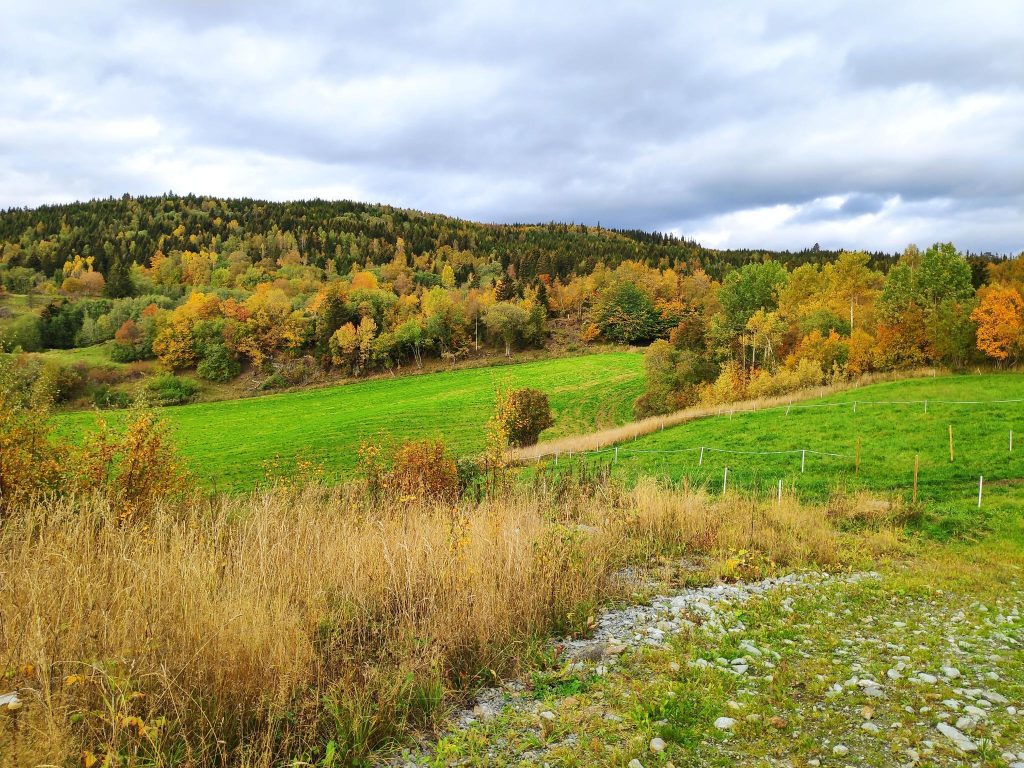
We are only at the beginning of fall now. The next two months will show even more changes in nature around us, as the days grow shorter and the temperature drops. More trees will change colour. More leaves will fall, as not all trees lose their leaves at the same time. While the days are still nice, I will continue to enjoy walks several times a week.
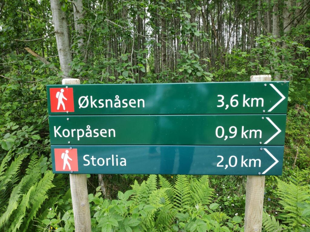
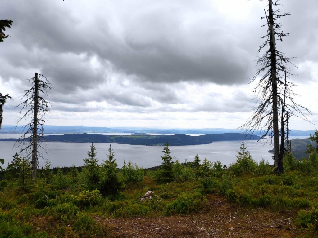
Sunday’s walk, with my husband and son, was to a hilltop not that far from where we live. I like the walk to Storlia (The Big Hill) and it is a walk I like to do about once a year as the views are spectacular from the top. However, it is quite a climb and I suggested we do the walk today while the temperature wasn’t too hot and there was a bit of a breeze.
We parked the car at about 120 meters above sea level and the hilltop we were heading to is about 380 meters above sea level, so this was a walk with a climb. Some parts of the path are quite steep, but I’ve done this walk several times and was prepared for it. The view from the top is worth the climb and the weather looked like it would be a good day to do it.
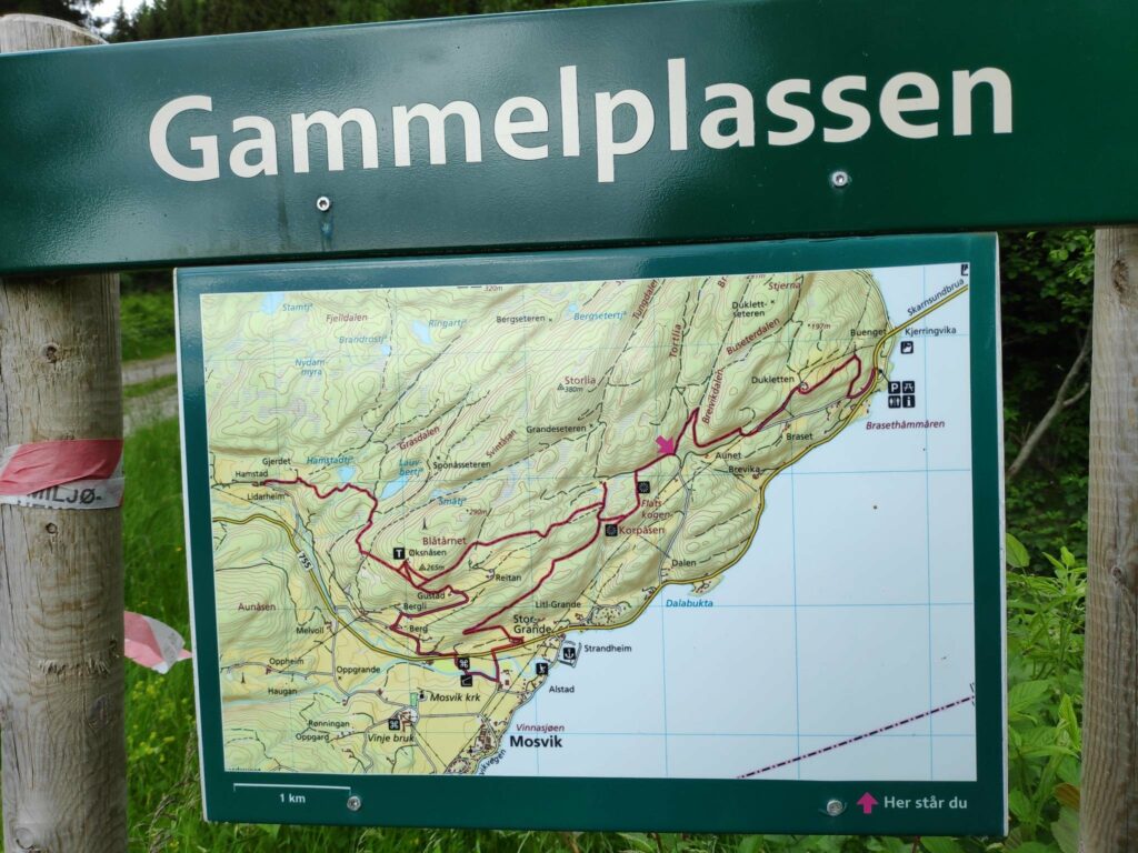
It can always be wise to have a picture of the map on your telephone so you know where the major trails will go. We are at the point with a red arrow
We parked at Gammelplassen where there is a map of the trails in the area and sufficient place for several cars to park. We have passed a closed gate so one can expect sheep on the hill.
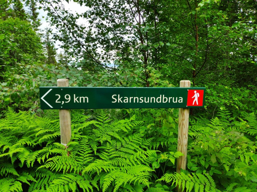
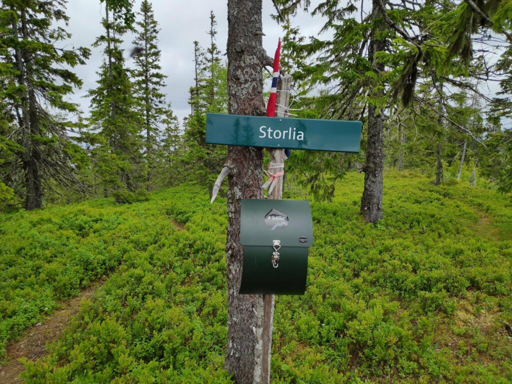
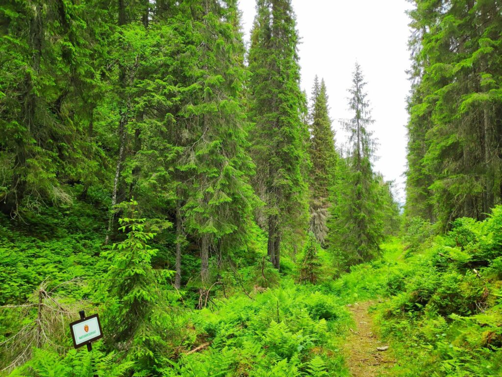
We are not that far from home, three kilometers to the bridge and one and a half kilometers over the bridge and through the woods to home. Note the ferns are growing well around the signposts.We have a two kilometer walk to Storlia on a red trail which means moderate difficulty with steep sections.
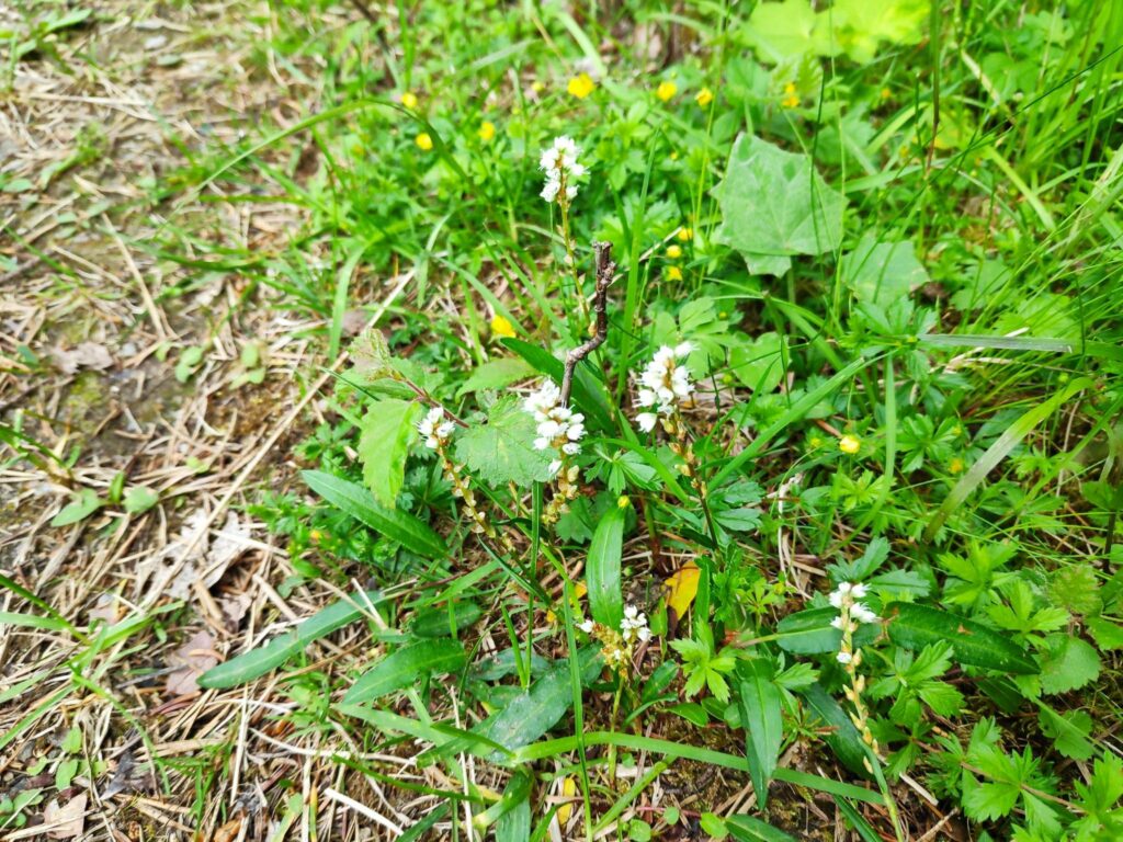
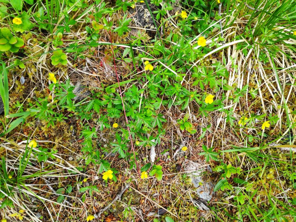
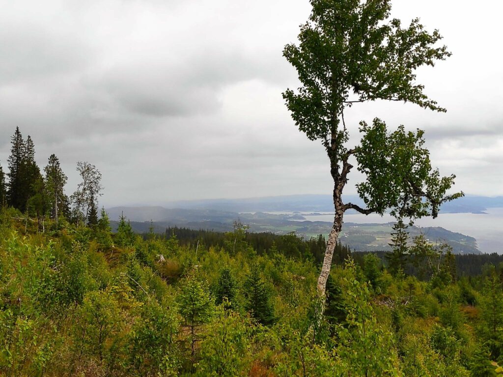
While walking uphill, I often stop to either look at the view or take pictures. Today I was mainly looking at the wild flowers that were blooming, many of which can be found in the wild areas of my own property. Taking pictures is a good way to get a pause while walking up steep trails. On looking at the pictures afterwards, I realize that it may be difficult to actually see the plant, however you will see the combination of plants that grow in the wild here.
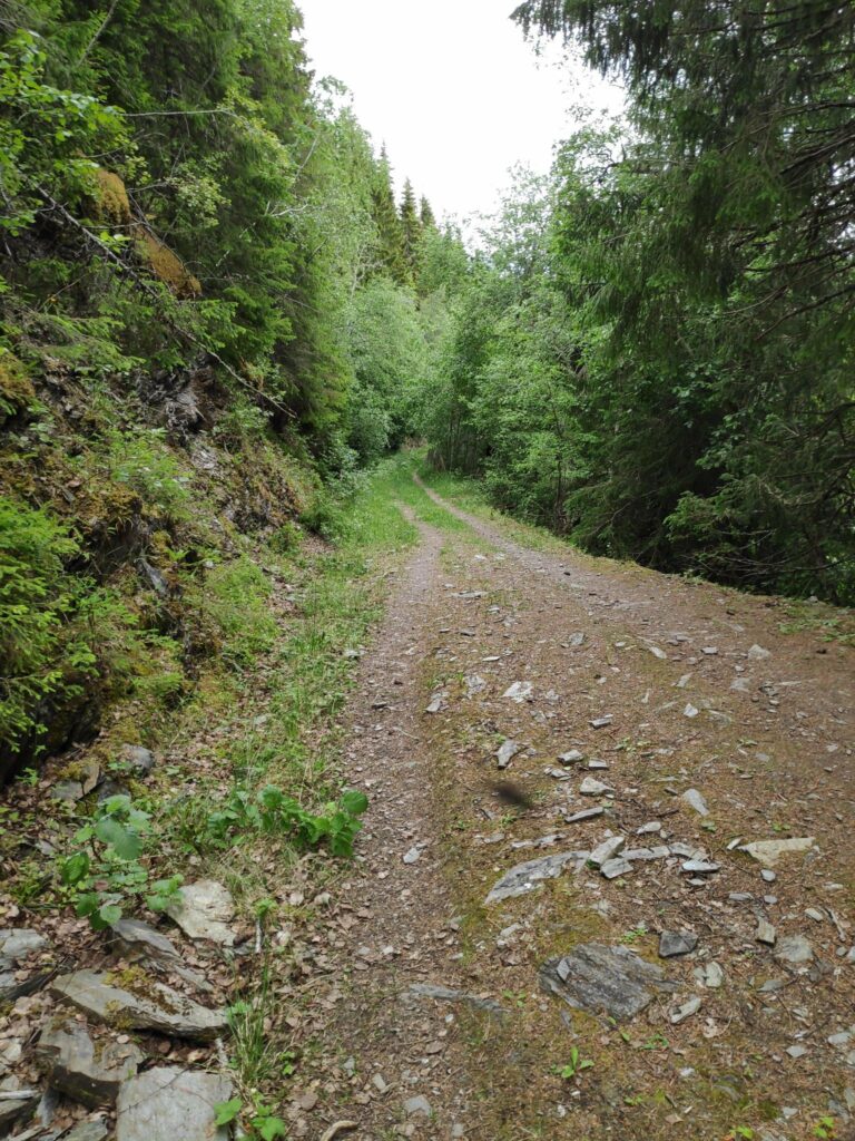
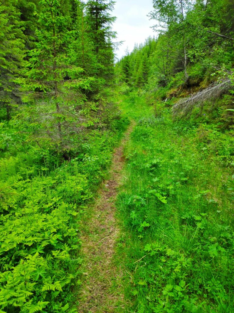
Today’s walk starts on a gravel road then climbs the hill, often on a trail that must have originally been a tractor road, probably made for harvesting the trees. Today the trees in this area are quite tall and it is many decades since they have been harvested.
Looking back down the trail after climbing for a bit. The others are ahead of me. I always like an excuse to stop in the middle of a steep section.
I’m no expert with plants but here are some of the common ones I saw on today’s walk. I have tried to find the Latin and English names as well as the Norwegian names.
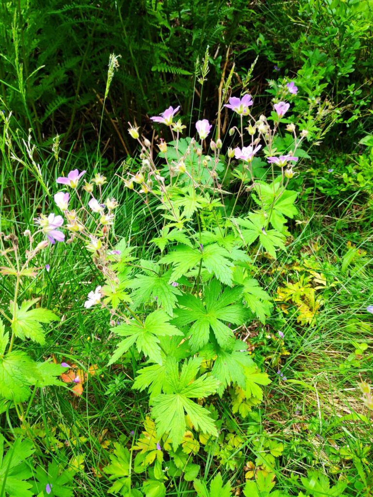
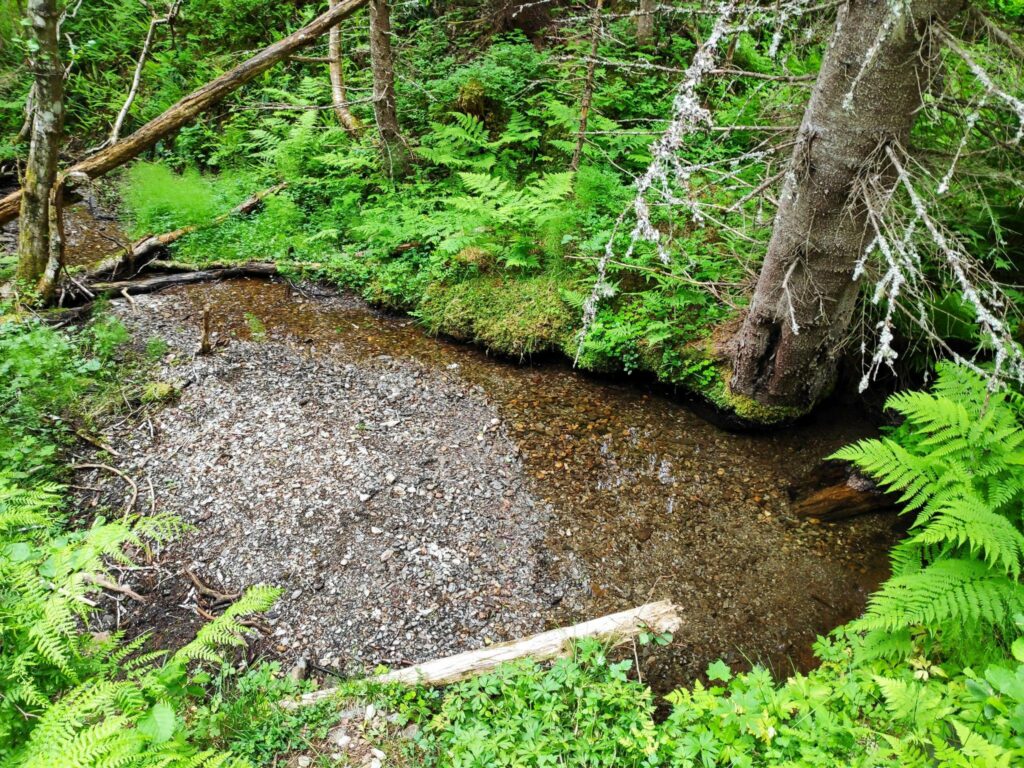
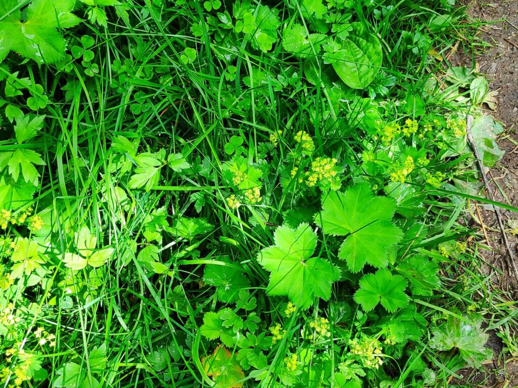
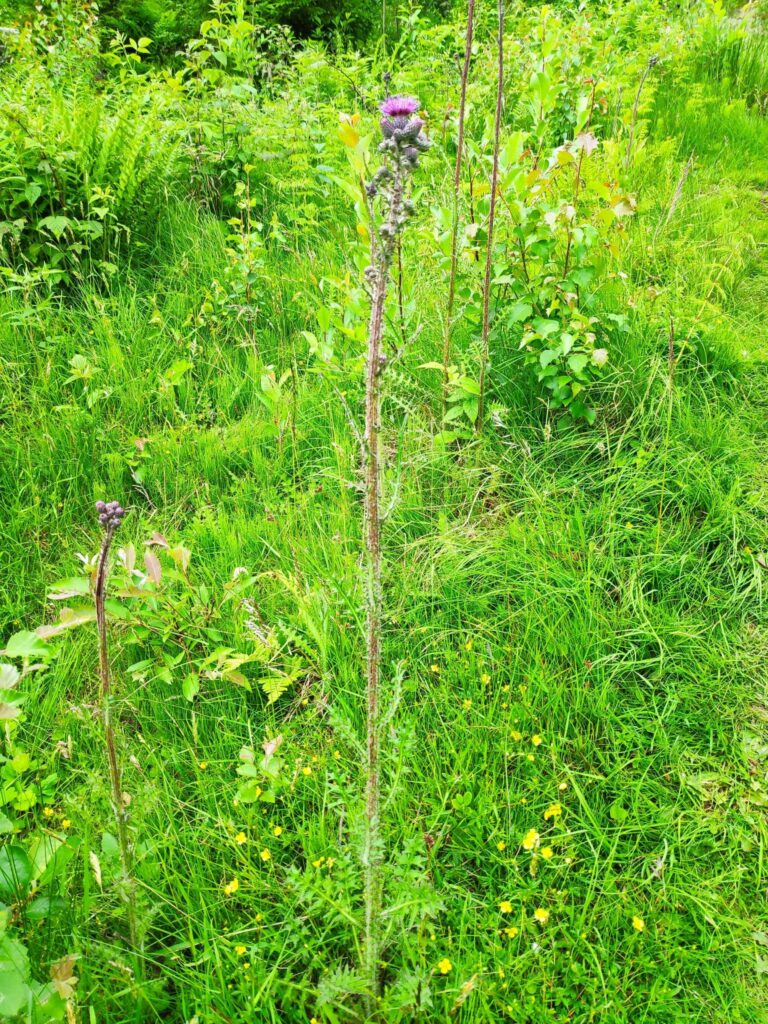
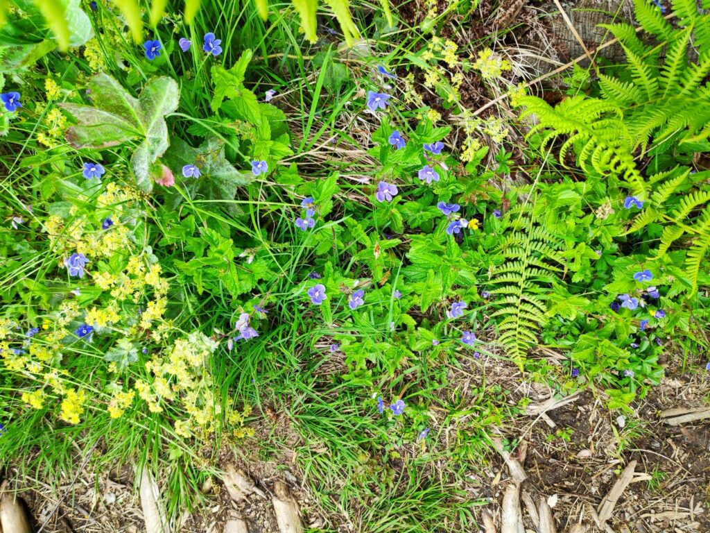
Vaccinium vitus-idaea is a member of the heather family. Called “tyttebær” in Norwegian and “cowberry in English, it produces a red berry that makes a nice jam to eat with meat. For those who live in North America, it would be used instead of cranberries.Ranunculus repens is a member of the buttercup family. It is called “krypsoleie” in Norwegian and creeping buttercup in English.Geraniaceae, sylvaticum is a member of the geranium family. It is called “Skogsstorknebb” in Norwegian and crane’s bill in English. It is a very common wild plant in our area, growing along roadways and open meadows.There was a little water in the stream, but we haven’t had much rain recently so there was little flow to the water. May and June have been dry months this year.Alchemilla family. This is a very common plant and I found it difficult to figure out exactly which plant this is. In Norwegian it is called “marikåpe” and I think it is called “Lady’s mantle” in English. It grows as a weed in our lawn and is difficult to remove. Along the edge of a road, it is a pretty plant with very large leaves. The thistles were just starting to bloom.I’m not sure what these blue flowers are, but they are a pretty blue when there are lots of them.
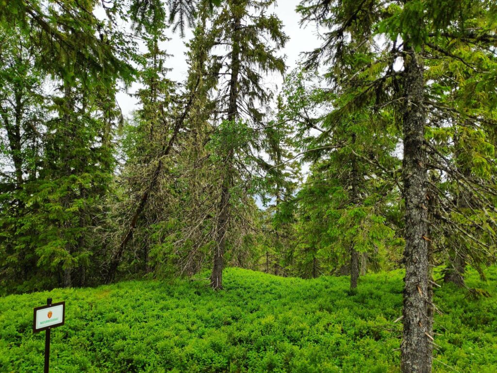
The top of the hill, and the goal of the walk is at the edge of a nature reserve called Skavdalen. This nature reserve was created in 2017 to protect old forest and covers 1012 decares (about 250 acres). (My source is only in Norwegian.)
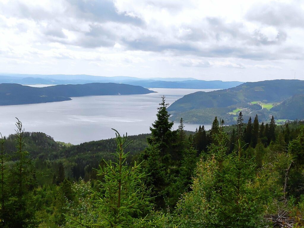
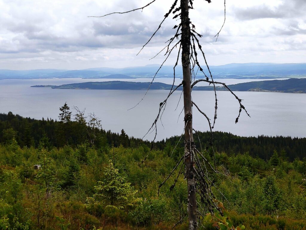
The top of Skavdalen nature reserve which covers 1012 decares of old forest. Here there were primarily spruce trees. On the forest floor there are cowberries and blueberries.We reached the goal of our walk. It was time to check in and get 40 points. There is a picnic bench to sit on and enjoy the view while one rests before heading downhill again.The view from the top is the reason for the walk. Even on a cloudy day, the view was spectacular. This picture is taken looking west with Mosvik center on the right and the island of Ytterøy on the left. We are at an elevation of about 380 meters above sea level.The western half of Ytterøy with Levanger in the background.The eastern half of Ytterøy with Verdal and Levanger in the background.Looking towards Straumen where it looks like it is raining. The agricultural area is Utøy.
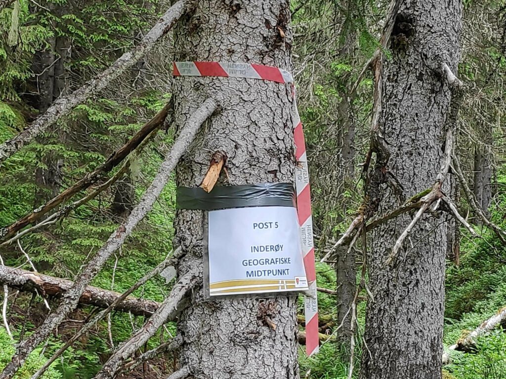
Today we gave ourselves a longer walk by also going to the post labelled “Inderøy’s Geographic Mid-point”, which is located in Tungdalen. It was about 700 meters from the trail we had taken up to Storlia, so we decided to find it as well. Though the trail went downhill at first, much of it was on a relatively level elevation. We entered Skavdalen nature reserve and with only one missed marking, found the post on the hillside.
The path to the geographic center of the municipality of Inderøy is not very well-travelled. This is a new post this year and it is still early in the season.Here we entered Skavdalen nature reserve. We are walking along a narrow valley with a small stream at the bottom, though there was no great amount of water in the stream at this time of year.We found it eventually, on an old tree, up a slightly muddy slope.
Then we turned around and headed back to the car where we were all glad to sit down. We had been walking for about 2 hours.
I like to take the walk up to Storlia once a year, but I did not feel the need to go to Inderøy’s geographical mid-point again, though it was interesting to do it once.
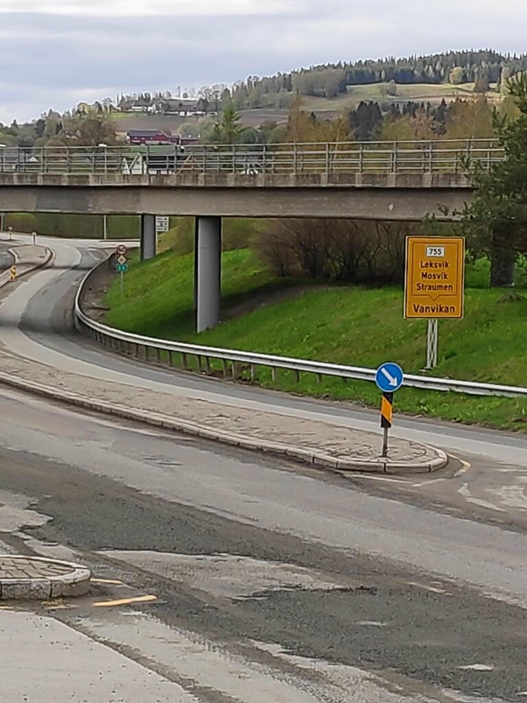
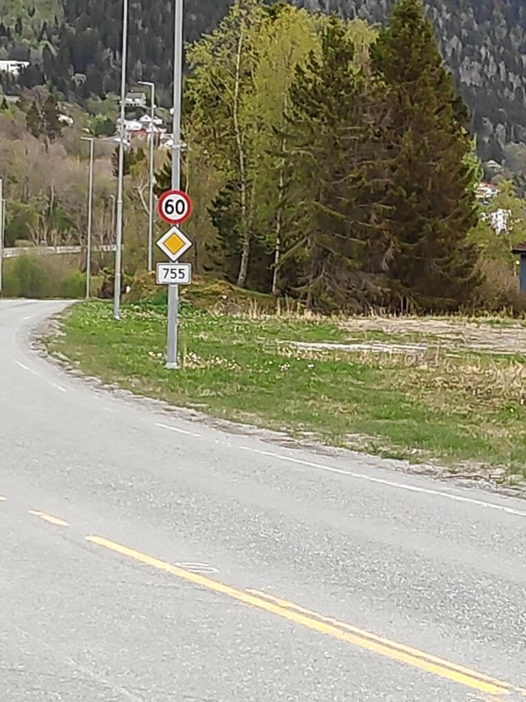
Route 755 begins at the E6 intersection in Røra, in the municipality of Inderøy. The E6 is a south-north major highway route through Norway, having started at the southern tip of Sweden, running up the west coast of Sweden and continuing north through Norway and ending at Kirkenes, close to the Russian border.
Route 755 runs east to west from the intersection at Røra to the intersection at Vanvikan with Route 715, which is another south-north route.
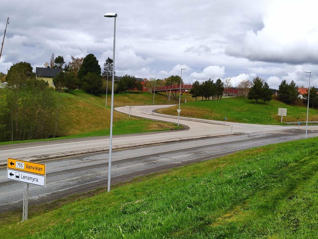
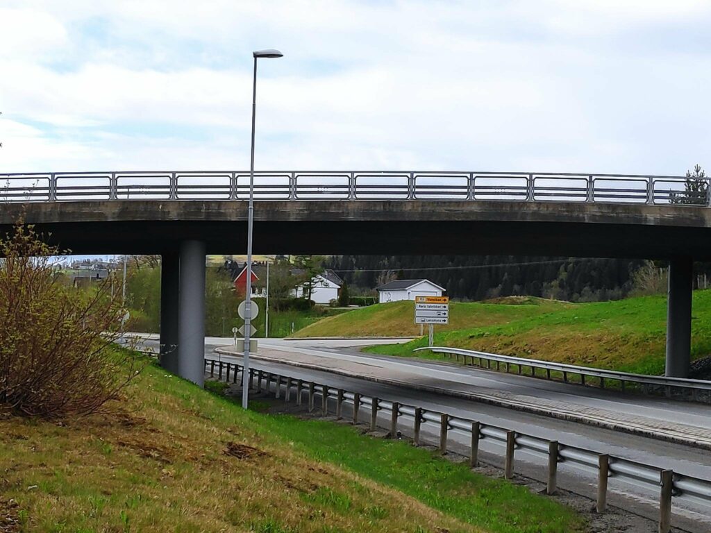
When driving from the south on the E6, and you see this building, make the next left-hand turn. This is our local juice and jam factory.When driving from the south this is the intersection of the E6 and route 755. There is a left-hand turn lane. The 755 goes to Vanvikan about 91 km away.
Coming from the south one makes a left-hand turn. In the years while I was working at Verdal Senior Secondary School, I went through this intersection twice a day. However, this is not how the intersection has always been. When I first started working in Verdal in 1988, there was a level crossing of the train tracks here, which created long line-ups in rush hour traffic as trains go by here at least twice an hour on working days. The current intersection opened in 2005 and everyone was glad when there was a bridge for the train and the road went under the train tracks.
The sign tells us that route 755 will take you to Straumen, Mosvik, Leksvik and Vanvikan. The closest bridge is the train bridge and the farther bridge is for cars and pedestrians. The intersection is a right-hand turn and just past both bridges. Note the farms in the background.Approaching the intersection of the E6 and route 755 from the north. One makes a right-hand turn. The cars now drive under the railway tracks. The bridge you see is for cars and pedestrians.Another view of the intersection, taken from the car bridge over the E6.
Røra to Straumen
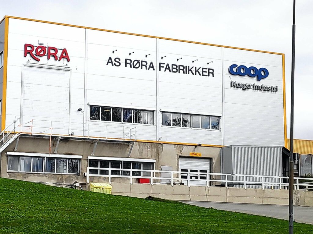
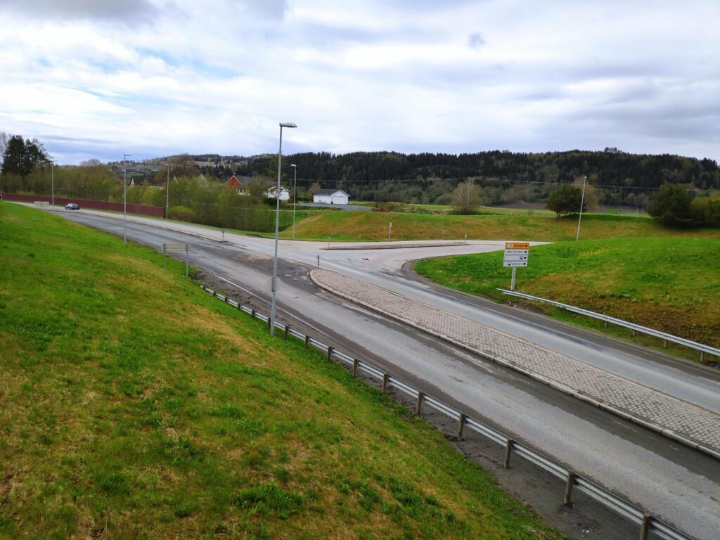
Røra is a housing area in Inderøy municipality and also features one elementary school quite close to this intersection, one railway station on the railway line from Trondheim to Bodø (called Nordlandsbanen). In addition there are several companies that are located here, including a jam and juice company and several construction companies.
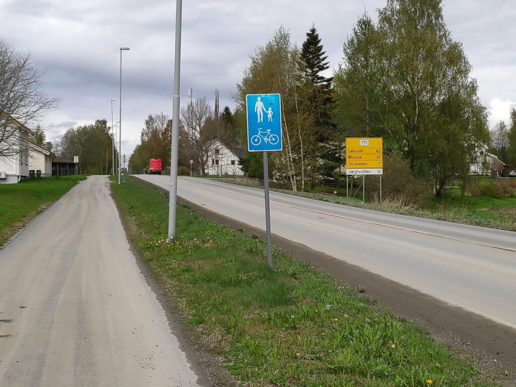
I am standing on a pedestrian/bicycle path beside Route 755, looking westwards.
A note about signs in Norway. The blue sign indicates that pedestrians and cyclists are to use the provided path. The yellow sign tells which route you are on (755) and the distances to major places along the route: Leksvik (62 km), Mosvik (25 km) and Straumen (7 km). The white sign indicates a business, in this case a hotel, Jægtvolden which is 10 km from here.
Route 755 is about 91 kilometers long, but it passes through various types of terrain, including farmland, shoreline on fjords, river valleys and forest-clad hills. The road goes downhill and uphill and rarely has straight sections. (See the Wikipedia article in English for other information.) For me, the importance of this route is that I used it for 30 years as part of my commute to work in Verdal. Now we mostly travel from home to Straumen. Every now and then we travel west of Mosvik. My husband worked in Leksvik for many years and he knew that section of the road a bit too well.
As one drives west from Røra, first the road passes the elementary school and the industrial area. Then it crosses farm fields before it goes downhill to Borgenfjorde, also called Bjørgin. Borgenfjord is tidal seawater and stretches north into Steinkjer municipality and is flanked by farm fields on all sides.
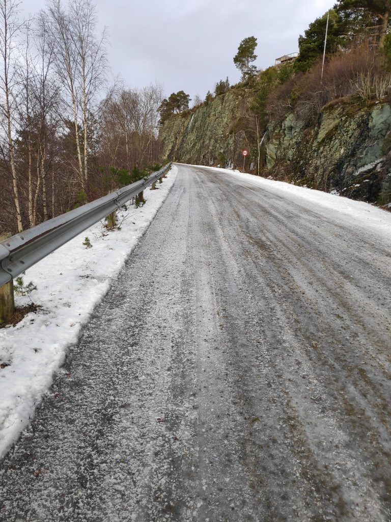
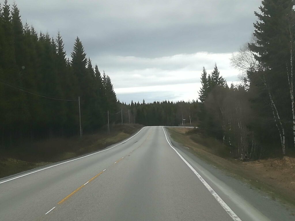
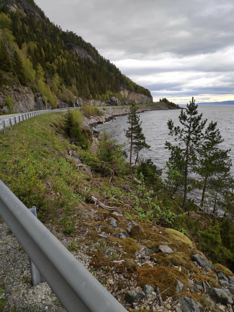
Borgenfjord on a day when the water was very still and gave beautiful reflections. Here the road runs along the edge of the fjord.When a road runs along the edge of a fjord, it is never straight. It winds this way and that and reduces the speed that one can drive at. Here the speed limit is 70 km an hour, but I usually drive it at 60 kmph or even less when it is covered in snow or ice.
After crossing Straumbrua and the swiftly flowing current under it, one comes to Straumen, the municipal center of Inderøy and 7 km from the start of route 755. Here you find shops, a bank, three levels of schools , an art gallery and a lot of housing, both single family dwellings and apartments. There is also the intersection with a road leading to Steinkjer (route 761).
Straumen is seen in the distance, across Borgenfjord.Straumbrua – Straumen Bridge built in 1958.
Straumen to Mosvik
Continuing west along route 755 one sees both the new church and the old church and continues between more farms on both sides of the road.
Looking west from the old church in Straumen, This part of the road is one that we have driven hundreds of times in the 32 years we have lived in Inderøy.
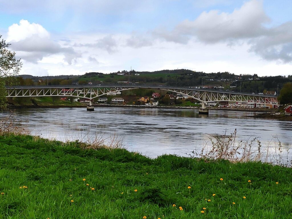
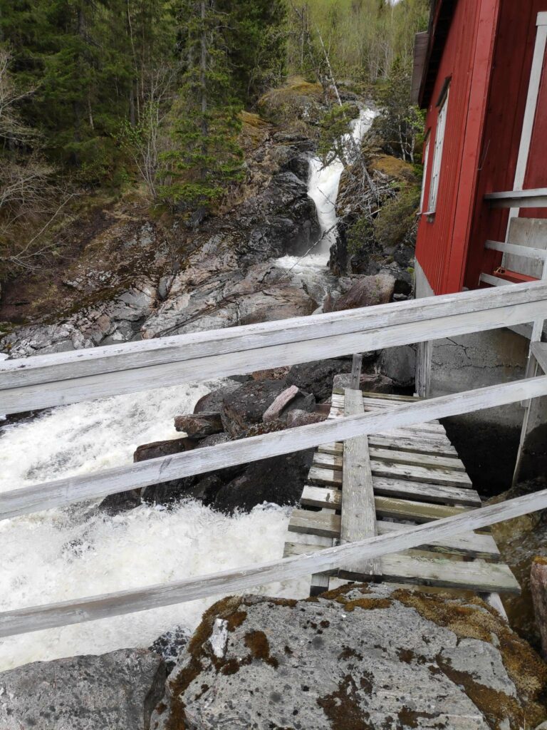
From Straumen, route 755 gives good views over Trondheim Fjord as the road follows the curves of the hillside and takes one through the area called Utøy to Skarnsund Bridge. Driving home from work along this road over the years, I watched the clouds discharging their loads, moving in the winds, or reflecting sunlight. It was never a boring route to drive, unless behind a slow moving tractor.
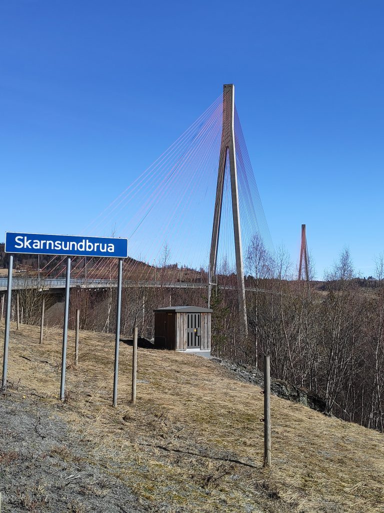
In its first years, Skarnsund Bridge was a toll bridge and we rarely drove over it, though we would walk over it for the exercise. Now that it is free, we drive over it regularly to go to Mosvik.
Skarnsund Bridge is a little over a kilometer long and bridges the gap between the peninsula of Inderøy and Mosvik. There will a separate blog article about the bridge and how it was built.
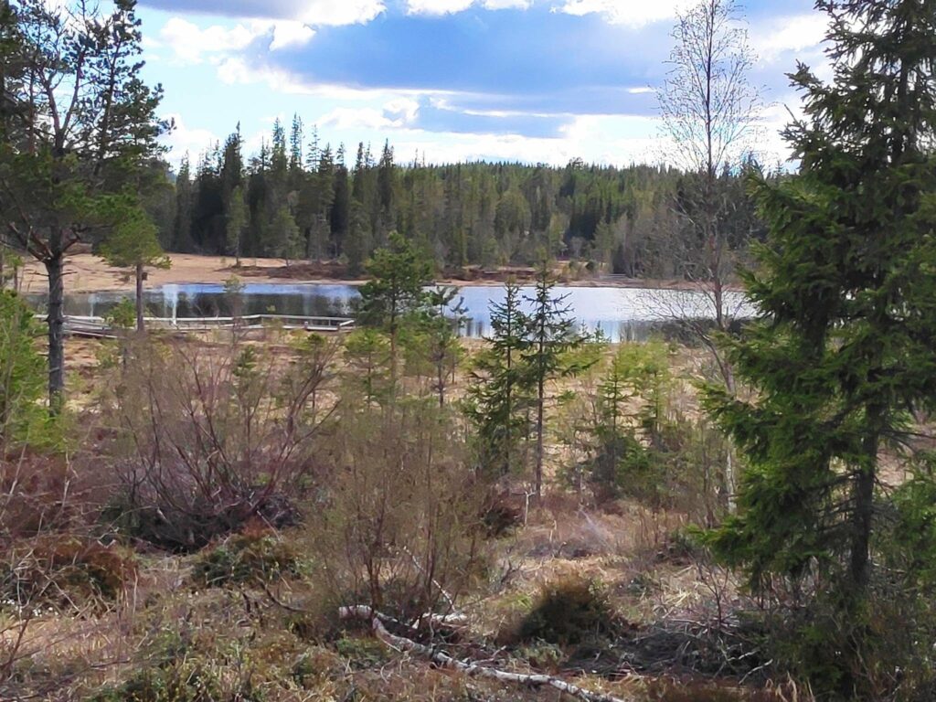
Once you have crossed the bridge the road mostly hugs the coastline along the fjord until you come to Mosvik.. You can see more about Mosvik in a previous blog.
Mosvik to Leksvik
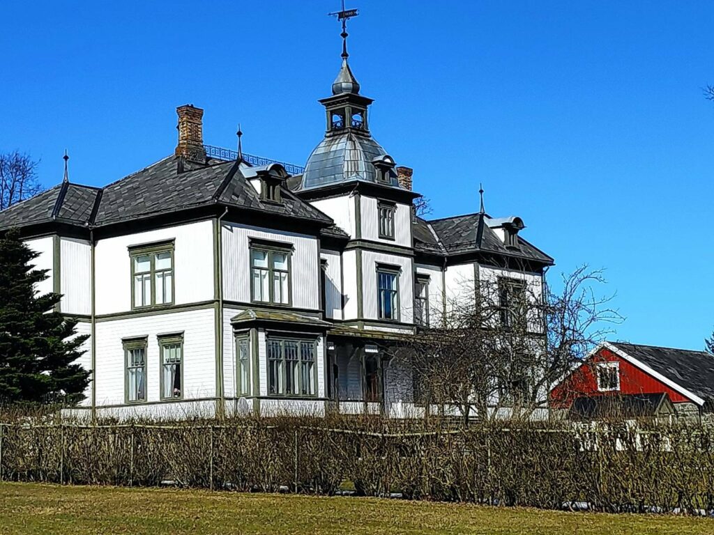
This impressive mansion lies on the hill overlooking Mosvik. The landowners own a large part of the forest in Mosvik which is used to provide income.
From Mosvik route 755 heads inland, and over the hills, around the lakes and through the forest. There are few farms and a lot of wild areas. The road can be a bit lonely, especially in the winter when it is covered in ice and snow. There isn’t the same amount of traffic on this section of the road as between our home and Straumen.
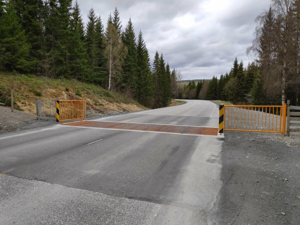
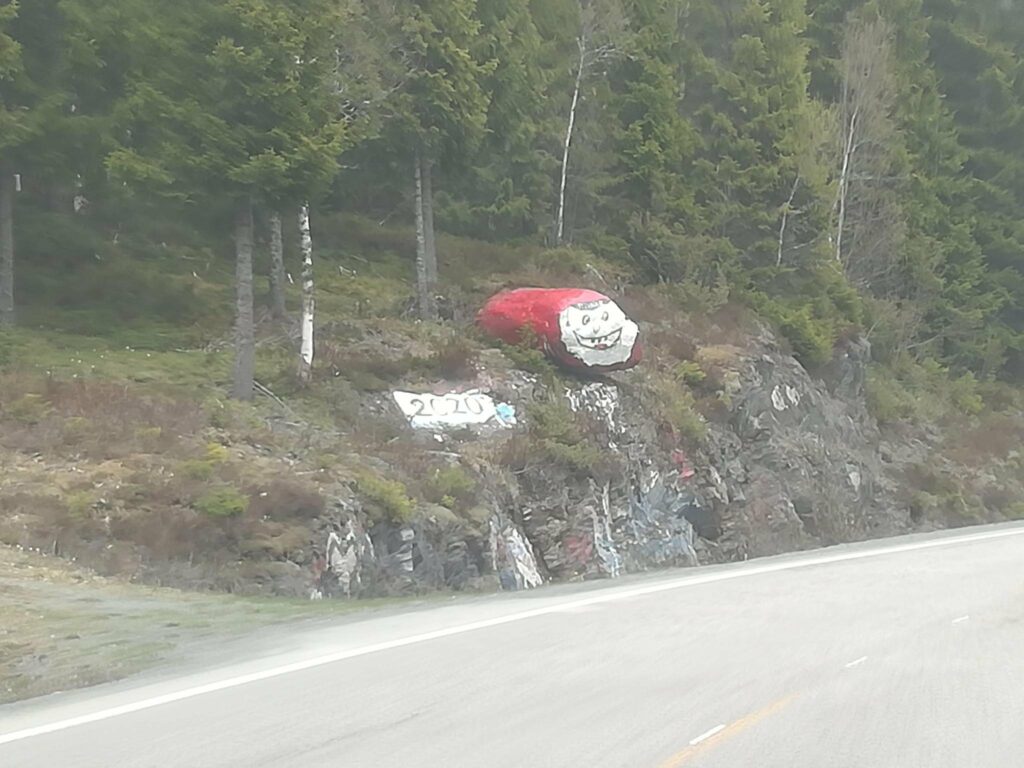
The barrier in the road is to keep sheep on the far side. In the summer months, one must be prepared to see sheep either wandering along the road, or even sleeping on the warm asphalt. We were lucky that the sheep weren’t out yet. This is a typical section of the road “over the forest”, as they say in Norwegian. Photo courtesy of Alasdair McLellan while I was driving.Liatjønna, one of many small lakes along this road. This lake, or tern, has been made accessible for wheelchair users and fishing is allowed, as long as you pay a fee.Every year this rock, that sticks out a bit in a bend of the road, is repainted by the secondary school graduates of Leksvik. This seems to be from last year’s graduates. Perhaps the pandemic has influenced this year’s graduates. Photo courtesy of Alasdair McLellan, taken while the car was in movement and through the windshield.One large lake along route 755 is Melting Lake, which is used to provide hydro power.
Eventually the road comes out of the forest and heads downhill through farms to the village of Leksvik which lies on Trondheim fjord. We are now in the neighboring municipality of Indre Fosen.
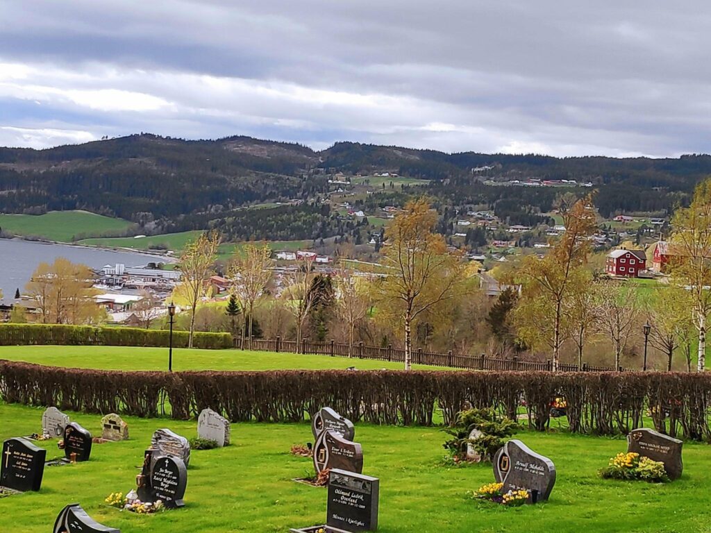
Coming down from the top of the hill into Leksvik – here the valley opens out and the land is farmed. Facing south, the slope captures a lot of sunshine.We stopped at the church as it is on the hill before going down into the village. Especially in rural areas, cemeteries are usually located beside the church. Down at the water’s edge, there is an industrial area. Up on the hill is agricultural land.
Leksvik to Vanvikan
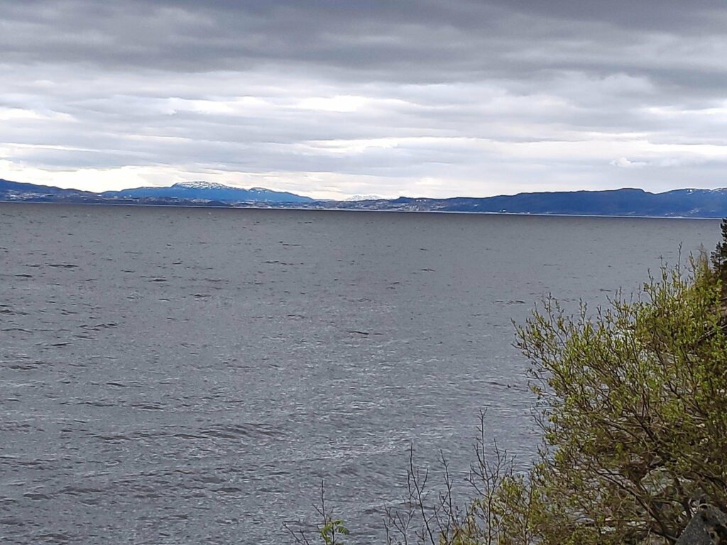
As we continue westwards from Leksvik, the road mostly runs along the coastline affording views of Trondheim on the south side of the fjord.
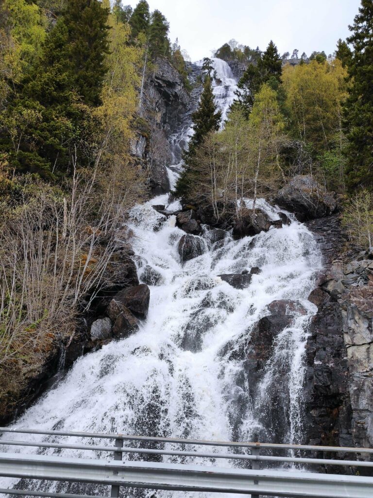
Trondheim Fjord is quite wide at this point. Trondheim is in the center of the picture on the far side of the fjord.This is looking back from where we came, in other words, looking eastwards. This is a very typical type of road in Norway.We saw several waterfalls and this one we stopped and walked back to get pictures. Lakes and streams at the top of the hill will still have snow run-off, though there isn’t much snow left now on the tops around here. This stream is called Bjørnåa and the water falls 200 meters to the fjord.
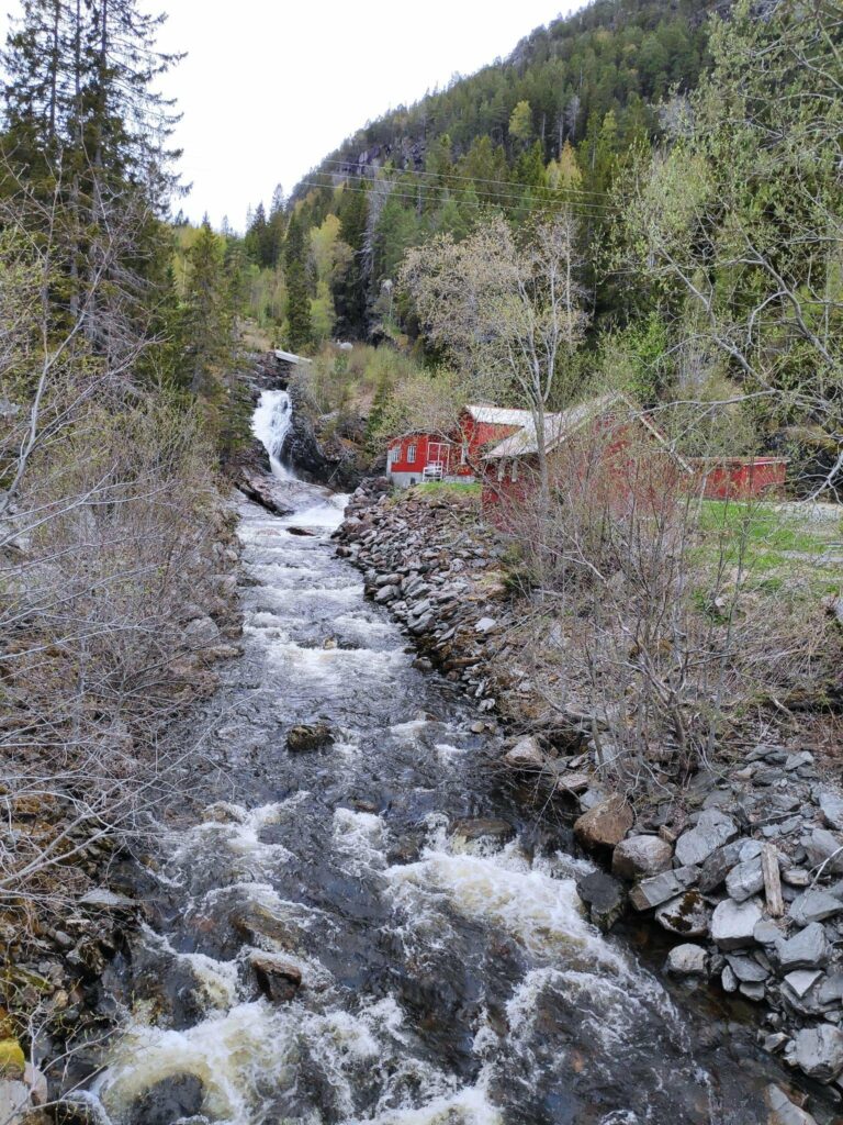
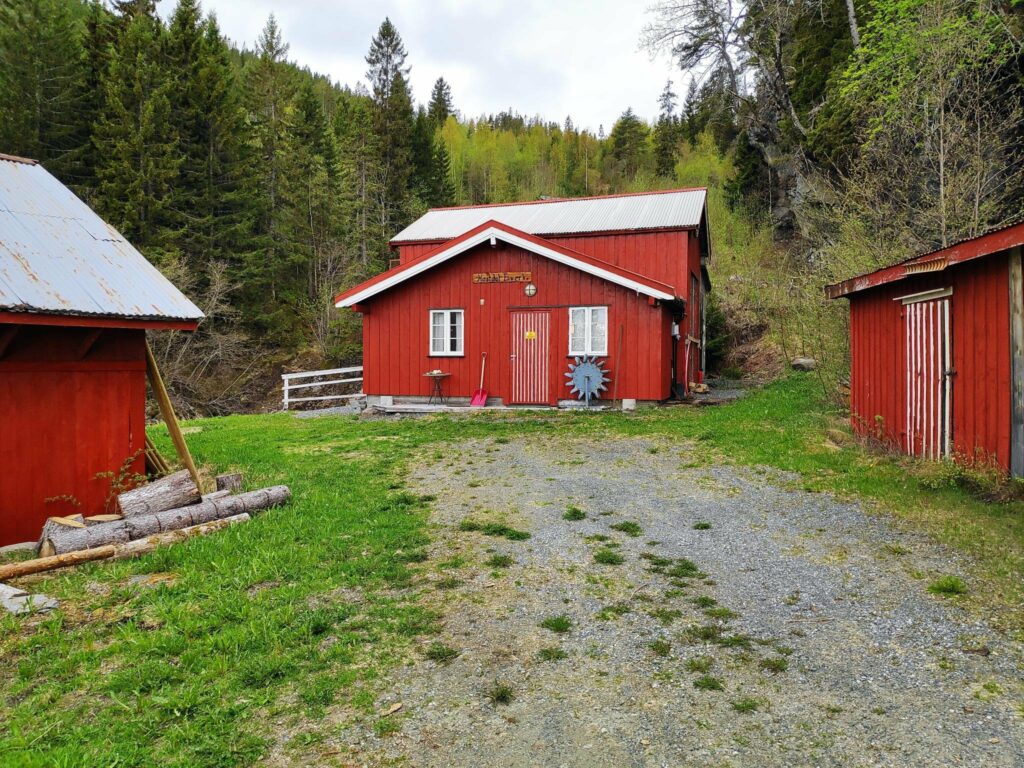
One interesting stop along this route was at Hestdal Hydro Power plant, a small independent electricity production plant.
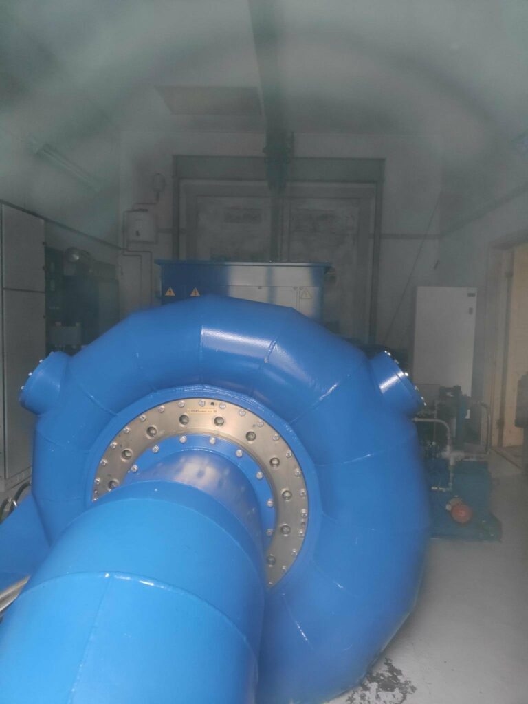
Here’s the stream that feeds the power plant which is in the red buildings on the right of the stream.The red building in the center houses the power plant. It was quite noisy beside that building.I found a dusty window I could get my camera to peek in. It was a beautiful blue turbine at work.The stream is in the background and the water that has been used to turn the turbine can be seen coming out at the bottom of the picture. There had been lots of rain recently, plus there was still snow on the tops of the hills here, so water was still plentiful.
Vanvikan and the end of route 755
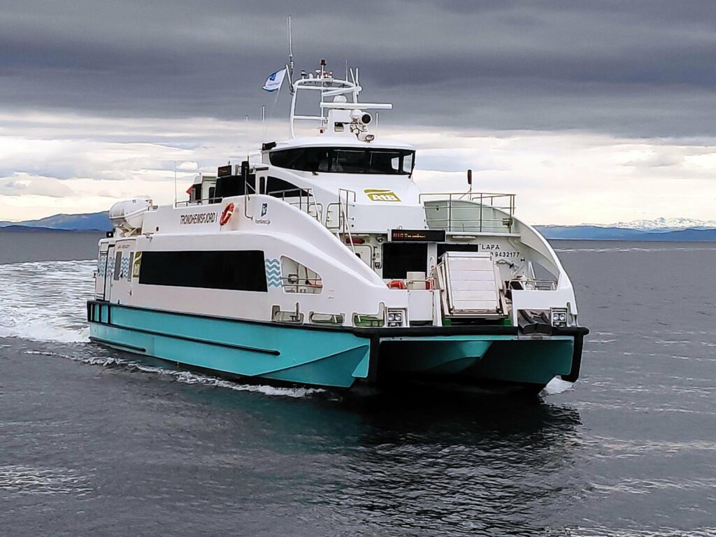
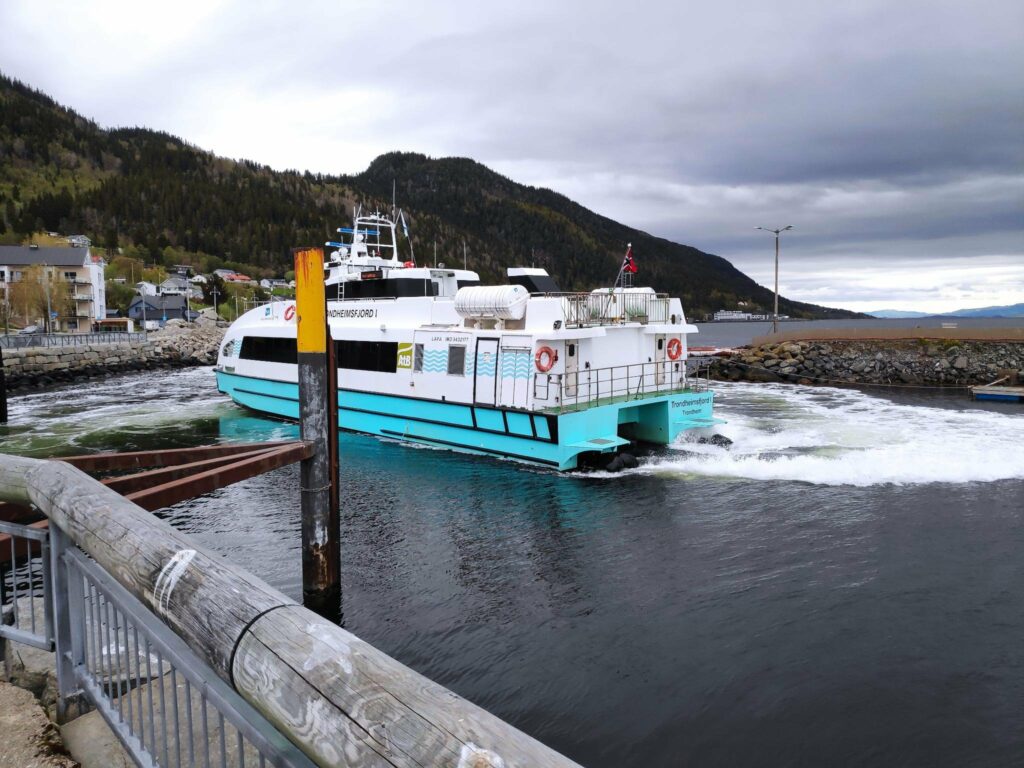
Vanvikan is a very small village of about 700 residents. There are some small industries here and you can get an express passenger boat from here to cross the fjord to Trondheim. We were lucky that one came in just after we had parked to look around.
We were in Vanvikan on a Sunday and there were quite a few people both getting off the boat and also going to Trondheim.. The crossing takes 25 minutes and on a Sunday it goes about every two hours.I must admit I was impressed at how little space the catamaran needed to turn around before heading out of the small harbor and back to Trondheim. You can see some of the village of Vanvikan to the left of the boat.
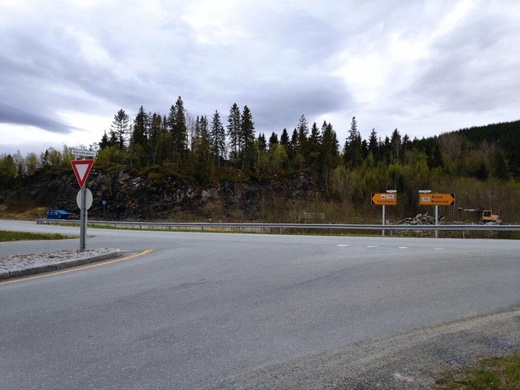
Finally we came to the end of route 755.
Route 755 ends in a T-intersection with route 715. If you turn to the left, you can get to a car ferry across the fjord towards Trondheim. You can also continue around the southern tip of this peninsula which is called Fosen. If you turn to the right, you can travel north and find many small villages and eventually make a round trip and get back to Inderøy.We, of course, had to turn around and drive home again and this was the first sign that indicated the speed limit (60 km per hour) and the route number (755).
The pictures for this blog have been taken on more than one occasion. We took a drive from our house to Vanvikan one Sunday morning, but with all the stops it took a lot longer than I had been expecting. In the end we drove straight home from Vanvikan with no further stops and it took us about 75 minutes.
The pictures of Røra and Straumen were taken on a different occasion and this section of the road I travel quite a lot.
I hope you have enjoyed this blog article. You will find other blog articles about different things along this route, including a walk at Liatjønna, the center of Mosvik, the tidal walk in Straumen and Skarnsund Bridge (to be coming soon).
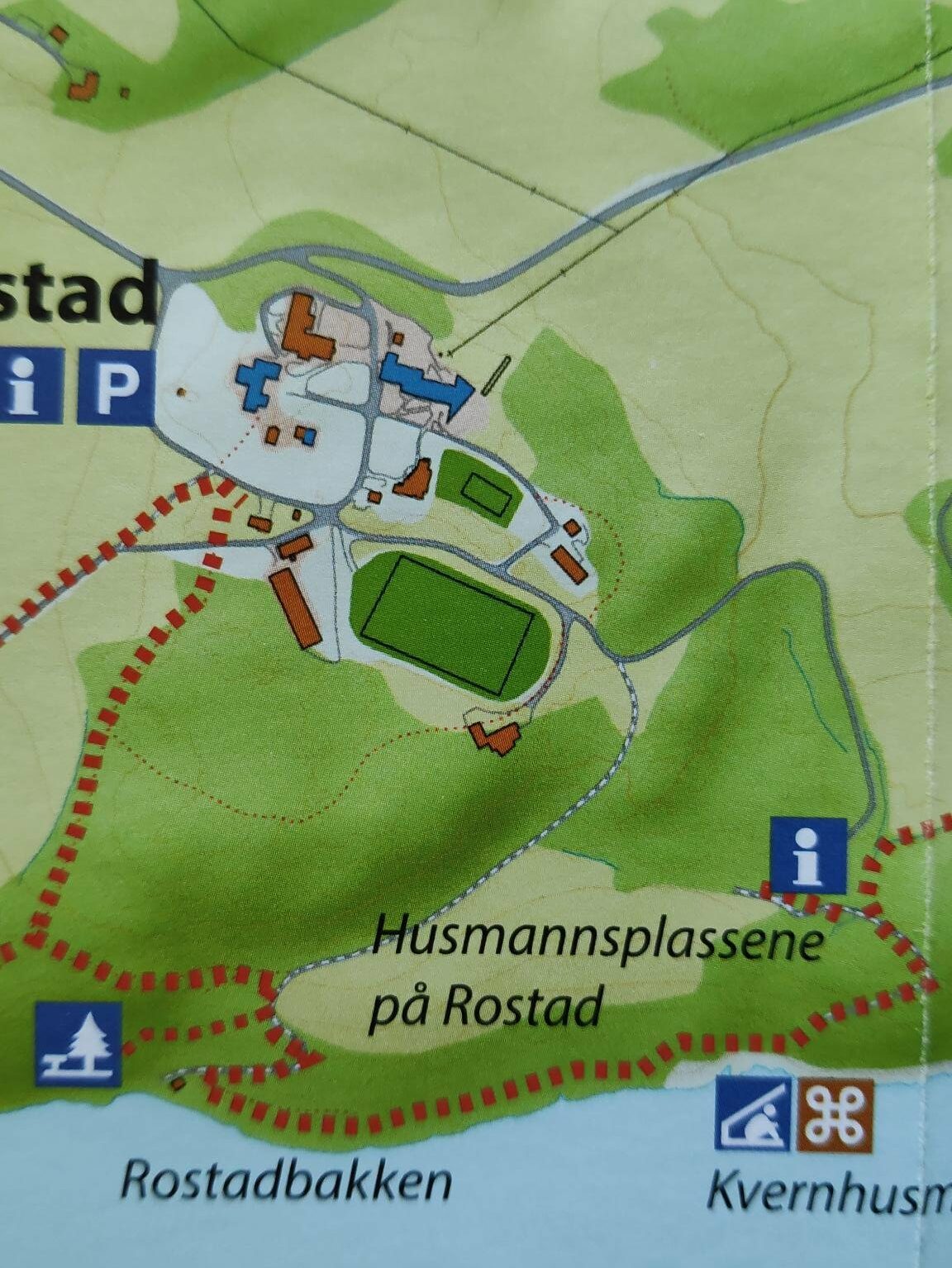
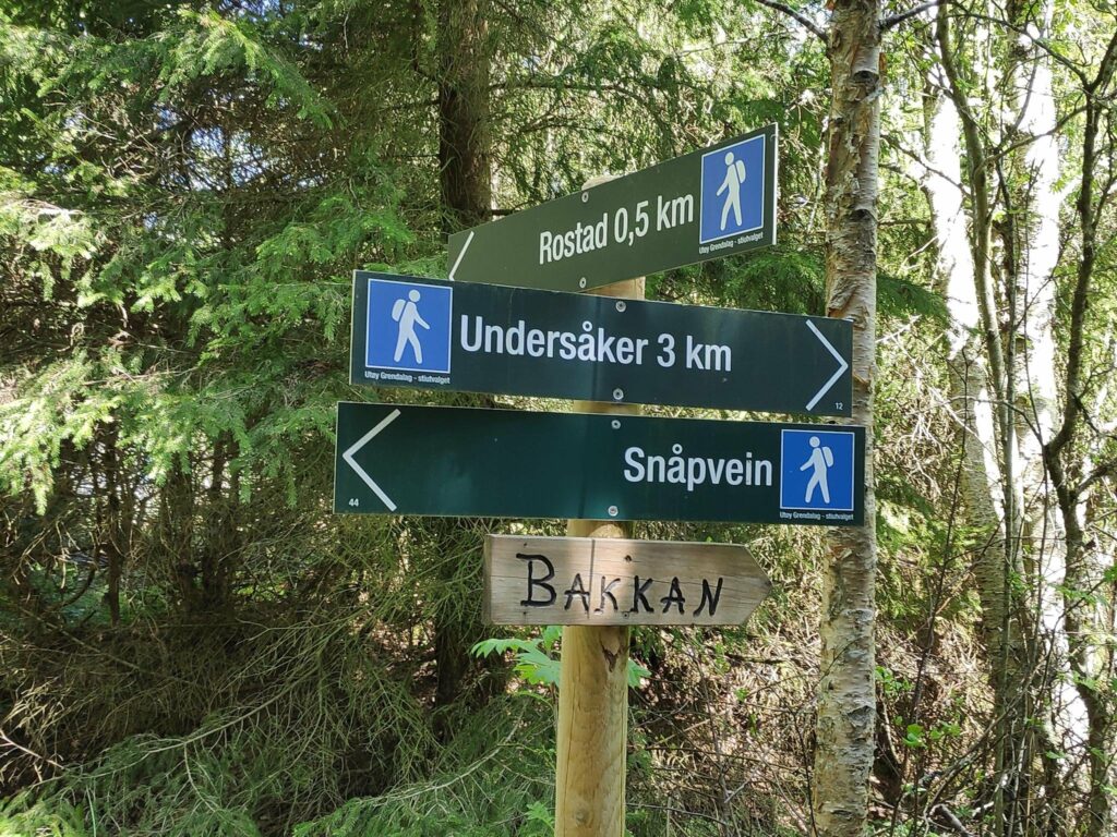
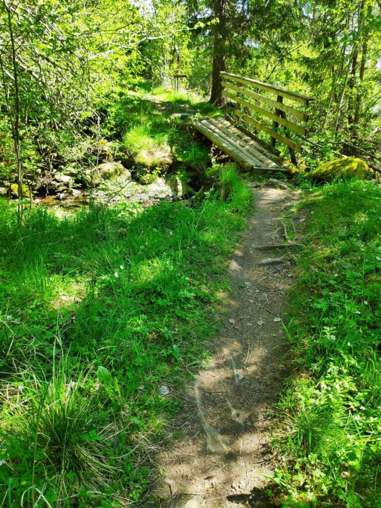
Rostad is a large property in Utøy in Inderøy. The walk my husband and I took on a holiday Monday was almost all on this large property. Much of the information along the trail has to do with the information about this property. However, in this blog I am only going to describe the walk itself. Another blog will be written about some of the history of this property.
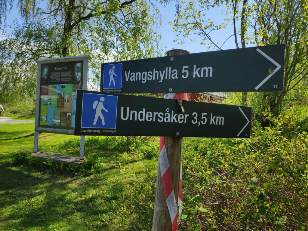
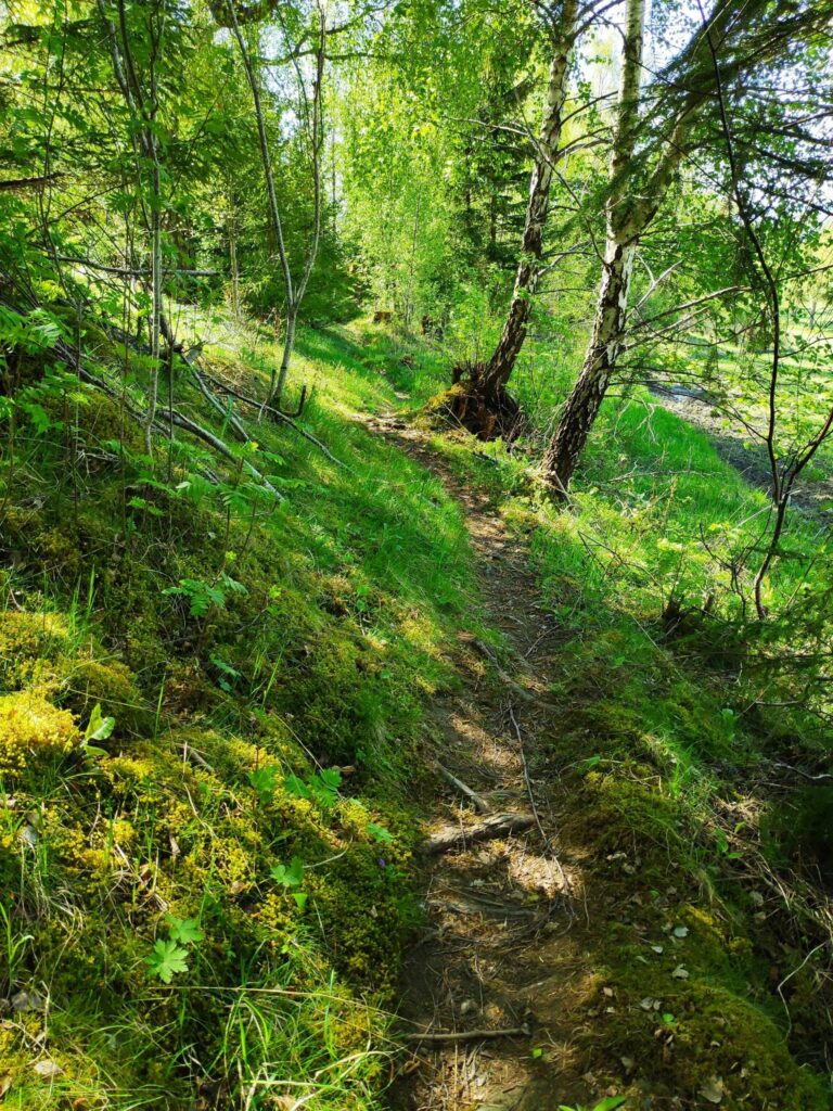
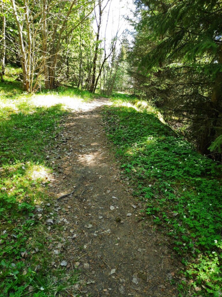
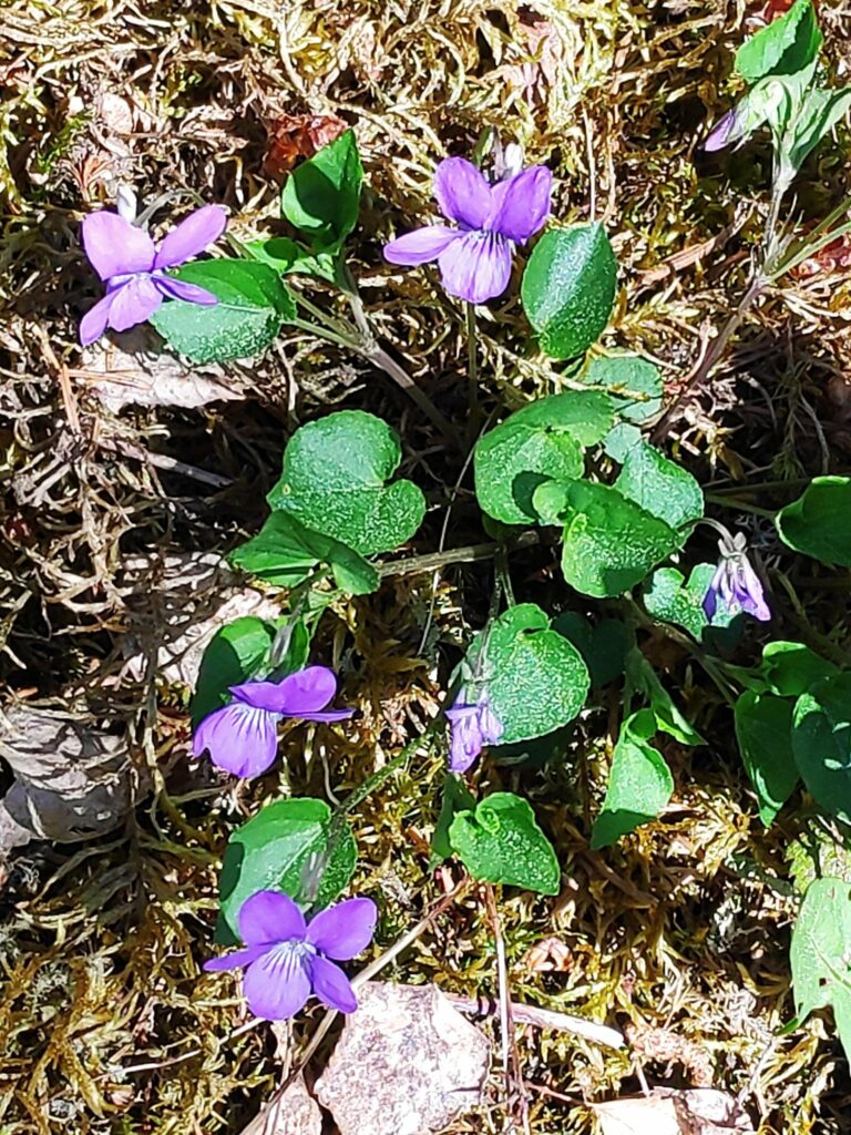
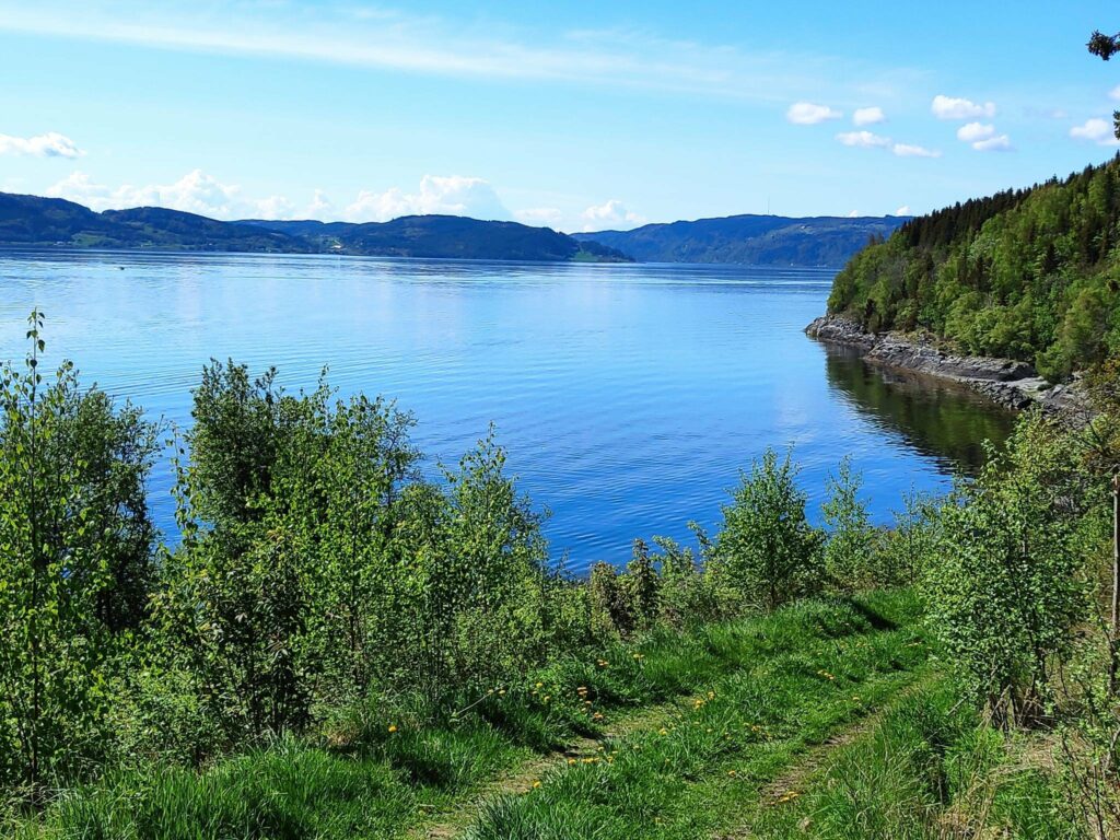
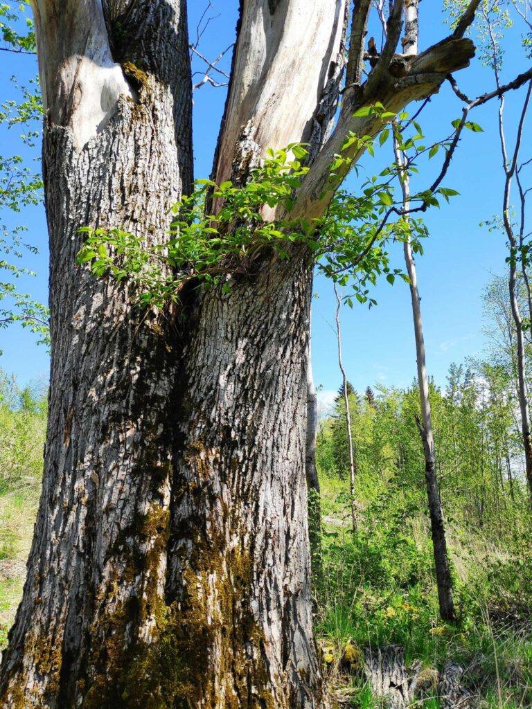
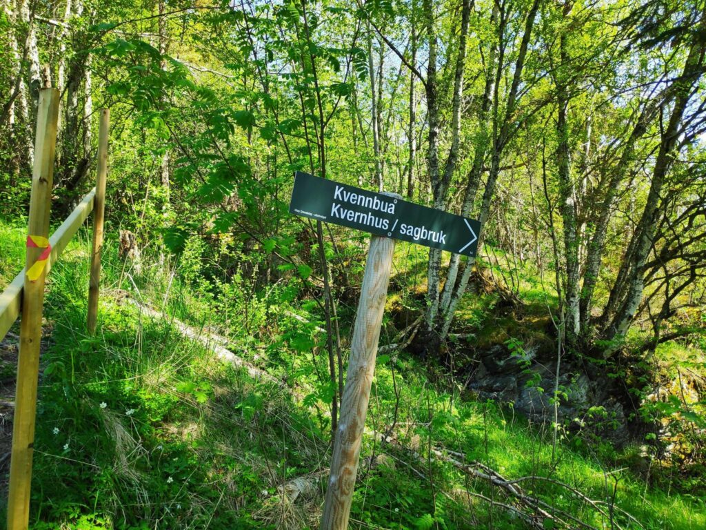
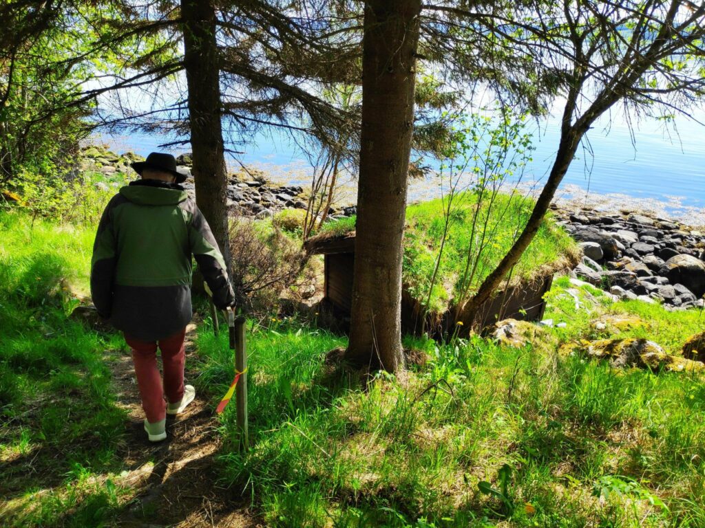
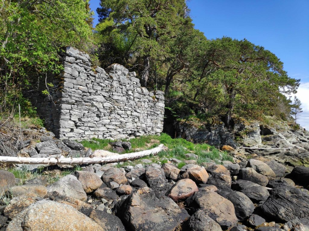
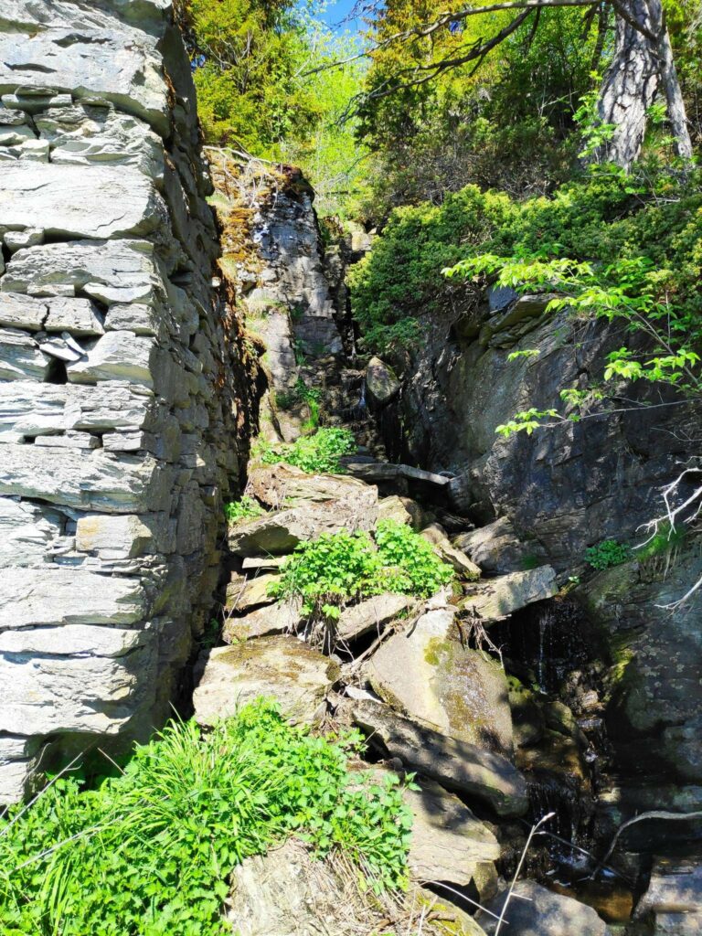
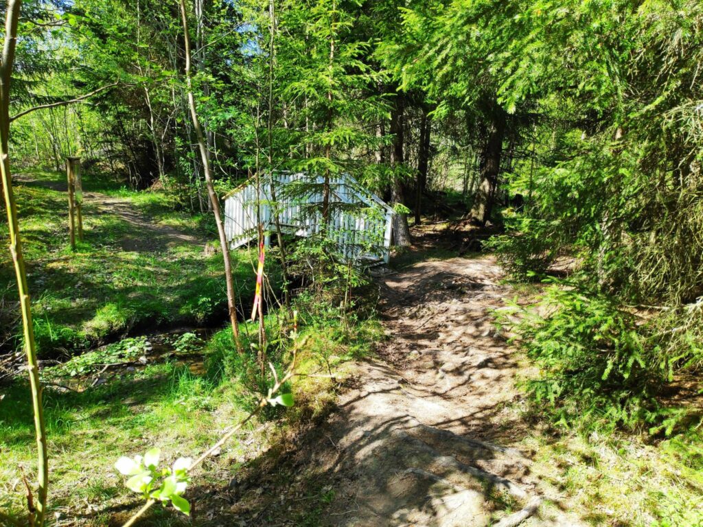
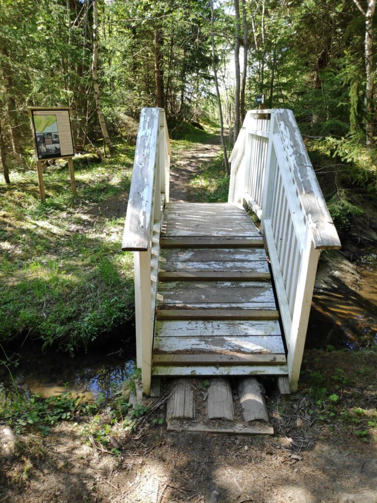
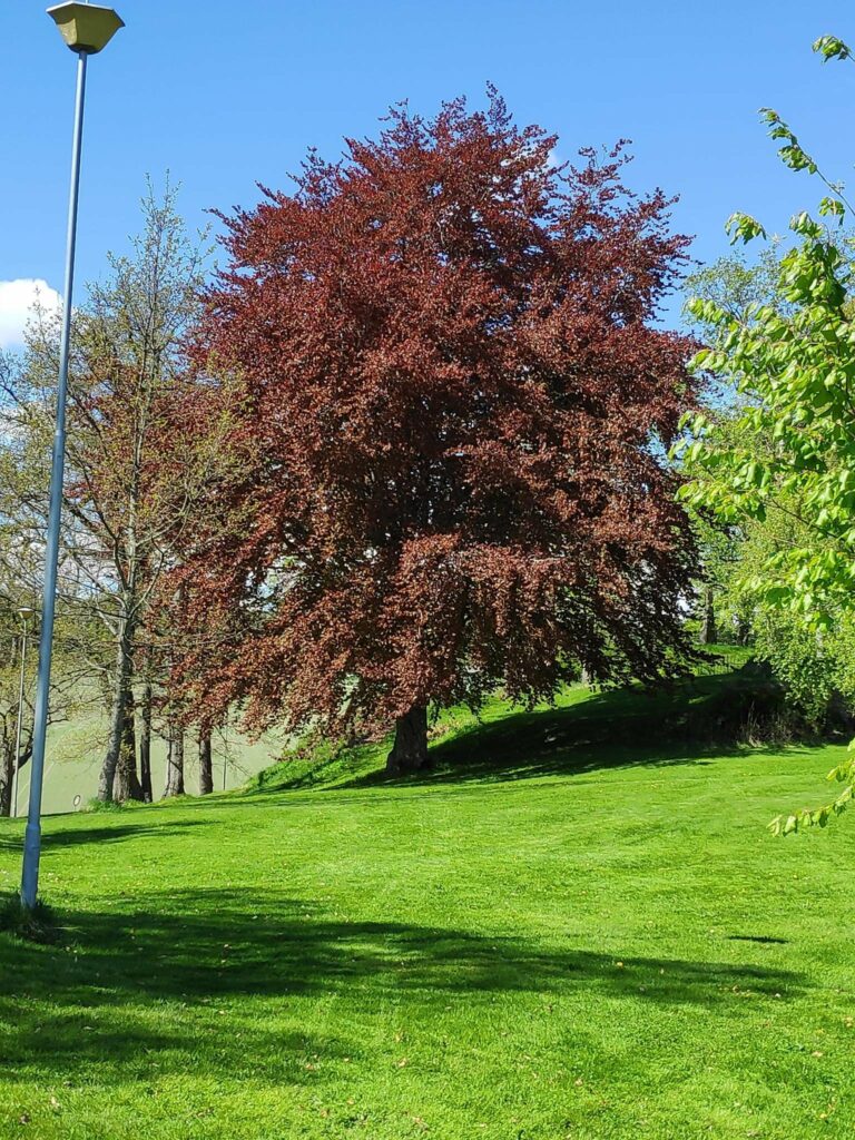
Here is a map of the area we were walking in. We parked at P. We took the right-hand dotted red line down to the water, then went along to the right until we came to Kvernhusmuren, We then continued along the path until we could take a short path to the left, then up the tractor road to the stadium. Then continued along the road back to the car. We used about an hour.We are 5 km from home, but we drove to the parking area. Walking one way would be fine, I no longer like walks of 10 km.It was a warm sunny morning and the first part of the trail took us through the woods. The property of Rostad is a farm as well as a school, but there are lots of forested areas.We have now come to the first intersection. We have come from Rostad and are going in the direction of Undersåker. “Snåpveien” means a short cut and takes you to Rostad Quay.We continued through the forest, with wild flowers growing in the open areas.I’m not sure the official name of these flowers. I call them wild violets. They grow in my garden as well. They like a sunny, open area.At one point we came out into the open and are following a tractor road down to a small beach. In the distance on the right is Mosvik and on the left is the island of Ytterøy.We came to a small beach.There was a new boat house and a small boat at the high water mark. We went a few meters back up the road we came along before heading off to the right.Along this part of the path there was an old elm tree that looked a bit dead, but when one got up close one could see that there was still life in the old trunk with new shoots coming from the trunk. In addition there were many baby trees in the surrounding open area.There is still life in the old tree.Our goal is in sight. There used to be both a sawmill and a grain mill here.My walking companion is heading down to the small building with the grass roof which is almost on the beach.Here is the remains of the mills that were here. The wall was built with flat stones without any mortar. The stream that supplied the power to the mill is on the far side.The stream that would have once powered the sawmill and the grain mill.The beach here is a bit rocky.We have now continued along the path towards Undersåkerand here is a little bridge that crosses the stream that goes down to the old mill.This bridge crosses the same stream farther uphill. If one continues straight ahead one would come to Undersåker, but we chose to cross the bridge and go left so that we got back to our car.The first time I crossed here many years ago, it was just a log bridge that was very slippery. This new bridge with railing was much nicer to use.We can see some farm fields. We will now follow a tractor road up to the football stadium and our car.The walking is easy when it is a tractor road that is used constantly to get to the fields.It’s called a “stadium” in Norwegian and is used for playing soccer, which is called “fotball” in Norwegian. When bantam leagues are playing they can have several games going at once here.We are back to the main building on the property, but that will be a different blog. Our car is nearby.The leaves are out on the red beech tree. The leaves on most of the deciduous trees have just come out in the last week or so.
We had a lovely walk on a sunny day. We used about an hour, but I stop a lot to take pictures. I think on this walk I took about 65 pictures. I love having a digital camera on my smart phone so that I don’t have to think about the cost per picture. This is a walk I will do again this summer. I hope you have enjoyed the pictures.
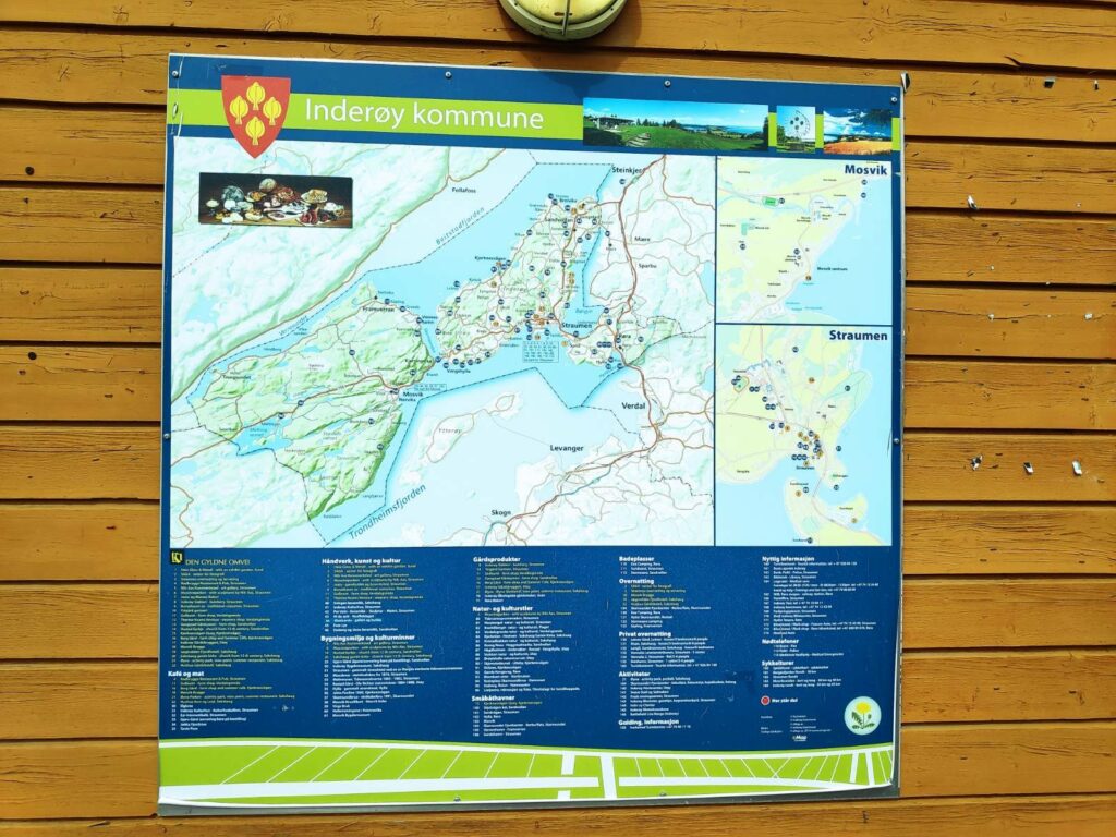
Inderøy is a municipality, but it is divided into several areas mostly based on the location of the elementary schools. In some cases the areas reflect municipal boundaries from the 1960s or earlier.
An information sign about Inderøy
If you look at the shape of Inderøy in the above map, you will see the central part is a large isthmus which is only joined at the top right to the mainland. In fact, the name Inderøy actually means the inner island (in Trondheims Fjord). This isthmus is divided into four main areas – Sandvollan, Straumen, Kjerknesvågen and Utøy. We live in Utøy.
To the left of the isthmus, that is to the west, there are two areas, Mosvik and Framverran which until 2012 were their own municipality. By that time the population had decreased so much that it was no longer viable to provide its own services to its residents. These two areas also have a large number of cabins which are used only part of the year and are not full-time residences.
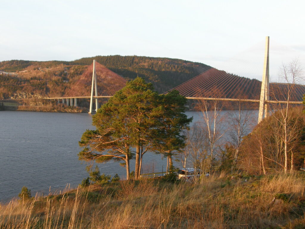
Mosvik and Framverran are joined to Utøy by a large bridge which is over a kilometer in length. The bridge spans Skarnsund which is a very deep trench between the mountains on either side. The trench is over 100 meters deep and is considered a good area for cold-water corals. It is a protected area from 2020.
Skarnsund Bridge, picture taken 2 January 2016. This bridge was built in 1991.
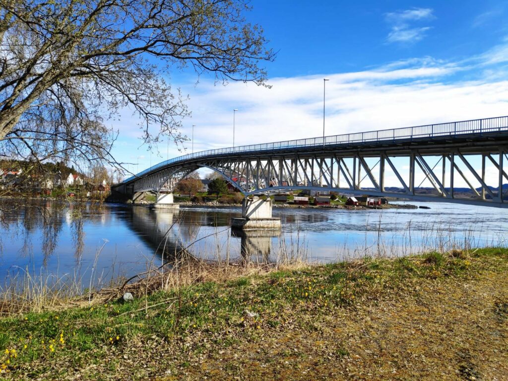
If you look at the map again, you will see there is one last area of the municipality, Røra, which is connected to Straumen by a bridge. Røra is where Inderøy has its one train station.
Straumbrua joins Straumen and Røra. I was standing on the Røra side when taking this picture. This bridge was built in 1958 and improved in 1987. There is a very strong current under the bridge when the tide is going in or coming out. At the time this picture was taken, the tide was going in, in other words going from left to right under the bridge.
Sandvollan and Røra were their own municipalities until 1962 when they were joined with Inderøy.
Straumen is the administrative center for the municipality and is also the area which has the shops, the bank, the junior high school, the senior high school, the city hall and the medical center. In recent years there have been a considerable number of apartments built in this area.
As Inderøy is an agricultural municipality, there are a lot of farms and open areas between the subdivisions. There is also some forested areas, particularly in Mosvik. So though I mention specific areas of the municipality, there will also be smaller neighborhoods, such as Småland or Venneshamn. Some of these areas will have their own store, but not all of them do.
At the moment, there are just under 7000 residents in Inderøy. If you want to read more about Inderøy, you could read here in English or here in Norwegian.
One of the reasons I decided to write this short article is that the Inderøy Walks for 2021 began yesterday. There are 42 walks where one gets points when one comes to a check-in place. Some give 10 points, many give 20 or 30 points depending on difficulty and length of walk. The most difficult walks give 40 or 50 points. I don’t do all of the walks any more, but I plan to write blog articles about the ones that I do. I thought it might be interesting for my readers (those who do not live locally) to have a better understanding of the different areas that these walks are in.
This year the list of the walks has been divided into these areas: Mosvik, 6 walks; Framverran, 5 walks; Kjerknesvågen, 5 walks; Utøy, 8 walks; Straumen, 7 walks; Sandvollan, 4 walks and Røra, 7 walks. Most of the walks are away from where people live, so you will be able to see some of the different types of landscapes we have in Inderøy.
The municipality of Inderøy has only one train station. It is located at Røra and is on the train line called Nordlandsbanen that goes from Trondheim to Bodø.
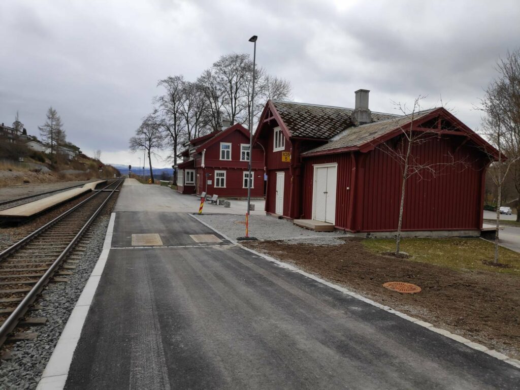
The train station was first opened in 1905 and the old station building was built at that time and has now been protected. However, what was most interesting for me today was the new platform that has been built so that there is better access to the new train sets that will be used from the end of 2021.
Røra train station is located 105 km from Trondheim central train station and lies 51 meters over sea level.
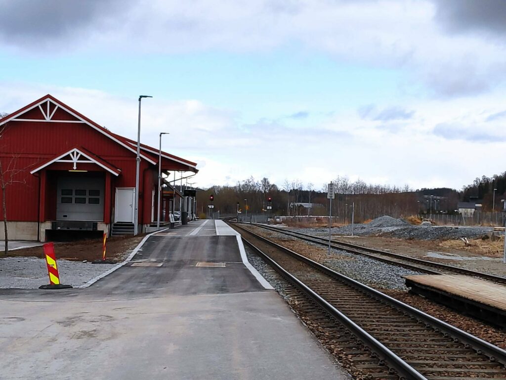
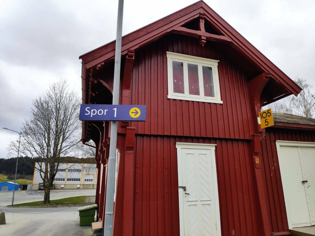
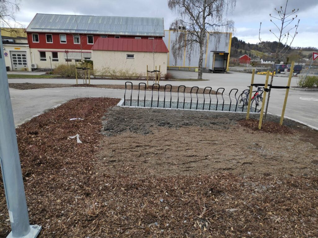
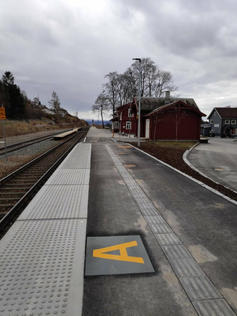
The old train station building is the farthest away. The closer building would be a storage building. The old platform is in the background and is slightly raised. There is enough track here for two trains to pass and a passenger train could stop on platform 2 (at the left) and passengers could cross the tracks to get to the exit (which is at the right). In the picture you can see where the new asphalt indicates the new platform.
When we first lived in Inderøy, the train station had a waiting room available for passengers. At present the station building is unused and is empty.
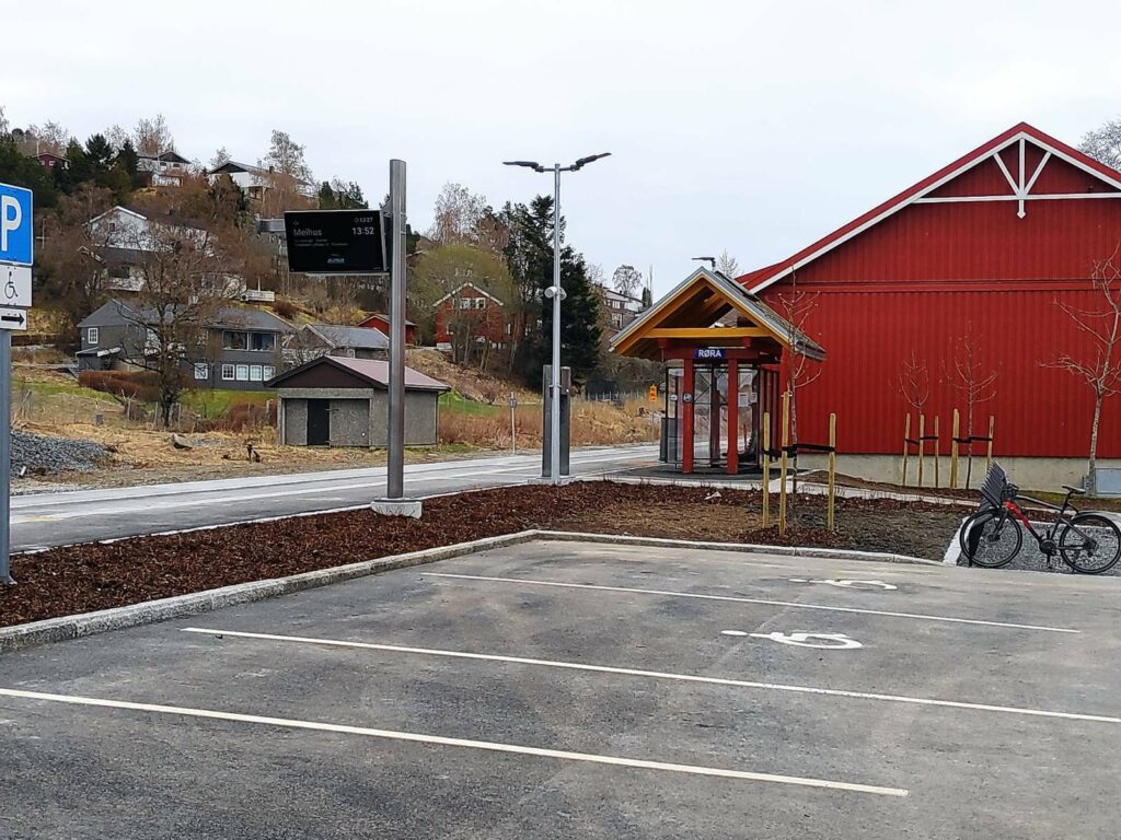
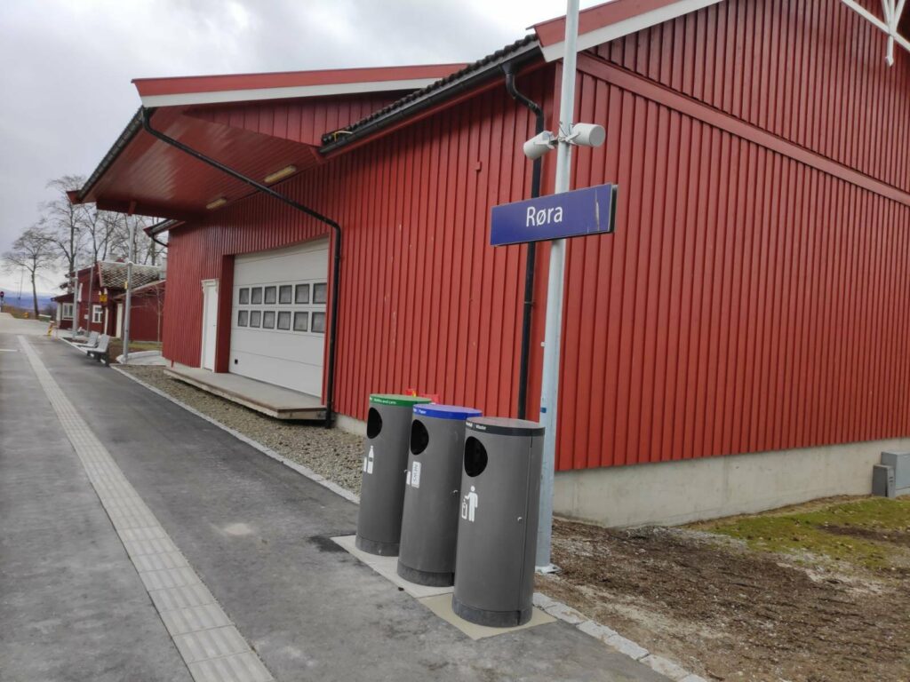
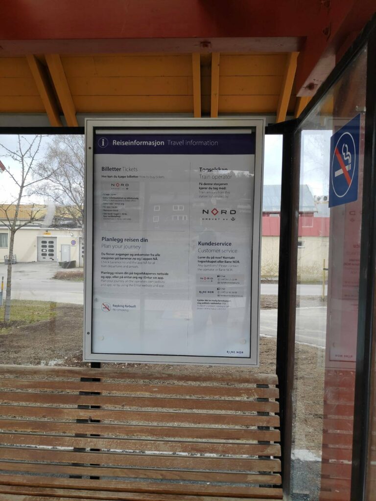
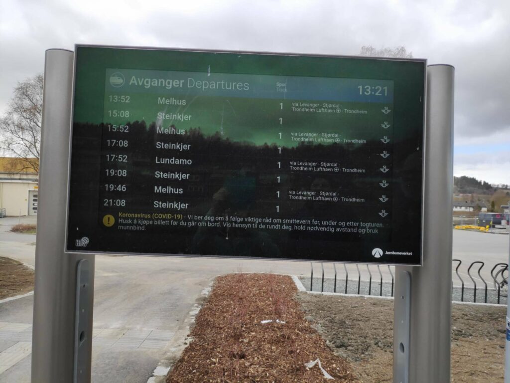
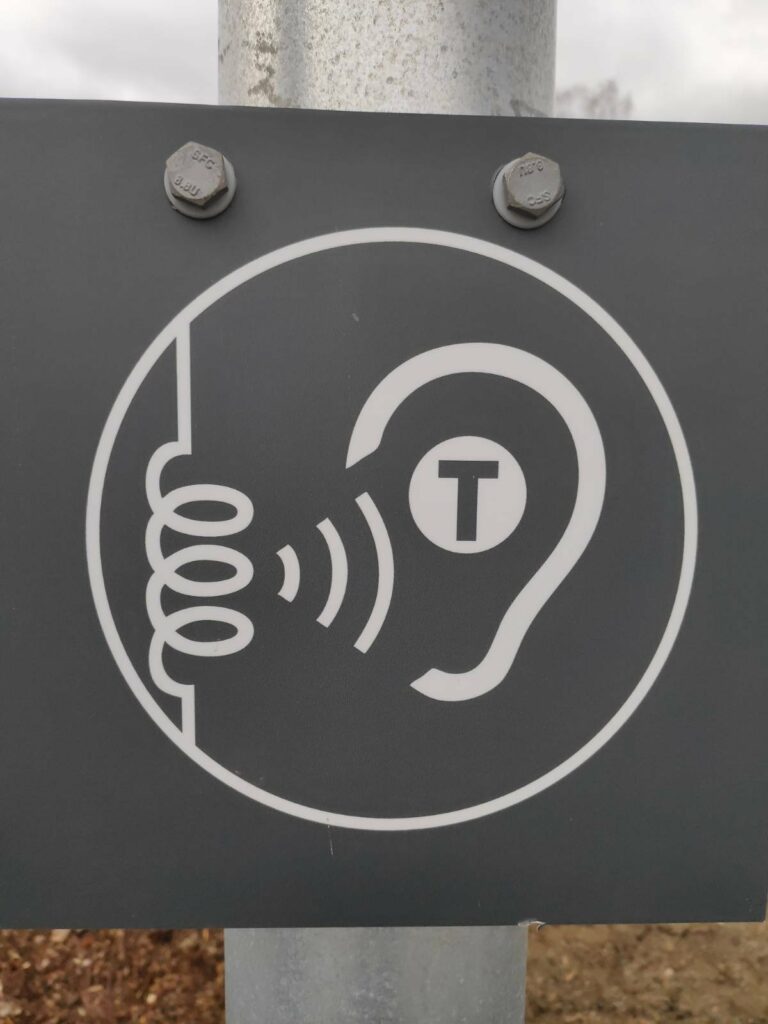
Looking from the old platform towards the new platform. The platform is 120 meters in length, 76 cm in height and 4 meters in width. The new platform was opened on 2021.03.13, so is about 6 weeks old when I saw it today.Platform One is off to the right. The yellow sign indicates that we are 105 km from Trondheim central train station.Taken from the parking area, one sees a small shelter for passengers as well as an information sign as to which train will be next. Sunday afternoon during a pandemic is not the best time to judge if the parking lot is adequate in size. Many people would drive to the train station and park for the day while taking the train to Trondheim. We have made use of the parking here while we have been out of the country for several weeks. Taking the train to an international airport is environmentally friendly as well as pocket-friendly.A suitable parking area for bicycles has been provided. It is a bit early yet for the landscaping to be finished but there are indications that when it gets warm enough there will be plants and perhaps grass here. In the building in the background is AS Røra Fabrikker which produces primarily jam and juice for the Norwegian Coop.Garbage must be sorted – green for bottles and cans, blue for paper and black for everything else. The blue sign tells you which train station you are at.Inside the shelter there is a bench to sit on and information about how to buy tickets – an app on your telephone, of course. There is an extra fee of kr 40, if you want to buy your ticket on the train. No smoking. please.The letters A, B and C on the platform are where the doors should be. This helps you know where to stand to get on the train most efficiently.Railway tracks are dangerous places and you should not be crossing them. Though some passenger trains may stop at the station, there will be both long-distance passenger trains and freight trains that do not stop in this station and can be going at considerable speed through the station area.An example of how many trains would be going through the station on a Sunday afternoon and evening. Melhus and Lundamo are to the south on the other side of Trondheim. Steinkjer is to the north and the end of the line. On a Sunday, there are two hours between trains in the same direction.For the hearing-impaired, you can turn your hearing aid to T and there is a hearing loop so that you can hear the announcements more easily.
It was rather fun to see the new platform open, but it was over half an hour before a train was due to come in, so we didn’t wait for that. Perhaps another time.