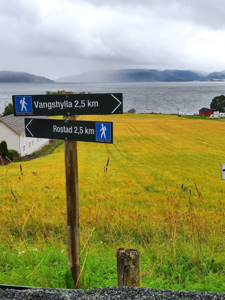
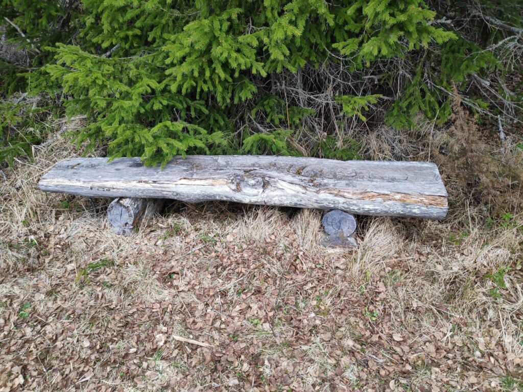
Today’s walk started with my son driving my husband and I to the parking area at Rostad where we started our walk. The goal of our walk was to pass two check-in points (30 points each) and get some fresh air and exercise for about an hour and a half. We usually go for our long walks in the morning, but today it poured with rain until about 3 pm. By the time we left home at 4 pm it had stopped raining. In open places there was a bit of wind. We wore hiking boots and rain jackets. It was often muddy on the paths and we had to walk carefully so that we didn’t slip. But it was good to get out for a long walk. It has been a while since the last time. Today’s temperature was about 12 degrees Celsius so for me a very pleasant temperature for walking.
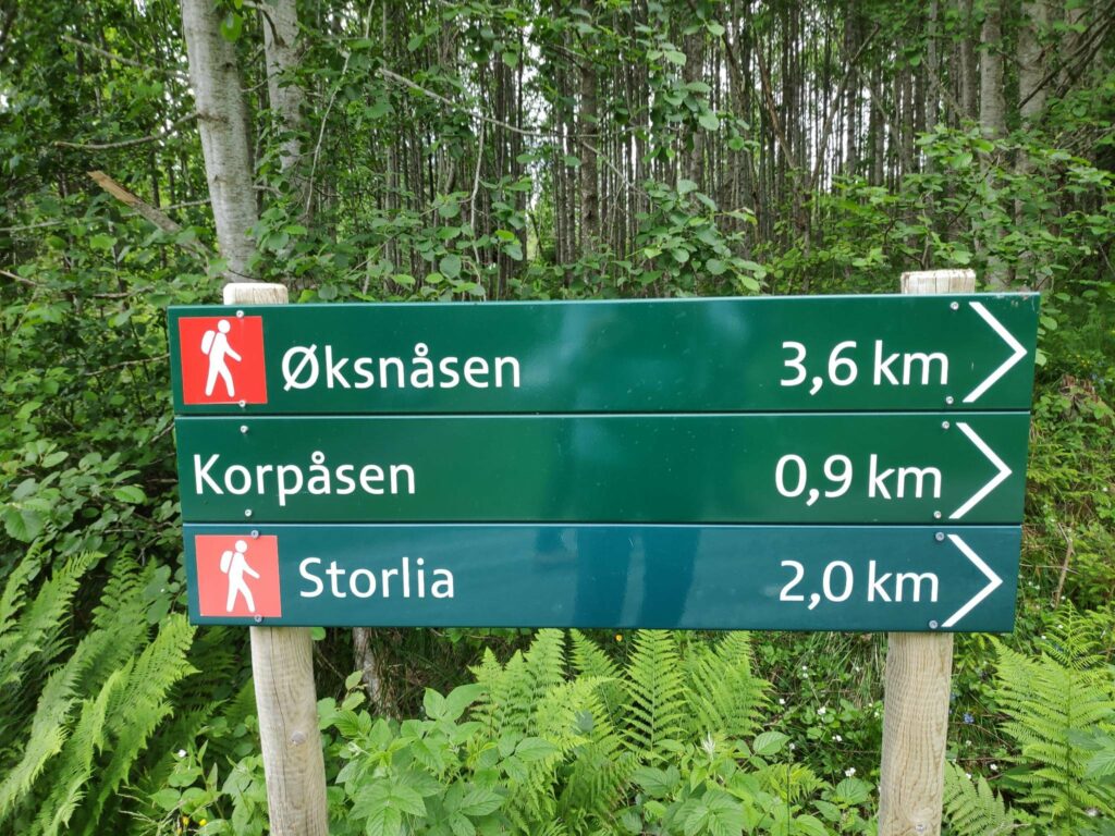
The first part of our walk, from Rostad to Frøsen has been written about in a previous blog (see here). Though the previous time we took this walk, it was a warm, sunny evening, today was an overcast, gray day. I am just going to write about the section of the walk from Frøsen to Bjømnbråtte.
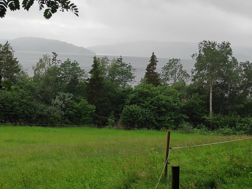
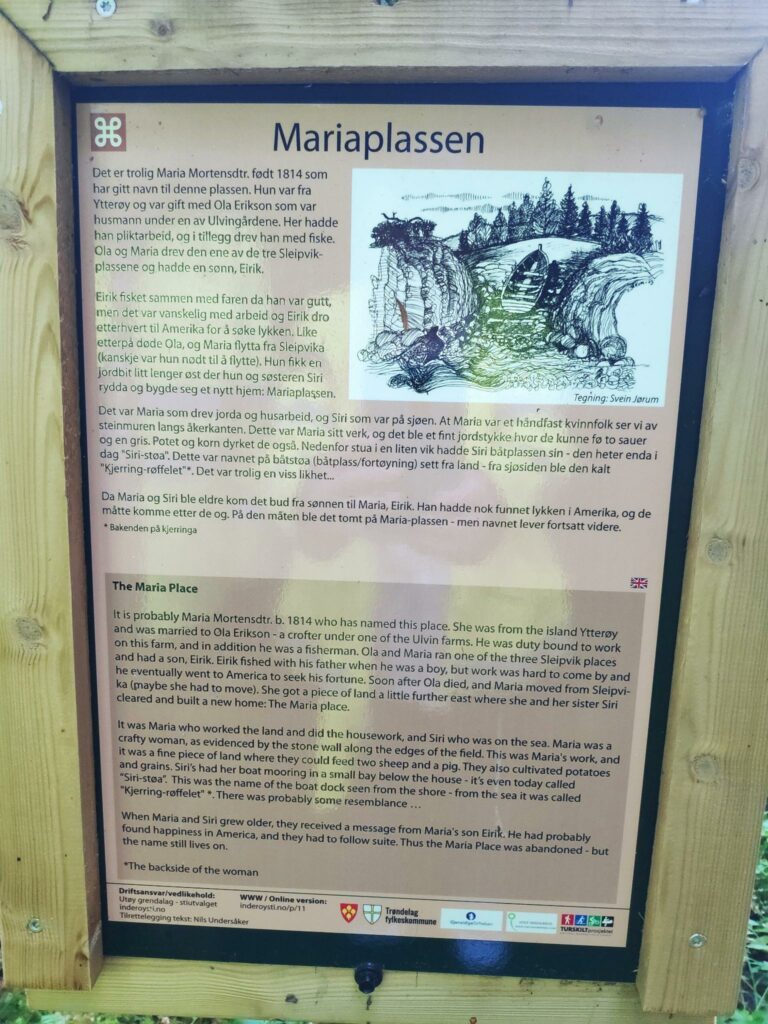
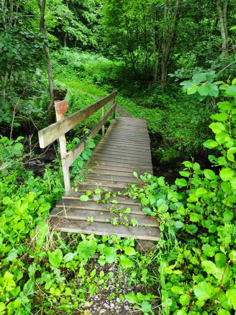
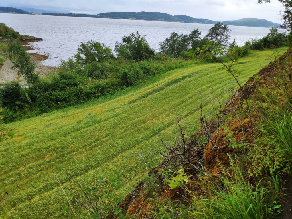
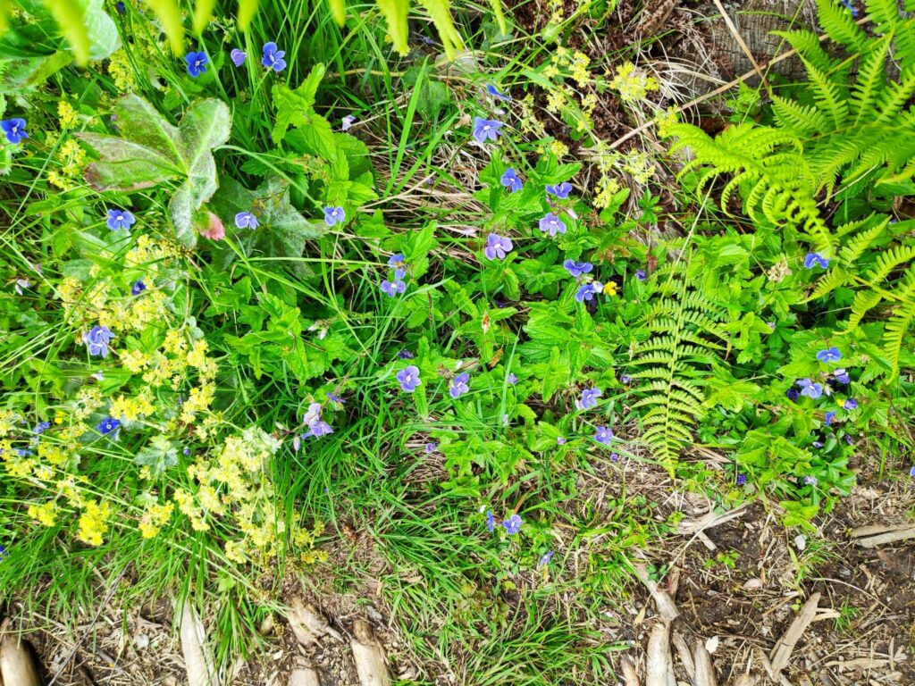
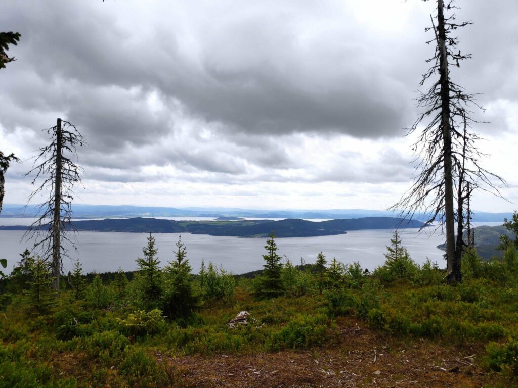
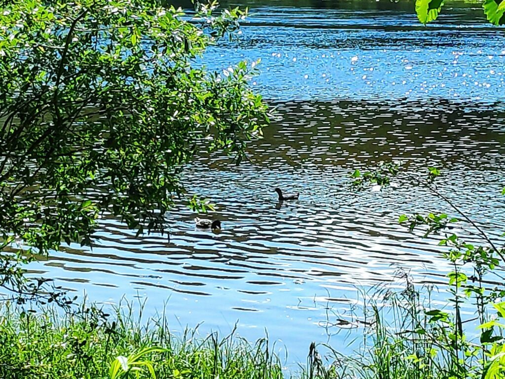
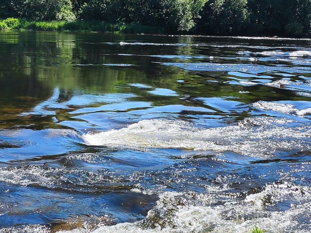
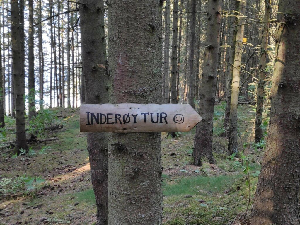
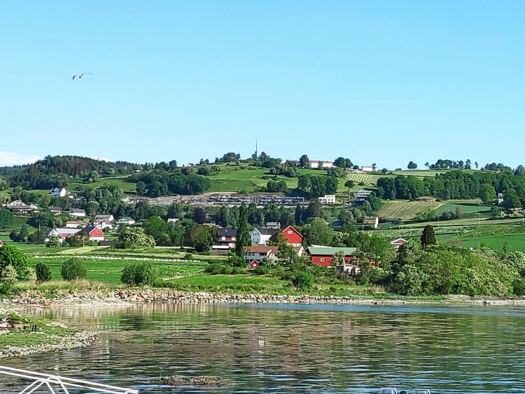
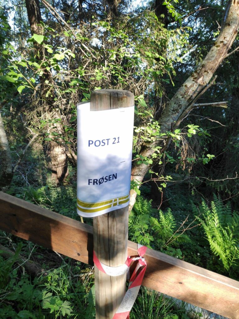
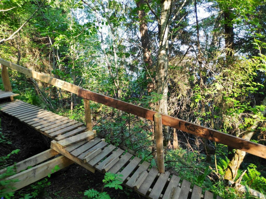
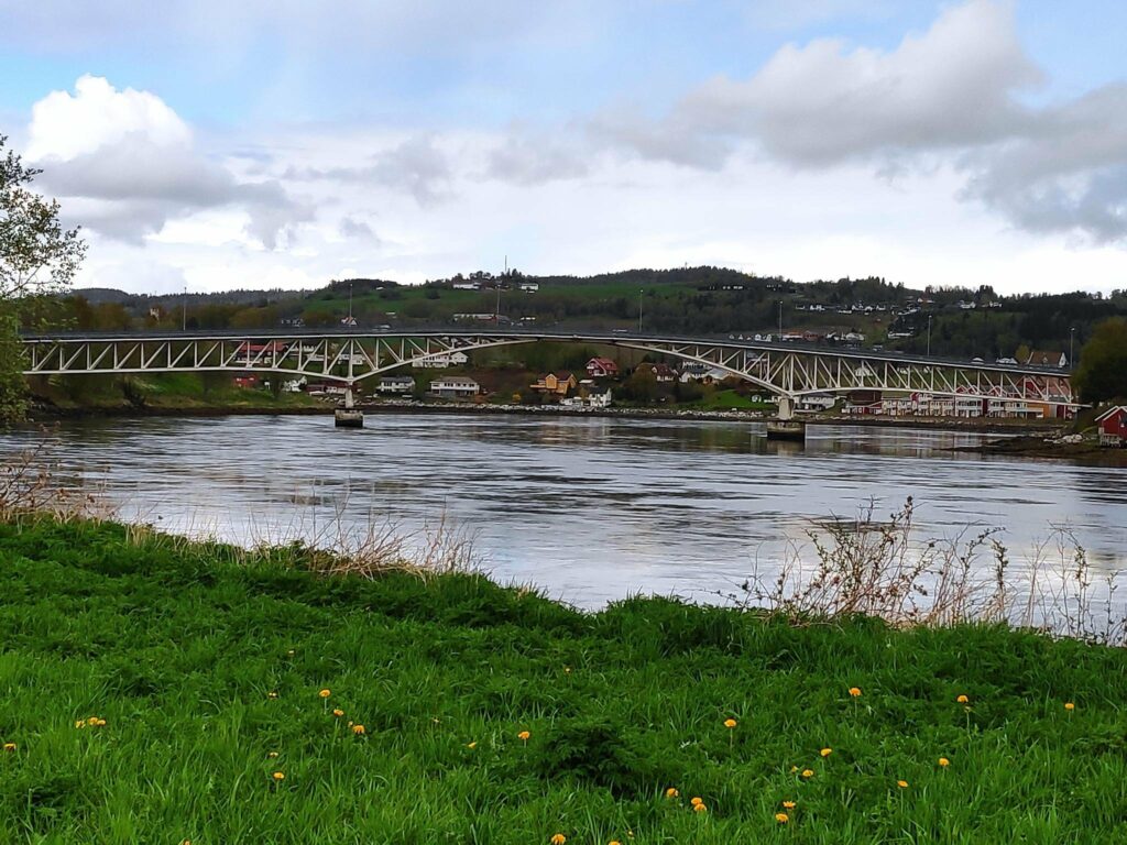
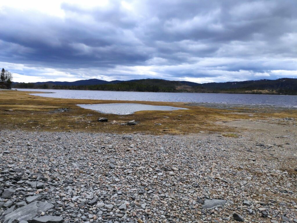
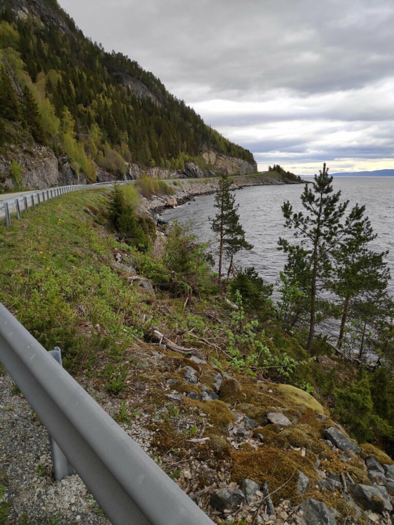
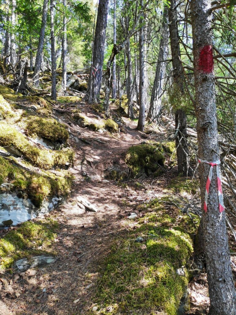
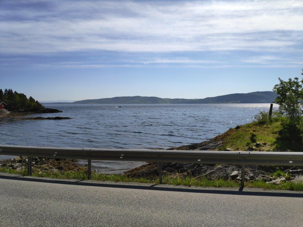
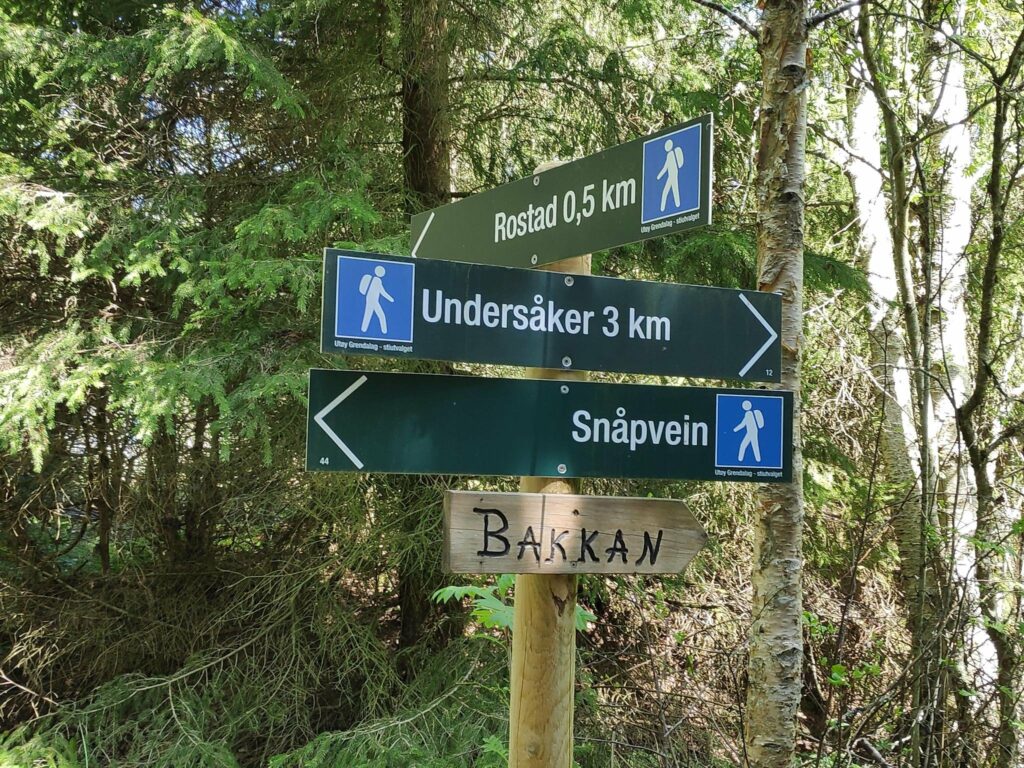
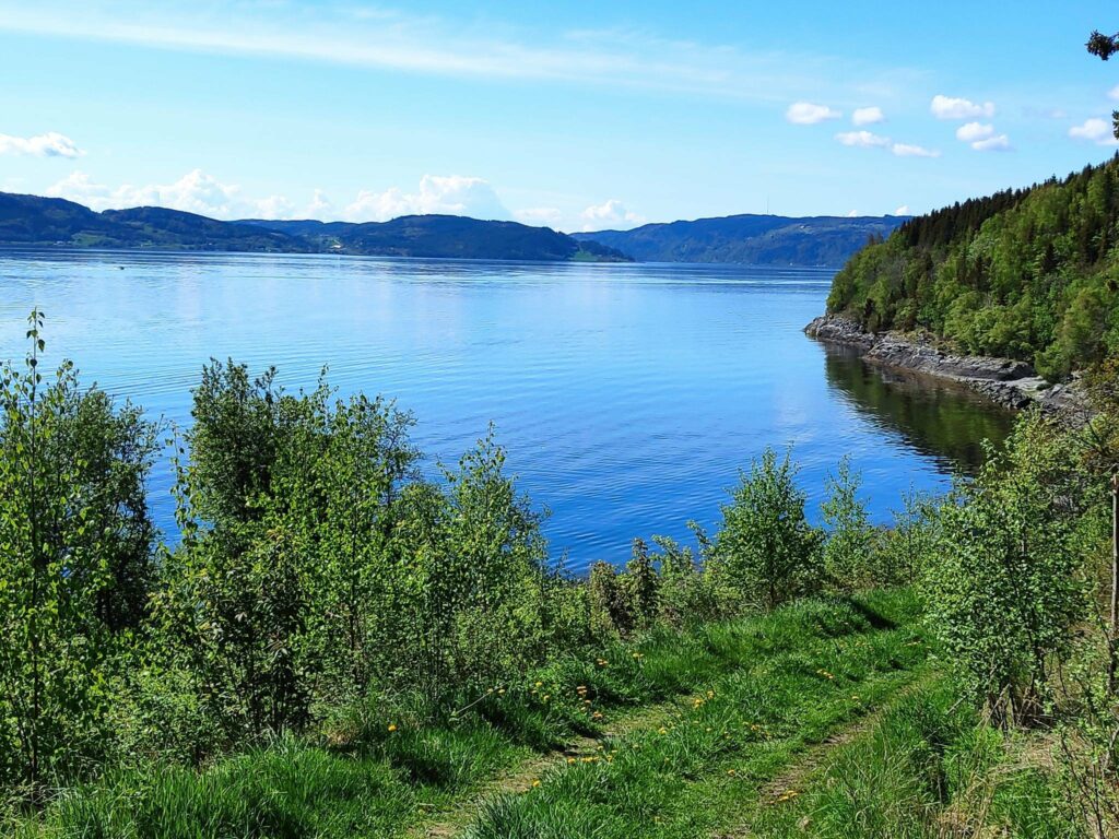
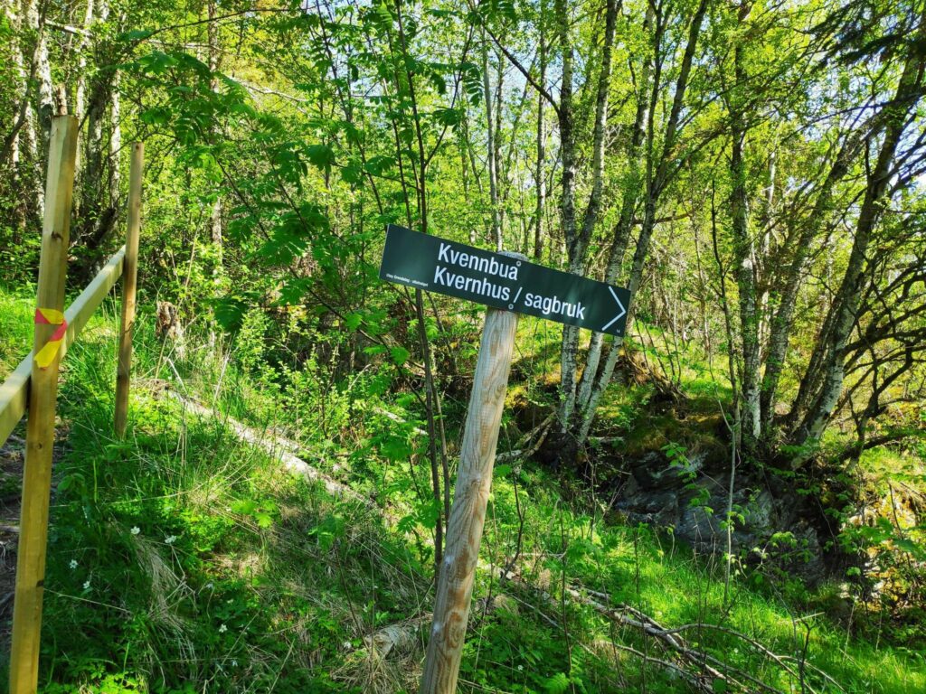
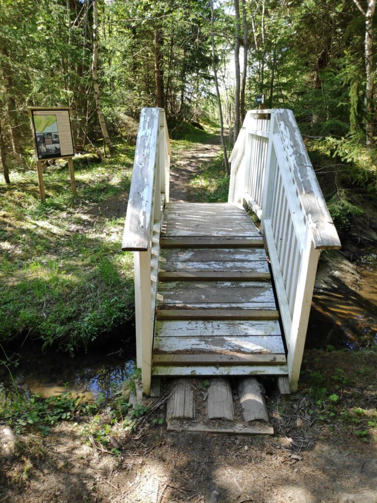
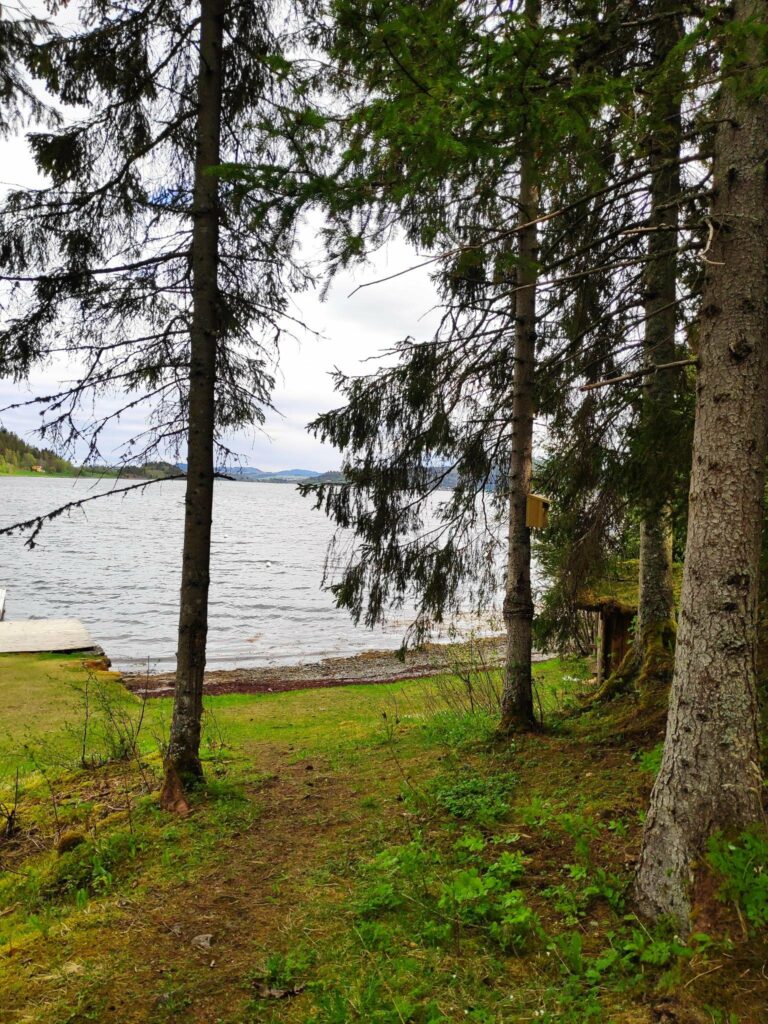
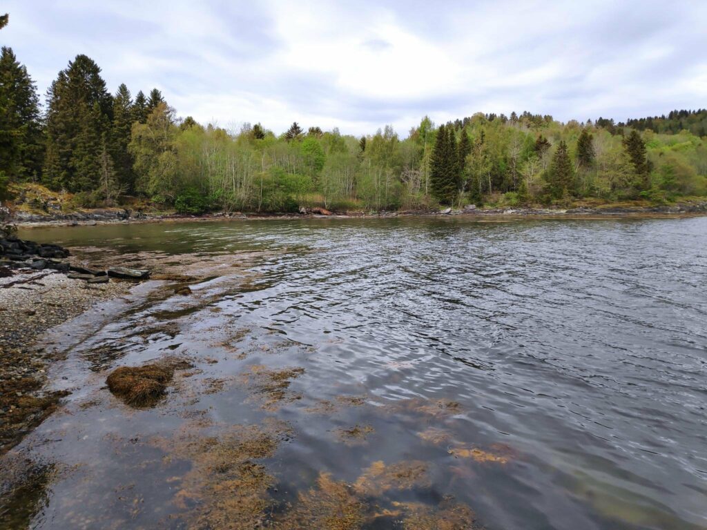
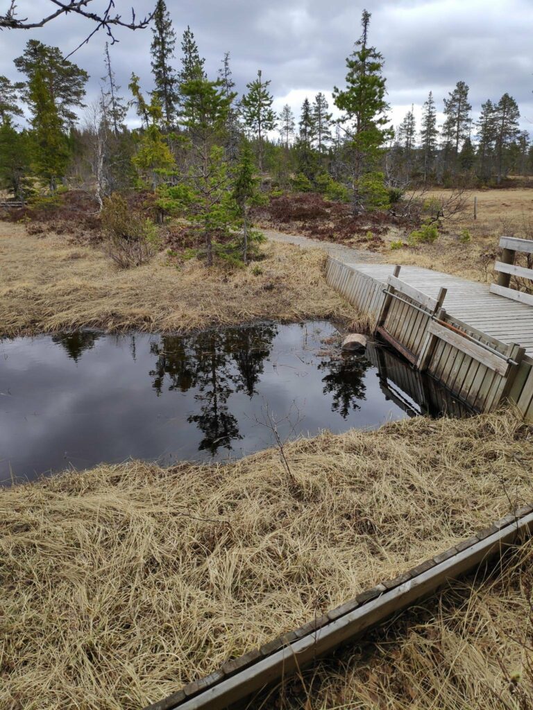
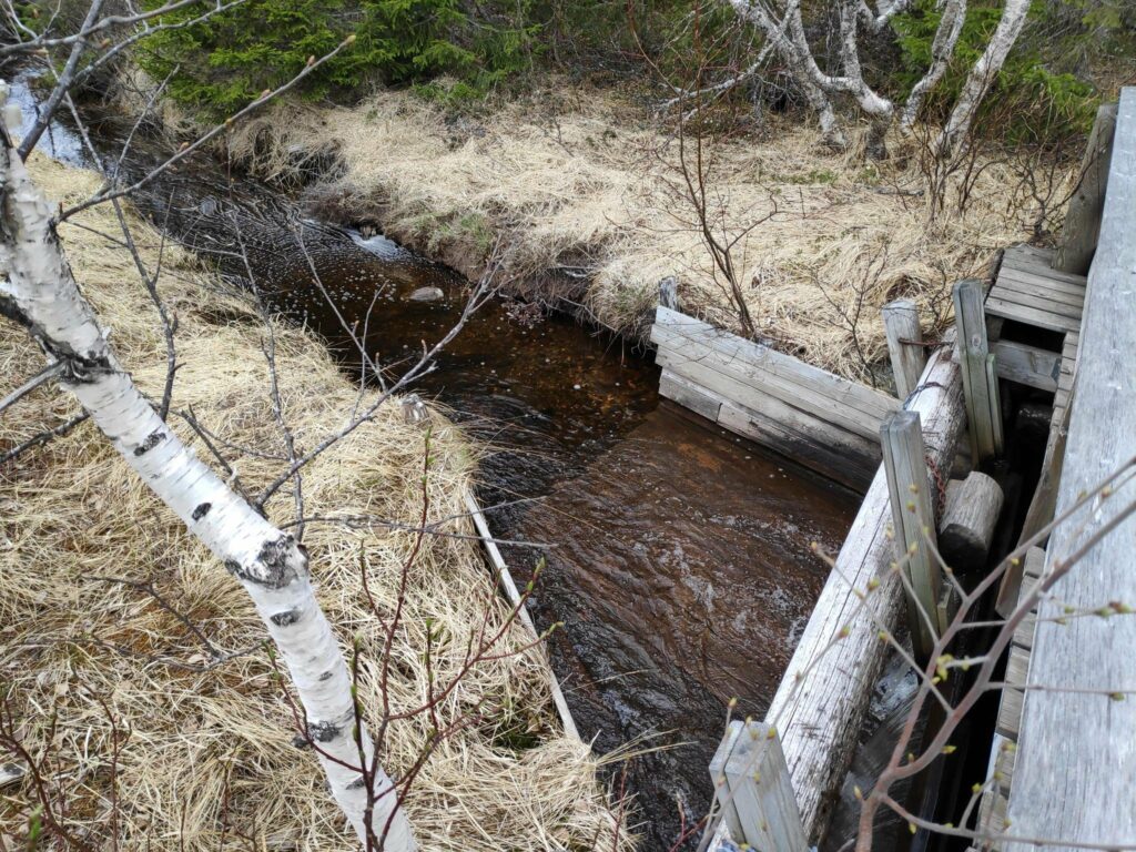
Frøsen is a bridge across a stream, which even after a couple of days of heavy rain and no water in it. This picture was taken on the previous walk at the beginning of June. Today the wooden boards were slippery as they were wet.This is what our weather was like today. The view from the path looking out to the fjord with Ytterøy on the left and Mosvik to the right and behind, both in the clouds. We didn’t experience any rain, but a lot of the walking we did was under the trees.This pathway we are on has information signs about historical events of places. This sign shows where Maria Mortensdatter (born in 1814) lived with her sister, Siri, after Maria’s son went to America. Maria worked the land and Siri went fishing. The house no longer exists.
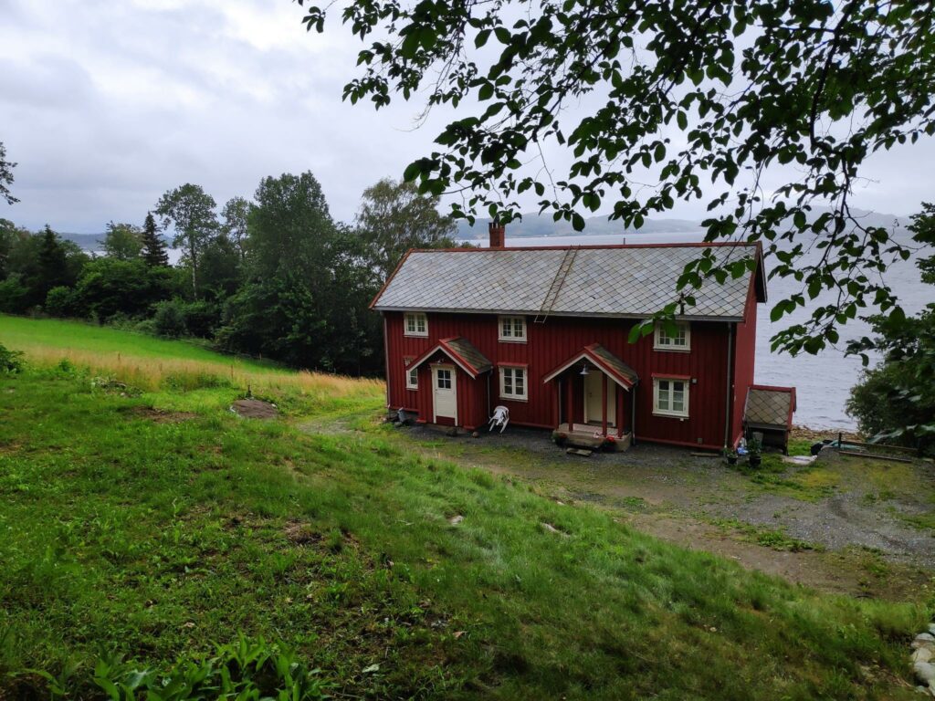
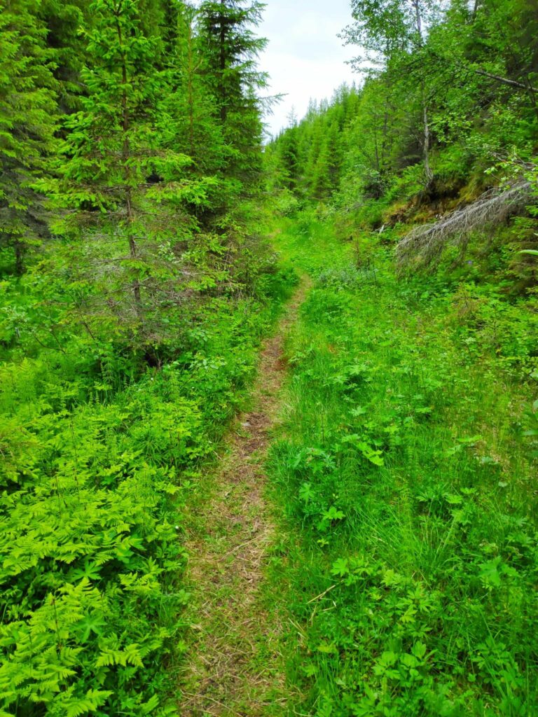
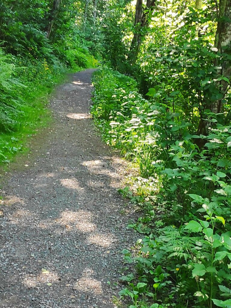
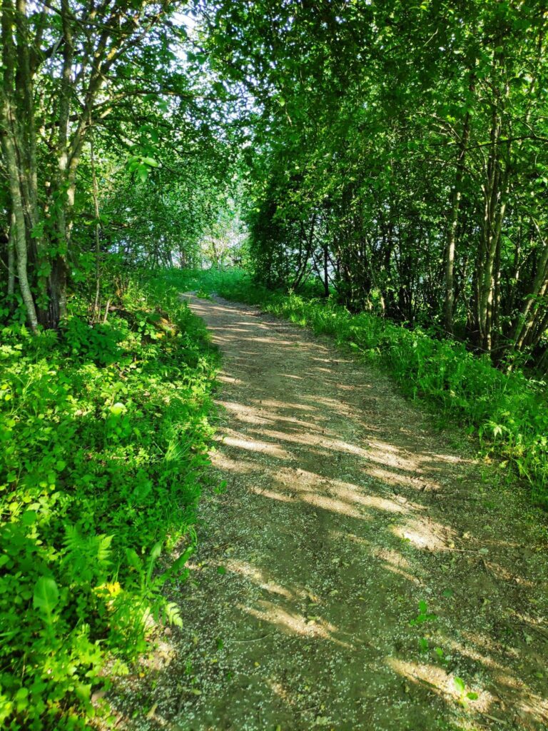
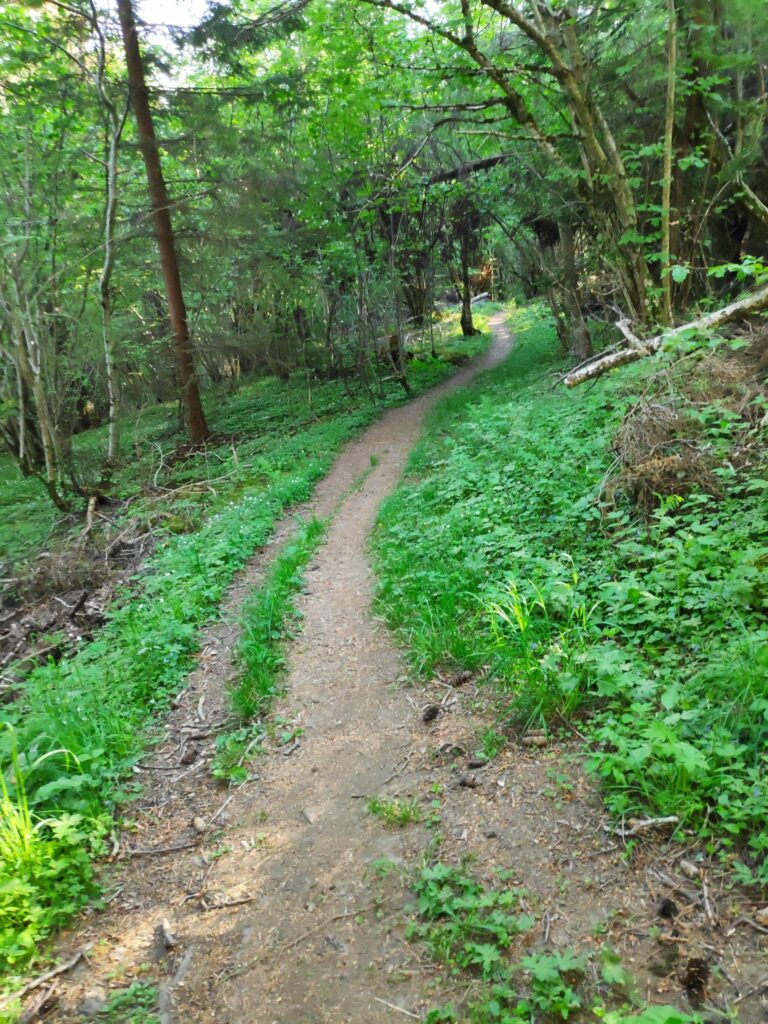
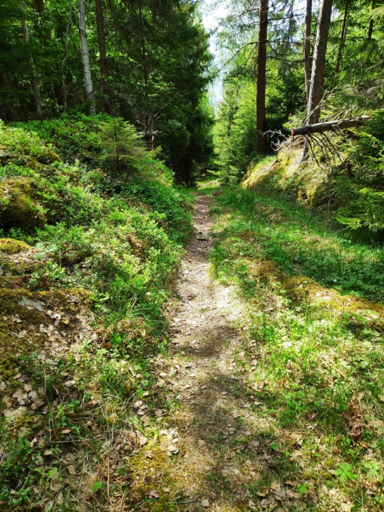
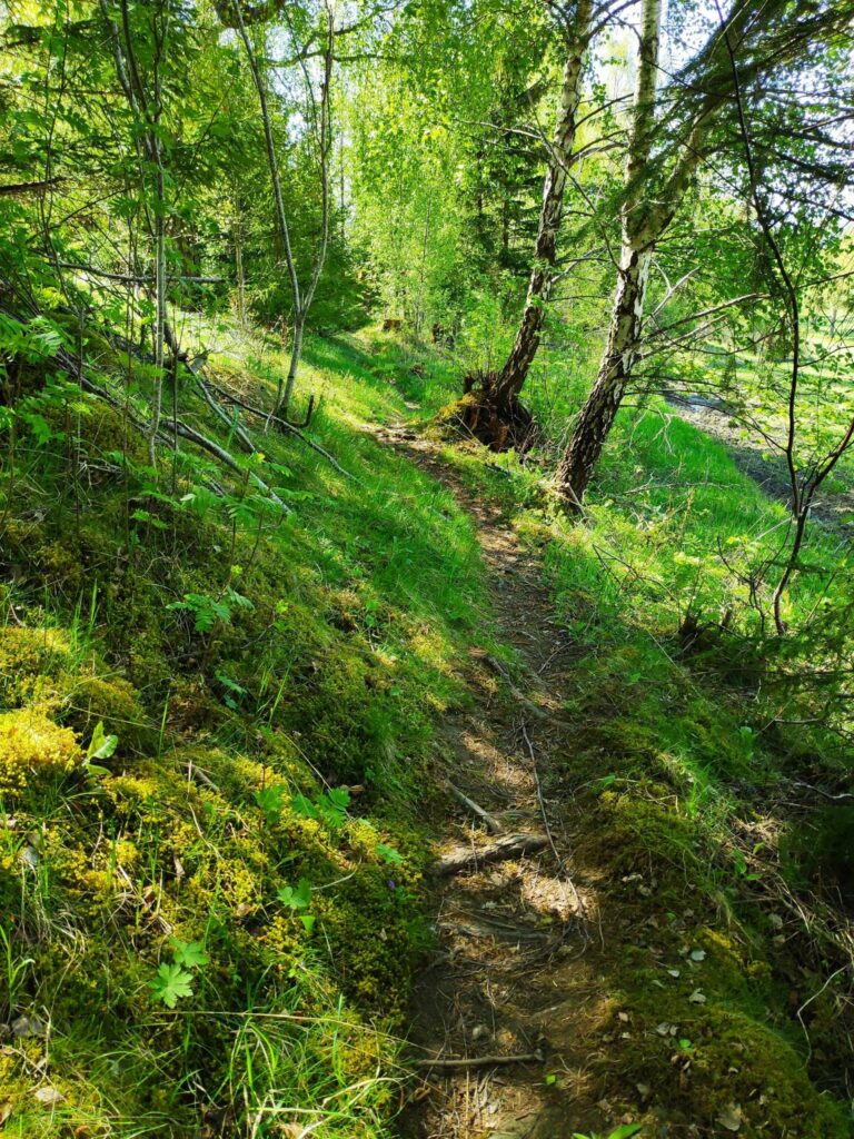
The trail from Rostad to Frøsen and onwards to Sleipvika is under the trees. At Sleipvika we came out to a road with several houses and farms.
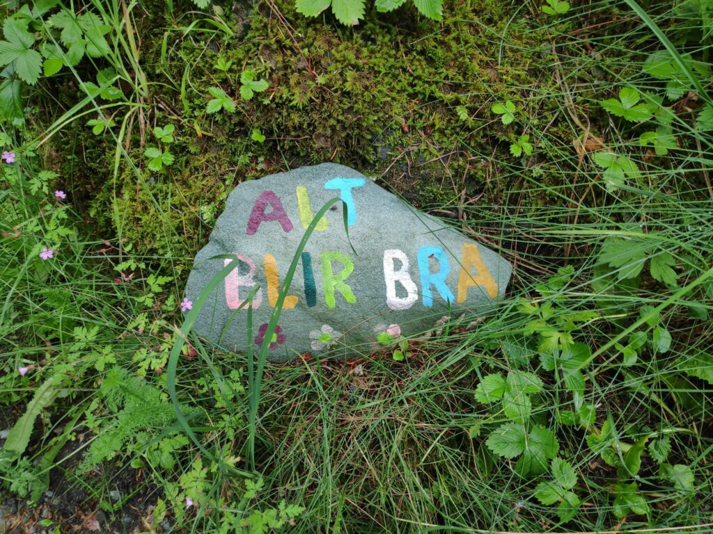
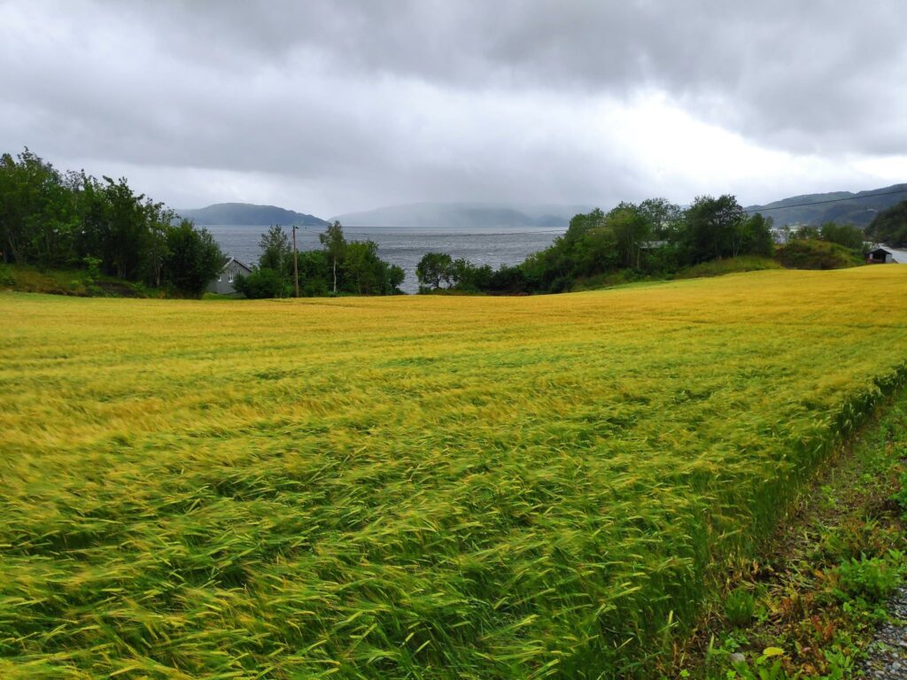
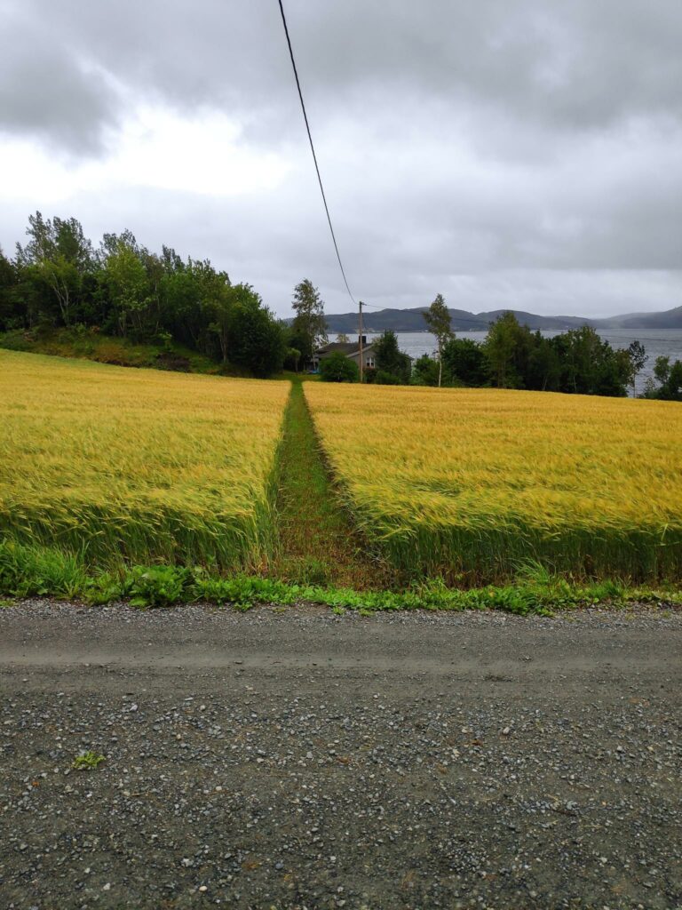
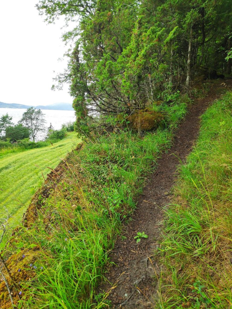
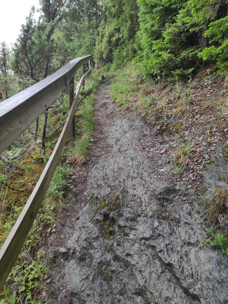
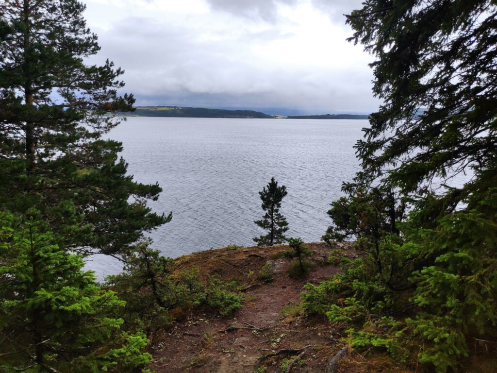
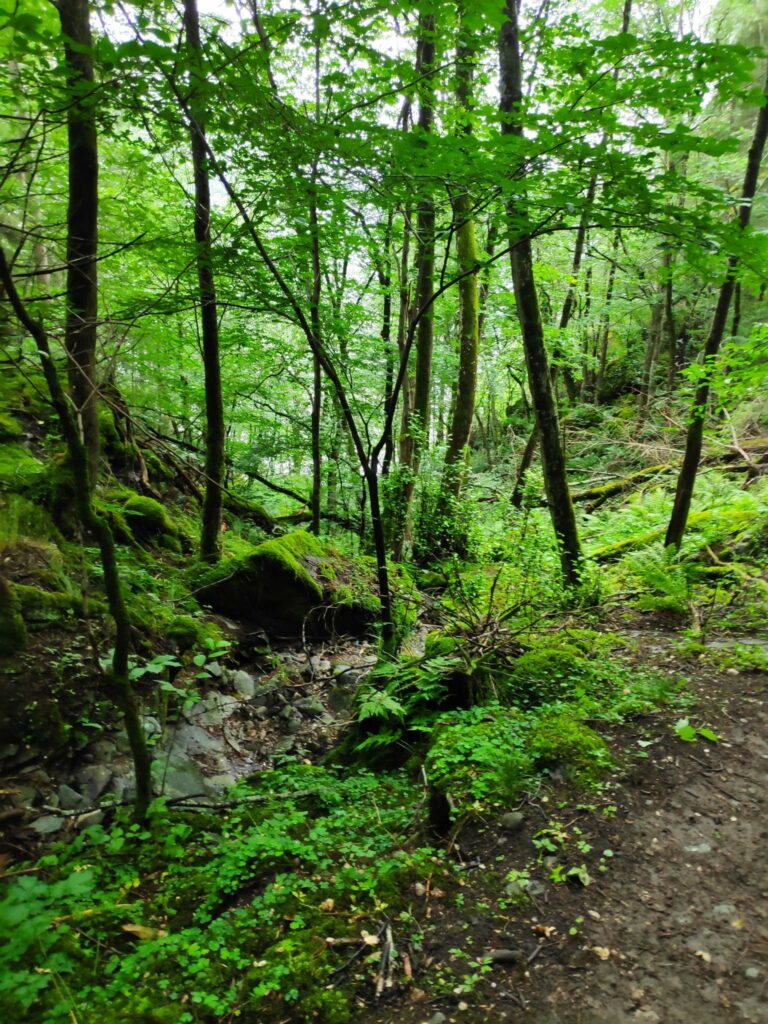
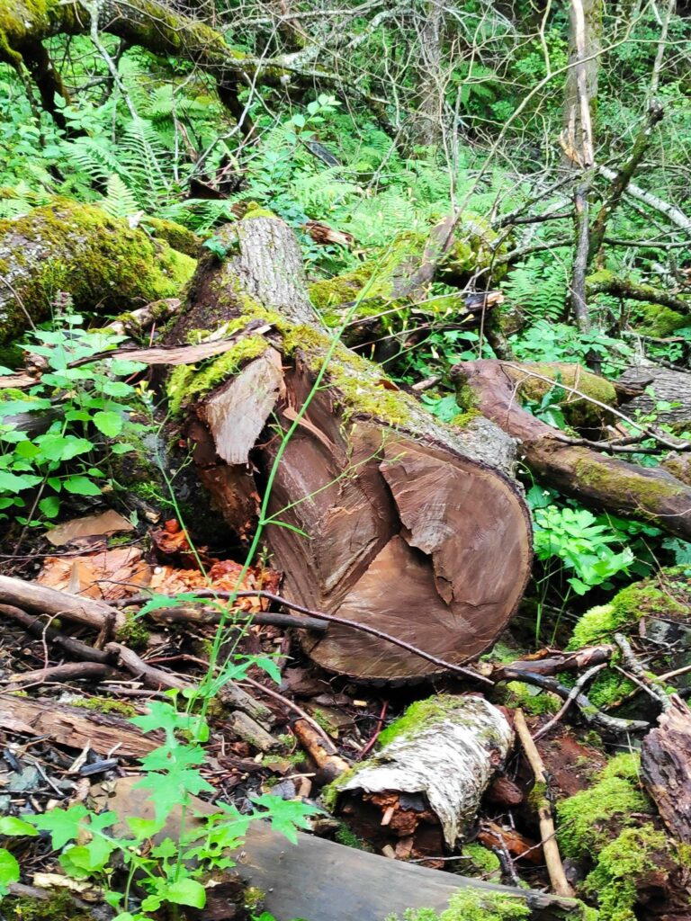
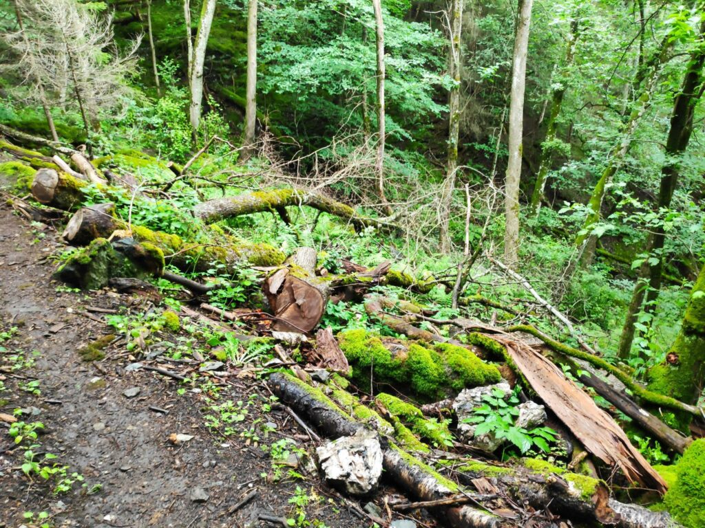
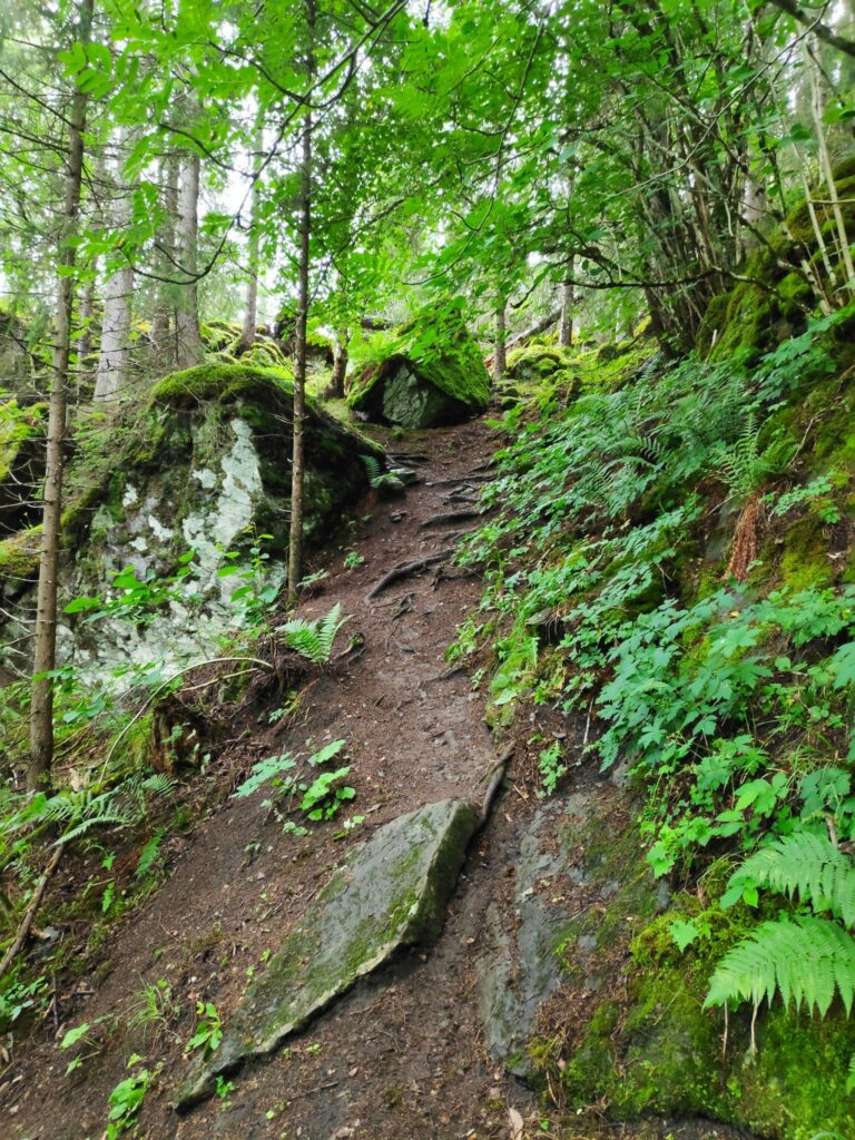
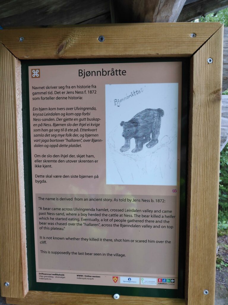
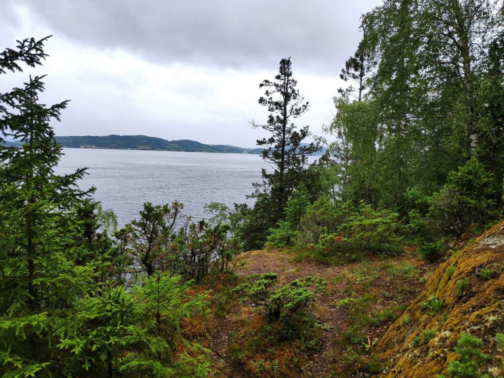
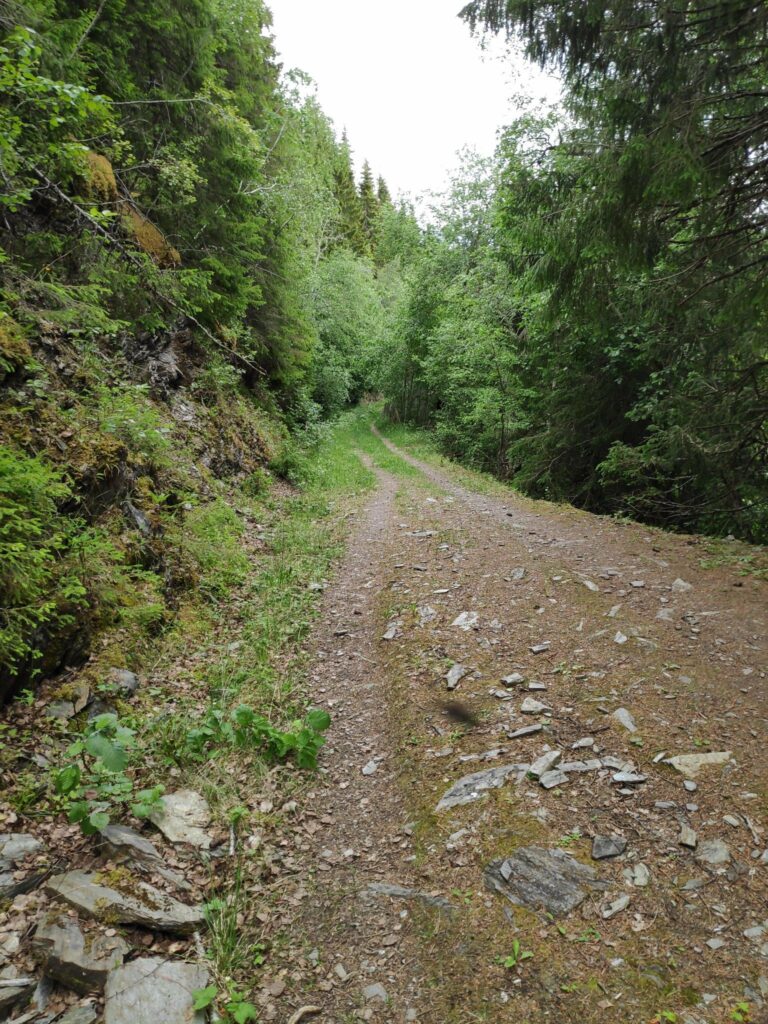
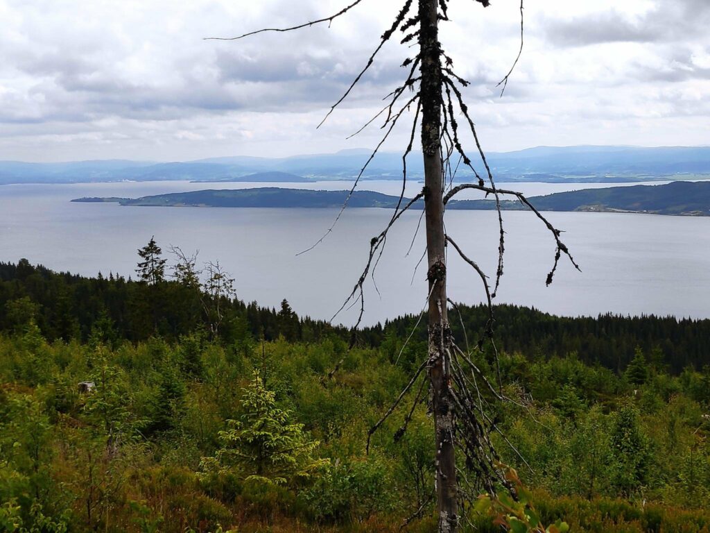
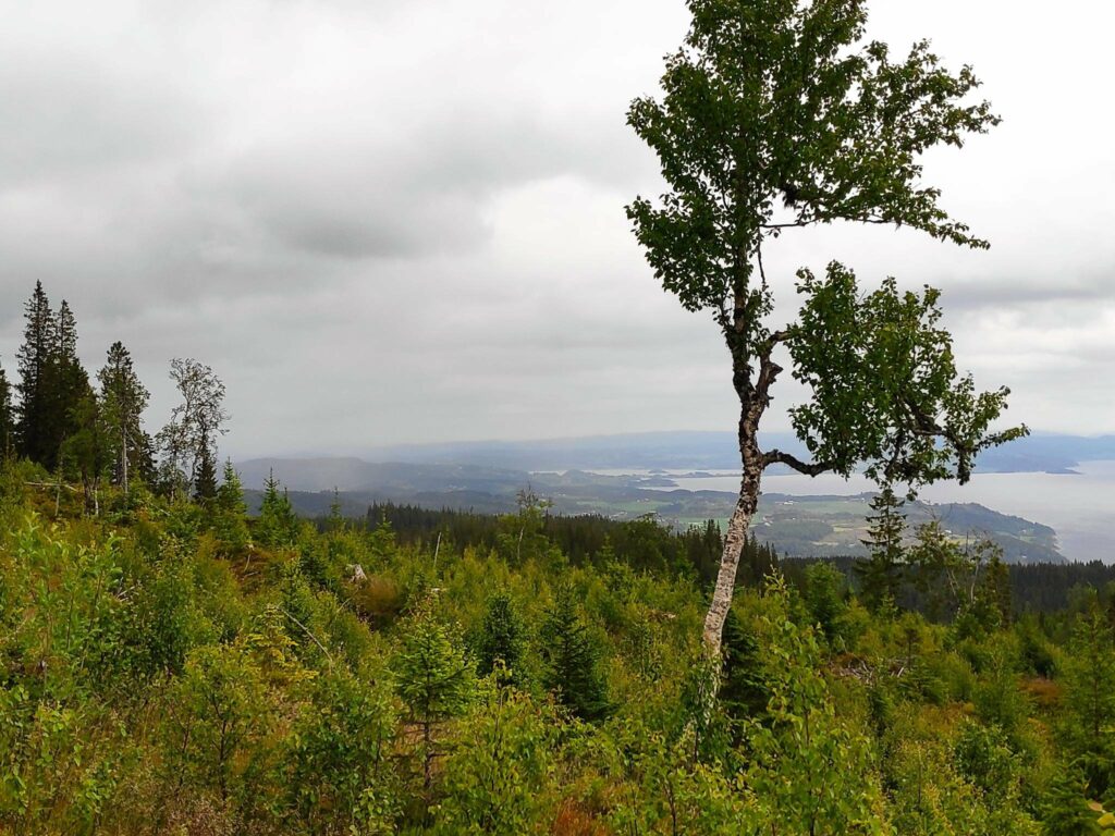
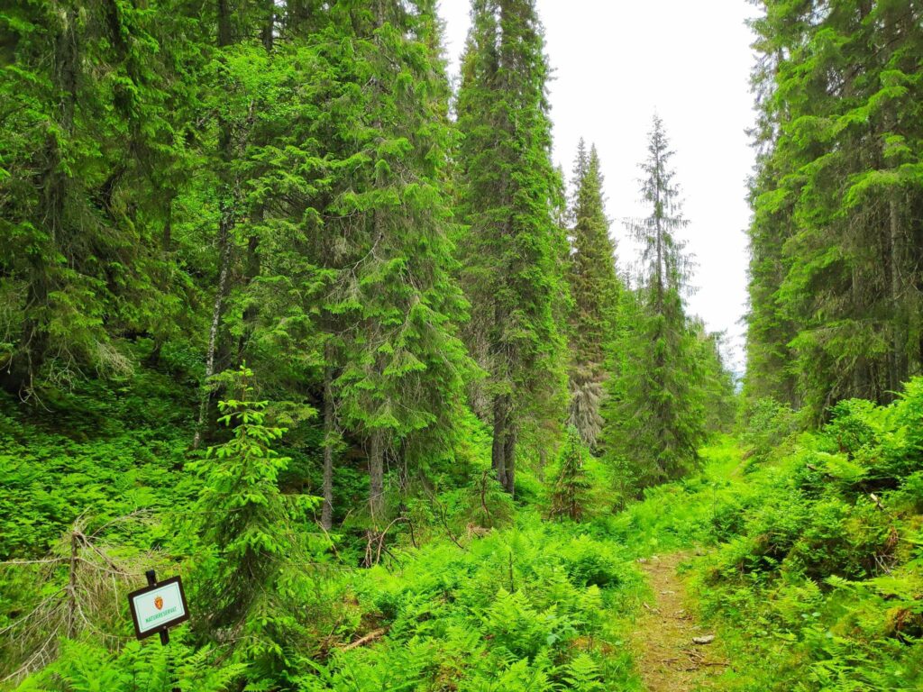
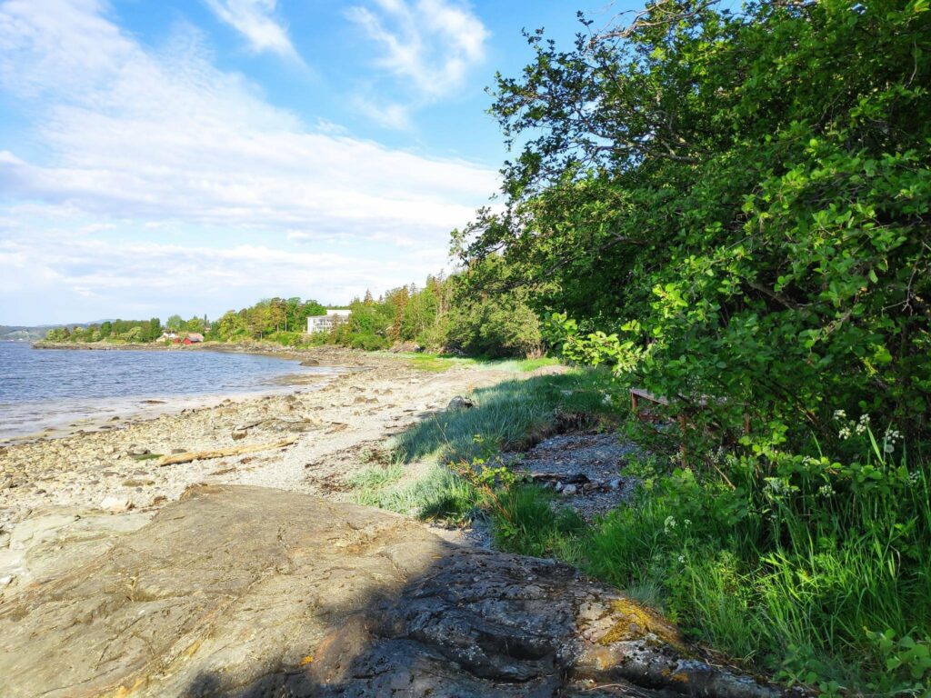
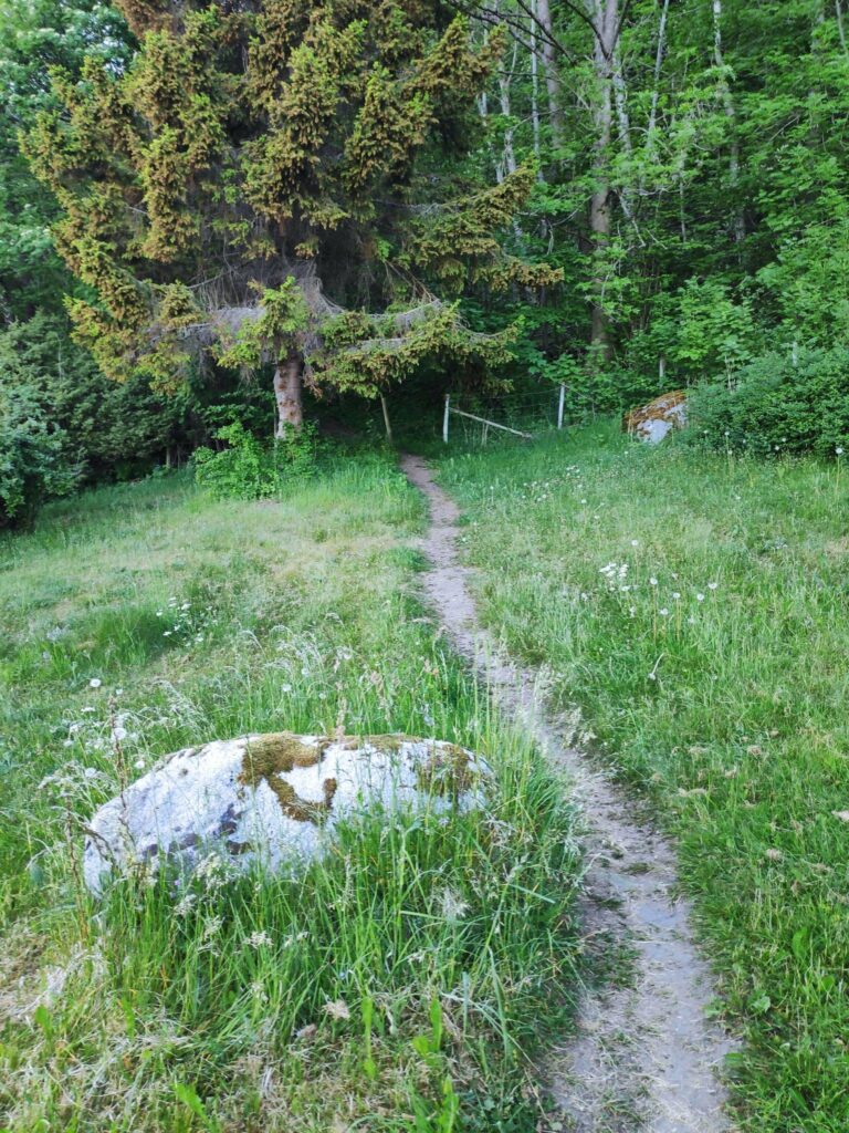
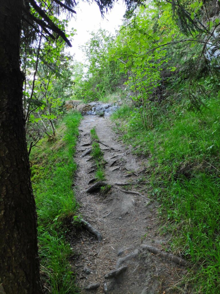
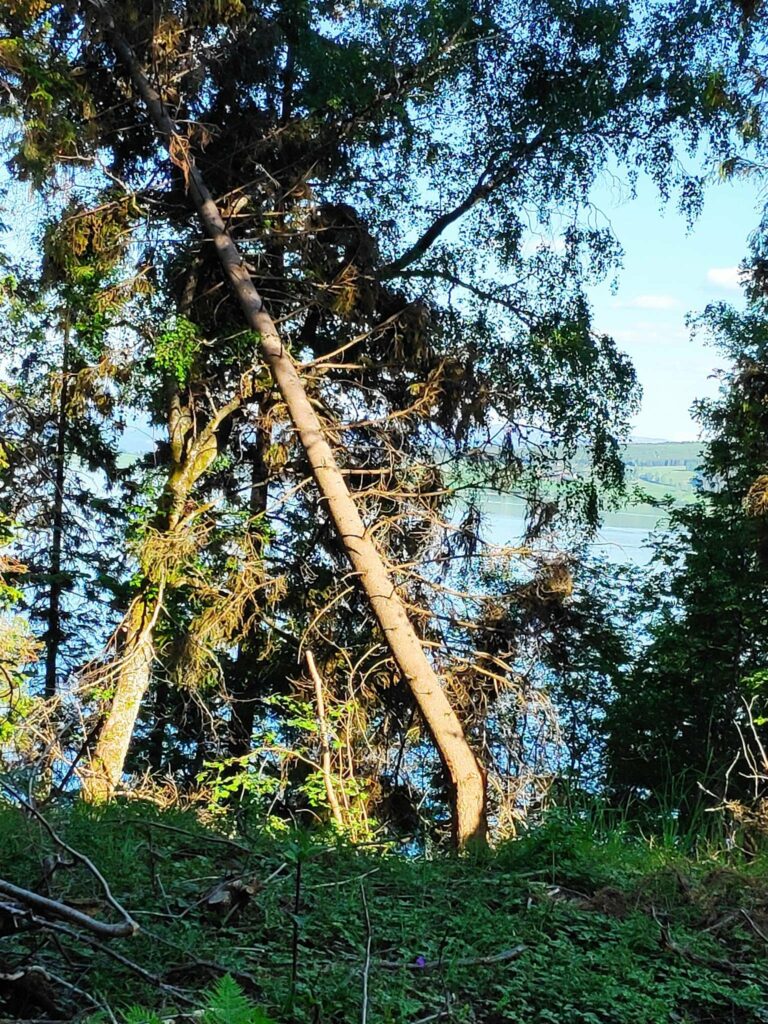
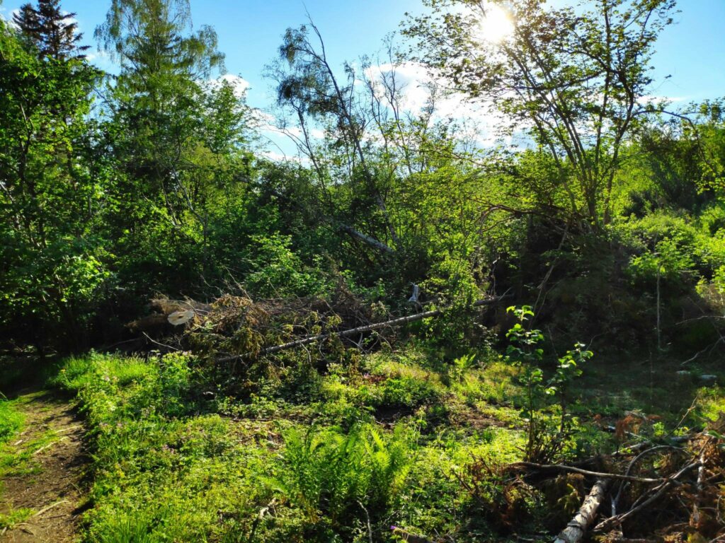
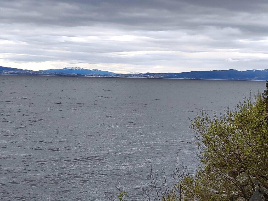
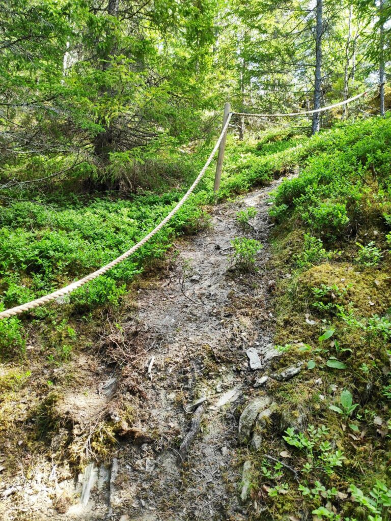
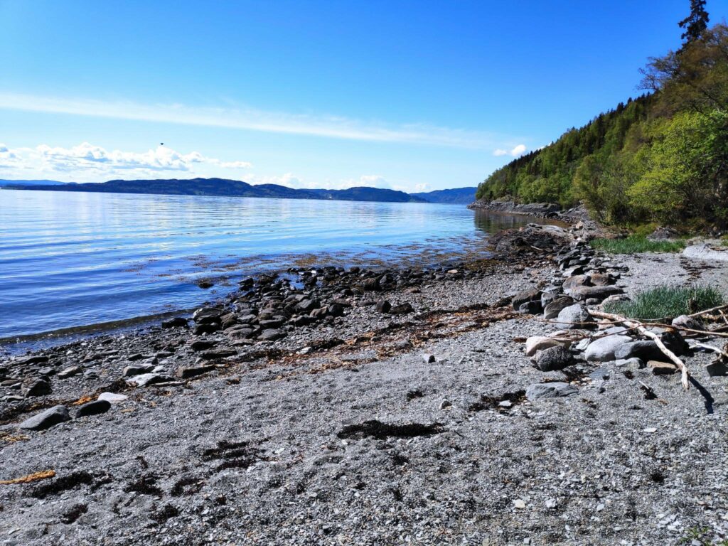
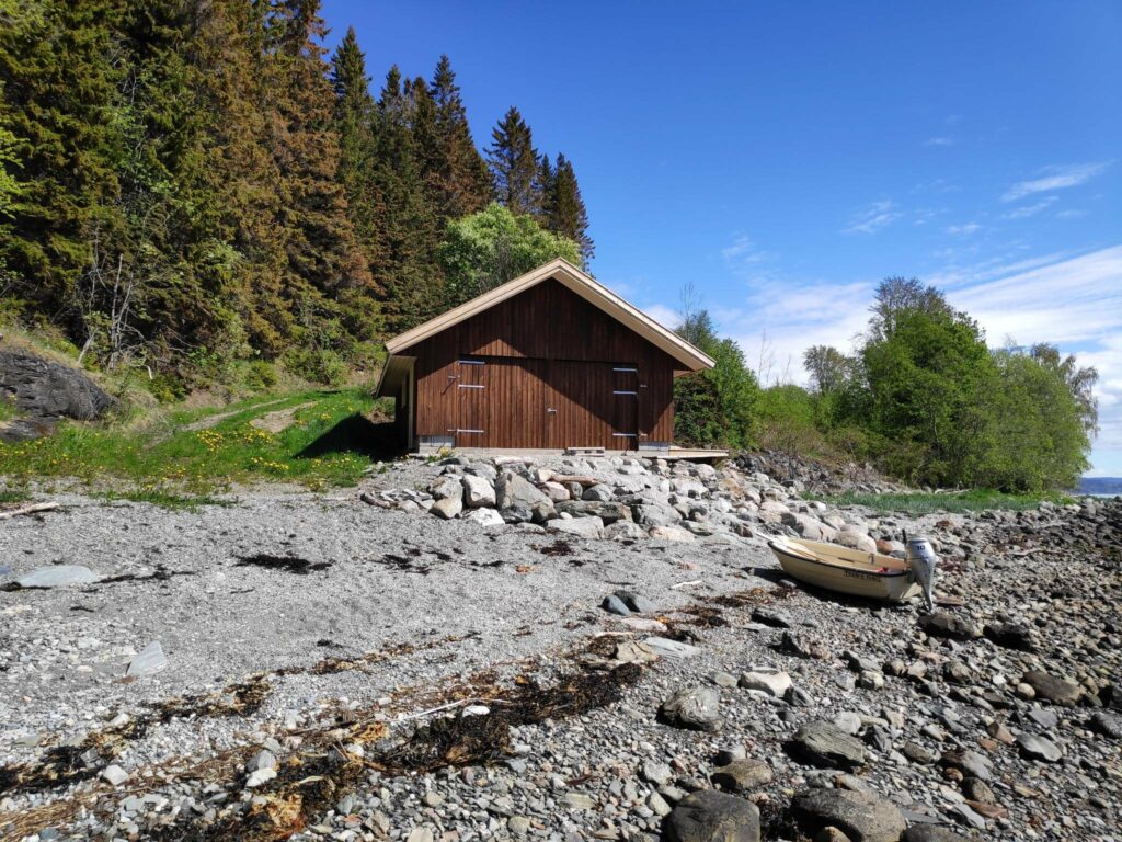
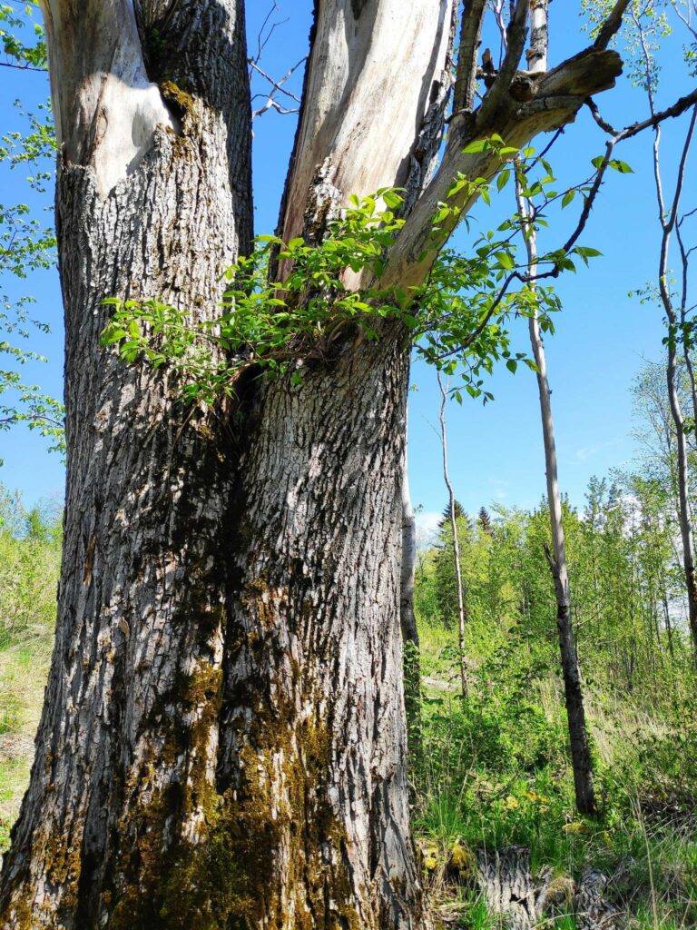
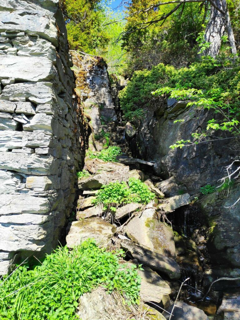
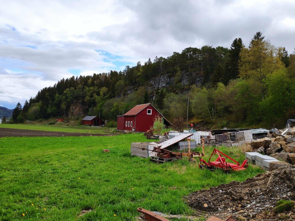
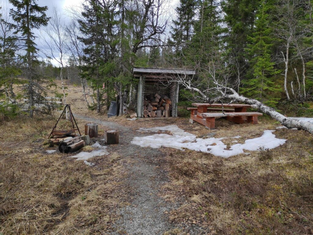
At Sleipvika, I saw this typical older house from this area with two entrances into the house. One entrance would lead into an entryway and the living room and would be used for guests to enter the house. The other entrance would be used as an area to take off muddy boots and clothing before going into the kitchen. I remember seeing this painted stone a year ago. The pandemic had started and with many activities in Norway shut down, the slogan “Alt blir bra” (meaning: all will be well) was commonly seen everywhere. It looks like this stone has been repainted newly.The sky was menacing but the rain seemed to be in the distance. This field of grain was turning a beautiful yellow and cheered up the landscape as we walked by.On the other side of this yellow field was a cottage and access to it seemed to be this path cut through the field of grain. In the foreground is the gravel road we were walking along.We are halfway on our 5 km walk.We’ve walked around the farms and head across the stream and we have a steep hill to climb.We’ve started to climb. We saw a deer making its way along the edge of the field, but he must have heard our voices and suddenly he dashed away, heading across the sands of the beach you see in this picture.We have headed into the trees again, but the climb is steep and narrow.As it has rained for two days, the trail was muddy in places. I was very glad to have a railing here as the drop goes straight down probably at least 50 meters.Eventually we got to the top and here there was a picnic bench to sit on and catch our breath from the climb. The view is looking over Trondheim Fjord to Ytterøy.Bjønndalen is a narrow ravine that goes from the farms at Nes and Rotvoll, down to the sea. There wasn’t much water in the stream at this time of year.This tree, I think an elm, has fallen down. In this part of the forest, with steep slopes, the ground can get washed away under the trees and eventually they fall. It also looked like some humans had come along and cut it up, possibly to get it off the trail. This was the first time I had been this way this summer, so I don’t know how recent it was.Trees have long lives, but they don’t last forever.One more very steep and muddy section to get to Bjønnbråtte, a place which we go to at least once a week.Bjønn = bear. There is a story about the last bear in the area. Perhaps he was chased to here and scared over the cliff. The view from Bjønnbråtte.
The walk from Bjønnbråtte to our house is about a 20 minute walk and is a walk we do quite regularly. It is partly on road and partly in the woods and mostly away from traffic. Once we had gotten to Bjønnbråtte today, I felt that we were “almost” home.
We were lucky with the weather and timed our walk for the correct time of day. I enjoyed our walk a lot. We haven’t been out for longer walks much as we have had quite a lot of warm weather and the last few times we have been out there have been a lot of flying insects, which I don’t like. Today was much cooler, and I didn’t notice any flies at all while we were walking.
It also made a change doing the walk just the one way. It is simpler to be driven to a place and then walk home, than to arrange to be picked up when one is tired. We also wanted to do the steep climbs going up them, as they were as slippery as expected. I always prefer to do very steep climbs going up, rather than down, if I can choose.
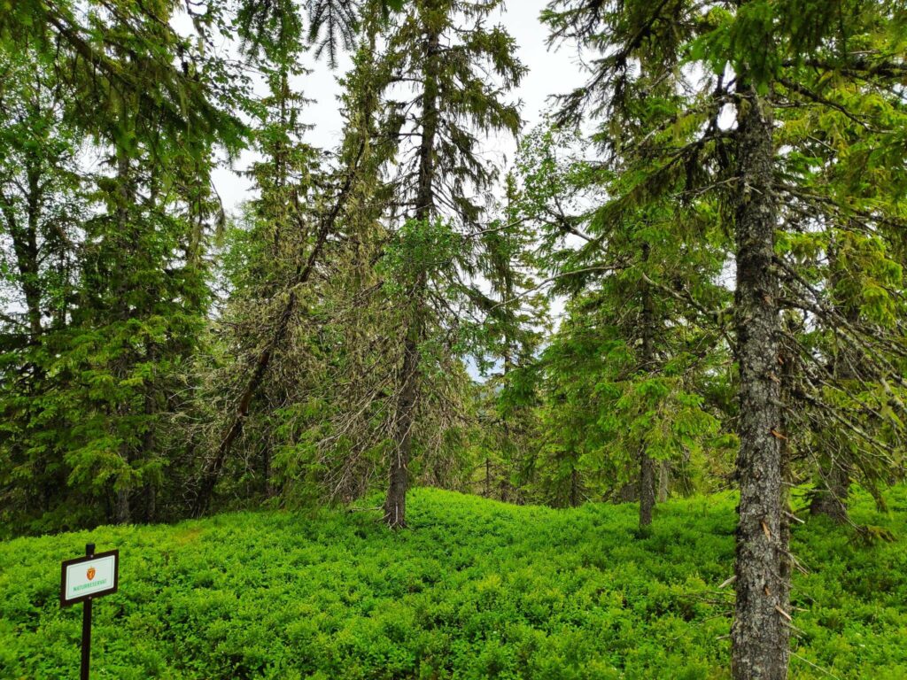
Sunday’s walk, with my husband and son, was to a hilltop not that far from where we live. I like the walk to Storlia (The Big Hill) and it is a walk I like to do about once a year as the views are spectacular from the top. However, it is quite a climb and I suggested we do the walk today while the temperature wasn’t too hot and there was a bit of a breeze.
We parked the car at about 120 meters above sea level and the hilltop we were heading to is about 380 meters above sea level, so this was a walk with a climb. Some parts of the path are quite steep, but I’ve done this walk several times and was prepared for it. The view from the top is worth the climb and the weather looked like it would be a good day to do it.
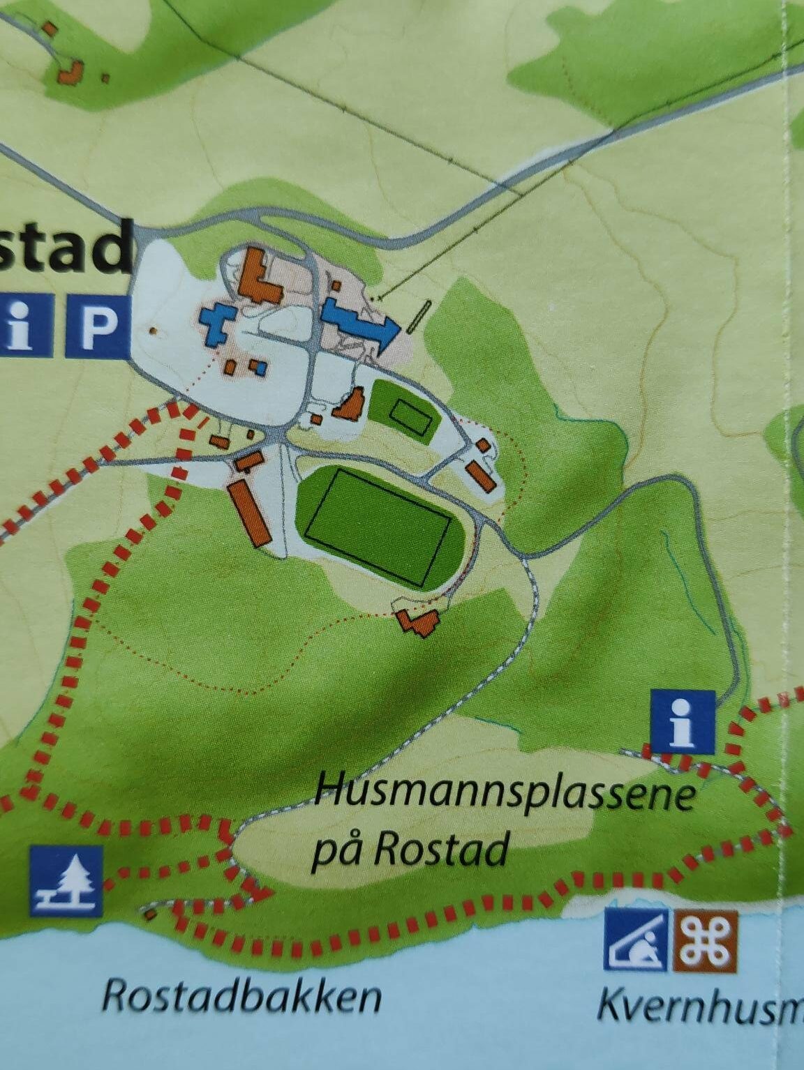
It can always be wise to have a picture of the map on your telephone so you know where the major trails will go. We are at the point with a red arrow
We parked at Gammelplassen where there is a map of the trails in the area and sufficient place for several cars to park. We have passed a closed gate so one can expect sheep on the hill.
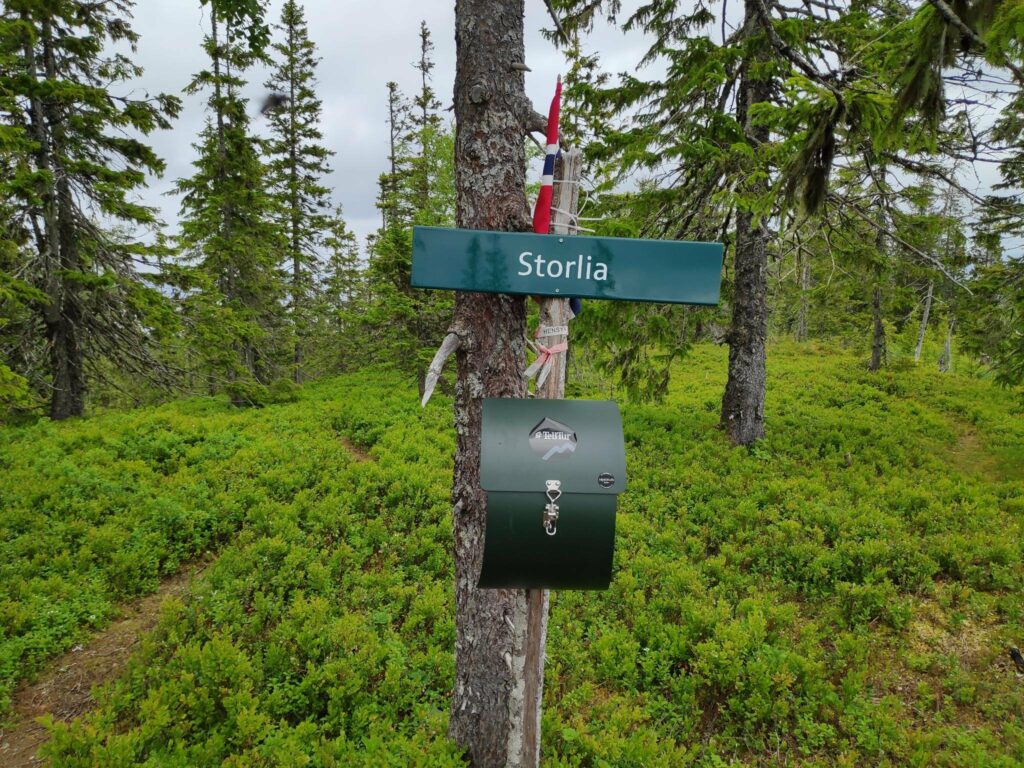
We are not that far from home, three kilometers to the bridge and one and a half kilometers over the bridge and through the woods to home. Note the ferns are growing well around the signposts.We have a two kilometer walk to Storlia on a red trail which means moderate difficulty with steep sections.
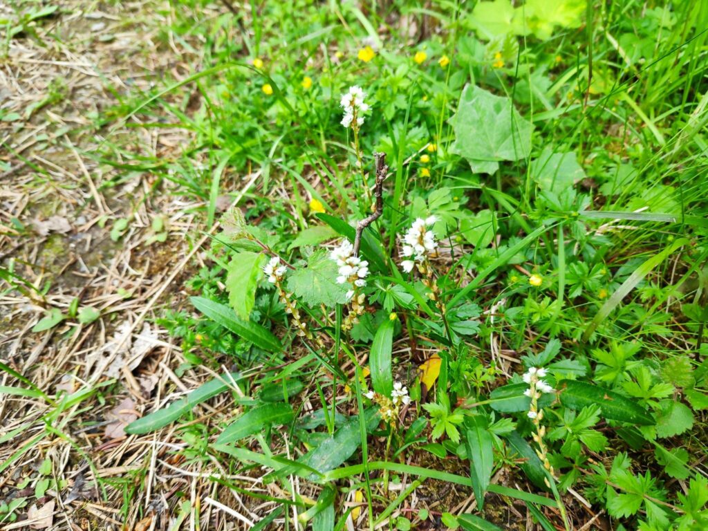
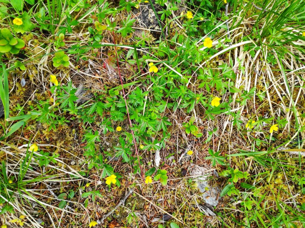
While walking uphill, I often stop to either look at the view or take pictures. Today I was mainly looking at the wild flowers that were blooming, many of which can be found in the wild areas of my own property. Taking pictures is a good way to get a pause while walking up steep trails. On looking at the pictures afterwards, I realize that it may be difficult to actually see the plant, however you will see the combination of plants that grow in the wild here.
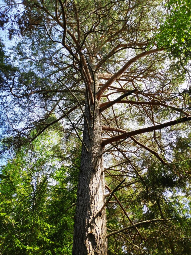
Today’s walk starts on a gravel road then climbs the hill, often on a trail that must have originally been a tractor road, probably made for harvesting the trees. Today the trees in this area are quite tall and it is many decades since they have been harvested.
Looking back down the trail after climbing for a bit. The others are ahead of me. I always like an excuse to stop in the middle of a steep section.
I’m no expert with plants but here are some of the common ones I saw on today’s walk. I have tried to find the Latin and English names as well as the Norwegian names.
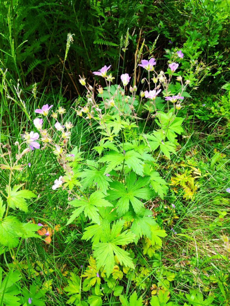
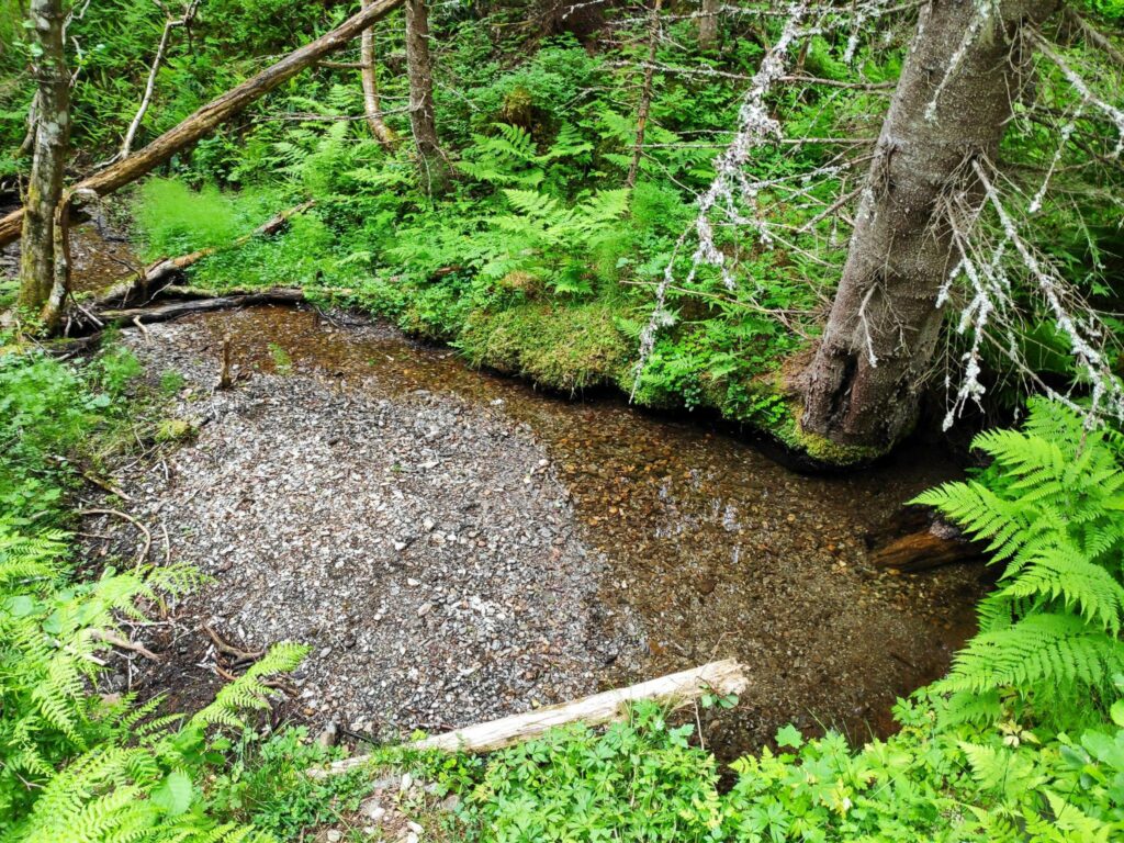
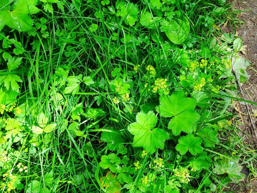
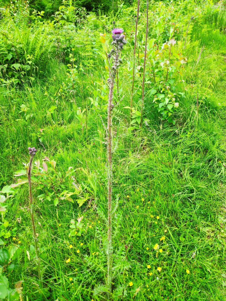
Vaccinium vitus-idaea is a member of the heather family. Called “tyttebær” in Norwegian and “cowberry in English, it produces a red berry that makes a nice jam to eat with meat. For those who live in North America, it would be used instead of cranberries.Ranunculus repens is a member of the buttercup family. It is called “krypsoleie” in Norwegian and creeping buttercup in English.Geraniaceae, sylvaticum is a member of the geranium family. It is called “Skogsstorknebb” in Norwegian and crane’s bill in English. It is a very common wild plant in our area, growing along roadways and open meadows.There was a little water in the stream, but we haven’t had much rain recently so there was little flow to the water. May and June have been dry months this year.Alchemilla family. This is a very common plant and I found it difficult to figure out exactly which plant this is. In Norwegian it is called “marikåpe” and I think it is called “Lady’s mantle” in English. It grows as a weed in our lawn and is difficult to remove. Along the edge of a road, it is a pretty plant with very large leaves. The thistles were just starting to bloom.I’m not sure what these blue flowers are, but they are a pretty blue when there are lots of them.
The top of the hill, and the goal of the walk is at the edge of a nature reserve called Skavdalen. This nature reserve was created in 2017 to protect old forest and covers 1012 decares (about 250 acres). (My source is only in Norwegian.)
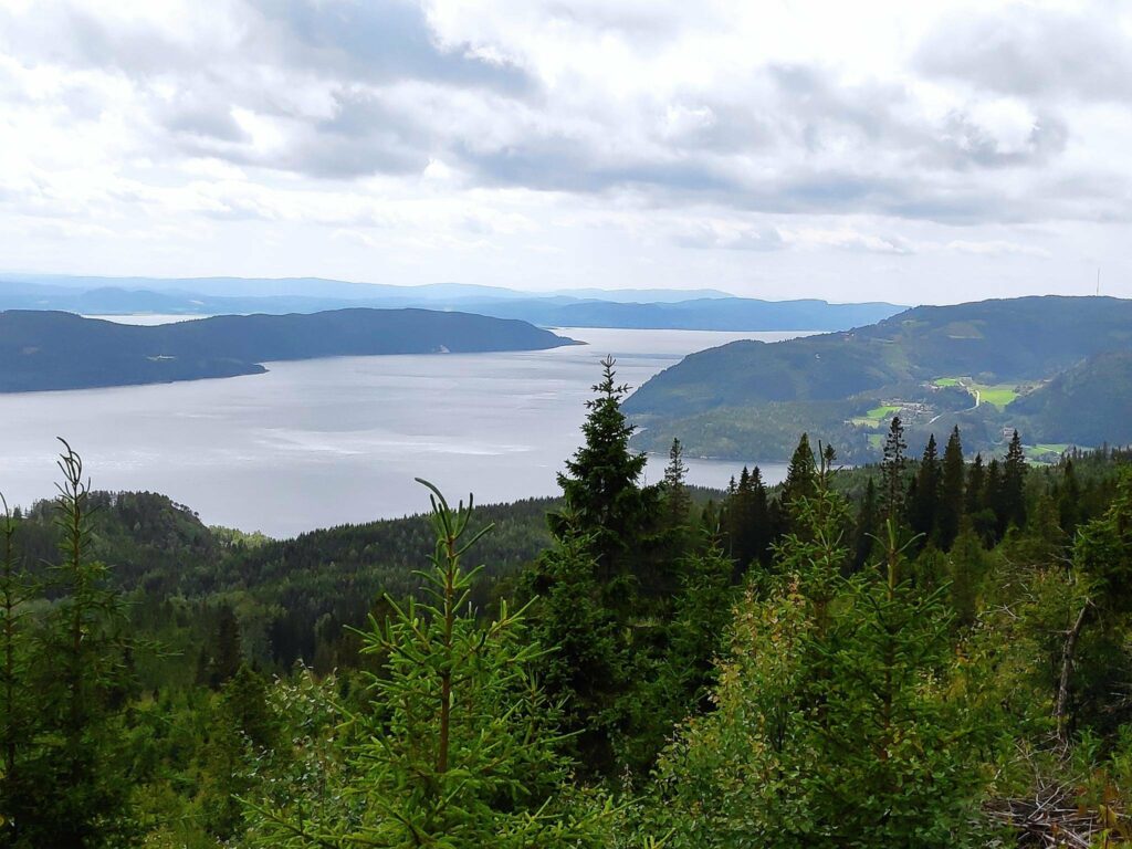
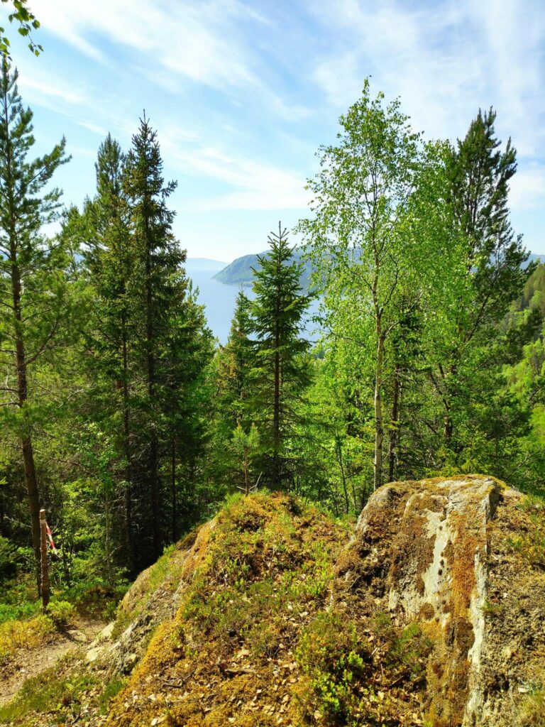
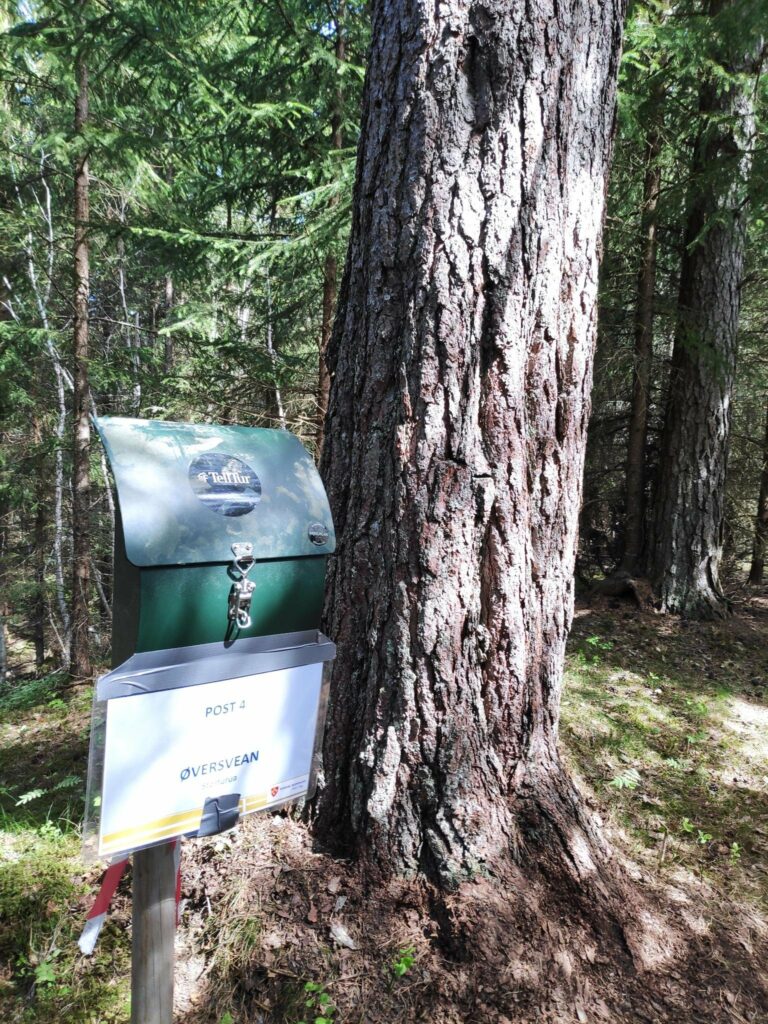
The top of Skavdalen nature reserve which covers 1012 decares of old forest. Here there were primarily spruce trees. On the forest floor there are cowberries and blueberries.We reached the goal of our walk. It was time to check in and get 40 points. There is a picnic bench to sit on and enjoy the view while one rests before heading downhill again.The view from the top is the reason for the walk. Even on a cloudy day, the view was spectacular. This picture is taken looking west with Mosvik center on the right and the island of Ytterøy on the left. We are at an elevation of about 380 meters above sea level.The western half of Ytterøy with Levanger in the background.The eastern half of Ytterøy with Verdal and Levanger in the background.Looking towards Straumen where it looks like it is raining. The agricultural area is Utøy.
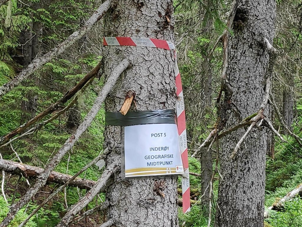
Today we gave ourselves a longer walk by also going to the post labelled “Inderøy’s Geographic Mid-point”, which is located in Tungdalen. It was about 700 meters from the trail we had taken up to Storlia, so we decided to find it as well. Though the trail went downhill at first, much of it was on a relatively level elevation. We entered Skavdalen nature reserve and with only one missed marking, found the post on the hillside.
The path to the geographic center of the municipality of Inderøy is not very well-travelled. This is a new post this year and it is still early in the season.Here we entered Skavdalen nature reserve. We are walking along a narrow valley with a small stream at the bottom, though there was no great amount of water in the stream at this time of year.We found it eventually, on an old tree, up a slightly muddy slope.
Then we turned around and headed back to the car where we were all glad to sit down. We had been walking for about 2 hours.
I like to take the walk up to Storlia once a year, but I did not feel the need to go to Inderøy’s geographical mid-point again, though it was interesting to do it once.
After a shopping trip in Trondheim, my husband and I were looking for a small park where we could relax, eat our sandwiches and have a walk before starting the two hour drive home again. This blog article is about the place we found.
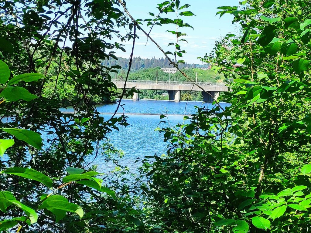
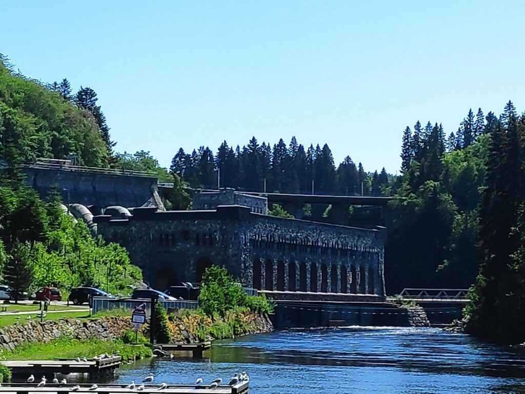
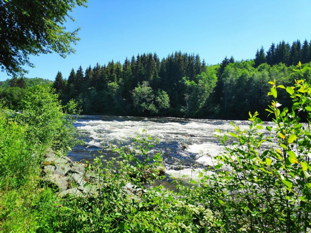
The Nid River is the river that flows through the city of Trondheim. It is 30 km long and starts in Selbu Lake and empties into Trondheim Fjord. On its journey it is dammed three times and used to make electricity in six places. We came across the dam called Nedre Leirfoss (Lower Leir Falls). Though today there is no waterfall visible from where we were, there is certainly a considerable drop which would be why this location was chosen for a dam and electricity production. All the water is returned to the river after having been used to produce electricity, primarily for the city of Trondheim.
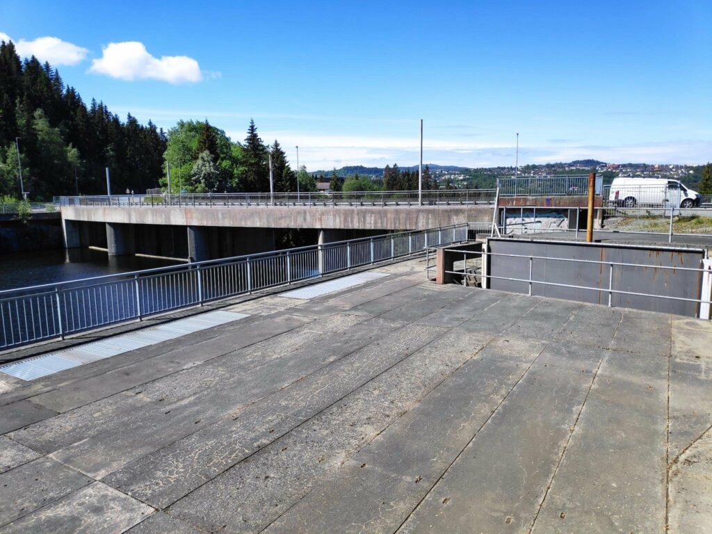
We drove over this bridge and it wasn’t until we had parked our car that I realized that it was a dam.There was a car parked here with the name “Statkraft” on it and the door was open to something under the road.
We were looking for a place to eat our sandwiches and we found a parking spot off the road on the eastern side of the bridge. We found a pathway into the woods which we followed for a bit, but it was obvious that there would be no comfortable place to sit and have our sandwiches. So I looked at the map on my phone again and realized that if we had driven just a bit farther there was a park with parking. So back to the car and we drove just that little bit farther.
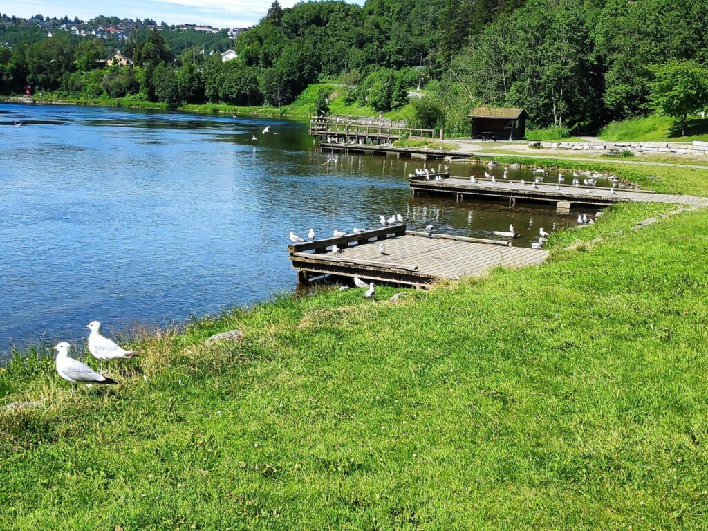
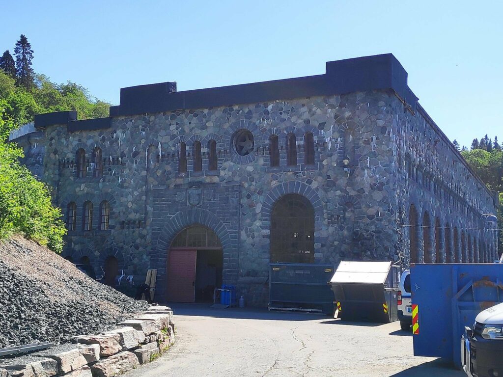
We followed a path into the woods. A sign had told us that we were in a nature reserve set aside in 1987. It is specifically to protect a deciduous forest of elm, ash, alder and grey alder.When we drove just a little bit further there was an open area right on the river. Because of the quantity of seagulls in the park, we chose to eat our sandwiches in the car and then go for a walk. I didn’t really want to share my sandwiches with the local residents. When we took our walk we continued along the path that followed the river.Looking up the river from the park, one sees the power station that was built between 1905 and 1910. It still produces electricity, but a newer power station has been built and was put into service in 2008. The new power station is completely underground and the water is returned to the river approximately here. At the top of the picture you can see the bridge that is over the dam and to the left you can see the large pipes that lead the water to the turbines. The water has a 27 meter fall to the turbines here.A close-up of the power station. The gates were open and several cars were parked here. The door to the building was open so there were obviously workers here.
A story from one of the signs in the area. The Canadian artist, Hal Foster, wrote and illustrated the cartoon series, Prince Valiant which was produced from 1937 to 1982.. Prince Valiant was the son of Kong Aguar of Thule, who lived in the wilderness of England at the time of King Arthur. Foster must have seen a picture or postcard of this power station and he used it as the basis of Thule’s castle in Vikingholm in the cartoon series.
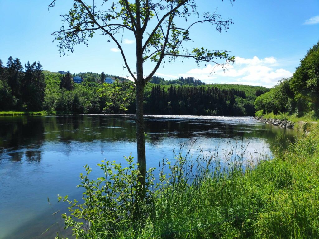
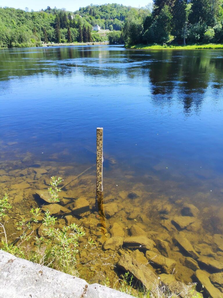
Naturally there was a turbine on display near the power station.As we walked away from the park, going down the river, sometimes we were in the shade of trees and sometimes out in the open. The path was very easy walking.The first part of the river below the power station was very smooth, though there was very obviously a strong current and a lot of water in the river. At this point we could see in the distance where the river became shallower and rocks broke the surface of the water.Looking upstream towards the power station. This stick was near the edge of the river and was obviously used to measure the depth of the water. I imagine that if there was any flooding, the path we were walking along would be covered in water.Two of the local residents enjoying a swim in a quiet section of the river.Here the river was certainly much noisier as the water tumbled over a rocky bed.
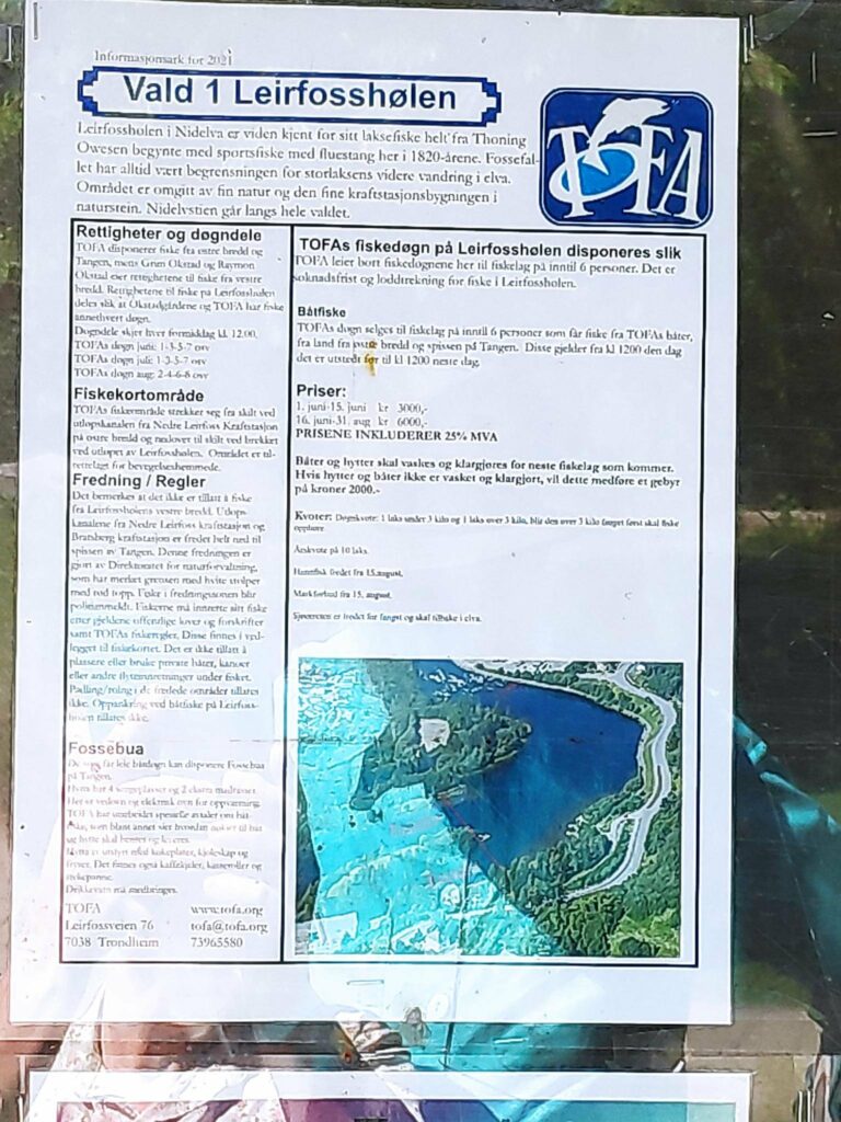
The Nid River is a salmon river up to the Lower Leir Falls, which was always its natural limit for the wild salmon. Today this area of the river is regulated for fishing, either from land or from boats.
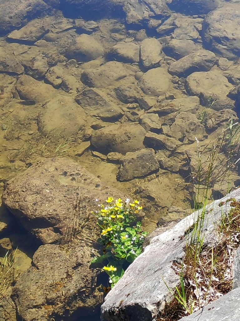
A small shelter for fishermen on the edge of the river.The rules are laid out with a map of this particular portion of the river called “Leirfosshølen”. It costs quite a bit to have a fishing licence here and each person is allowed maximum 10 salmon a year. The fishing season is from June 1 to August 31.Some plants like lots of water.
We had a very relaxing walk, for about half an hour, away from traffic. The day was sunny, but not too warm (about 20 degrees Celsius). We weren’t in a hurry. It wasn’t necessarily quiet, as the river was noisy. We met a few other people walking including those who were walking their dogs. Cyclists also used this path along the river. This was a little park I would go to again when I’m finished my shopping in the south of Trondheim.
Today’s walk was short and in the early morning, at about 8 am. My husband and I had been food shopping in Straumen and we chose a short walk to get some fresh air and exercise before breakfast and before getting down to work.
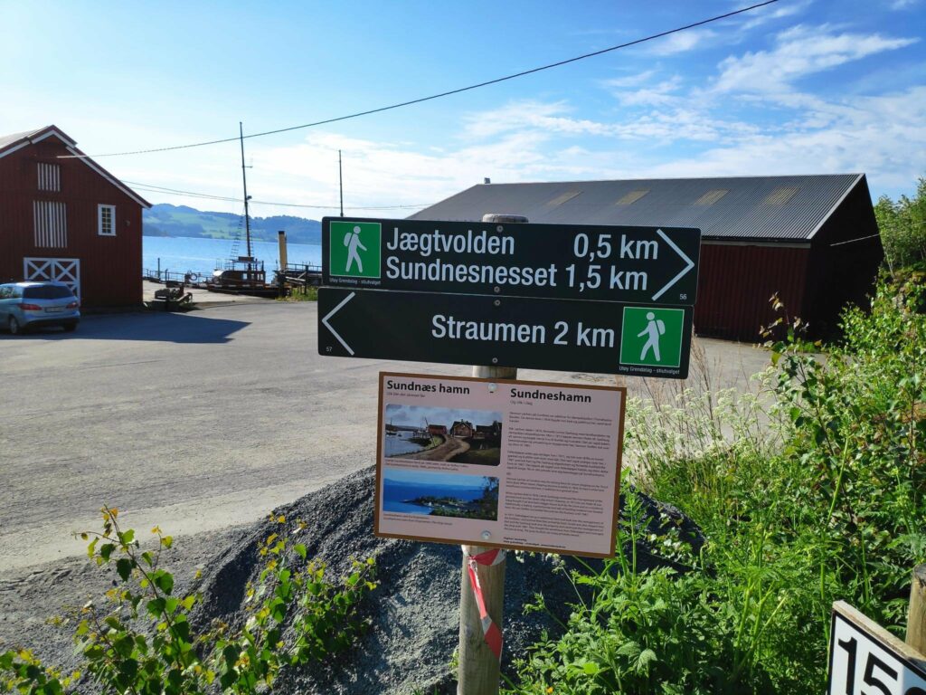
The starting part of our walk was at Sundneshamn which is about 2 km from the center of Straumen.
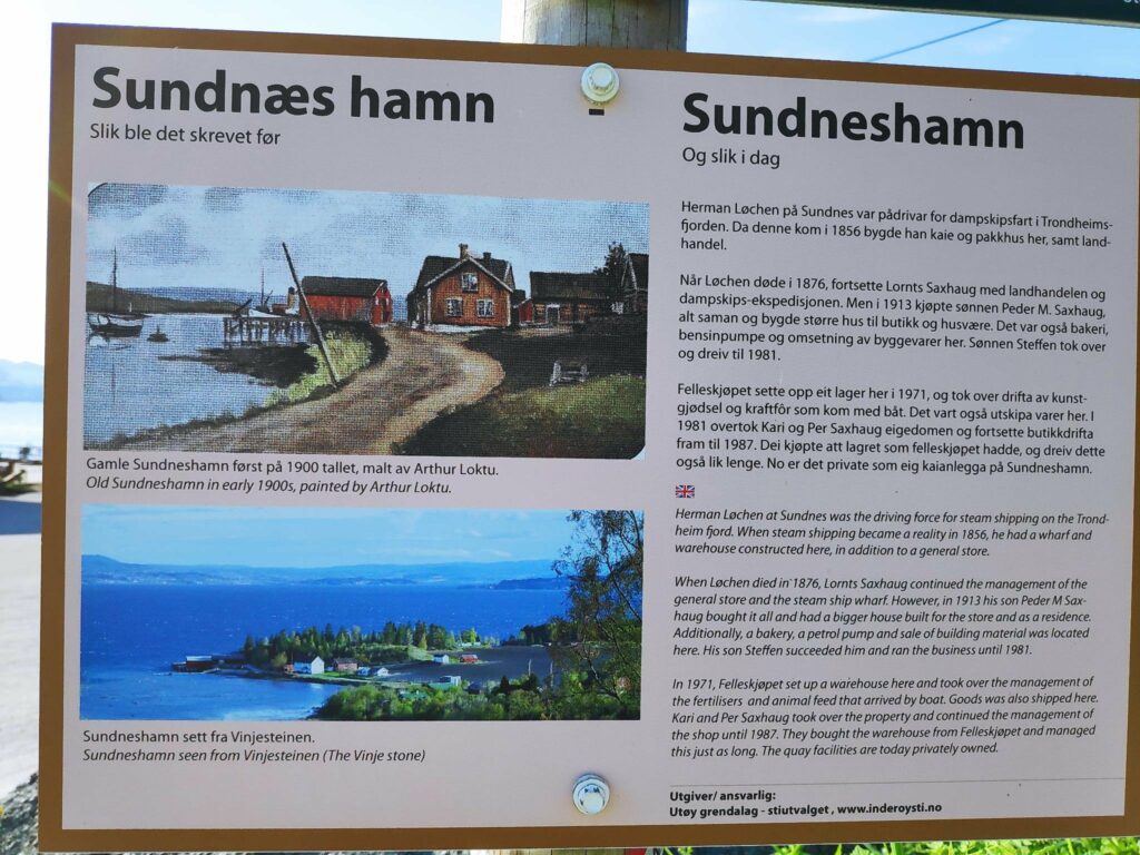
On the left is the name as is used to be and on the right the way it is written today. The top picture is actually a painting which was painted about 1900. The lower picture is taken from the hill in Straumen. The large white building would have been the store and Peder Saxhaug’s residence.
From the information sign: “Herman Løchen at Sundnes was the driving force for steam shipping on the Trondheim Fjord. When steam shipping became a reality in 1856, he had a wharf and warehouse constructed here, in addition to a general store.
“When Løchen died in 1876, Lornts Saxhaug continued the management of the general store and the steam ship wharf. However, in 1913 his son, Peder M Saxhaug, bought it all and had a bigger house built for the store and as a residence. Additionally, a bakery, a petrol pump and sale of building materials was located here. His son, Steffen, succeeded him and ran the business until 1981.
“In 1971, Felleskjøpet (a cooperative organization for farmers) set up a warehouse here and took over the management of the fertilisers and animal feed that arrived by boat. Goods were also shipped from here. Kari and Per Saxhaug took over the property and continued the management of the shop until 1987. They bought the warehouse from Felleskjøpet and managed this just as long. The quay facilities are today privately owned.”
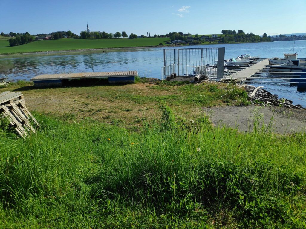
Today it is mostly the quay that is used as well as the small boat harbor.
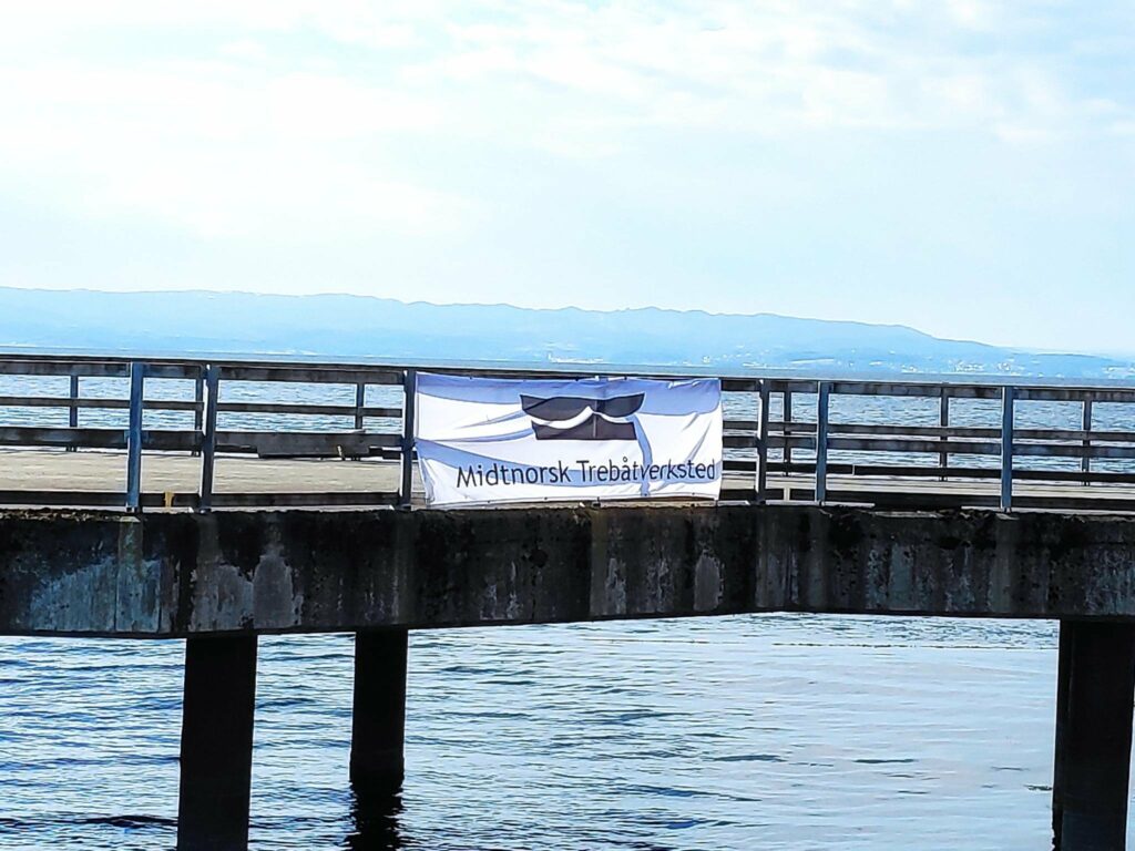
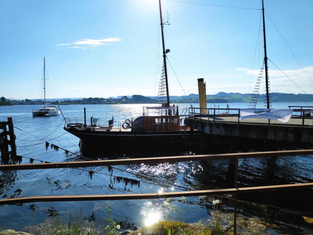
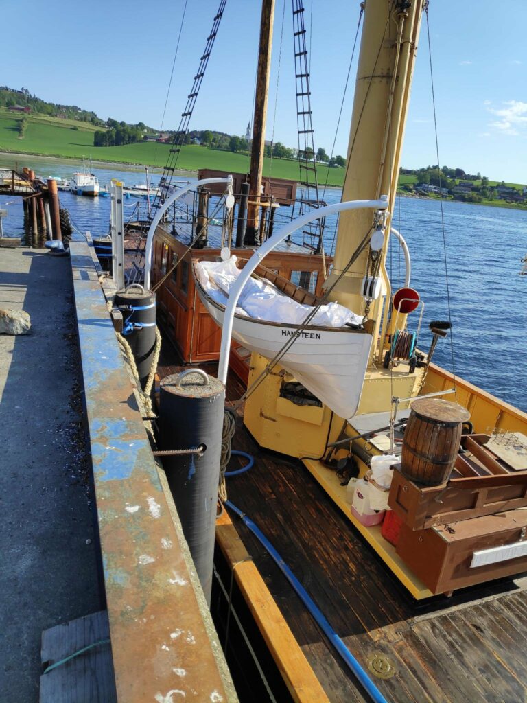
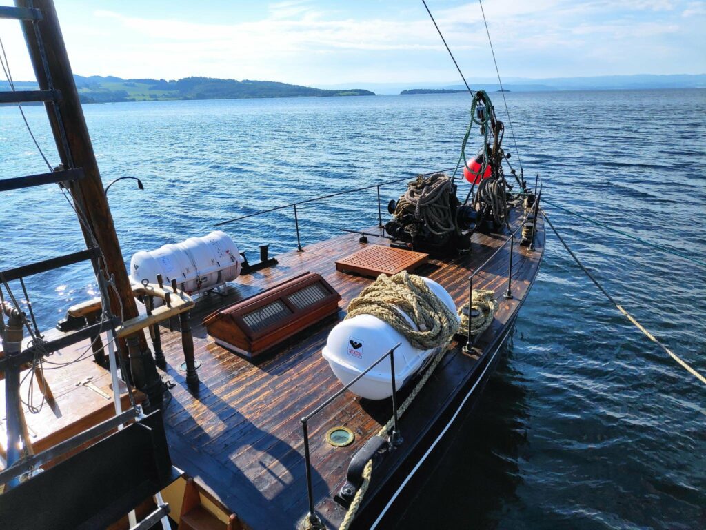
The small boat harbor at Sundneshamn, looking towards Saxhaug Church (you should be able to find its steeple in the background.Middle Norway Wooden Boat Workshop – this is at the main quay at Sundneshamn.SDS Hansteen at the quay.SDS Hansteen has been fixed up nicely. The tourist information calls it the world’s oldest steam sail ship.SDS Hansteen
As we started on our walk, we had the inevitable signposts.
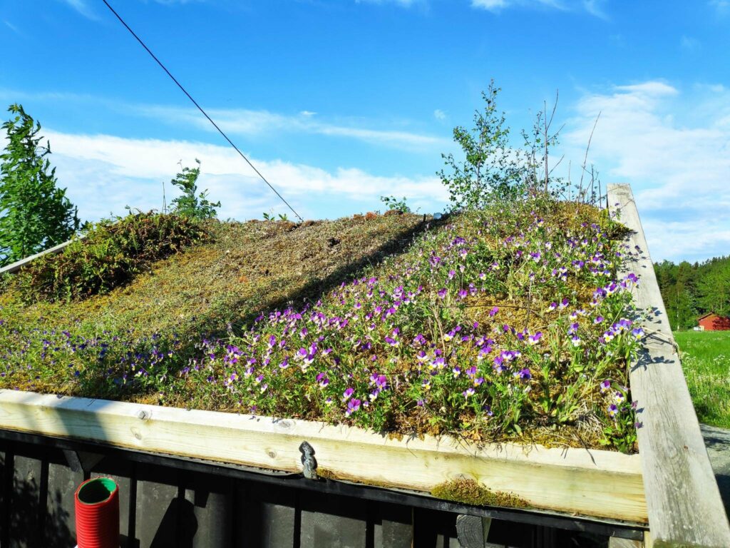
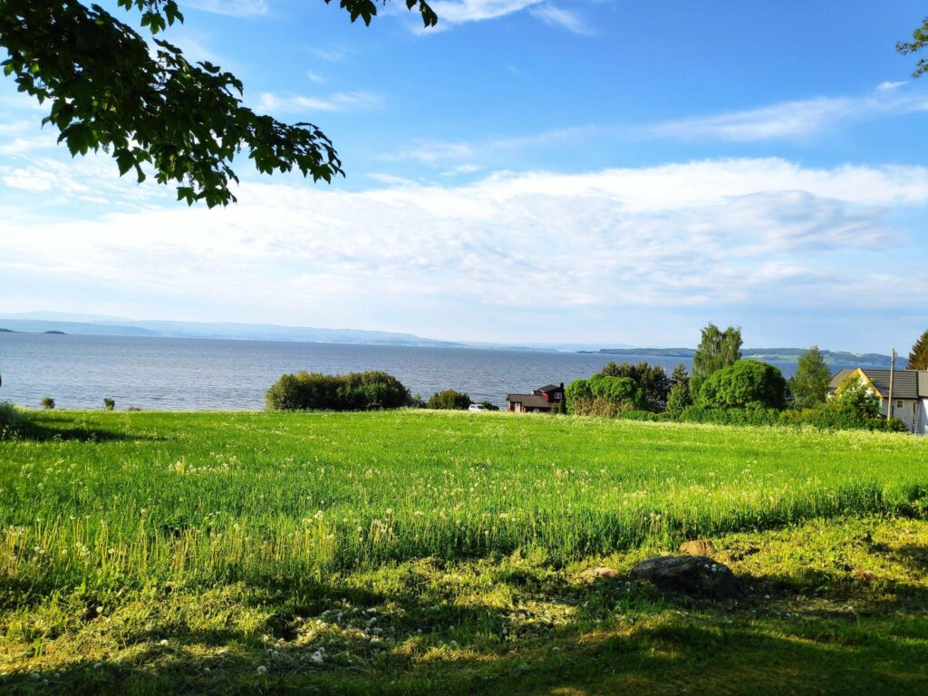
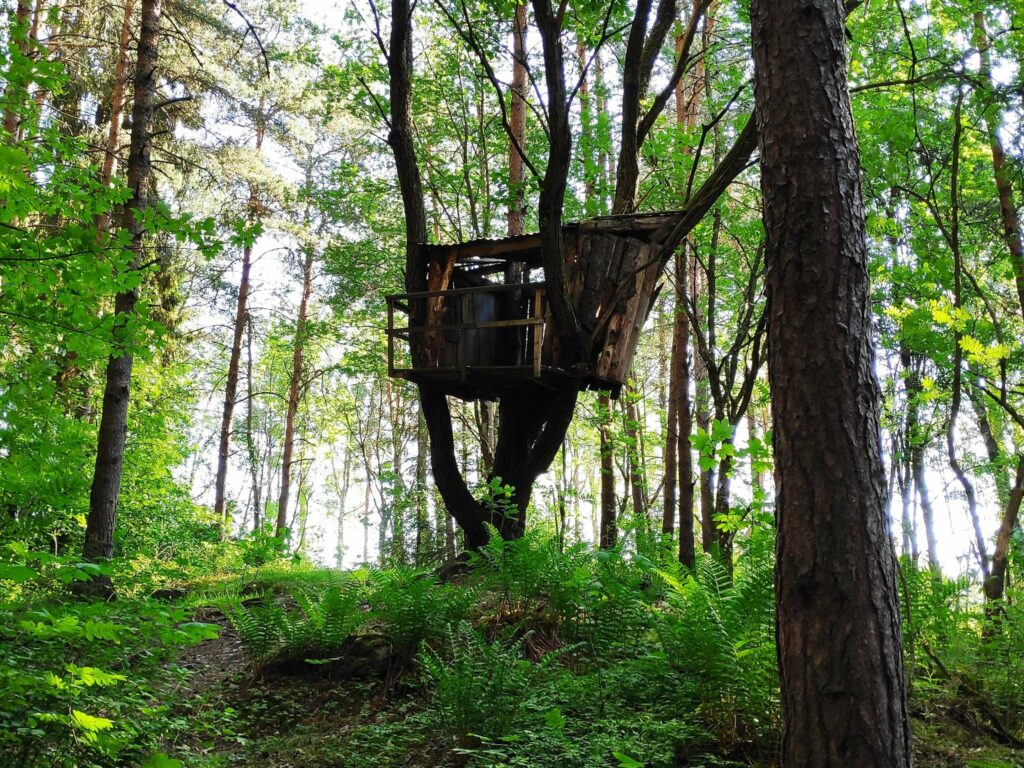
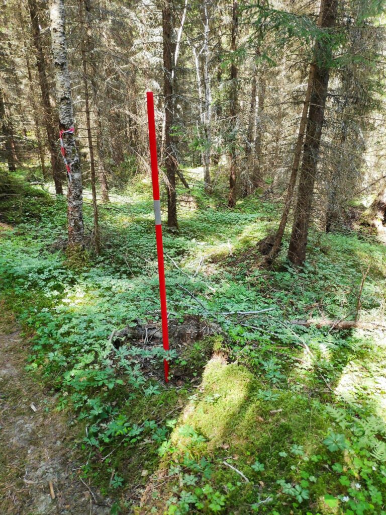
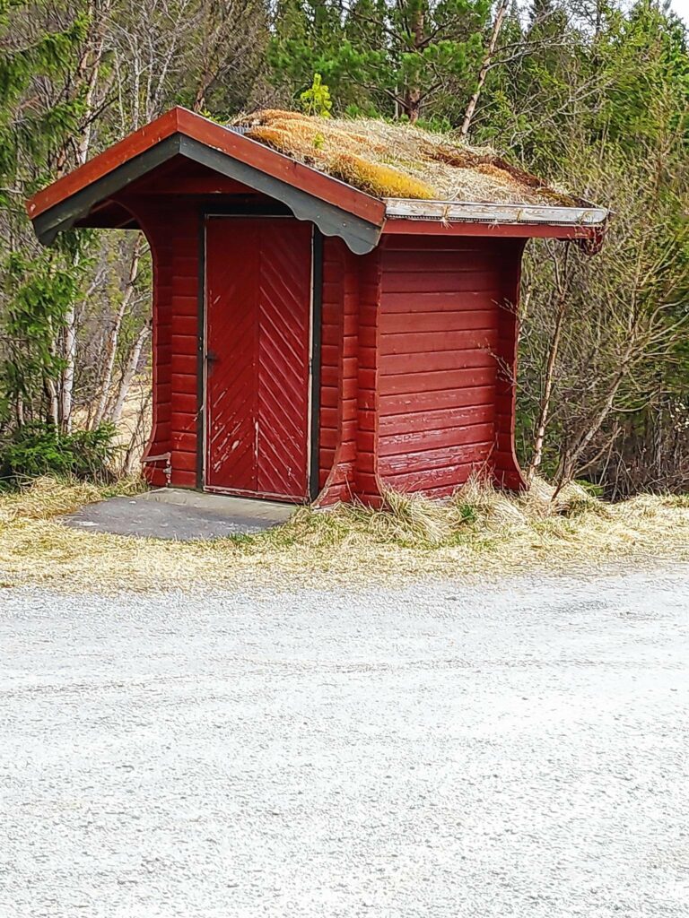
Sundneshamn in the background, with the warehouse right behind the signs. We are going towards Jægtvolden, the local hotel, but we aren’t going quite that far, so we probably walked maximum one kilometer on our walk, including wandering around the quay.We climbed a short hill and came across this small building with its grass roof. Wild flowers on the roof were unusual, though the flowers can be found all over the place in Inderøy. They are a type of pansy.At 8 am on a Saturday morning it was very quiet here. We walked by a few houses and some summer cabins. The view is looking towards Levanger.We then headed into a wooded area.Somebody had been building a tree house.If you weren’t sure where to go, there was a sign to give the correct direction.But first a walk out to the fjord. The white building in the background is Jægtvolden Hotel. We didn’t walk that far.Back to the main path and there was our check-in point, with the sign tied to a spruce tree. This was our turning around point and we headed back to the car.The smaller wharf at Sundneshamn.There are farms in the middle of the picture and behind that is route 755. To the right is the center of the village of Straumen. To the left is Utøy and home. There have been quite a lot of new homes built on the hillside. At the top of the hill is a small hotel, Husfrua Country Farm Hotel.
We enjoyed the short walk, but we were wanting our breakfast so a half hour walk was sufficient. In the summer months, it is often quite enjoyable to go for a walk around 8 am, when the world is still peaceful, the sun is shining brightly and the temperature is still relatively cool. Enjoy your own walk today.
Yesterday evening, my husband and I went for an hour’s walk. It was a warm evening for us, at about 26 degrees Celsius, even at 7 pm. Where we live, we often get a two-week period of lovely, warm weather in May and sometimes it can get quite warm. This year our warm weather is also lasting into the beginning of June. It has been up to 29 degrees in the shade at our house.
As I have mentioned before, Rostad is a large property in the Utøy area of Inderøy. We again parked here and headed in a slightly different direction than when we went to Kvernhusmuren.
We headed off through the old main gates of the mansion to the road that leads to the fjord.
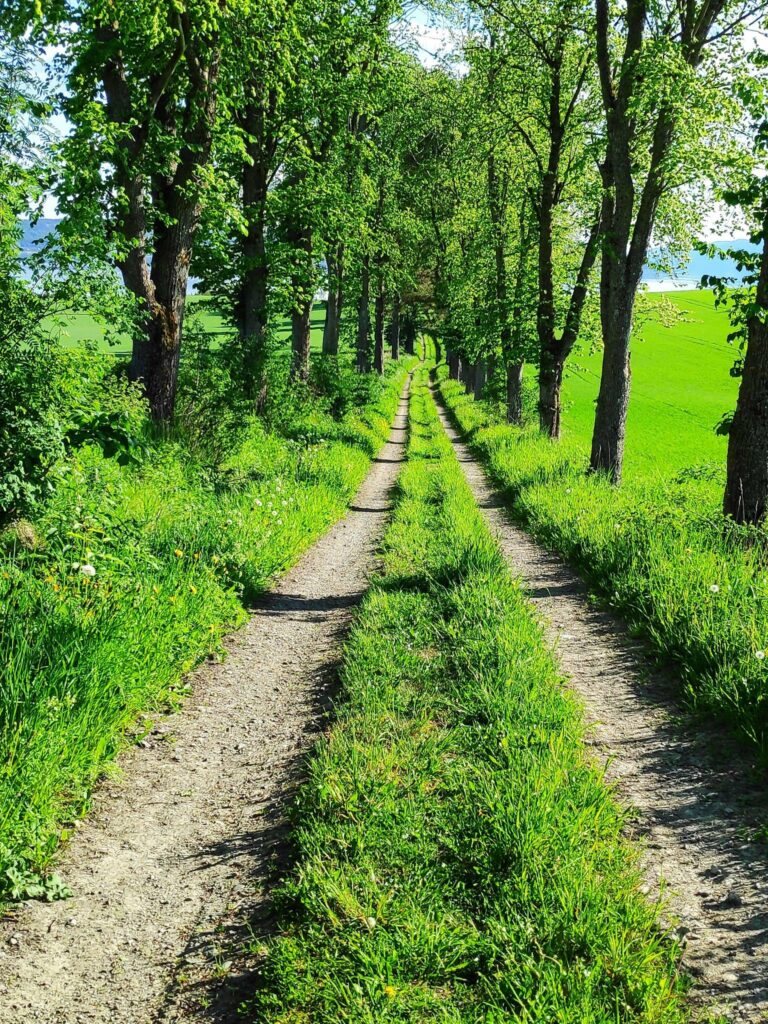
In the old days, access to this property, which has a large mansion and is also a farm, would have been by water. So we follow what is today a tractor road accessing fields, that would have given the residents two hundred years ago access to a quay. Certainly the tree-lined road would have been impressive.
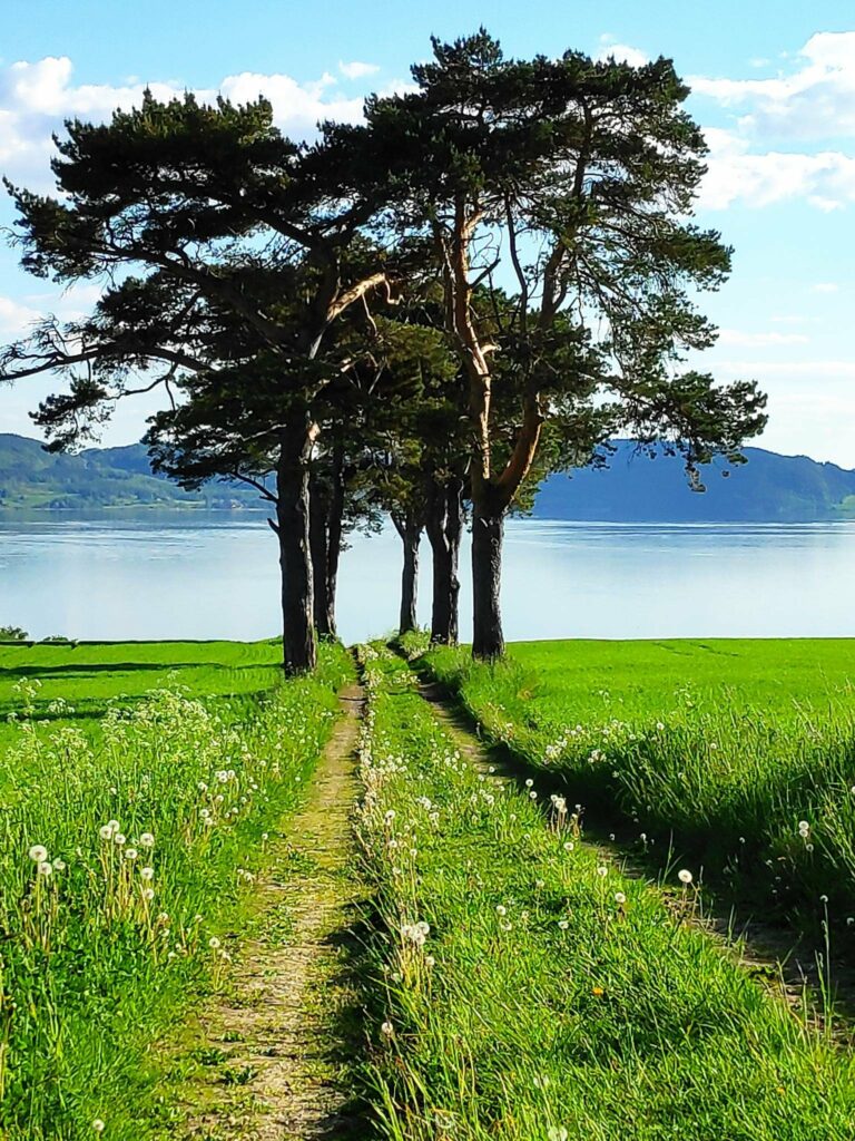
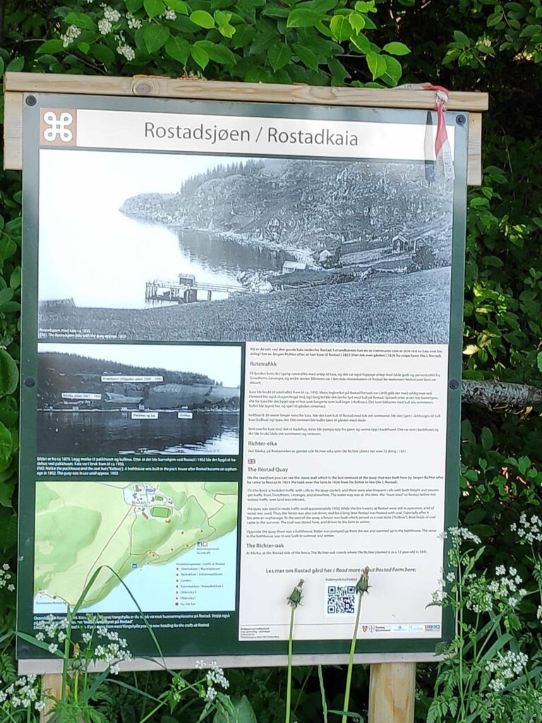
I think these were elm trees, though there may be different types of trees. Closer to the fjord there were also pine trees lining the road.These were pine trees, but there are large gaps between the sections of trees as if many have died over the centuries. The dandelions are mostly finished blooming and are sending their seeds flying in the breezes.Now the road heads into the trees and swings down to the right.This information sign gives you an idea of what the quay would have been like in 1875.
All of the information signs on this walk can be found online, so you may want to follow this link to get a better view of the picture. The quay was built in 1823 and was in use until about 1950, when I presume the current road for motorized traffic was used more than the quay for boat traffic. Among other things, the quay was used to bring coal to the farm. The coal would have been used for heating, especially in the winter. I notice in the old pictures, that there weren’t nearly so many trees back in the 19th century. They would have been cut down for building or for firewood.
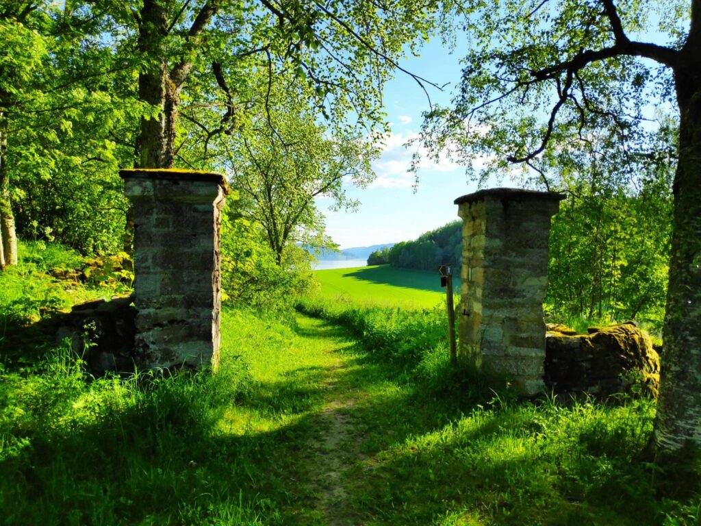
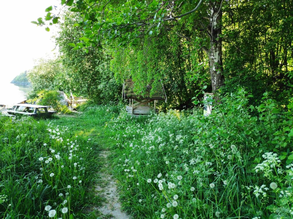
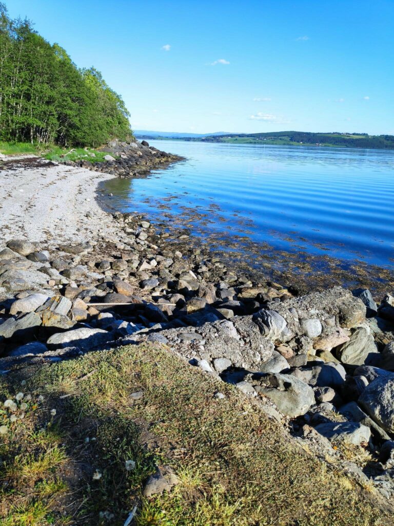
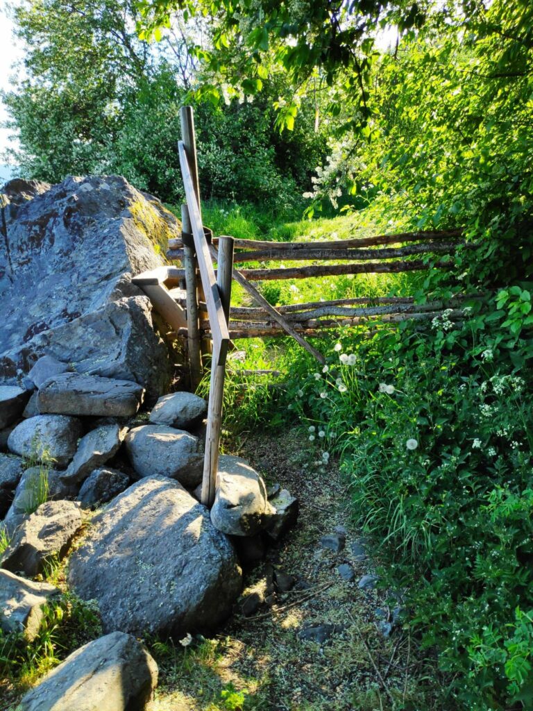
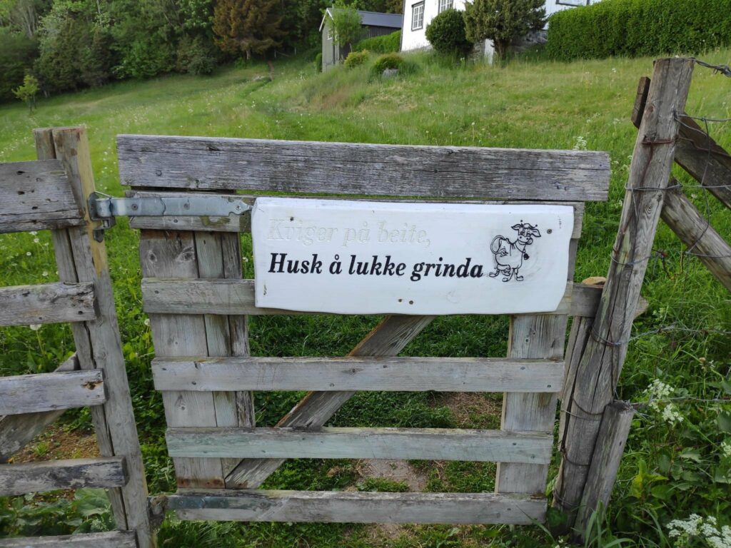
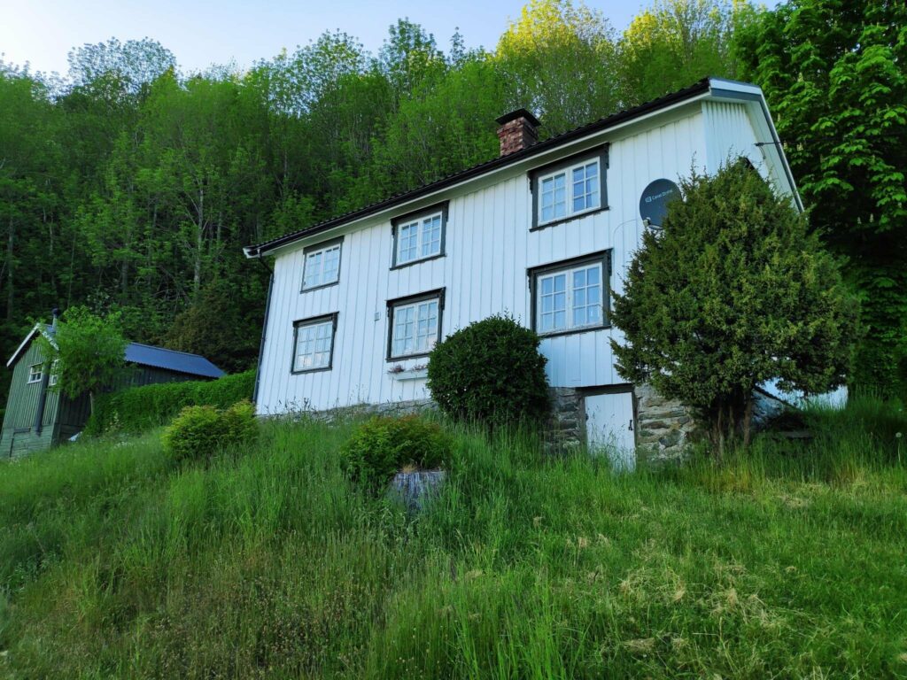
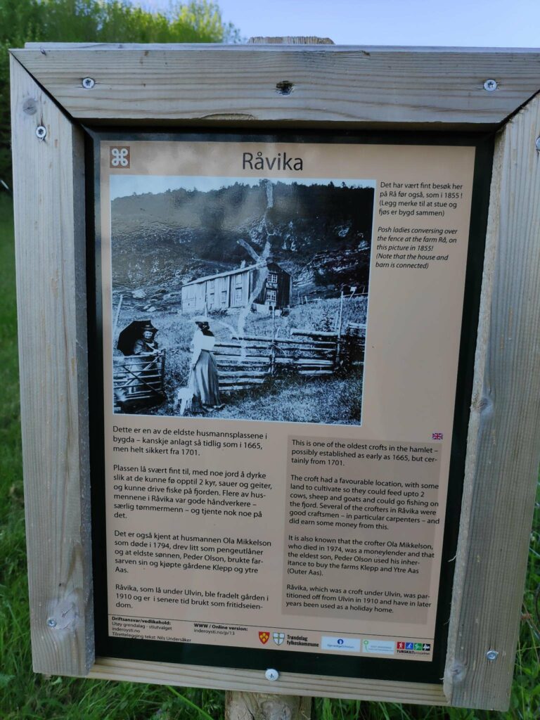
This is where the quay used to be. It is now a picnic area.In the foreground are the remains of the foundation for the quay. Now there is a little beach here. In the background in the picture is the island of Ytterøy.We are now leaving the Rostad property. We cross over a stile that is made from stones and wood.“Remember to close the gate”. Though there were no animals out in the fields here, there could be grazing cattle.This house is called Råvika and would originally have been a crofter’s farm. Today it would be a leisure property and is painted in white.Råvika was probably established in 1665 and would be one of the oldest crofts in the area. It is interesting to contrast the picture from 1855 where the house and barn are connected and there are few trees on the hillside with the previous picture of what the house looks like today. There have been a few changes in the last 170 years.Our trail leads in front of the house at Råvika which stands in an open area and we are then heading into the woods. Being in the woods was nice on a warm summer evening.The path became rougher in the woods and we had to both climb up and down the hillside.This tree was being lit up by the sunshine, but seems to have broken in the wind. There were open areas as if there had been some logging of trees.Quite a few trees seem to have been blown over in the wind. Does the wind cause the damage first, or is it logging that opens up areas so that the trees are more susceptible to strong winds?Our goal for the walk.The goal was this bridge which seem to cross a muddy area. We have had quite a bit of dry weather so there was no stream visible today.
Having reached our goal, we turned around and headed back to the car the same way we came. It was nice walking in the shade of the trees, but the climb back up the hill across the open fields was a bit warm for me. We used about an hour for this evening walk.
We could have continued along the path and gotten home that way. It is only about 4 km from here, though there are two steep climbs. But we decided to head back to the car and take it home with us.
I hope you enjoyed this walk. I would encourage you to find a wooded area and go for a walk yourself.
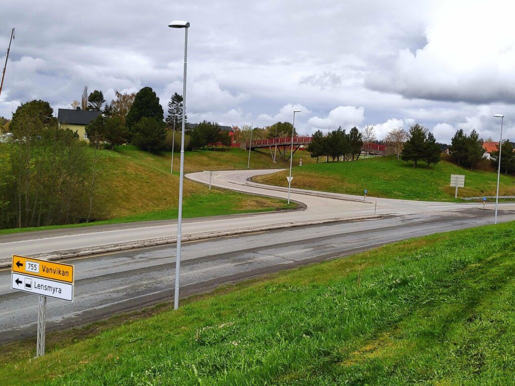
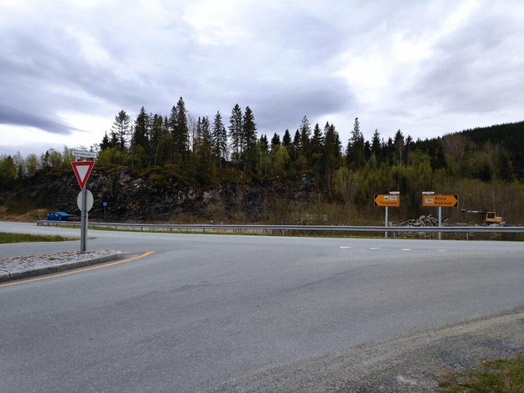
Route 755 begins at the E6 intersection in Røra, in the municipality of Inderøy. The E6 is a south-north major highway route through Norway, having started at the southern tip of Sweden, running up the west coast of Sweden and continuing north through Norway and ending at Kirkenes, close to the Russian border.
Route 755 runs east to west from the intersection at Røra to the intersection at Vanvikan with Route 715, which is another south-north route.
When driving from the south on the E6, and you see this building, make the next left-hand turn. This is our local juice and jam factory.When driving from the south this is the intersection of the E6 and route 755. There is a left-hand turn lane. The 755 goes to Vanvikan about 91 km away.
Coming from the south one makes a left-hand turn. In the years while I was working at Verdal Senior Secondary School, I went through this intersection twice a day. However, this is not how the intersection has always been. When I first started working in Verdal in 1988, there was a level crossing of the train tracks here, which created long line-ups in rush hour traffic as trains go by here at least twice an hour on working days. The current intersection opened in 2005 and everyone was glad when there was a bridge for the train and the road went under the train tracks.
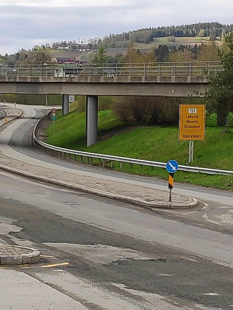
The sign tells us that route 755 will take you to Straumen, Mosvik, Leksvik and Vanvikan. The closest bridge is the train bridge and the farther bridge is for cars and pedestrians. The intersection is a right-hand turn and just past both bridges. Note the farms in the background.Approaching the intersection of the E6 and route 755 from the north. One makes a right-hand turn. The cars now drive under the railway tracks. The bridge you see is for cars and pedestrians.Another view of the intersection, taken from the car bridge over the E6.
Røra to Straumen
Røra is a housing area in Inderøy municipality and also features one elementary school quite close to this intersection, one railway station on the railway line from Trondheim to Bodø (called Nordlandsbanen). In addition there are several companies that are located here, including a jam and juice company and several construction companies.
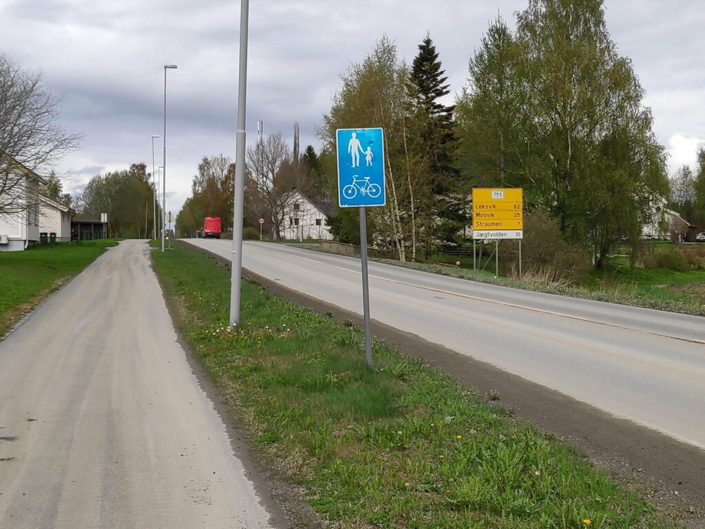
I am standing on a pedestrian/bicycle path beside Route 755, looking westwards.
A note about signs in Norway. The blue sign indicates that pedestrians and cyclists are to use the provided path. The yellow sign tells which route you are on (755) and the distances to major places along the route: Leksvik (62 km), Mosvik (25 km) and Straumen (7 km). The white sign indicates a business, in this case a hotel, Jægtvolden which is 10 km from here.
Route 755 is about 91 kilometers long, but it passes through various types of terrain, including farmland, shoreline on fjords, river valleys and forest-clad hills. The road goes downhill and uphill and rarely has straight sections. (See the Wikipedia article in English for other information.) For me, the importance of this route is that I used it for 30 years as part of my commute to work in Verdal. Now we mostly travel from home to Straumen. Every now and then we travel west of Mosvik. My husband worked in Leksvik for many years and he knew that section of the road a bit too well.
As one drives west from Røra, first the road passes the elementary school and the industrial area. Then it crosses farm fields before it goes downhill to Borgenfjorde, also called Bjørgin. Borgenfjord is tidal seawater and stretches north into Steinkjer municipality and is flanked by farm fields on all sides.
Borgenfjord on a day when the water was very still and gave beautiful reflections. Here the road runs along the edge of the fjord.When a road runs along the edge of a fjord, it is never straight. It winds this way and that and reduces the speed that one can drive at. Here the speed limit is 70 km an hour, but I usually drive it at 60 kmph or even less when it is covered in snow or ice.
After crossing Straumbrua and the swiftly flowing current under it, one comes to Straumen, the municipal center of Inderøy and 7 km from the start of route 755. Here you find shops, a bank, three levels of schools , an art gallery and a lot of housing, both single family dwellings and apartments. There is also the intersection with a road leading to Steinkjer (route 761).
Straumen is seen in the distance, across Borgenfjord.Straumbrua – Straumen Bridge built in 1958.
Straumen to Mosvik
Continuing west along route 755 one sees both the new church and the old church and continues between more farms on both sides of the road.
Looking west from the old church in Straumen, This part of the road is one that we have driven hundreds of times in the 32 years we have lived in Inderøy.
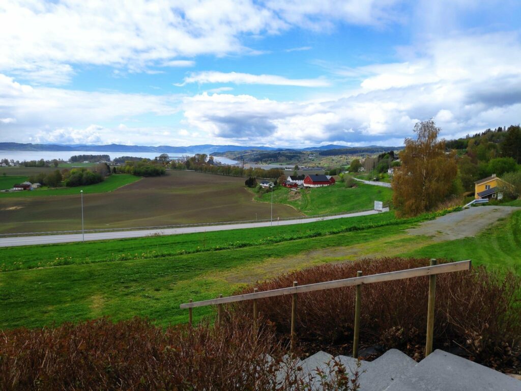
From Straumen, route 755 gives good views over Trondheim Fjord as the road follows the curves of the hillside and takes one through the area called Utøy to Skarnsund Bridge. Driving home from work along this road over the years, I watched the clouds discharging their loads, moving in the winds, or reflecting sunlight. It was never a boring route to drive, unless behind a slow moving tractor.
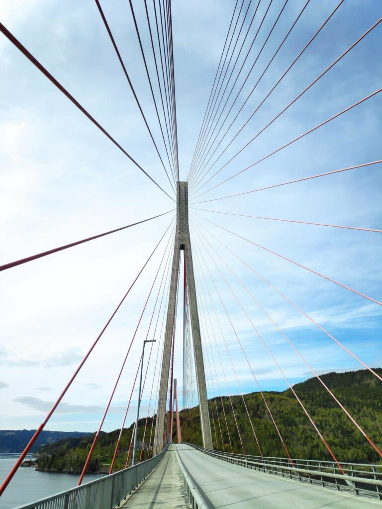
In its first years, Skarnsund Bridge was a toll bridge and we rarely drove over it, though we would walk over it for the exercise. Now that it is free, we drive over it regularly to go to Mosvik.
Skarnsund Bridge is a little over a kilometer long and bridges the gap between the peninsula of Inderøy and Mosvik. There will a separate blog article about the bridge and how it was built.
Once you have crossed the bridge the road mostly hugs the coastline along the fjord until you come to Mosvik.. You can see more about Mosvik in a previous blog.
Mosvik to Leksvik
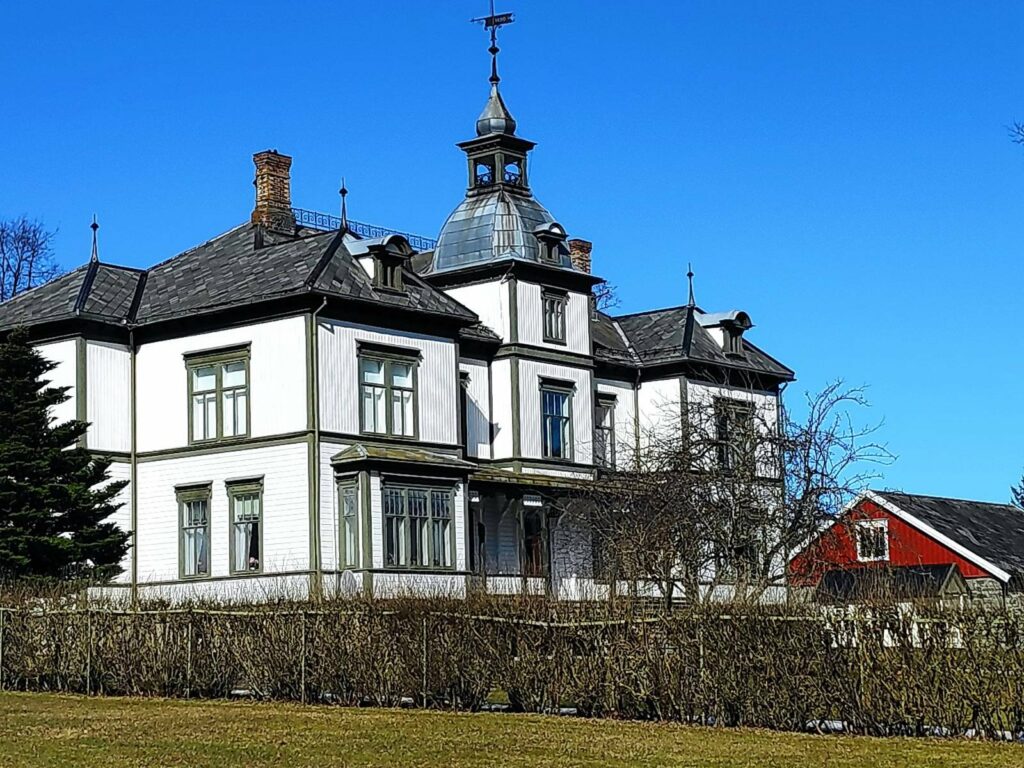
This impressive mansion lies on the hill overlooking Mosvik. The landowners own a large part of the forest in Mosvik which is used to provide income.
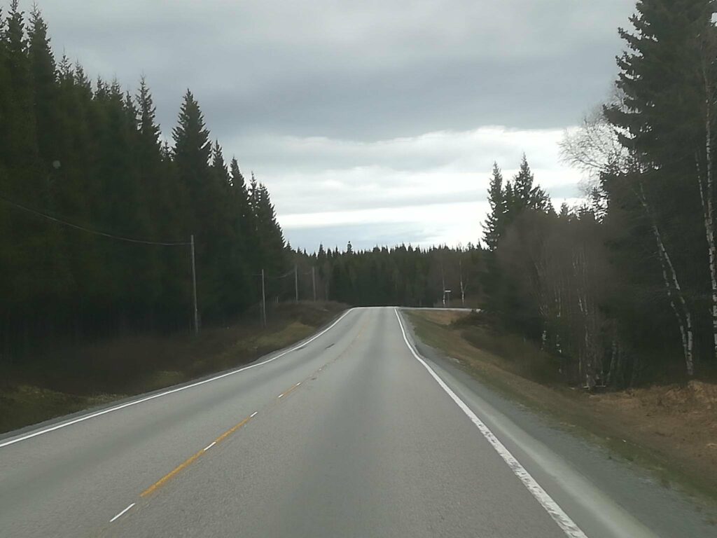
From Mosvik route 755 heads inland, and over the hills, around the lakes and through the forest. There are few farms and a lot of wild areas. The road can be a bit lonely, especially in the winter when it is covered in ice and snow. There isn’t the same amount of traffic on this section of the road as between our home and Straumen.
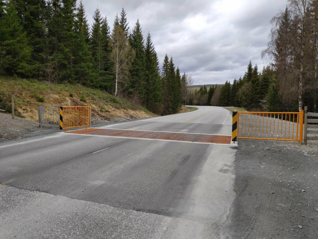
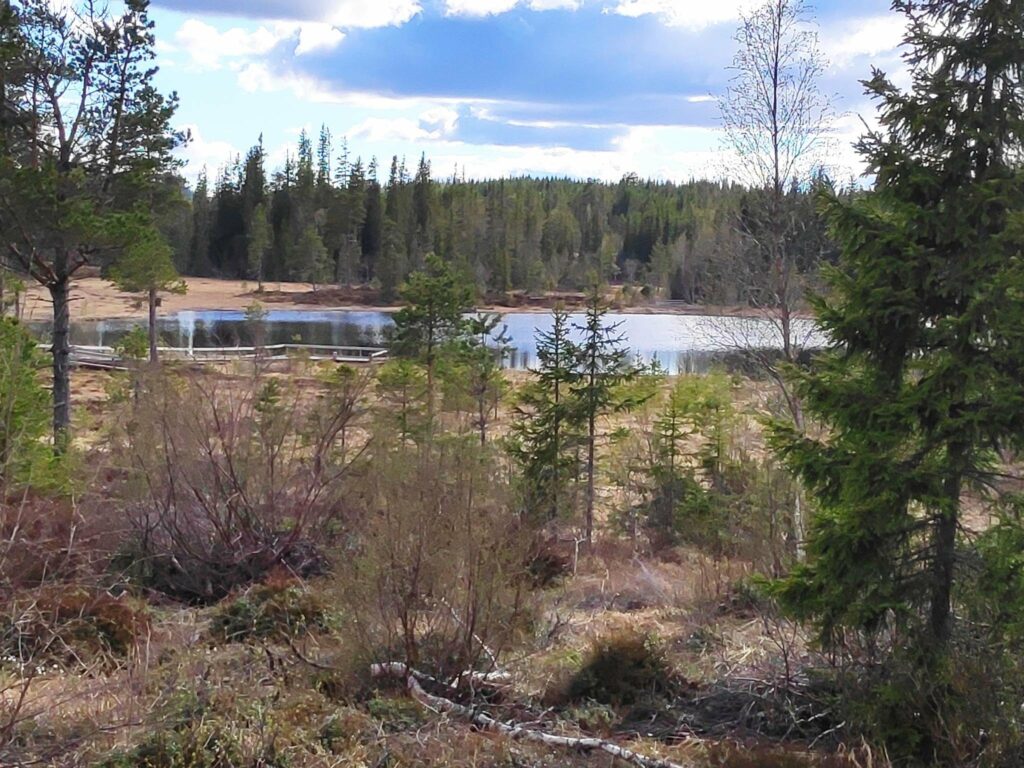
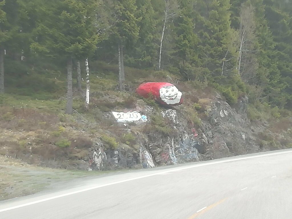
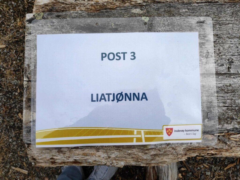
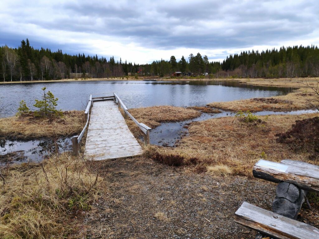
The barrier in the road is to keep sheep on the far side. In the summer months, one must be prepared to see sheep either wandering along the road, or even sleeping on the warm asphalt. We were lucky that the sheep weren’t out yet. This is a typical section of the road “over the forest”, as they say in Norwegian. Photo courtesy of Alasdair McLellan while I was driving.Liatjønna, one of many small lakes along this road. This lake, or tern, has been made accessible for wheelchair users and fishing is allowed, as long as you pay a fee.Every year this rock, that sticks out a bit in a bend of the road, is repainted by the secondary school graduates of Leksvik. This seems to be from last year’s graduates. Perhaps the pandemic has influenced this year’s graduates. Photo courtesy of Alasdair McLellan, taken while the car was in movement and through the windshield.One large lake along route 755 is Melting Lake, which is used to provide hydro power.
Eventually the road comes out of the forest and heads downhill through farms to the village of Leksvik which lies on Trondheim fjord. We are now in the neighboring municipality of Indre Fosen.
Coming down from the top of the hill into Leksvik – here the valley opens out and the land is farmed. Facing south, the slope captures a lot of sunshine.We stopped at the church as it is on the hill before going down into the village. Especially in rural areas, cemeteries are usually located beside the church. Down at the water’s edge, there is an industrial area. Up on the hill is agricultural land.
Leksvik to Vanvikan
As we continue westwards from Leksvik, the road mostly runs along the coastline affording views of Trondheim on the south side of the fjord.
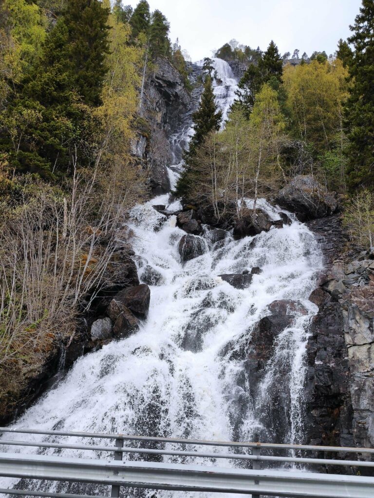
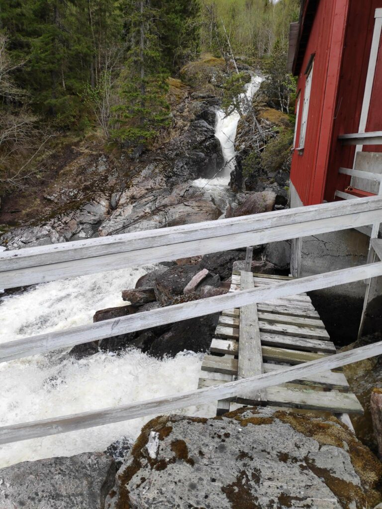
Trondheim Fjord is quite wide at this point. Trondheim is in the center of the picture on the far side of the fjord.This is looking back from where we came, in other words, looking eastwards. This is a very typical type of road in Norway.We saw several waterfalls and this one we stopped and walked back to get pictures. Lakes and streams at the top of the hill will still have snow run-off, though there isn’t much snow left now on the tops around here. This stream is called Bjørnåa and the water falls 200 meters to the fjord.
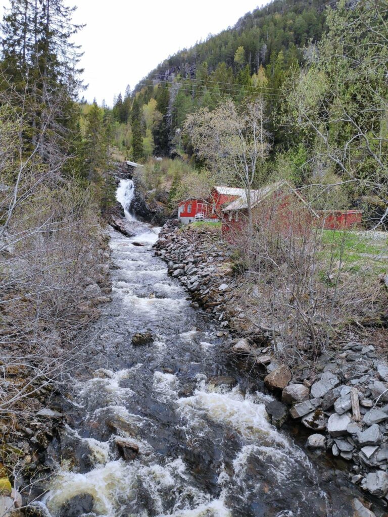
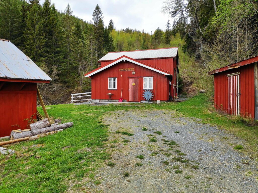
One interesting stop along this route was at Hestdal Hydro Power plant, a small independent electricity production plant.
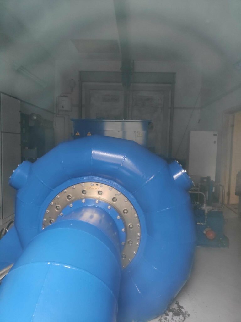
Here’s the stream that feeds the power plant which is in the red buildings on the right of the stream.The red building in the center houses the power plant. It was quite noisy beside that building.I found a dusty window I could get my camera to peek in. It was a beautiful blue turbine at work.The stream is in the background and the water that has been used to turn the turbine can be seen coming out at the bottom of the picture. There had been lots of rain recently, plus there was still snow on the tops of the hills here, so water was still plentiful.
Vanvikan and the end of route 755
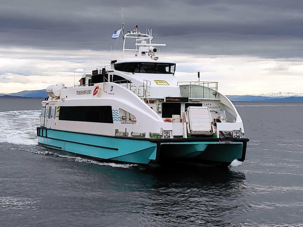
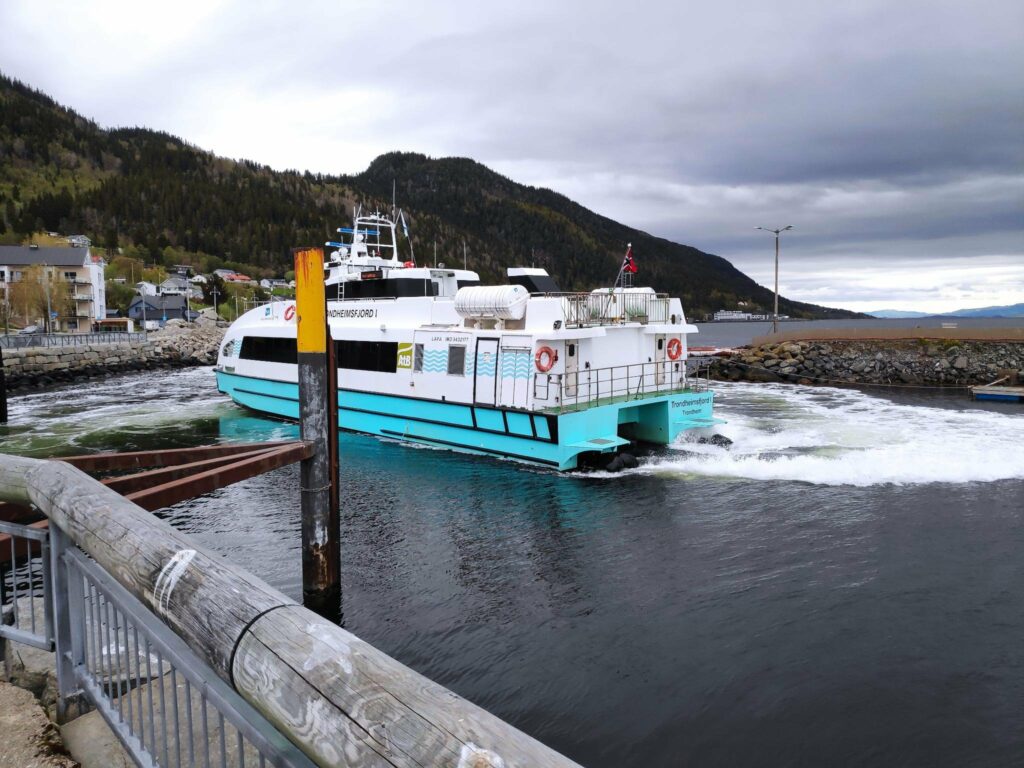
Vanvikan is a very small village of about 700 residents. There are some small industries here and you can get an express passenger boat from here to cross the fjord to Trondheim. We were lucky that one came in just after we had parked to look around.
We were in Vanvikan on a Sunday and there were quite a few people both getting off the boat and also going to Trondheim.. The crossing takes 25 minutes and on a Sunday it goes about every two hours.I must admit I was impressed at how little space the catamaran needed to turn around before heading out of the small harbor and back to Trondheim. You can see some of the village of Vanvikan to the left of the boat.
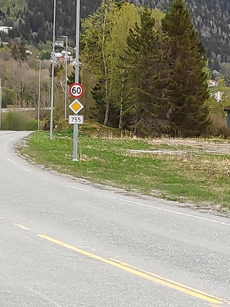
Finally we came to the end of route 755.
Route 755 ends in a T-intersection with route 715. If you turn to the left, you can get to a car ferry across the fjord towards Trondheim. You can also continue around the southern tip of this peninsula which is called Fosen. If you turn to the right, you can travel north and find many small villages and eventually make a round trip and get back to Inderøy.We, of course, had to turn around and drive home again and this was the first sign that indicated the speed limit (60 km per hour) and the route number (755).
The pictures for this blog have been taken on more than one occasion. We took a drive from our house to Vanvikan one Sunday morning, but with all the stops it took a lot longer than I had been expecting. In the end we drove straight home from Vanvikan with no further stops and it took us about 75 minutes.
The pictures of Røra and Straumen were taken on a different occasion and this section of the road I travel quite a lot.
I hope you have enjoyed this blog article. You will find other blog articles about different things along this route, including a walk at Liatjønna, the center of Mosvik, the tidal walk in Straumen and Skarnsund Bridge (to be coming soon).
Today’s walk took the three of us up quite a steep climb to where there was a large pine tree on the top of a hill, with an elevation of about 120 meters above sea level. The three of us were agreed that it was nice to do the walk once, but it wasn’t interesting enough to do more than once.
One of the things that I appreciate about a walk in the woods, is getting to a place where I can get a good view, preferably over water. We had a lovely sunny day, so there should have been some good views, if there weren’t so many trees.
We parked the car near the main road between Vangshylla and Mosvik and then went into the woods and immediately began to climb up a path which is narrow, but dry.
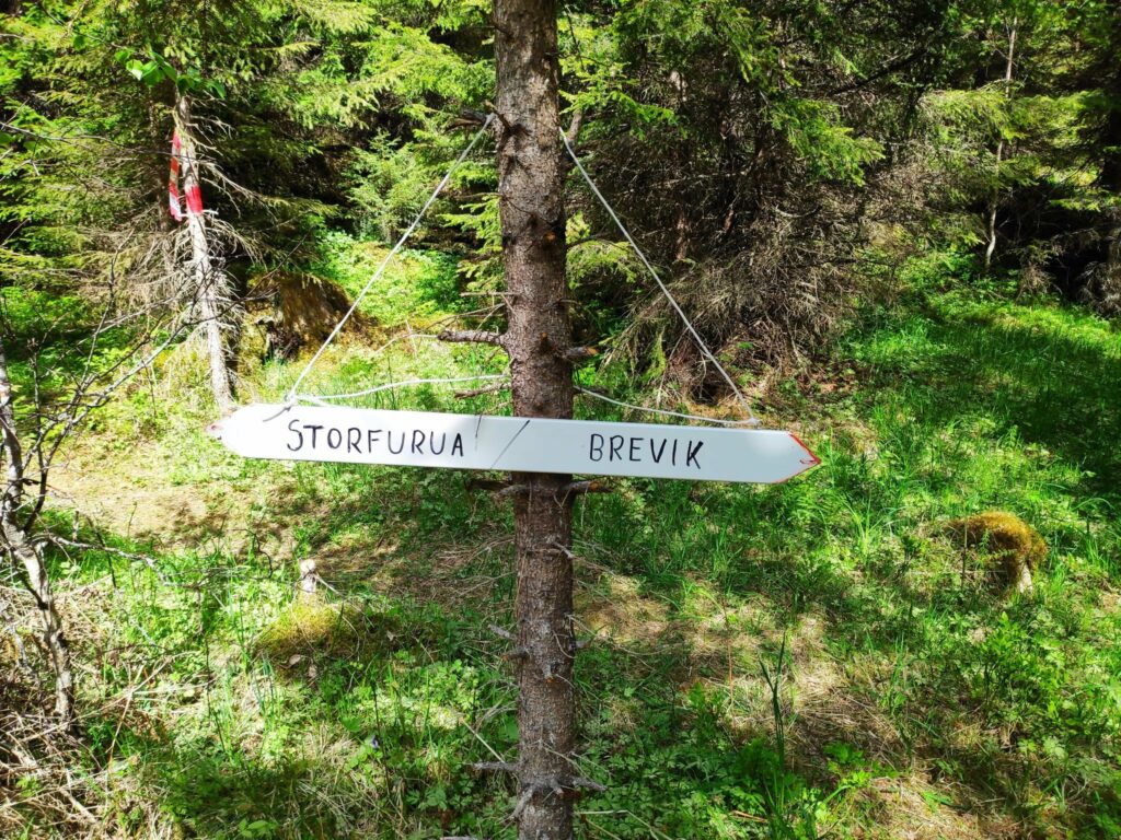
This is looking back the way we came and on the right you can see the slope that we have zigzagged up.Looking uphill. My walking companions have already disappeared around the corner.This section of the trail has less slope, but we are still gently climbing. Note on the tree to the right two different methods of marking trails: the red blotch of paint and the red and white plastic tie.The forest was very pleasant to walk through on a sunny day, though we did get quite warm on the steep sections.We headed off to the left to the big pine tree (Storfurua).
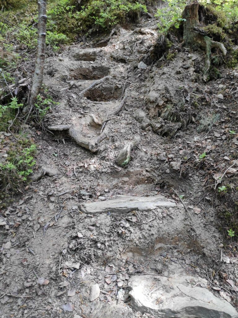
I had read in the local newspaper that this trail that we were following today was relatively new and this is the first time that it has been on the list of Inderøy walks. As we climbed higher there were indications of improvements to the trail to make it easier to climb.
Flat stones had been placed strategically to make steps in the hillside. Somebody had done some work here to make access easier.Then there was a section with a very heavy rope so that one could pull oneself up the slope. I wouldn’t want to do this part of the trail just after a rainfall.Though one could glimpse Trondheim Fjord through the trees, there wasn’t really much view with such tall trees.The goal of our walk ended at a large pine tree. But there was no particular view out over the fjord.The view was looking up at the tree. I have large pine trees in my yard, and though this one might be taller and bigger, I wasn’t impressed at this being the goal of the walk, especially after the very steep climb. But that is my personal likes for a walk.
The information about the walk indicated that one could continue along the marked path and do a circle tour back to one’s car, partially on a road. I didn’t really want to go down the steep parts that we had come up so we continued onwards.
The red plastic stick seemed out of place in the woods. We normally have these along the roads in the winter so that drivers and snow plows know where the edge of the pavement is. However this picture also shows what the vegetation is like in this area.Here is where the path we have come along, seen straight ahead, meets a gravel road. We went back to the car by going down this road to the right in the picture.Finally, a view of the fjord, but we are back to the busy paved car road and we were shortly back to our car.
We used about an hour for this walk. It was listed as 3 km, round trip, but when sections were such steep climbs, we don’t walk very quickly. Even the gravel road down to sea level was steep.
We got the exercise we wanted but we were glad to sit down when we got to the car. Next week will be a different walk.
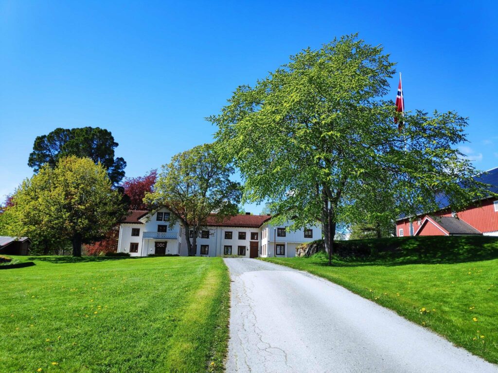
Rostad is a large property in Utøy in Inderøy. The walk my husband and I took on a holiday Monday was almost all on this large property. Much of the information along the trail has to do with the information about this property. However, in this blog I am only going to describe the walk itself. Another blog will be written about some of the history of this property.
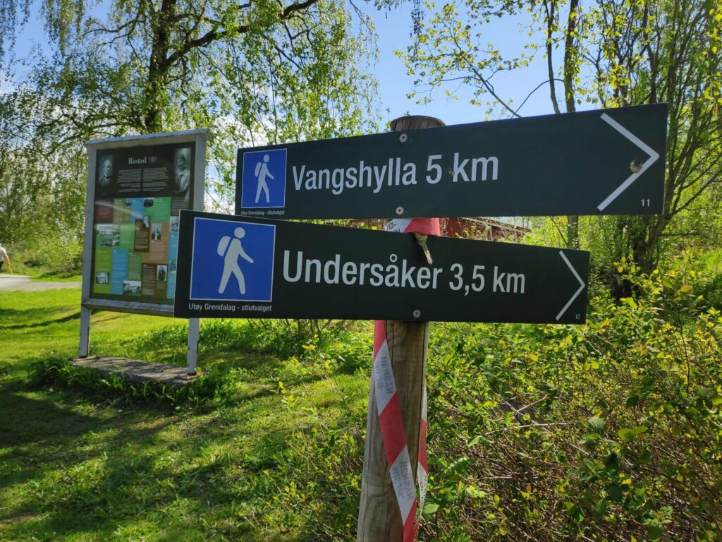
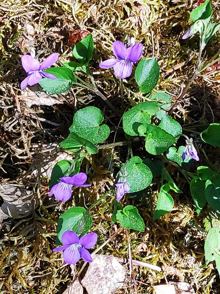
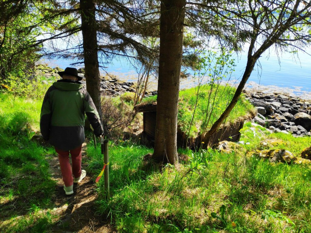
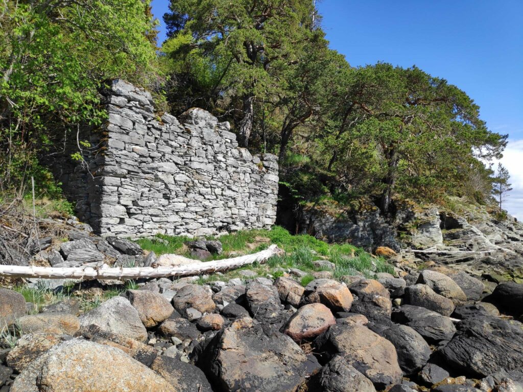
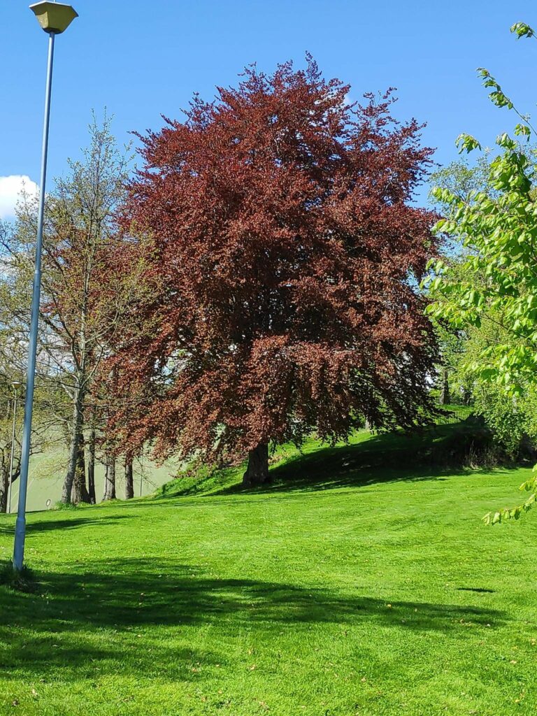
Here is a map of the area we were walking in. We parked at P. We took the right-hand dotted red line down to the water, then went along to the right until we came to Kvernhusmuren, We then continued along the path until we could take a short path to the left, then up the tractor road to the stadium. Then continued along the road back to the car. We used about an hour.We are 5 km from home, but we drove to the parking area. Walking one way would be fine, I no longer like walks of 10 km.It was a warm sunny morning and the first part of the trail took us through the woods. The property of Rostad is a farm as well as a school, but there are lots of forested areas.We have now come to the first intersection. We have come from Rostad and are going in the direction of Undersåker. “Snåpveien” means a short cut and takes you to Rostad Quay.We continued through the forest, with wild flowers growing in the open areas.I’m not sure the official name of these flowers. I call them wild violets. They grow in my garden as well. They like a sunny, open area.At one point we came out into the open and are following a tractor road down to a small beach. In the distance on the right is Mosvik and on the left is the island of Ytterøy.We came to a small beach.There was a new boat house and a small boat at the high water mark. We went a few meters back up the road we came along before heading off to the right.Along this part of the path there was an old elm tree that looked a bit dead, but when one got up close one could see that there was still life in the old trunk with new shoots coming from the trunk. In addition there were many baby trees in the surrounding open area.There is still life in the old tree.Our goal is in sight. There used to be both a sawmill and a grain mill here.My walking companion is heading down to the small building with the grass roof which is almost on the beach.Here is the remains of the mills that were here. The wall was built with flat stones without any mortar. The stream that supplied the power to the mill is on the far side.The stream that would have once powered the sawmill and the grain mill.The beach here is a bit rocky.We have now continued along the path towards Undersåkerand here is a little bridge that crosses the stream that goes down to the old mill.This bridge crosses the same stream farther uphill. If one continues straight ahead one would come to Undersåker, but we chose to cross the bridge and go left so that we got back to our car.The first time I crossed here many years ago, it was just a log bridge that was very slippery. This new bridge with railing was much nicer to use.We can see some farm fields. We will now follow a tractor road up to the football stadium and our car.The walking is easy when it is a tractor road that is used constantly to get to the fields.It’s called a “stadium” in Norwegian and is used for playing soccer, which is called “fotball” in Norwegian. When bantam leagues are playing they can have several games going at once here.We are back to the main building on the property, but that will be a different blog. Our car is nearby.The leaves are out on the red beech tree. The leaves on most of the deciduous trees have just come out in the last week or so.
We had a lovely walk on a sunny day. We used about an hour, but I stop a lot to take pictures. I think on this walk I took about 65 pictures. I love having a digital camera on my smart phone so that I don’t have to think about the cost per picture. This is a walk I will do again this summer. I hope you have enjoyed the pictures.
“Næss” is a very common surname in Inderøy. An alternative spelling is “Ness”. One of the major farms in the Straumen area of Inderøy is called Næss and so there are quite a few places with “Næss” in the name, including this forested hill in between different housing areas in Straumen. “Berg” is a mountain or rocky hill.
I regularly go for walks with a girlfriend who lives in Straumen, and we often include climbing this hill on our walks. However, yesterday, I took the walk with my husband and in the opposite direction from what I normally do. That made it a bit more interesting too.
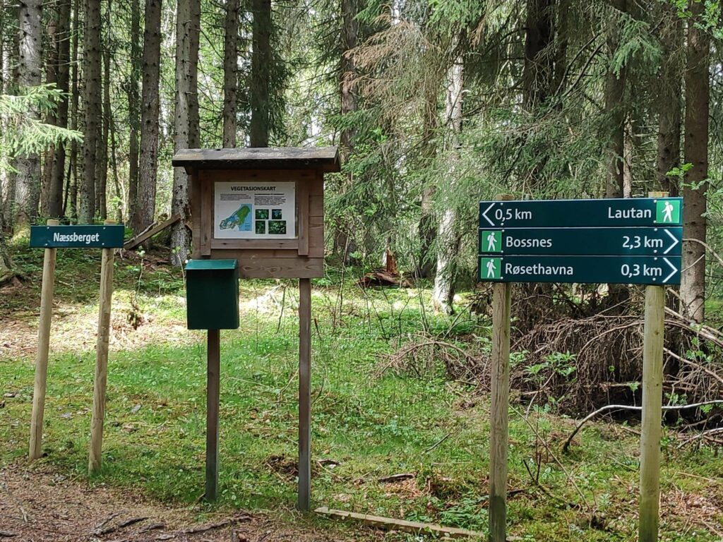
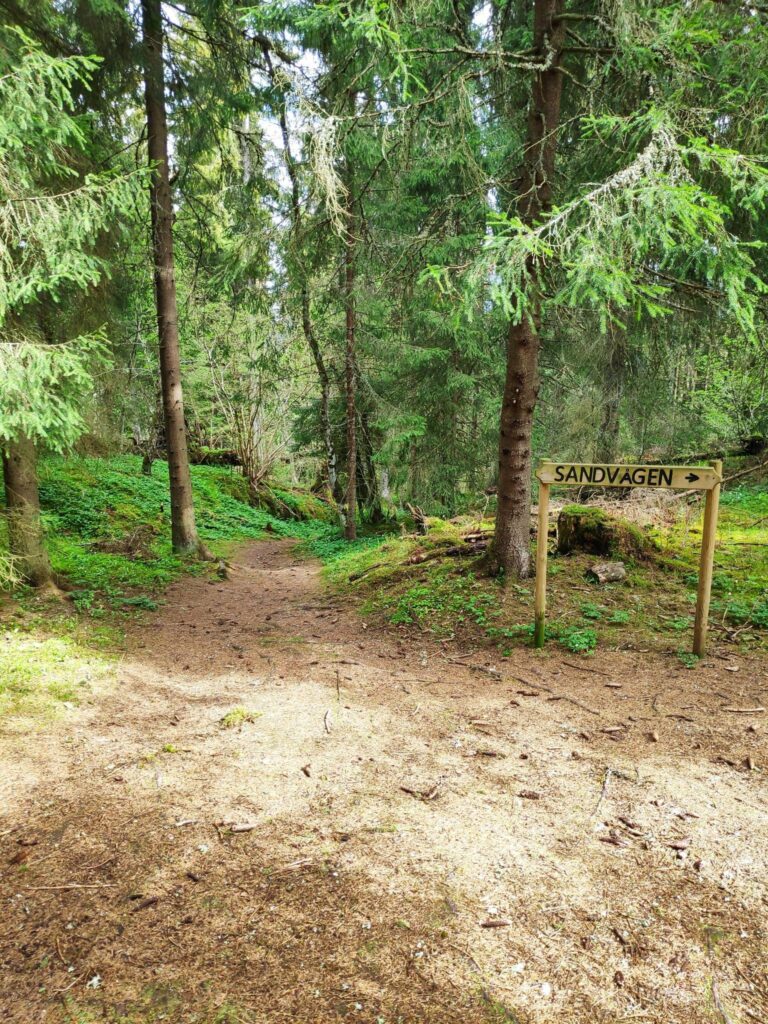
This is the top of Næssberget and from here you can go in three directions from this intersection in the woods. To the left one comes out at a housing area. To the right one comes out to a small harbor on Borgenfjord. If you continue in that direction another 2 km you can get to a farm called Bossnes. We came from Sandvågen which is behind me as I took this picture.
The post box will contain a book to write your name in to say that you have been here. Because of the pandemic, fewer people write their names in these books that are scattered in many popular walking areas.
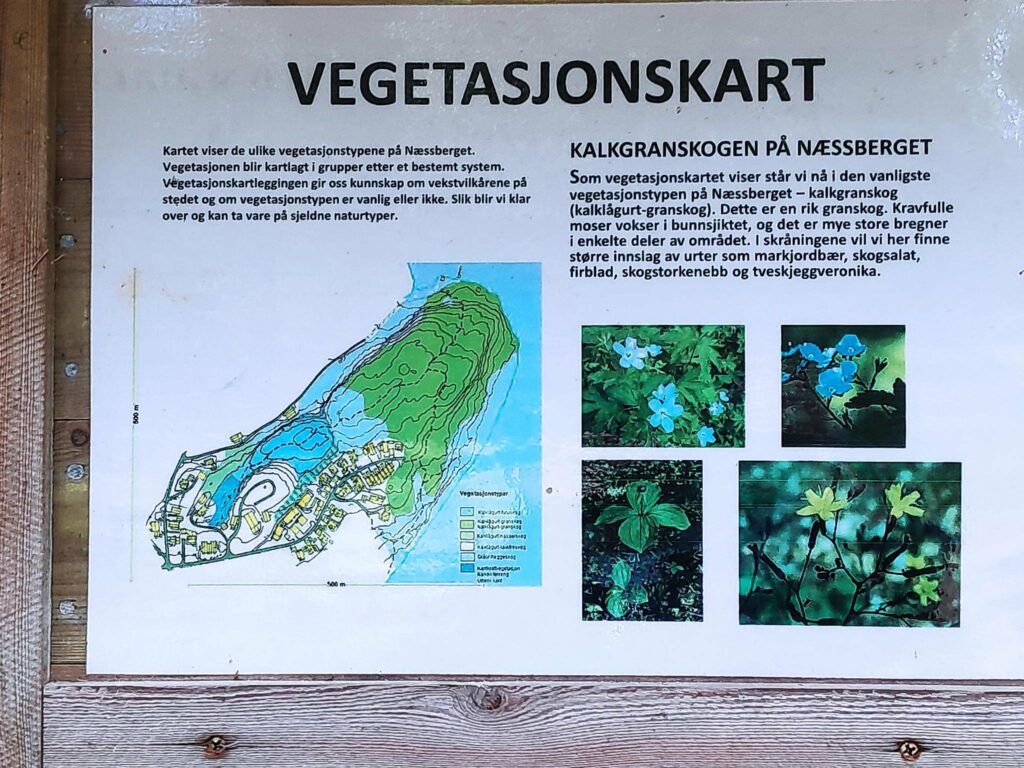
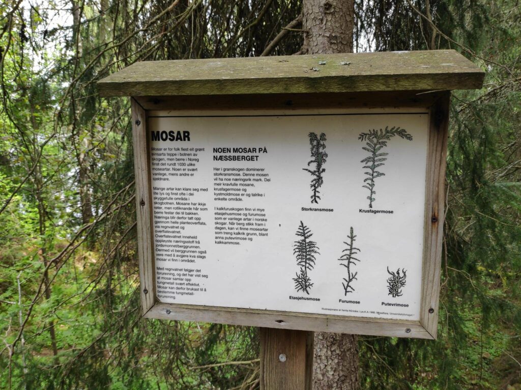
The information sign is about the vegetation in the area. The map shows the area called Næssberget and we are in the forested area indicated by green. This is a limestone based soil which gives a rich soil and a thick spruce forest. The yellow rectangles are houses and the dotted lines are where the trails go.
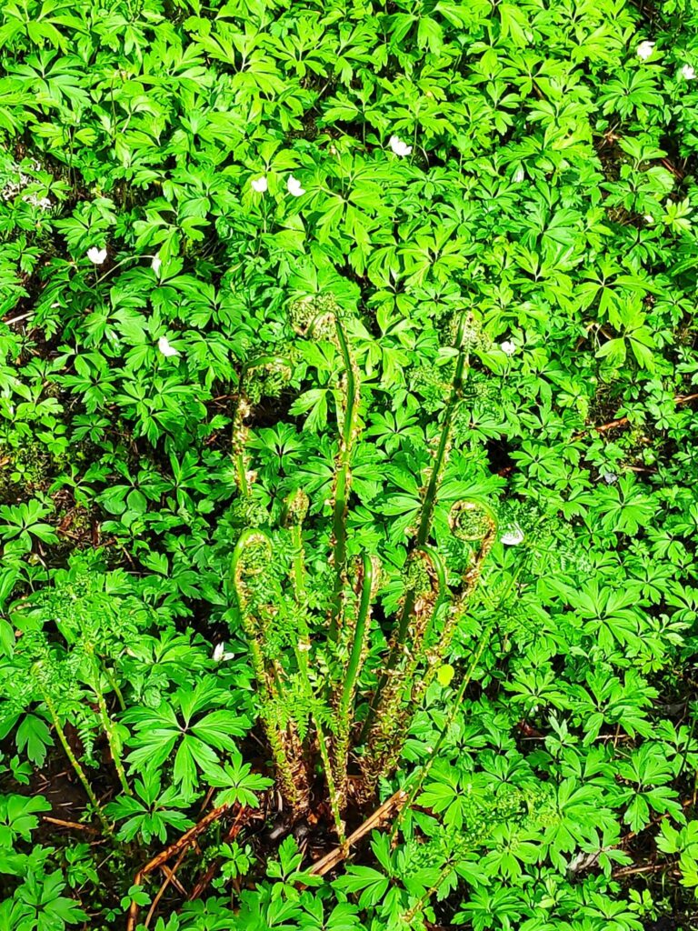
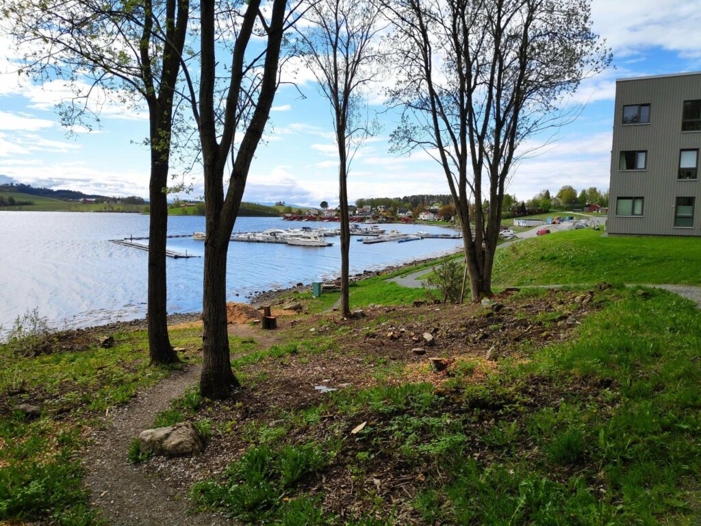
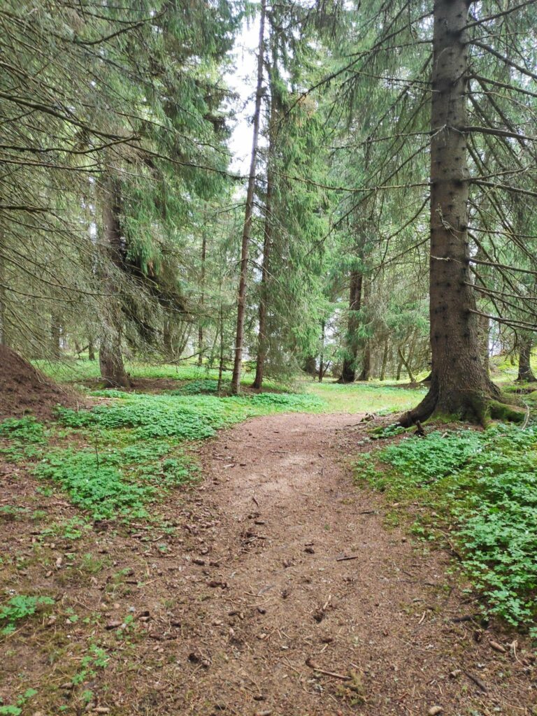
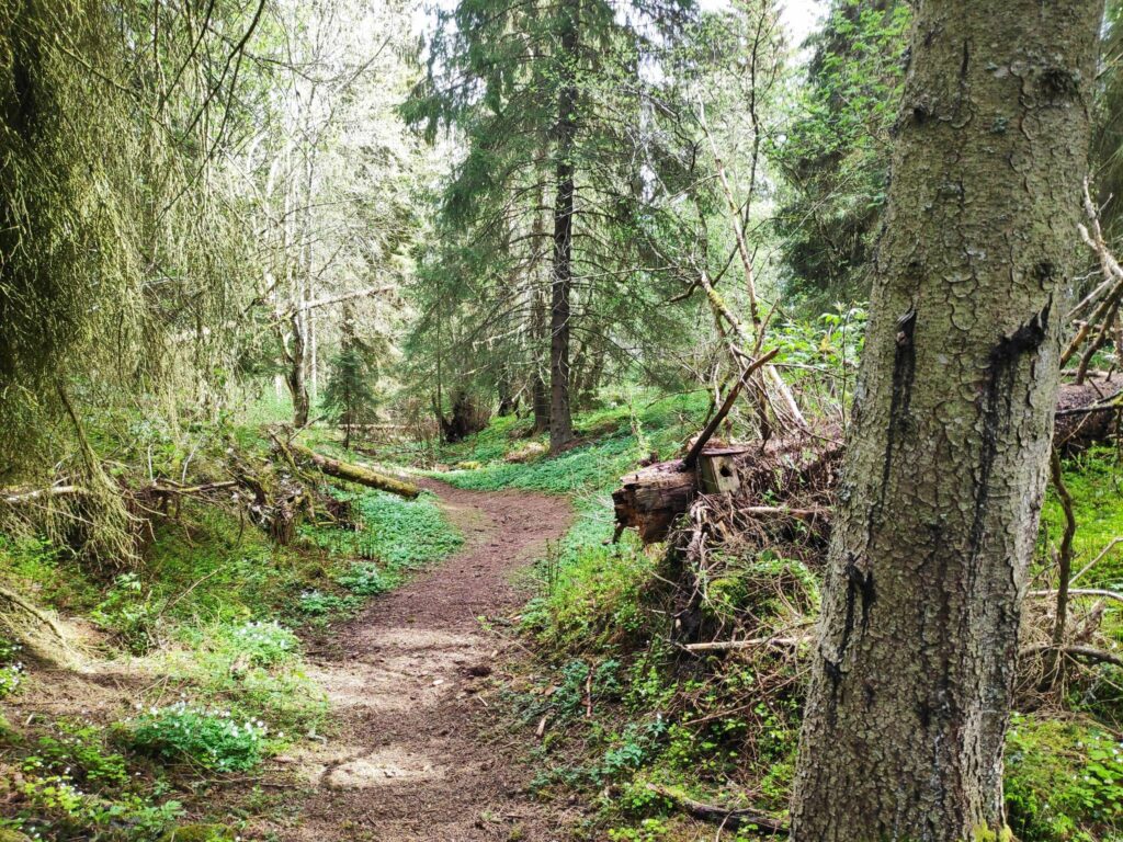
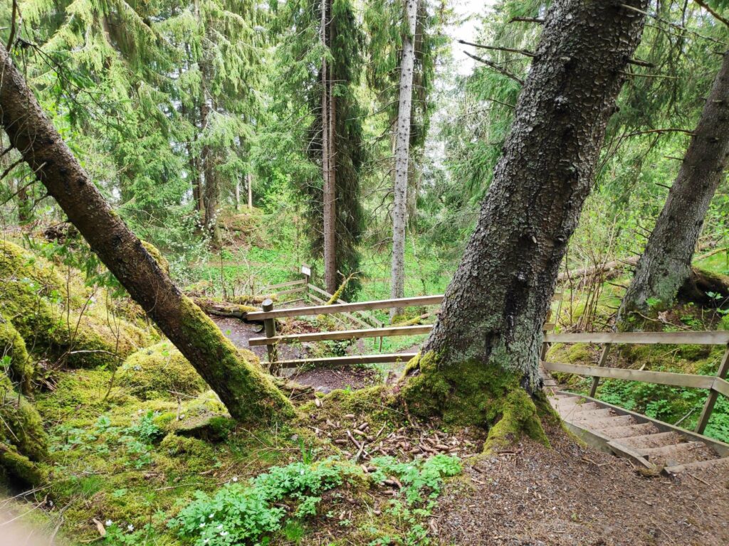
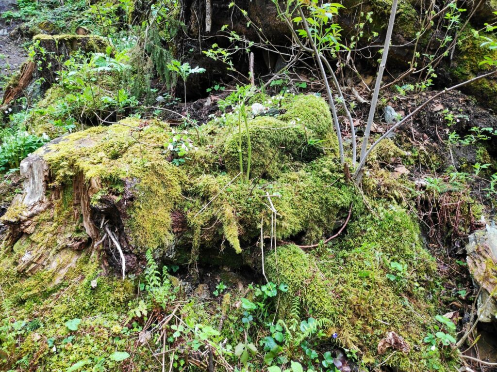
In the open areas under the spruce trees, white anemone and ferns grow. Here is a fern just unravelling its fronds.We started our walk in Sandvågen and the path on the right can be used by wheelchair users, though it only goes part way up the hill. Ahead is a small boat harbor on Borgenfjord and at the right you can see one of the new apartment buildings that have been sprouting up in this part of Straumen.The trail up the hill from Sandvågen is wide and easy to follow.We came from the right and are going to continue straight ahead to Røsethavna, half a kilometer of walking away and mostly downhill.This is old forest with fallen trees and old bird houses. Can you find the bird house in the picture?At this point the trail downhill gets very steep and there are stairs and a handrail. I usually walk up these stairs which is really quite a climb. It was pleasant to go down them this time.Half way down the hill there is an information sign about several different types of mosses that are found in this area.So I turned around and looked at the mosses on the ground behind me. Moss survives very well in shady areas, but like it where it is quite moist. These are on the slope as we went downhill.Røsethavna, with a small beach and a place to tie up a boat. This is part of Borgenfjord and Steinkjer municipality is in the far background.. It was very quiet and peaceful here on a Friday morning.The cove at Røsethavna at low tide.Choices, choices and you better know where you actually want to go. “Fjæran” is a beach at low tide. There are a lot of trails in this areas often leading to different housing areas.The path up from the small harbor to the housing area. Note that the leaves are out on most of the trees now and the grass on the field has just sprouted and showing green. Warmer temperatures and several days of rain encourage plants to get growing.Næssberget from the northwest. Røsethavna is to the left past all the red buildings.
We walked from Næssberget to the yarn shop and then through the residential area back to our car and so avoided climbing up the hill. This was a very pleasant walk away from the busy shops on a Friday morning.
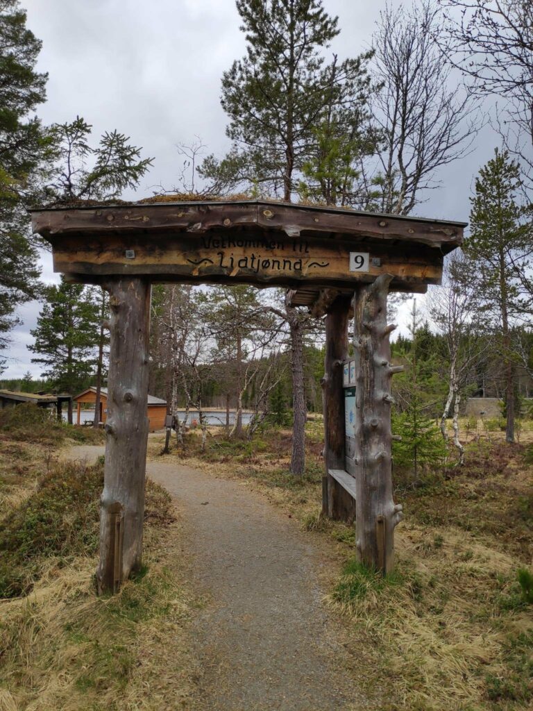
Today’s walk was just a short stretching of our legs on a drive. However this was one of the Inderøy walks this year and we got points for taking it.
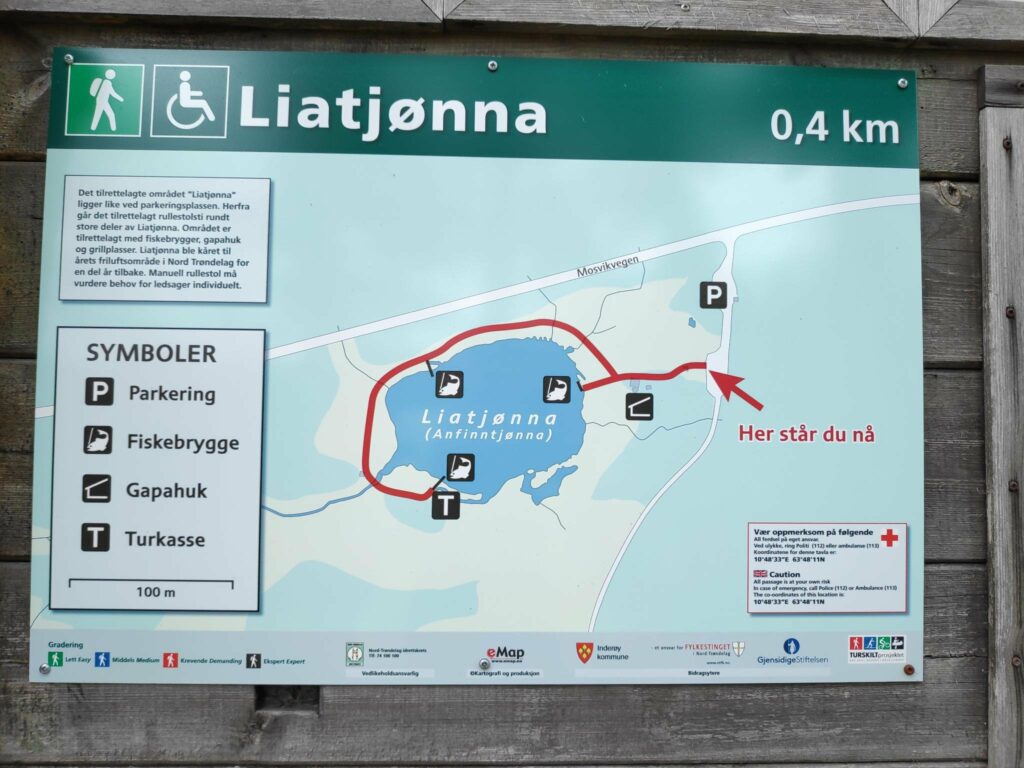
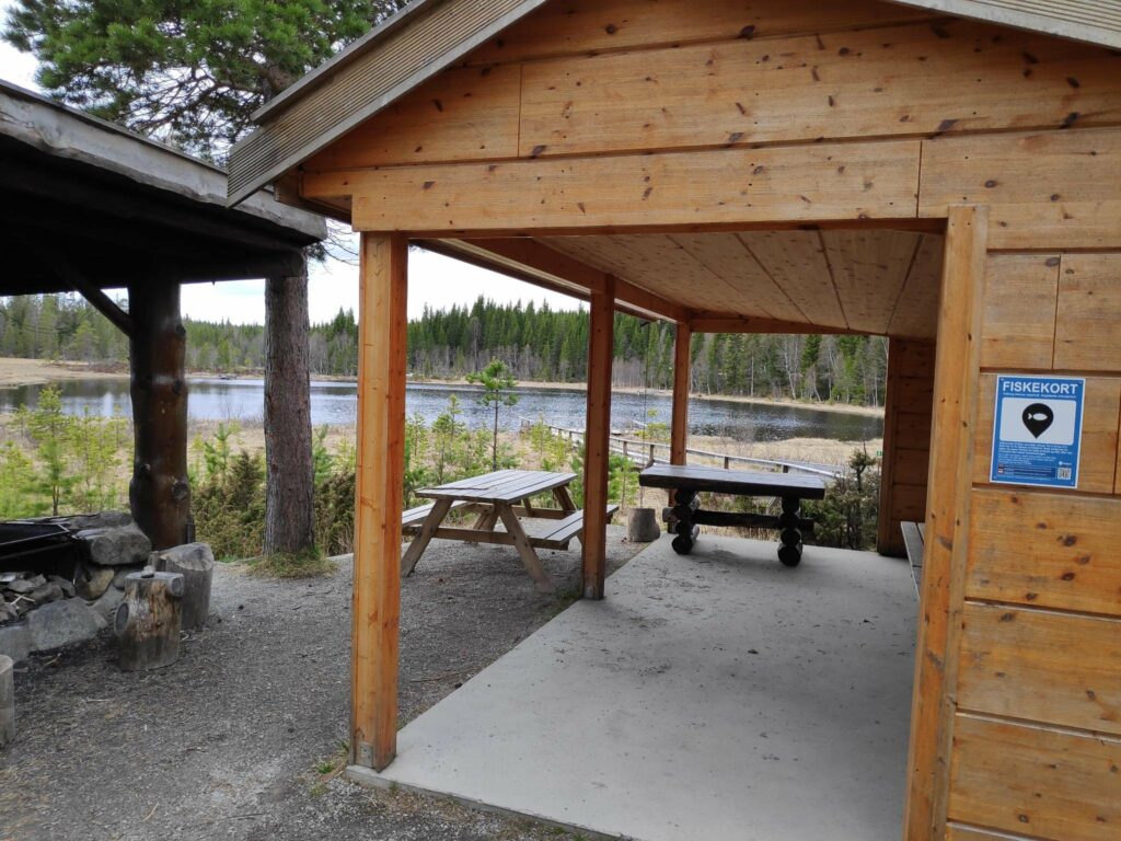
“Tjønna” in Norwegian would be best translated as “tern”, or a little lake. Mosvik has a lot of lakes and many of them would be good fishing lakes. This one has been improved with a picnic area and places for people who use wheelchairs to go fishing. If you want to fish in lakes, you have to have a fishing card for the area you want to fish.
Information on one of the signs says that a fishing card for this lake costs NOK 20 and is good for 4 hours. Children up to the age of 15 and the handicapped can fish free.
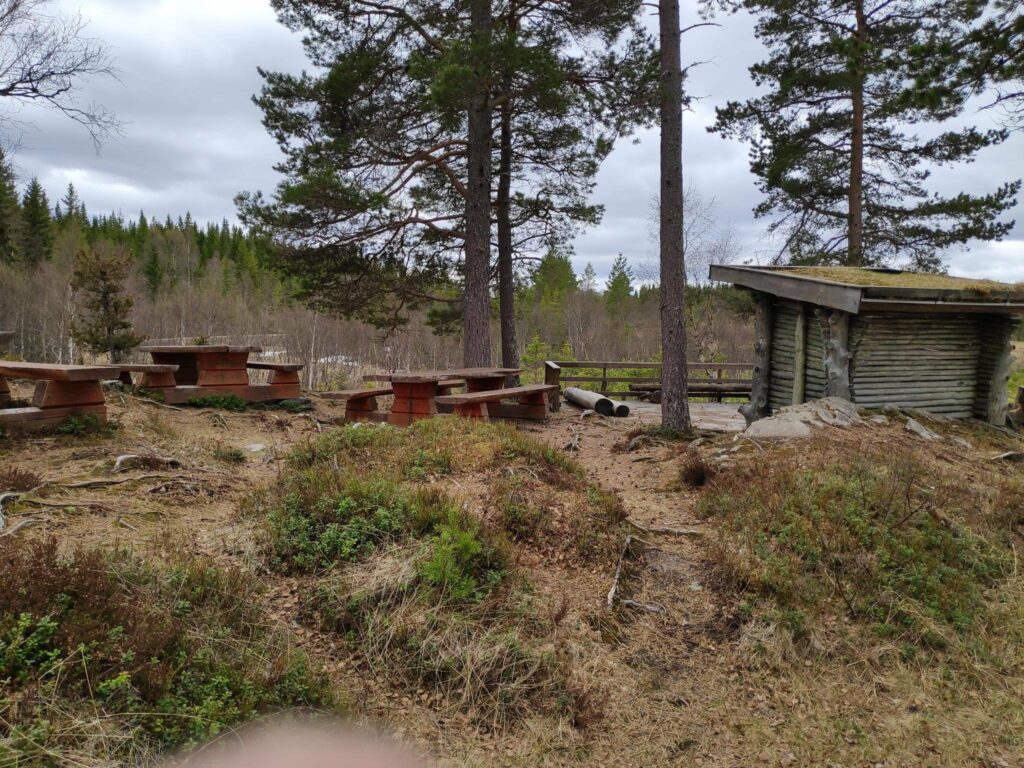
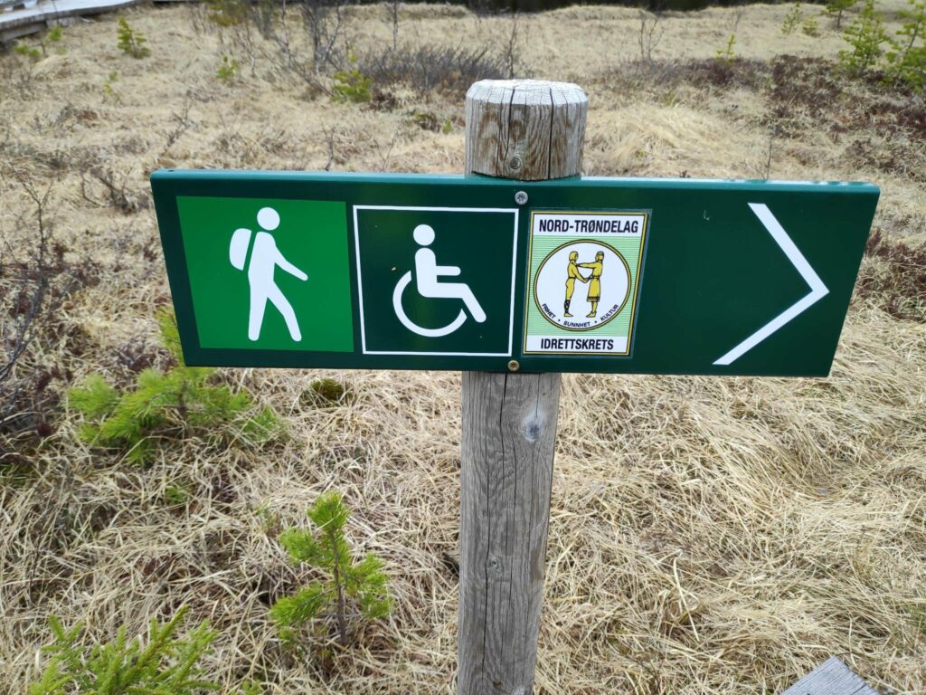
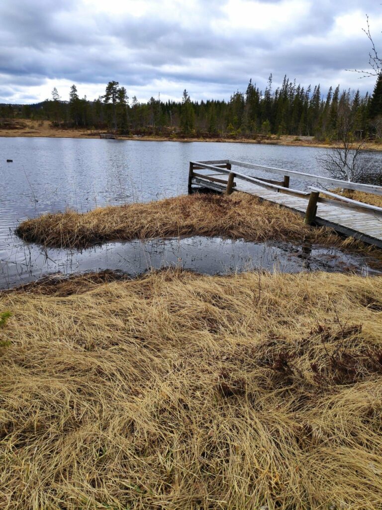
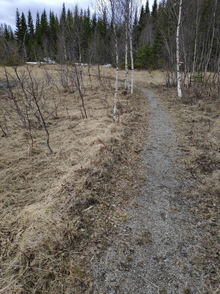
Entrance to the built up area around the little lake.This is a short walk of only 400 meters around part of a small lake. There are three places for fishing, otherwise it is quite swampy close to the lake.There were quite a few picnic benches and several places with roofs.More seating area, with the mandatory grill place to the left. You can see the little lake in the background.This is an easy walk and suitable for wheelchairs. It is the North Trøndelag Sports Club that has sponsored the work here.One of the fishing places, adapted for wheelchair users.The path has been put far enough away from the lake to be solid.In several places there were wooden benches to just sit and enjoy the view over the lake.On the far side of the lake, there is another open grill place with its own picnic bench and supply of firewood. There was still a bit of snow left on the ground. We are at over 200 meters above sea level here.This is where the water leaves the lake and heads to another larger lake, Meltingvatnet. Note how there is a very sturdy grate in the stream. This is to prevent the fish in the lake from leaving.Here the water is flowing downhill.We got to the goal of the walk.The third fishing spot. You can see where we started from on the opposite side of the lake.Though there were pine and spruce trees near the lake, we are at over 200 meters above sea level, so it is neither warm nor a long growing season here. Many of the trees looked quite stunted.Back at the parking area, there was a place to put garbage. There are many cabins in the area and this would be where they could deposit their garbage.Humans too have bodily needs which require the use of the little red building.