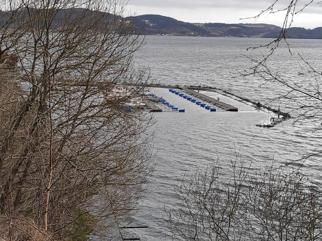
Today there was still a very high tide in the afternoon at Vangshylla. It was about 20 cm lower today than yesterday, though still about 40 cm above the calculated high water in the tide tables. Today was a bit windier than yesterday so there was some wave action on the breakwater.
One thing that I find interesting is how accurately they were able to calculate the additional affects of the weather on the high and low tide levels. Even the low tides have been higher than normal.
It is normal that the height of tides varies from day to day, with a monthly swing based on the moon phases. The highest and lowest tides will be when there is either a full moon or a new moon. Where we live there will normally be two high tides and two low tides every day, and the times move about 45 minutes later each day. So yesterday, high tide was at 13:09 and today it was at 13:53. In three days time, the difference between high tide and low tide will only be 2 meters, instead of the 3.5 meters the last few days. This is part of the regular cycle.
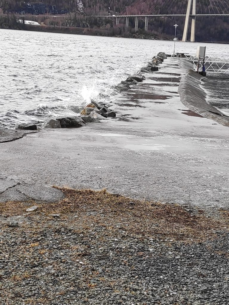
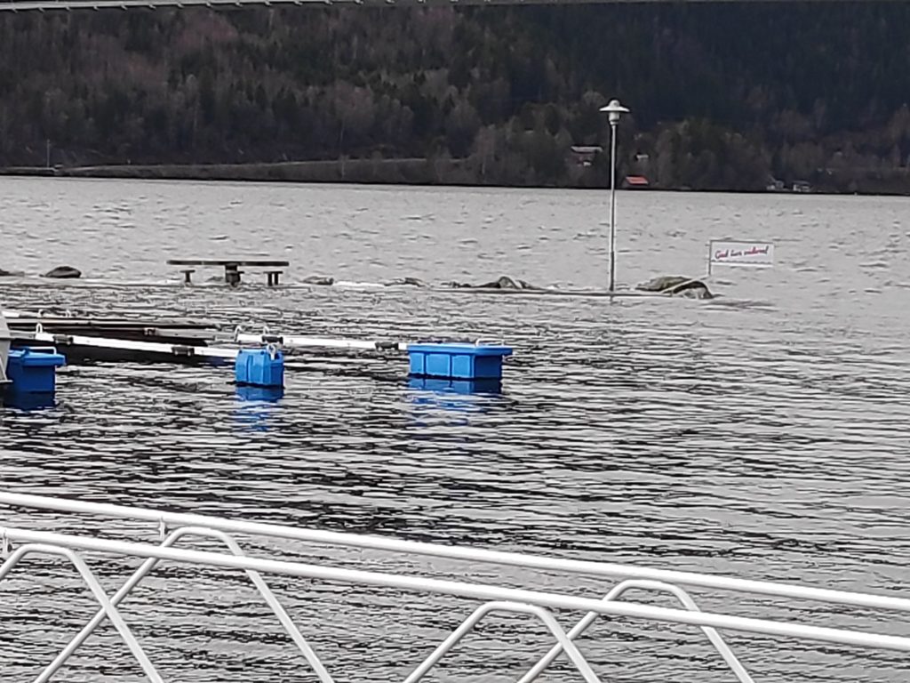
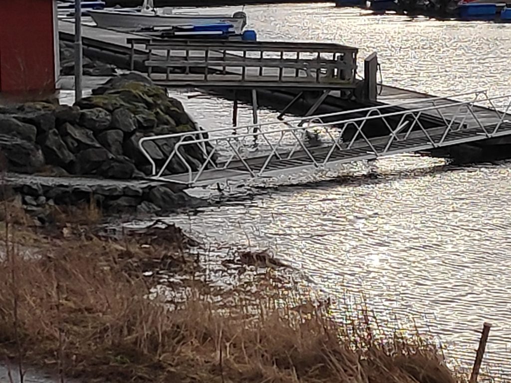
This picture was taken about 15 minutes before the official high tide. If you compare it with yesterday’s picture you will note that the breakwater is much more visible, though still quite wet on top and waves were breaking over it. Yesterday the end of the breakwater that bends inward was not visible above the water at all.Though there weren’t a lot of waves today, there was enough wind for even gentle waves to break over the top of the breakwater leaving it very wet.It was much more obvious where the end of the breakwater was, with the stones on the outside edge at least showing the location of the breakwater. One news item yesterday was about a boat that had grounded on a breakwater that had been completely covered in water and not visible. That was farther north in Norway where they have also been having extremely high tides,Quite a bit of seaweed has been washed up on land, but it also indicates that the water was not going to be so high today. Though it is still a bit uphill along the ramp to the dock, the clearance underneath is much greater than yesterday. Note how much space there is between the ramp and the water. The gap was measured at about 20 cm, which would indicate that the water is 20 cm lower today.