The nature trail that starts in Vangshylla goes all the way to Straumen. What can be driven in a car in 12 km, will be 19 km if you decide to walk along the trail. I have never done the whole trail all at once, but I have done most of the trail, in easier portions.
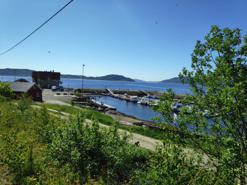
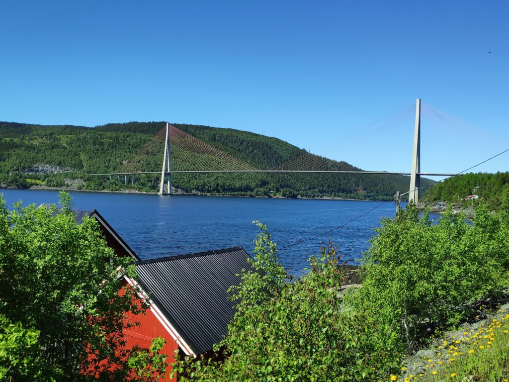
Vangshylla used to have a ferry in order to cross to Mosvik. Now it is mostly a small boat harbor and there is a building where you can rent accomodation or a small fishing boat. There are about 30 cabins in the area and about 10 houses with full-time residents.In 1991, the ferry was replaced by a bridge that spans Skarnsund. The bridge is just over one kilometer long. We moved to Vangshylla in 1988, just as they were starting to build the bridge.
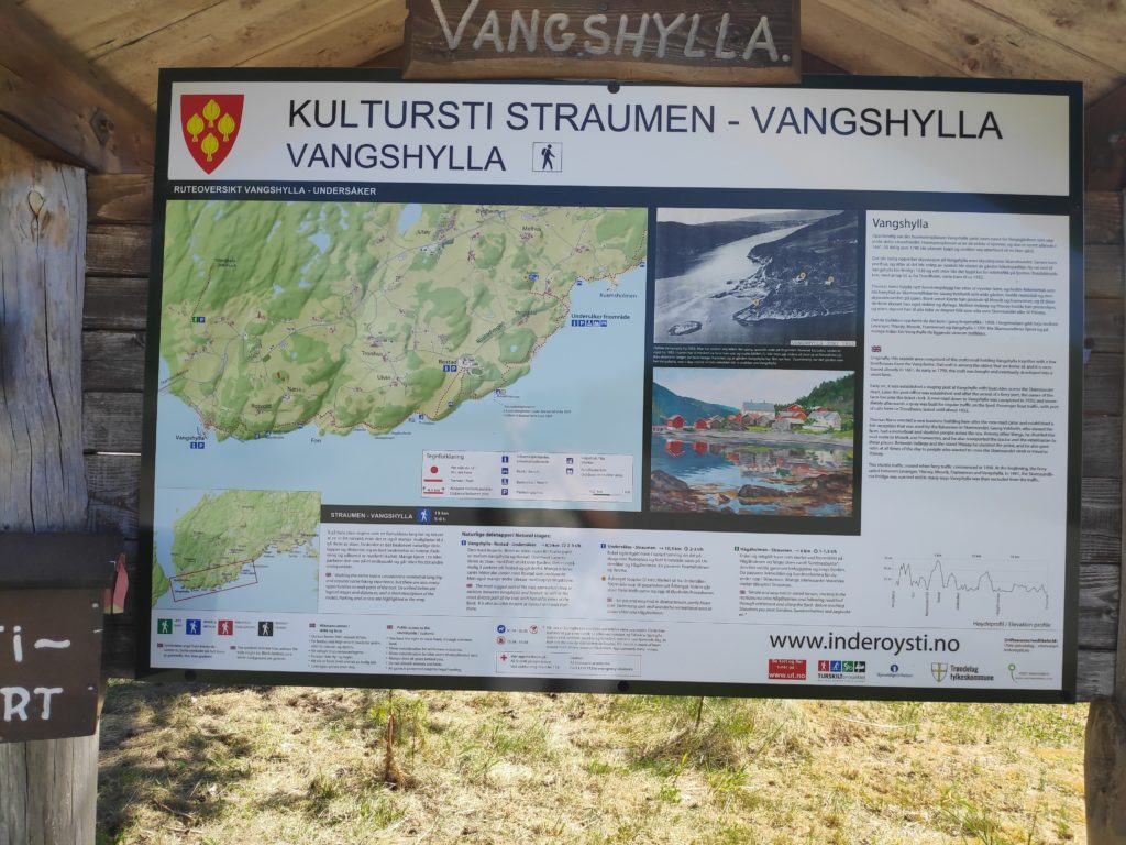
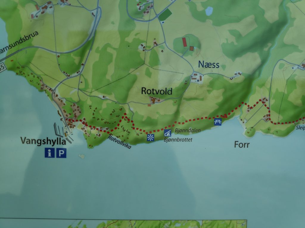
As usual, there is an information board, with a map and some information about things along the trail.
The information board at Vangshylla about the culture trail from Vangshylla to Straumen.
The term “culture trail” (kultursti) indicates that there will be information along the trail, either about the animals or plants that are there, or human buildings that are still there or used to be there. There can be information about how the place got its name. The idea is that you are supposed to learn something as you walk along the trail.
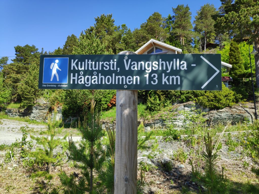
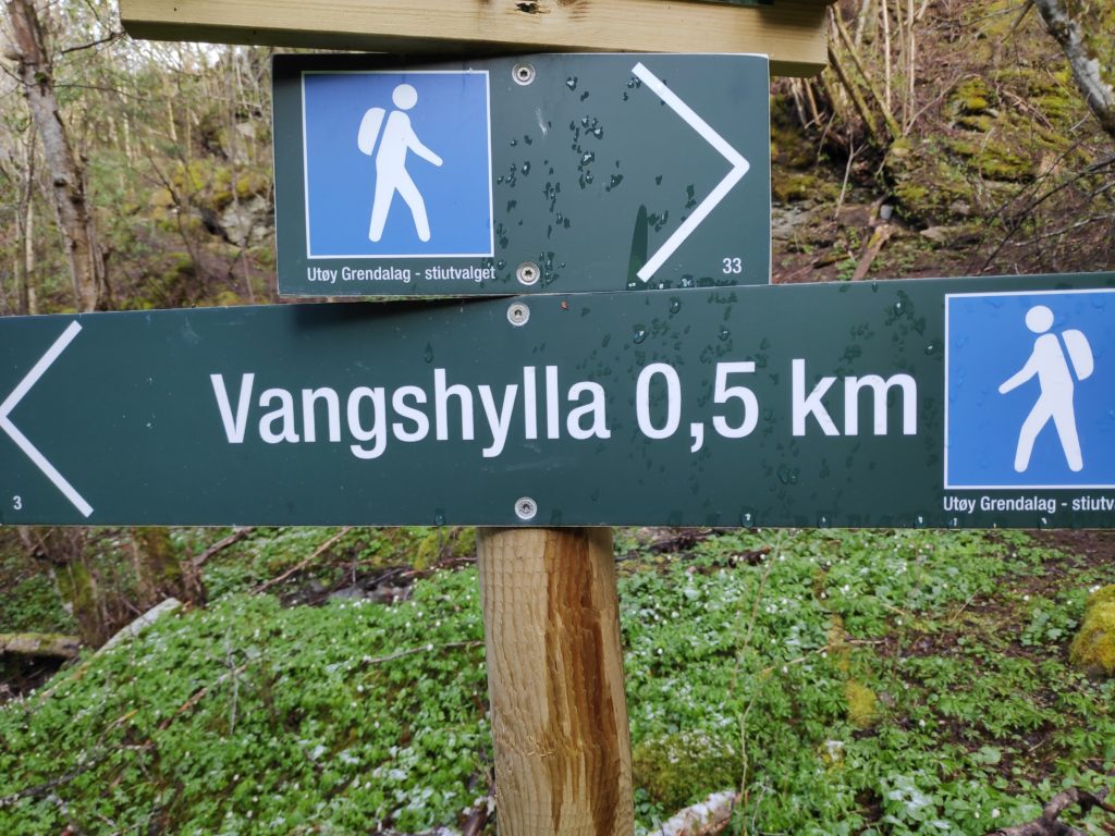
This sign is at the beginning of the trail and you can just see a cabin behind the sign. The main part of the trail is 13 km, but since this sign was made an additional 6 km have been added at the Straumen end of the trail.
When starting at Vangshylla, the trail first follows a road that goes both to full-time dwellings and cabins that are only occasionally lived in. The trail is considered to be of medium difficulty.
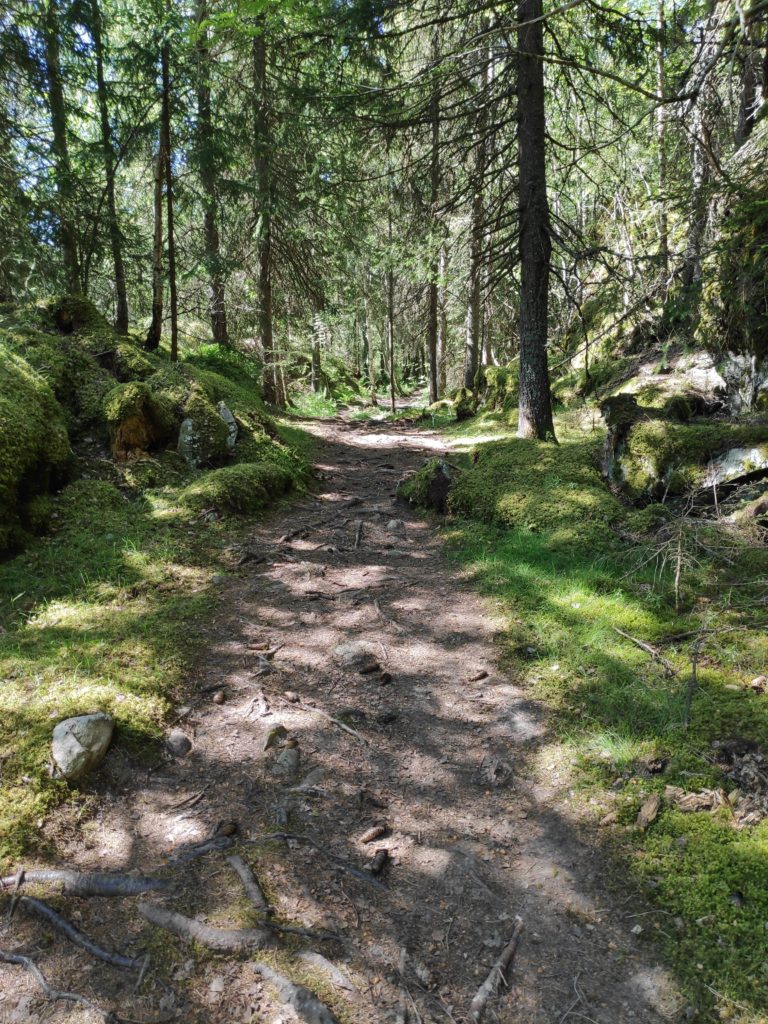
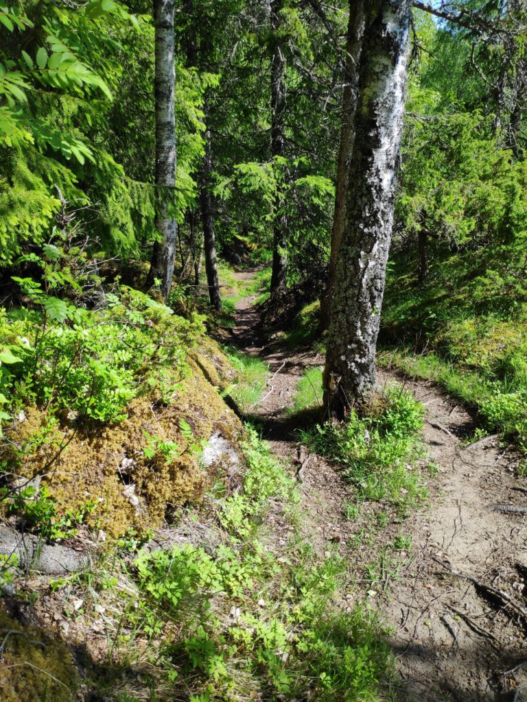
This picture was taken a while ago, after a rain shower, and before the trees had their leaves out.Much of the trail goes through the woods and is pleasantly shady on a warm June day. Notice that the trail is well-used and the tree roots make the surface very uneven.This shows a close-up of the map showing the section from Vangshylla to Forr. I usually walk to Bjønnbrøttet which this year is a check-in point for Inderøy walks. The red dotted line is the trail and the small black squares are the houses or cabins. There are quite a few cabins in this area, in the woods and overlooking the fjord.The trail can be quite steep at times. Here it goes quite steeply down into a ravine.
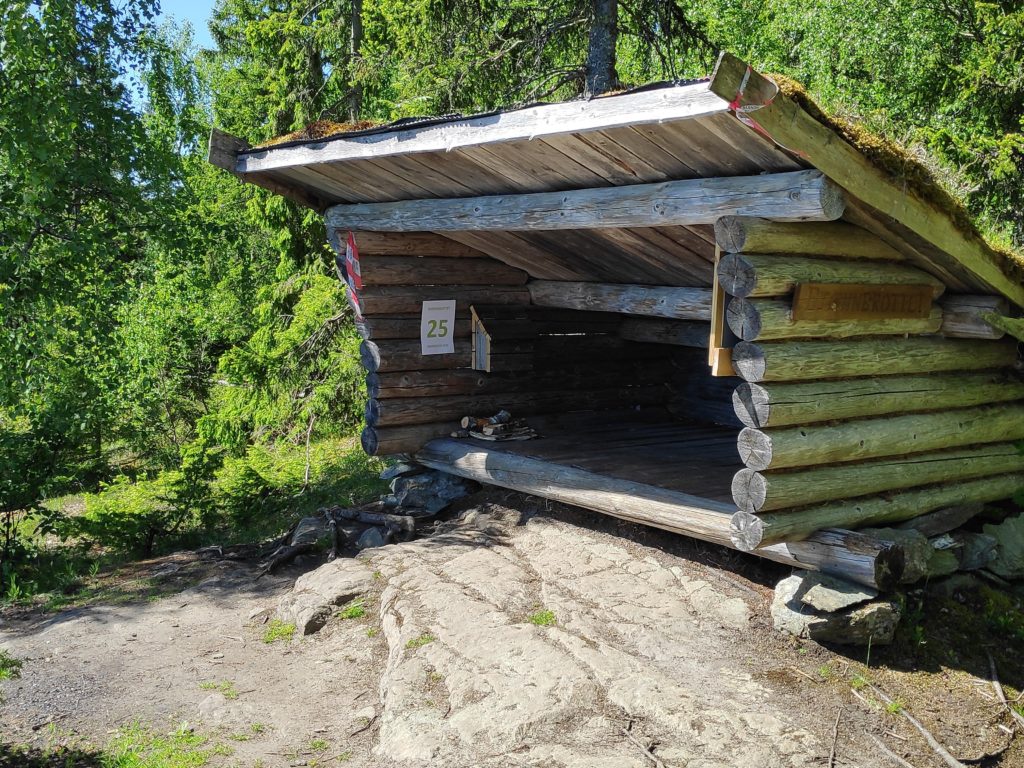
The goal for today’s walk was a shelter that has been there for many years. I have been taking this walk for most of the thirty years that we have lived here. Things have changed during this time, but I continue to enjoy the walk that is partially through these shady woods.
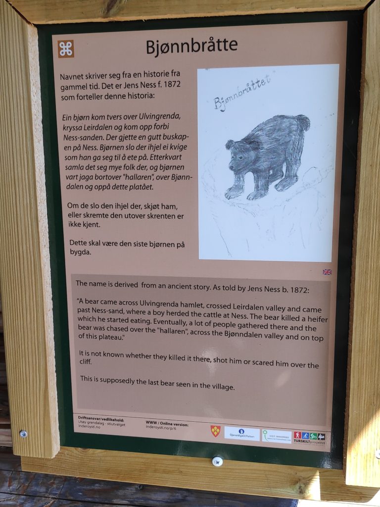
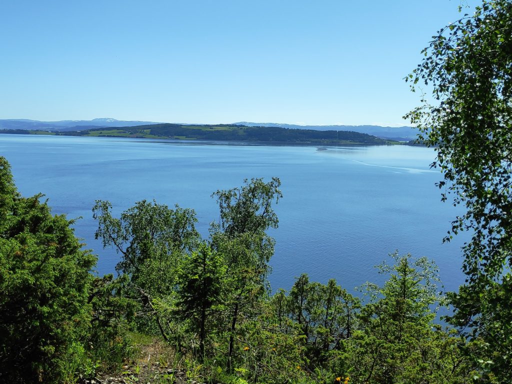
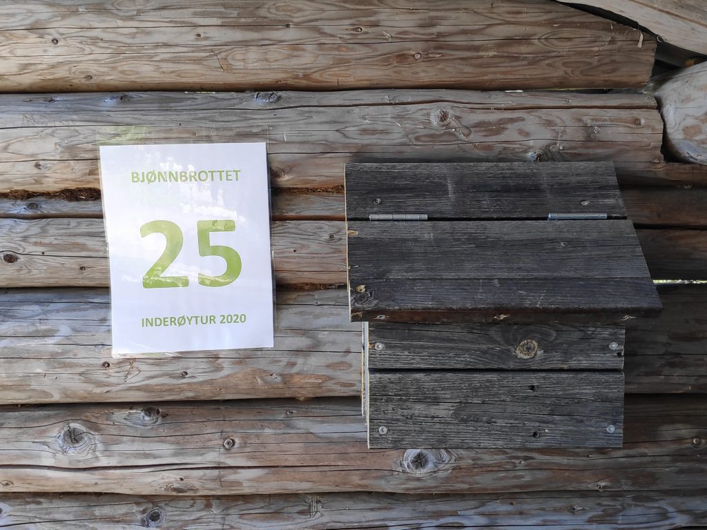
The shelter for post 25, the goal of today’s walk.This sign inside the little shelter explains how the place got it’s name. The story is in both Norwegian and English.The view from the shelter, looking across Trondheim Fjord, towards Ytterøy, which is in Levanger municipality.The sign indicates which post one can check-in to here, and the dark box has a book in which you can write your name. The book is out all year and some people like to count how many times they visit this location.