May in Norway is full of holidays and the first of May is the European Labor Day. Stores are closed and even though we are retired, it was nice to have a day-off household chores. In addition, the weather was sunny and promising to be warm, up to 20 degrees in the afternoon. So my husband and I decided to use the early part of the day for a longer walk and chose to climb the hill in Mosvik that we see from our house. It’s called “Storlia”, the big hill. The car is parked at about 130 meters above sea level and we get to about 380 meters above sea level, so it’s a bit of a climb. It’s good exercise and the views are beautiful on a sunny day.
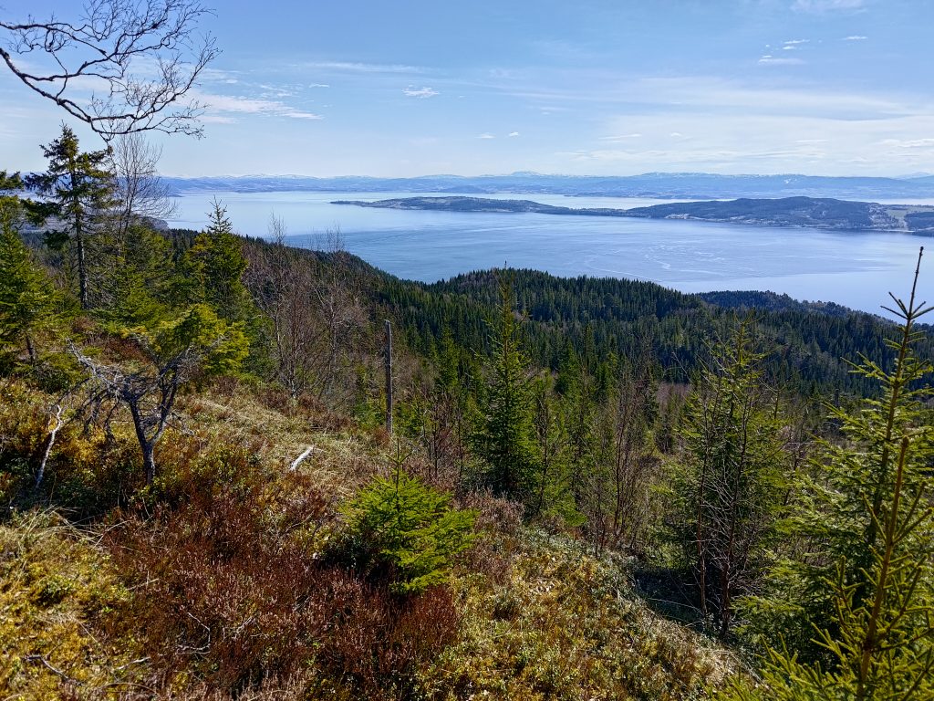
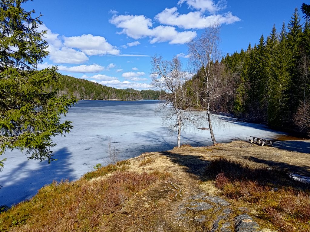
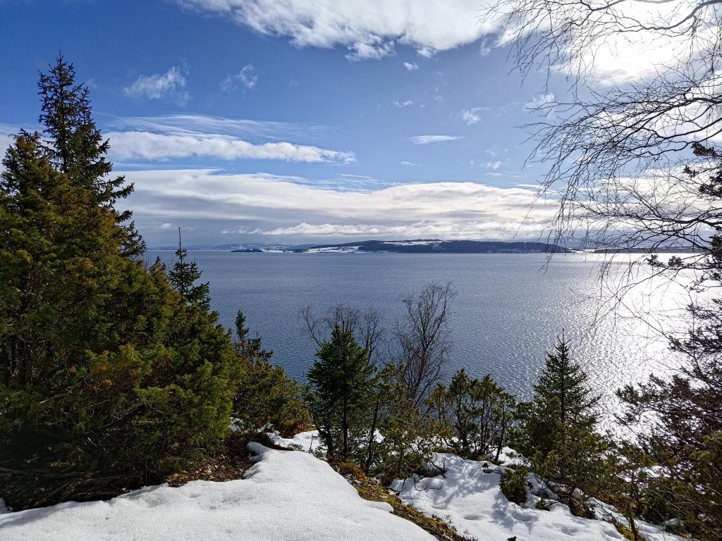
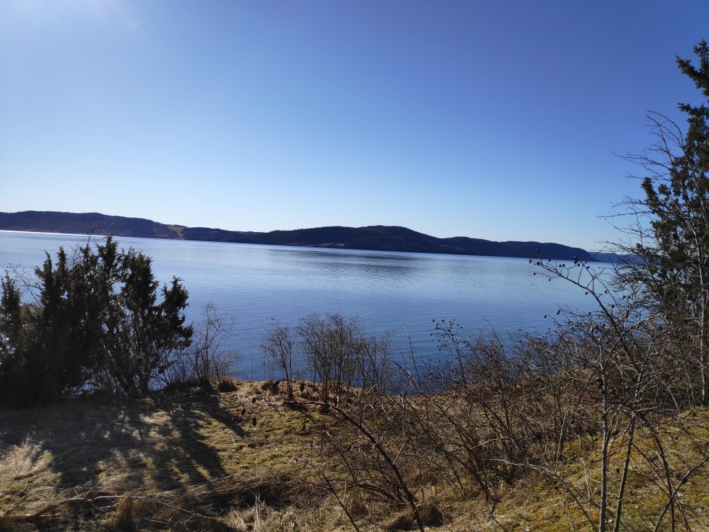
View from partway up Storlia, looking southwest through Nordviksundet.
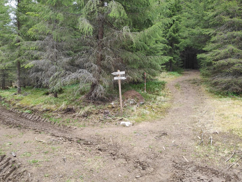
As usual, I started by taking a map of the area. We parked at Gammelplassen (the old place), which is marked with a red arrow on the map below. There are a lot of trails on these hillsides. Many of the trails would have originally been logging roads. Some are still wide enough for two people to walk abreast. Other trails are quite overgrown. The red line on the map shows some of the major trails that are marked. But there are dotted black lines that are also good trails that can be followed.
The map at GammelplassenGammelplassen
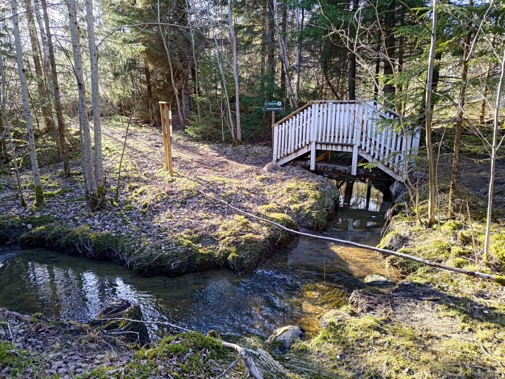
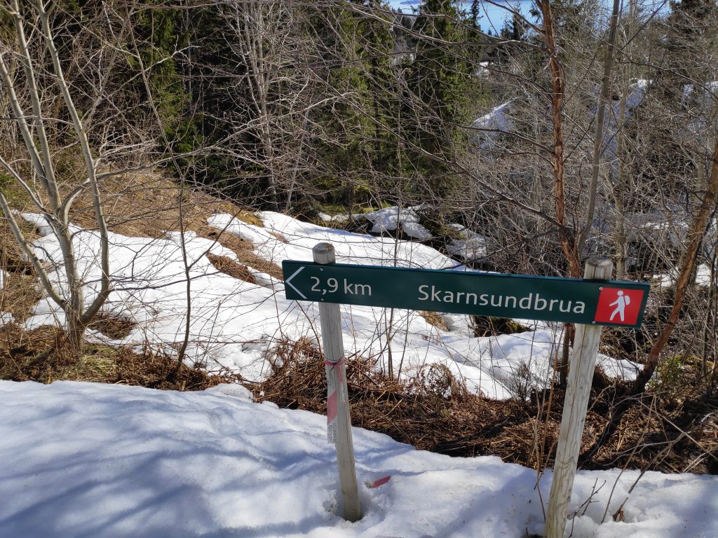
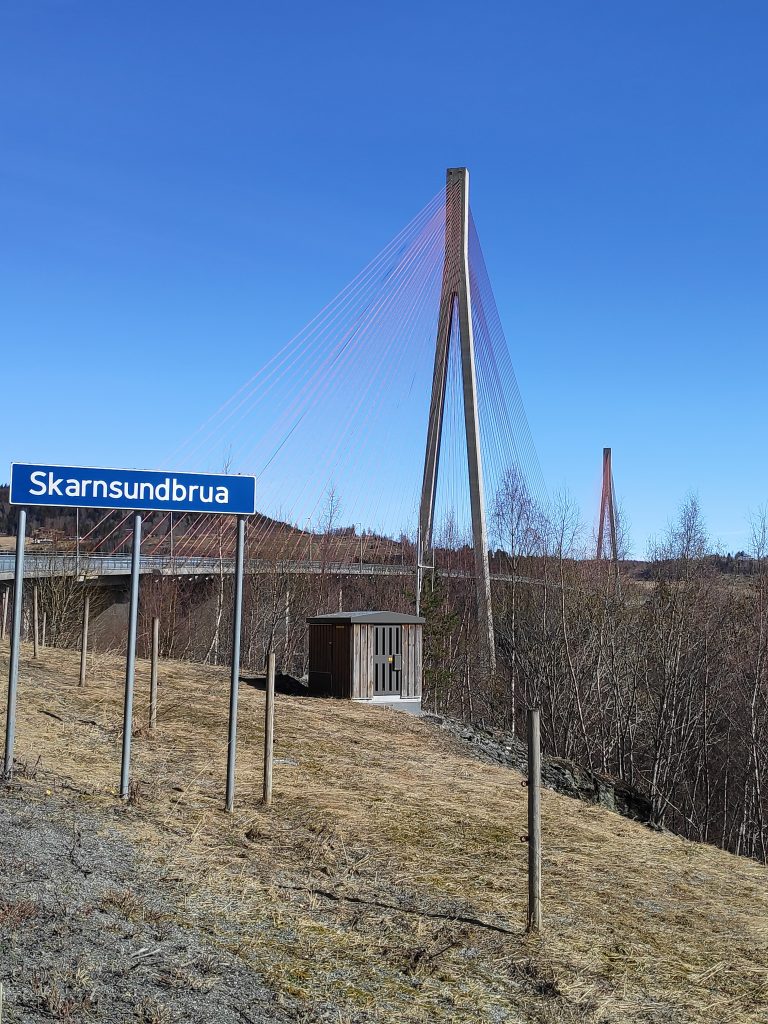
Gammelplassen is large enough to hold several cars. When we arrived we were the only car there, however when we came back to our car, there was one other car there. Notice the signpost on the right hand side of the picture. That is showing you the direction of Skarnsund Bridge if you are walking. It’s a nice walk and I have done it several times from home, but today we wanted to climb a hill. Gammelplassen is about 2.3 km from the bridge.
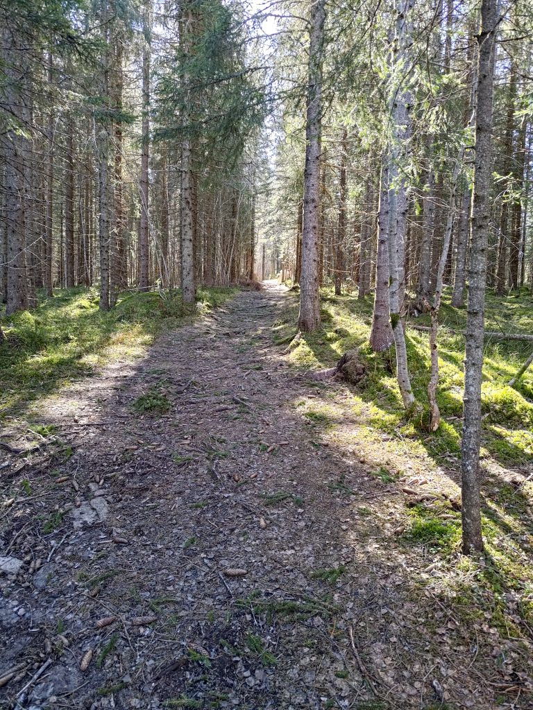
The road going uphill from Gammelplassen
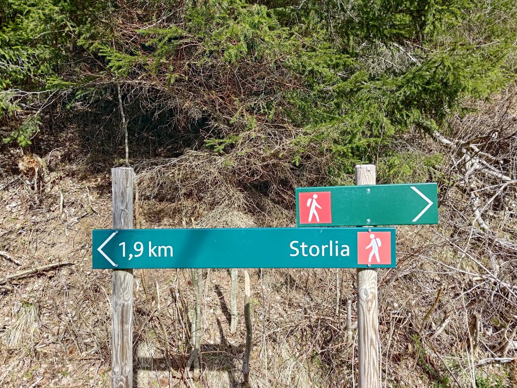
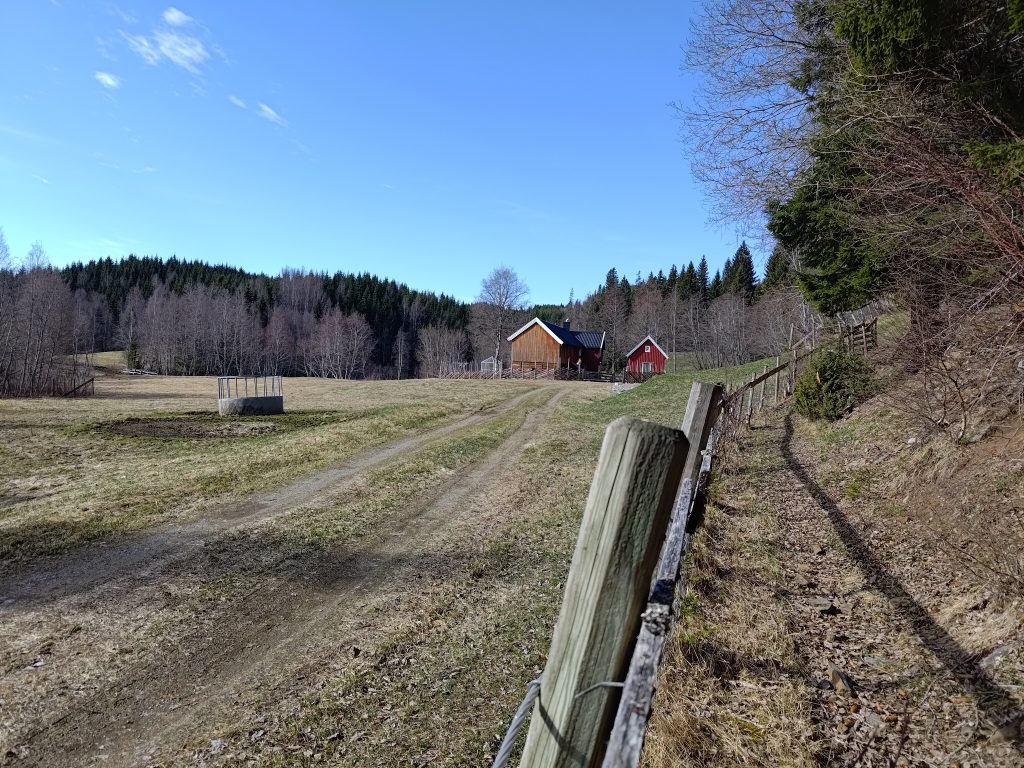
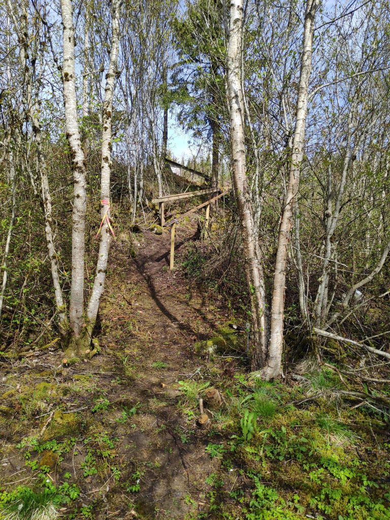
The first part of our walk, which is actually climbing uphill for about an hour, is along this dirt road which leads to a small farm. At this point you can see that the marked “red” trail from the map takes off to the left. We are going straight ahead. These trails are marked with red hikers, indicating that the trail is of some difficulty. In other words, uneven and often steep terrain.
Only 1.9 km to go, but it will take us about an hour as it is a steep climb.The small farm at the end of the road. I have seen cattle grazing here, but the gates were all open. It’s too early in the year for animals to be outside grazing as the grass is just starting to grow. The buildings are probably used as a leisure cabin and the fields rented out to the nearest farmer.One of the steeper sections of the trail, with my walking companion a few meters ahead of me. He goes faster than me uphill.
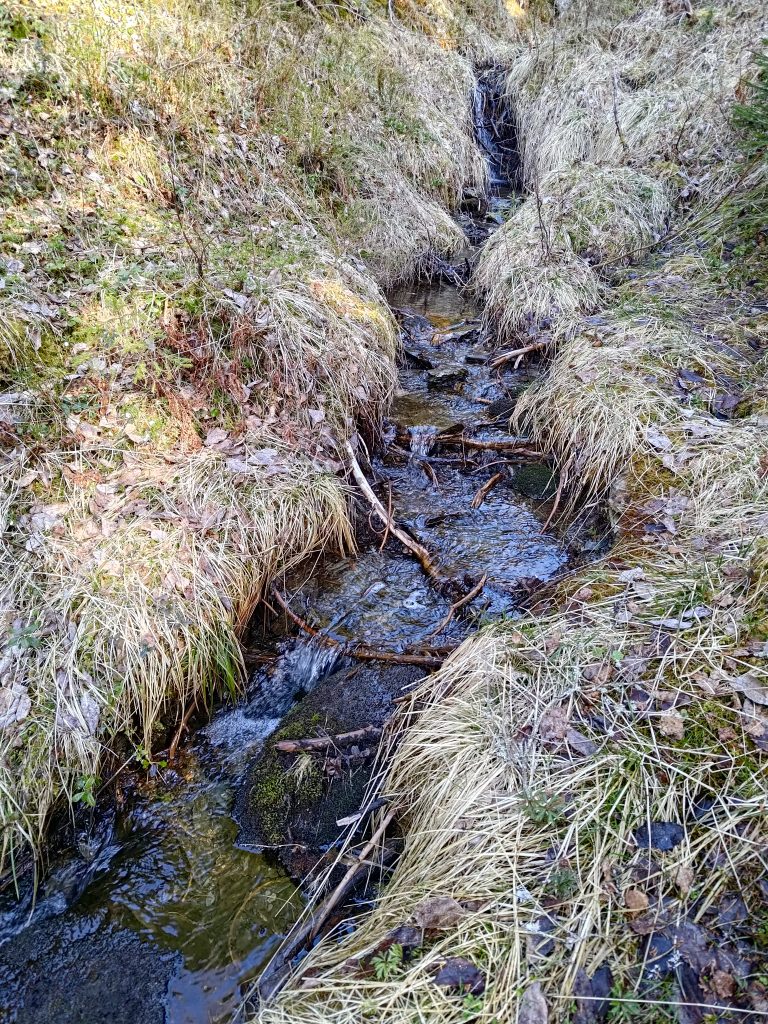
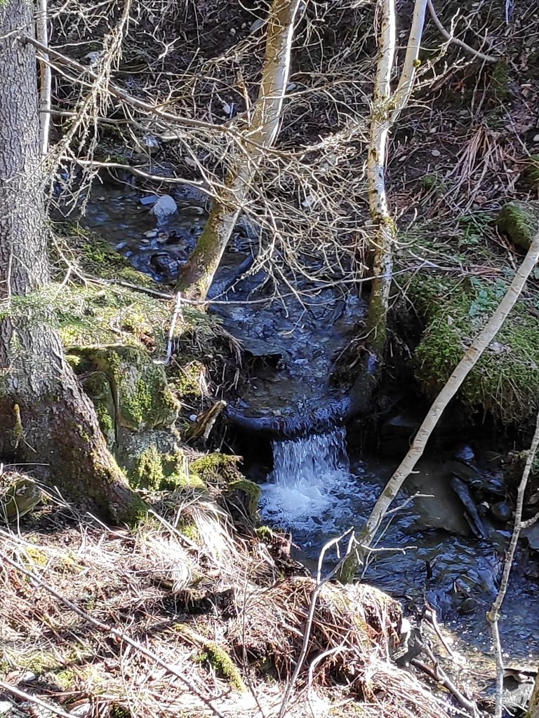
We could hear a lot of birds talking to each other. I’m not very good at recognizing the birds from their sounds. However, I heard the sound of water near the trail. It’s not long since we have had rain, so there was a fair bit of water in the stream. In addition there is probably still some snow to melt.
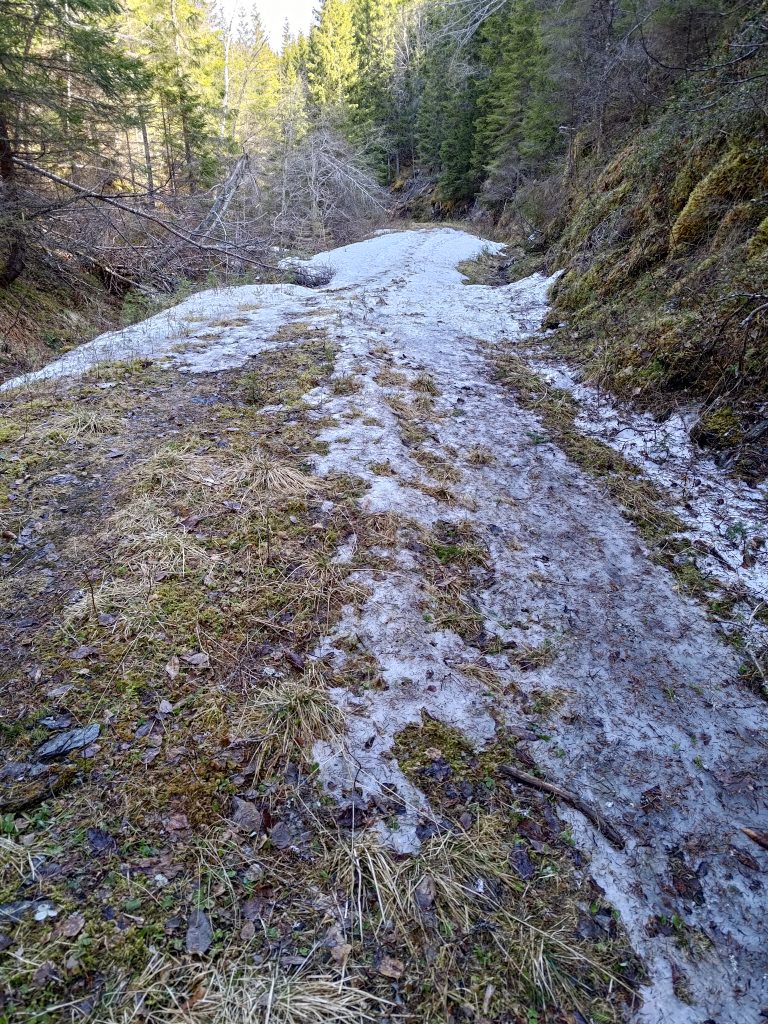
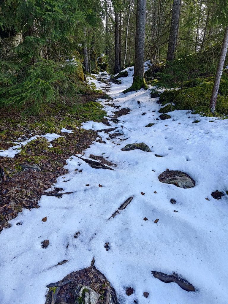
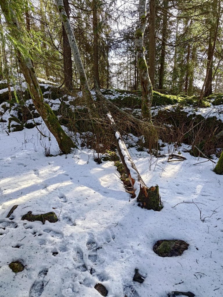
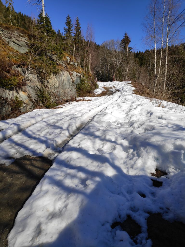
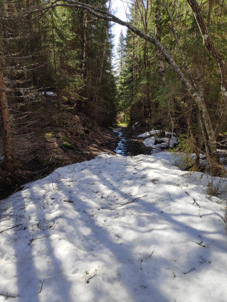
A small stream along the trailThis section of the trail was still covered in snow and ice and was tricky to walk along.
It is always tricky to know when the trails will be free of snow. We could feel the temperature change as we came into this section of the trail that probably gets very little sunshine. It felt like the temperature dropped three or four degrees. In the sunshine it was lovely and warm, but the snow itself would also make the temperature drop. We managed it fine, but when we came to a second section of snow that was much longer, we almost turned back to wait for another day. But then I saw a very small trail, possibly human, but definitely used by deer or moose. We decided to try it and see where it went.
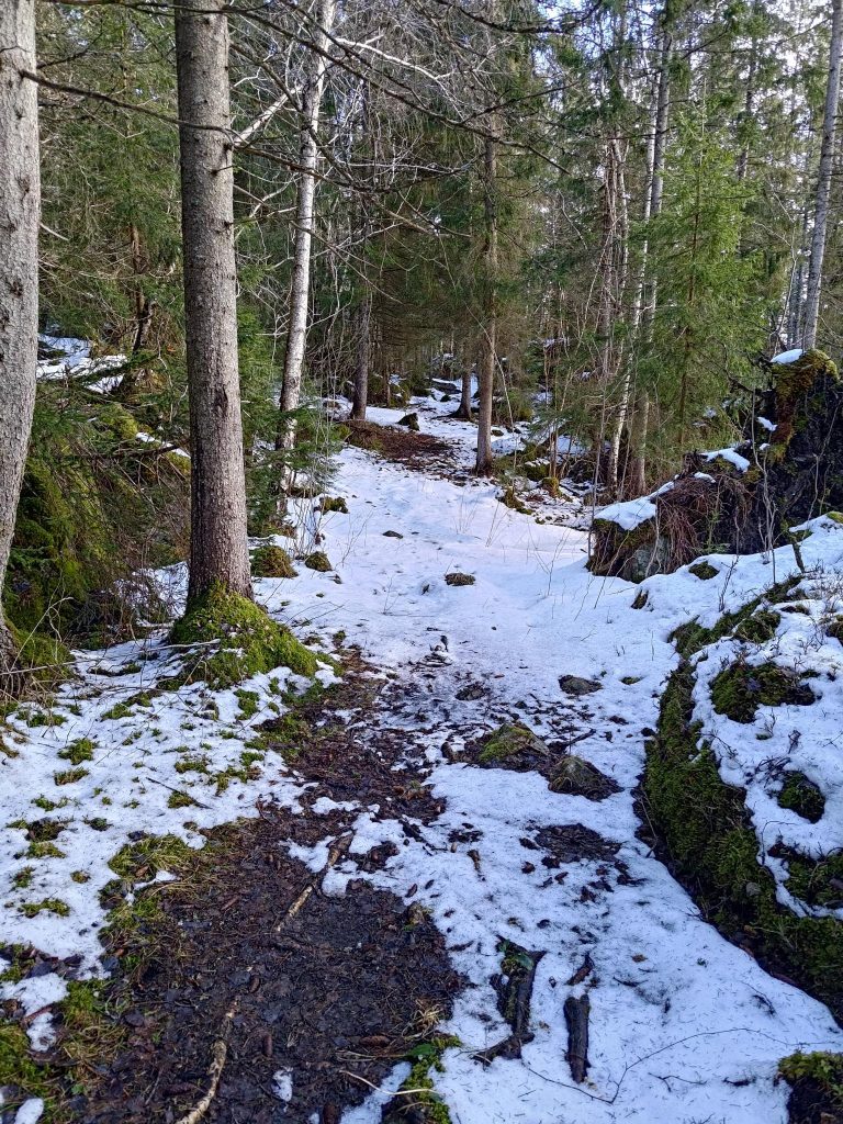
The trail may not look like much, but we decided to try it and so avoid a trail with a lot of snow on it.
It was interesting to try this trail which would its way around the hillside, slowly climbing. I had hoped that it would come out onto the main trail. A check on the map on my phone, which tells me where I am, said that we were going roughly in the right direction, but that we need to head upwards. So we did, climbing up steep slopes, that were partly covered with trees, partly open with grasses and heather. After a lot of work, but not impossibly difficult, we did actually reach the main path.
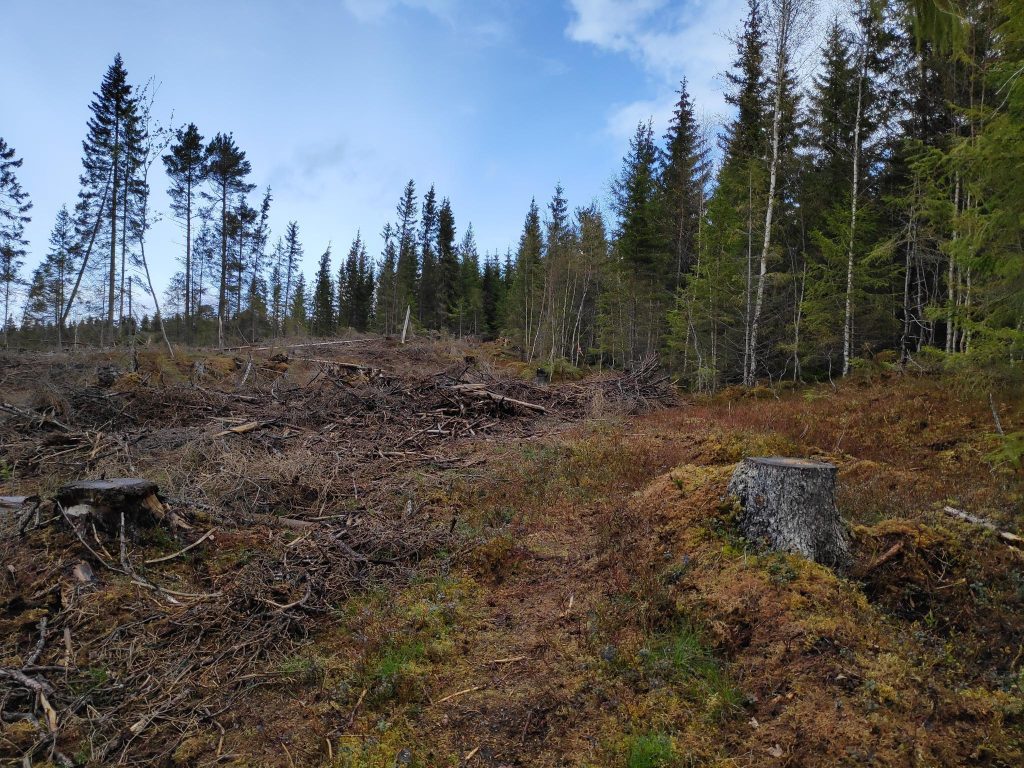
This picture was taken from our scramble up the hillside. You can see how the slope is mostly open but with some trees. It has probably been logged within the last twenty years. Ground cover was mostly heather and moss of various varieties. Trees were irregularly spaced so probably seeded by nature.
Thinking back on our scramble up the hillside, it was rather fun. We’ve done this sort of thing before and we both enjoy it. However, it is the sort of slope that is much easier to go up than to go down. So I said we had to take the main path down, in spite of the sections of snow and ice on them.
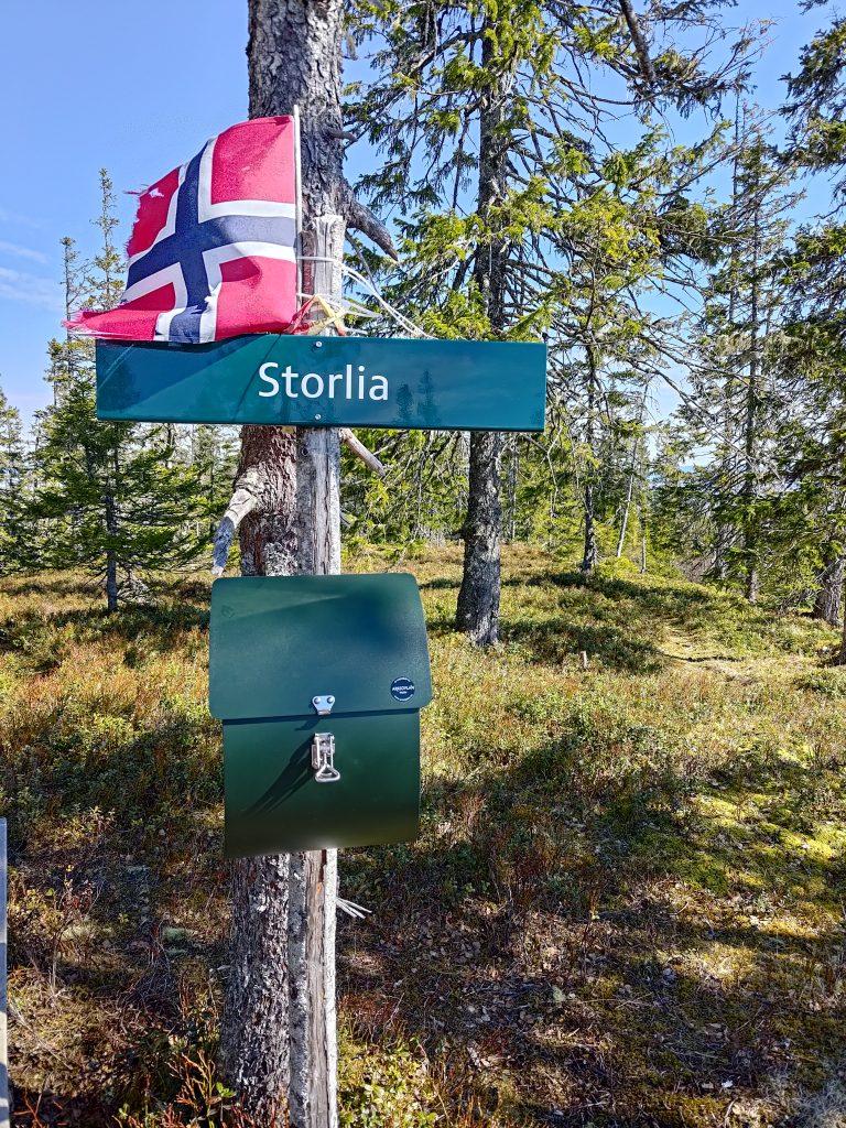
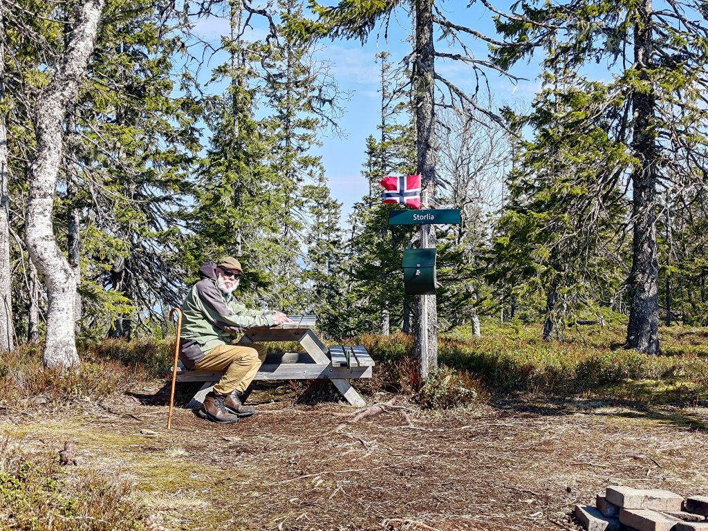
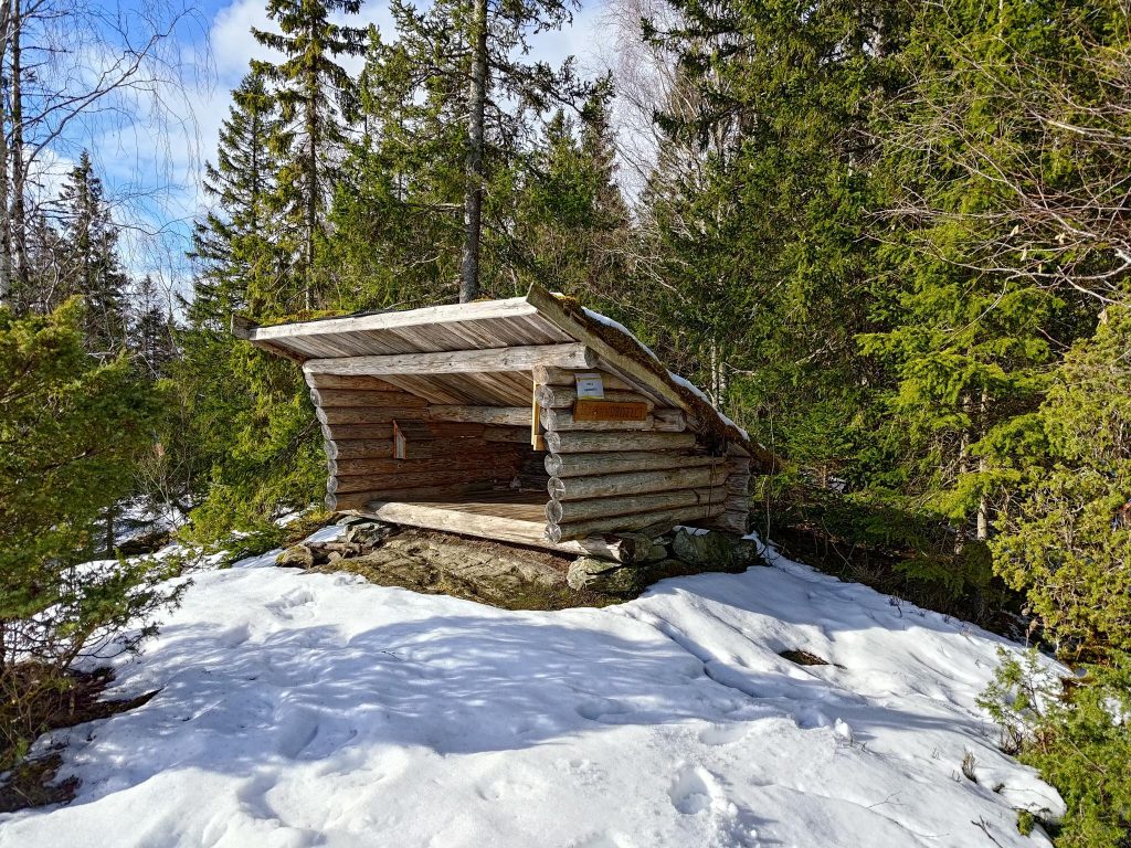
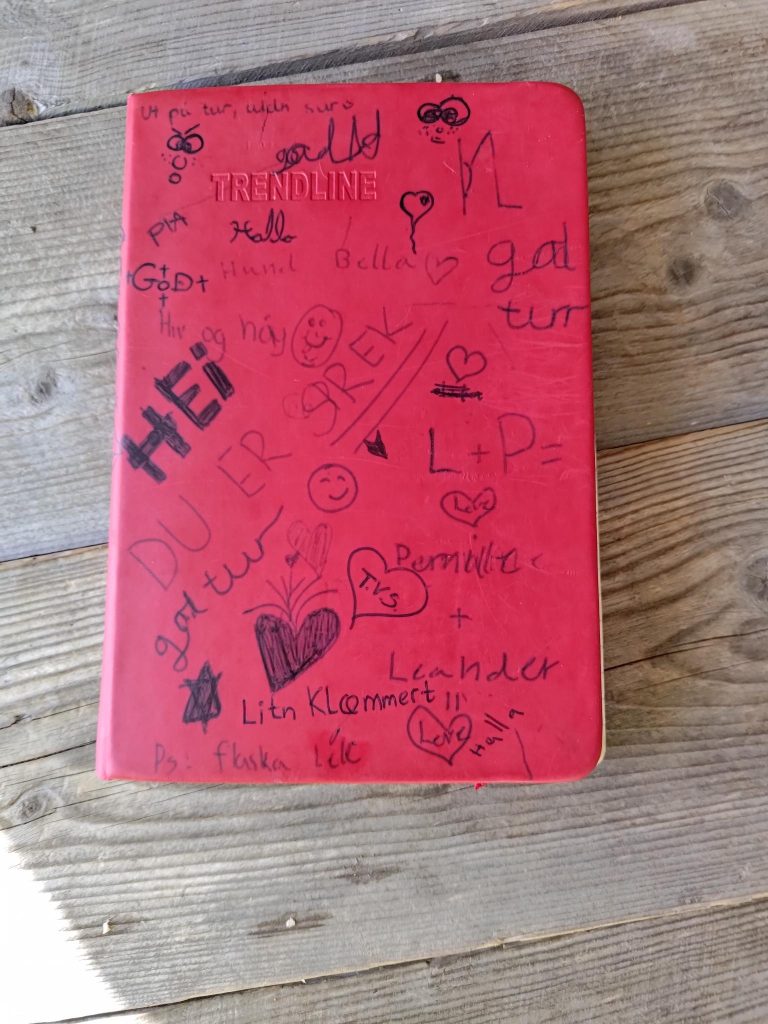
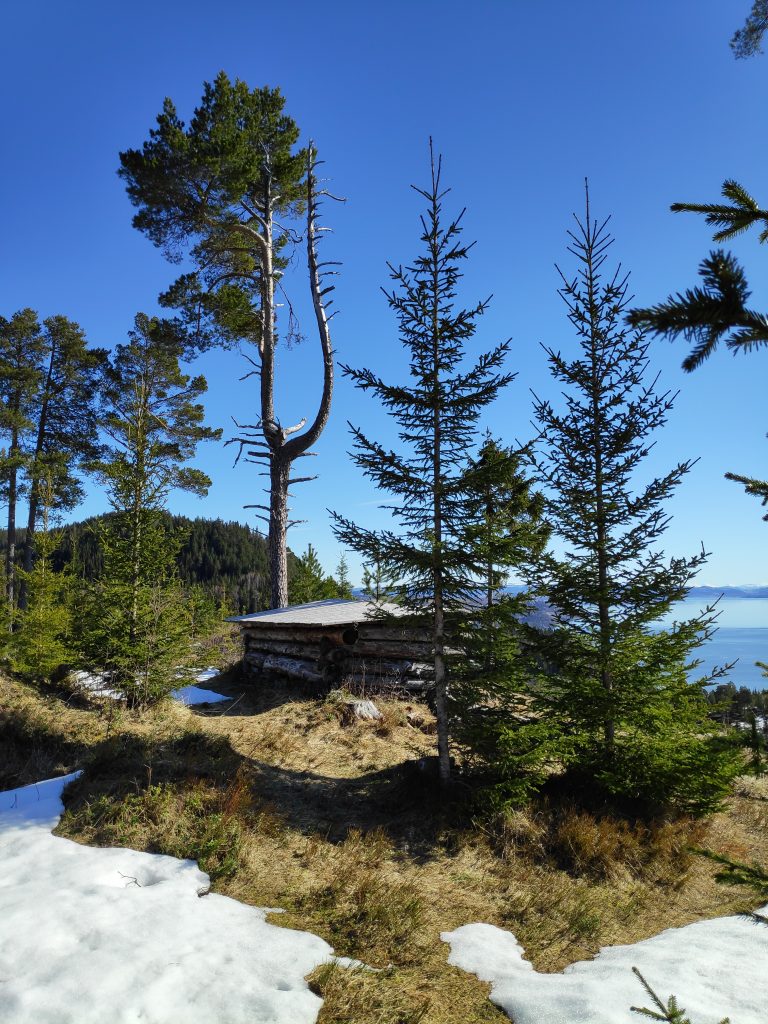
We made it to the top and were able to write our names in the book in the mail box. It’s always fun to come to places like this and find a Norwegian flag flying in the breeze.There’s a picnic table to relax on while having a snack and enjoy the view. We were alone until we were about to leave when a man and his dog arrived.
We had a good break at the top. A bottle of water and two cookies each gave us the energy to find our way downhill to the car. I took a lot more pictures, of course, after all, the reason I like to come to the top is to look at the view.
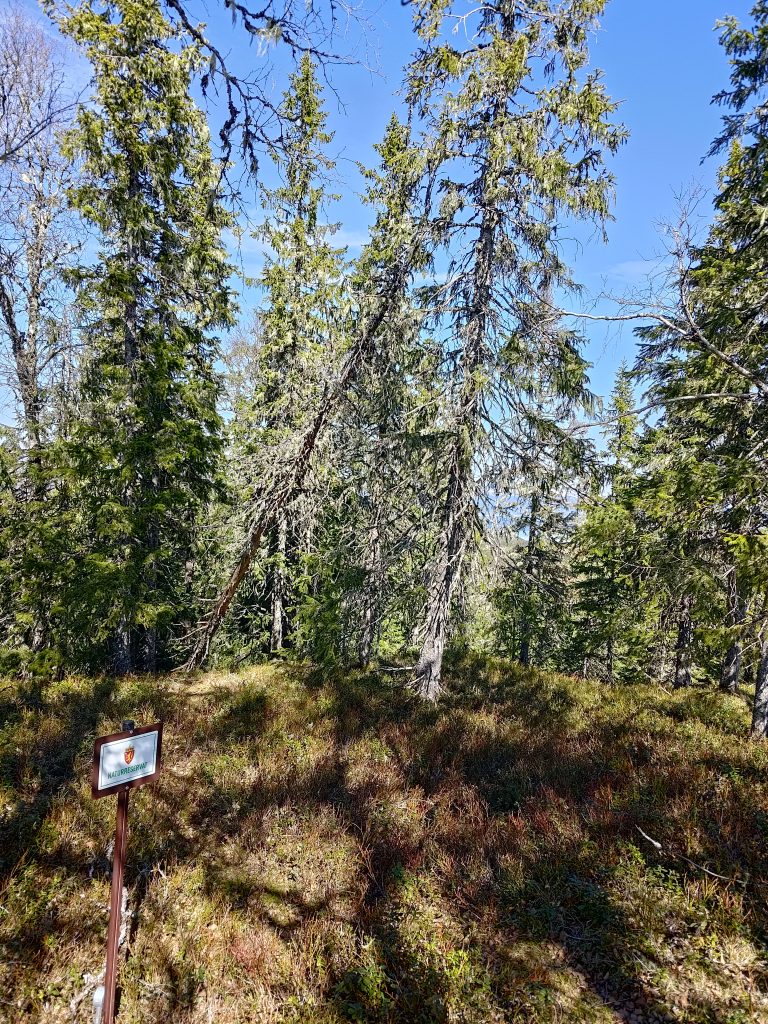
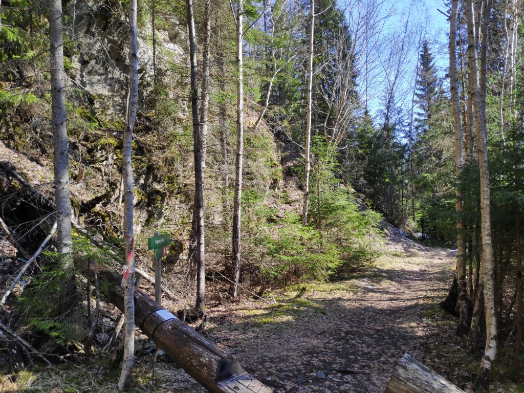
Skavdalen Nature Reserve
To the northeast of the summit of Storlia is a nature reserve. This area has been made into a reserve because of the very old growth forest. Most hillsides near us have been logged every 60 to 100 years, so the trees are not really that old. You can see in this picture how the trees here are not very young and there is a lot of lichen on them. This nature reserve is on a north-facing slope, so will be very moist. It stretches from the top of the hill almost down to sea level.
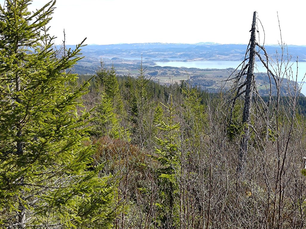
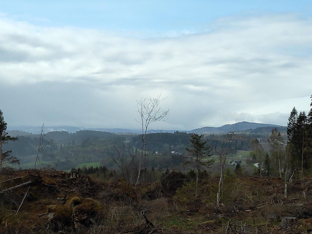
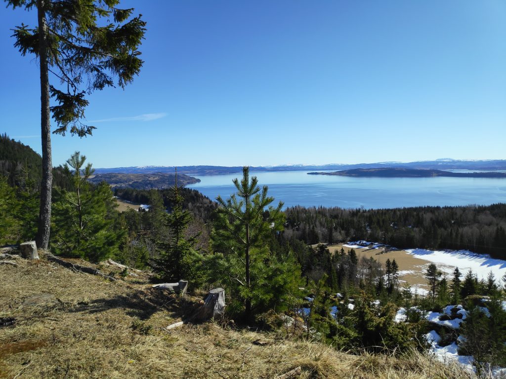
Looking from Storlia eastwards to the peninsula of Inderøy. The snow-topped mountains in the distance would be in Verdal or Levanger. Deciduous trees do not have their leaves out yet, but with warm that can change quickly.A beautiful day, looking southeast, across the island of Ytterøy to Verdal and Levanger.
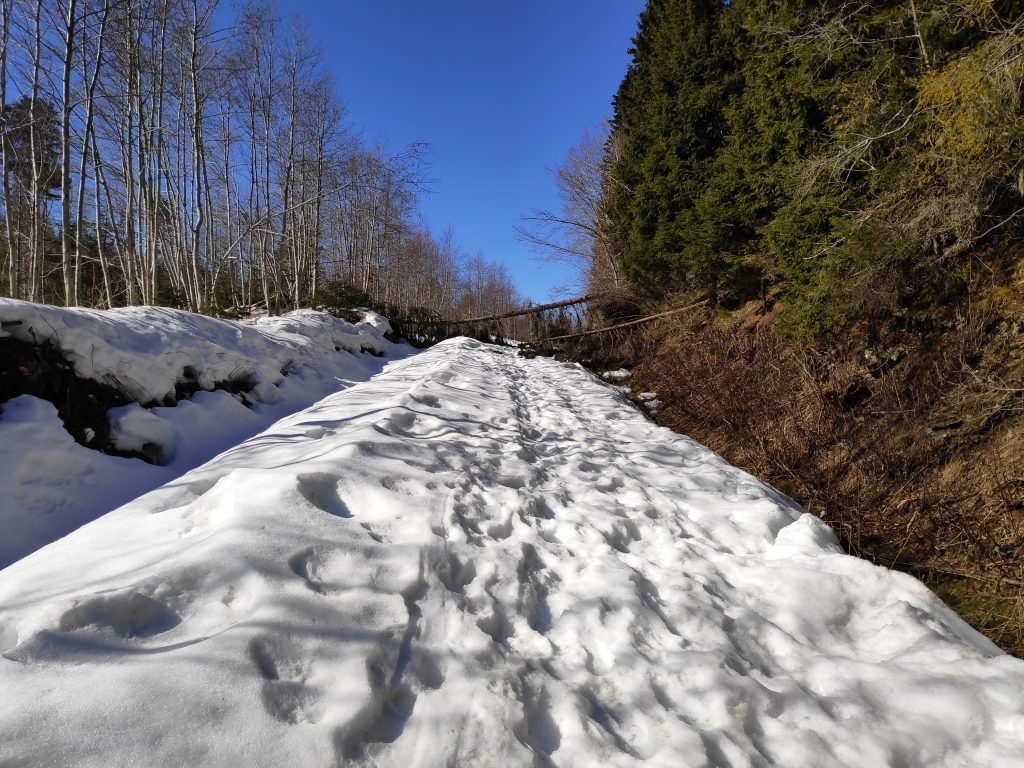
The walk back to the car took a little less time than the uphill climb. But crossing patches of snow and ice also slowed our time as there was little crust on the snow, so one was suddenly in a hole, or one’s feet were sliding on the ice that had formed. We used about one and a quarter hours up the hill and about one hour down again. In all, we were walking for almost two and a half hours. Good exercise on a beautiful sunny day. But I may wait another month or so before doing it again, just to make sure all the snow has disappeared.
A sunny Sunday got us out of the house and walking in the woods. Though it was only 5 degrees centigrade when we left home, by the time we came back about three hours later it was up to 12 degrees. With sunshine all day long and almost no wind, it was the first really pleasant day this spring.
To get to the beginning of our walk we took a 25 minute drive up into the hills of Røra in Inderøy. We parked the car and headed uphill. Though we saw one family at the parking lot, and met one couple on our way back, we were alone with only the sounds of nature. Even the sounds of birds were seldom. As with many of the walks that we take, the first section was uphill, then there was a fairly even section, then downhill to the lake we were heading to. We walked back to the car on the same route this time. As it is a lengthy drive from home, when we come up into these hills we like to take a walk that is at least two to three hours.
The map at the parking place. We are at the red dot on the map, will walk south about 2.5 km to the south end of the lake called Leklemsvatnet. We walked back the same route. The information sign also gave several suggestions about different walks in the area and telling how long each walk was.
One thing I have learned to do is to always take a picture of the map at the parking spot. One may need to reference it during the walk to see if we are on the right path. There are all sorts of paths in these hills and we had a definite goal for our walk. In addition I have a map on my telephone, which I love. The advantage of a map on the phone is that it actually tells you where you are. I’ve always loved reading maps, but it is also important to actually know where you are. GPS, both in the car and on my phone, is very useful.
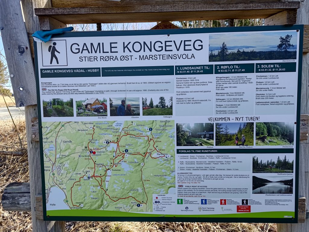
We are going to follow part of the Old Royal Road or King’s Road, which was used until about 1800 as the main road through our area. This section of road that has been preserved by the local history clubs is about 7 km, but we only went along part of it.
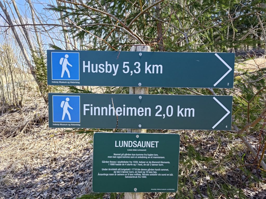
The starting point of our walk, at Lundsaunet.
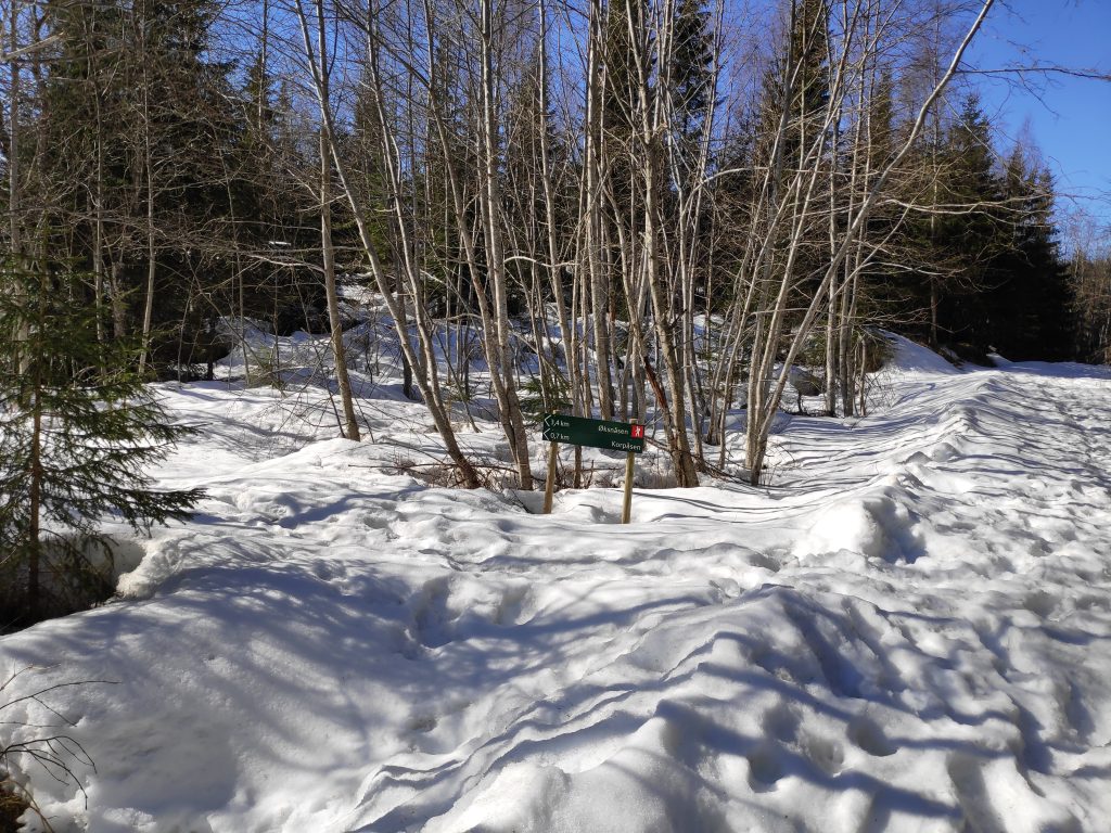
The name for the farm, Lundsaunet, which is where we parked, could come from the name of the bird, “lom” / loon, though it could come from a man’s name. The farm was registered in 1559 and is still a working farm. We often walk to Finnheimen at the north end of Leklemsvatnet, but today we decided to walk to the south end of the lake where there is a dam. We are headed in the direction of Husby, but only walk about half way, about 2.5 km.
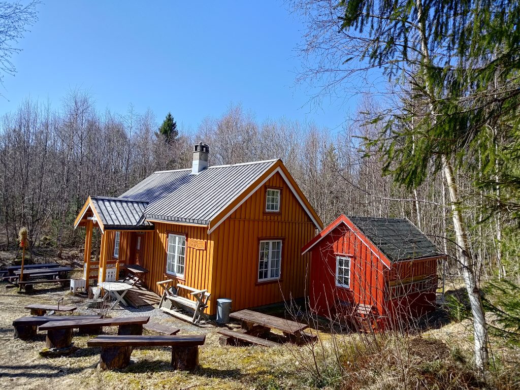
Kvennstu- Eva Moestu
As we walk along the trail, we come across this building owned and operated by the Inderøy Museum and History Association. There are often meetings held here, but there was no activity as we walked by. They have made a lot of seating outside the building. This is the typical size house from the 1800s for those living in rural areas and not owning their own prestigious estate.
The trail through the woods
Most of our walk was through the woods. We were walking southwards, so often the sun was in our eyes. Even though I was wearing sunglasses, it wasn’t always easy to see with both bright sunshine and shade alternating on the path. The first 20 minutes or so of the walk was primarily uphill and in some places it was a bit rocky. Other places, like this section, were fairly level and covered with leaves and relatively easy walking.
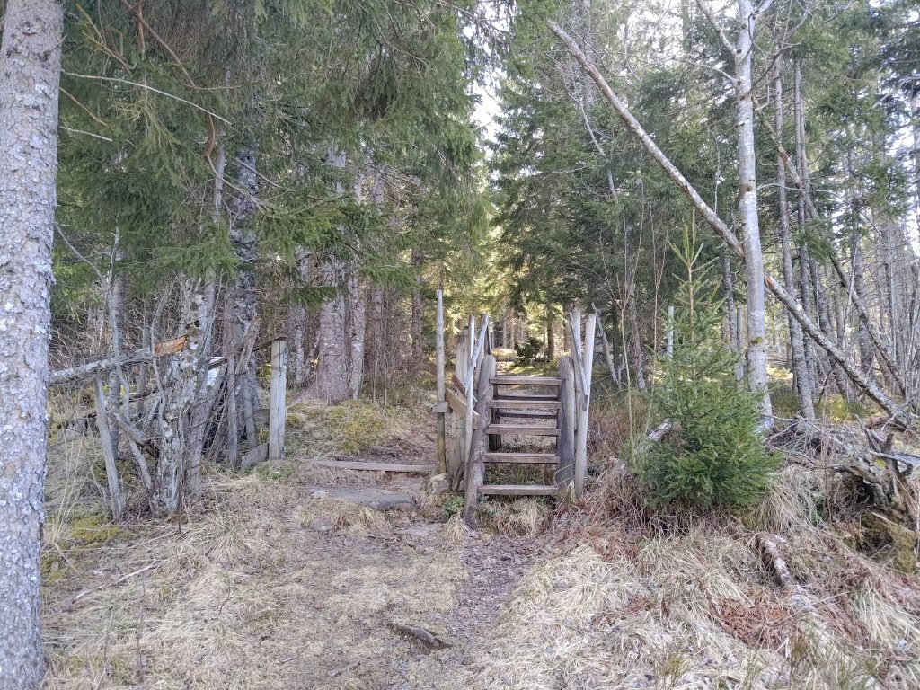
The open gate and the stile for when the gate is closed.
This is a farming area and in the summer months there will be sheep out grazing. They are kept away from the cultivated fields by fencing. As it is too early in the year for the sheep to be out, the gate has been put completely to the side so that walkers have no problems following the trail. Once the sheep are out, the gate will be closed and people will be expected to climb over the stile. This saves a lot of problems as not all people are good at closing gates behind them.
Eventually we got up high enough to get a view towards Straumen. The mountains in the distance still have a bit of snow on them.
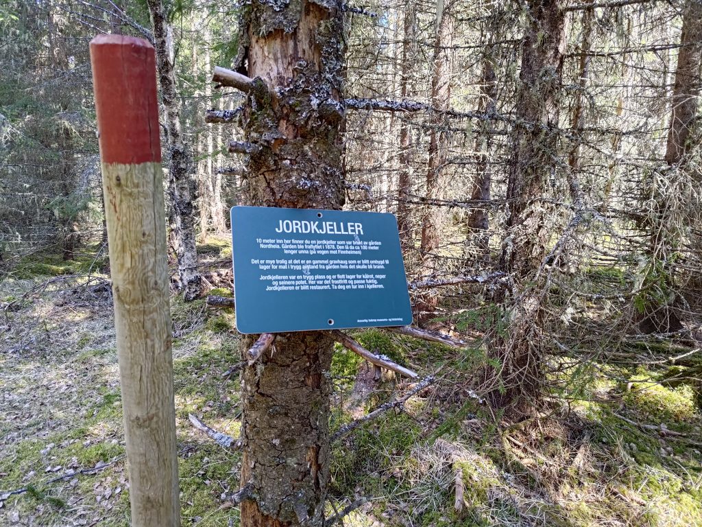
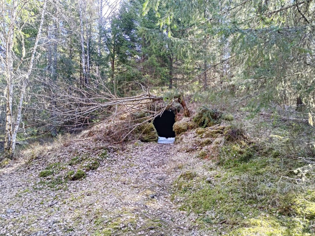
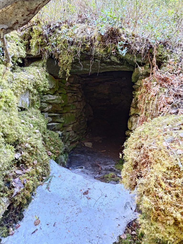
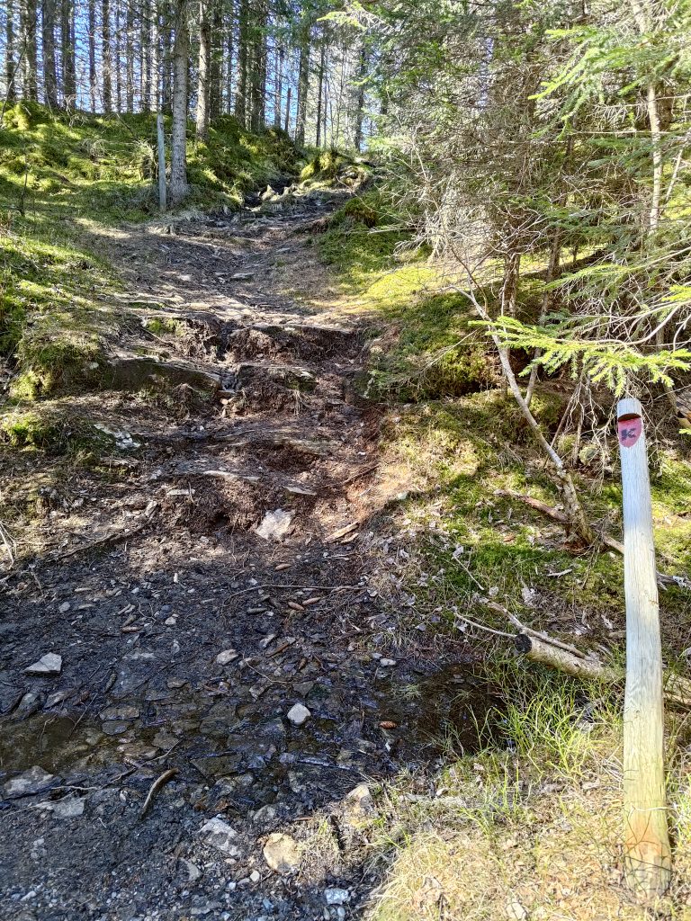
I hadn’t seen this sign before so I went to investigate it. The earth cellar was used by a farm nearby. The farm was abandoned in 1878. In the cellar they would have kept root vegetables, such as turnips and potatoes, in a damp, but above freezing place. This cellar is about 100 meters away from the farm buildings, a safe distance if there should be a fire. Note in the picture the pole with the red top which is used to mark trails so that they are visible both summer and winter.
The earth cellar, with a bit of snow still in the entrance way. This was in a very shady part of the forest.The earth cellar, showing how it is built up with stones, then covered in earth and moss.
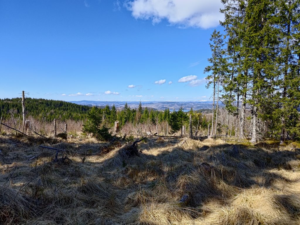
Eventually we began to climb again and came out into the open where the forest has been cut down relatively recently. Lots of choices on where one can go from here. We chose to continue on the trail towards Husby and climbed up the hill ahead of us.
This was the only place on the trail that we came across snow still on the trail itself. As the area is quite open, I expect the snow got blown onto the trail here and built up to a greater depth than elsewhere. Today it was in the sun, so I don’t imagine that it will last much longer.
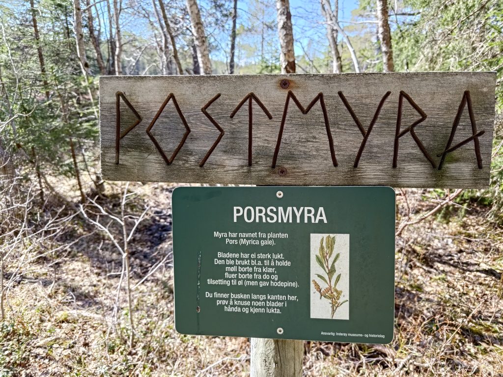
“Myr” is a swampy area. Though we haven’t had much rain recently, this would be a very wet area. This swamp is called “Porsmyra” because of the plant “pors” which grows here. Pors /myrica gale has a strong smell and was often used to keep moths from clothing, flies away from outside toilets and in making beer. Inderøy is full of swamps, but what was most interesting for us was seeing a pair of cranes feeding in the swamp.
Porsmyra, with two cranes located under the tallest tree. They are difficult to see as they were quite far away.
Cranes (grus grus) are the largest bird found in Inderøy. They are from 95 to 130 cm in height and can weigh between 4.5 to 6 kg. We have seen cranes several times this spring, including in the field next to our house. There seems to be more and more each year. They avoid people and quickly fly away if one gets too close to them. I have learned to recognize their trumpet-like call, so I heard them first then looked for them in the swamp.
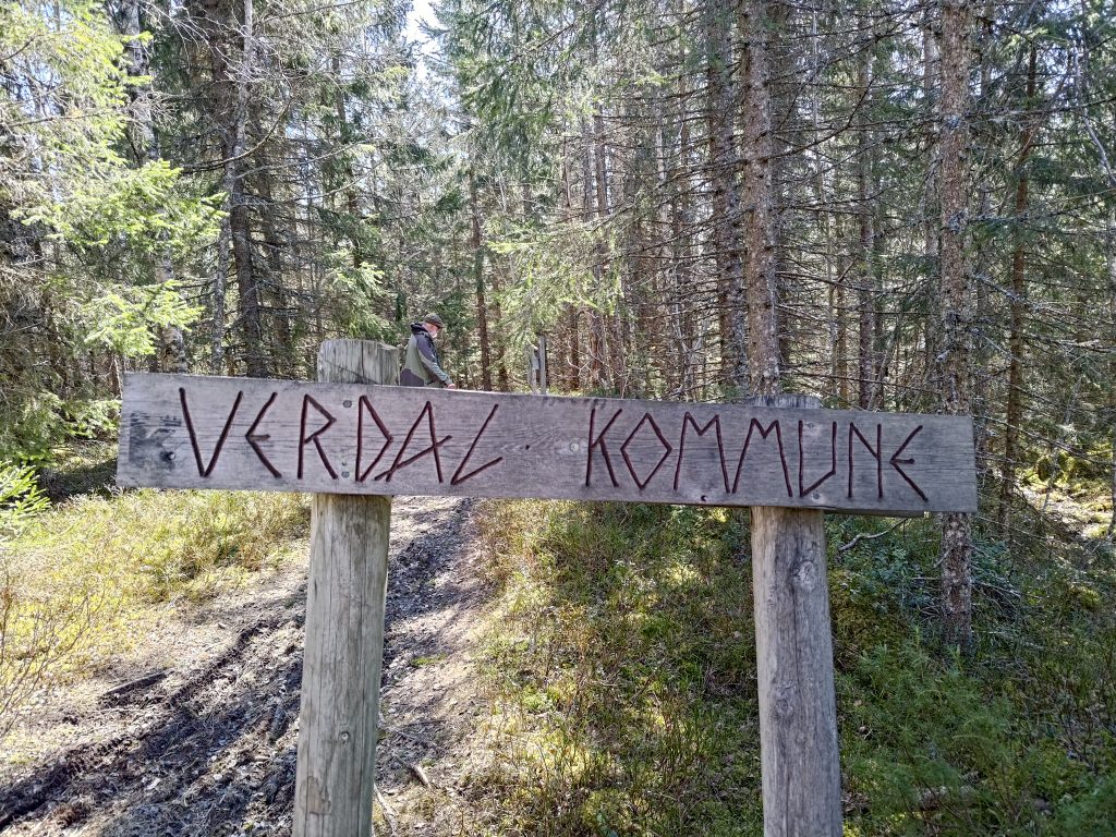
We crossed into the neighboring municipality on our walk. Behind the sign is my walking companion, dressed in traditional green and black.
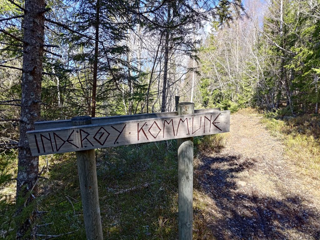
Of course, if we look back the way we came from, it shows that we have come from Inderøy municipality.
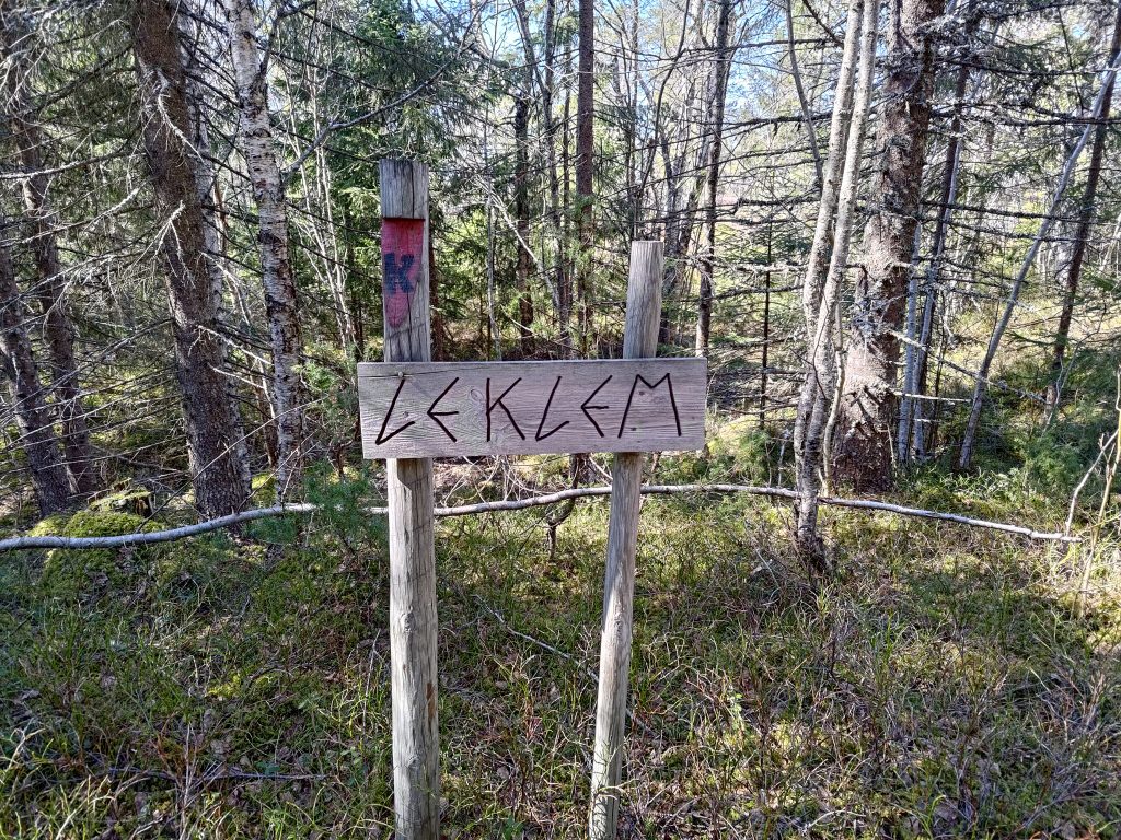
Once we had crossed into Verdal, we were in the area called Leklem, and we are headed to the south end of Leklem Lake. Note the post, with a red section and a large K, showing that we are on the King’s Road (Kongeveien).
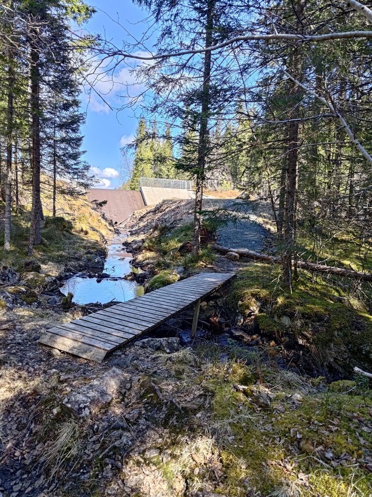
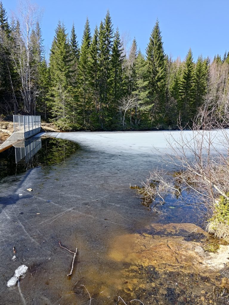
The dam on the south end of Leklem Lake
Our goal for the walk was to get to this dam. The first time we found this place, they had emptied the lake and were rebuilding the dam. The lake is a water reserve for Verdal municipality, but otherwise the water spilled over the top of the dam and ran down this stream that we crossed.
Not all parts of the trail were equally smooth. I imagine that when it is raining, this section is also a stream. I use two walking sticks when out in rough terrain and find it very useful on sections like this, especially when going downhill.The top of the dam. There is a spillway and water was gently running over the top of the dam.Leklemsvatnet
The lake was still partly frozen, but with 12 degrees and sunshine, I don’t imagine it will stay frozen very much longer. We found a picnic bench to sit at so we took a well-deserved pause in our walking. We had used one and a half hours to get to this point, with all the stops we had taken to look at the views, to watch birds and to take photos. We used only one hour to get back to the car, but I think there was less uphill on the way back, which certainly means that we walked quicker.
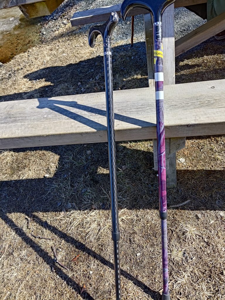
I have had the walking stick on the right for several years. It was purchased in Canada by my daughter many years ago, and I have been using it for the last couple of years. The walking stick on the left was purchased this winter (online from a Norwegian business but the stick is made in Germany) so that I could have two sticks when walking in rough terrain. I like having two out in the wooded hills and on rough ground. I like this type of handle as my weight is on the palm of my hand, not on my fingers which don’t always work well.
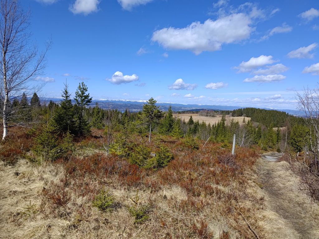
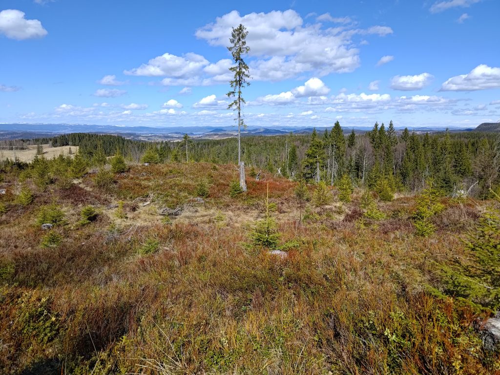
Walking north, back to the car, we saw the views that I quite like. The best views were from a logged area, where it was very open and the new trees were still quite short. Though there is a lot of wooded area on these hills, there are also a lot of farms in Inderøy and Steinkjer.
Looking north, with Steinkjer in the background.Looking northeast, also towards Steinkjer
We used two and a half hours on our walk today, and we were healthily tired when we got back to the car. A thermos with coffee and two cookies each helped revive us. We also changed our shoes so that tired feet felt a bit of relief.
Something we could have done better was to have taken a small backpack with bottles of water. Today was the first warm day and the longest walk we have taken this year, but a drink of water would have been good when we took a break before heading back to the car. It can also be nice to have something to put clothing in as layers get taken off as the day gets warmer. I had taken off my wind jacket about half an hour into the walk. With no wind and lots of sunshine, it wasn’t needed.
This was a most enjoyable walk. We were well away from roads with traffic. It was quiet except for our noises and voices, which is something we both appreciate. The temperature was perfect for walking, not cold, nor too hot. Next time we come to these hills we will probably take a slightly different walk, but this is one I especially enjoy. I hope you were able to get out in nature on the weekend too. Being near trees is supposed to be very good for our mental health.
One of the nice things about April is the light evenings which allow me to get out for a walk. This week I met a girl friend at about 6 pm and we took a 50 minute walk that we have done many times before, but this was the first time in 2024.
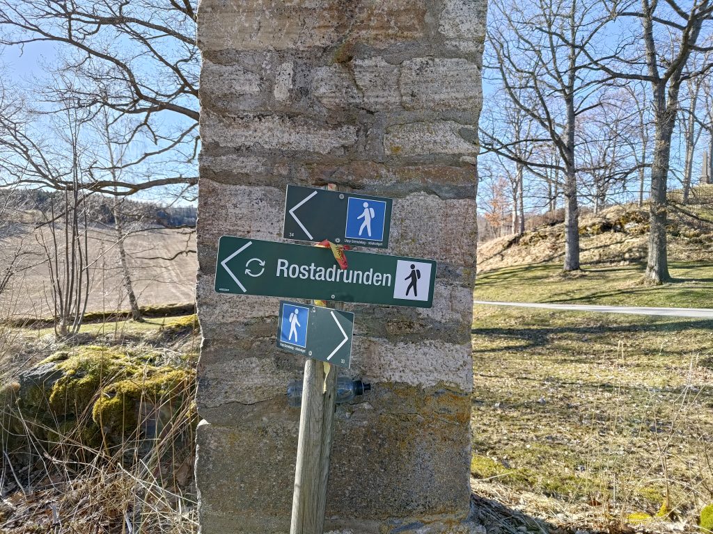
“Rostadrunden” means that the trails go in a circle and one can walk either way.
During the summer months, we can often get points for going to certain parts of this trail, but it is too early in the season yet for that. But it was a nice sunny evening, though there was a very cold wind blowing. The temperature was about +5 degrees centigrade, but there was a big difference between being in the sun or being in the shade. There is public parking near these signs, which holds five or six cars. We each drove a car as this location is halfway between where we live and we come from opposite directions.
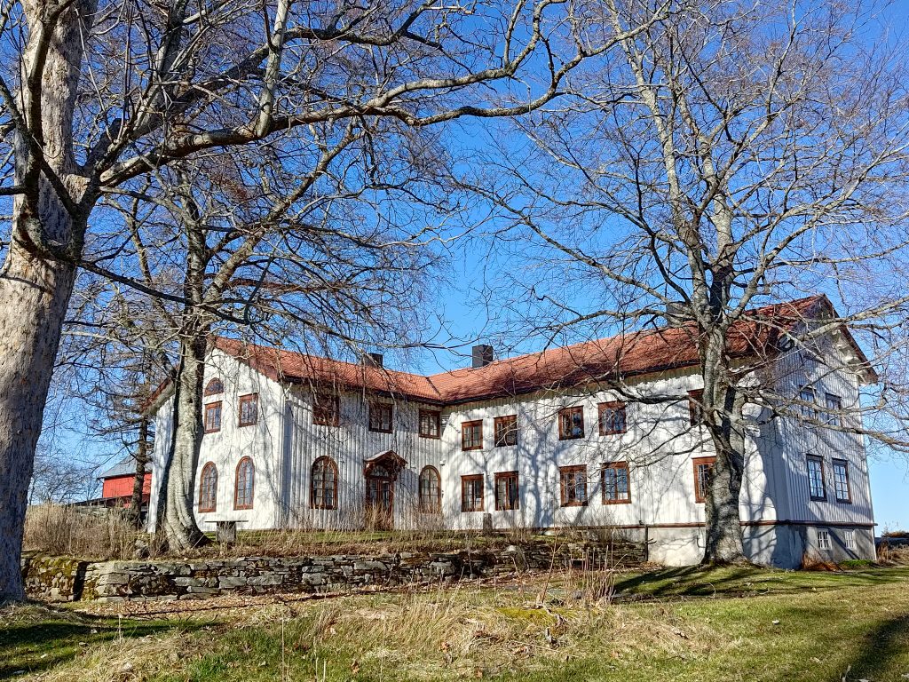
The house at Rostad Farm in Inderøy
The property at Rostad was originally a wealthy family’s farm. The house has been well-preserved and is often used for meetings. The farm continues to be used as a farm. However, for about the last one hundred years, a residential school has existed on the property. Over the decades the type of school has changed and who has run the school has changed. The first school was an orphanage which started in 1902. The property is currently run by the CRUX Foundation. CRUX Rostad is an institution for teens aged 13-19 who need a place to live when their parents are not able to function. The institution has 12 residential places. The children live in other newer buildings on the estate.
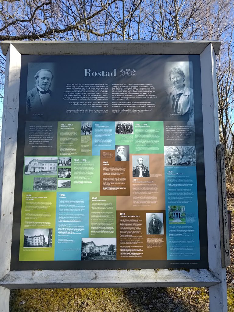
Information about Rostad
At the parking spot there is information about Rostad. A former prime minister of Norway, Ole Richter, grew up here and later represented Norway during its union time with Sweden. He inherited the farm but had no descendants so at his death the estate was sold. Ebba Astrup became the first director of the orphanage that opened in 1902 and she worked there until 1918. In 1927, she gave money to start the Rostad Foundation. It is still run by a foundation.
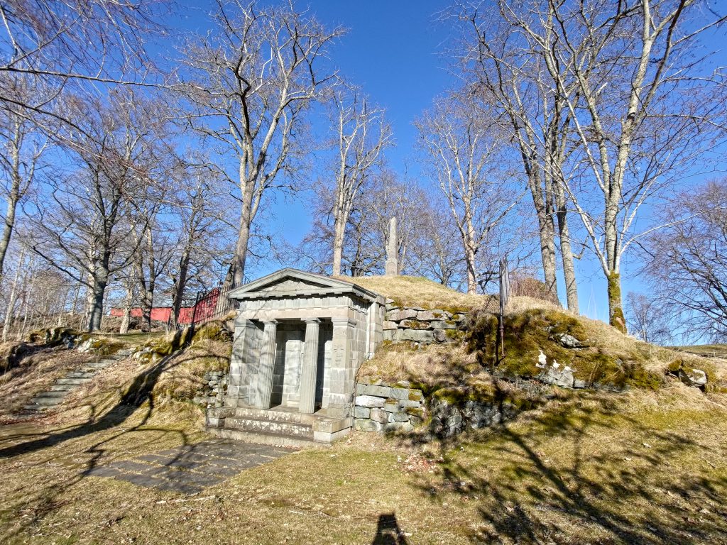
The mausoleum where Ole Richter is buried.
There are not many mausoleums in Norway, but on this property there is one. Ole Richter was buried here after his death in 1888, along with his wife who had died a few years before.
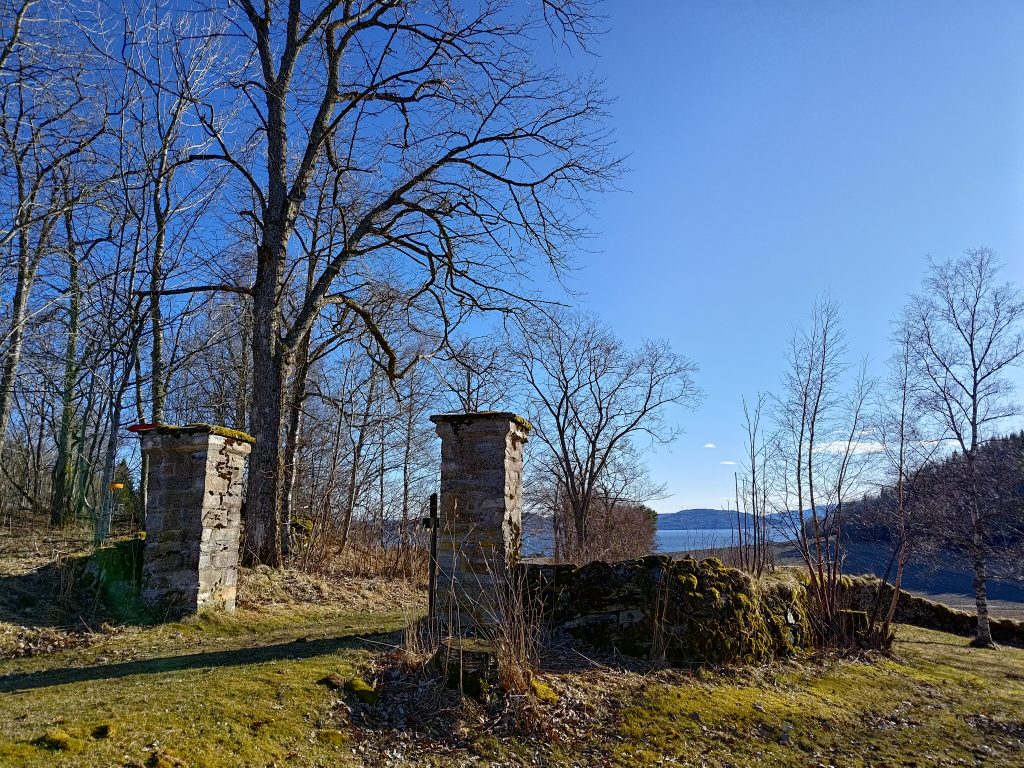
The gate posts on the road up from the fjord
Though today this estate is easily reached by paved road, in the 19th century, access to the estate would have been from the fjord. There is a gravel, tractor road that we followed down the hill. The gate posts in the picture would have been the formal entrance to the main building. We decided to take the walk in the counter-clockwise direction, so we started by going downhill, about 500 meters towards the fjord. It was very windy on the water, so we avoided going right down to the fjord.
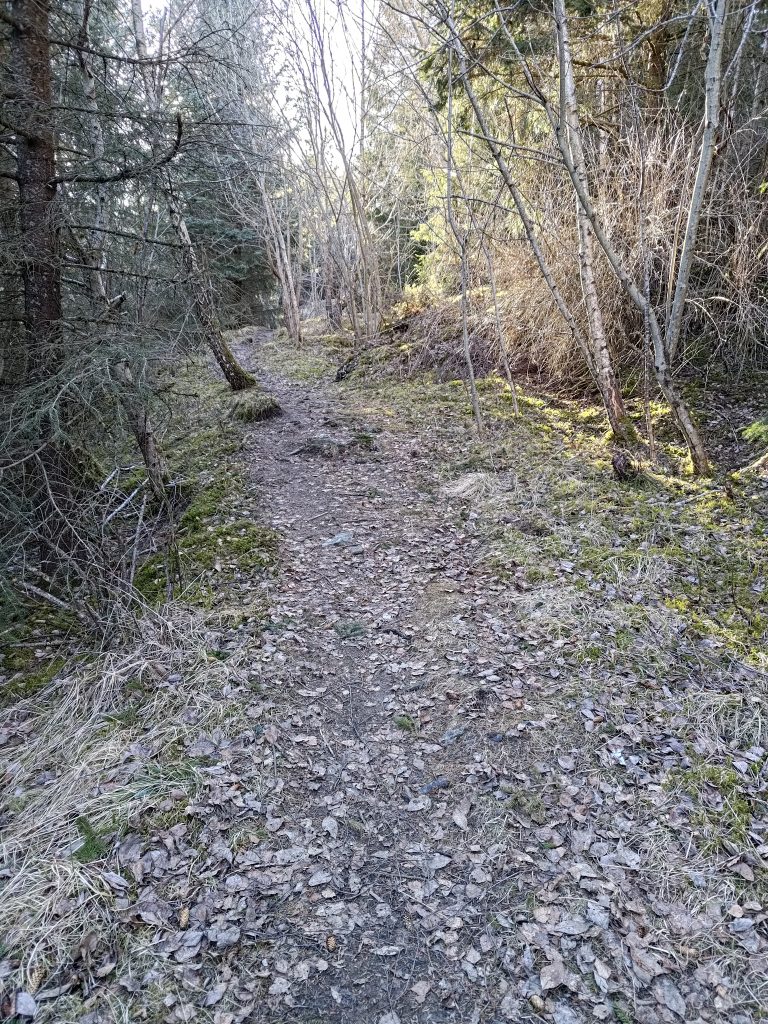
The trail through the woods
A lot of the walk goes through the woods. It goes up and down quite a bit, but there are no very steep sections. Most of it was quite dry, though the streams had plenty of water in them. The trees are quite bare still and the ground is covered with the leaves that came down in the fall. It is evening, so there are small patches of sunshine, but at times the woods are quite dark. It stays light until about 9 pm now.
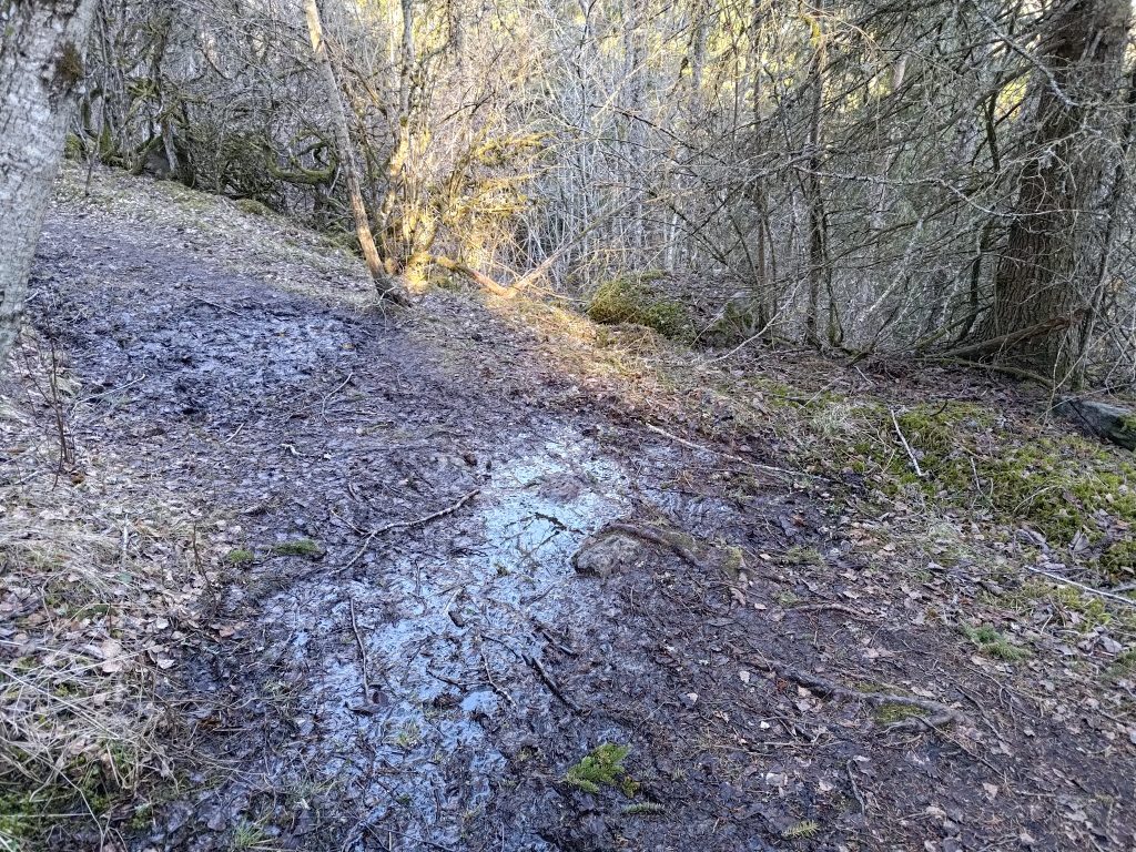
A muddy section on the trail
There was only one section that was muddy, so here there is obviously water that drains off the hillside that is not put through a pipe. It was a very short section and very easy to get around.
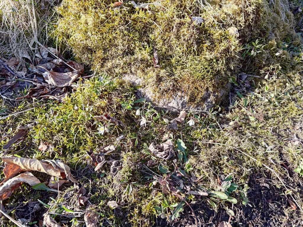
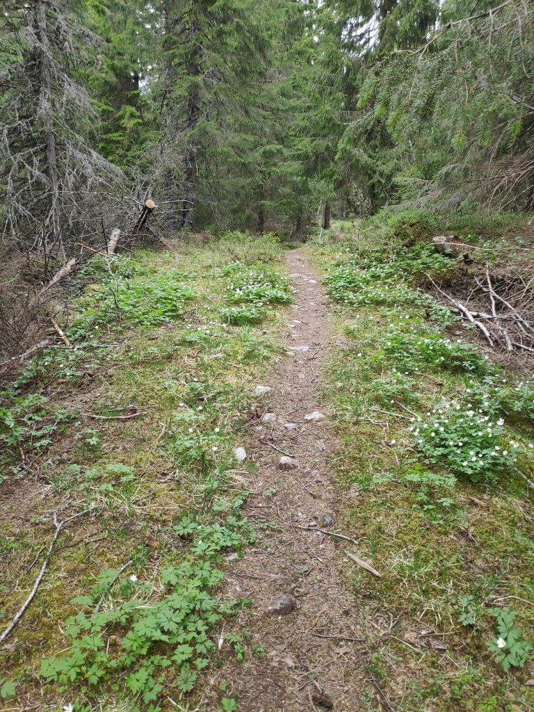
White anemone, beside the trail
The white anemone is an early flower that comes out on the forest floor before the leaves come out on the deciduous trees and take away the sunshine. These were the first ones that I had seen this year, so it must be a spot that is both sheltered and sunny. Note that the moss seems to be growing quite well here as well.
A cute white bridge over the stream
There is a stream that runs through the property. Where it comes out at the fjord, there is quite a drop and it has been used to power a grain mill in the past. It doesn’t look like a very large stream here, but it is nice to have a bridge to cross it. At this point the trail divides and if one wanted to walk to Undersåker (approximately 2 km to the east by the trail), one could take off on a trail that goes off to the right from here. We are coming from the foreground, will cross the bridge and head off to the left. You can see directional signs, but there are also a lot of information signs on this part of the trail, primarily about dwellings in the past.
Farm field at Rostad, looking toward Trondheimfjord
As we came out of the woods, we looked across a farm field to see the fjord in the distance. This is a working farm with grains and grasses being grown.
It didn’t take us long from here to get back to our cars. It was lovely to get out. For me it is also a social time with a girl friend. I enjoy springtime, with sunny days and nature just starting to turn green again. The air can be cold still, but with no leaves on the deciduous trees, one can see more in the distance. I hope you can enjoy a walk today too.
When one lives in a rural area in Norway, one sees people cutting down trees for firewood. It is almost the end of the heating season, but many people still have wood stoves for heating their homes. Those who cut down trees themselves are often out at this time of year to get the wood necessary for the next heating season. Personally I am very glad that we have cut out burning wood inside our house. We’ve removed one old wood stove from our living room. No more bad air there.
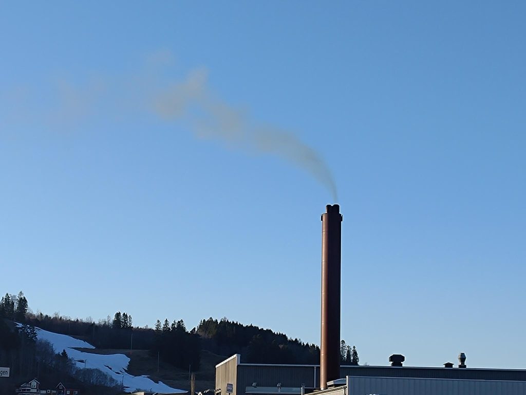
I have read quite a bit in recent years about climate change and what we have done right and what still has to be done. I’d like to quote Bjørn H. Samset who writes in The Climate Book (published by Allen Lane in 2022):
“If you light a bonfire and look towards the sky, you will see a rising column of smoke. Spreading upwards and outwards, it twirls and thins until it fades to invisibility. But it’s not gone. Smoke particles – one example of what we call aerosols – can remain airborne for days, and in that time they can travel both far afield and high up in the atmosphere. And while there, they have a strong effect on both the weather and the climate.” (page 57)
Picture taken in Straumen, Inderøy, on 2024.04.03 at 18:55. Smoke stack from a wood-chip burning, central heating system at the busiest intersection in Straumen, our local municipal center.
If I am out walking, I can smell when my neighbors are heating their homes with a wood fire. A lot of the electricity in Norway is made with hydro power and some is made with wind. Neither of these types of energy production pollutes the air, though there may be other disadvantages. In this blog, I’m wanting to mainly focus on air pollution. With the rise of electricity prices in the last year or so, heating homes with wood has again became popular, as people are trying to reduce the cost of heating their homes. Their electricity bill might be lower, but is burning wood a good alternative to using electricity produced by water or air power? Electricity can be used for heating, either using space heaters or a heat pump.
If we look at historical methods of creating energy, burning wood is one of the oldest methods. Open fires inside homes for cooking food was still common in the 19th century. Baking ovens were used, but meat was usually cooked in large fireplaces over an open fire (i.e. roasted). In countries like England, wood became a scarce resource as trees were cut down and not replaced. The discovery of coal made possible the transition to burning coal instead of wood. But coal also pollutes the air when burned and was one of the causes of very bad air in London, England during the 19th century.
When I was small we had a furnace in our house that burned coal in a closed stove in the basement and sent heated air throughout the house. There was a storage space for coal inside the basement. Coal is very dirty to handle and there was an automatic feeder to get the coal into the furnace. This was replaced, probably in about 1966, with a natural gas furnace.
The house I grew up in was built in the 1920s and at that time, the City of Vancouver was piping natural gas to new housing as a cleaner alternative to coal or sawdust. As far back as I can remember, we had a gas stove and oven in the kitchen when I was a child. There was a constant flame, a pilot light, which then lit the burner that one wanted to use. As I think about this now, I am surprised that people accepted an open flame in the kitchen. Though gas is a cleaner burning fuel than either wood or coal, it is still a fossil fuel that creates air pollution.
I have always had a sniffy nose and though I now think of it as primarily a reaction to pollen. As I have been writing this, I have been wondering how much my physical development as a child was affected by the burning of “dirty” fuels in my home. When I was about 10 years old, I suffered a lot from constant coughing. Was it indoor air pollution, or pollen from the fruit trees in our yard?
Looking at Our World in Data, they separate air pollution in two categories, indoor and outdoor. Let’s look at some of the information that they have on these two categories.
Indoor Air Pollution
“Indoor air pollution is caused by burning solid fuel sources – such as firewood, crop waste, and dung – for cooking and heating. Burning such fuels, particularly in poor households, results in air pollution that leads to respiratory diseases, which can result in premature death. The WHO calls indoor air pollution “the world’s largest single environmental health risk.” (from OWID)
Note that indoor air pollution primarily comes from cooking and heating, and its severity would depend on what was actually being burned and how good the ventilation was. There is a distinction between solid fuels, such as dung, wood, charcoal, and coal, and non-solid fuels, such as kerosene, methanol, natural gas and electricity. Access to clean cooking fuels, such as electricity, improve as a family’s income improves and as the standards within a country improve. I see this also in my childhood, where heating was first coal, then natural gas, and cooking was natural gas, then electricity. The change came about as my parents were able to afford a better standard of living in the 1960s than in the early 1950s.
Looking at the charts available at Our World in Data, Europe and North America come out with the least indoor pollution as here there is better access to clean cooking and heating fuels. If you find looking at charts interesting, I suggest you go browse their website.
Outdoor Air Pollution
According to Our World in Data, outdoor air pollution is one of the world’s largest health and environmental problems. Outdoor air pollution is a risk factor for several of the world’s leading causes of death, including stroke, heart disease, lung cancer, and respiratory diseases, such as asthma. Is the rise of asthma in European and North American countries attributable to worsening outdoor air pollution? I don’t know the answer, but I imagine there is a connection.
Some of the sources of outdoor air pollution can be:
industrial plants that put pollutants in the air
burning solid fuels to make electricity
vehicles that burn gasoline or diesel
wild fires which put a lot of small particles in the air
Many air pollutants contribute to the small particles that float in the air. As we age, our exposure to these types of pollutants accumulate and can affect our health. At the moment I live in an area with relatively low air pollution, so that most of the year I enjoy sleeping with a window open so that I get fresh air while I’m sleeping.
However, there are three types of outdoor air pollution that still affect me.
Wood smoke, or the burning of dry grass or refuse. Both of these can be common in a rural area in Norway. In winter, there are people heating their homes with wood fires. In spring, dry grass or garden refuse may be burnt so that it disappears. In summer, there is the burning of charcoal in grills, by people who think that this is a great way to prepare food outdoors.
Gases from animal manure, particularly as it is being spread on the fields near me. The older technique was spraying the manure in the air so that it spread over a wide area. This technique was terribly polluting and created bad air for several days, until the field was either plowed or it rained heavily. Fortunately, farmers here have learned new techniques with new equipment, whereby the liquid manure is forced into the ground rather than up in the air. Now there is much less of a smell of manure which I’m sure also means that there is less pollution from it.
Pollen, from flowers and trees, can also affect me. I don’t react to everything and how much pollen there is in the air will vary from day to day. Some years can be quite bad and other years I am affected a lot less. Many people have it a lot worse than myself. However I have stopped drying clothes outdoors so that I don’t get pollen on my clothes. Filters on ventilation systems can also improve air quality indoors.
Conclusion
I grew up in a house built about 1926 so the standards that were relevant at that time, have hopefully been improved by 2024. In fact, I have read that Vancouver is no longer allowing natural gas installations in new housing. Heating with coal and cooking with gas should be replaced with cleaner fuels.
I live in a house which was built in 1963 and we have improved it since then. There is more insulation now and better windows with three layers of glass so that we use much less electricity to heat the house now than we did even 10 years ago. We also use electricity to cook, using an induction stove top which uses electricity much more efficiently than older styles of cook tops.
Even though I live in an area with little air pollution, either indoors or outdoors, I can still have problems. How much of my problem is a result of pollution in my childhood I will never know, but I do think it is a possibility. However, every individual has to adapt their living conditions to their own sensitivity to air pollution. Parents also have a responsibility for giving their children a good environment to grow up in. For myself, living in a rural area helps, and getting rid of local polluting devices, such as a wood stove and a diesel car, have improved my living conditions.
I have been quite lazy this winter, doing very little walking outdoors except when going specific places, like the dairy farm or the egg farm. But today, the temperature was finally a bit more comfortable, at 12 degrees centigrade, so my husband and I put on walking trousers, hiking shoes and went for our first walk in the woods.
We have a favorite location that takes us along some gravel roads and a path in the woods. It takes about 20 minutes to get to Bear Cliff (Bjørnbrøttet), where there is a book to write one’s name in and a small shelter to take a short pause. I have written blogs about this walk previously. You might like to contrast today’s walk with the one in 2023 when the weather was quite different.
The view from Bear Cliff taken at 16:31, looking towards the island of Ytterøy with Levanger in the background.
As you can see from the picture, it was cloudy and there had been rain showers earlier in the day. We did not have any rain while we were walking and we were out for about an hour. But shortly after we were home again, there was another short rain shower.
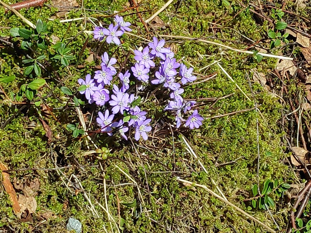
As this was the first time for this walk in 2024, it was interesting to see if there were any changes, either in nature, or to the cabins we walked by. There were a couple of trees that had been blown over, some that had been cut down. There seemed to be more open spaces as if cabin owners wanted more sunshine or a better view. At this time of year I am always looking to see what flowers are out. The two earliest ones here in Inderøy are coltsfoot (which is yellow) and anemone hepatica (which is blue).
Coltsfoot /hestehov) or tussilago farfara. The flowers come out from the rhizome first before any leaves appear. The leaves are very large but disappear during the summer. These flowers like the sunshine and appear first in sheltered, sunny spots and along the roadsides.The blue anemone, sometimes called liverwort, (hepatica nobilis / blåveis) is a bit hard to see, but they are also very common in Inderøy and one of the signs of spring. They will eventually cover large areas as the days warm up. They are quite small and are often found under trees.You’ll have to look closely in the photo to see the hepatica / blåveis, but it is in several parts of the photo.
Getting out in the fresh air is important. Getting walking exercise helps keep us in good shape. I was surprised that I was in such good shape as I did not labor up any of the hills. So that is a good sign. I also feel that it is important for our eyes to look far in the distance and not always to be looking at a screen or things close to us, for example, knitting projects.
Looking south-west towards Trondheim, through Norviksund, with Mosvik on the right and Ytterøy on the left. There are rain clouds in the distance but they didn’t get to us until after we were inside again. Looking at the small island on the right, we see that it was relatively low tide.
We live in an area with quite a variation in tides. When this picture was taken (at 16:46), the tide was still going out and low tide was at 18:40 and at 6 cm above the base level. At high tide, later this evening, the water level will be at about 324 cm, so the water level will be more than 3 meters higher than at low tide.
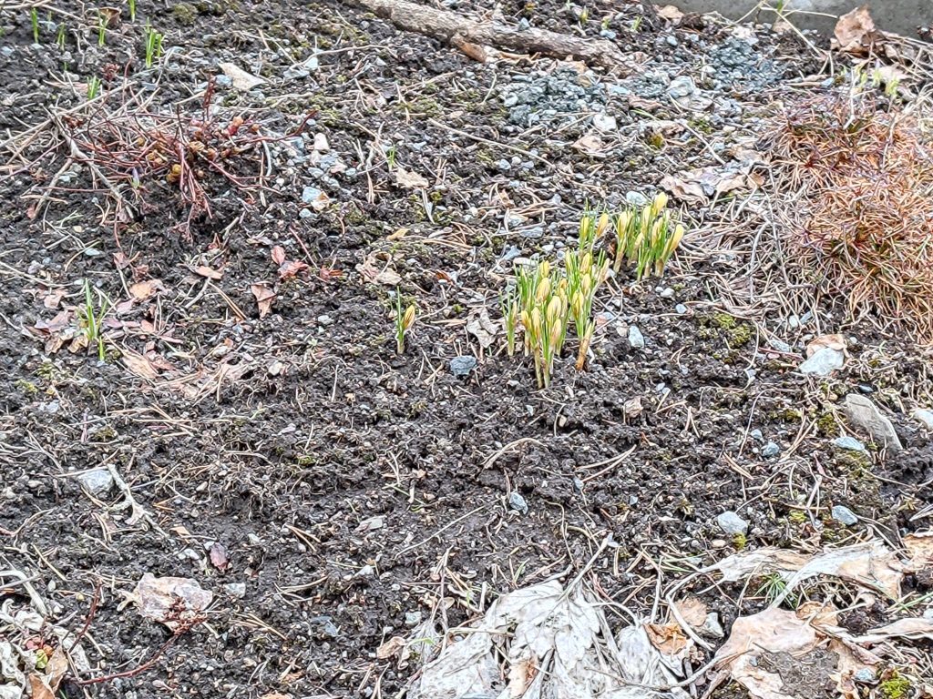
As we came up our own driveway, I looked to see if there was anything flowering yet. I have lots of bulbs, but the ground has been frozen until the last few days. Crocuses are just starting to show some color and only need a few days of sunshine to come out in full bloom.
Not wild flowers, but planted in my garden. Crocuses are the first flowers that bloom in my garden. These need a bit more sunshine before opening out.
I hope you too are able to get out for longer walks out in nature, now that we are in April. Enjoy the nature you have around you.
Today I went for my first walk in the woods in 2023. I’ve been wanting to do it for quite a while, but both in February and March we have had quite a bit of snow which required removal from our long driveway. So, there was no energy left for pleasant walks in the woods.
The snow is not gone, but today is the vernal/spring equinox, (at 22:24 our time), so the feeling is that spring is just around the corner. The weather today has been a mixture of sunshine, rain and sleet, with plus degrees. But underfoot there is still snow or mud. I didn’t see any flowers yet. Here the first wild ones are usually seen at the beginning of April, so there is still two weeks before that sign of spring should appear.
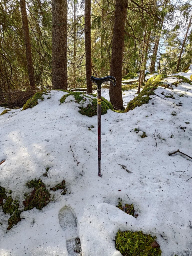
For safety sake, I often carry a walking stick with me. It helps give me better balance both when it is slippery or I’m on slopes. I’ve accepted that I’m not so young any more.
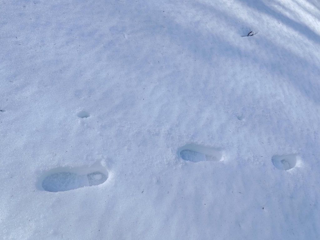
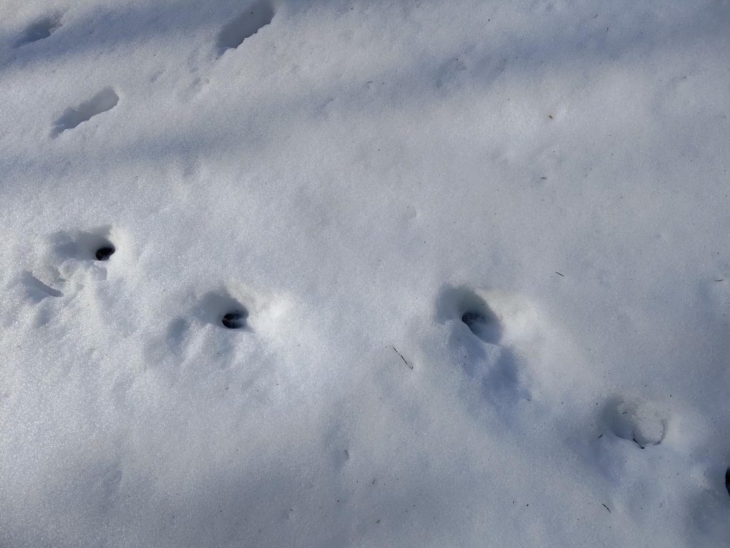
Animal Tracks
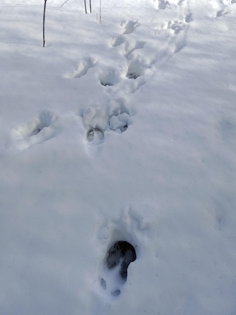
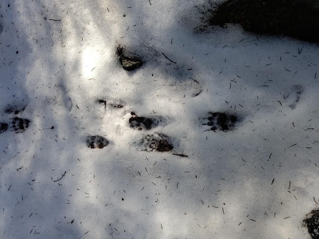
With snow on the ground, it is easy to see where wild animals walk. We are used to seeing deer, squirrels and birds in our yard, usually near the bird feeder which has sunflower seeds. But once I got away from our own property, it was interesting to see other tracks in the snow.
These are definitely the tracks of a human who uses a walking stick in her right hand.These tracks are deer tracks, the most common tracks I see near us, often across our lawn and through the flower beds.These tracks are much larger than the deer tracks and belong to a moose. Moose are common in the woods in Inderøy, but I seldom see them on our lot.I’m not positive, but I think these are the tracks of a wolverine. They were seen in the woods, away from the cabins. Wolverines are often nocturnal animals.
The Trail
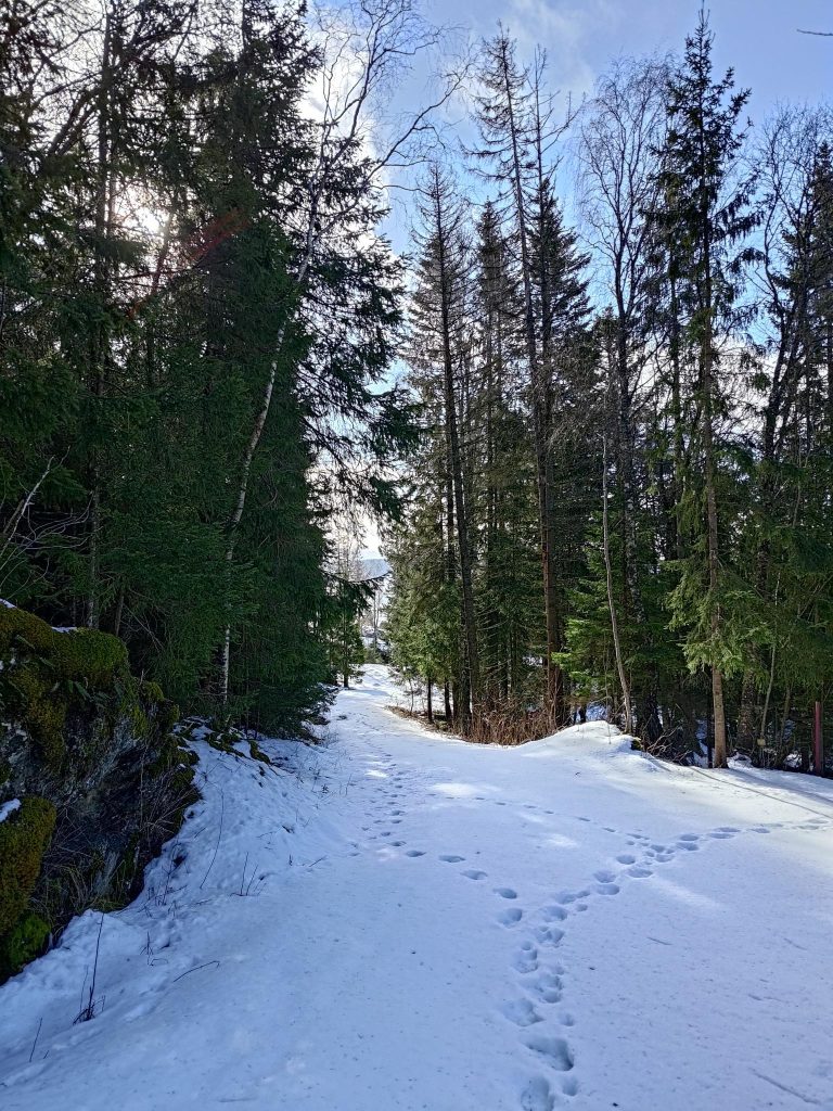
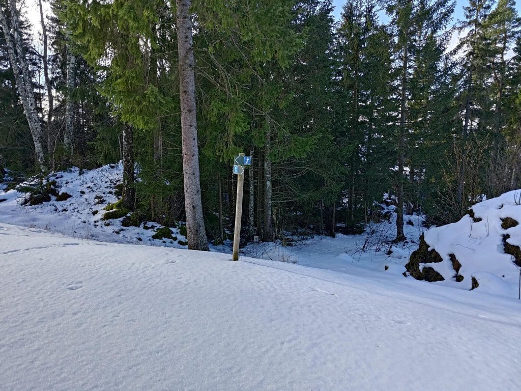
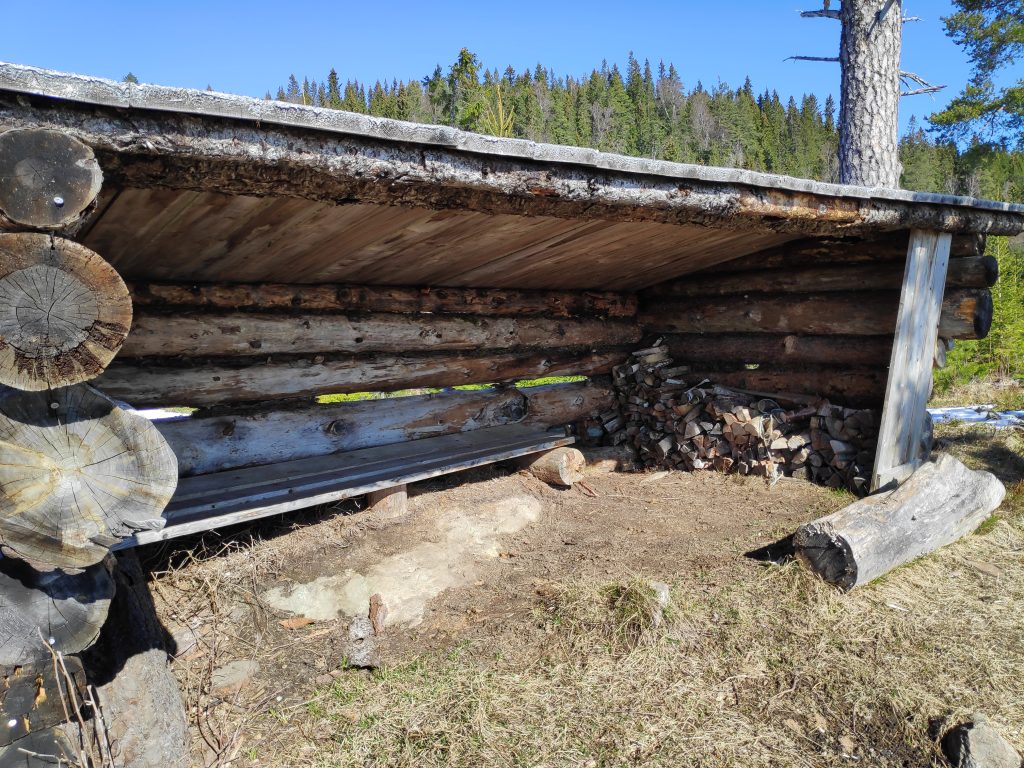
In the summer months, this is a road that can be driven on by car, but it is not cleared in the winter. Most of the tracks were animal tracks, but some were human bootprints. The snow was not so deep that there was any problem walking.In some places there were even few tracks from before.As I went away from the road and into the woods, there was even less snow. It was almost muddy.This section of the trail is often a small stream. The ground was soft and it was thawing, but there were no problems with running water or large pools, yet.The turn-around point of my walk, “Bjønnbrottet” or Bear Cliff as I call it in English. Inside the lean-to there is a box with a book in it, so that visitors can write the date and their name. I like to count how many times I write my name in the book. Today was the first time for 2023. There were a few names before mine, but not many yet in 2023.Here is the book that is used for walkers to register their visit, if they wish. Over the years, the book itself has been decorated as well.The view from the lean-to, looking south to the island of Ytterøy.
Changes
When I haven’t been to a place for a while, it is always interesting to see if there are changes. In the woods, winter storms can blow down trees. Near the cabins, humans can also make changes.
This tree looks like it just rotted and fell over. This has happened during the winter as the trail used to go on both sides of the tree.Suddenly I came to an open area which used to be dark from the trees. The cabin up the slope on the right has probably wanted a better view.The view from the open area where the trail goes. People in the cabin up on the hill would probably see over the trees. The view is looking south-west out over Trondheimsfjord. When I got farther along on my walk, the wind was blowing up from the fjord in that direction.
This is a walk I usually take many times in a year, and I will certainly be doing it many more times in 2023. It takes about an hour and has several uphill sections so that I get good exercise. I was lucky with the weather when I was out today. Shortly after I came indoors, it poured with rain.
How would you define spring where you live? I think of spring as the first wildflowers blooming, the snow disappearing, the farmers ploughing fields, the temperature being above zero degrees and more hours of daylight. So spring is still around the corner here, but I don’t think it will be long. We have plus degrees in the daytime, many more hours of daylight than we had in January and the snow is slowly disappearing.
I hope you are also starting to get out for walks in nature. It is said that being near trees is very good for our mental health. Have a good week and a good spring.
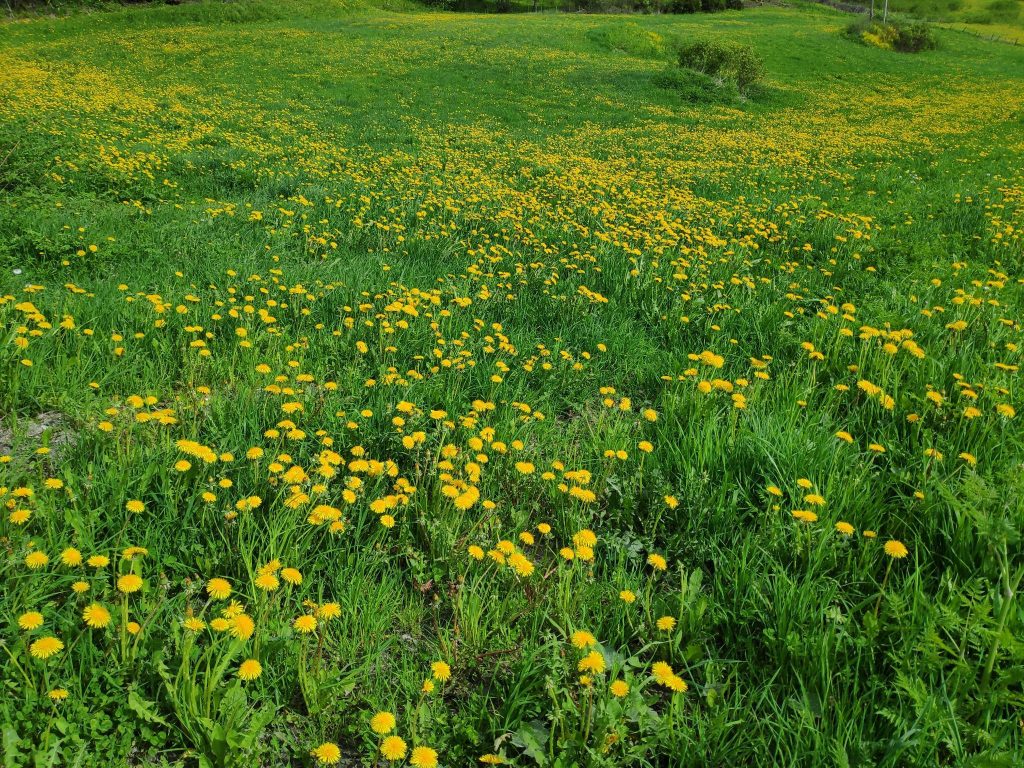
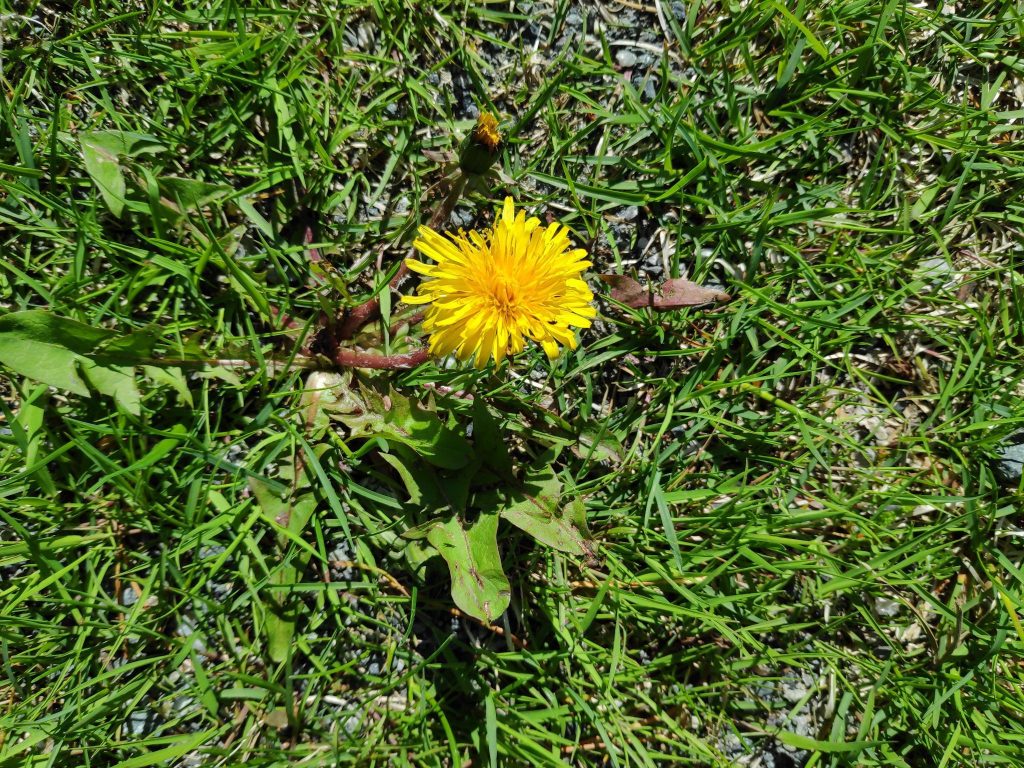
We live in the municipality of Inderøy and its official flower is the dandelion. When one looks at the fields in Inderøy during the second half of May, it can be seen why this flower has been chosen.
A field in Inderøy, picture taken on 25 May 2022.
As an agricultural municipality, there are many fields in Inderøy which are devoted to growing grass to feed animals. These fields are not plowed every year and each year the crop of dandelions in any given field will increase. Then the farmer plows the field and the field becomes primarily green the first summer.
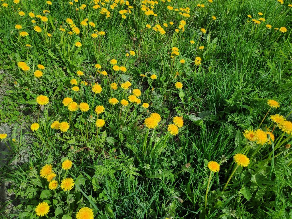
The Latin name for the common dandelion is Taraxacum officinale. In Norwegian it is called løvetann (lion’s tooth). The English name, dandelion, seems to come from the French name for the plant, dent-de-lion, which also means the lion’s tooth.
Lots of dandelions in this field and they mostly bloom at the same time.
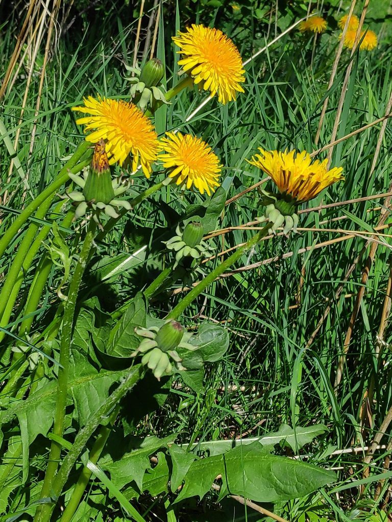
Here in Norway, the dandelion will have its first flowering in May, or perhaps June at higher altitudes. Where I live, it will be found along the edges of roads as well as in gardens and fields. Beekeepers say that it is an important flower for the bees early in the season. This year there have been comments in the Norwegian press to refrain from cutting one’s lawn and letting wild flowers grow, as the bees need the nourishment.
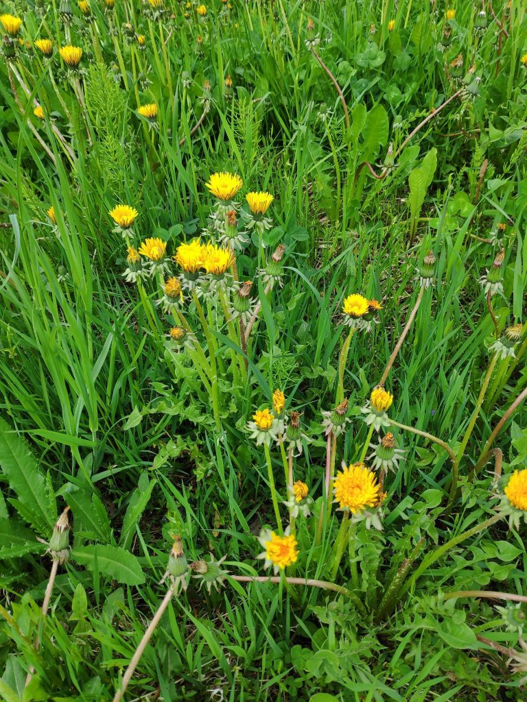
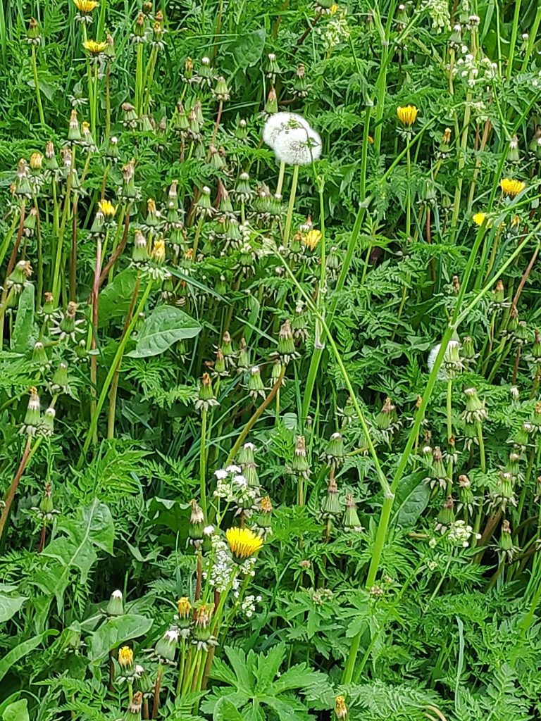
A group of dandelions growing in a grassy field. Picture taken 27 May 2022.
Dandelions have a characteristic yellow flower that opens wide on sunny days and long toothed leaves. When they grow in the open, they are very upright plants. When they grow with other plants, they can grow very tall in the competition for sunlight. They do not have to be pollinated and therefore can produce seeds that have the same genetic information as the parent flower. This means that even without insects, the flowers will go to seed. The flower grows on a hollow stem and the leaves grow separately from the long root. If the leaves and flower are broken off, the plant will regrow from the root.
All parts of the dandelion are edible and provide vitamins A and K, as well as calcium and iron.
At night, the dandelion closes its flowers. On a cloudy morning, the flowers have not opened completely. Some are closed completely while the seed is formed.If a dandelion grows where the grass is cut, it’s leaves will spread out along the ground instead of growing primarily upright. The flower will come out on a very short stem.Some of the dandelion flowers have become gray and the fluffy seeds will spread in the wind. In this picture we can see that the dandelions on this road bank are almost finished and the next flowering plant (Anthriscus sylvestris / hundekjeks / cow parsley or Queen Anne’s lace) will soon dominate the roadside.
I usually consider the dandelion a weed and will remove as many as possible before they go to seed. However, I do find it an attractive flower and quite understand how it is an important flower for bees.
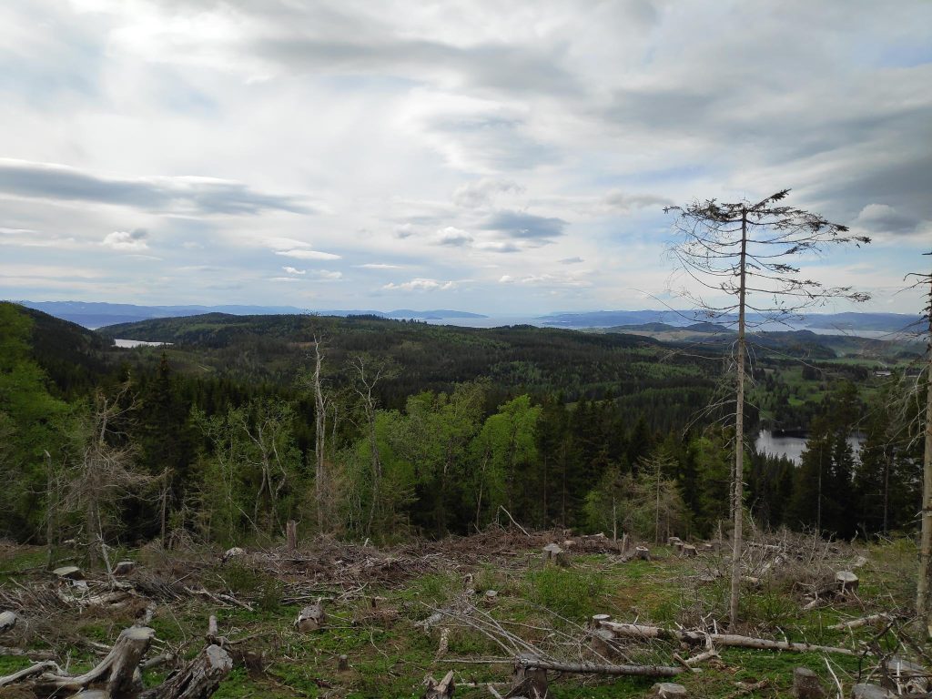
The view from Aunan, looking west. The gap in the distance is Trondheim Fjord with Levanger on the left and Mosvik on the right.
Tuesday, May the 24th, was a Bahá’í holy day, so my husband and I decided to take a walk in the hills at Røra. It is an area we both enjoy walking in. Today’s walk was about 2 hours plus a sandwich break for about 15 minutes. I have been to both Aunan and Floåsen before and if you want to read about the walk taken to Aunan in August 2021, you can read it here.
As we started our walk, I wondered what sort of theme I should have for this blog and my husband suggested “signs”, so that will be the main theme. What sorts of signs do we see while walking in the woods? Some are easy to read, some are directional (i.e. which way to go), some were about the place where we found the sign, some were almost impossible to read, some were official signs, some were hand-made. I think one thing that can be learned from some of these pictures is that signs with writing on them need to be looked after.
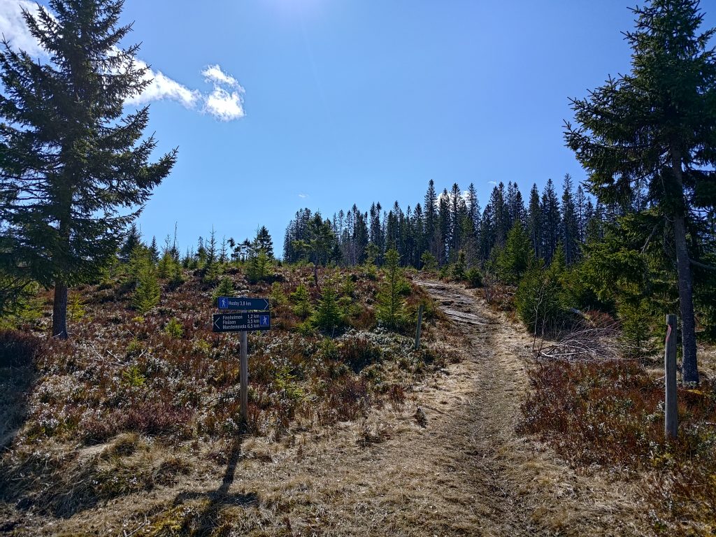
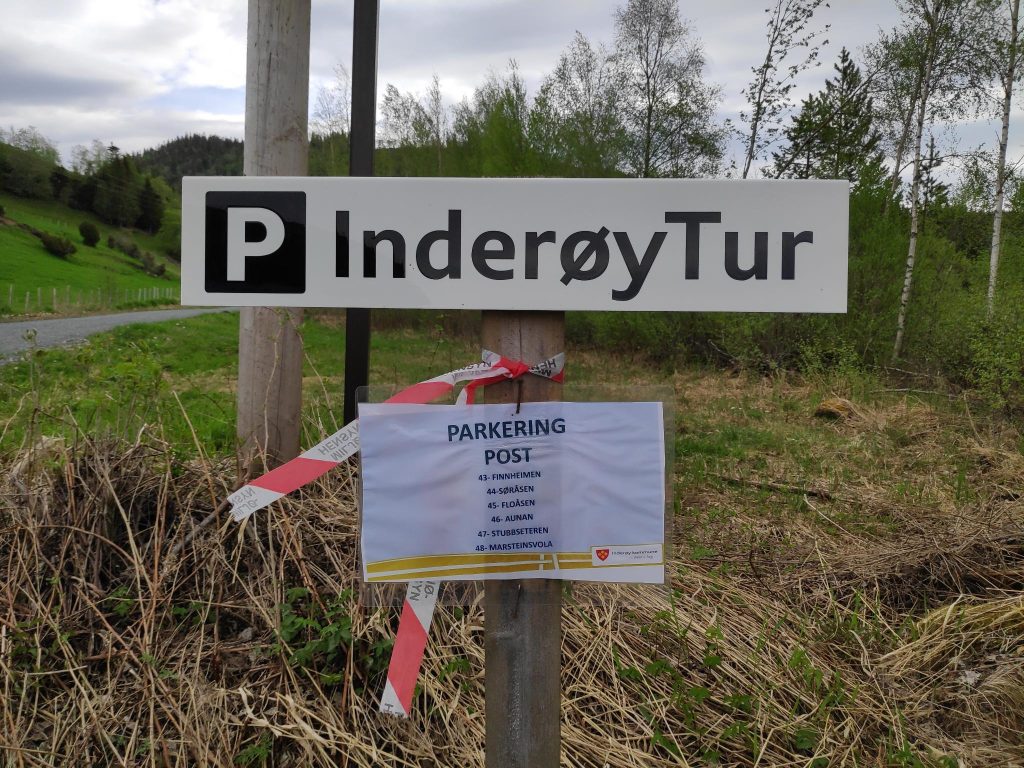
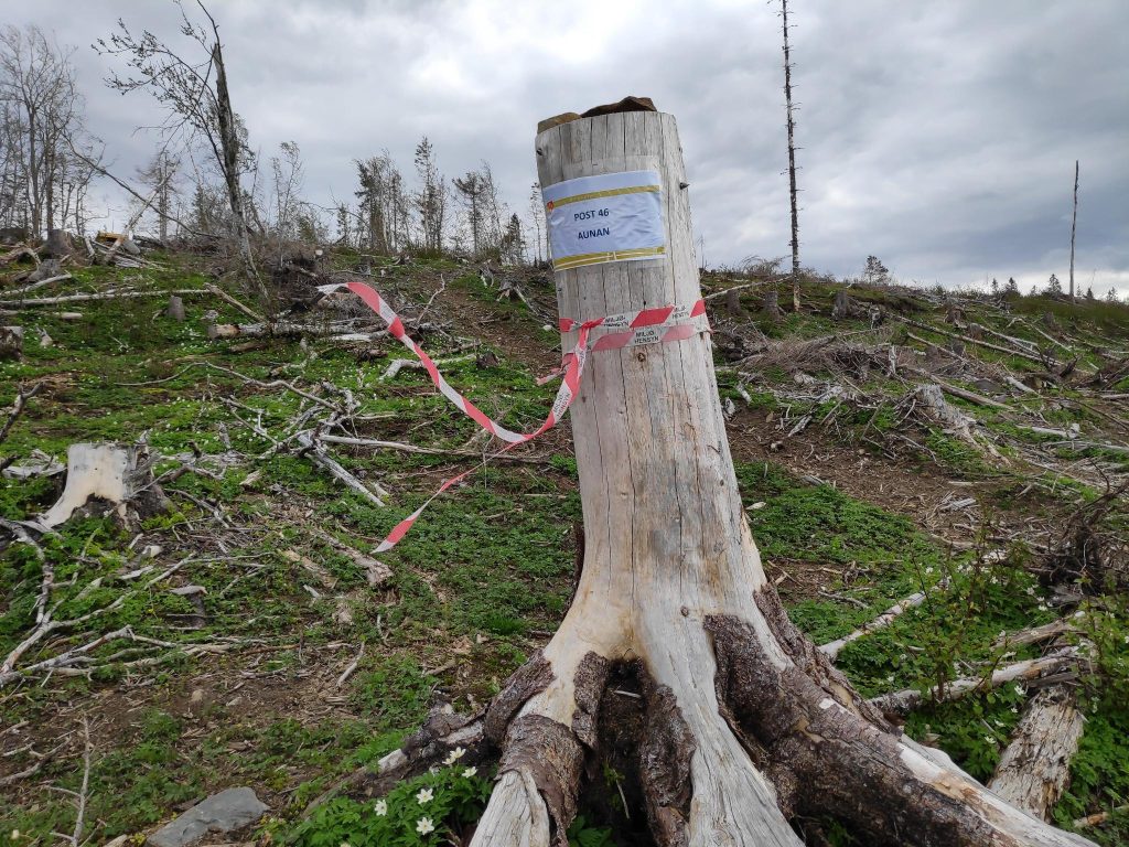
The parking area at Røflo Lake has a sign indicating that one is allowed to park here. There is also a sign showing which posts can be reached from this parking area.
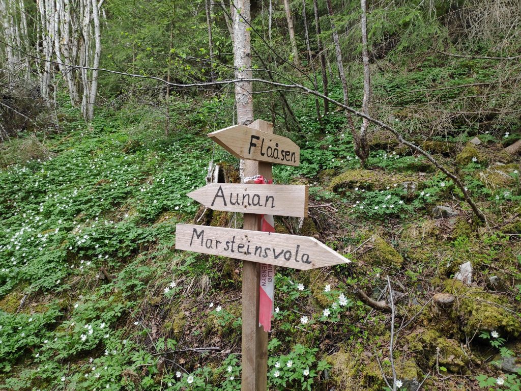
When taking an Inderøy walk, one of the first signs one sees is the indication of where parking is allowed. This year they are wanting people to park in one place and find multiple posts from the same parking spot. From this parking area, one can walk to six different posts depending on how far one wants to walk. We visited two posts, nr. 46 Aunan and nr. 45 Fløåsen.
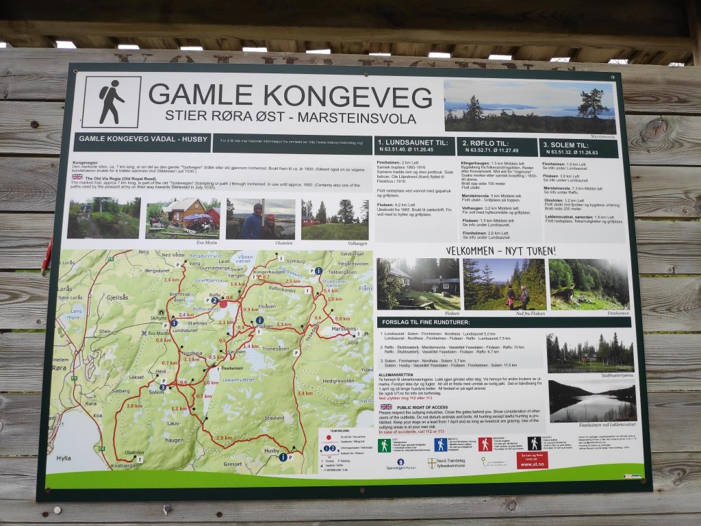
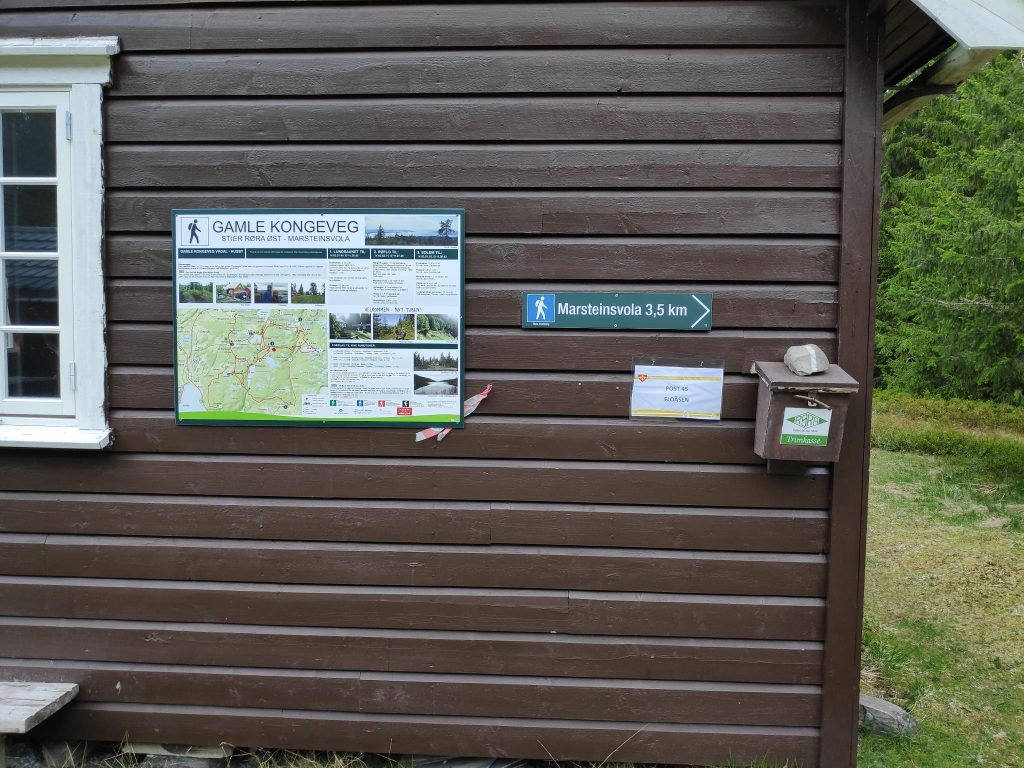
This map covers an area called “The Old King’s Road” and up to Marsteinsvola which is a hilltop at the junction of the municipalities of Steinkjer, Inderøy and Verdal.
One of the things I have learned over the years (at least since having a camera on a smart phone) is to take a picture of the map that is posted at the parking area. One can always look at it if one isn’t sure which trail goes through. The app for the Inderøy Walks has a good map, but not all trails are actually marked on it. Today we were walking on some good trails that didn’t seem to be on the app’s map at all, though the dot that shows us where we actually are indicated that we were going in the correct direction.
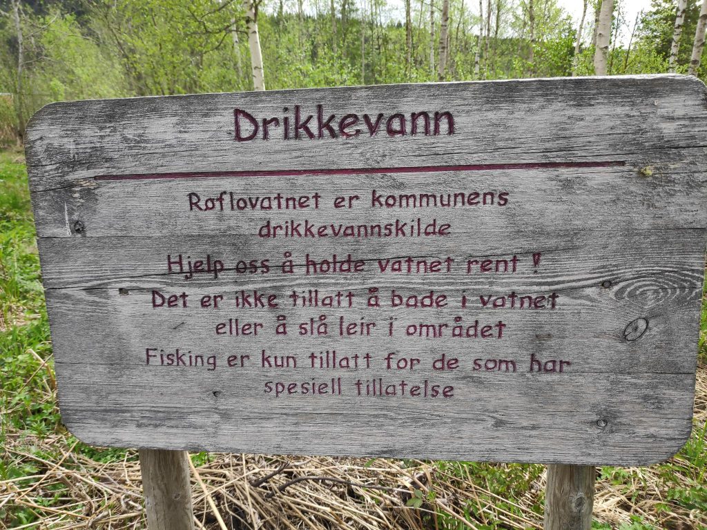
Our walk started at Røflo lake which is the main drinking water source for the municipality of Inderøy. The water is purified before sending it out to the customers which also include a juice factory.
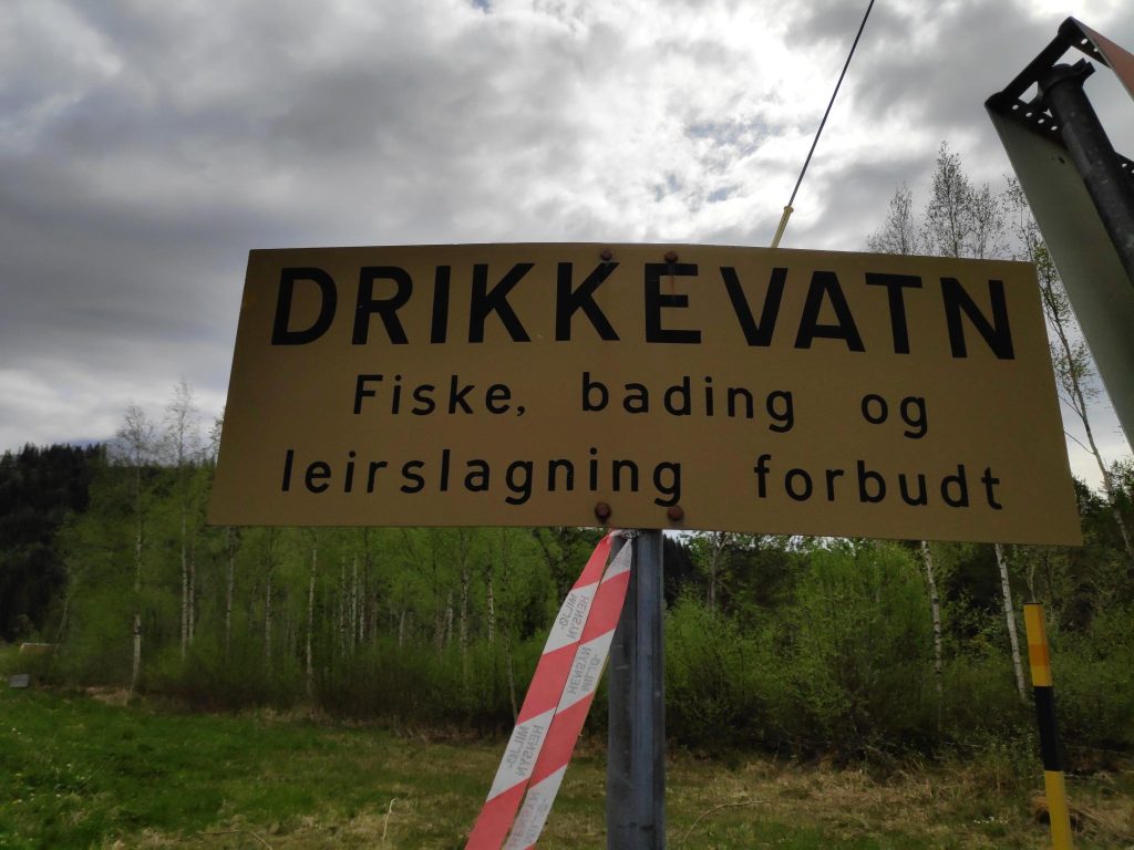
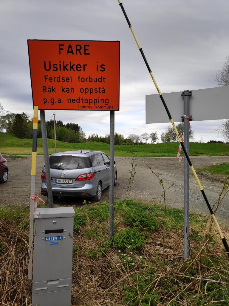
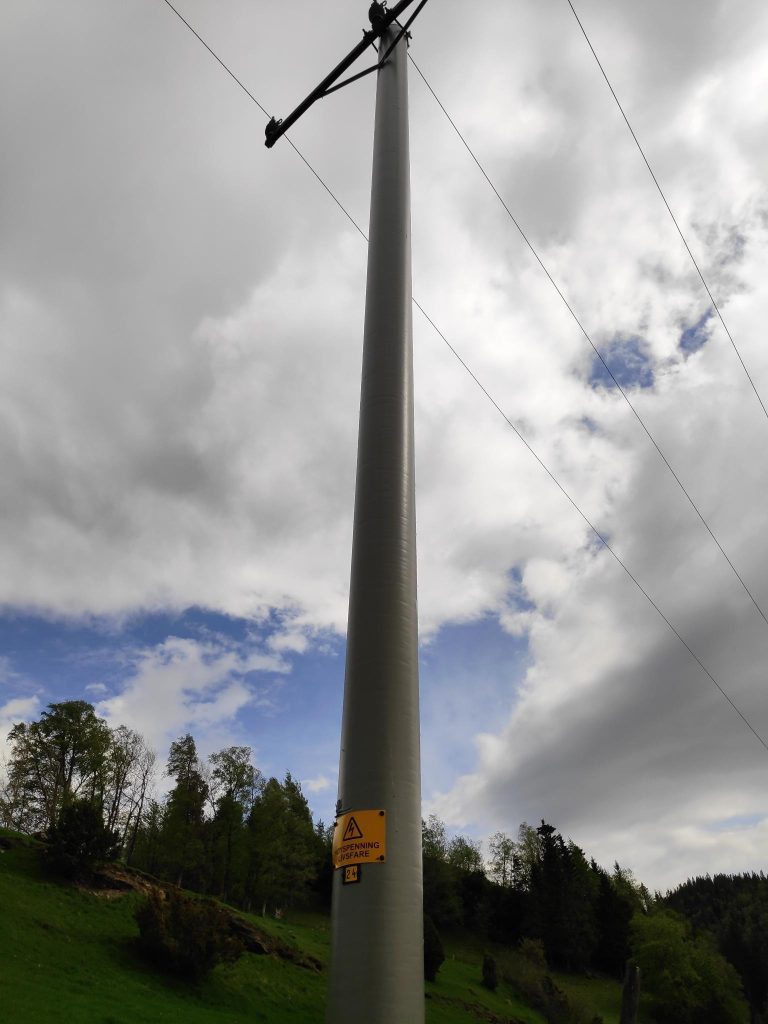
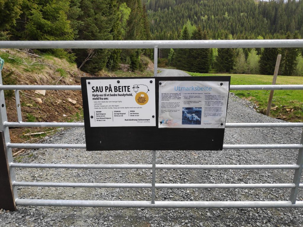
Drinking water – fishing, bathing and camping are forbidden.This is an older sign which has been looked after. It is important to repaint the lettering regularly. Translation: “Røflo Lake is the municipality’s source of drinking water. Help us keep the water clean. It is not allowed to bathe in the water or to camp in the area. Fishing is only allowed for those who have special permission.”Røflo Lake would freeze over in the winter, so it becomes important to have a warning sign. Translation: “Danger: Unsafe ice. Traffic on the ice is forbidden. Openings can occur because of draining.” Notice also the gray box below the sign has a number on it. These gray boxes are usually connected to electricity.Near the parking area, there were a lot of electricity poles which, of course, each have a sign on them warning of the danger. “High voltage, life threatening” plus a number.These two signs indicate that there are grazing sheep on the other side and give information on the purpose of this area as well as contact information if one sees injured animals or other problems. Dogs must be on a leash.
The field closest to the parking area had cows out today. They are usually kept close to the barn for milking. However sheep are sent up into the hills for the summer and are expected to look after themselves. Here there is a fence so that they don’t get out onto the road. We saw the sheep briefly and the lambs are still quite small. We saw two lambs laying on the grass resting and eating the grass that was in reach!
We will cross the road and head up the steep trail on the other side.
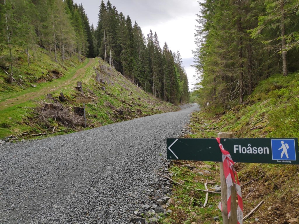
Most of the walks in Inderøy have good signs to indicate how to get places. The sign above shows that we are on a blue trail (not so easy trail, but not too difficult either) taking us to Floåsen. Under the blue man is the name of the organization that is responsible for this trail, Røra Sports Club, and at the extreme lower left hand corner is the number 28. All this type of signs have a number. The red and white tape on the sign indicate that this is a marked trail for this year’s Inderøy Walks.
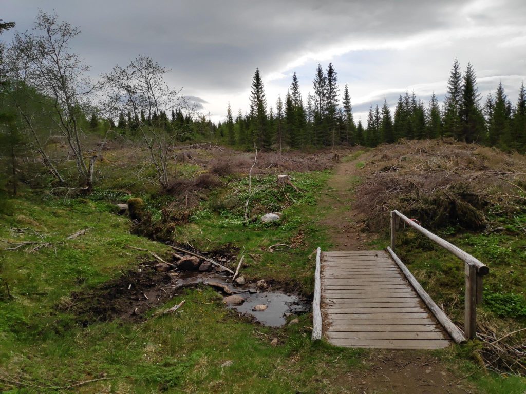
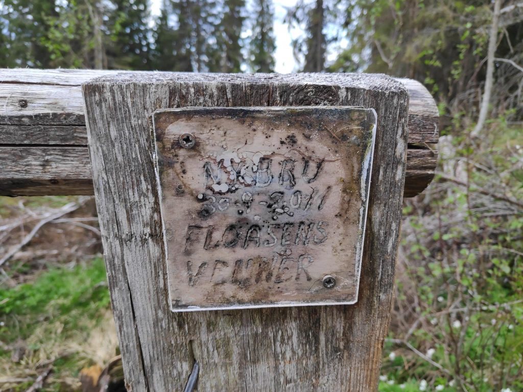
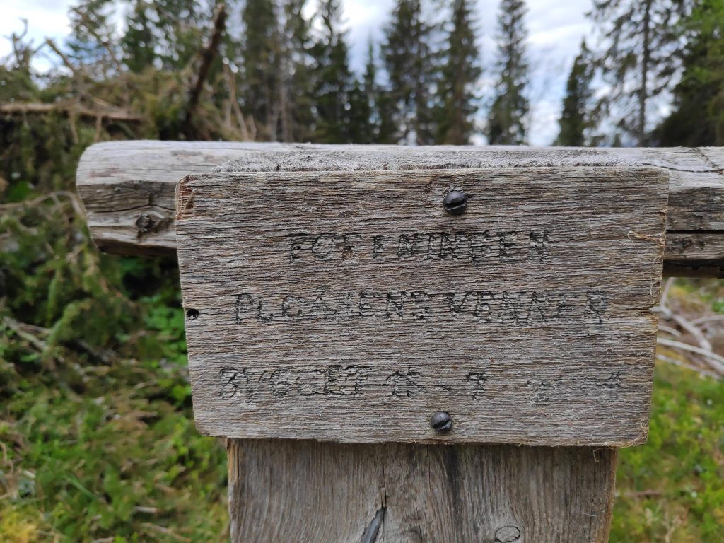
We came to a bridge with a railing, crossing a stream that was very gentle today. Wooden bridges like this can get very slippery in the rain so having a railing on one side is very nice. On this bridge there were also two signs, neither of which were easy to read.
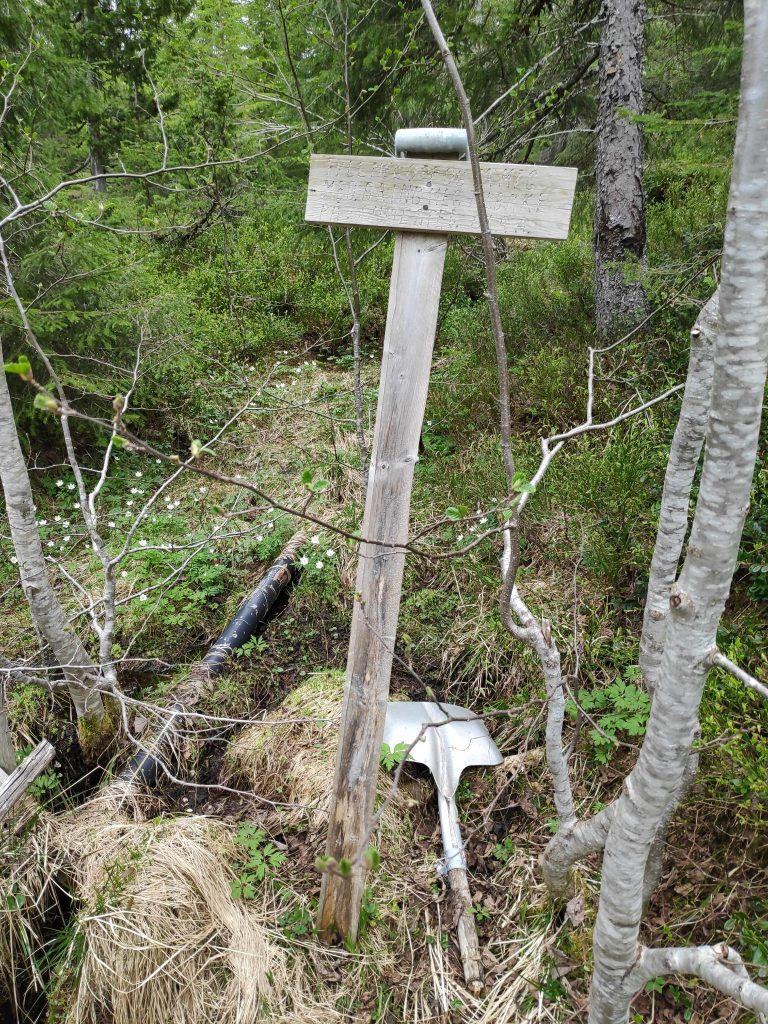
Not all of this sign is easy to read, even though it has a plastic cover on it. There is the name of the bridge (“bru”), a date (30-9-2011) and the name of who put it up (Floåsens Venner = Friends of Floåsen)On the far end of the bridge was a different sign, which also needed a bit of maintenance to be easier to read. I couldn’t read everything on this one, though it also seems to mention “Friends of Floåsen”.I came across this sign that was almost impossible to read, but the text indicated that you could borrow this shovel, but please return it here on your way back.
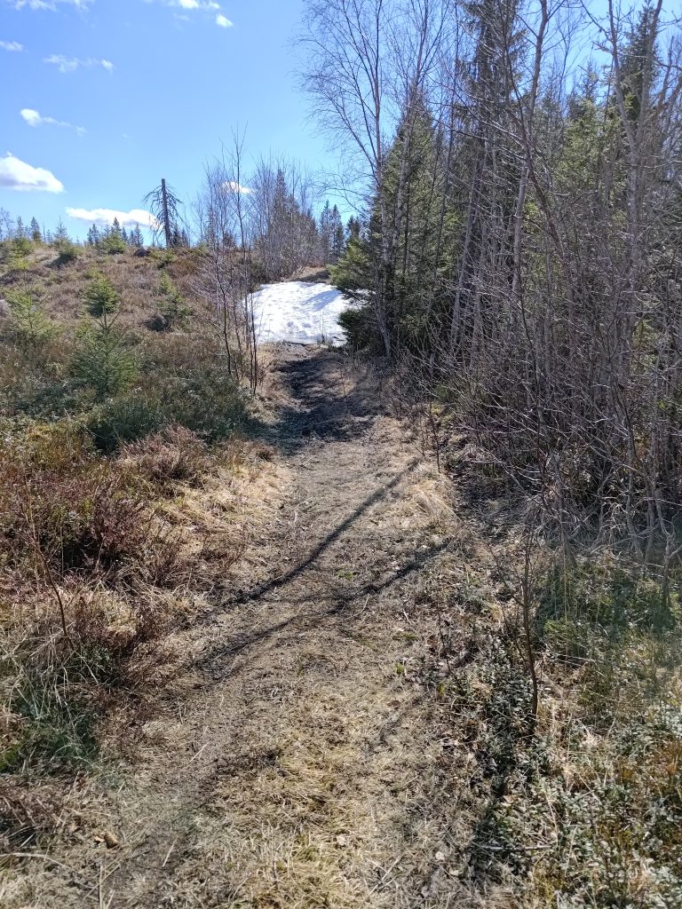
This was the first time that we had gone walking in this area this year. Last year we had gone too early and the trail we had taken was still covered in a lot of snow. So I was curious to see if there was much snow left at all. We’ve had plenty of warm weather and sunshine so I wasn’t expecting too much snow left now.
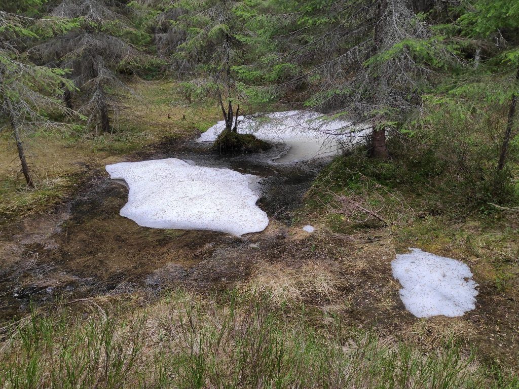
This was the biggest patch of snow that I saw on our walk. It was in a very shady area, under the trees.Aunan to the left and Floåsen to the right.
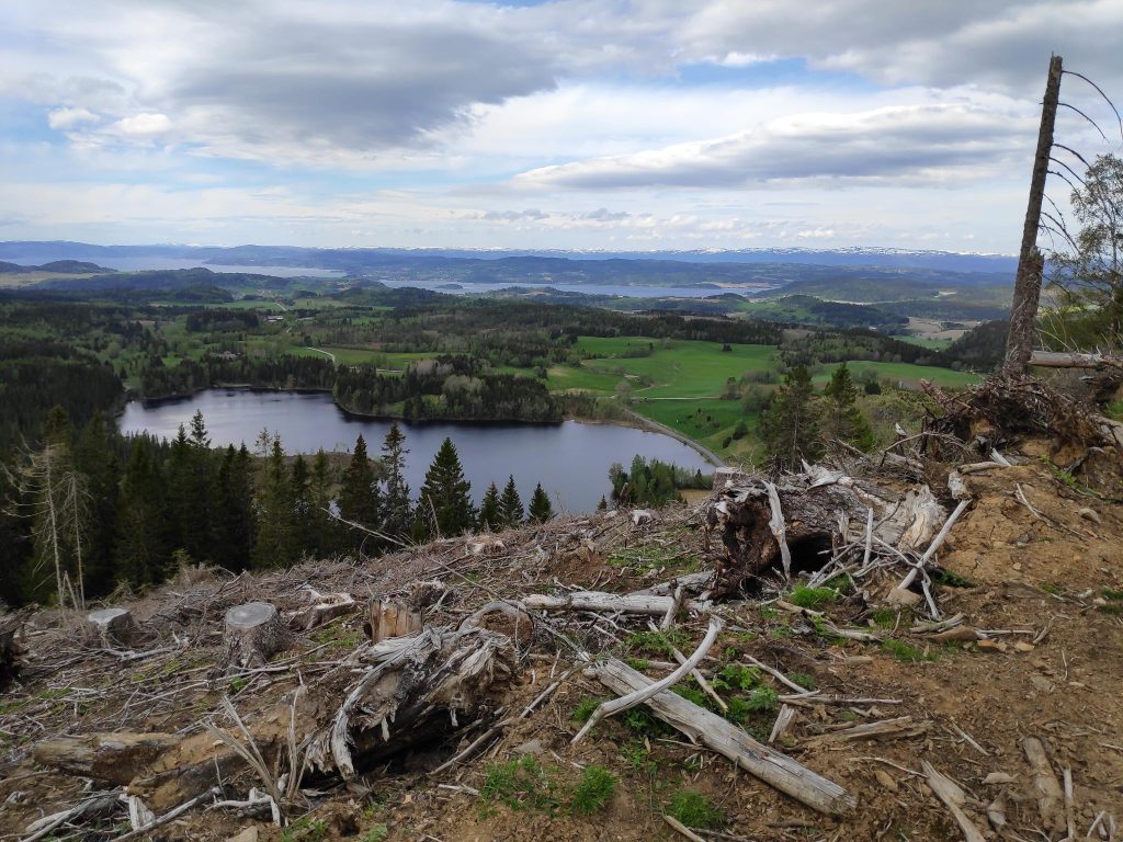
Aunan is a relatively new place to go to in these hills. It is a hilltop that has been recently logged so that there is a beautiful view looking north and west. These signs have been put up after the more professional signs were erected along the trails. At the distance this picture is taken, it is hard to read what is written, but it was quite clear when one stood closer. We headed off to the left to go to Aunan first. We made a circle tour and came back to this intersection on our way back from Floåsen.
Of course there is a sign where we check-in for the post. This picture shows what a logged area looks like a few years later. There are lots of white anemone blooming, an early spring flower that will cover the ground.The view from Aunan, with Røflo Lake in the foreground and Straumen in the distance. The hills in the far distance are in the municipality of Steinkjer.
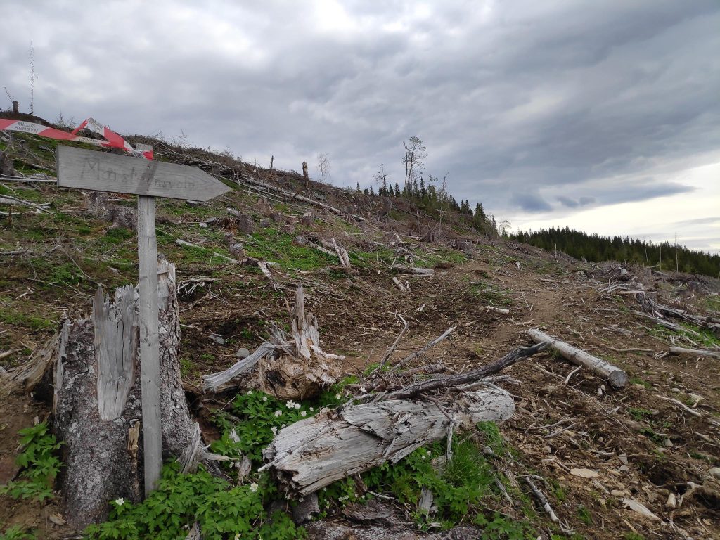
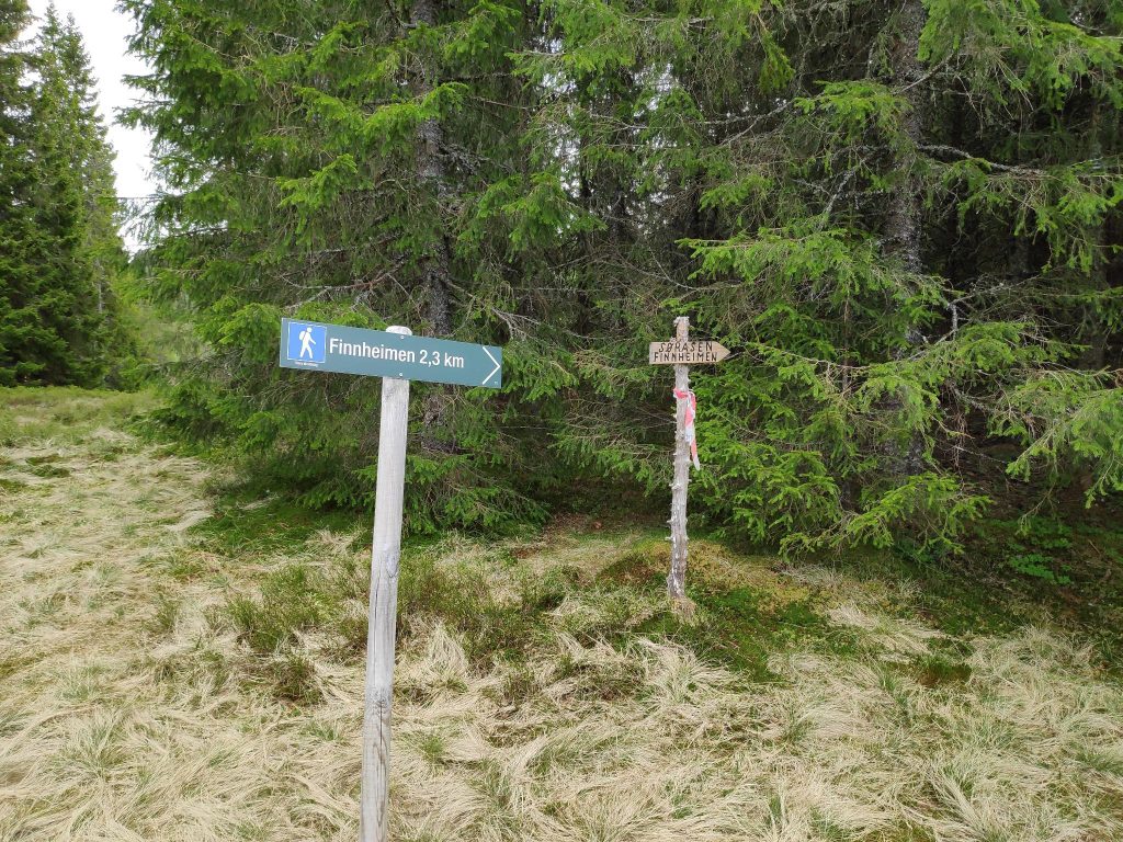
On the way up to Aunan I had seen a sign that indicated a path and I suggested to Brock that we take it and explore. He agreed, so we ended up taking the long way round to Floåsen, but along lovely trails through the forest.
The sign indicates that Marsteinsvola is in that direction, so we take that trail and look for a turn off it to Floåsen.Part of a trail that we hadn’t taken before. It is well used, even though it wasn’t on the map I had.We have come from Aunan. Marsteinsvola is another hilltop, but we won’t go there today. We head off to Floåsen. This next section of the trail we have been on before, on our way back from Marsteinsvola.Floåsen
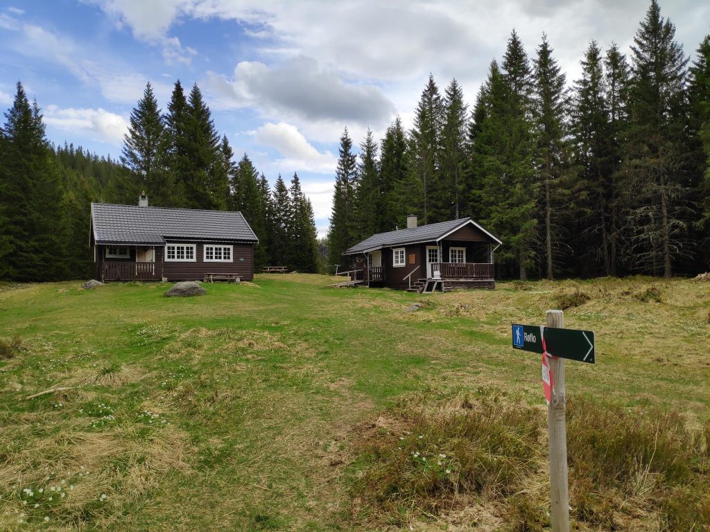
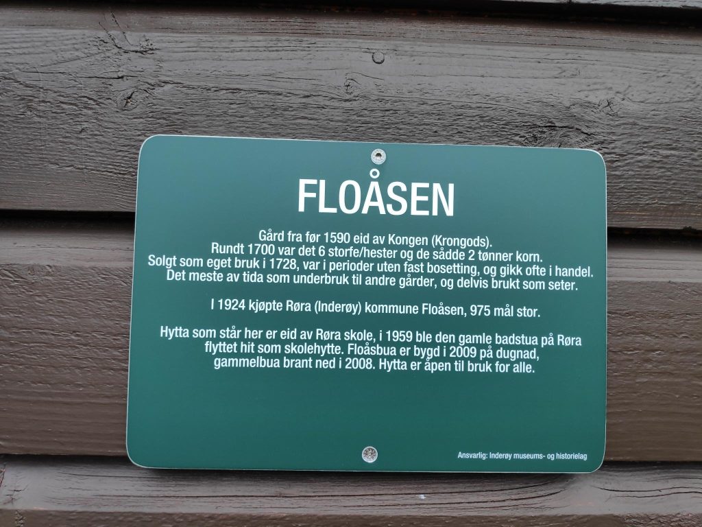
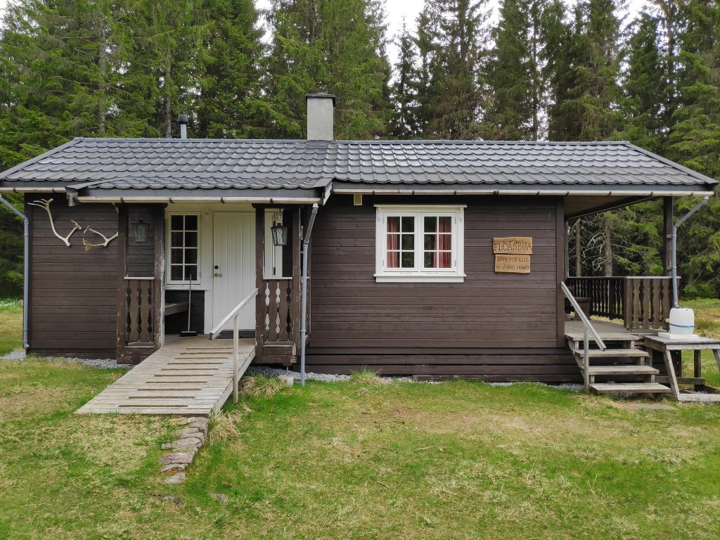
Though there is a lovely view from Aunan, Floåsen is an open area in the middle of the forest. There are two buildings at Floåsen, and there are several signs here. The sign below tells the story of this location. This was originally a farm owned by the King. It was purchased by municipality of Røra in 1924. The cabin that is here is owned by the Røra School.
More signs, a map, a notice that this is a check-in post for Inderøy Walks, and a box put up by the local sports club, with a book inside. You can write your name in the book to indicate that you have been here.The sign says, “Floåsbua, Åpen for alle, Floåsens Venner” Translation: Floås Cabin, open for everyone, Friends of Floåsen The left hand door leads to a toilet and to the right is a room with a small kitchen, where one could take shelter in bad weather. We sat at a picnic table outdoors and ate some sandwiches. Two places we decided not to go to today.
We had now been walking for about one and a half hours, enjoying our time out in nature. There were other places we could have walked to from here, but we agreed that going back to the car was appropriate. Taking the quickest way back it would take about half an hour to the car.
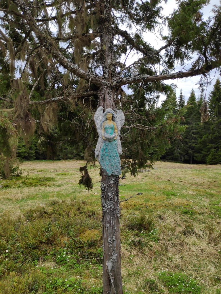
We found this angel hanging in the tree on our way back to the car.
The walk took a little over two hours, in cloudy weather and about 14 degrees Celsius. We were tired by the time we got back to the car, but we want to do walks this long regularly so that we keep in good shape and grow old gracefully. We got to try a different trail we hadn’t been on before and we didn’t get lost.
I hope you have a chance to get out for a walk today. Enjoy nature! They say trees are good for our mental health.
Today, Sunday, the 8th of May, was the first day of the Inderøy Walks for 2022. My husband and I took our first walk today. There were also a lot of other people out walking too. The weather was mostly just cloudy, but we had one rain shower while we were in the forest, so we didn’t get too wet.
This year there are 48 posts and often several can be found on the same walk. We did a circle tour and were able to check in to three posts. We use an app on our phones to check in to posts when we get to them. For several years now, there have been posts that have been accessible to those who use wheelchairs (which also allows access for those with baby buggies or strollers), but this year there are also several posts that are accessible for those who are kayaking. However, I will be traditional and use my two feet. Today, I also borrowed my husband’s second walking stick to see if that was useful. On flat bits, I didn’t like having to carry the stick, but on steep areas it was useful.
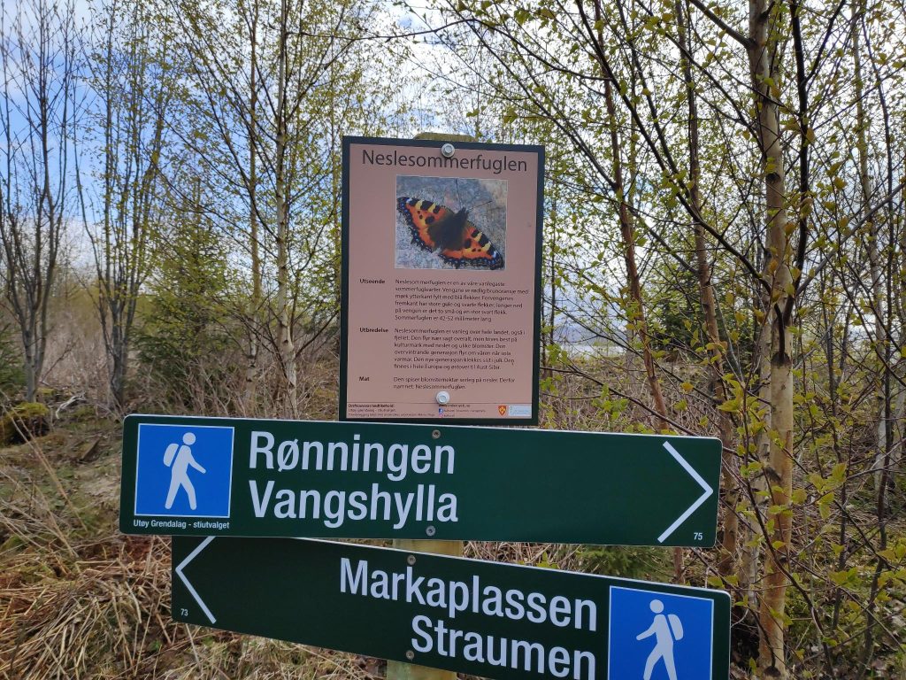
We parked at our local recycling center (previously known as the garbage dump) and headed off on an easy walk through relatively open terrain. The trees are just starting to put out their leaves. The walk from the car to Markaplassen was about 600 meters.
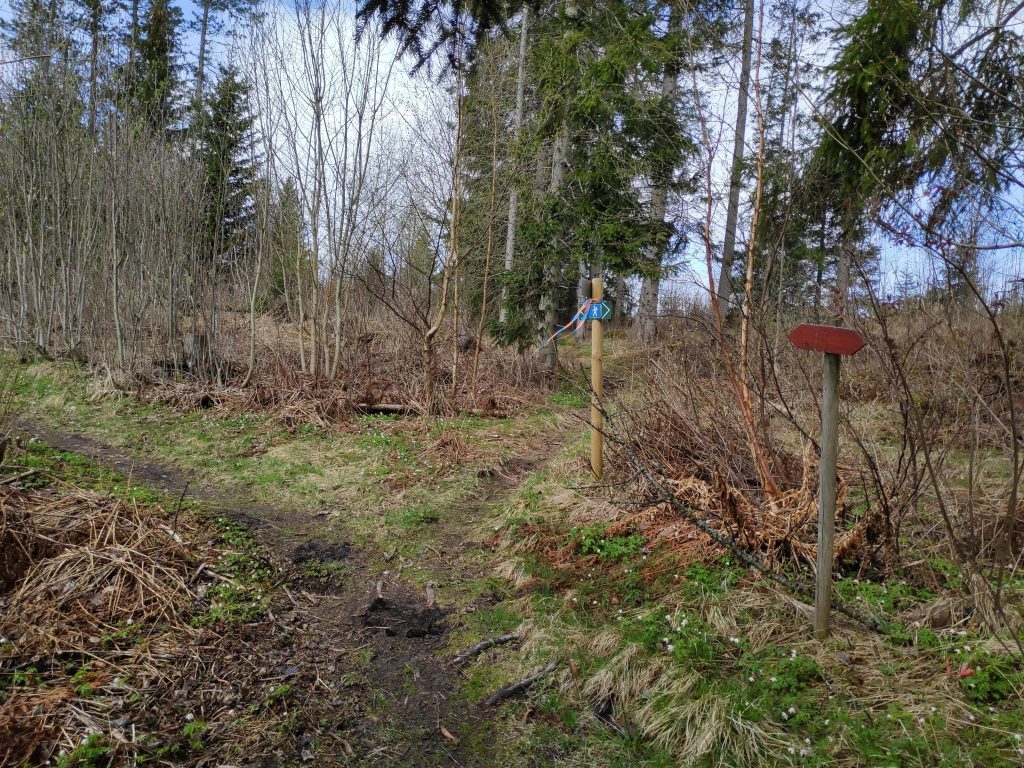
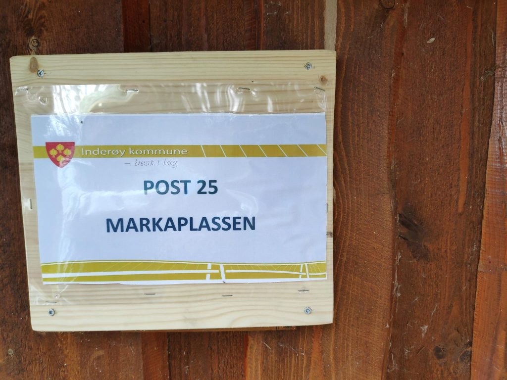
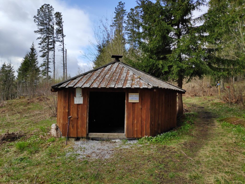
Yes, we could walk to Vangshylla and home from here, but it’s a bit too far for me. Today we chose to go left, towards Markaplassen. There were new information signs along this path, primarily about insects, birds or other animals. The blue hiker on the signs indicate that this is middle difficulty, though the section we did today was quite easy. In spite of recent rain, the ground was not muddy or particularly wet.Here is the trail and the open forest that we were walking through. The trail is marked both with signs and streamers. The red arrows are an older version of the signs. Today they use signs with a hiker on them.Our first post, number 25, for 2022. We got 10 points each for this easy walk.This little shelter at Markaplassen can be used if the weather turns bad. There would be benches inside to sit on. We were still energetic so we continued our walk without sitting down.
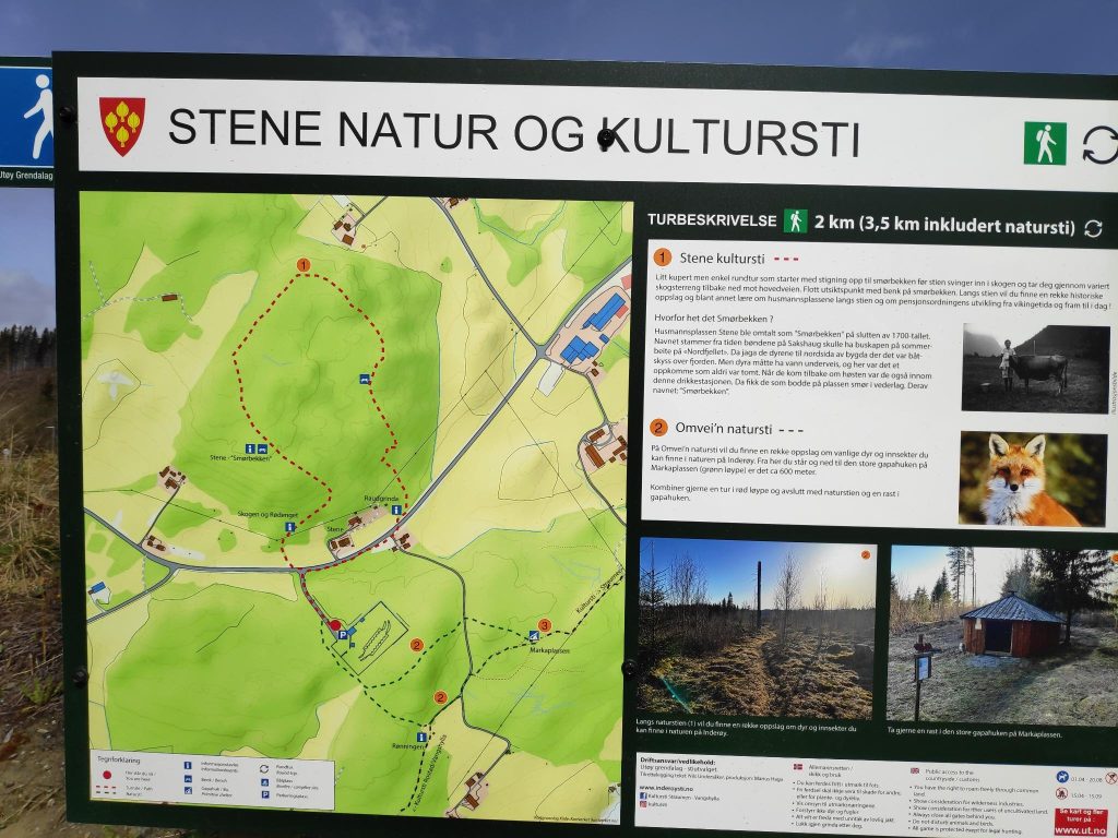
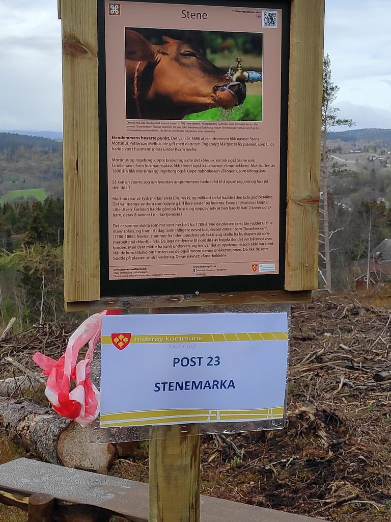
New this year were two posts on the Stene Nature and Culture Path. It is posted as a green trail, which means it is quite easy. It is not a very long trail, but does go around in a circle. We came to the path from the right on the map below and took the trail in a counter-clockwise direction, meeting many people going in the opposite direction.
We came from Markaplassen (labeled 3 on the map, went up to the main car road, crossed over it and followed the red dotted line in a counter-clockwise direction.
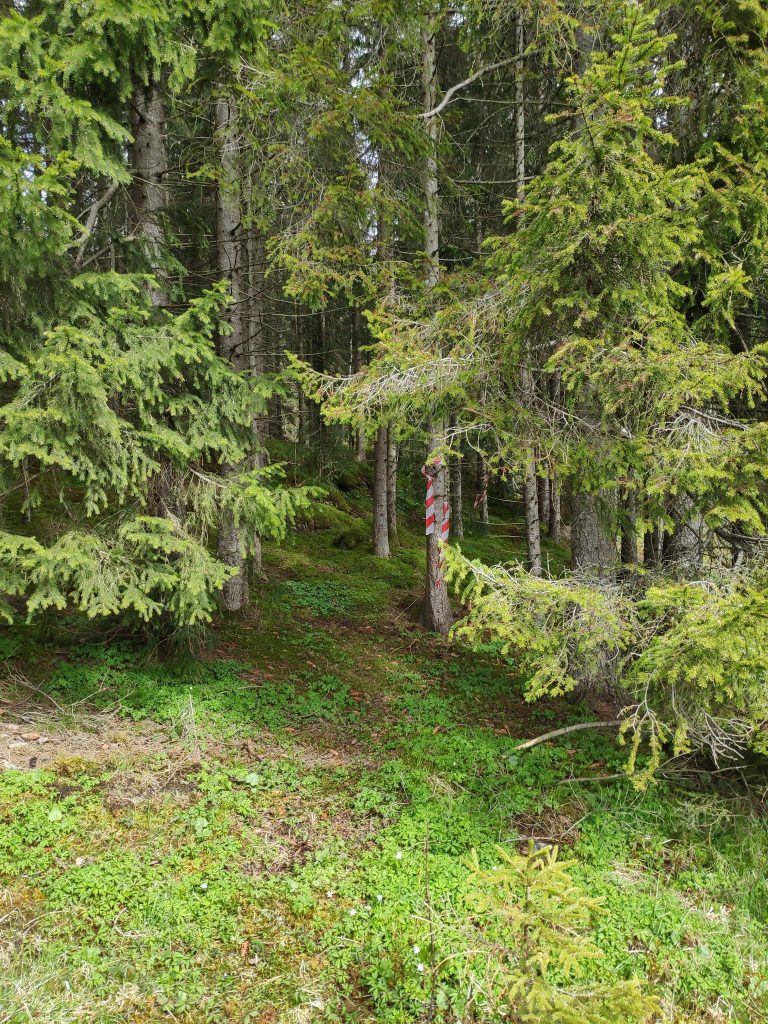
It is always fun trying a new trail. This trail was well marked with streamers, and I’m sure by the end of the summer, it will be very easy to see on the ground as well. However, there were many narrow trails, probably deer trails, in the forest so we had to keep a good eye on the streamers in the trees.
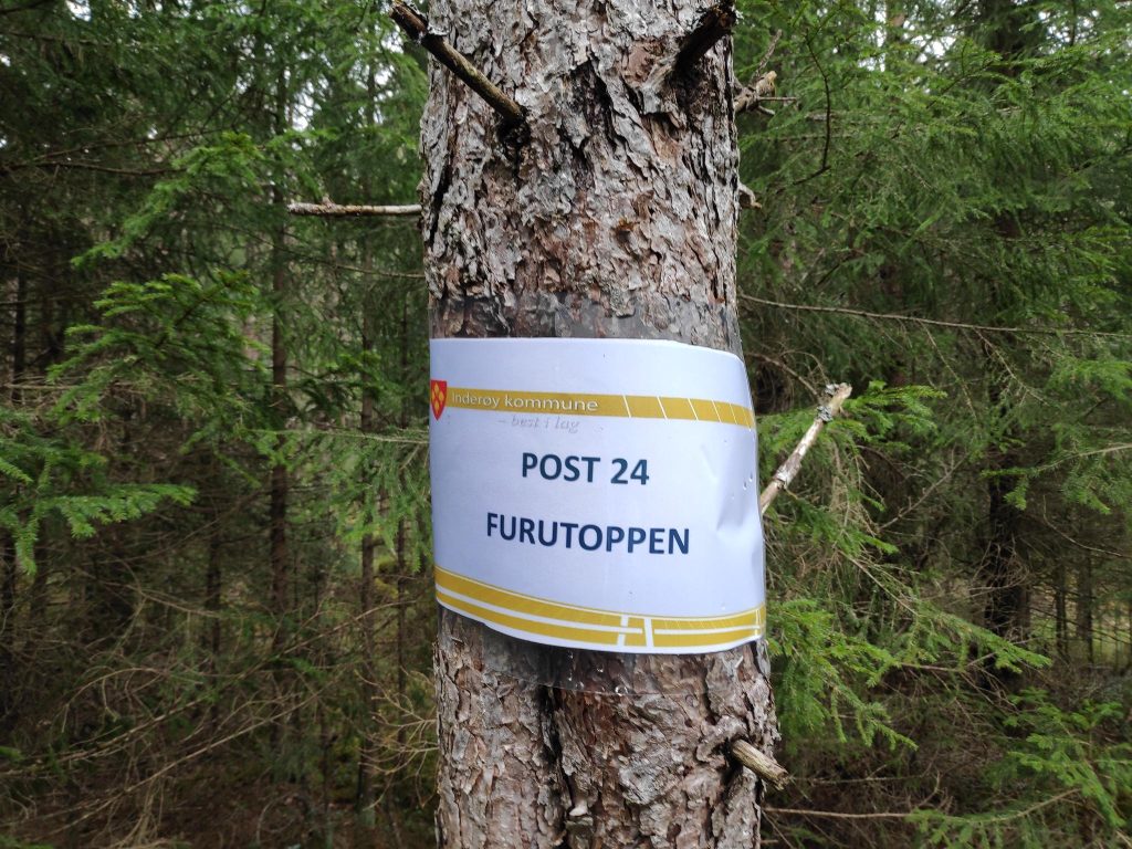
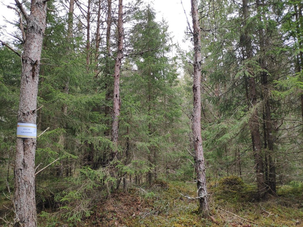
Into the trees we go. We had to keep an eye on the red and white streamers so that we went in the right direction. Most of this trail was in a coniferous forest that has not been logged recently. We climbed quite a bit, so we got good exercise. Our second post of the day, number 24, was called Furutoppen, the Pine Top, Here we got 20 points for our efforts.The forest at Furutoppen.
There was a little bench to sit on while we checked in on our app. We now had been to two posts and gotten 30 points each. Onward ho! We have to get back to the car, so we keep on going. We are enjoying the quiet of the forest, though every now and then we hear the voices of others who are out walking. It is Sunday, so lots of people will be out on the trails today.
While we were in the forest, there was a short rain shower. By the time it was finished we came out into the open where the forest had been cut down, perhaps a year or two ago. I noticed that small spruce trees had been planted in this logged area.
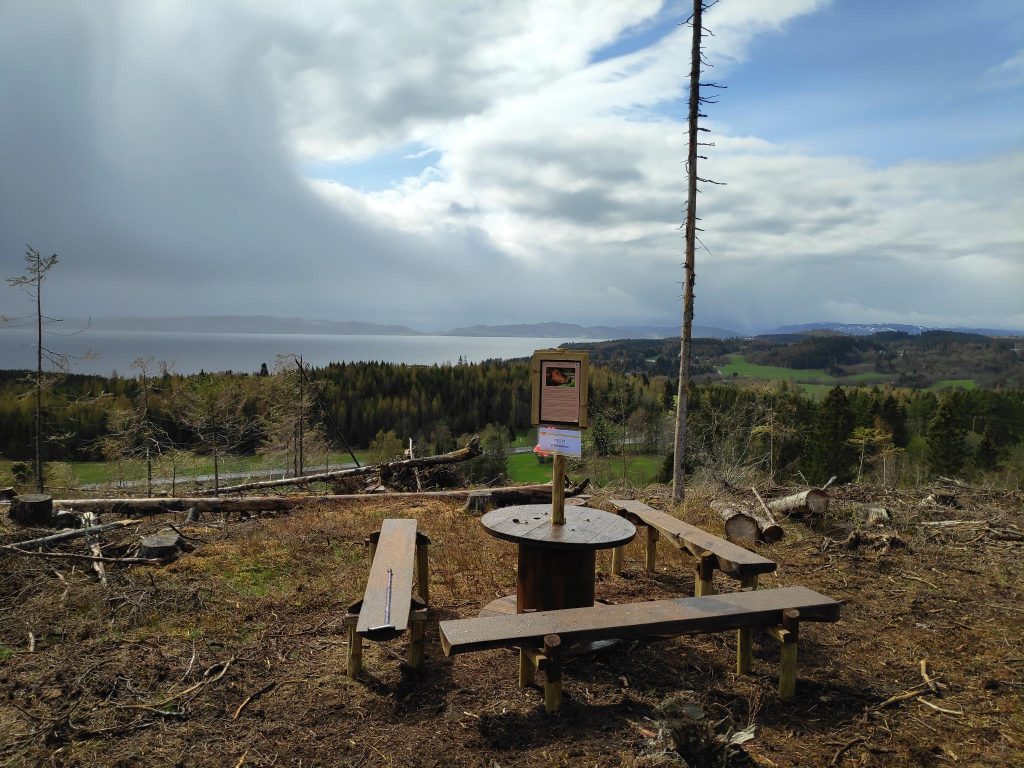
Looking back the way we came. We are going downhill now, and I’m looking back at the forest we have come out of.Suddenly, when we get out into the open, there is a view over the farmland of Utøy. It is just clearing up after a short rain shower.Our third post of the walk, number 23, for which we got 10 points.They have made a nice sitting area here, with a view out over farmland and the fjord. The island of Ytterøy is in the background.Suddenly, the sun has come out again. We’ve just come down this section of the trail and it was very nice to have both a railing to hold onto and a walking stick to help with balance.
We enjoyed our walk today, in spite of the weather not really cooperating at one point. We were prepared for rain and mud, so there was really no problem. We used about one and a half hours on this round trip and we agreed that we would do it again. Though we have to drive to get to the starting point, the parking area is only about ten minutes drive from home.
I hope you get out for a walk today too. Enjoy the nature you have near you.
Though Easter is a moveable Christian holiday marking the death of Jesus Christ, in Norway this is a national holiday that no longer has anything to do with Christianity. Though Christians may attend church services, most people just see it as a nice break from work or school. Most people will have a five-day weekend and it is traditionally the time to either go to the mountains and have one last skiing trip, or head to the cabin near a fjord and get it ready for the summer season.
Thursday, Friday, Sunday and Monday are all days that are holy days and therefore most people will have the time off, unless they have a job that has to be manned 24 hours a day and seven days a week, like the police, hospitals and other health care services. Schools take the whole week off, so that children and students get ten days free. Stores are open on Saturday, but will often close a bit early so that the workers can also have extra free time. For example, my local grocery store has standard opening hours from 7 am to 11 pm but on the Saturday before Easter Sunday they will close at 4 pm.
I’ve never been keen on skiing, but getting into the woods and up a mountain have always been things I like to do. For me, this year, this is the week that my walking season has begun in earnest. Yesterday I took a one-and-a-half hour walk with my son and we covered about 5 km. However, I took no pictures yesterday so I won’t write more about that walk except to say that I really enjoyed it and I wanted to do more.
Today was again a bright sunny day. There was frost when I got up, but as the sun climbed higher in the sky, the air temperature warmed up considerably. While my son and my husband headed off for a day-trip in the car, I got a ride to a drop-off point that is about 5 km from home. I walk up and along a back road that brings me to Skarnsund Bridge, cross the bridge and walk through the woods to home again. It is only on the bridge that I have to listen to the noise of cars. Today I used two and a half hours, so probably walked almost 8 km.
The typical Easter weather that everyone wants is a sunny day, with heat in the sunshine. Today was a good day for fulfilling that dream weather.
Dream weather for an Easter walk – sunshine and no wind. Too bad the photographer couldn’t hold the camera parallel to the horizon. We can blame it on sun in her eyes, or perhaps just carelessness.
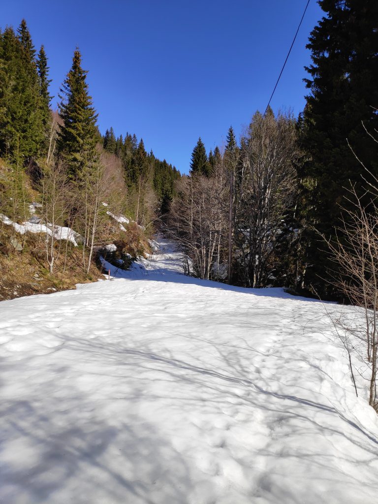
Though the snow is gone in low-lying areas, I was prepared for snow as I climbed up the hill. Mosvik gets a lot more precipitation than we get at Vangshylla. I quite often notice it raining or snowing in Mosvik and we don’t get anything. We also got a lot of precipitation in March this year, often as snow in higher elevations. Several storms would also have blown the snow, causing drifts in open areas in the woods.
Dalavegen in Mosvik is a back road with only a few houses on it, but it is kept open all winter long. However there are a lot of trees preventing the sun from melting the snow in the ditches. The higher I climbed up, the more snow there was. I use about 20 minutes to walk up this road as it is a steady uphill climb.The snow was melting and there was lots of water in all of the streams that I saw. This little waterfall captured my attention as a bent tree gives the water a nice edge to fall over.
When I got to a farm called Setervang, the road divides and continues eastwards towards Skarnsund Bridge or heads north then west to reach another farm which I think is only used as a summer house. This road is not always suitable for driving, even in the summer as it can have quite deep ruts. It is not plowed or kept open in the winter. In the summer there is a gate to keep the sheep away from farm fields.
There was still quite a bit of snow on this back road, one that is not kept open in the winter months. However there were lots of tracks from people walking up the road. This is a popular walking area in the summer.There were a few challenges where trees had stopped standing and were lying down for a rest. Someone had come by with a saw and made an opening for people to get through.
The main reason I had decided to come up this rather snow-covered road was to get to a viewpoint where I could see out over the fjord. There are several that can be accessed from this road, but I decided to neither go to Storlia nor Korpsåsen, both of which are lovely walks, in the summer. By the time I had gotten to this point, I did not want to go much farther across snow. I was on my own and had to be careful that I didn’t twist my ankle or otherwise injure myself. So I decided on a place that I knew about which was closer than either of those places.
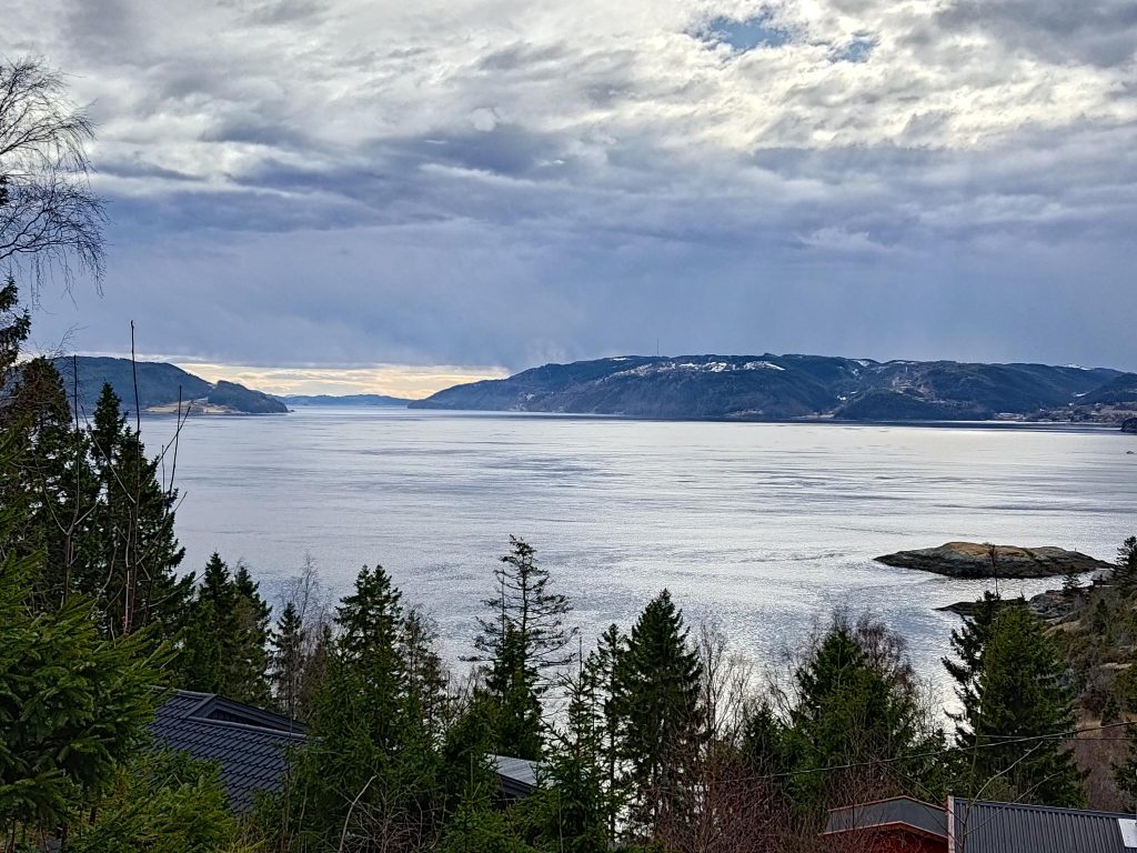
I took a left turn here but I’m not going to go as far as Korpsåsen, which is 700 meters according to the signpost, but I always feel is about twice that distance.Maybe a hundred meters from the snow-covered road, then turn left at the top of this hill.A viewpoint with a shelter, at the edge of a cliff.The shelterThe view, looking east towards Vangshylla and Verdal. The island of Ytterøy is also visible. This was the reason to trudge through the snow. I stopped her for a few minutes to just enjoy the sunshine and being able to see a long way. Though it doesn’t show up well in this picture, there are snow-covered mountains in the distance.
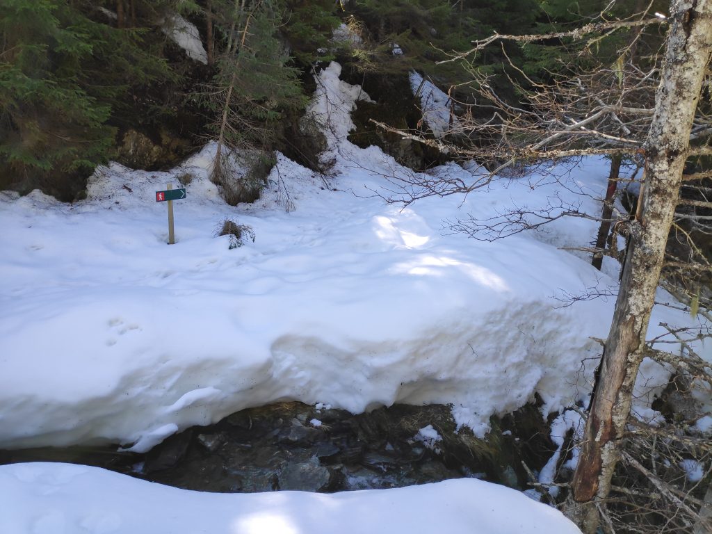
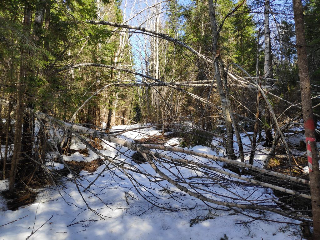
After enjoying the view, I went back to Gammelplassen, where in the summer you can park a car and headed off towards Skarnsund Bridge and home. However, there was a lot of snow on the trail, trees that had blown over, and a stream to cross before I got onto the section of the trail that was mostly free of snow.
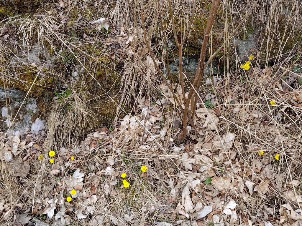
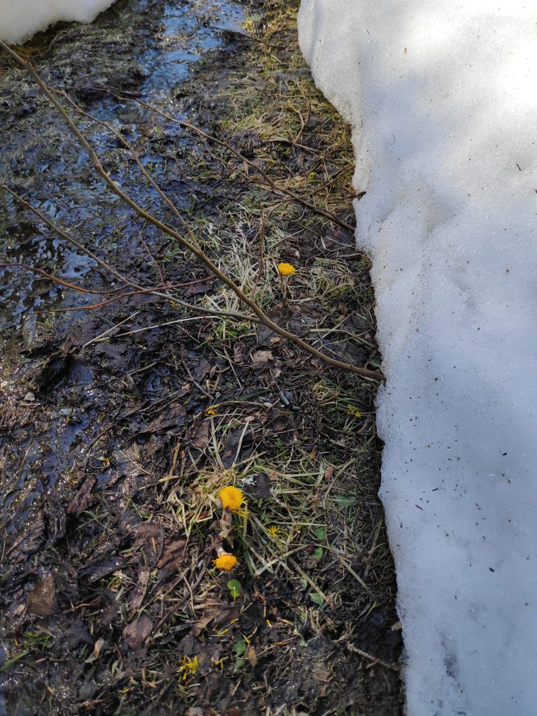
Gammelplassen – no parking available at the moment. Come back in a month or two. But I’m not the first one to cross on foot. There were both human and animal footprints.I’m on my way home, but first I have to get to the bridge. I’ve used about an hour so far.Colt’s foot (in Norwegian, hestehov) is one of the first flowers to come up in the spring. The flower comes out first and then large leaves grow throughout the summer. These fellows had plenty of water and were eager to get on with their lives. They were not going to wait for the snow to disappear.The trail continues on the other side of the stream. I followed the footprints and found a good crossing point. There was quite a bit of water in the stream, heading down to the fjord.Here too there were all sorts of lazy trees who couldn’t stay standing. Some of the trees were more difficult to get around, over or under than others.Finally, the trail becomes more bare than snow-covered, though the first part was quite wet.Furufjellet (the pine mountain), the goal of the walking trip, about an hour and a half from the start of my walk, and about 50 minutes from home. As I suspected, there was little snow on this part of the hillside.Looking up from the previous picture. There are pine trees at the top of this cliff.
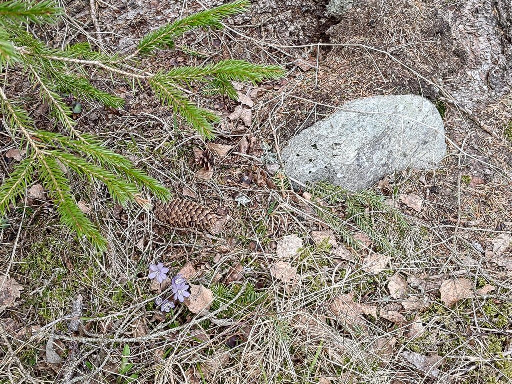
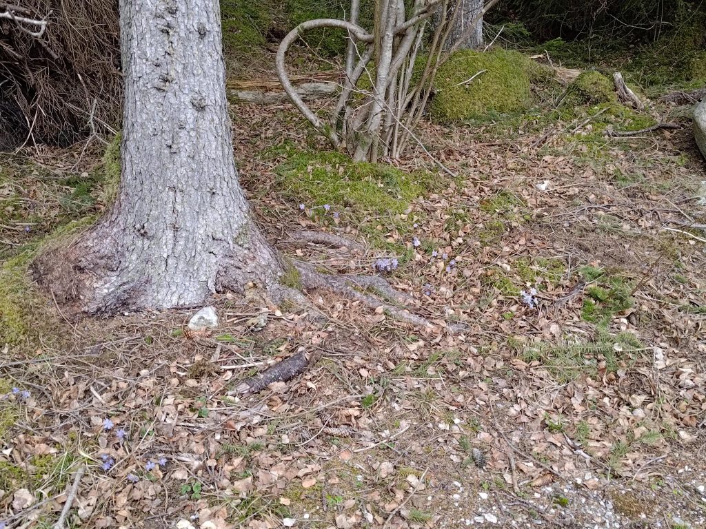
I often like to look at the flowers that are growing in different places, but in the middle of April there are still very few wild flowers out. I’ll have to wait until May before more come out. At this point there are a few that have to get their blooms out before the leaves come out on the deciduous trees. Colt’s foot (hestehov in Norwegian) is usually the first one and at lower elevations there are now numerous blooms along the sides of the road. Another plant, hepatica nobilis, (blåveis in Norwegian), anemone hepatica or liverwort in English, is very characteristic for Inderøy municipality.
This picture was taken on a sunny slope facing south. Anemone hepatica likes dry and calcium-rich soil. We have this on our lot and it is quite common throughout Inderøy.I’m back to the bridge. One kilometer across the bridge and about half a kilometer to home on the other side.
This was my first long walk of the year, using about two and a half hours, without any breaks except to take pictures. I was tired when I got home, but not as much as I had expected. Getting out into nature, away from cars and people, helps me charge up my batteries and keep me in a good frame of mind.
I am planning to do other walks and perhaps there will be blogs about them. Most of the walks that I can do easily from home I have already written about, so no promises about how often new blogs will come out. From about the middle of May, the municipality of Inderøy has a series of walks which I am hoping to participate in this year too.
Have you been out for a walk in nature recently? Is this the weekend for you to get away for an hour or two? Enjoy your walk.