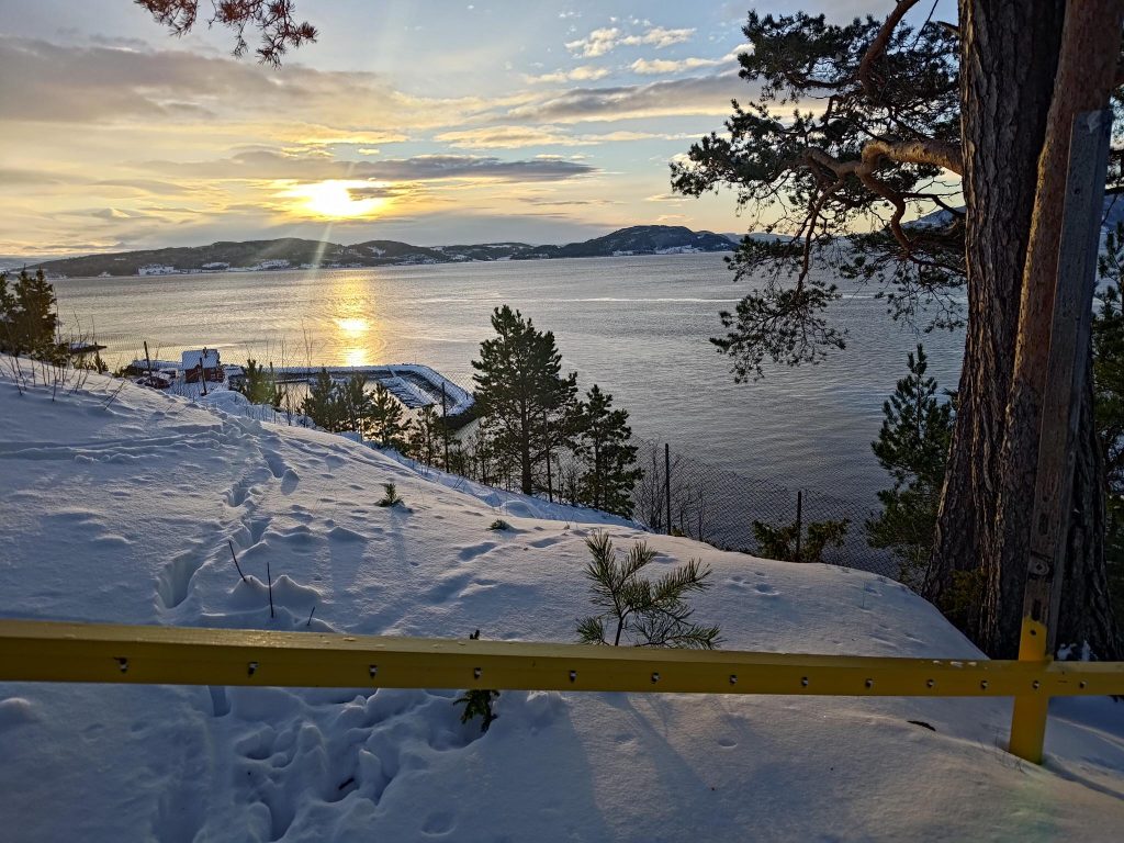
I’m finally getting out for walks in the woods again, after a long pause, mostly caused by poor weather. This week there is a pause from storms, both wind and rain. The air is refreshing at about -1 degree centigrade. Getting out of the house in the middle of the day gives me some much needed daylight.
About 10 days ago, in the afternoon of Friday, the 17th of January, our area of Trøndelag in Norway was hit by a storm with very strong winds, of hurricane strength in the gusts. The power went out for us about 4 pm and we didn’t get it back again until noon on Saturday. At its peak, there were about 40 000 homes without power. The main reason the power was out so long was that the wind had blown down an enormous number of trees. One of the contributing factors for so many trees down was that the ground was not frozen and there had been quite a bit of rain in the days before the storm. So when I went for my walk today, I was interested in seeing how much damage had been done in our local area.
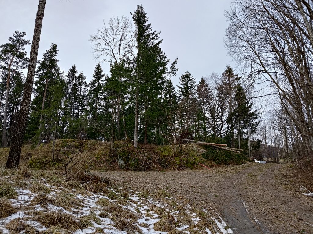
The morning after the storm we had noticed several large trees across the road leading to the cabins beside us. Today they had been at least partially removed. There was also a tractor and a man with a power saw working on cutting down other trees that were no longer upright.
The road leading to the cabins beside us. Three large trees had blown over, but have now been cut so they are no longer blocking the road.
Most of the trees that are blown over in the wind are spruce trees as they have very shallow roots. A strong gust of wind, from a slightly different direction than the tree is used to, will often make them fall over, with their roots in the air. The main way to help the trees is to have a mixed variety of trees standing together so that the roots are intertwined and the roots from deciduous trees help hold the conifers in place. Solitary trees will be affected more, as are the trees on the windward side of a grove of trees.
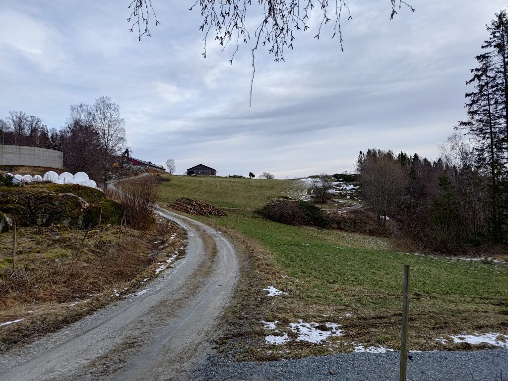
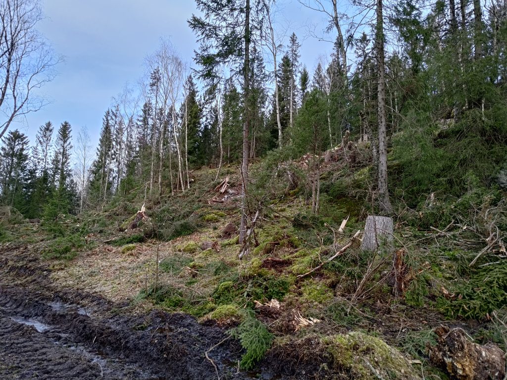
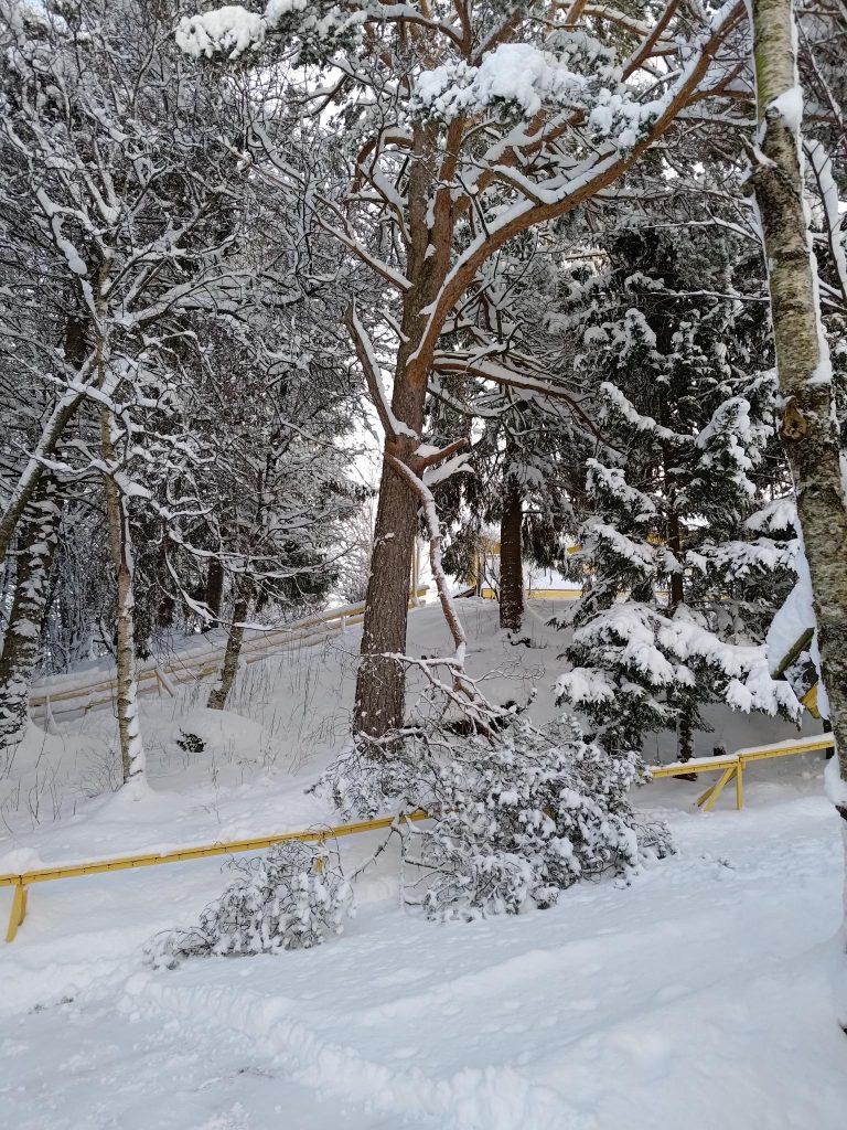
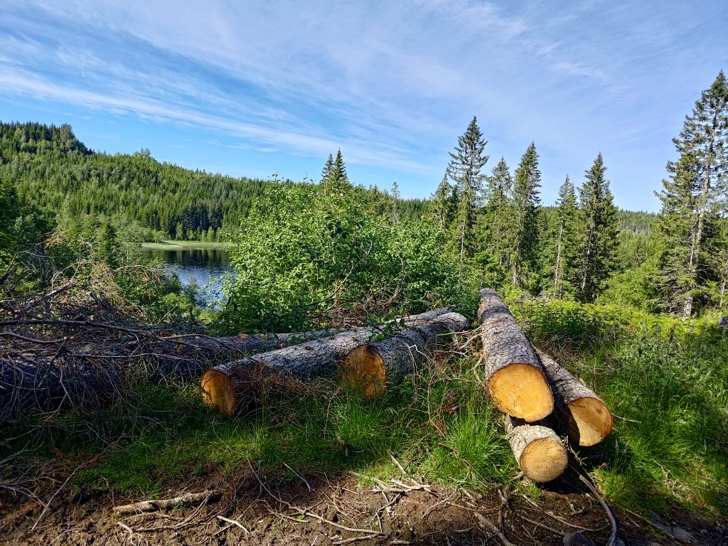
As I reached the crest of the hill that I walked up, I saw the following, a pile of logs and a bigger pile of branches. Note that most of our snow has disappeared now.
The farm Rotvoll is in the background, but I noticed a stack of logs and a lot of branches on the field.
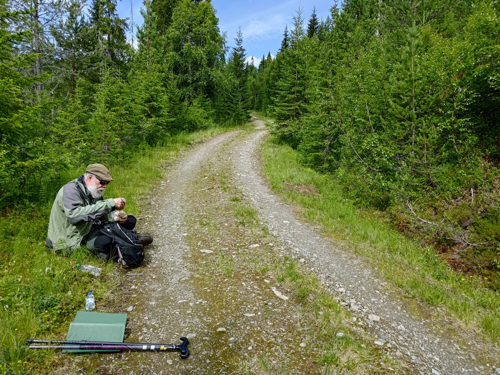
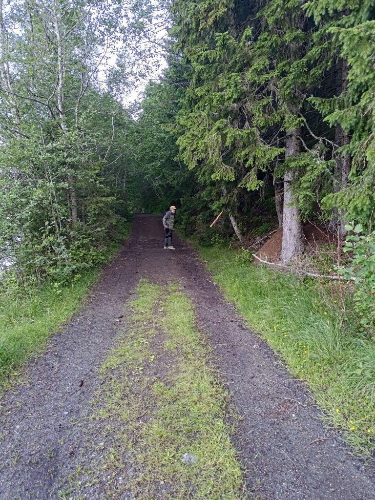
So I started wondering if all those trees had come down in the wind, or were they planned logging? It’s hard to know, but I wonder if it was a combination of both. My walk takes me down the road that goes off to the right in the distance. Locally it is known as the Golden Toll Road, as it is a private road and normally has a locked bar across the road.
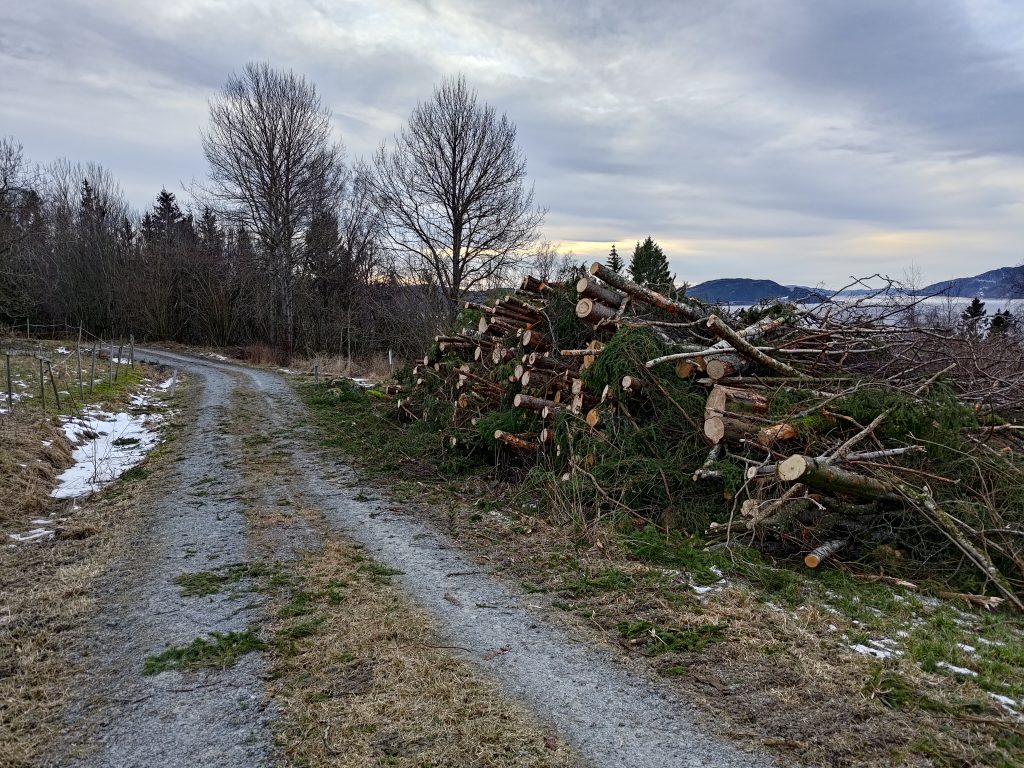
The Golden Toll Road is missing the bar across it. The bar was laying safely on the ground. From the stack of branches at the right, I’m guessing that some of this was planned logging.Signs of where the trees had been taken out. Had these been taken out before the storm? They don’t look like they had blown over. Certainly their removal makes the road more open.
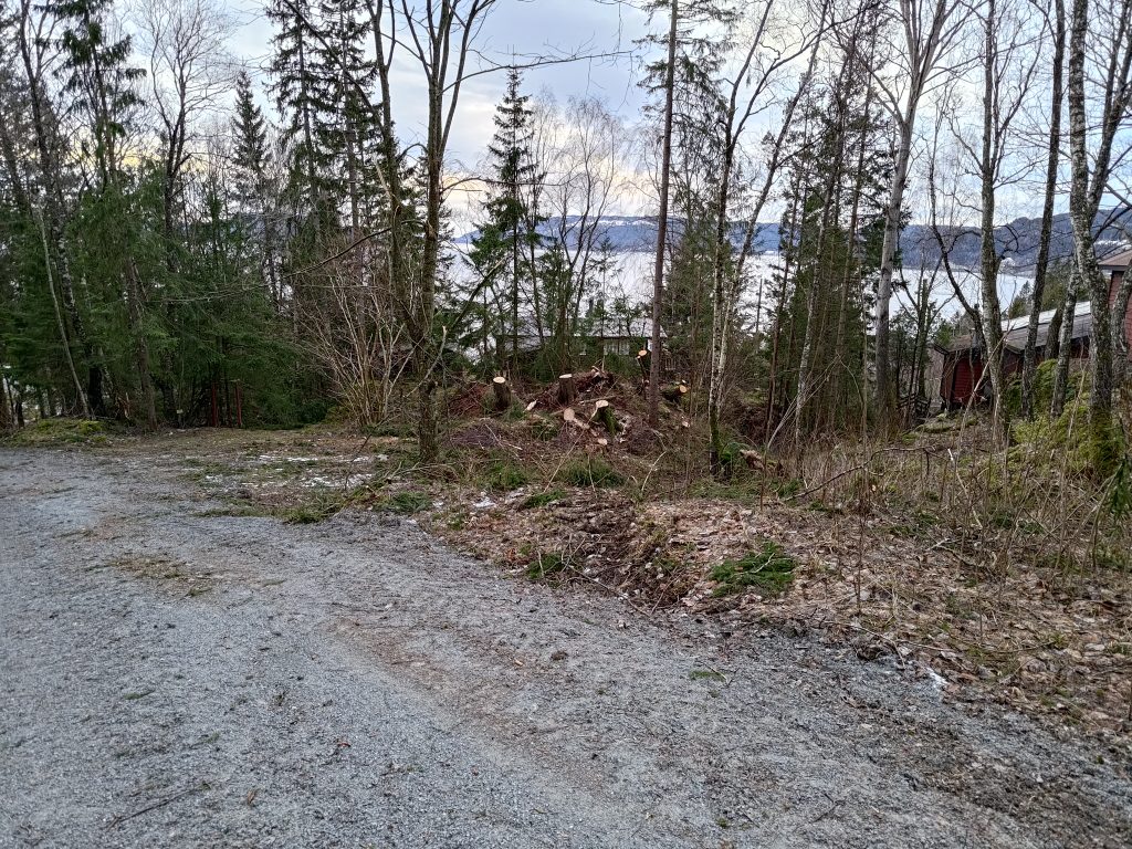
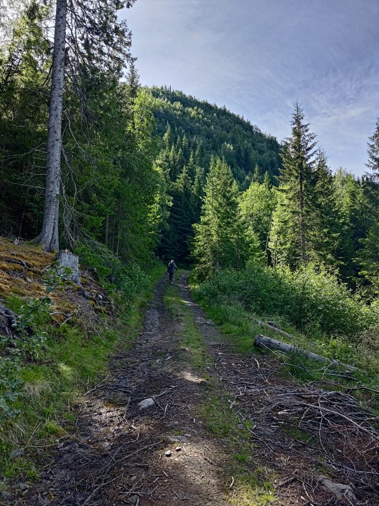
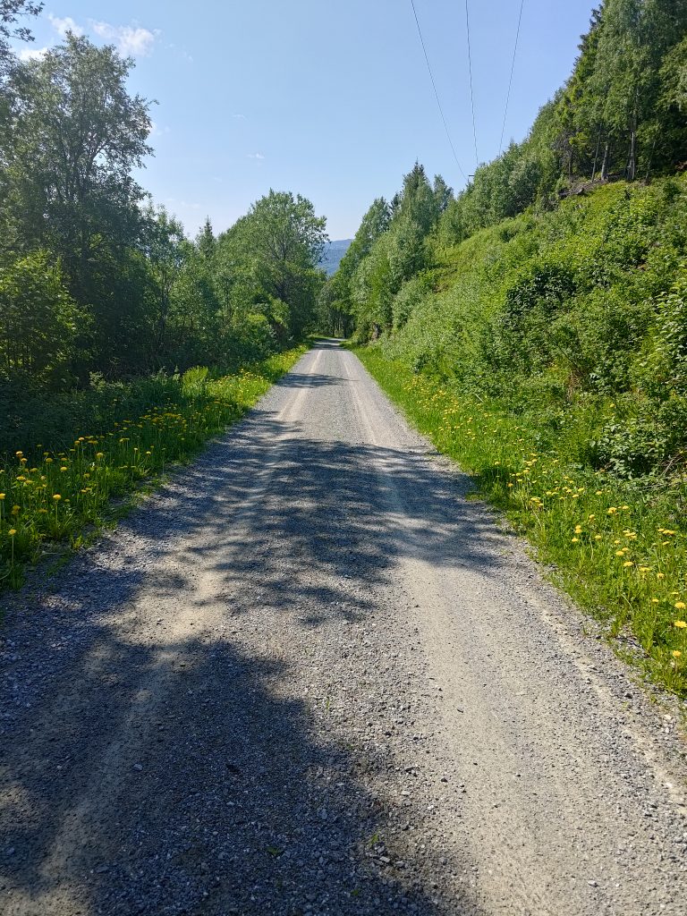
As I continued along the road, it was quite obvious that at least some of the trees were taken from along the road. This is quite a shady area in the summer, so I can imagine that the cabin owners wanted some of the trees taken out, to make it brighter along the road and so that trees were not hanging over the road. Whoever owns the land will also be able to sell the trees for lumber, a common source of extra income for farmers.
Here was an area where quite a few trees had been taken down, but it doesn’t look like they were blown over in the wind. There are heavy tracks on the ground made by some large, probably logging machine, which indicates it may have been done before the storm.
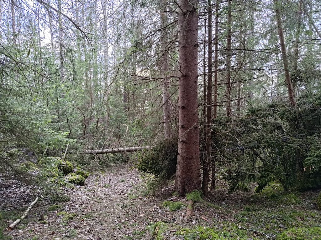
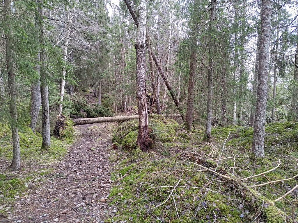
My walk continued from this road that leads to many cabins to a path through the woods. Over the years that I have walked through these woods, there are always changes. Old trees break or fall over in winter storms. New trees sprout. Those who are responsible for keeping the trail usable usually go along the trail in the spring and make sure the fallen trees are cleared away. This trail is part of a longer trail that goes about 20 km from Vangshylla to Straumen (which is 12 km away by road).
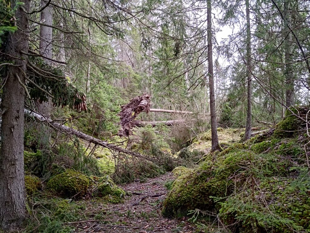
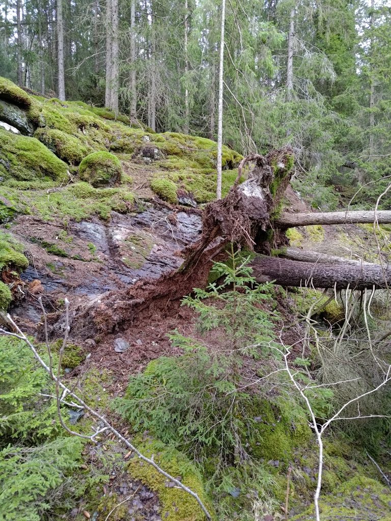
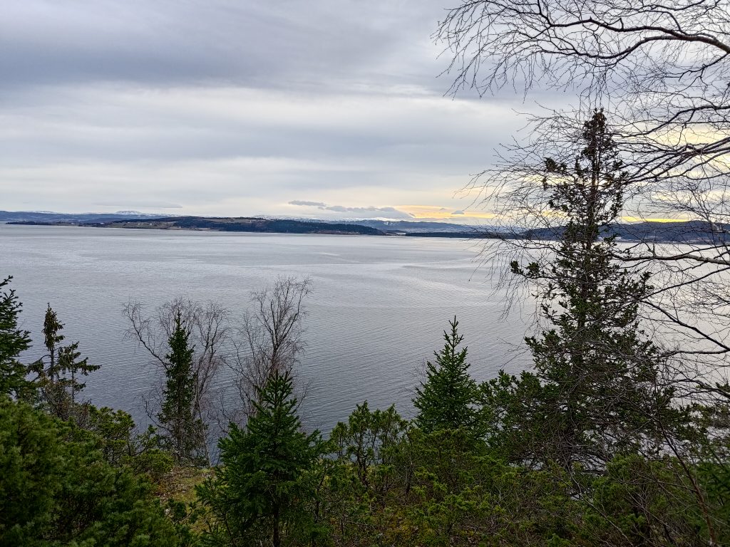
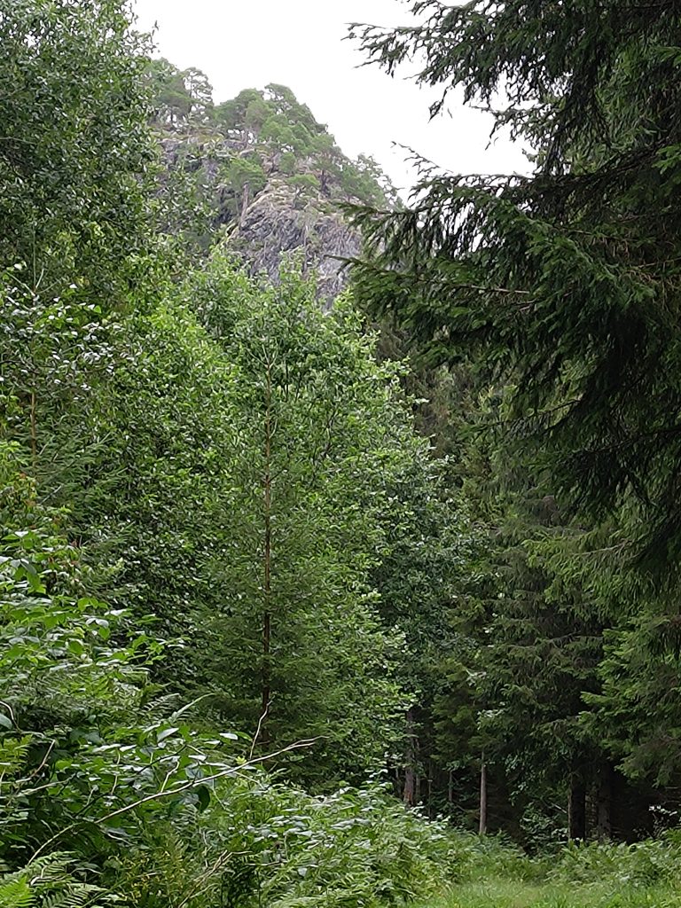
Though there were no trees obstructing the car road, once I was on the trail there were still trees blocking my way. I had no problems getting around these ones.Another tree that had blown over, but it was easy to walk around. The roots were so shallow that there wasn’t much holding that tree upright, if the wind suddenly came from a different direction.More trees blocking part of the trail, but I go up to the right and don’t have to worry about the trees straight ahead in this picture.This picture illustrates how shallow the roots can be with these spruce trees which are growing up on a steep, rocky slope.The view from Bear Cliff, looking across to the island, Ytterøy, and Levanger behind the island.
The goal for my walk was what we call Bear Cliff (in Norwegian Bjørnbrøttet). There is a book in a box where I wrote my name. I was the fourth person to write my name in the book in 2025. It hasn’t really been good weather in most of January for walking in the woods. The first names for 2025 were recorded yesterday which was a Sunday.
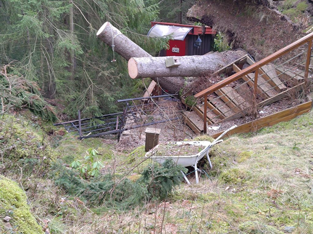
As I continued my walk, taking a circular route for as much as I can, I came across one place where there had been damage to human-made things, though thankfully not the cabin itself.
Here there had been damage in the storm, so at least some of those trees on the field had been taken down after the storm. The cabin owner will have some repairs to do this summer. Thankfully the trees and blown down away from the cabin itself and only damaged the stairway. There is still a considerable mess to clean up.
The rest of my walk was quite uneventful. But I don’t need to see the results of a storm every time. Just walking amongst the trees is enough for me. I used an hour on today’s walk and I must try to prioritize doing more such walks. Getting away from roads and people can be very pleasant. I got back home feeling very refreshed and motivated both to write this blog and to do similar walks.
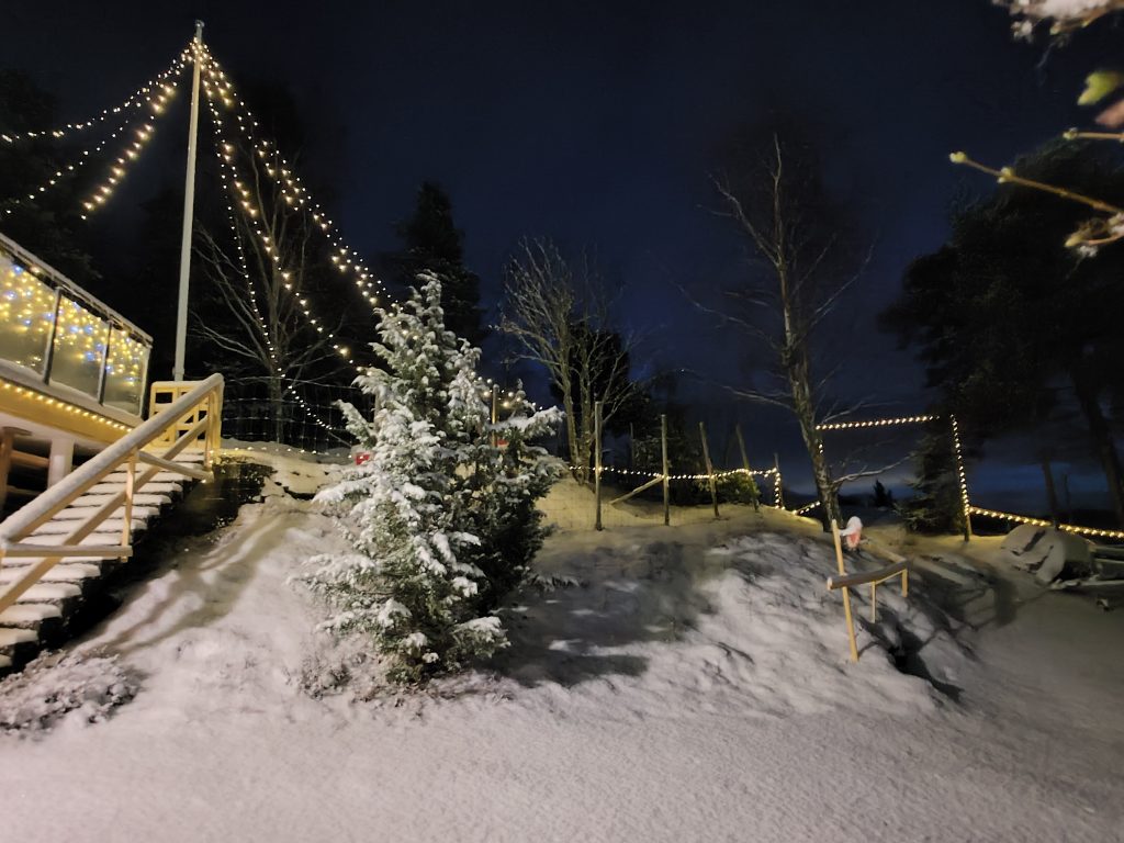
Winter at Vangshylla, with extra lights to cheer up the lot. Picture taken on 3 December 2024 at 16:32.
We live in a part of the world where it snows in the winter. It is also dark a large part of the day during November, December, January and February. Today, the 8th of January, sunrise was at 9:52 and sunset at 14:52, so officially light for five hours. However, how bright the day is depends on whether the sky is clear or not. On cloudy days, it can seem dark all day long if one doesn’t get outside and one needs lights on inside to be able to do anything.
Winter at Vangshylla with the sun slightly above the horizon and the clouds. Picture taken 8 January 2025 at 12:04. The tracks in the snow are made by deer.
I’m writing this blog while taking breaks from moving snow. We have a long driveway so it takes many hours to clear the driveway well. We got heavy snow on the 2nd of January and it snowed for several days creating chaos in many places. Among other things our garbage bins were not emptied on the designated day as the garbage trucks were not able to get at many of the garbage bins which had been snowed over.
One day it was blowing the snow, so it got quite packed as well. I’m still working on doing peripheral areas so that when it snows the next time it will be slightly easier. Usually we have one very heavy snowfall during the winter, so I’m hoping we have had it now. The worst that happens is that it turns mild, the snow melts but refreezes as ice at night. That is forecast for about 5 days in the future.
I actually enjoy having something to do outside that challenges my muscles and gives me fresh air and exercise. Now that I’m not working and having to get up at 5 am to clear the driveway to go to work, I find that removing snow by hand shovel very enjoyable. I wait until it’s daylight and quit when it gets dark. We don’t have to take the car out every day, so we plan trips out for shopping or being social with the weather forecast in mind.
Not every winter is filled with as much snow. Sometimes snow comes as early as October and sometimes it comes and goes as some days are milder. We often get a heavy snowfall in March, just when I’m wanting spring to arrive. Usually the ground freezes in November at the latest and then melting snow will often become ice. Ice I don’t like. As we get older, ice, especially under a thin film of snow, can cause even the most cautious walker to slide and injure themselves.
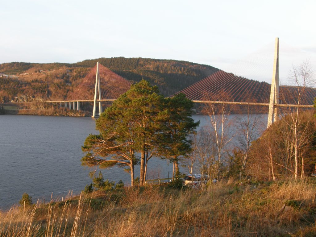
Skarnsund Bridge taken from near our house, 2 January 2016. There has been snow and frost but the day the picture was taken, there was no real amount of snow on the ground.
We have now lived in our house for almost 36 years, moving in on the 1st of March in 1989, a short time before our daughter was born. During all these years, there have been winter storms, hurricanes and heavy rain, but never any major damage to our house or lot.
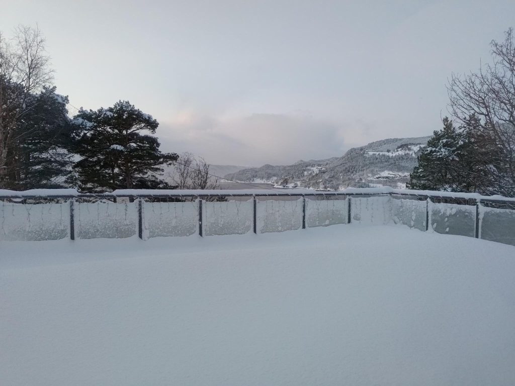
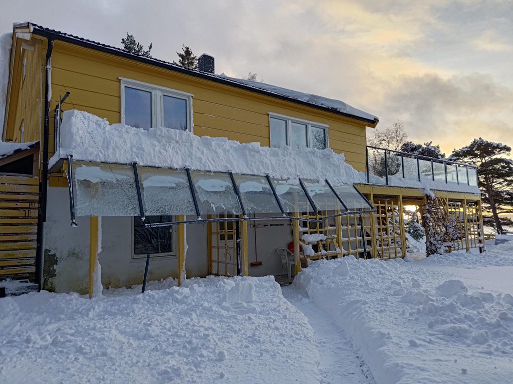
Terrace at Fjellheim, picture taken on Sunday 5 January 2025 at 9:19. It is promising to be a sunny day and light long before sunrise. The snow has piled up a lot on the terrace but at least it has stopped snowing.
Usually I like to get the driveway cleared first, so that we can get out with the car, so on the 5th of January I was working on that. I found a large branch that had broken off a pine tree. I called Brock to help cut the branch into smaller pieces so it was easier to move. Sawing the branch indicated that the wood was quite dry which is probably why it broke under the weight of the snow.
A broken branch from a pine tree, Sunday 5 January 2025. The picture was taken at 11:19. There was no damage to the fence.
We work for at most 30 minutes at a time and go inside for warm-up breaks regularly. Fingers get cold fastest. The rest of me keeps quite warm with the layers of clothing that I use and I have warm boots. But fingers, even with two layers of gloves, can get quite cold when it is -10 degrees Celsius and the shovel one is holding is also cold. There’s usually no hurry to get the work done, though I want to make as good use of the daylight hours as possible.
Suddenly, Brock came to me and told me something had happened. I hadn’t heard anything as my hearing disability makes me unaware of even some danger sounds. I walked part way up the driveway and saw the damage to the railing.
Damage to the railing on our terrace, 5 January 2025. Picture taken at 13:16.
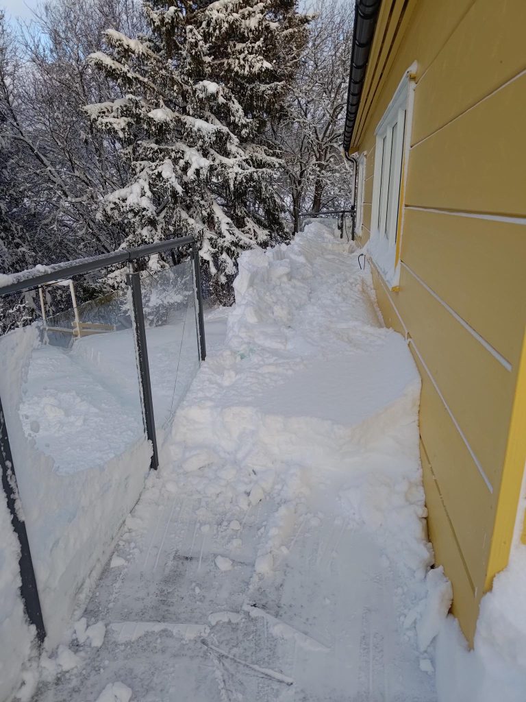
That changed on Sunday, the 5th of January 2025 when heavy packed snow on the roof of our house slid off and damaged the glass railing we have on our terrace. There were no person injuries, and material damage can be repaired. I’ve been reflecting on this damage since and realize that since we have lived in the house for so long, it is not surprising that something like this happened. An analysis of the situation made me think that the packed, blown snow last Friday was probably the major reason for suddenly getting damage. Usually the snow just slides off the roof, missing the railing and piling up on the terrace. We remove it once or twice during the winter so it doesn’t get too heavy. This time there was too much blown snow on the terrace already, so the snow from the roof had nowhere to go.
As you can see from the picture, there is a lot of snow on the ground, one section of glass has been shattered and seven sections have been pushed over by the weight of the snow. Our first challenge is to remove the broken sections, some of which may be reusable. But replacing the railing will be a job for the summer months. Brock has already started getting things supported so there isn’t more damage. Working in freezing temperatures does not make loosening bolts easy.
Damage to the railing as seen from the terrace. Usually the snow from the roof just fills up this section of terrace and we remove it when we have time.
As you can see from the picture, there is already a fair bit of snow on the terrace, before more came down from the roof. We normally remove at least some of the snow from the terrace. In some places on the terrace, where it is more open and the wind was blowing the snow, there is about 40 cm of snow.
Winter always gives us different challenges. No two winters are alike, but here in Norway there is always winter and many people get surprised by the first snowfall. Weather forecasting is much better now so that we get warnings of heavy snow so everyone can prepare themselves, and perhaps plan to have a day at home instead of going to work, to school or to go shopping. I like the change of seasons, no matter which season is coming next. I look forward to having snow on the ground to brighten up the long dark evenings. We add extra lights along our terrace and inside our living room to make things a bit brighter. Before you know it, winter retreats. The snow always disappears and spring is around the corner with longer, lighter and warmer days. I’m going to enjoy winter while it is here.
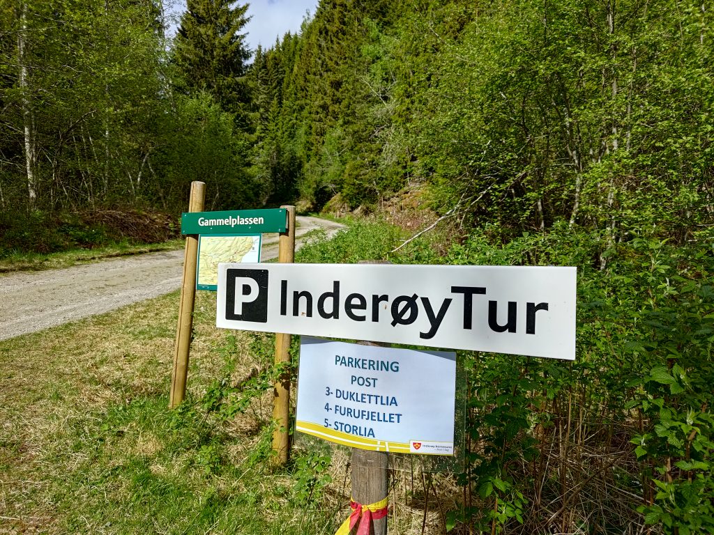
As I was going for a walk on my own, I thought that this Inderøy walk would suit a cloudy Wednesday afternoon. However, I read the information wrong and it was a lot longer than I was expecting, over 6 km. In the end I used an hour to go up the hill and an hour to come back to the car a slightly different, and slightly easier way. I usually figure 5 km is an hour and a half walk when in the woods. So 6 km ended up being two hours.
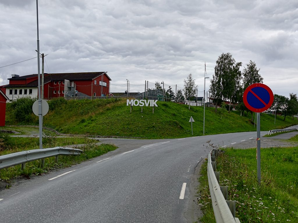
Mosvik is a very small village, with one food store with post office, a restaurant open mostly in the summer and not much else anymore. Even the main access to the village is across a one lane bridge. The elementary school has become a private school. The kindergarten has just closed down at the end of the school year after 40 years of existence. The residents are just not having enough children to even keep a kindergarten open.
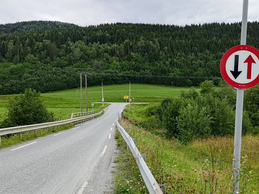
The road is only one lane across a bridge, but they do want you to know where you have come to. The red building on the hill is a private school, but was once the local elementary school.The one-lane bridge over the river Mossa. Notice that the cars coming into the village have right or way over those leaving. The main east-west road of Inderøy is at the intersection. Home for me is about 8 km to the right. If you look carefully, you will see two red flower baskets hanging on the flagpoles at the entrance to Mosvik. My walk will take me into the treed hillside straight ahead.The river Mossa, as it has just gone under the one-lane bridge.
But I’m not going into the village. ‘m going to walk into the treed hills. It’s a walk I’ve done before, though I don’t remember all of it. Memories came back as I walked along, first a tractor road and then a forest trail to find a picnic table.
Looking south-east, with the island of Ytterøy visible beyond the fjord.
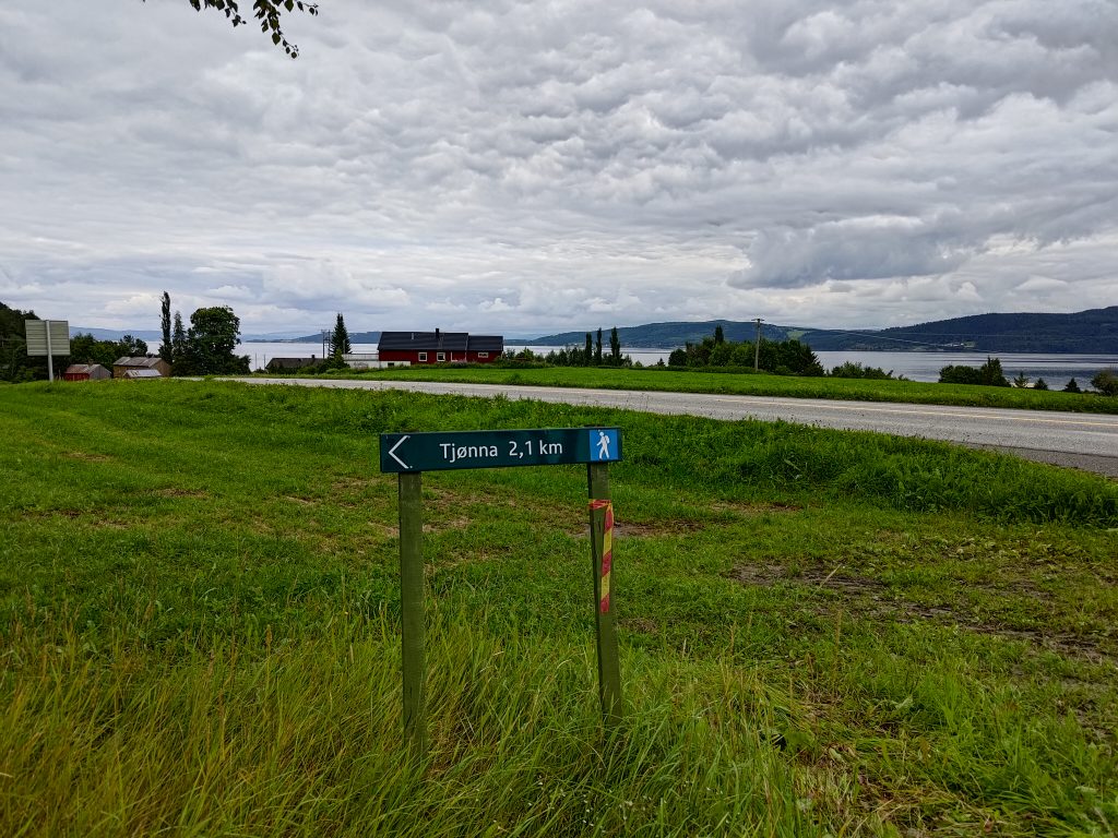
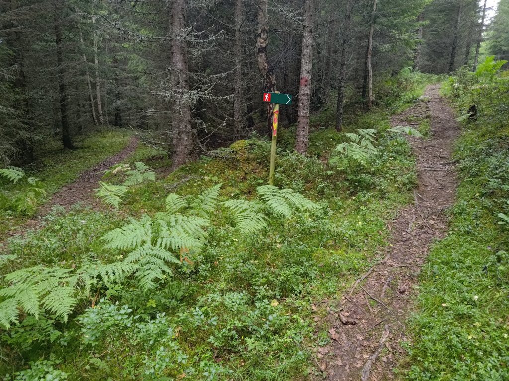
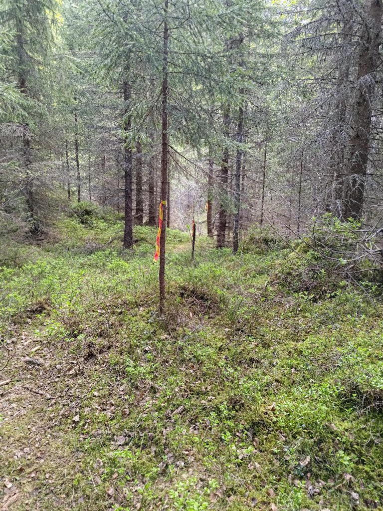
The red and yellow marker on the pole indicates a marked Inderøy walk. I’m headed in the correct direction. The blue man indicates an intermediate trail that should be relatively easy walking for me. It is a little over 2 km to a small pond (tjønna), though that is not the goal of my walk. I will turn off before the pond and go farther uphill.
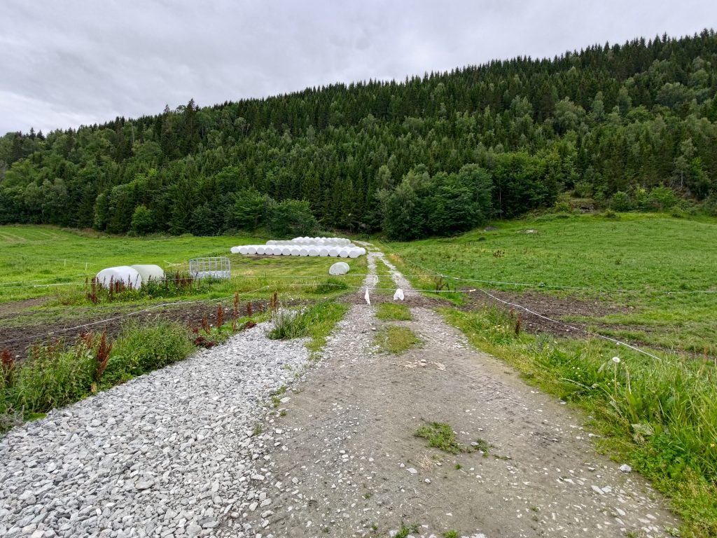
This is summer time and there were animals in the field on the right. There are two electric wires across the road I want to follow. I’m used to opening and closing such wire fences after living 35 years in a farming area. The animals were curious, but let me cross . This is July, so the farmers have already cut their grass fields once, hence the tractor eggs, or what I think of as marshmallows, lined up beside the road. That will be food for the animals in the winter time.
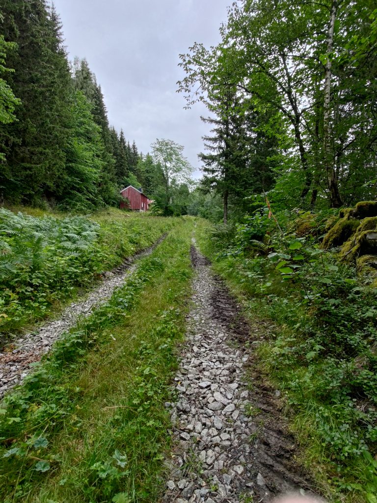
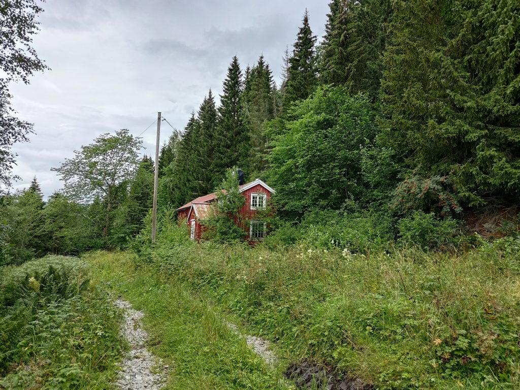
I followed the tractor road up the hill. There was lots of new gravel on it, especially in the bits that might have been muddy. I saw evidence of a tractor having driven on the road recently and I wondered why the road was kept in such good condition. What was up the road? Suddenly I saw a building on the left as I climbed the hill. When I got closer, it didn’t look particularly used.
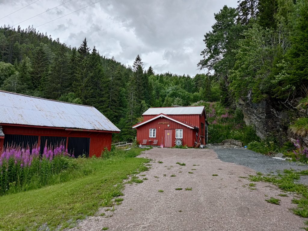
An old house with barn appeared on the road. In the old days, on a small subsistence farm, the barn would be attached to the house as the warmth from the animals would be appreciated in the winter months.Looking at the same building from the opposite side, showing two floors to the house, with relatively large windows. But the trees have not been cut back for a long time and there was no evidence that it was used at all.
I continued on up the hill, still following the tractor road that had definitely been maintained and used.
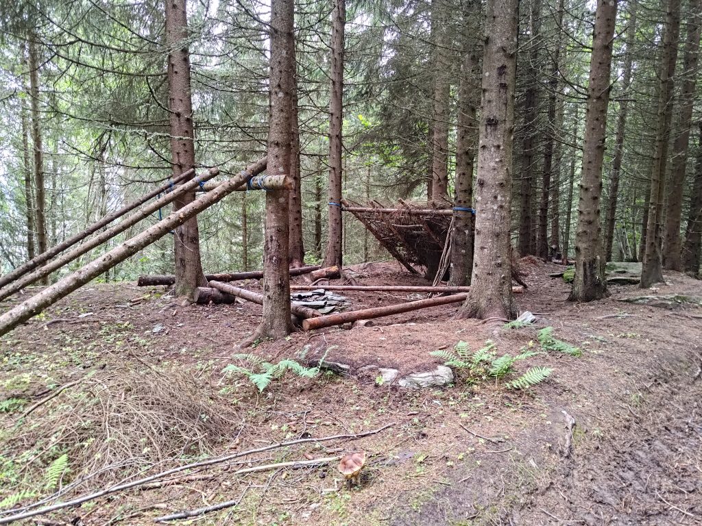
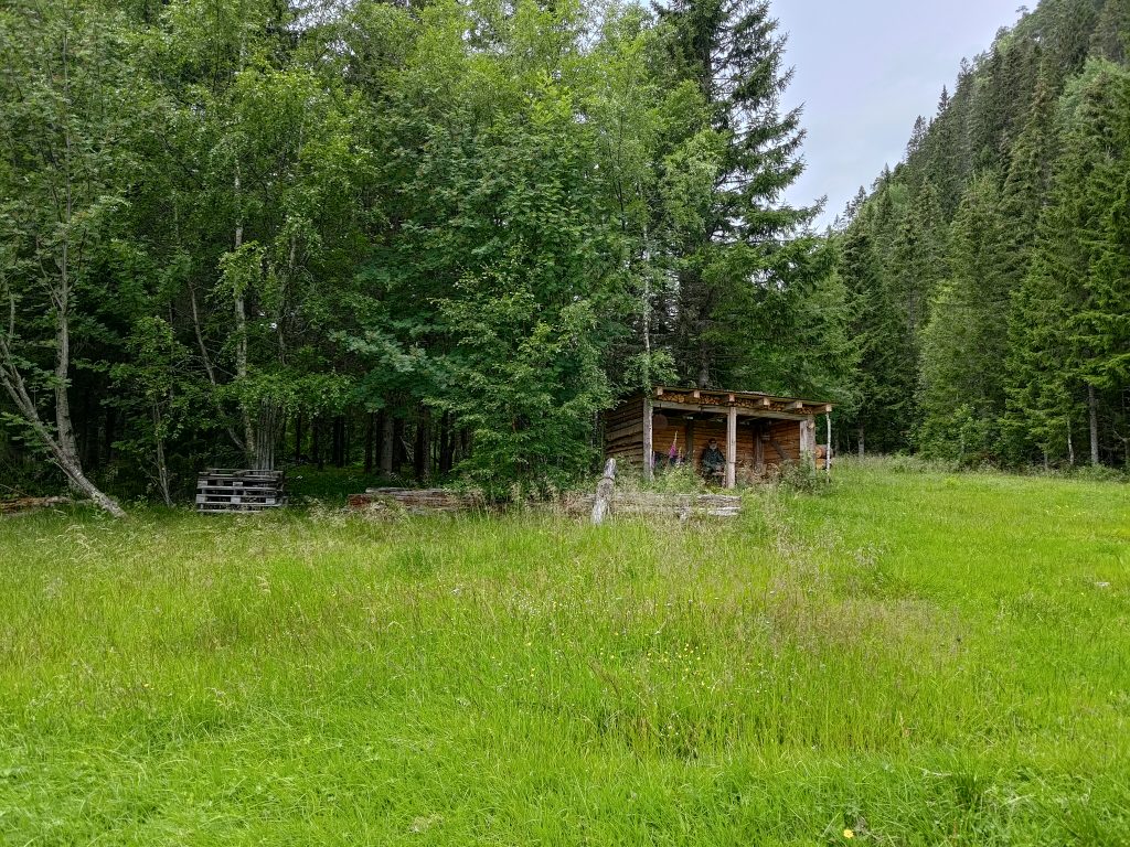
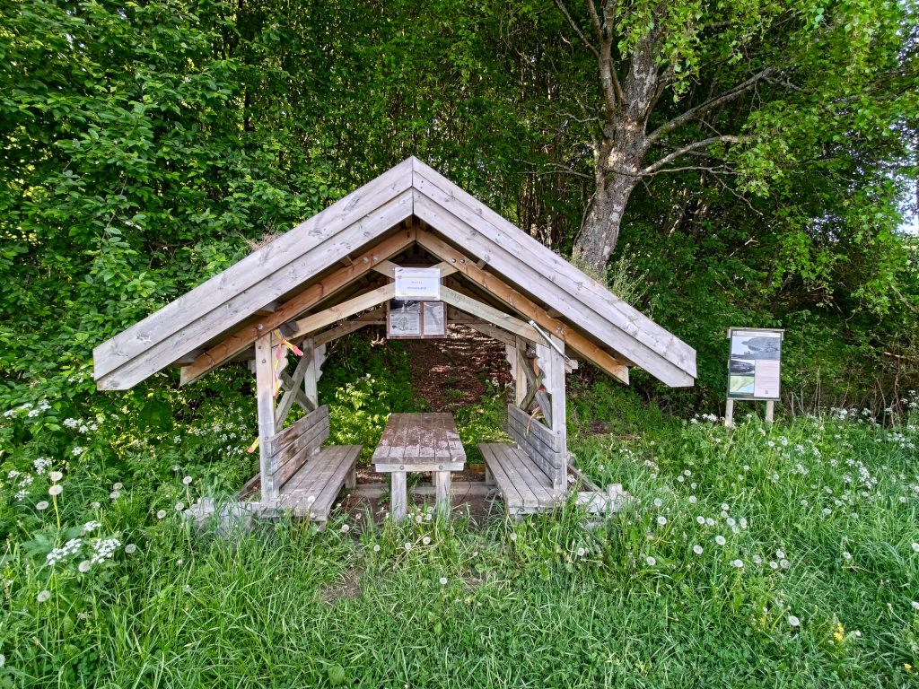
Somebody, or a group of people, have been at work in the woods, creating a shelter under the spruce trees. Without knowing who was responsible, I started wondering – a 4H group, a scouting group, a school class, some private individuals. I didn’t see anyone, so I’ll probably never know.
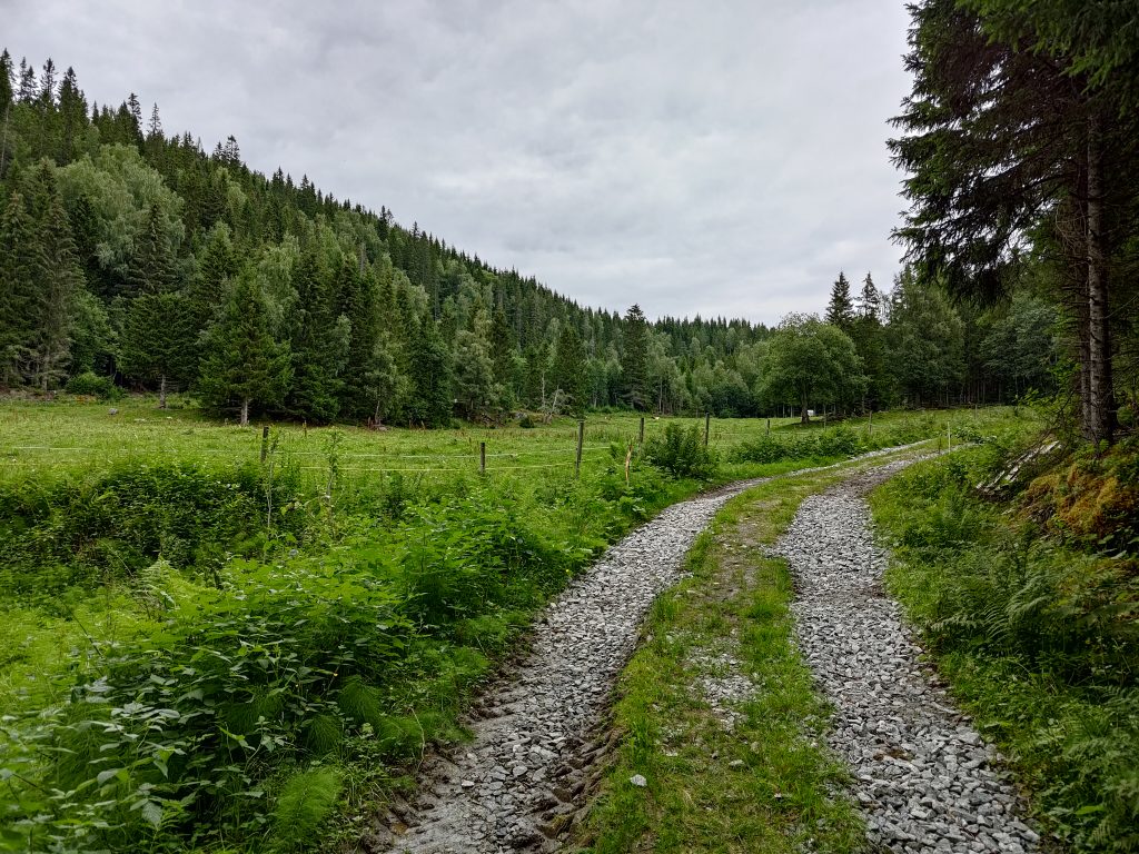
Suddenly the reason for the road became obvious. A fenced-in meadow with grazing cattle. The cattle don’t show up in the picture, but they are there. At the far end of the field is a large container of water for the animals. When I got to that container, the maintained road changed into a more common forest trail. Though once a tractor road, possibly for taking out lumber, it was now only used for walkers and wild animals.
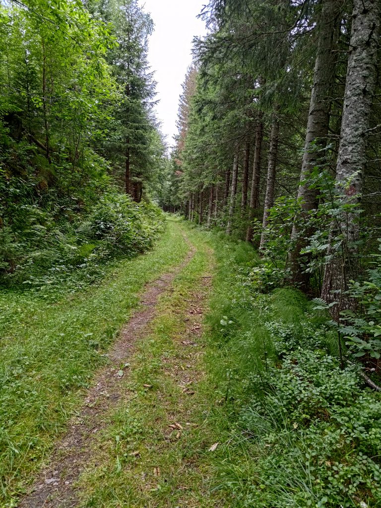
Into the woods I go. Though the path was still wide enough for a tractor, it hadn’t been driven on recently.
In a previous blog I have written about Furufjellet (The Pine Mountain) and here I caught a glimpse of it in the distance.
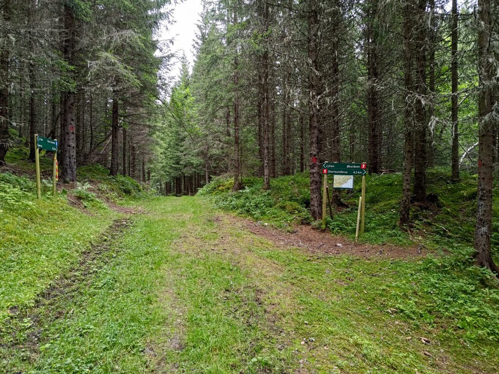
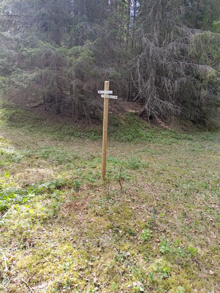
Furufjellet (The Pine Mountain) in the distance, probably over a kilometer away in a straight line, but there would be several ups and downs to get anywhere near it.A crossroads in the woods
Then I had to make some choices. Going straight ahead is the small pond that was mentioned as I left the road at the bottom of the hill. It would be about 300 meters ahead. If I went to the right, I could get to Skarnsund Bridge and home, the bridge being about 4.5 km away and home another 1.5 km from there. Note also that the blue man at the bottom of the hill has become a red man on these signs, indicating that the trails are going to become more challenging. They may be steeper as well as narrower. The sign on the left indicates that I have walked a bit more than 2 km, but I’ll have at least another 0.5 km before reaching my goal. I chose the path that goes up the hill to the left. The trail definitely becomes more difficult. It has rained quite a bit lately, so parts of the trail are muddy and I have to be careful about not slipping on the wet rocks.
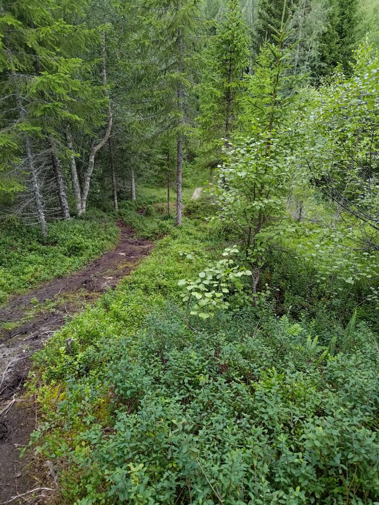
The trail goes up and down and the wooden boards ahead indicate crossing a swampy area.
I now remember this part of the trail from before, and I don’t really care to walk on such paths anymore, especially when I’m walking on my own. I want to reach the goal, but I start thinking about alternative ways to get back to the car. I know there are a lot of trails in these woods.
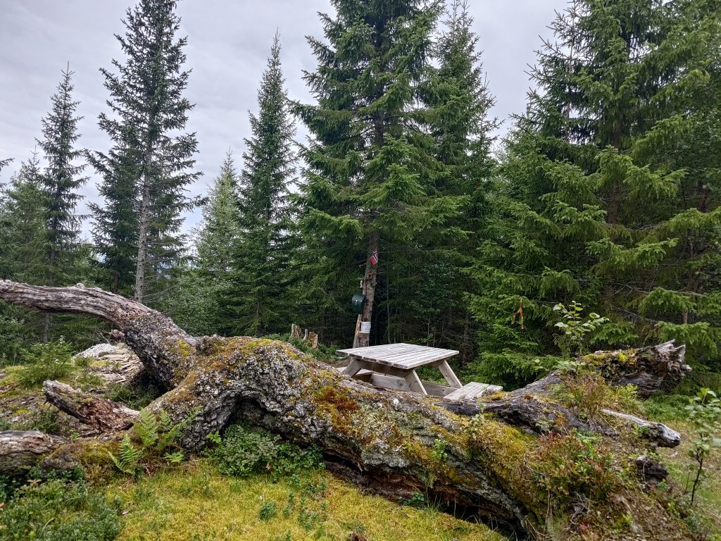
Made it. Post 6 Skoleposten, with book in the green box on the tree as well.
I made it to the post, where there is a picnic table to sit at. The name of the post, “Skoleposten” translates as the “school post” as this walk was specially marked so that the pupils at the elementary school at the bottom of the hill (seen behind the sign “Mosvik”) could have a walk and get points for their walk. This point is actually as high as the trail goes, at about 230 meters above sea level. If one continued on the trail it would go down again from this point.
It was good to be able to sit for a few minutes while I checked into the post on my app, and wrote my name in the book in the green box on the tree. Shall I continue on and find a trail that goes downhill? Shall I go back the way I came? The app on my phone has a good map which shows trails in the woods. There are at least three alternatives. I decide to go back to a trail that I noticed and see if I can get to the nearest farm and from there onto a road which is safer to walk along.
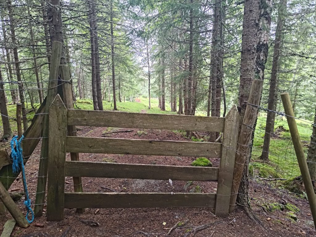
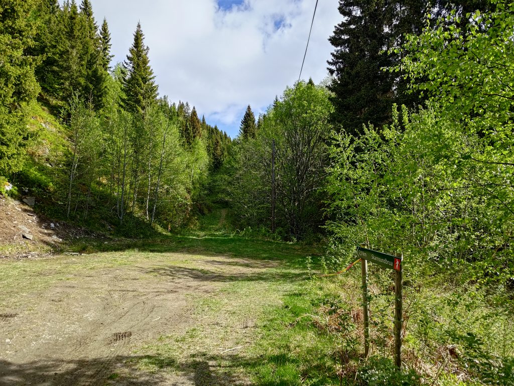
I’ve come down the trail on the right, which is the marked trail, and I’m going to head off on the slightly narrower but well-used trail on the left. It heads slightly downhill and in the direction I want to go.End of trail, farm fields ahead. I go through the gate and hope that there aren’t any large animals in the field.
As expected, the trail came out to a farm field. I had to go through two gates, plus an electric fence, before I got out to a car road. In one field there were some calves. They eyed me but didn’t bother me. I sighed with relief when I got out onto a car road. It had certainly been shorter and easier than the trail that I had taken up the hill. I still had a long walk to get back to my car, but now the walking was on a gravel road.
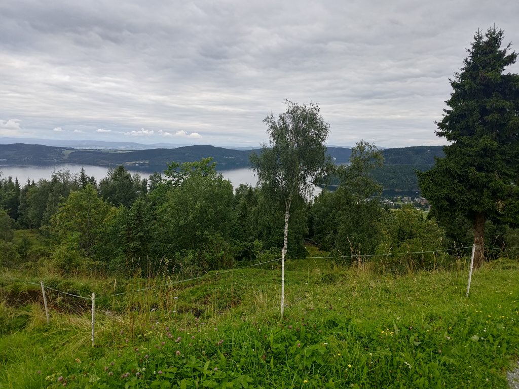
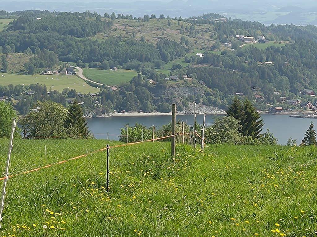
The view from the farm called Reitan.
Looking out over the fjord, I felt happier being where the walking was much easier. In the distance is Ytterøy again. The small clump of houses in the middle on the right of the picture is the village of Mosvik. At this point I am about 200 meters above sea level, which gives a good view.
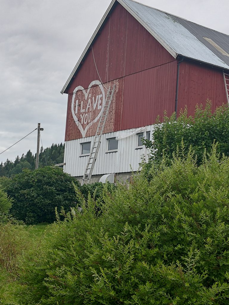
The barn is being repainted, but it was the heart on the wall that caught my attention.
In Norwegian, a barn is called “låve” and this one was being repainted. There were several long ladders and I’m glad it wasn’t my job to do the painting. I noticed that there were ropes attached to the roof as well, I presume as a safety measure for whoever was on the ladder. But the heart with its mixture of English and Norwegian caught my attention. “I LOVE YOU” had become “I LÅVE YOU”. Just one letter was changed!
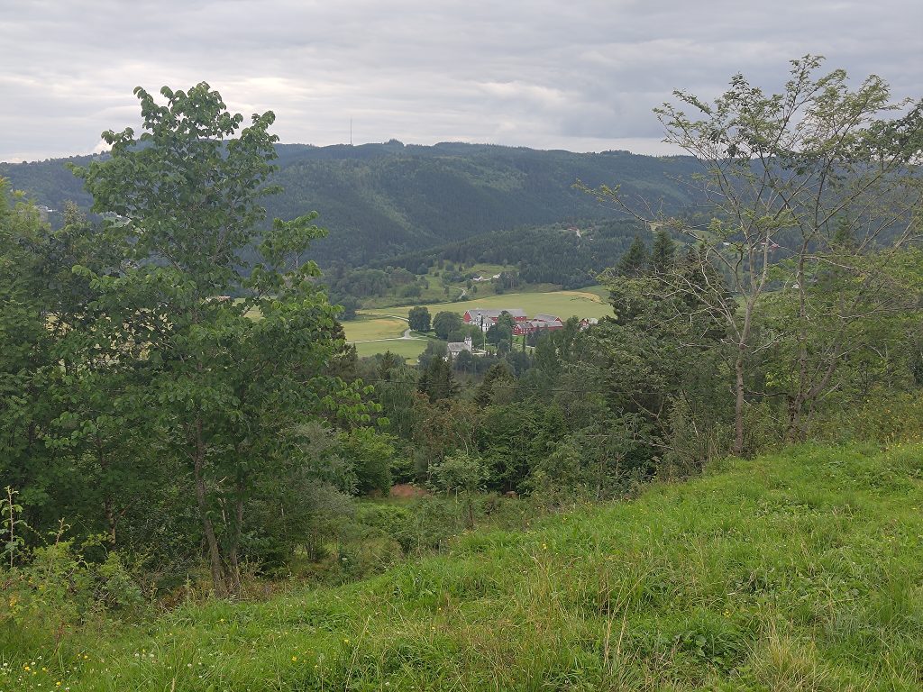
The largest farm, Vinnan, and Mosvik church, in the distance. Those with good eyes will see the mast for the television/radio sender on the top of the hill.
Mosvik, in the past, was dominated by one major land owner, who would have had a social status above most others in the community. You can just see their house and farm buildings in the center of this picture. All the green fields around it would belong to that farm. The church is located within a few meters of this large holding which would originally have included much of the forested areas for miles around. The farm is now used for raising horses, but cutting down trees would still be a major source of income.
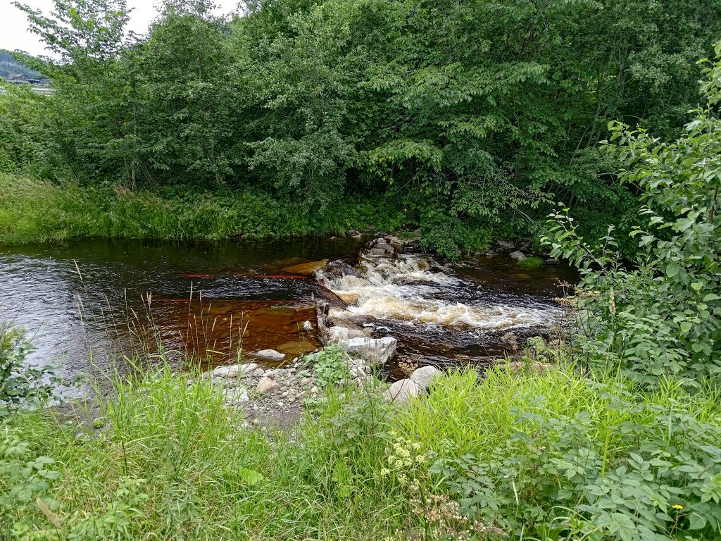
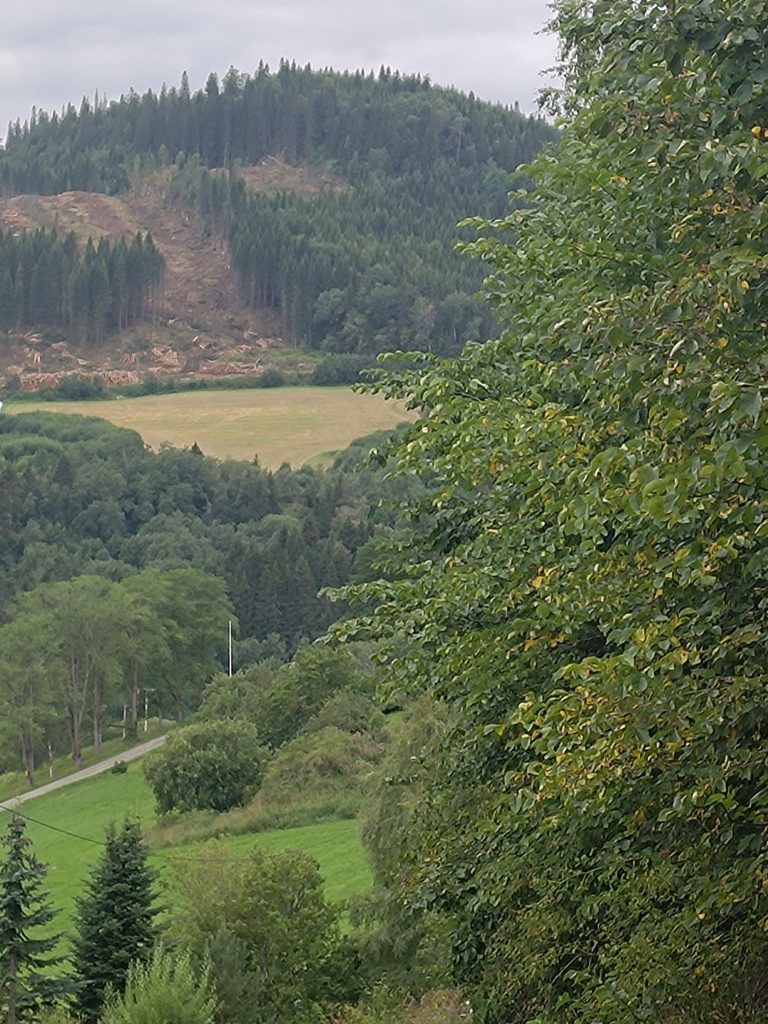
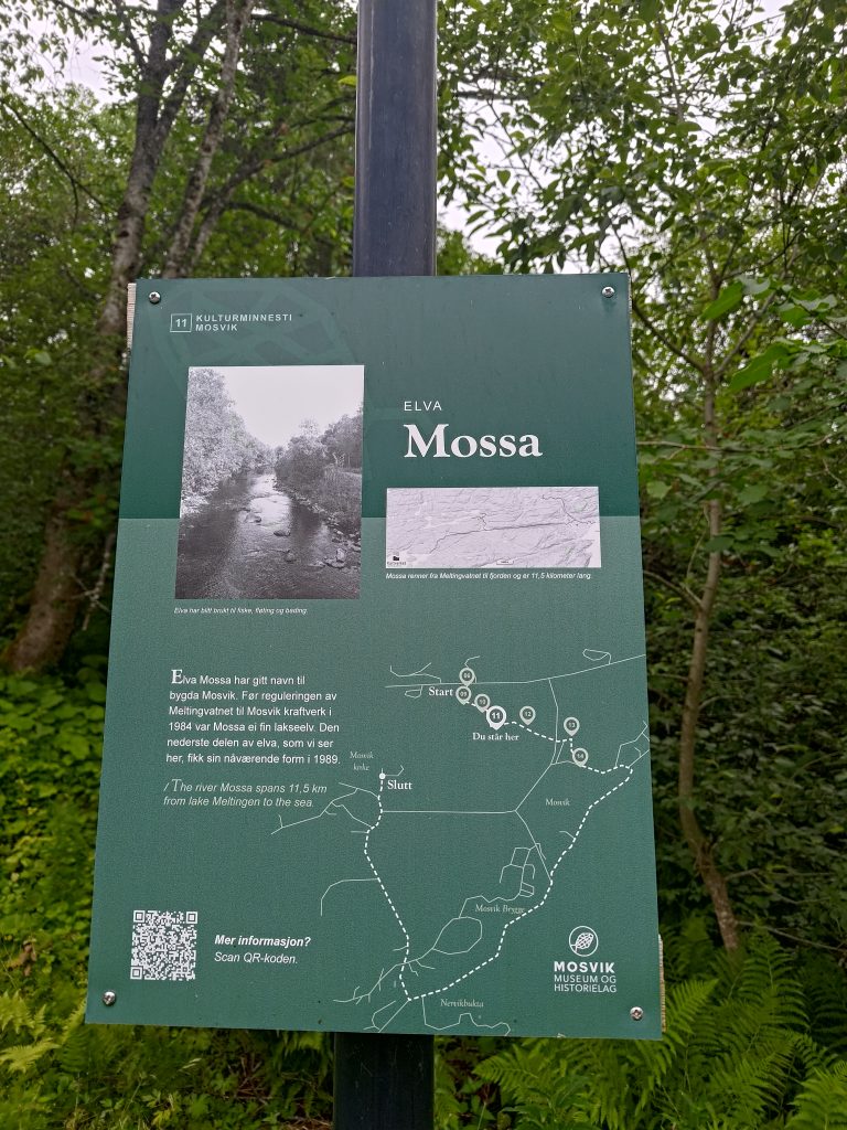
Quite a few trees have been taken down on that hillside in the distance and the logs are piled up at the bottom, ready to be taken to either a pulp mill or a lumber mill, both of which we have within an hour’s drive.Many people still burn wood to keep their homes warm. With the price of electricity skyrocketing in winter the last couple of years, burning wood has again become more popular, though I consider it to be a bad air polluter.Information sign about the river Mossa that flows through Mosvik.
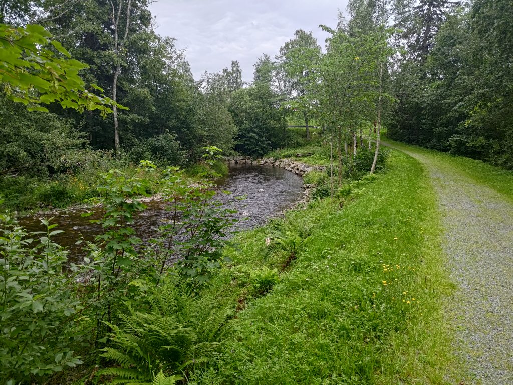
I’m back down the hill and take a slight detour to get back to my car, mostly to stay off the main road where there was quite a bit of traffic. It was now about 5:30 pm, so quite a few people on the go somewhere. I follow a trail along the river that has given its name to the village of Mosvik. The river, Mossa, drains a large lake, Meltingen, which is about 11.5 km up into the hills and is a water reserve for a power plant. This lower section was fixed up in 1989 as part of the maintenance of the power plant.
The river, Mossa, and the trail beside it.
If you look carefully, you will see that the right-hand side of the river has been carefully edged with stone so that the bank is reinforced and less likely to be damaged. In the winter, this portion of the river can freeze. I am following a very pleasant path beside the river which will take me back to my car.
I used two hours for my walk, which was more than I had actually planned. It was a cloudy afternoon and 16 degrees, so that part was pleasant. I was exhausted once I got home and I made the decision that I didn’t need to do that walk again. There is no view at the top. The views came once I was out at the farm and walking along a car road. I need to remember that when planning walks in the future. There are other nicer walks I can do in Mosvik.
For many years I have wanted to try out a trail that goes uphill from Hestdal Power Plant which is located about 12 km west of the center of the village of Leksvik, though it’s mailing address is Vanvikan, which is even farther west. We wanted a day away from the house, and the weather was promising to be suitable for a lengthy walk, which for us is two to three hours.
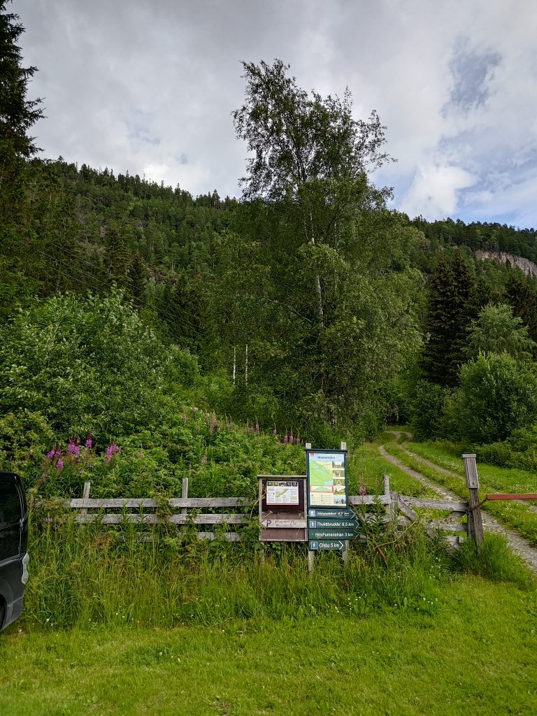
These signs have captured my curiosity several times over the years and the 4th of July 2024 was the day we picked to see what this trail was like.
Liatjønna, Mosvik
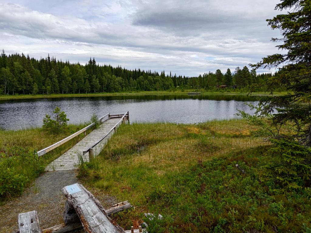
But before I take you on this walk, I’ll explain what we did before we got to the parking spot by this sign. My husband likes walking around lakes. There are many lakes in Inderøy, but there was one small lake on our way to Hestdalen. We often stop here as it is not far from the road, and there is a very nice walk around part of the lake. It doesn’t take very long, and is a very flat walk. One goes back the same way as one came as the path only goes about halfway round the lake.
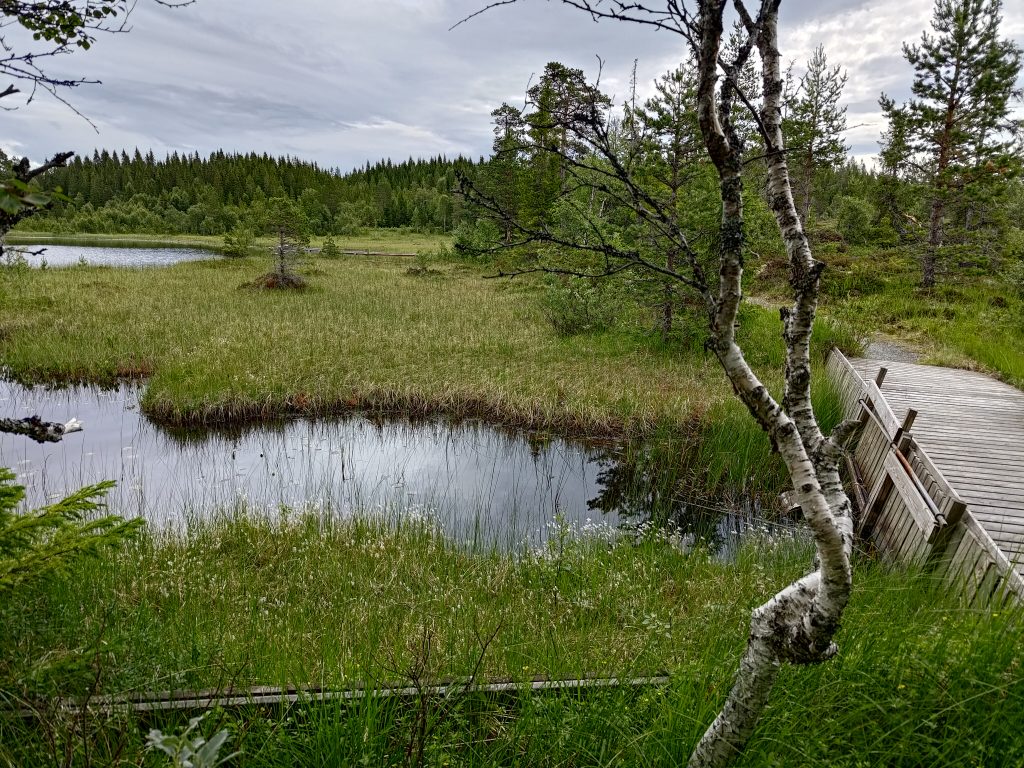
Liatjønna, the small lake, in Mosvik. This picture is taken from the far end. There are three ramps that go out into the lake and allow handicapped people to go fishing in the lake.The water level of the lake is kept pretty much at the same level by this small dam. When the water rises above a certain level, it drains away into a stream that leads to a much larger lake which is used for electricity production.The stream that drains Liatjønna.
After a short walk we continued driving westwards to the village of Leksvik, where Brock used to work at the high school, and kept on going for about 12 km, to get to Hestdal.
Hestdal, Indre Fosen
We parked near these red buildings. Hestal e-verk (Hestdal Power Plant) is privately owned and produces about 4 GWh a year. It uses water that falls about 120 meters. The original equipment was from 1940, but it was modernized in 2004.
Hestdal electricity production buildings
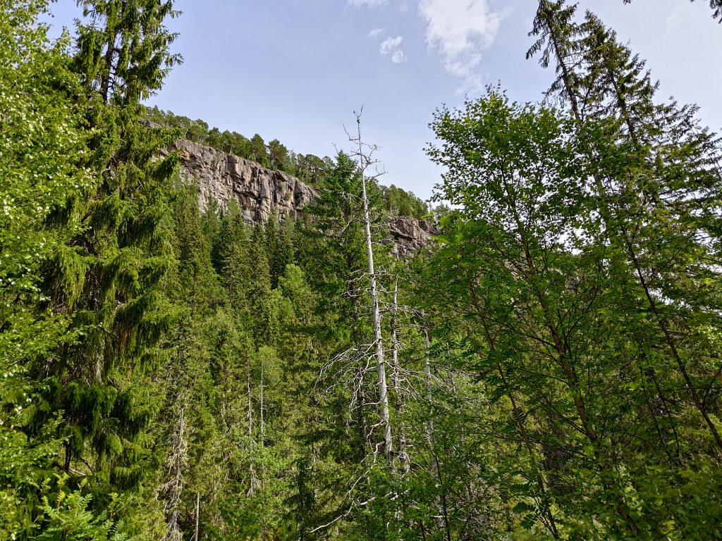
So we started the walk, and I wasn’t sure how far we would make it. The information online about the walk indicates that there is an elevation climb of over 400 meters if one wants to get to the top, to Himmelriket, the kingdom of the sky. The signs at the parking area indicate that the top is over 4 km, one way. An 8 km walk is too much for us now, so I was prepared to not make it to the top, but was interested to see what there was up the trail.
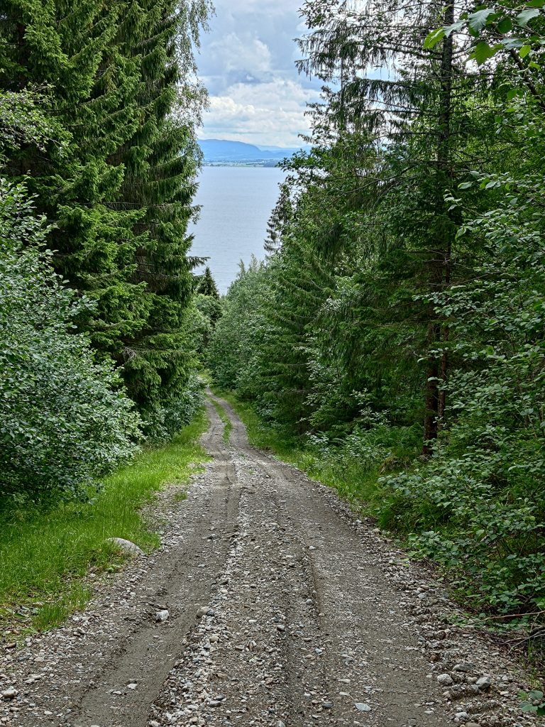
We followed a road uphill. This is looking back at where we came from. One can see across the fjord to Frosta which is a farming community. The road is actually a lot steeper than it looks.At about 130 meters above sea level, we came to a clearing with an interesting rest spot. We were proud of our efforts, but a short rest was pleasant before we continued on up the hill.The view from the rest spot. Lumber has been piled up here, so there must be some maintenance work being done somewhere nearby.These grow wild here, usually in the ditch at the side of the road where it is quite damp and shady.
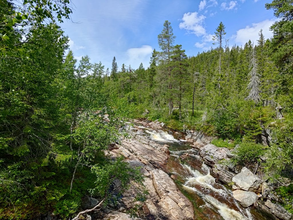
We were steadily climbing uphill almost the whole time, but once we were above the intake to the power plant, we could hear the river as it tumbled over the rocks. By July, most streams and rivers have finished carrying the spring melt water down to the sea, and they are draining lakes. A look at an official Norwegian map ( https://atlas.nve.no) that shows lakes used for hydro power production, shows that this stream drains five lakes up in the hills. These lakes would all have dams on them to regulate their outflow of water.
Hestdal RiverThis was the first crossing of Hestdal River. We are still following a road that one could drive a vehicle on, though some of the sections of the road are quite steep, so an ATV or four-wheel drive vehicle would be necessary.
We continued walking along the road and not really able to gauge how far we had come. I’m no good at judging distance when walking, especially when I stop to take photos as much to have the photos as to take a break from the climbing. The road itself was easy to walk along, but some of the sections were quite steep. The ground was dry and the gravel was loose. When we turned around and walked downhill, we had to be careful that we didn’t slip on the loose gravel.
Looking up to “Himmelriket”, the kingdom of the sky, I knew we would never make it up that high.
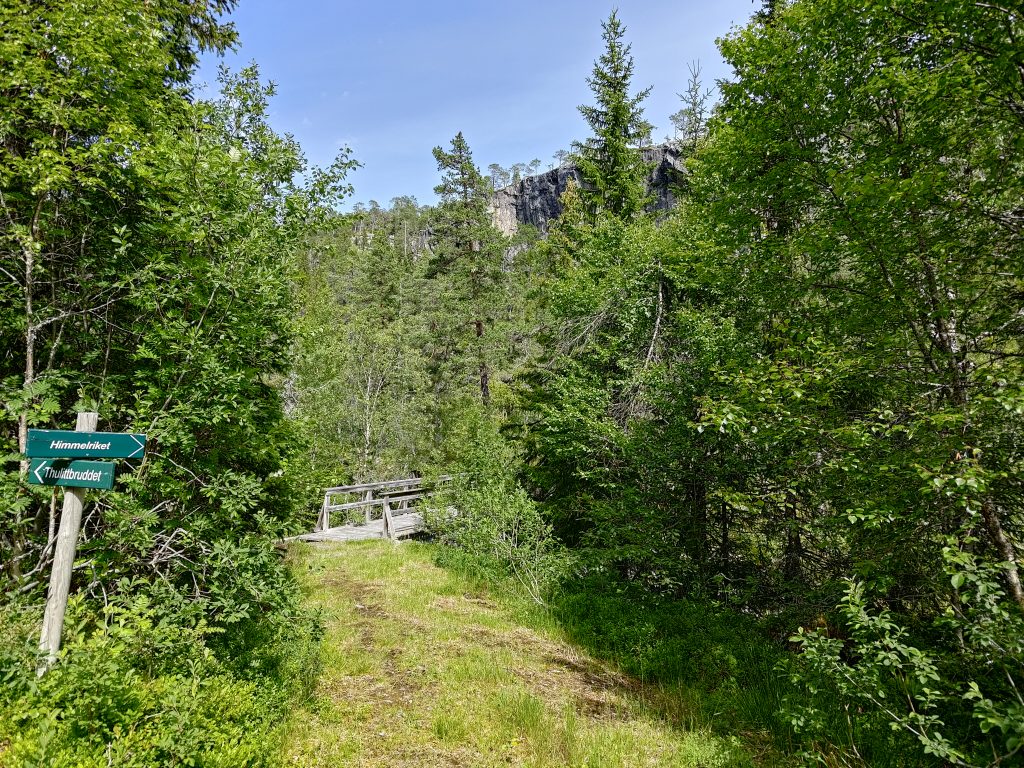
Eventually we came to where there was a divide in the paths. We could continue to follow the road which went to a stone quarry which was 6.5 km from the parking lot, or we could head off across a small bridge over the river and climb up to the sky. We decided to do the latter. So we crossed the bridge.
A second trail took off towards Himmelriket, the kingdom of the sky.Hestdal River where we crossed it on a wooden bridge. The trail went off to the right in this picture.Hestdal River as it flows downhill to the hydro power plant.The trail to Himmelriket became very narrow and much more difficult to walk along.
We had now been walking about 50 minutes and I figure that we had climbed about 200 meters in elevation. I knew we would never make it to the top. We discussed this narrow trail and made the decision to go back to the gravel road and walk along it a bit more. We were out to enjoy ourselves. We are in our mid-70s and have to accept what we actually can do at our age. I no longer want to walk on such narrow trails, that are uneven with roots, and reaching the sky is not a goal.
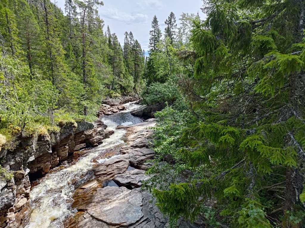
So we continued on, up the hill, following the gravel road and the river. We crossed the river again. I was enjoying the walk, but starting to get tired as it had been all uphill with a few flat stretches as you can see in the picture below. The day was sunny but not too warm, about 19 degrees.
Crossing Hestdal River again. We had been walking about an hour and 20 minutes when I took this picture.
After we had been walking for an hour and a half, including the short breaks we had taken to either take pictures or catch our breath, we decided it was time for a proper break. There was no sign of any appropriate place to stop, so we just sat down at the side of the road to eat our sandwiches and drink our water. My estimate, afterwards, is that we had walked about 3 km so far, and we still had to get back to the car. We didn’t sit for very long, as the flies and ants liked us a little bit too much. But it was good with a bit of food and water before starting the downhill trek.
The road kept on going and going uphill, so we took a break, had our sandwiches and water, then started downhill.
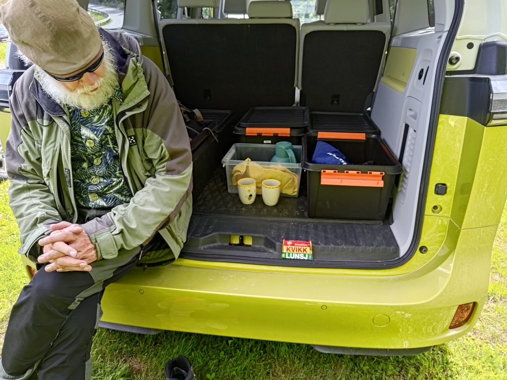
We used about an hour to get back to the car. We changed our socks and shoes, and that was very pleasant on the feet. We shared a chocolate bar and had a cup of coffee each, while sitting at the back of our car. My curiosity was partly satisfied. I had had a pleasant time on the walk, but it was perhaps a bit more strenuous and longer than I was used to.
It was good to be back at the car, to share a chocolate bar and have a warm drink. Soon we were on our way home.
It was a good day trip for us. We got one short easy walk, and one longer walk that was perhaps a bit too long for us. We were away from home for over 5 hours, which was part of the point of the day.
Note: I have an offline map on my smartphone which is quite useful. I found that on this walk, if I tapped on the position indicator, then on “details”, it could tell me my elevation. At the last place that we stopped it said that we were at 311 meters above sea level. I’m not sure how accurate that is, but it at least gives an indication. While writing this blog, and using an online map that shows the terrain, I estimate that we were at about 210 meters above sea level. So there was quite a difference. I think I would prefer to rely on the official online map.
It was a sunny Saturday and we had chosen to go for our weekly long walk in the hills up from Røra, in Inderøy. There are several Inderøy Walk posts here and we weren’t sure how many we would get today. Four were possible, but two was more likely. It was already about 15 degrees when we started walking and the day was promising to get warmer. I don’t like walking too much once the temperature is much above 15 degrees, as the heat saps me of energy. We’ve had a lot of rain lately and more forecast for tomorrow, so we picked the day with sunshine for our walk.
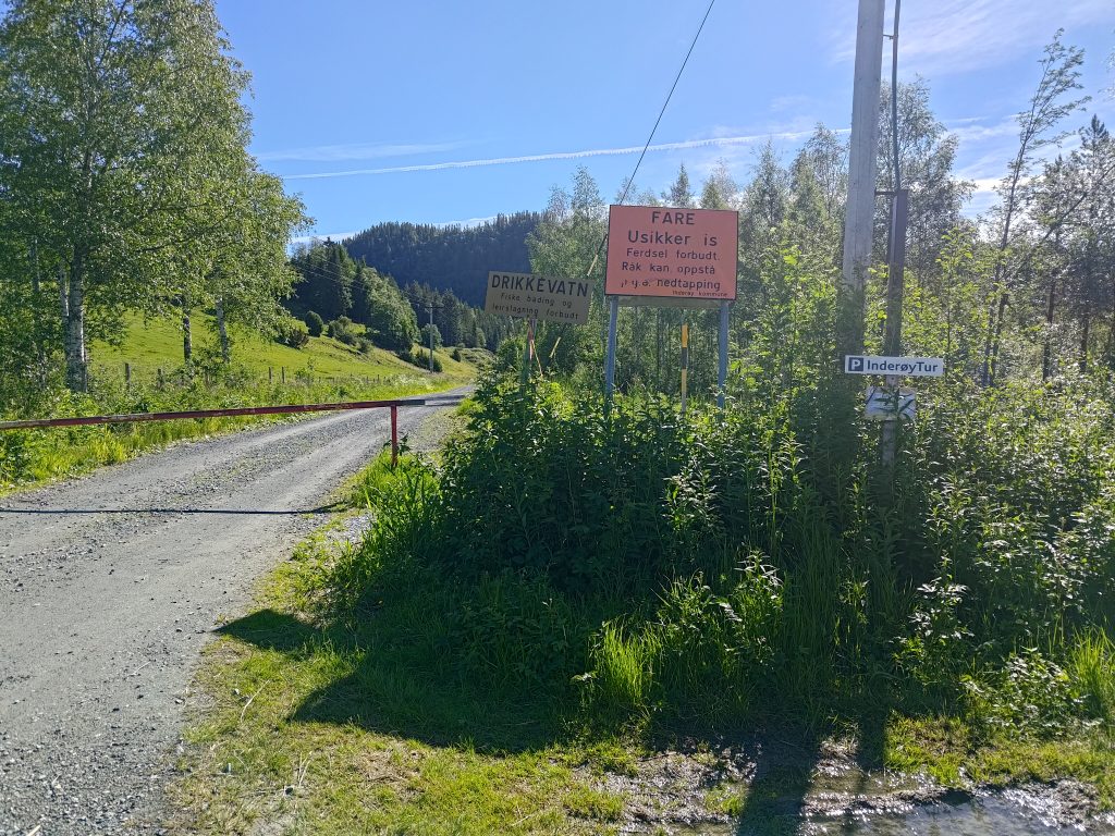
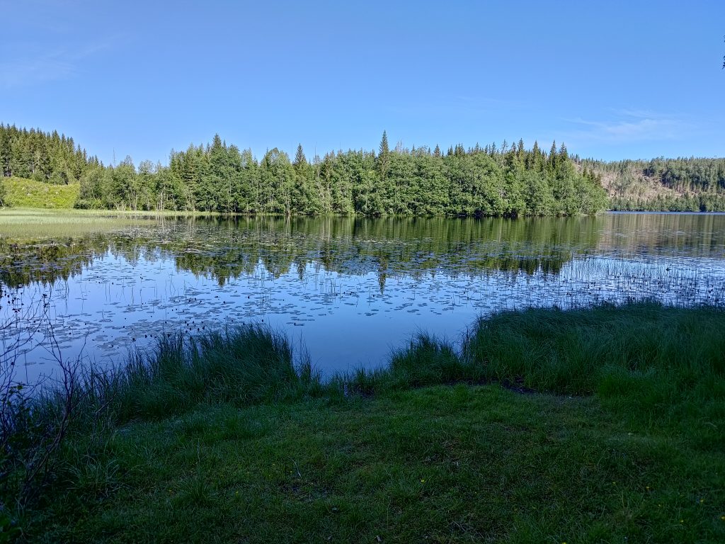
At the parking lot at Røflo Lake, our drinking water source. Blue sky and sunshine was nice after several rainy days.
We parked at Røflo Lake, which is Inderøy’s main drinking water source, so there are all sorts of signs to let one know that. No fishing or bathing is allowed, and you are not allowed to camp near the lake. In the winter there can be a problem with unsafe ice where water is taken for the water supply system. Inderøy has a major factory for producing jams and juices, so the water that is supplied has to meet critical standards. In recent years, there has been a problem supplying sufficient processed drinking water to the residents. This is not because there isn’t water, as I’ve never seen the lakes here low on water. The problem is the capacity to purify the water. Inderøy is now spending a lot of money on connecting itself to the neighboring municipalities of Steinkjer and Verdal, who don’t seem to have the same problem. I often wonder if that is a good use of investment funds, rather than investing in increased capacity within the community.
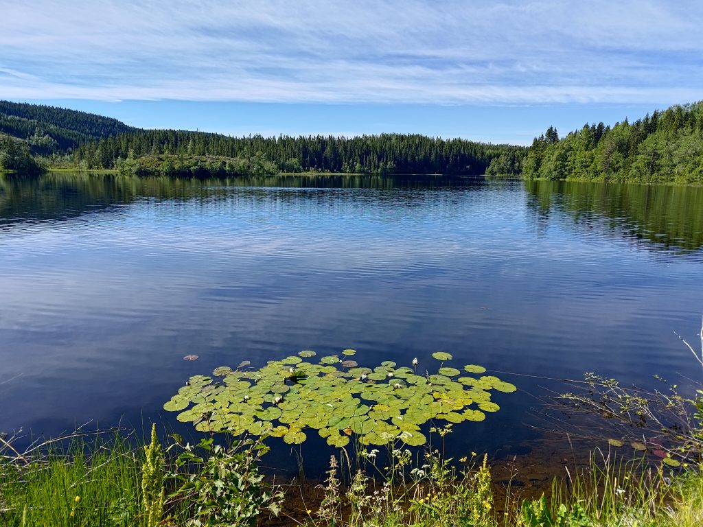
Røflo Lake, our water supply.
On Røflo Lake there are water lilies, which were almost ready to bloom. The flowers will open out in a couple of days, perhaps even later in the day. We started our walk about 10 am, so there would be lots of time as the day warmed up for the lilies to open up later. This lake is at about 188 meters above sea level.
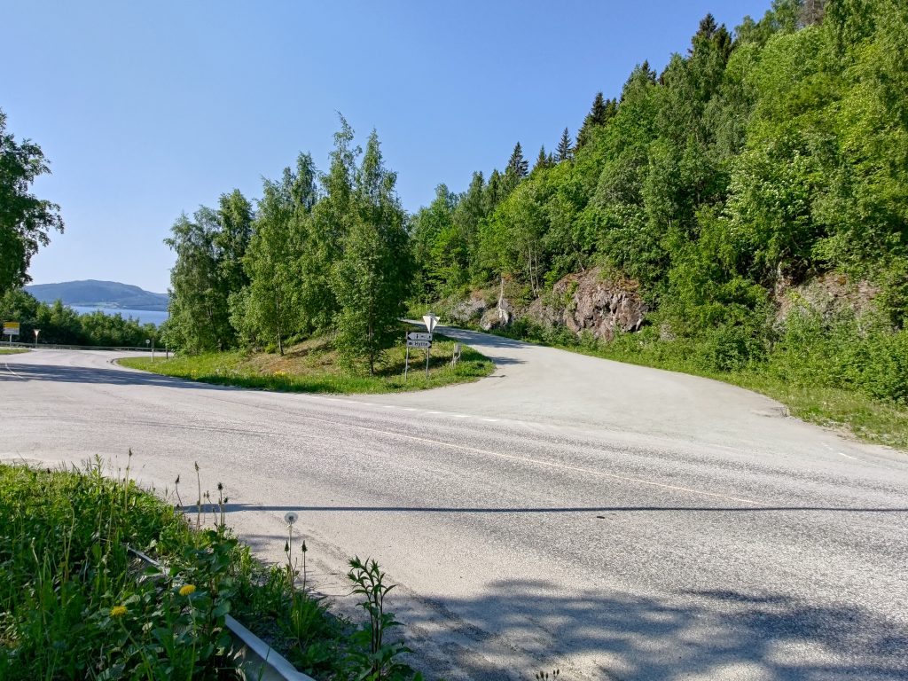
Choices to be made. We are actually going to make it to the top of that treed hill, roughly in the center of the picture. They are hard to see, but there are two grazing sheep visible in this picture.
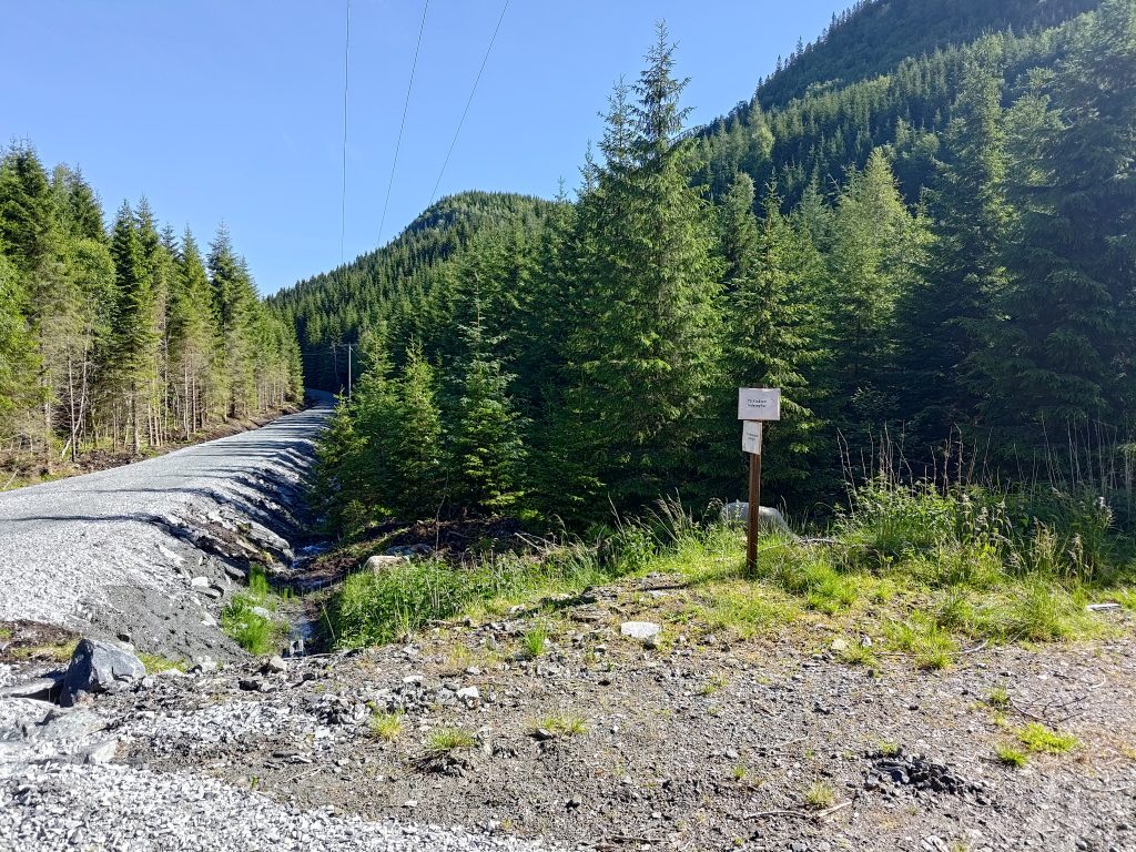
We wanted to walk to Vådal Lake first, which is the road off to the left. This has always been a gravel road, but they have much improved the road in the last year. This is the first time this year that we have been at this location. The road to Vådal Lake is restricted access for vehicles, but anyone can walk along it. They have improved the ditches on either side of the road and put down a lot of new rock to both raise it above the old road bed and to give a better surface.
Because we were going to a new post this year, we also saw some new signs, indicating which choices one has. The old signs were still there, but now there were some additional ones that are probably only temporary. From this point, there are actually five posts that one can access. They all require a steep climb uphill, except for the first one on Vådal Lake, which is actually at only 158 meters above sea level, so at a lower elevation than Røflo Lake.
Our first post has been reached at Vådal Lake.
We used about 20 minutes to get to this first post as I stopped to take pictures along the way. I don’t put all of the pictures I take in a blog, but I pick out the best and most interesting ones. I find taking pictures in the sunshine and with sunglasses on a bit risky and I don’t always see whether they are good or not until I get them on my computer at home.
The southern end of Vådal Lake also has water lilies. The boundary between Inderøy and Steinkjer municipalities is probably about the edge of the picture on the right side. This is really just a small bay on a much larger lake.
Vådal Lake is also a drinking water supply lake, though most of the lake is in Steinkjer municipality and it drains at the far end, so the water actually flows north. The lake’s water eventually drains into the Figga River which empties into the fjord in Steinkjer. The stream from Røflo Lake flows west and empties into the fjord at Røra, though it is a very small stream as so much of the water is used for the water supply system.
After checking-in on our apps on our phones, we continued along the edge of Vådal Lake until the road/trail headed up the hill.
Vådal Lake to the left and my walking companion clearing dead branches off the road.
We have been along this route many times before, though this was the first time this year. About two days ago we had a lot of wind, so there were dead branches along this section of the road. My walking companion likes to use his walking stick to get these dead branches off the road. This road was probably originally used as a logging road and there are signs that it is still used for motorized vehicles, though where streams cross the road there are large grooves in the road. It is not suitable for car traffic at all.
Signs of some logging activity in the woods. We have now started to climb uphill.
All this land would have private owners who are then asked to allow walkers access to the roads and trails. When a trail is marked for an Inderøy walk, there will be a lot of use of the trail. These trails may have to be maintained, either by a sports club or a property owner. Especially where people park their cars, it would have to be agreed with the land owners. Norway has a law that protects free access to uninhabited areas, but one still has to respect the rights of the landowner, whether it is a person, a business or the local municipality.
I stop to take pictures, so my walking companion can get quite far ahead of me. We are heading to the top of that hill in the distance. The road/trail we are following works its way up the hillside, primarily following a stream that flows between the hilltops.
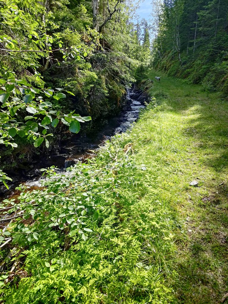
Our walk now took us steadily uphill. Most sections were not that steep. There were sheep on the hillsides as well. In fact we were following one small lamb that seemed to have misplaced its mother. I hope it found its way back to her after we turned off the main trail.
We are following a stream, Bjørbekken, uphill. This stream basically follows the boundary between Steinkjer municipality and Inderøy, and drains a lake farther uphill. It goes to Vådal Lake. In the picture, you can also see a lamb that has gotten separated from its mother. It wanted to stay ahead of us, though I suspect the mother was farther downhill. I hope it was learning some navigation skills and not just keeping away from people.
Klingerhaugen, the hill we are attempting to climb, has a summit of about 300 meters above sea level, which means we have about 150 meters of elevation to climb. The route we took was relatively gentle and much of it was tractor road quality, meaning that we could walk side by side and chat. Though when we are climbing a hill, the chatting lessens as we go.
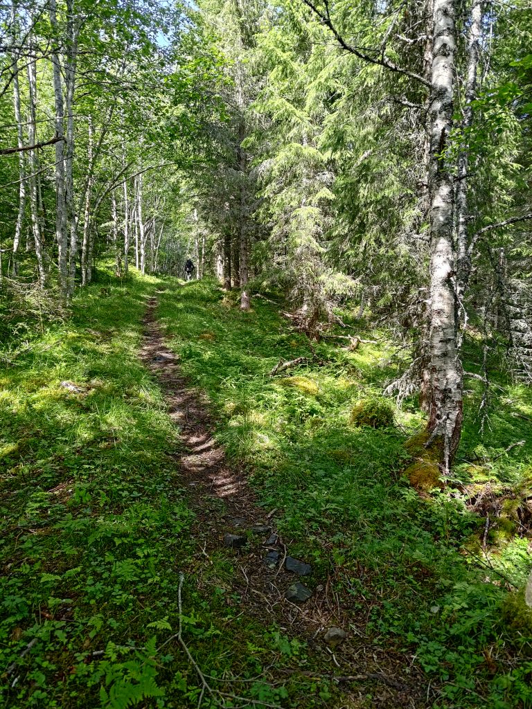
Eventually we turned off the trail that we had taken many times before and headed up a different trail. Initially this was also quite wide, as if it had been a logging road originally. Now it was a single track, and we continued to head uphill, but now turning back in the direction we had come from, but at a higher elevation.
Like many of the hills in our area, Klingerhaugen has a steep, cliff-face, though it is covered with trees. To get to the top, one has to walk a long way round, and come at it from the back side. As this was the first time that we had taken this new trail, we were having to look out for the red and yellow markers hanging from the trees, and almost missed the viewpoint.
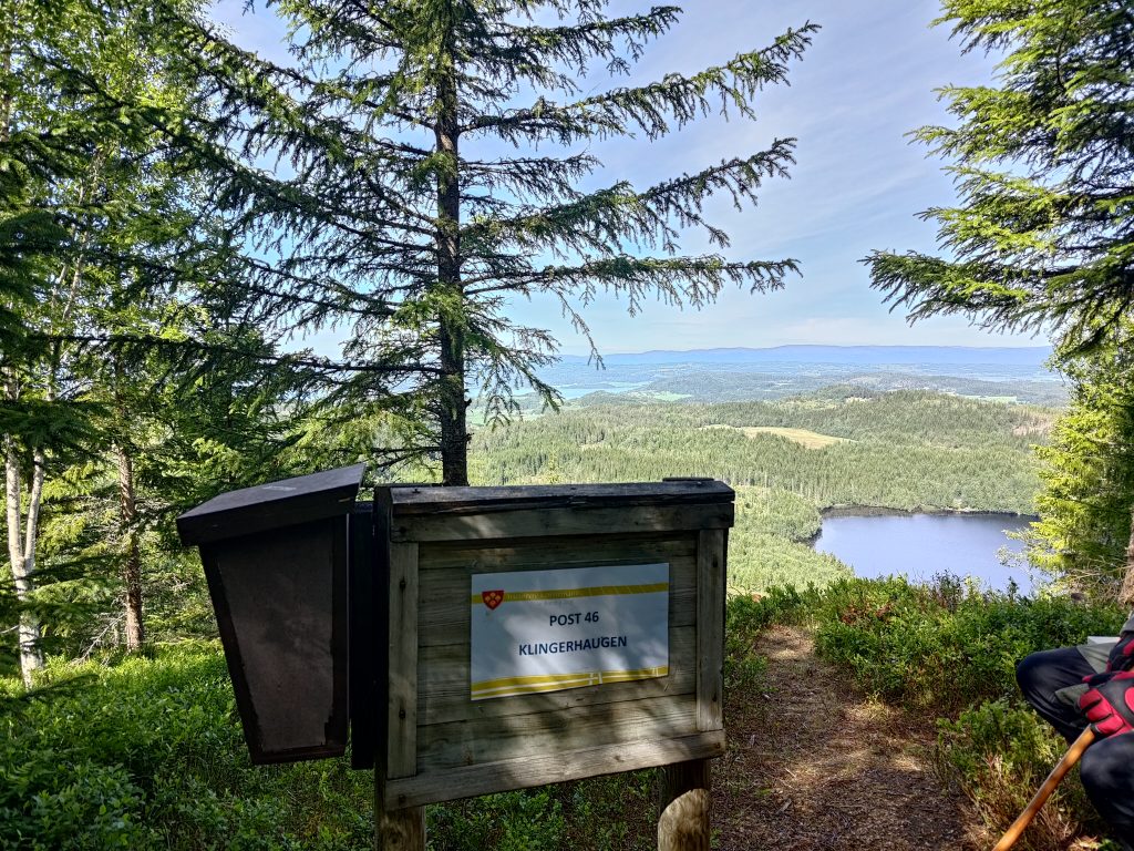
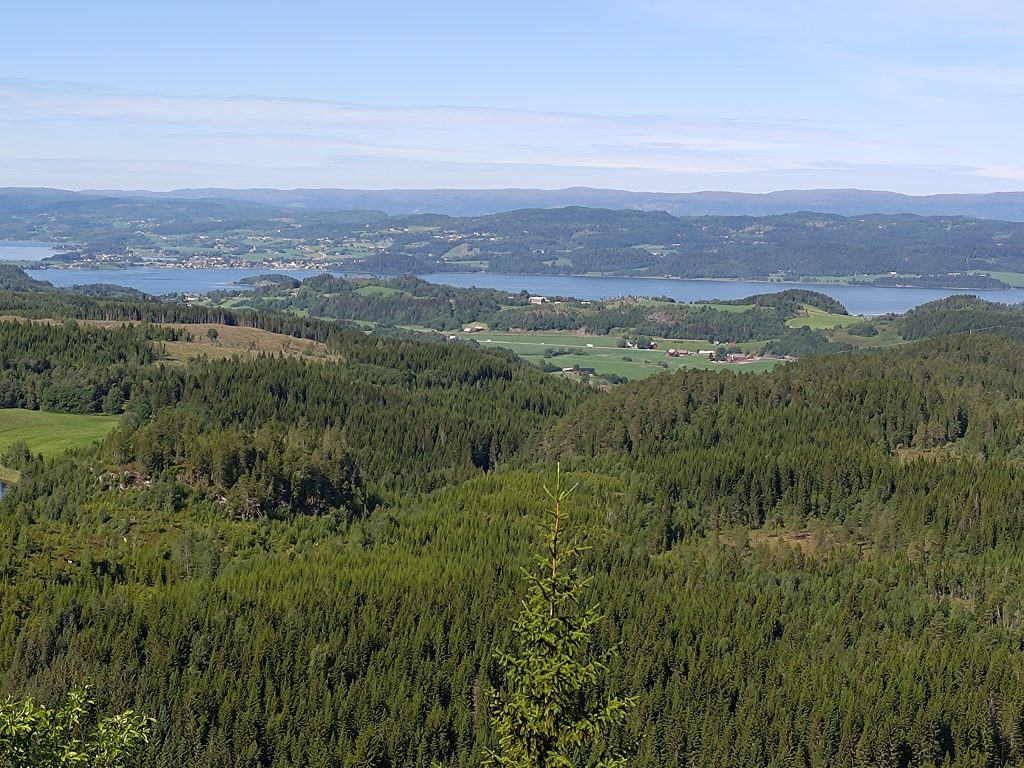
We finally found the post at Klingerhaugen and could see Vådal Lake a long way down. We’ve climbed about 150 meters in elevation from the lake. There was a book to write our names in and a picnic bench to have a rest on.Inderøy as seen from Klingerhaugen
In the above picture, one can see the village of Straumen, our local shopping area, towards the left of the picture. The hills in the far distance are in the municipality of Steinkjer and there would be a fjord arm between Inderøy and those hills. We live out of the picture off to the left. For those who know the area a bit, the main north-south road in Trøndelag, the E6, is also visible in this picture as it runs through some farm fields. Thankfully we were too far away to hear the noise of the traffic. One of the reasons we enjoy walking in these hills is the quiet and the lack of vehicle noise.
Another place to make decisions. We were able to check-in to the second post here and we had used about 45 minutes from the lake.
We came along the trail on the left and had originally thought of doing a third post so we actually started heading off to it using the trail on the right. However, though it started out as an okay trail we soon got into difficulties because of the steepness of the trail. As we age, we find narrow, steep trails in the woods more difficult to handle. Steep trails are best taken going uphill. We were going downhill on this one. The chances of sliding are much greater when going downhill.
This trail even has its own name, Finnstien, Finn’s trail. It is narrow and here I’m actually looking slightly uphill to take the picture.Brock is going down Finn’s Trail and just about to come to a very steep section. The trail actually goes along a wooded cliff at this point.
Even I felt that the trail was too dangerous for us, so we made the decision to turn around and go back the way we came. We sat down just beside the trail, had a drink of water and shared some of the chocolate bar I had taken with us. We both needed to de-stress before continuing. It was actually on the way back that we found the viewpoint from the cliff top.
We used about 2 hours and 20 minutes on this walk, so lots of fresh air and exercise. By the time we were back at the car, the temperature had risen to 20 degrees. However, we both found it a bit more tiring and stressful than we like, so this will not be a walk that we repeat, at least not this year. We will continue to go for long walks during the summer months and have agreed that a minimum of one a week is important for our health. It would be ideal if we set aside enough time for two such walks a week. I hope you too get out for walks in your neighborhood.
It was Sunday again and time for a walk, though I wasn’t that enthusiastic. Warm nights have meant that I haven’t been sleeping well, though I know that getting out in the fresh air and walking is good for me, no matter what my mood is. We didn’t want to drive that far, so decided on two posts that are about a 7 km drive from home.
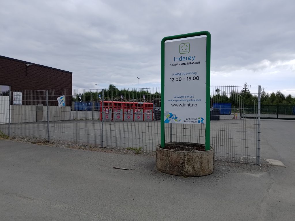
We parked near the recycling center for our municipality. It is only open two days a week, Tuesday and Thursday from noon until 7 pm. “Garbage” delivered here is sorted by the person bringing it. We have gotten to know it quite well since this new place was opened in September 2018 about the time we started fixing up our house and creating a lot of construction garbage. There are some bins for garbage that are available at all times. The red containers seen behind the fence are for clothing. We sort out metal, wood, impregnated wood, electrical appliances, paint, batteries, light bulbs, etc.
The recycling center where we have parked our car is seen as the eye-sore in the picture. It is quite practical for the residents and we put our garbage in different places or containers depending on what type of garbage we are delivering. This picture is taken from about halfway up the hill we climbed.
As you can see from the pictures, the weather was cloudy, but there was no wind or rain. The temperature, according to the car, was about 14 degrees, so a nice walking temperature.
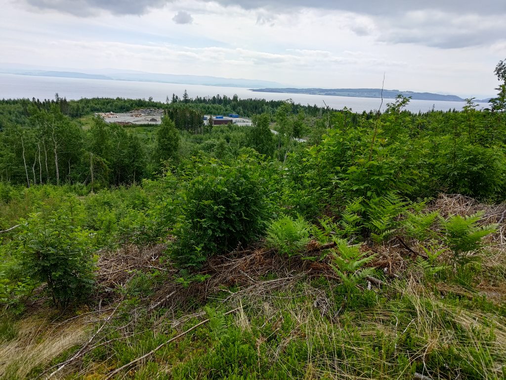
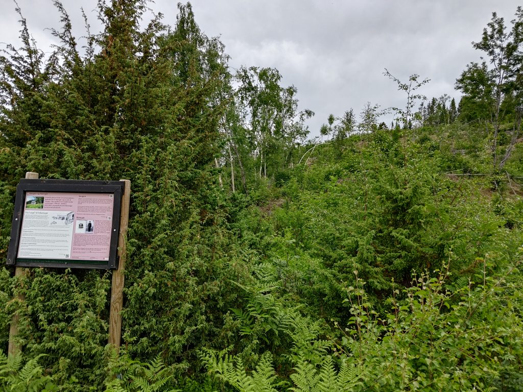
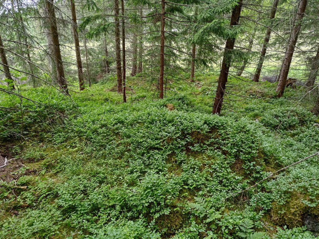
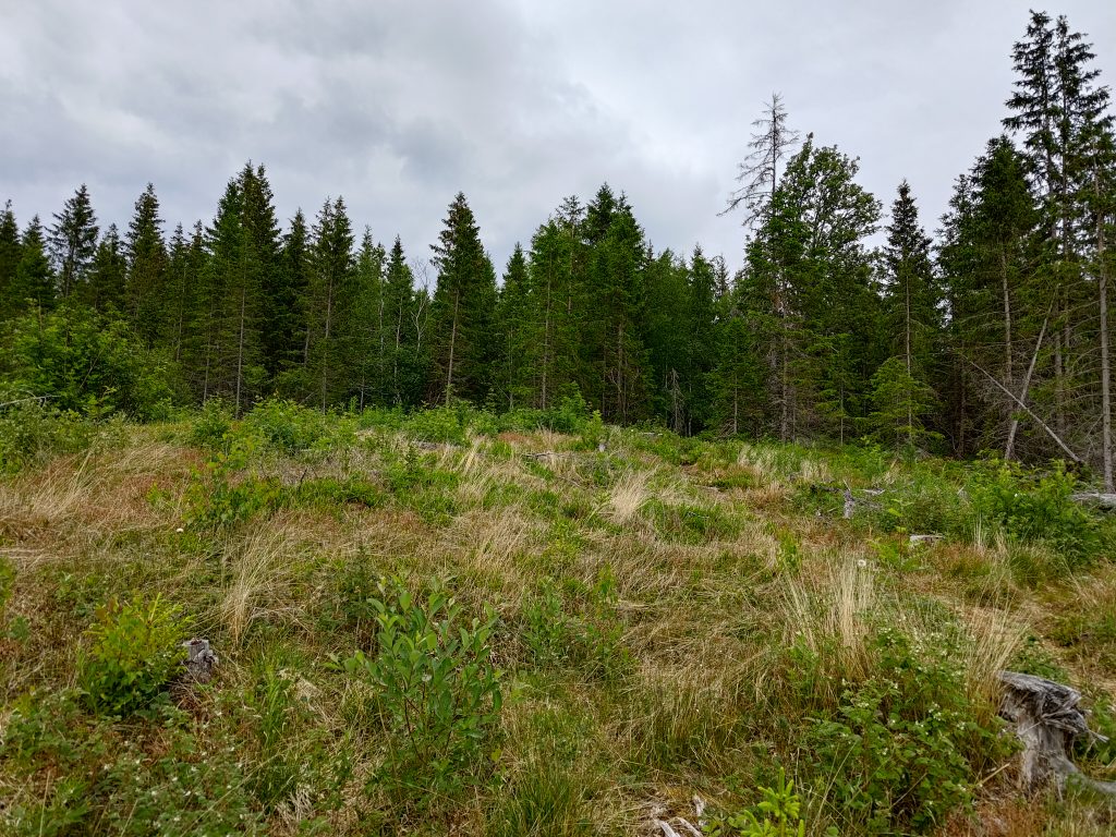
We climbed this hill which was logged not so many years ago.
The first time we walked up to this post, called Stenemarka, this was a newly logged area. It was interesting to look at what vegetation has grown up since the first time I climbed this hill. Now small trees have started to grow, primarily birch and rowan. The old forest was primarily spruce. Ferns were abundant where the moisture collected.
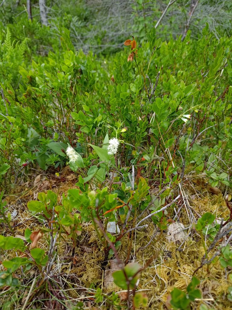
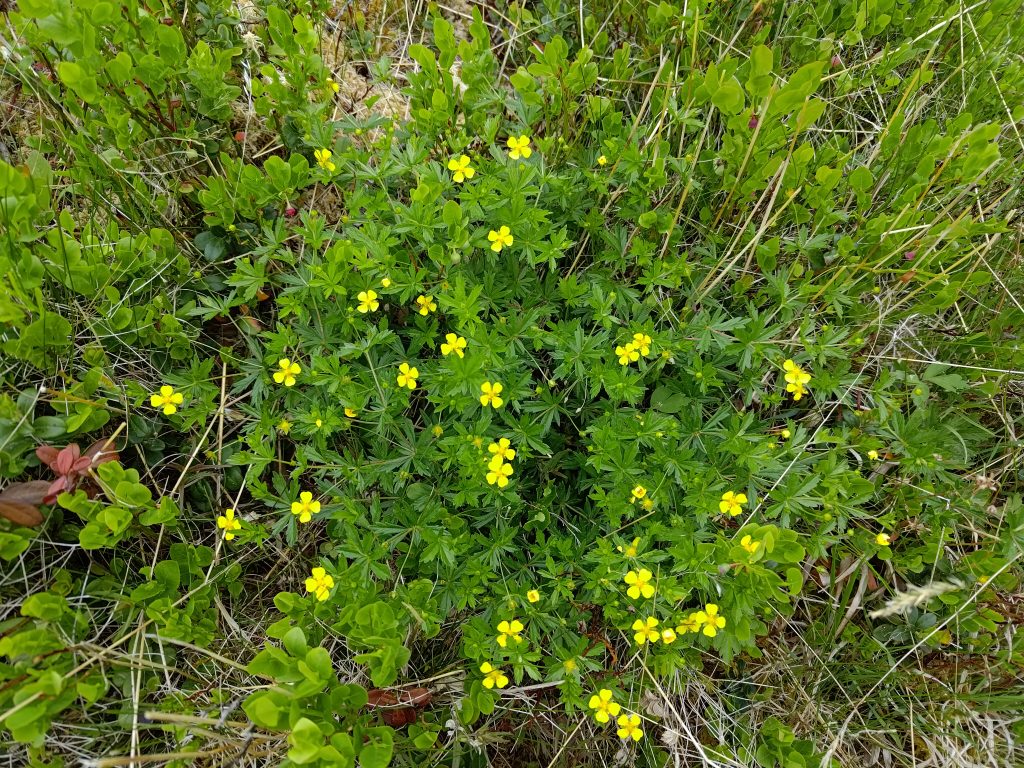
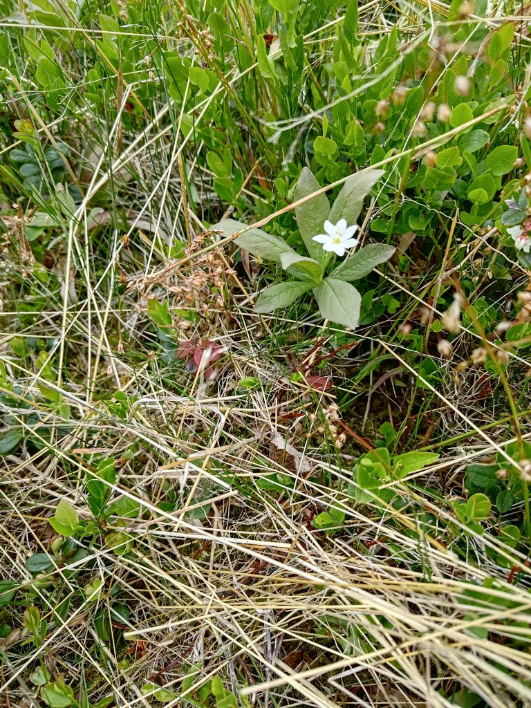
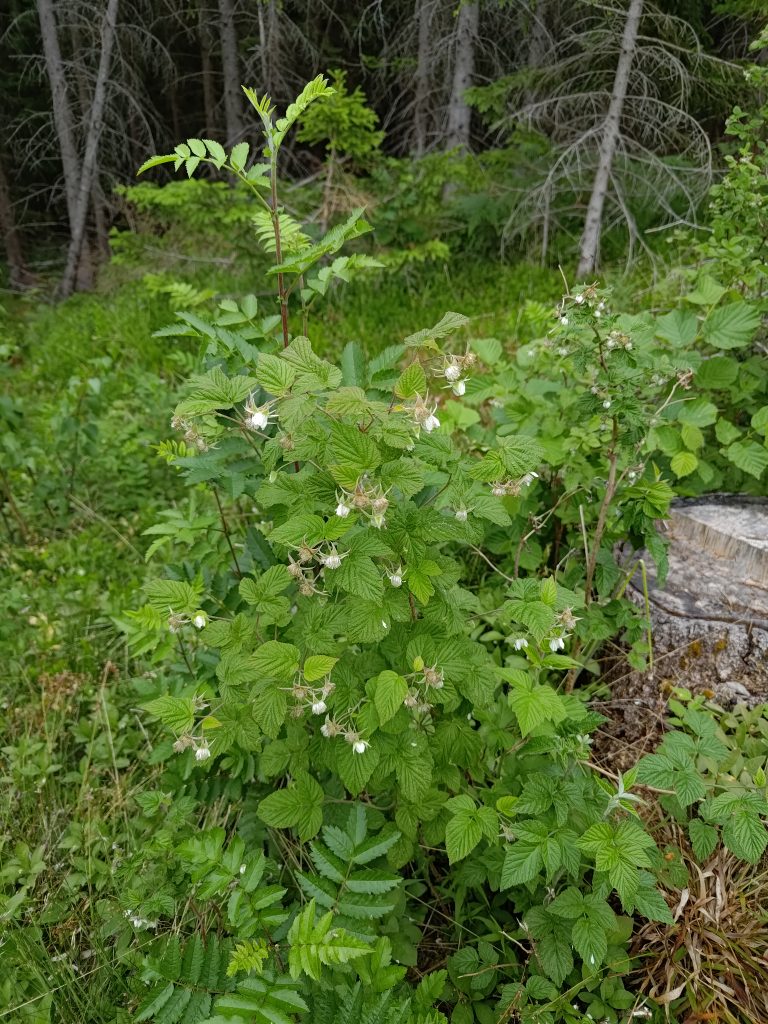
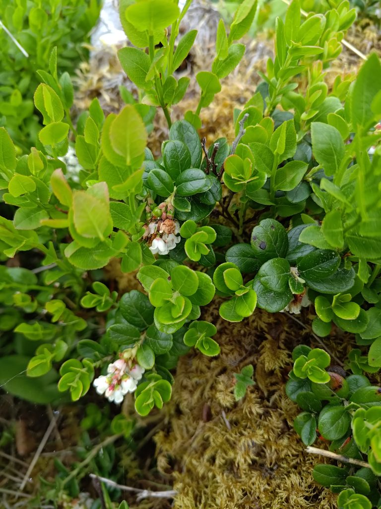
Where there are open spaces, small ground cover plants are blooming and there is a lot of berry plants growing too. Not all of the plants am I familiar with and I’ve had to look up even the Norwegian names for some of the ones in the pictures below.
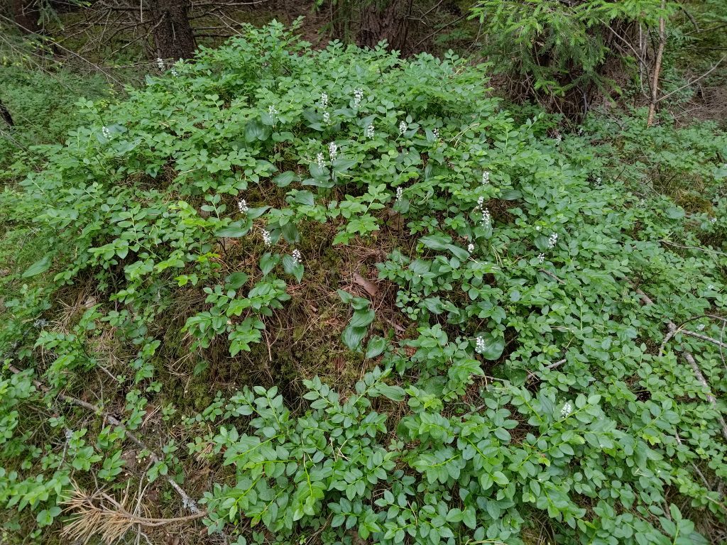
In Norwegian this is called “maiblom” (May flower) and in Latin it is called Maianthemum bifolium. In English it is called May lily or false lily of the valley.Later in the walk I found this small mound covered in Maianthemum bifolium.In Norwegian it is called “tepperot”, in Latin Potentilla erecta, and in English erect cinquefoil. It belongs to the rose family and will bloom from May until September. It usually grows in colorful clumps.I’m not sure, but I think this is “skogstjerne”, Trientalis europaea, or chickweed-wintergreen or arctic starflower in English.Raspberries grow wild here, especially on newly logged areas.Here is the undergrowth once we were back in the spruce forest. They are mostly blueberry or lingonberry (“tyttebær”).The lingonberry (“tyttebær”) is very common here and people will go out in the woods to collect the berries in August. For those of you who live in North America, it is used to make jam used with meats and tastes similar to cranberries.
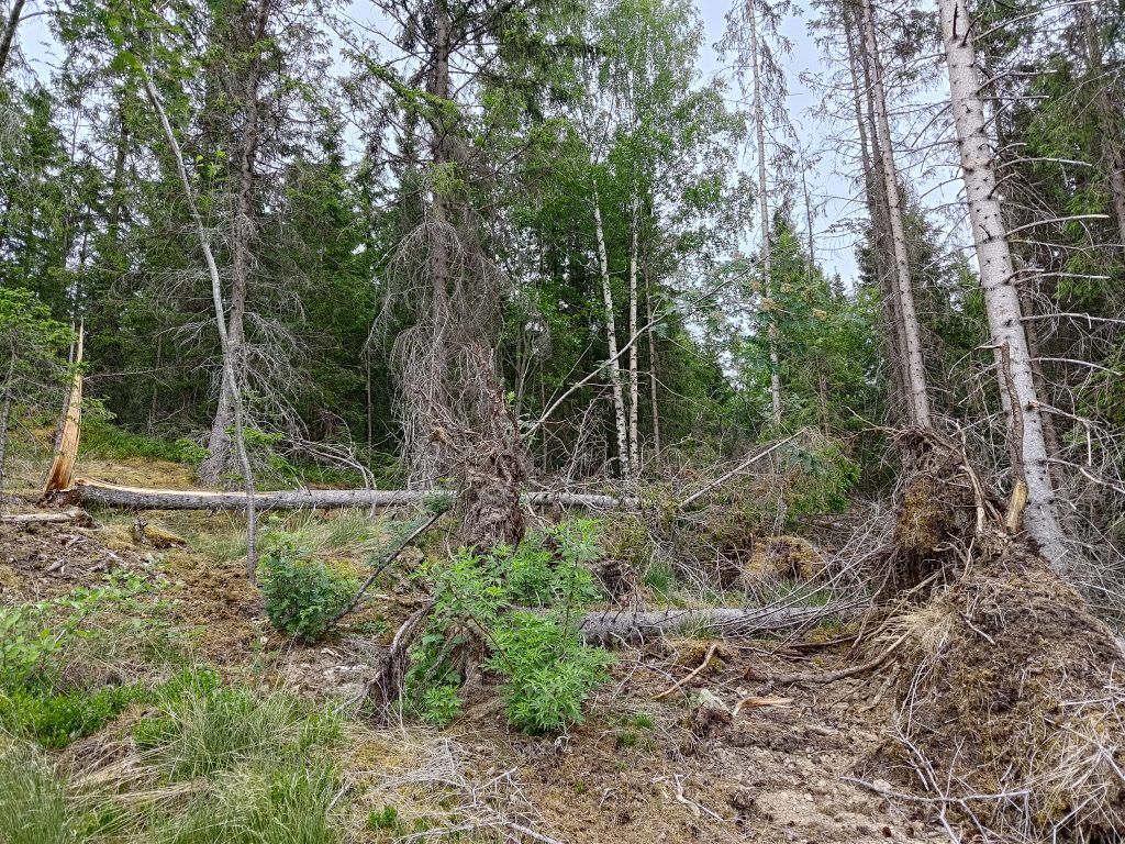
Where the logged area meets the old forest, the trees may have a hard time standing up if the wind blows hard from the open area. So along the edge of the old forest there are often a lot of dead trees.
Here is where the logged area meets the old forest that has not been logged.In storms, spruce trees are very susceptible to being blown over as they have very shallow roots. You can also see a tree that has cracked in the wind.
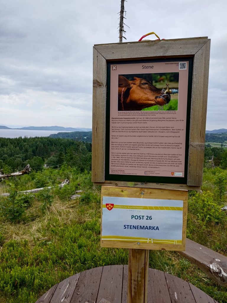
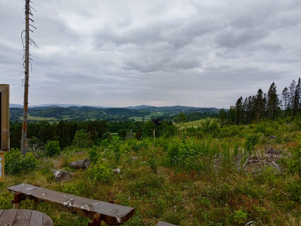
We were going to two posts today, Stenemarka and Furutoppen. The first one is in the open and gives a beautiful view over the area called Utøy and out to Trondheim Fjord. To reach the first post, one has a bit of a climb. The second one is in the old forest. The walk between the first post and the second post is pretty much a level walk. After the second walk one has to get down to the starting level again, so there are a few steep bits where one needs to be careful. We have had very little rainfall this spring, so the ground is very dry. There can be a lot of cones and dead needles on the ground which can make steep areas a bit slippery. Canes and gloves are useful, especially going downhill.
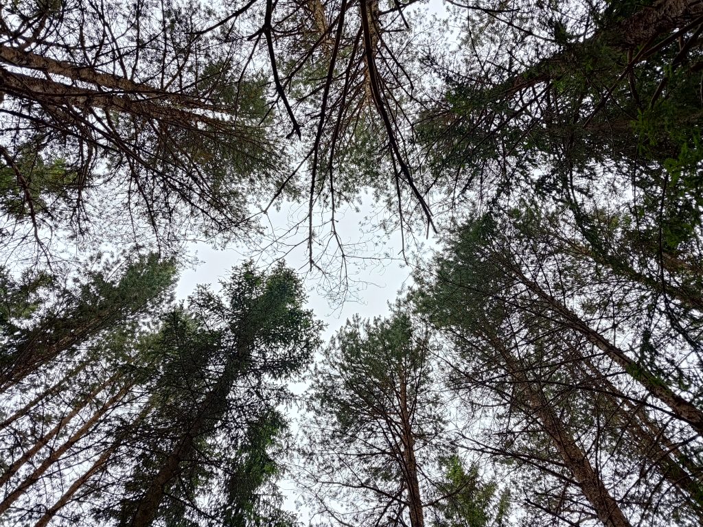
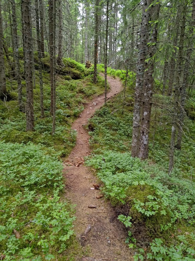
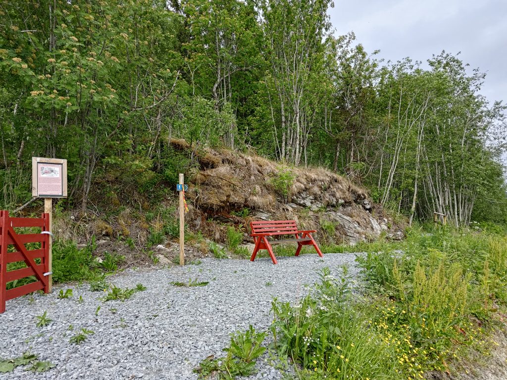
We’ve reached the first post, with information about the farm and a beautiful view over Utøy and the fjord. Here I’ve taken a picture looking south-west.Utøy has rolling hills and a lot of farms. The fields are primarily green now.The second post is in the woods with only a view of trees and ground plants.The view is looking upwards.There is a well-used trail through the forest and it was not difficult to follow.When we came out of the forest, there was a red bench and a red gate. The red gate is more symbolic than being used to close off an area.
We used about an hour on our walk, which is the minimum that we like to do on a Sunday. Cooler temperatures meant that we were able to keep up a good pace, even on the steeper sections, though there wasn’t really a large height difference. This is actually a walk that suits being done on a cool evening.
My husband and I like to go for longer walks on Sunday, meaning that the walk should be at least an hour and perhaps as much as two or three hours depending on our destination. Our temperatures have been very warm this week but we decided to do the same destinations as last Sunday, but to do the walk differently. We invited a couple to go walking with us as that also becomes a social time for us. The challenge for this walk was that it was already over 20 degrees at the beginning of our walk at 10 am and we were going to climb about 200 meters in altitude.
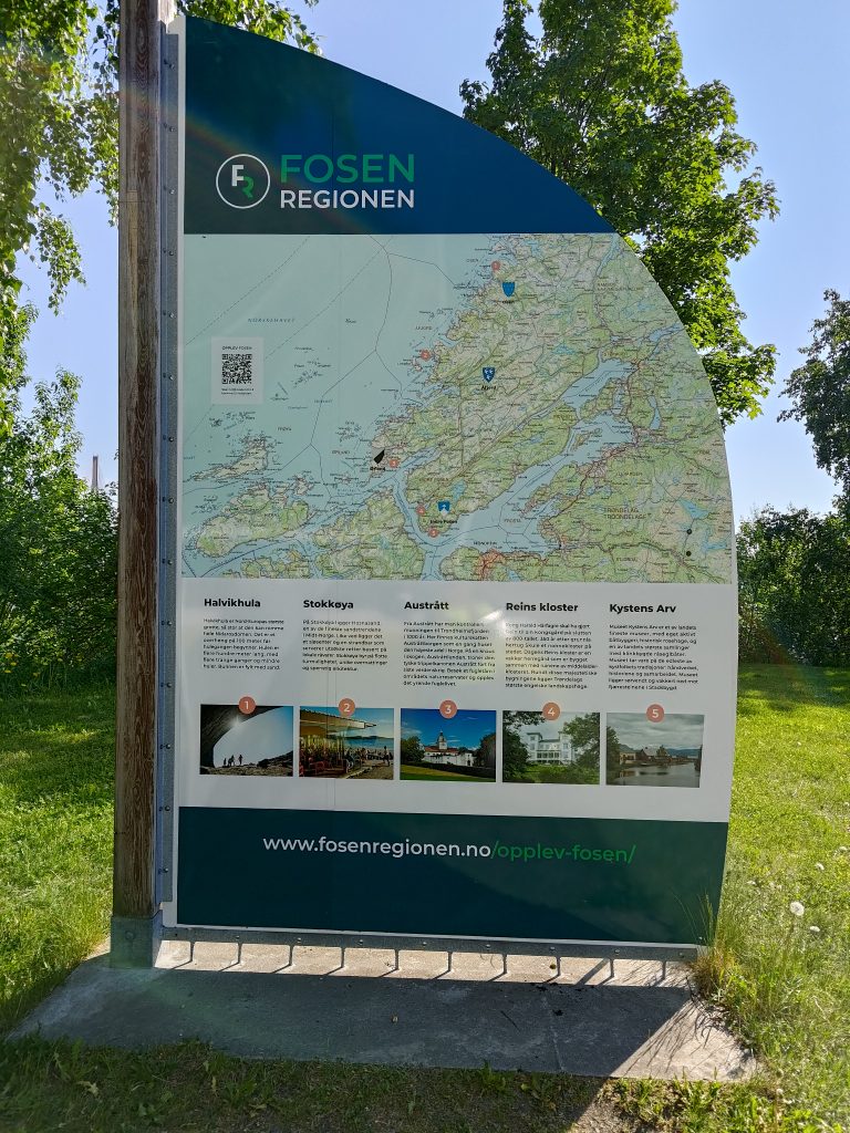
Information sign for the whole region of Fosen, in the parking lot at the west side of Skarnsund Bridge. Fosen is a large peninsula that can be accessed by ferries from the south and Trondheim, by the bridge at Skarnsund or by road at the northern end of the peninsula.
We decided to meet our friends on the Mosvik side of “our” bridge, that is on the western side of Skarnsund Bridge, where there is a large parking lot. No narrow roads to navigate or worry about meeting another car. We agreed to meet at 10 am and we were back at our cars shortly after noon.
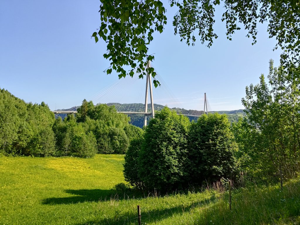
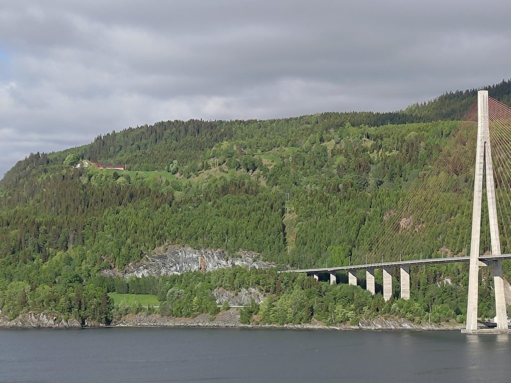
Skarnsund Bridge from the parking lot at the western side of the bridge, in Mosvik. The weather is sunny and warm and no clouds in the sky early in the morning.The main road from the bridge comes from the right in the picture and goes off to the left and down a hill. We are going to start our walk on the gravel road that is in the middle of the picture and that climbs up the hill to several houses and farms, including the farm Duklett. We are heading to the hill above Duklett.
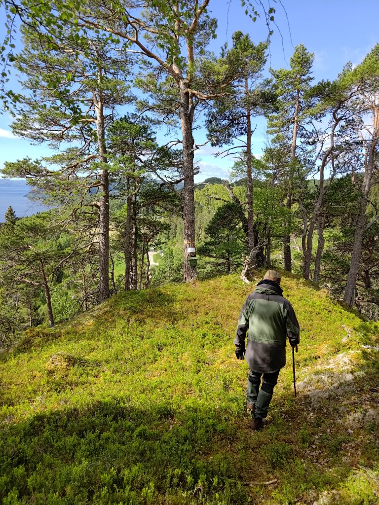
Last week we drove up to a parking area that brings one up to about 100 meters above sea level. Today we are walking from about 20 meters above sea level, but the climb will be mostly gentle. Our goal was to visit both the posts for Furufjellet and Duklettlia, the latter being at 242 meters above sea level. We walked uphill along the gravel road for about 15 minutes before turning off into the woods where we were mostly in the shade and the temperature was fine. This trail takes us around Furufjellet (the Pine Mountain), before we branch onto the trail that took us to the top of Furufjellet.
Walking in the woods was relatively cool and very much in the shade. The day was warm, but it wasn’t a problem when the trail was only gently sloping upwards.Furufjellet, the Pine Mountain from the trail halfway upFurufjellet, the Pine Mountain, looking up to where we are going shortly
The trail curves around this cliff and after a bit we head up the trail that took us up to the top. I found that taking the trail from this direction was actually better than the way we went last week. It didn’t take long to get to the top, about 30 minutes from the car.
Looking over the cliff face, but not venturing near the edge at all. You saw the picture taken from below. It’s a pretty sheer cliff, though there are a lot of pine trees growing on the cliff. We are at about 180 meters above sea level at this point.
We then went back to the main trail and continued up the trail to Duklettlia, as we did a week ago. I found the steep sections more difficult this week as it was much warmer, but I took my time and I made it.
When we were four of us, it was lovely to sit at the picnic table, getting re-hydrated and having a nibble to get energy for the walk downhill. This is one of those walks where it is almost all uphill getting there and then almost all downhill getting back to the car.
Vangshylla from Duklettlia. If you zoom in on the photo, or house is actually visible from this angle, but it is surrounded by trees and difficult to see if you don’t know where to look. There are a lot of farms around us, and one of the farmers was cutting his grass field yesterday and making “tractor eggs” or “marshmallows” which can be seen as white dots on a light green field.
This time we decided to take the round trip as posted so we could see where the trail came out. It seemed a gentler slope down the hill and the first section was in the shady woods. After a bit we came out on a grassy tractor road which was probably originally built for logging purposes.
The sign says that we can continue on the trail and get back to where we started.
The sun shone through the trees, so it wasn’t so very dark. I was glad to be going downhill now as the day was definitely getting warmer. Eventually we came out at the farm, Duklett, and went through two fences to get to their driveway. I think we missed a turnoff to the trail we should have been following, but there was no problem finding our way back to our cars from the farm.
Looking back to where we have come from, the top of that hill. This picture is taken from near the farm buildings at Duklett.For us, an unusual view of Skarnsund Bridge, taken from Duklett farm. The white dots on the green fields are round balls of newly cut grass. We call them “marshmallows” or “tractor eggs”.Vangshylla is on the other side of Skarnsund. Our house is yellow and almost dead center in this picture, sitting on a cliff. We often call the house, Cliff Cottage, because of its location.Gravel road from Duklett farm.
From the farm we were able to walk down a gravel road, getting back to the one we had climbed up about two hours before. We reached our cars a little over two hours after we had started our walk. We had probably spent about 25 minutes at the top. It was a warm morning and I certainly had difficulties coping with the heat on the steepest uphill sections. Going downhill was much more pleasant. But the view from the top makes the hike worthwhile and this is one that we will do again. Perhaps next time we will take the walk in the opposite direction and I think I’ll wait until the weather is a bit cooler.
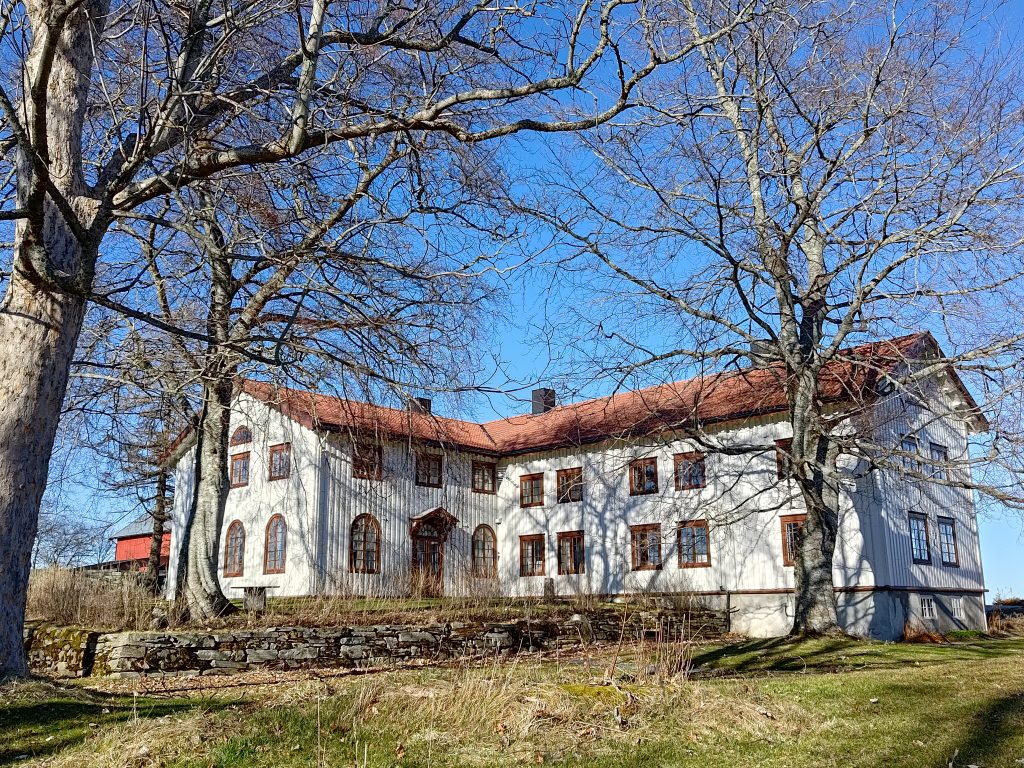
About a month ago, on the 18th of April I took a walk at Rostad with a friend. On the 24th of May, we took the same walk, but there were a lot of differences in nature. In April there were no leaves on the trees, but by the end of May, their leaves were out. This year we have had over a week of warm, sunny weather, so nature is green again. In this blog, I would like to share how beautiful this part of Inderøy is at the end of May.
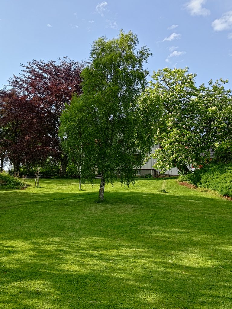
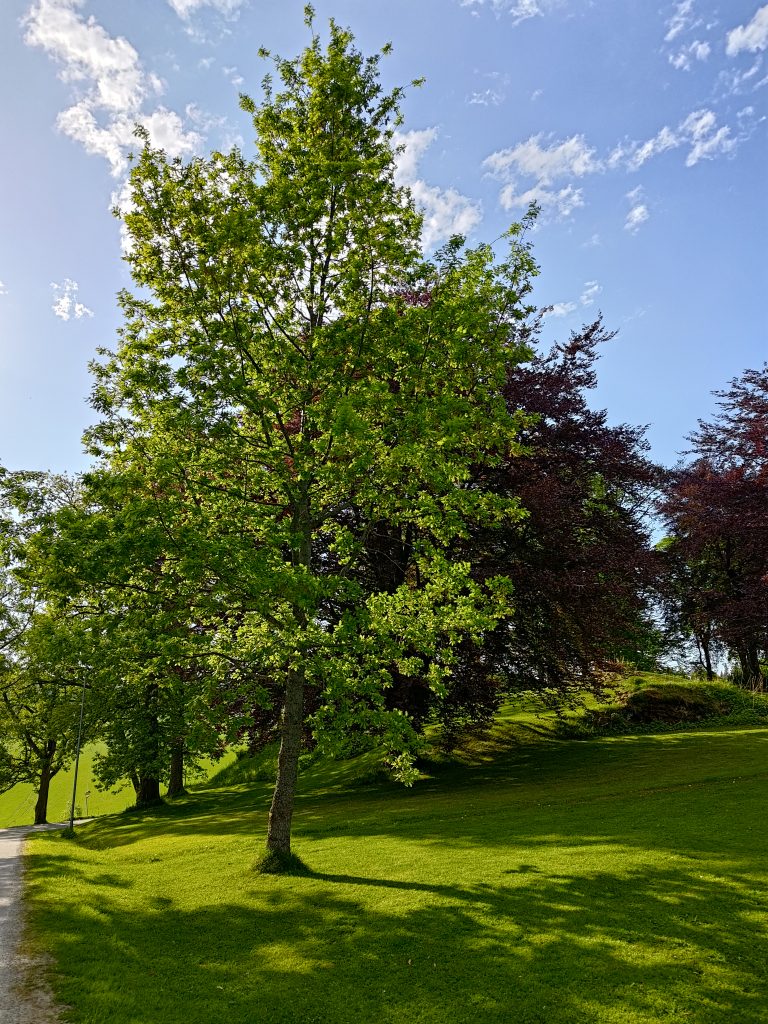
The manor house at Rostad farm is now hidden behind these beautiful trees. The grass is growing nicely and I saw a robot lawn mower out working. The dark trees in the back are beech trees, and the tree in the center is birch.I forgot to look closely at this tree when I took the photo, but it is probably an oak tree. These lovely old trees will all have been planted, and they have been given lots of room to grow and create lovely shapes.Just to show the contrast from the 18th of April, 2024, a little over a month ago.
My friend and I have again chosen to go for our walk in the evening. We started at about 6:30 pm, when the warm day has started to cool. As I started the drive from home, there were a few raindrops on my windshield, and the road was wet, but there was never a deluge. Looking at the lightning map when I got home again, there had been lightning east of us, near the Swedish border. My friend had gotten a message from a friend that where he was there had been a deluge of rain. At this time of year, rain showers are often very local and difficult for the weather forecasters to predict exactly where the rain will come.
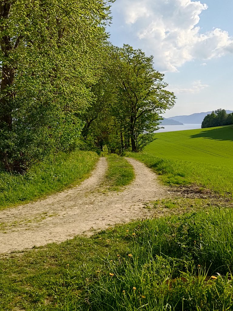
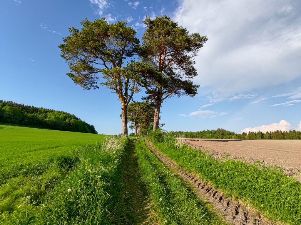
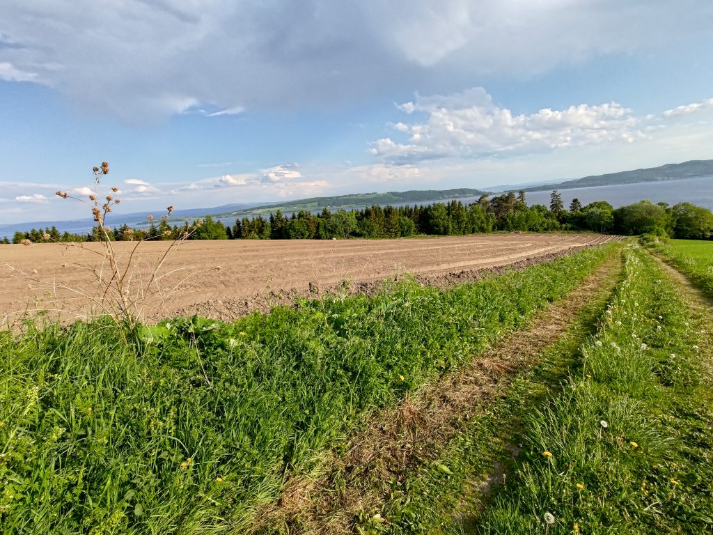
This is still used as a tractor road for access to the field, which on the right, has become quite green since I was last here. This road goes down to the fjord and would originally have given access to the farm from the fjord.Looking back where we had come from, up the road which is lined with pine trees at this point. Notice that there is a grass field on the left and on the right there will be potatoes in a while.Looking down towards the fjord, across the potato field. Unfortunately I didn’t manage to get my picture very horizontal, but the fjord does not actually slope. It is the field that is on a slope. Note the clouds in the sky are of various types, some of which may give moisture to what is underneath it.
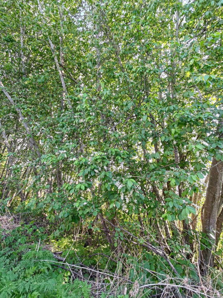
Many trees are blooming right now, including birch and spruce. Birch pollen causes a lot of misery for those who have allergies, including my son. Spruce pollen is much larger and very visible, on all surfaces, including the fjord. Spruce trees do not bloom every year, but this year there is a lot of flowers and pollen.
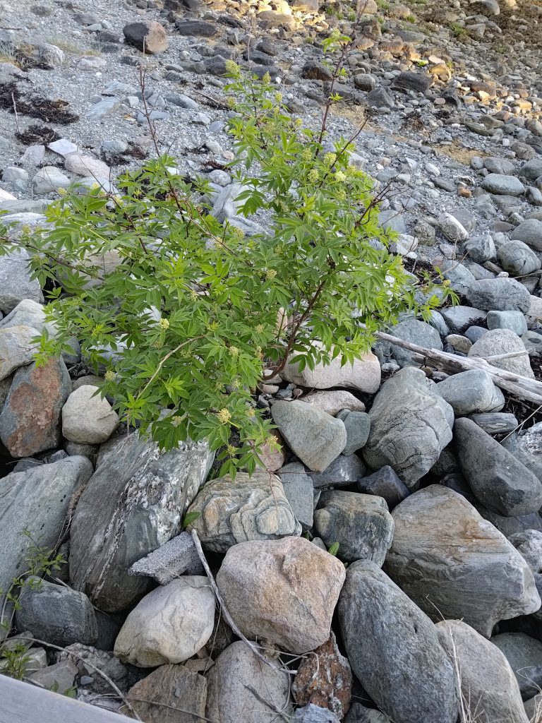
This picture was taken from home, rather than on the walk, but shows spruce pollen on the fjord. The picture was taken on 2024.05.17.Prunus padus, or bird cherry is blooming with its white clusters of flowers. This shrub,often grows in clumps and when blooming they are very visible from a distance. There will eventually be small dark berries.Even down near the fjord, small shrubs have taken root and are blooming. This is the red elderberry, or Sambucus racemosa. The flowers eventually become clumps of red berries.
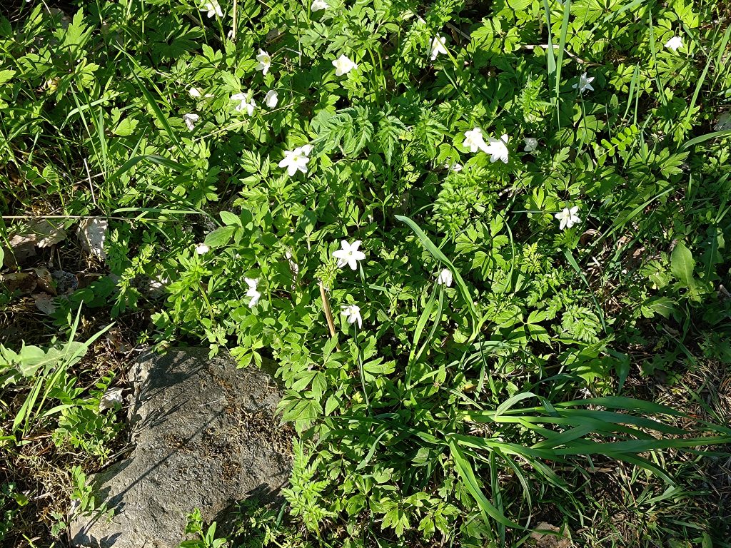
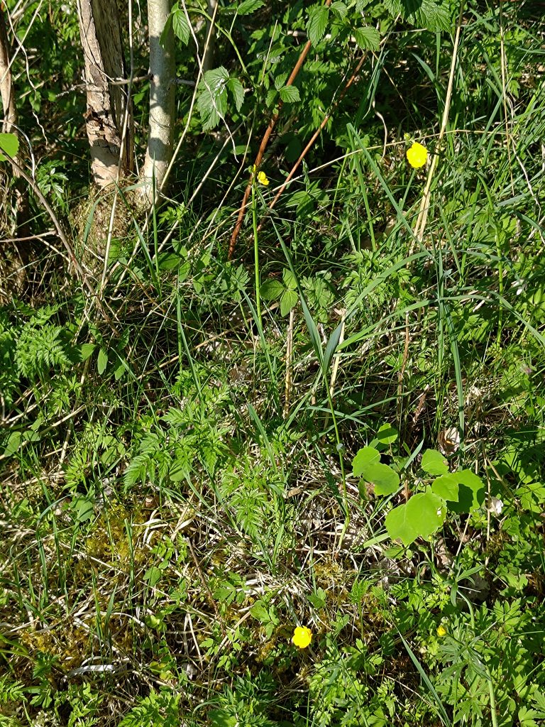
In addition to the trees blooming, there are now many wild flowers in bloom. The warm weather, with temperatures up to 26 degrees centigrade, has encourage many plants to bloom, perhaps earlier than in other years.
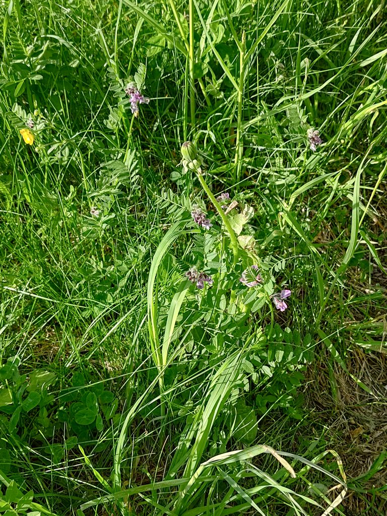
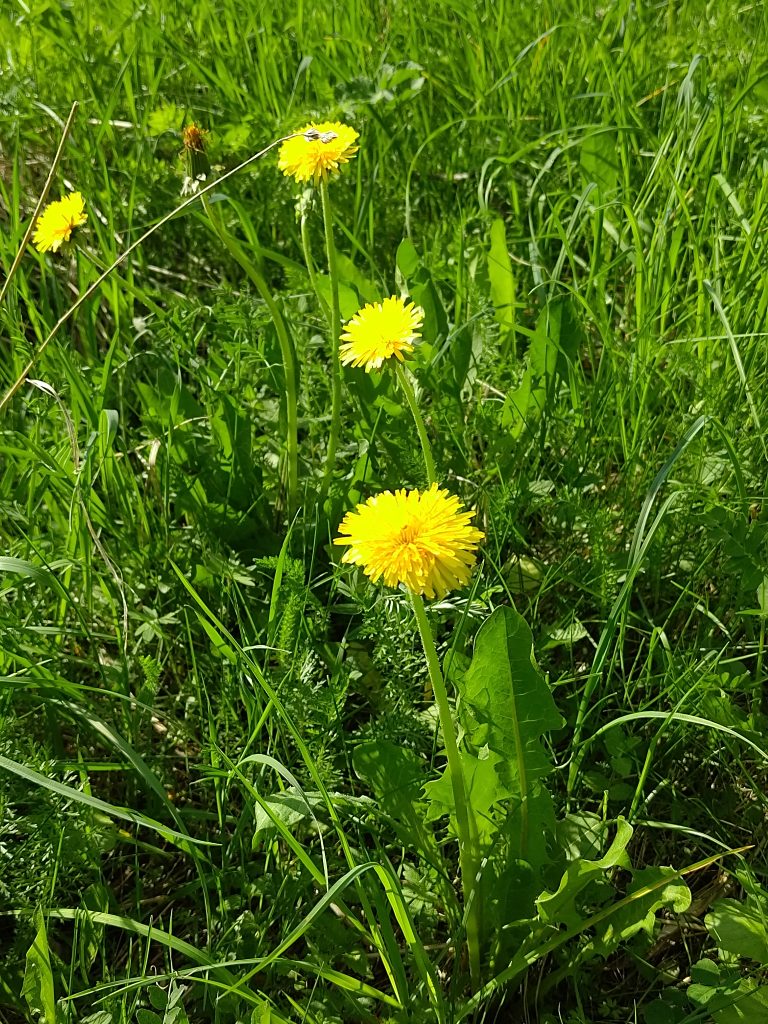
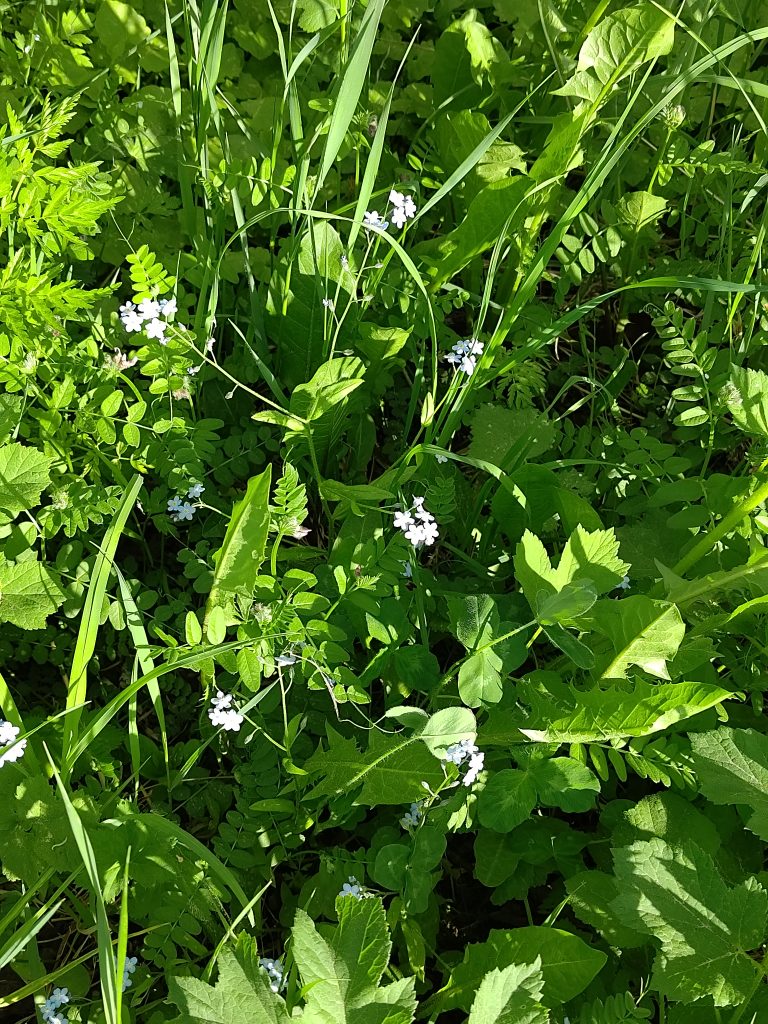
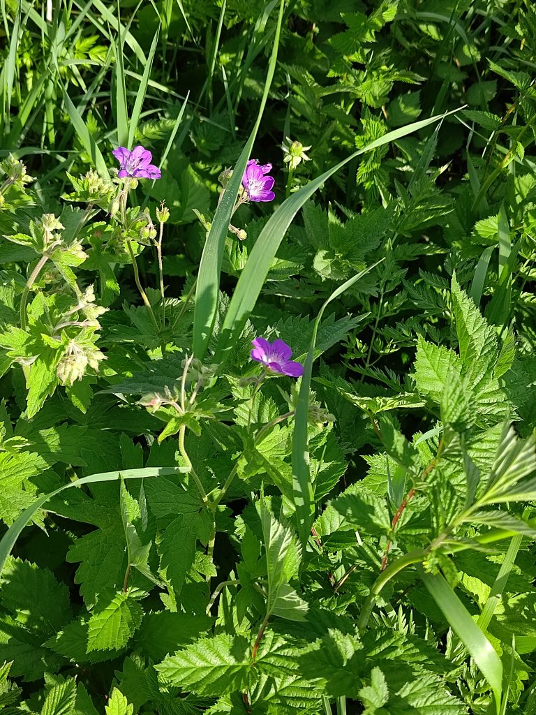
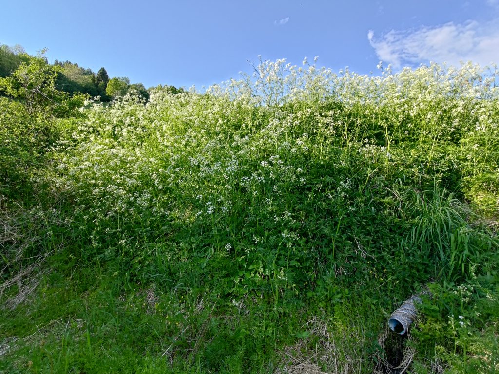
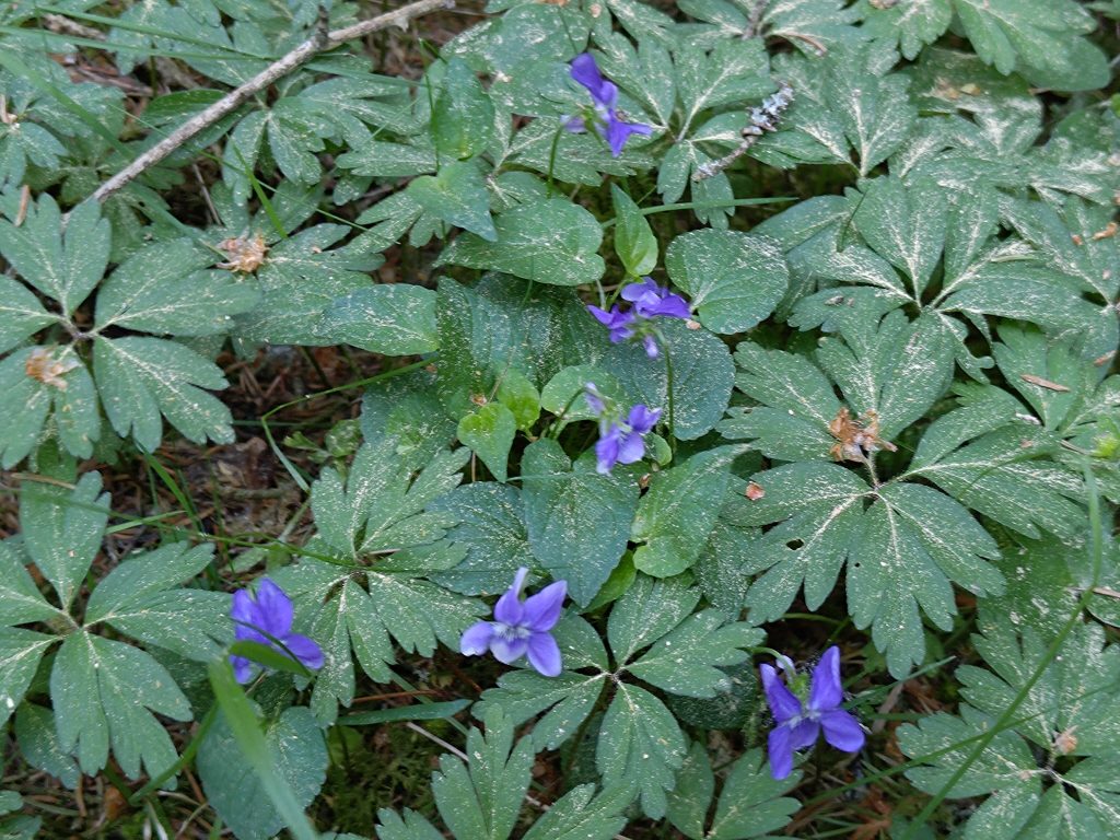
The small purple flowers are on a climbing plant called vetch (vicia) and is found often on roadsides. I have a lot in my garden as well.Dandelions are very common here in May. On some farms there are whole fields of them. In addition they grow along the roadsides. I find them a very beautiful, colorful flower, though I must admit that I don’t like them growing in my lawn and spend quite a bit of time removing them from the lawn.Forget-me-nots (myosotis) are a very light blue, but in the bright sunshine they come out almost white. Notice that there are many types of leaves indicating a wide variety of wild plants. This picture was taken along the tractor road down to the fjord. Bright sunshine most of the day, along with warm temperatures, has brought the flowers in bloom.These purple flowers, crane’s bill, (a type of geranium) are very early this year. It is a very common wild plant along roadsides and other open places.This plant is called “dog cookies” in Norwegian and is very common along the roadsides, once the dandelions are finished. In Latin it is called Anthriscus sylvestris, and in English it has various names including cow parsley and Queen Anne’s lace.In not so sunny areas, the white anemone (Anemone nemorosa) is still blooming. It usually blooms before the leaves come out on the trees, so they are mostly finished now.The first buttercups (ranunculus) are just starting to bloom.Wild violas (Viola odorata) grow in a lot of places in Inderøy. Notice all the yellow spruce pollen on the leaves.
This year, there are three posts to find on this walk, with 10 points for each post. Two of the posts are down by the water and the third one is at the end of a tractor road so that it is accessible for wheelchair or baby buggy users.
Post 21, Rostadsjøen. Here the dandelions have turned grey and their seeds will soon be spread by the wind.It was low tide while we were at Rostadsjøen.Post 22, Rostadnaustet, the boat house at Rostad. On the far side of the building are a couple of chairs and a picnic table to sit at. We took a rest here, as we were about halfway. It was a pleasant temperature in the shade.Post 23, Husmannsplassen i Rostadbakken. In the 19th century, large farms would have many crofters who had small places to live, grow a few crops for their own consumption and perhaps have a few animals. The crofters would have to give services to the landowner, perhaps helping with planting or harvesting, or the women might help in the house. There are six of these locations at Rostad and most of them were abandoned before 1900.
In spite of being worried about walking when it was over 20 degrees, as I don’t tolerate the warmth very well, we had started our walk late enough that the worst of the heat was over for the day. There was a little breeze when we were out in the open, though in the forest it seemed much warmer as there was no wind. We used a little over an hour for our walk, neither of us in a hurry to get back to our cars. By taking the walk counterclockwise, we went down the long hill in the sunshine and came back up the hill on gentler slopes that were mostly in the shade of the trees. It was interesting to see the changes in nature, in the month since we had taken this walk last.
Today’s Inderøy walk started in an old parking place (Gammelplassen) which we have used quite often, but we went to two places we had not been to before. We drove about 10 minutes from home, crossing the bridge in the picture below. We walked first to Furufjellet (The Pine Mountain) and then Duklettlia (The Duklett Hill).
The weather was mostly sunny, but still cool at 9:30 am at 8 degrees centigrade when we left home. That’s a perfect walking temperature for me, especially when I am going to be heading up a hill.
Duklett is the farm in a clearing near the left of the picture. This walk is about climbing the hill that is above the farm. This picture was taken from our own lot and you see the Mosvik side of Skarnsund Bridge in the picture.The parking place is for several posts on the Inderøy Walks. We are going to post 3 and 4 today. We went to post 5, Storlia on the 1st of May and you may have read the blog I wrote about that walk.The parking place at Gammelplassen (the old place). Our car is just out of sight on the left. Just after I took this picture, another car drove up. We let the two younger people head on up the trail ahead of us. When we came back there were two different cars here. Note that this trail is labeled with a red walking man, which means it is reasonably difficult.
Furufjellet – The Pine Mountain
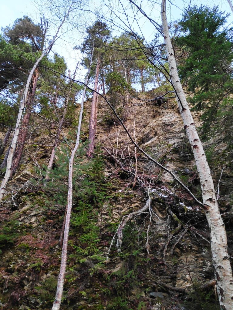
We have walked to the Pine Mountain many times before as it is a pleasant walk from the bridge. The picture below shows the cliff from below from the path that we have often taken. I had often wondered what it was like at the top and today we took the trail that took us up there. But this picture is to show you why you don’t get too close to the edge.
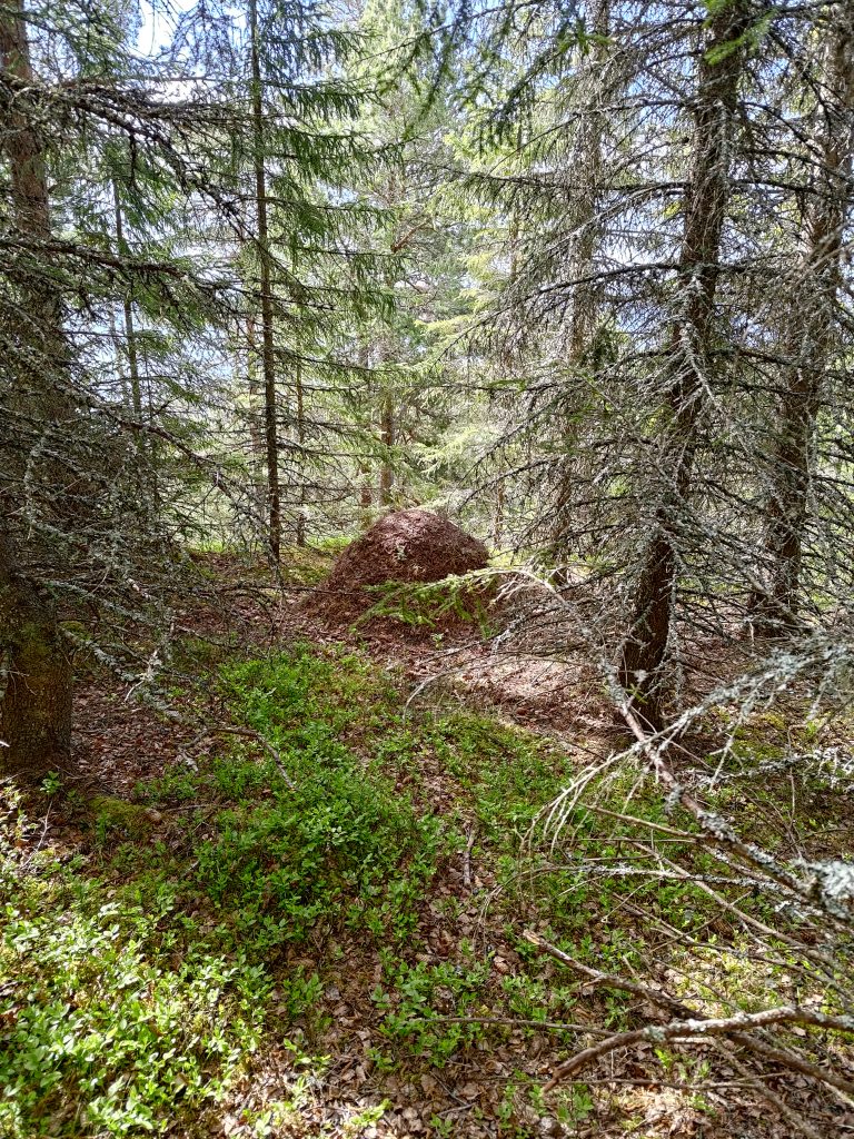
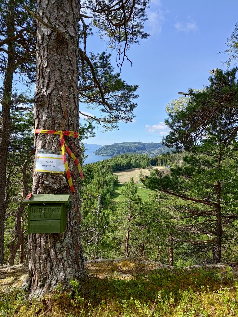
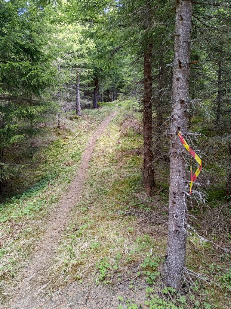
I have walked to the Pine Mountain many times and quite enjoy the walk from the bridge to this spot. It is a steep cliff and the last time I walked here I was wondering what it was like up at the top. (Picture taken 2021.12.20)As often happens, the trail follows a stream uphill. We followed this one for a bit, before crossing it and heading in a different direction.This is a well-used trail, both by humans and animals. Note the red and yellow streamer on the left indicating that we are on a marked Inderøy Walk. On both sides of the trail the slope is very steep.At the crossroads we had to choose which direction to go in first. Duklettlia is to the left and Furufjellet is to the right. We chose to go to Furufjellet first, which is off to the right. We walked just a few meters and then made a turn to the left. We came back to this point to go to Duklettlia.This is a relatively new trail and not so easy to follow. It is good to see the red and yellow streamers to make sure we keep on the correct trail. There are deer and moose that use these woods all year long and often sheep in the summer months, so there are many trails.We were almost at the top and I saw this very large anthill.My walking companion, Brock, was slightly ahead of me at this point. Though there is a small clearing in front of the tree that marks the post, it is also the top of a cliff.We made it to Post 4, Furufjellet / Pine Mountain. Do not go beyond this tree, as there is a cliff straight down, as you saw in the picture taken from below.
Most of the trees in the woods we were walking through were spruce trees. So I was very interested in finding out if there were actually pine trees at the top of this hill. Though there were definitely a lot of spruce trees, even at the top, there were also pine trees, particularly along the edge of the cliff. The box in the picture is attached to an old pine tree. All of our walk today was in relatively old forest.
In the green box is a book in which to write our names. In addition we “check in” on our phones on an app that keeps track of our points and when we do the walks. I checked in to post 4 at 9:56, about 20 minutes after leaving the car. The app won’t let you check in again within 22 hours of a check in. This makes sense, but it means you can’t take a walk in the evening and get points and do it again in the morning and get more points. Of course, walking in the woods can be done at any time even without getting points for doing it. The points are just an added benefit and incentive to get out of the house.
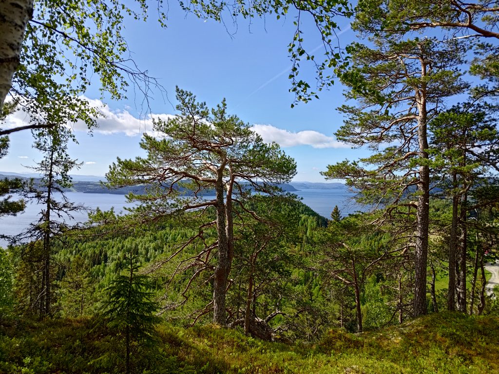
Pine trees do not need nearly as good soil as spruce trees and tolerate having much less moisture in the soil. This is the view looking southwest. You can just see the road that we have driven up.
Duklettlia – Duklett Hill
We went back down to the crossroads and started up the other trail. This one was even steeper. Everything is quite dry on the ground. Cones on the trail can be slippery. The trail is quite visible, but as it was the first time we had been up this way, it was necessary to check for the markings regularly to make sure we chose the correct path.
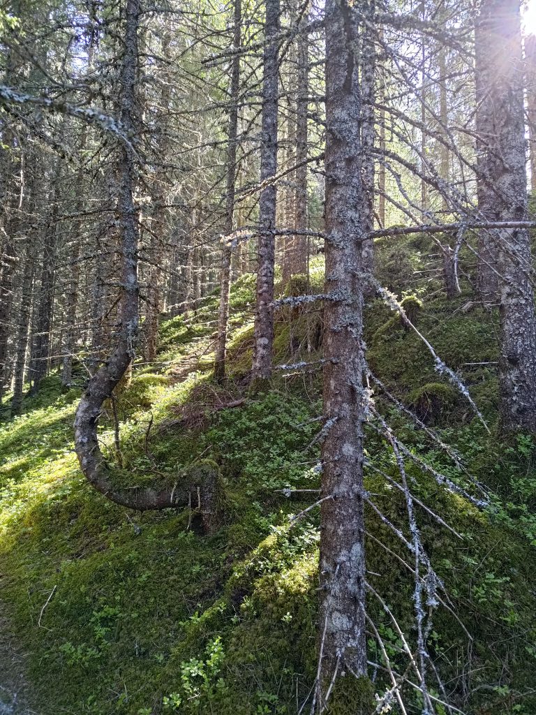
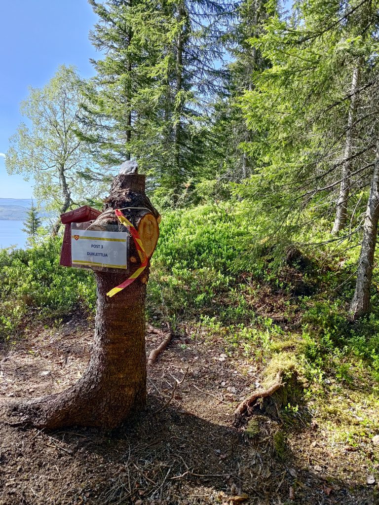
This path was actually quite steep. It doesn’t look as bad in the picture as it was climbing the trail.Taking a short break to get my breathing back to normal, I noticed this piece of quartz showing beneath the roots of a tree. It is quite common here to see bits of this type of rock. I also use taking pictures as a good excuse to stop walking for a minute or two.Some trees get a bit bent out of shape trying to find a way up to the sunlight. Most of the trees in this part of the woods are spruce.We’ve made it to post 3, Duklettlia. I checked in at 10:37, so about 40 minutes after checking in at Furufjellet. We are at 242 meters above sea level, having climbed about 130 meters in height from the car.
Was the walk worth all the effort? Definitely. Not only is it good exercise, but I enjoy being out in the woods. We heard some birds, but it was actually quite quiet in the woods, except for talking to each other. At post 3, there was a picnic table to sit at and we made use of it. Resting our hearts, lungs and legs. Note the red box on the tree stump, where there was a book to write our names in. Then, of course, there was the view.
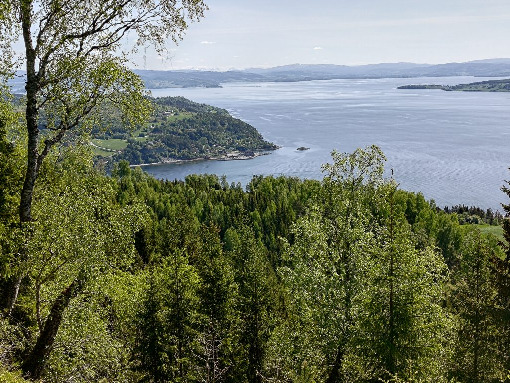
Vangshylla – home! You can’t see our house, as it is hidden by trees, but you can see the small boat harbor at the end of the road. The app on my phone tells me that Duklettlia is 2 km away from home, but that is in a straight line.The farm, Duklett, from above. In the background is the island of Ytterøy and behind that Levanger.Looking a bit to the right of the previous picture. Ytterøy with Levanger in the background.
I love walks that take me to a place where there is a view, so this is definitely a walk I will do again. It was marked as a round trip, so next time we will do things a bit differently. Today we just went back the way we came, sliding down some of the steepest parts of the trail where cones and dry moss made safe walking almost impossible. We both use canes. Brock uses one and wears gloves so he can grab things to keep his balance. I use two canes which helps me keep my balance both going uphill and downhill on uneven terrain. We got back to the car at 11:18, having been walking about one hour and forty minutes. We were away from home almost exactly two hours, but that also includes the short drive each way.
We picked a good day for our walk. It is a holiday in Norway, but we didn’t see many others on the trails that we took. The sun was shining, it wasn’t too warm, and we were enjoying each other’s company along with the restfulness of being amongst the trees.
This is the 19th year in a row that Inderøy Walks have been arranged. This is a cooperation among many local organizations including sports clubs, the municipality and many volunteers. Inderøy has a lot of walking trails and only some of them are marked as Inderøy Walks. In 2024, there are 50 posts. 14 of them are suitable for those with reduced abilities to get around. As in previous years, it is possible to park the car and go for longer walks where one can check in to more than one post. (Rough translation from Norwegian of the introduction on the website).
Information printed in our local newspaper, on Friday, the 10th of May, the day before the competition official opens.
In the local newspaper, the municipality has been divided into seven areas, so that there are several walks available in each area. We live in the area called Utøy. Our local newspaper printed a list of the 50 posts. Those in red are accessible for those using a wheelchair or pushing a stroller. Those in blue are walks accessible to an elementary school.
Today, the 11th of May, was the first day of the Inderøy Walks 2024 and the competition is open until the 2nd of November. I don’t really want to compete with others, but I enjoy having the app on my phone and different places to go walking to and explore. For me, it is mostly about getting somewhere interesting, perhaps somewhere I haven’t been to before, and getting a reward for getting there. I never have the goal of trying to get every post, but I do try to get to some from each area of the municipality.
Saturday’s Walk
As it was forecast for rain later in the day, I decided to go as soon as I was up for the day, shortly after 6 am. It was nice walking weather, partly sunny, no wind and about 9 degrees. I chose to go to the two posts that are easiest to get to from home without driving.
General information about the cultural path (kultursti) between Vangshylla and Straumen, as well as some specific information about Vangshylla, including an aerial photo from 1953.
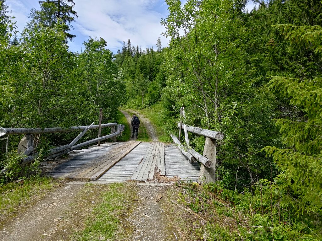
The walk I went on is part of the municipal cultural walk from Vangshylla to Straumen which is about 20 km along this path through the woods, though the driving distance is about 12 km. I only went a short part of the whole walk and then returned partly the same way.
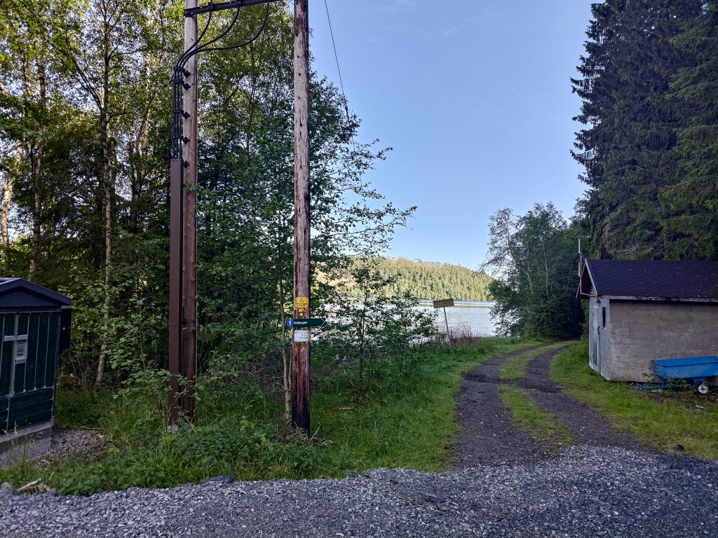
We live in an area that has a lot of leisure cabins, mostly used during the summer months. So I often use other paths than if one started at the parking area at Vangshylla. The first part of the walk for me is along a dirt road that leads to one year-round dwelling, one farm and a restricted-access road.
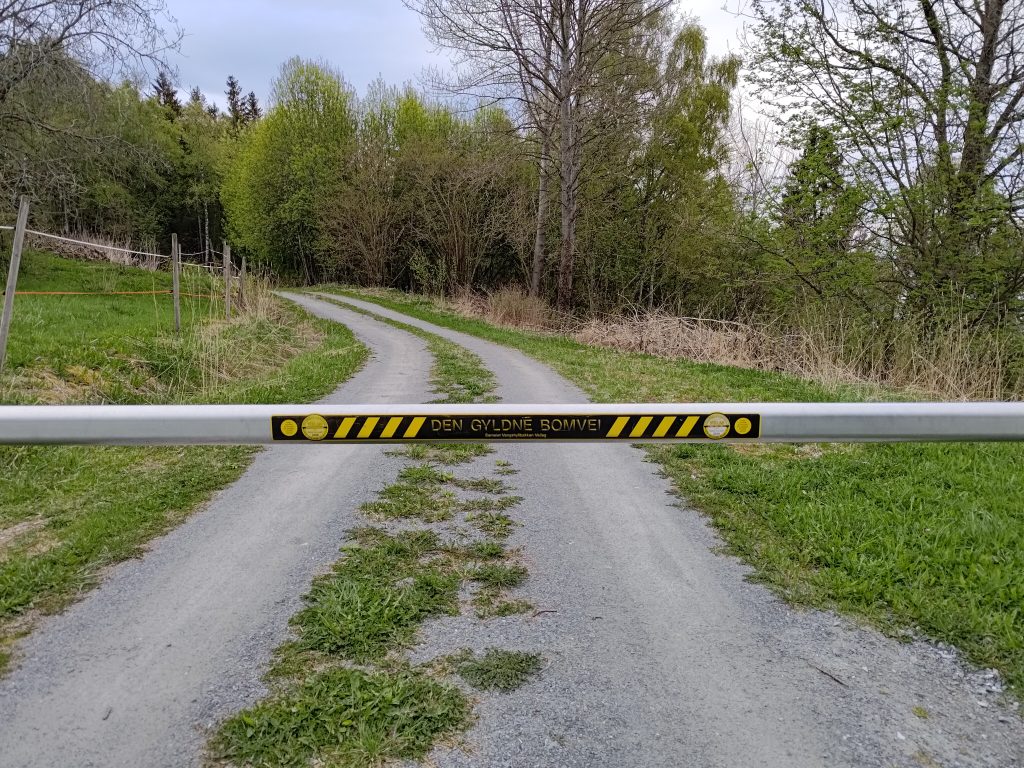
This is called “The Golden Toll Road”, but is really just a private road that only the cabin owners have driving access to. There is no problem walking around the barrier.Welcome to Vangshyllbakkan road cooperative. The barrier is to always be closed. Parking is only allowed in marked places and is forbidden on the roadway. Vehicles without a visible parking wafer can be towed away at the owner’s expense. Driving with a heavy load or heavy machinery needs to have special permission. (“Vangshyllbakkan” is the name of the road.)
We have lived in our house for over 35 years and during that time I have walked these trails many times and seen many changes. Often after the winter, there can have been damage in the woods, both from loggers and from storms. I had been along part of the trail once before this spring, but not the whole way to Høghalleren.
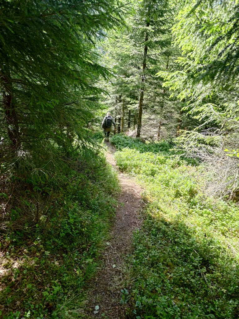
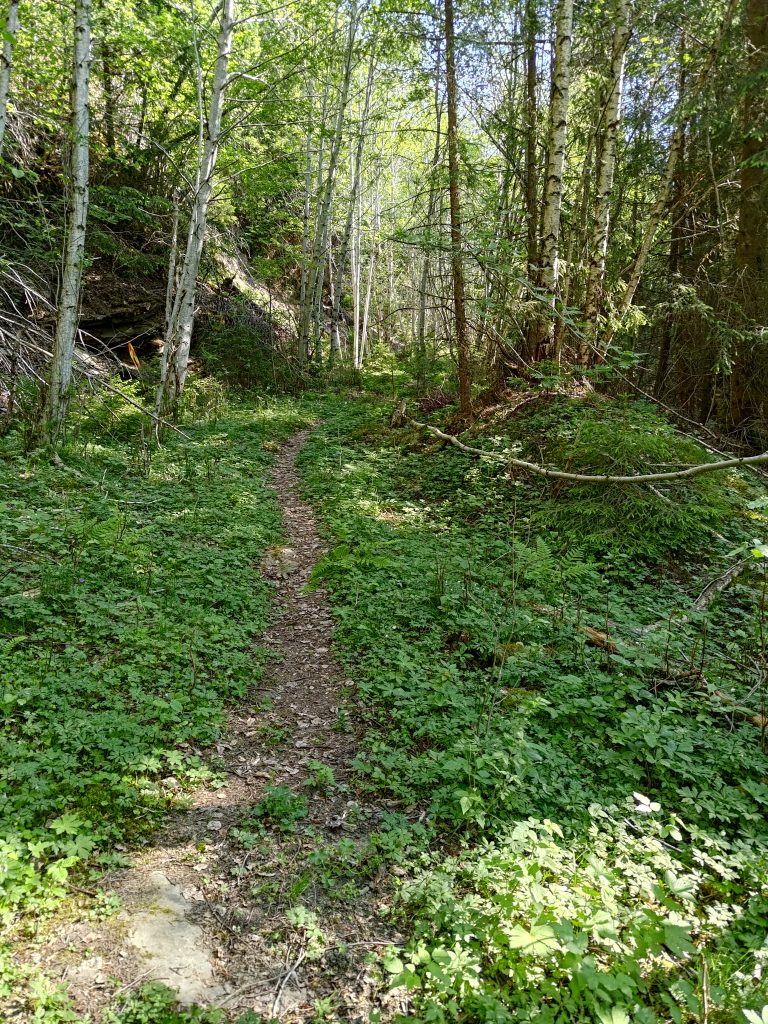
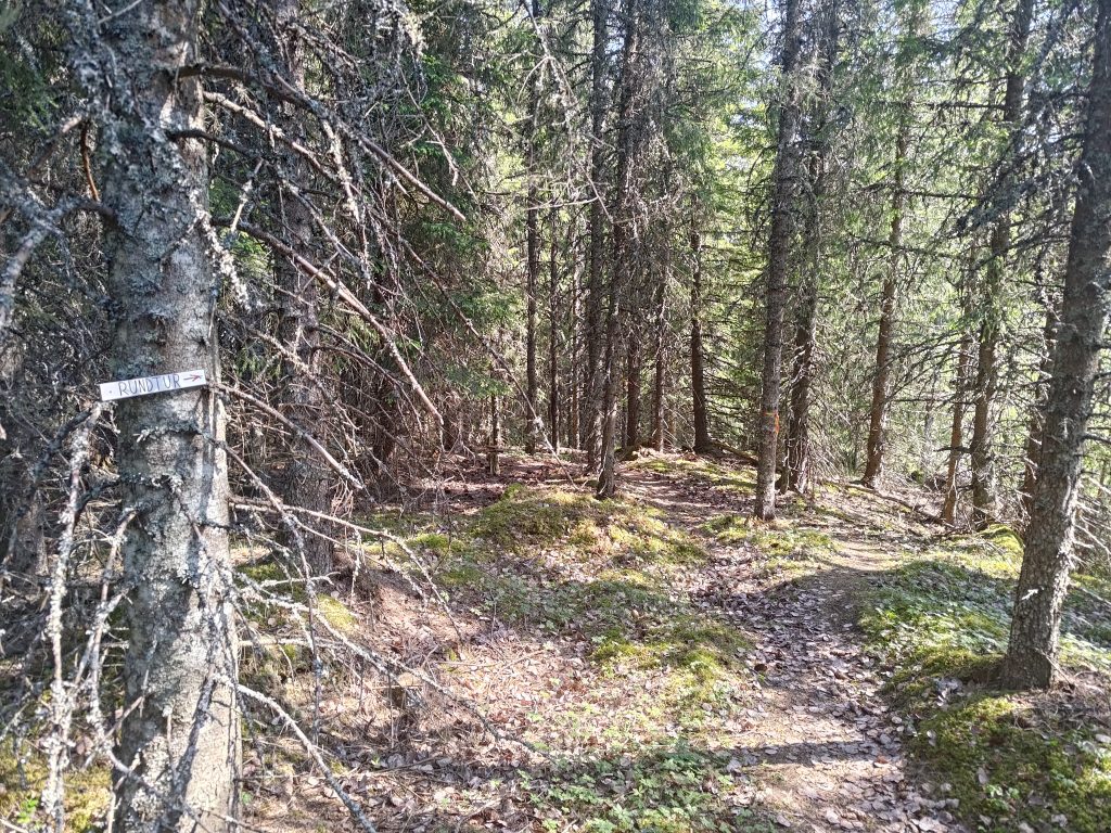
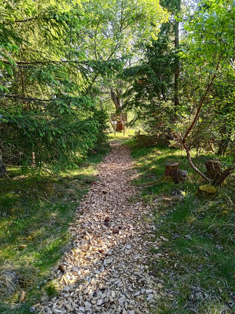
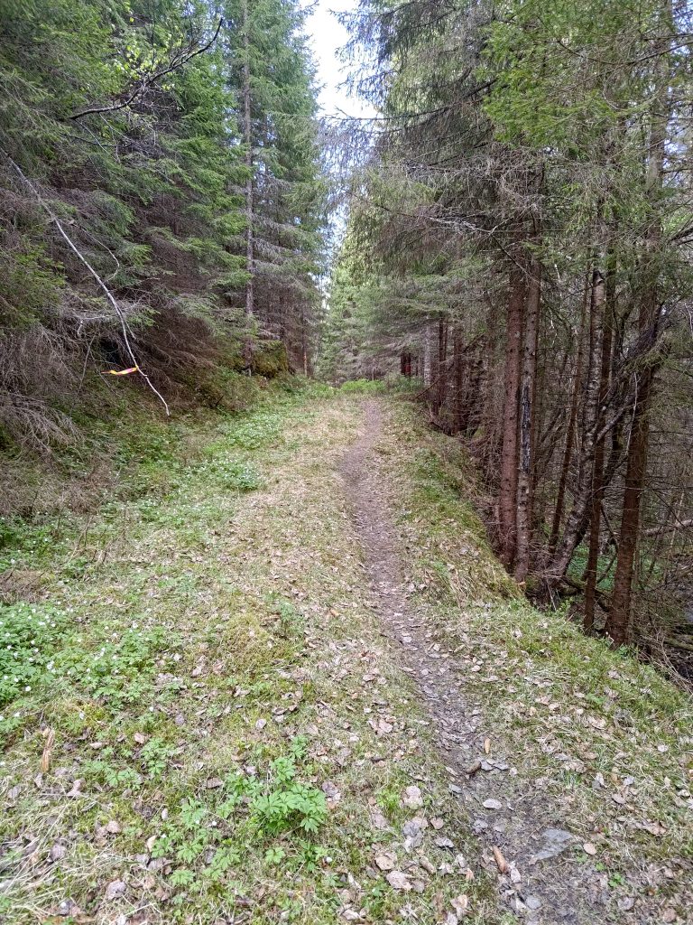
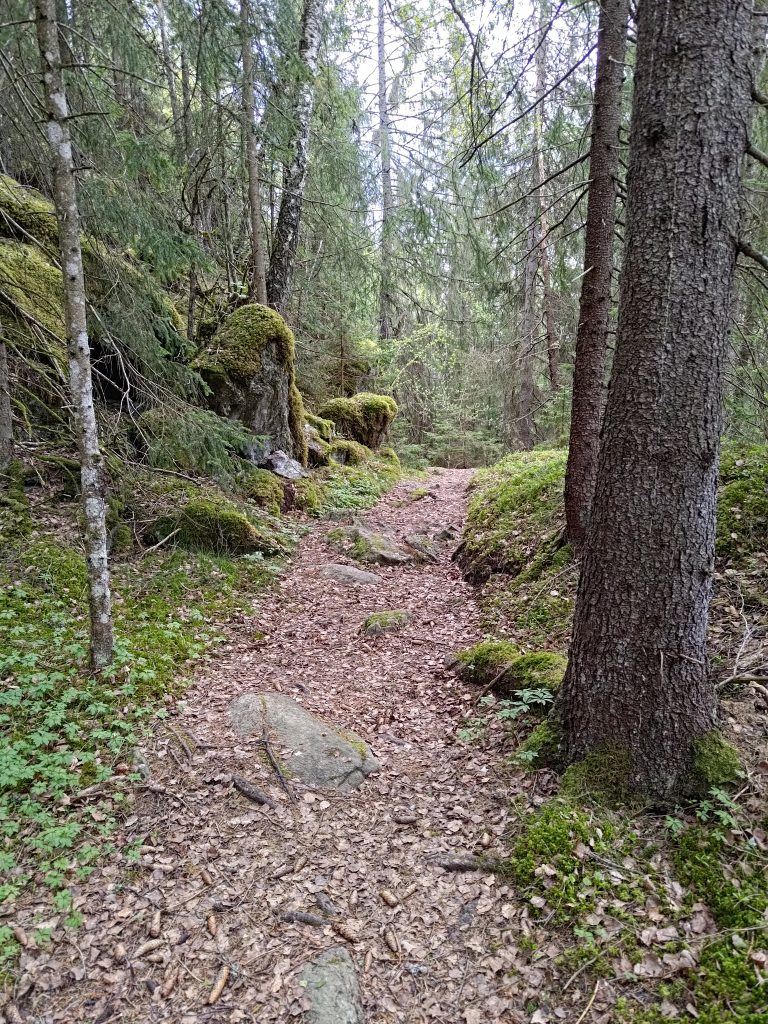
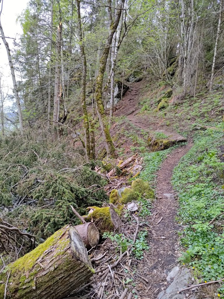
Once I was away from the cabins, the trail went into the woods with various types of trees, but primarily spruce, birch and rowan, as well as hazel, willow and pine. The trail goes down at this point and one has to walk carefully. It is quite easy to see the trail as it is well used.
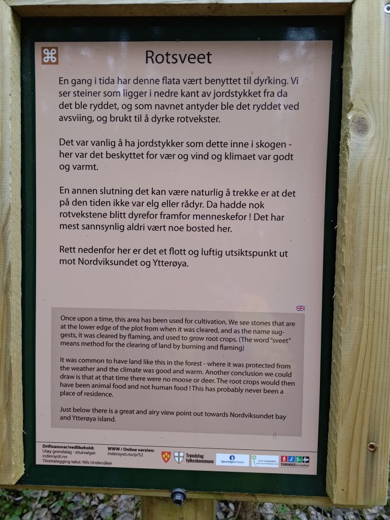
As mentioned, this trail is a “cultural” trail and there are a lot of information signs along the way. They have been printed in Norwegian and English. Most of them give historical information about what the area has been used for.
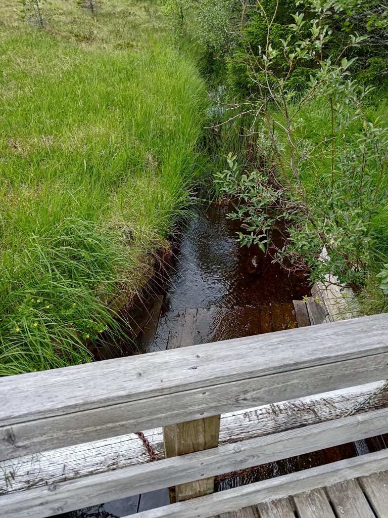
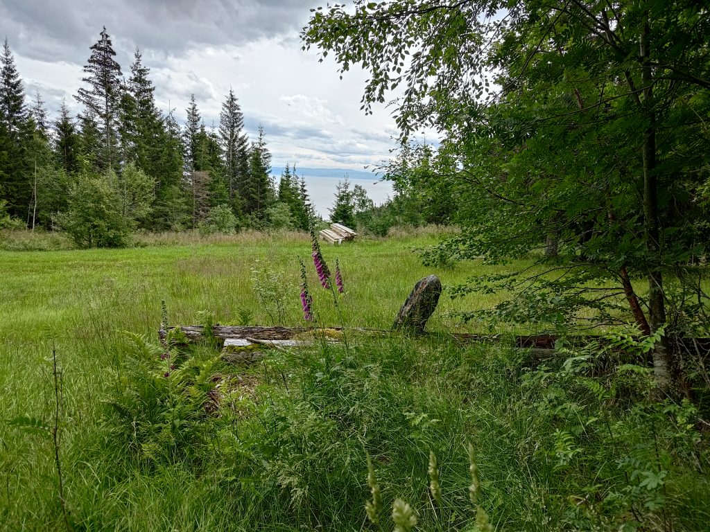
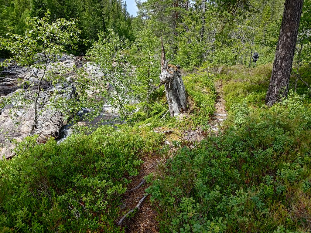
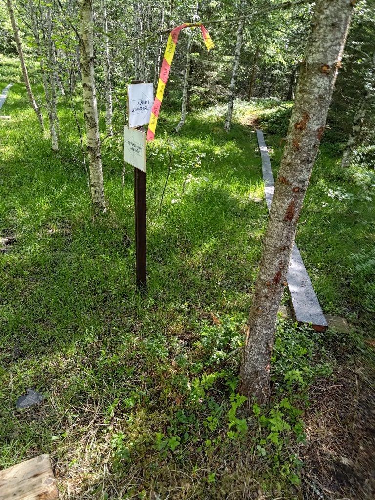
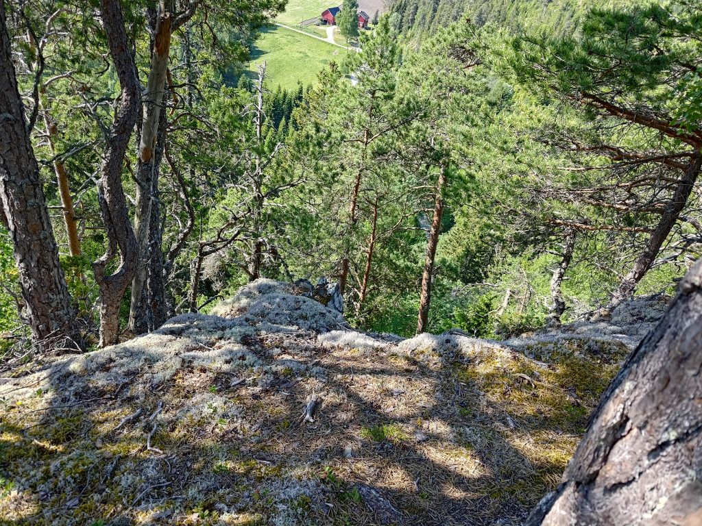
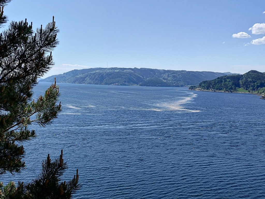
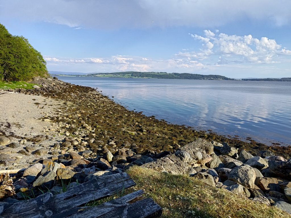
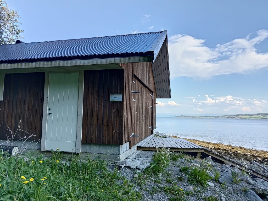
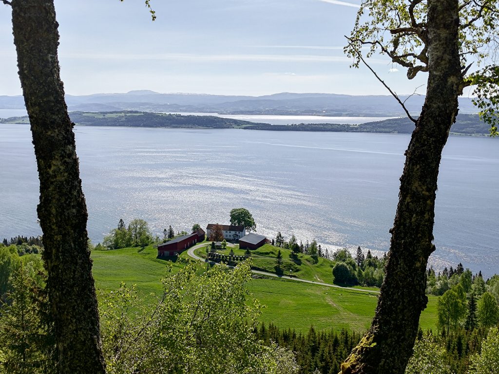
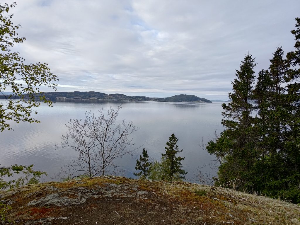
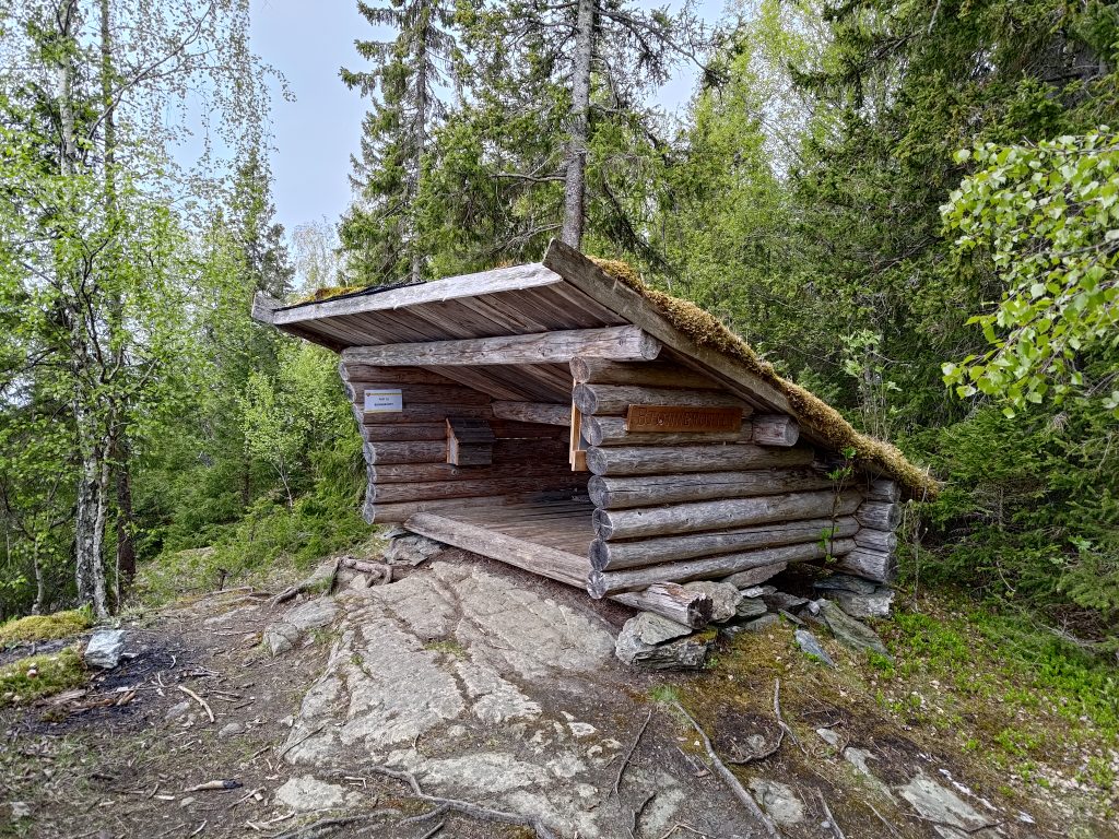
The view from “Rosveet”, looking towards the island of Ytterøy. Don’t get too close to the edge as there is a sharp drop down to the water.This is called a “gapahuk” in Norwegian and is a very small shelter, usually made from logs. The white sign shows that I have come to post 19, so I checked in. There is also a book in the box on the wall which I wrote my name in.
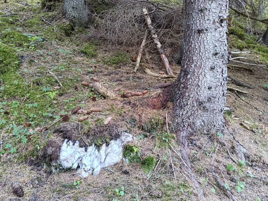
I got to the first post at Bjørnbrottet (Bear Cliff) about 20 minutes after leaving home, but I wanted to continue on and visit one more post. What surprised me as I continued on was the changes since I had been here last summer.
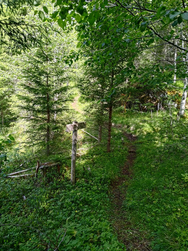
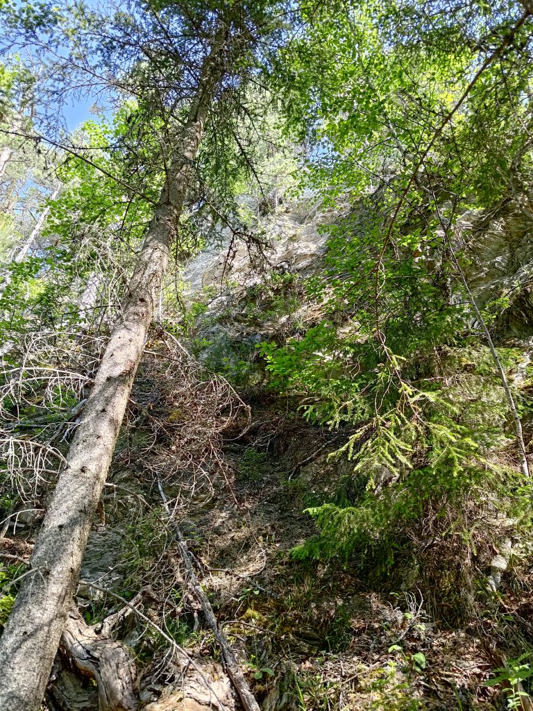
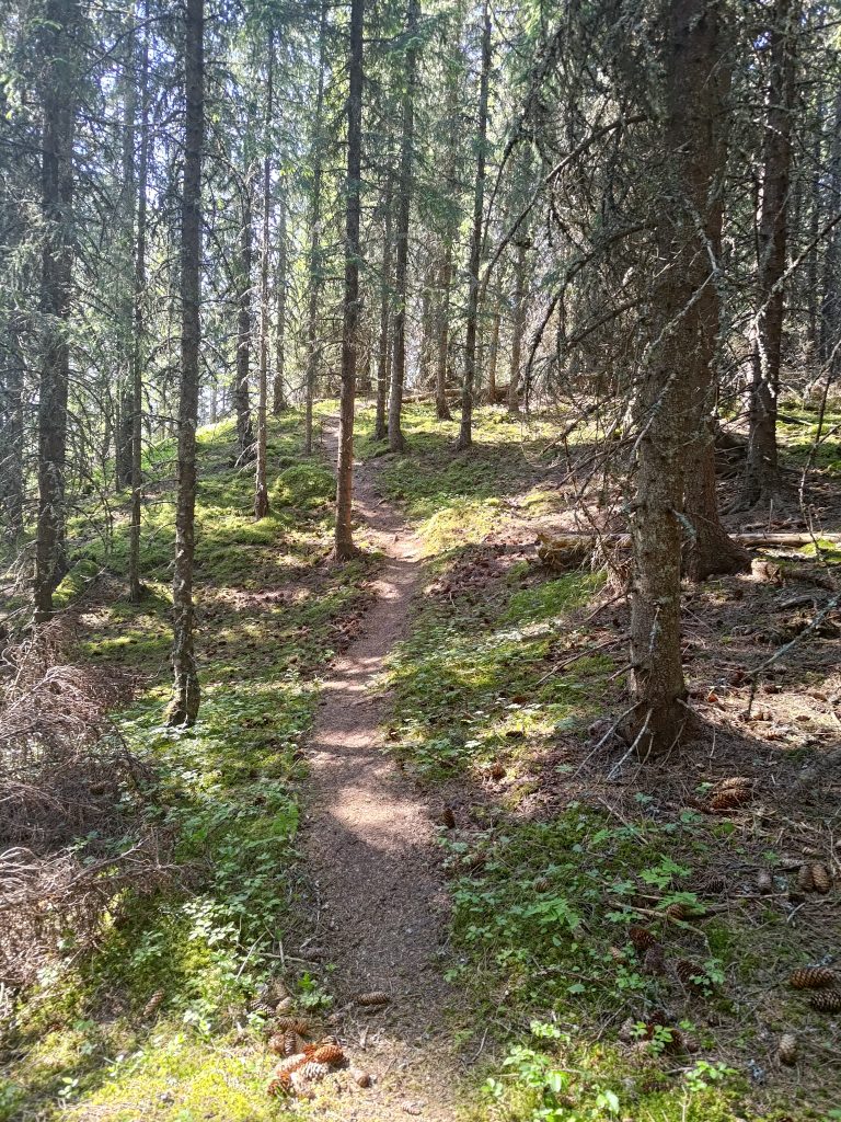
But first I had to go down a very steep section of the trail. Where the trail seems to end, it actually goes down quite a steep slope.
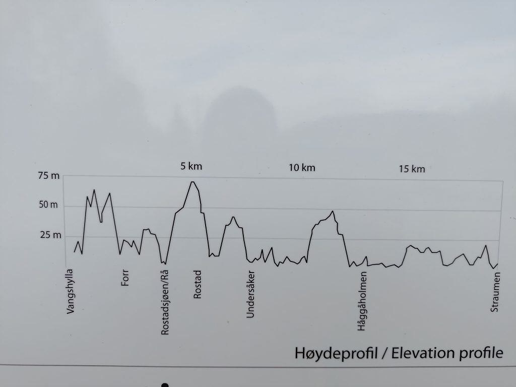
This was on the information sign at Vangshylla and shows the changes in elevation along the trail. I am walking along the trail from the left and go the the first three peaks before “Forr”. Forr is basically at sea level.Looking back up the trail I had just come down. It’s a bit narrow.
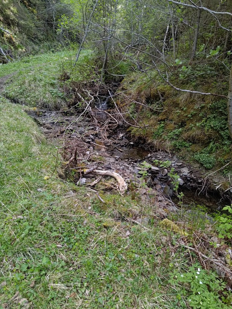
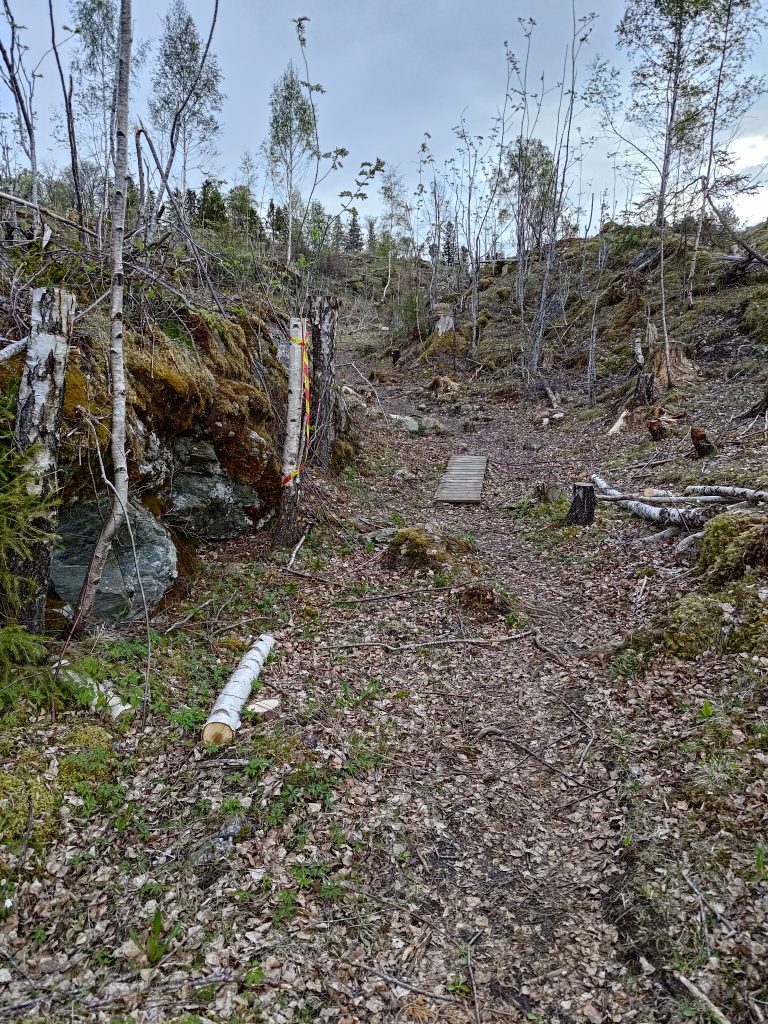
From this point on, I started noticing quite a few changes. Even in the picture above you can see how there are a lot of branches on the left hand side of the picture. There had been a very large tree that had toppled over in a bad storm during the winter and it had been cut up a bit to clear the pathway. Spruce trees have very shallow roots and are very susceptible to being blown over with their roots in the air. I continued on, crossing a small stream and came out into an area that was much more open than the last time that I had walked here, sometime last summer. All this land will be privately owned, so access to the trail has to be agreed on with the landowners.
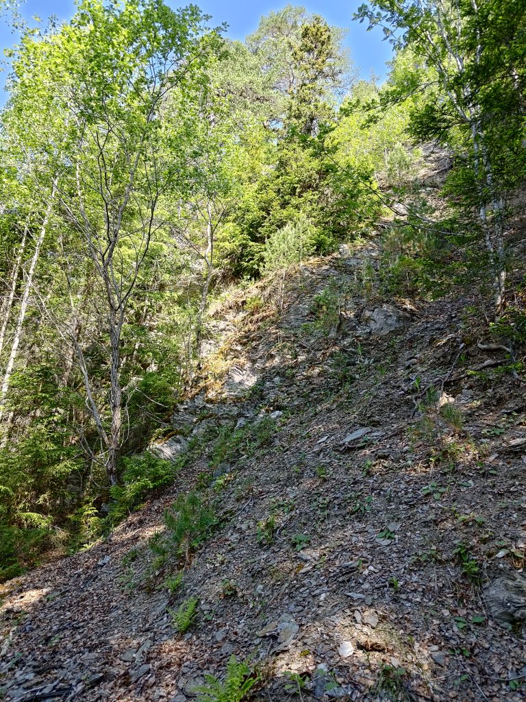
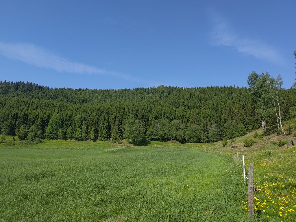
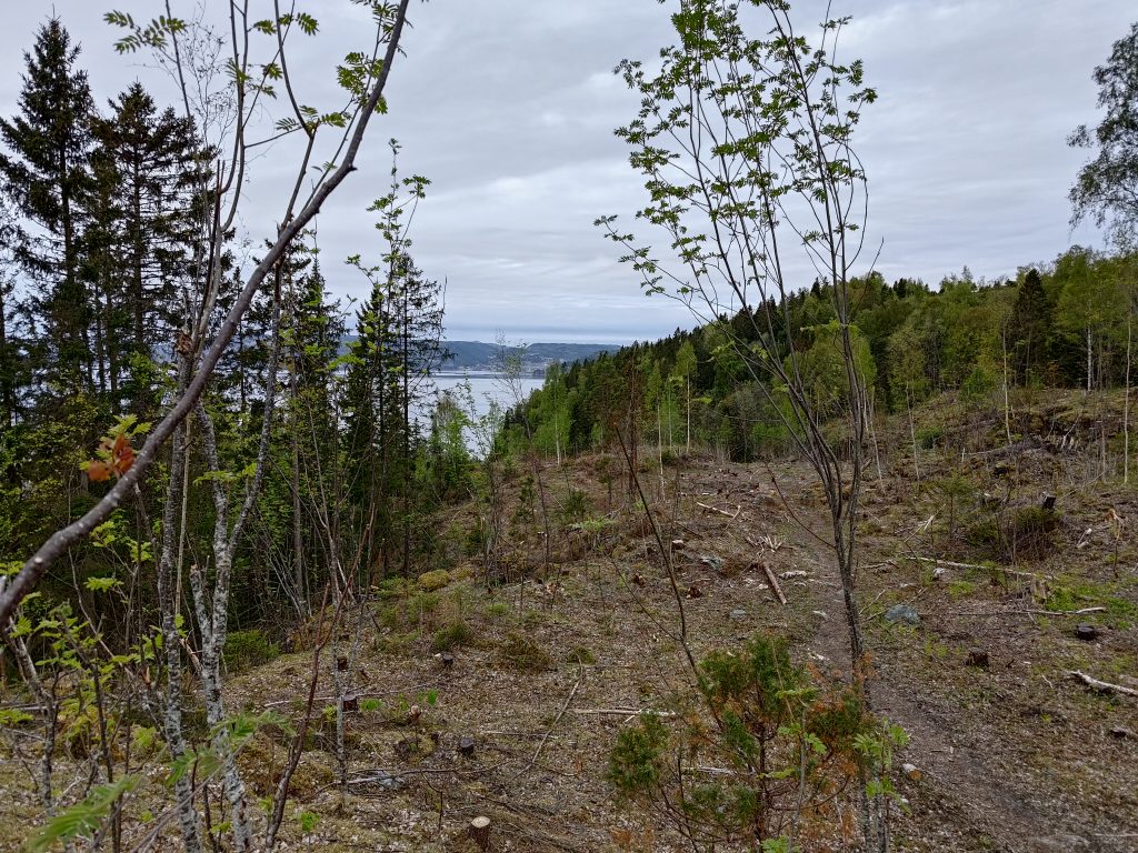
When we first went walking here 35 years ago, this was a densely forested area. It was logged after several years, so the forest that was growing here was probably only about 30 years old. Once again it has been logged, though it definitely gave some gorgeous views out over the water.
Loggers have been at work here and the trail is seen going over a very open area. This is a fairly flat area, so not too difficult to log. To the left in the picture, the slope gets very steep and the old trees have been left. The trees would mostly have been quite small, so are perhaps going to be used for either firewood or the central heating system in Straumen.Back into the old forest and one can see that trees have broken in the wind, or been knocked over by another tree.This tree had suffered in the winter’s storm.
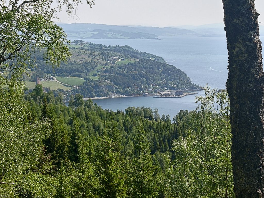
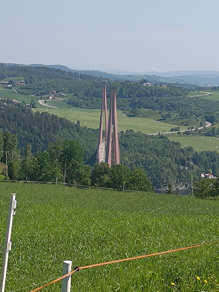
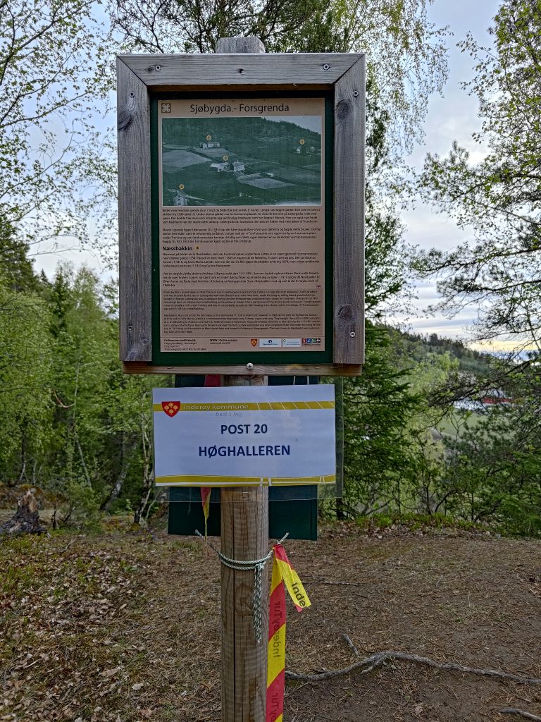
I reached my second post, no 20, at Høghalleren, about 20 minutes after the first post. I had spent a bit of time taking photos along the way. There is a picnic bench here to take a rest, and the mailbox on the back side of this post has a book in it to write one’s name. The view is very nice from here.
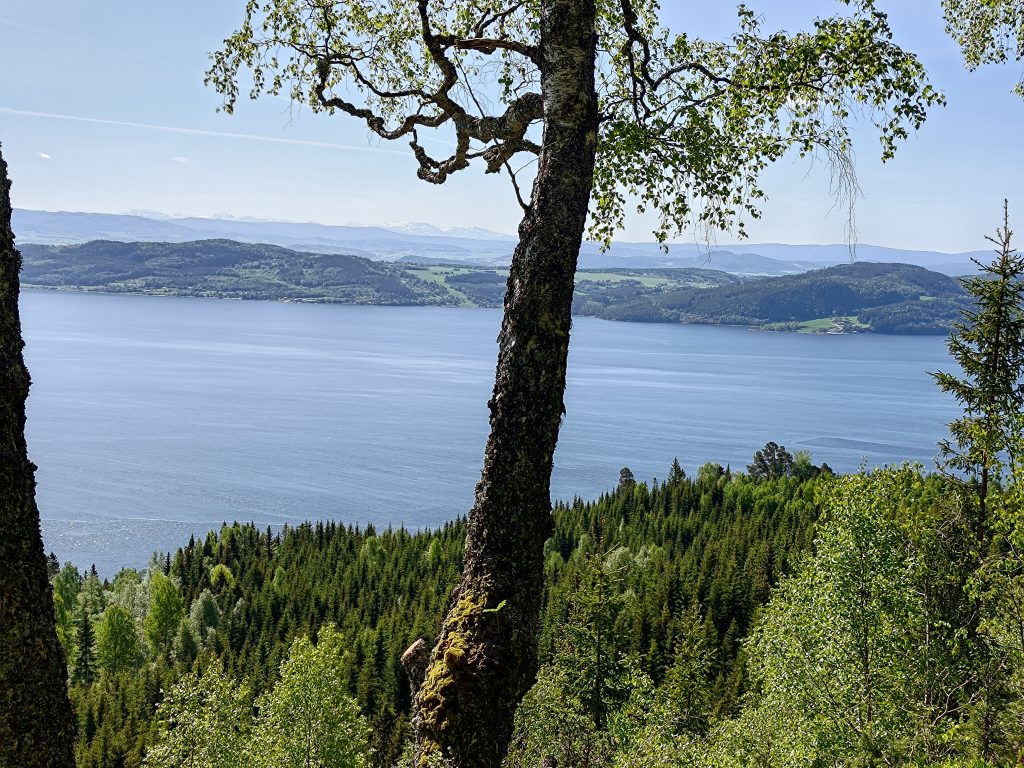
The cliff goes very steeply down here, so I’m very careful to not go too close to the edge. The tide was low when I was here. This view is taken looking southeast, with the island of Ytterøy first and Verdal in the background.
Even though I was walking on my own, I really enjoyed having a walk early in the morning. I used about one hour and twenty minutes for the whole walk, but I stopped quite a bit to take pictures. I took about 45 pictures on the walk and you have seen only some of them. I will be doing this walk several times over the next few months and I need to remember that I enjoy early morning walks. As predicted, it started to rain later in the day, so I was out in the best part of the day.
I plan to go on more of the Inderøy Walks in the coming weeks and hope to be able to share my experiences with my readers.