Brock and I traveled for nine months, mostly in Europe, from July 1979 to March 1980. It was partly our stay in Norway, during September 1979, that made us decide to move to Norway, arriving in August 1980. We’ve lived in Norway ever since and I feel that we made a good choice.
Memories often get started because of a chance comment or something that happens. The memories in this blog have been triggered by my son starting a two-week car trip with his first stop being Kristiansand, in the south of Norway. This triggered my first memory of Kristiansand which was arriving by boat from Denmark at 5:30 am on Monday, the 3rd of September, 1979. It was a sunny morning, but very early.
Memories are not very accurate, and Brock and I often disagree on what actually happened, who made which decisions, etc. But during our long trip in 1979 to 1980 we regularly wrote letters to our family in Canada, which have been kept and can be reread to fill in the gaps of our memory 45 years later. Much of the rest of this blog is based on a letter written by either Brock or I, as there are two different handwritings in this letter.
“Today [1979.09.03] began early. The Christian IV docked at Kristiansand at 5:30. We took our time leaving the ship. At that time of the morning nothing was open, so we walked around the city. The city was designed by Christian IV in 1691. Of particular interest is the fact that the streets are laid out in a rectangular grid uniformly spaced with wide streets. The buildings are primarily wooden.”
“At about 7:00 we started phoning Oslo trying to find where the Baha’is lived in Kristiansand. We were given two addresses, but had to wait til 9:00 until the tourist office opened to find the location of the addresses. We also picked up some general travel information about Norway. We decided to walk to the hospital where the Sextons lived. It took about half an hour to walk to the hospital, though we made a wrong turning and stopped at the nursing school first. From there we got directions and found Eg Sykehus [Eg hospital] fine. At the reception we asked for Mrs. Sexton who came over to greet us She was glad to see us though not expecting us. She took us to her house where we sat and chatted.”
That was how 45 years in Norway started, early in the morning on a sunny day and being met by an American woman who put us up for several days on short notice.
“Kristiansand was a very nice town of about 60 000 people. The town is nestled on the hills. There is a river running through it. It is much like West Vancouver with a few roads and then small roads branching up each side of the hills on the outskirts. Only the oldest part of the city is on flat land. It felt very comfortable and very much like British Columbia.”
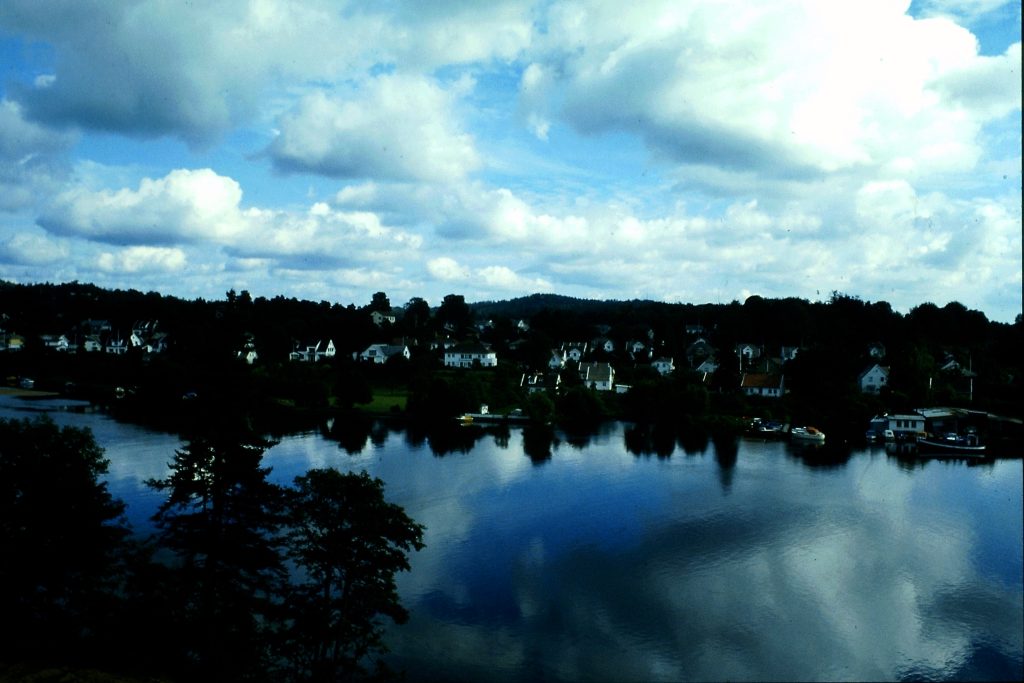
We only took one picture in Kristiansand and this is it, the Otra River. This was originally a slide that has been scanned into my computer. Taking photos in 1979 was an expensive hobby so we didn’t take nearly as many photos then as we would today.
Eg hospital is now called something else (Sørlandet sykehus Kristiansand), but all the roads around the hospitals area are called “Egveien” so I presume there was a connection.
Hal Sexton worked at the hospital for the mentally ill and Anne worked part-time as a nurse. They had four children between the ages of seven to fourteen in 1979. They had previously lived in Oregon and Alaska but were now living in Norway as Baha’i pioneers, in other words, supporting the Baha’i community in Norway. Through Hal’s job, they were given accommodation on the hospital grounds. We didn’t meet Hal at this time as he was away on a course. The fun fact is that we met this family several years later and became good friends with them, when they lived in Levanger and we had moved to Inderøy. I remember having Christmas dinner with them one year when Shelagh was still a baby, so 1989.
We stayed in Kristiansand from Monday to Thursday, leaving in the middle of the day on Thursday. We visited several other people during our days there and started learning about how people lived in Norway.
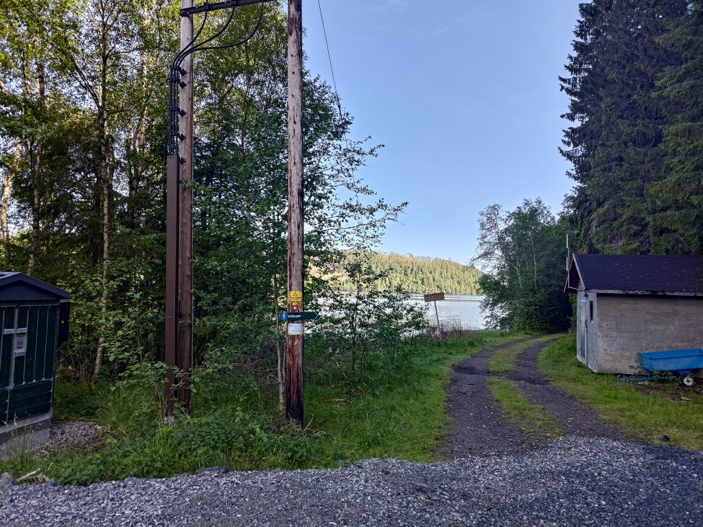
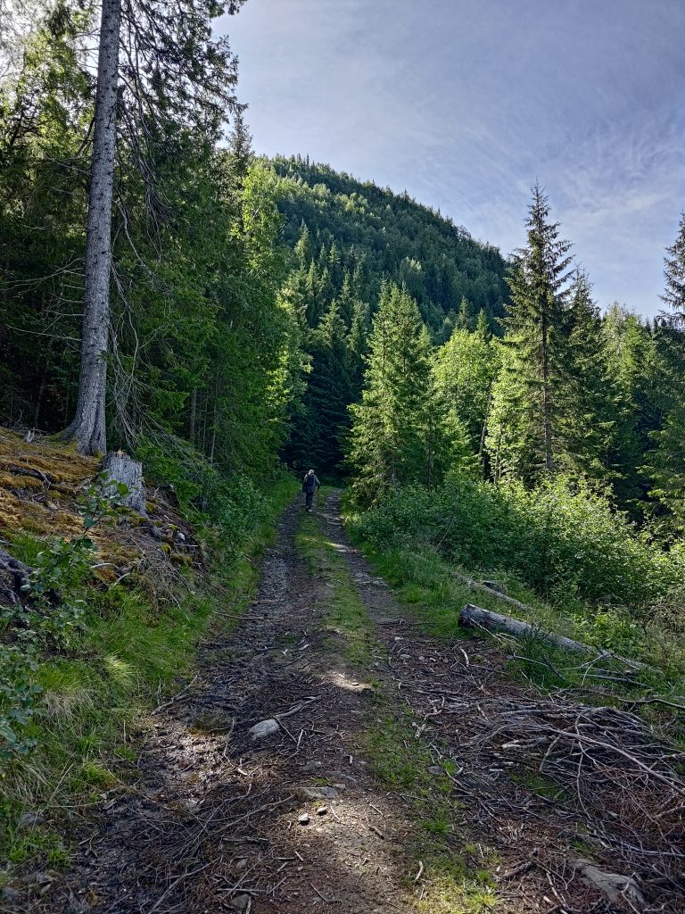
It was a sunny Saturday and we had chosen to go for our weekly long walk in the hills up from Røra, in Inderøy. There are several Inderøy Walk posts here and we weren’t sure how many we would get today. Four were possible, but two was more likely. It was already about 15 degrees when we started walking and the day was promising to get warmer. I don’t like walking too much once the temperature is much above 15 degrees, as the heat saps me of energy. We’ve had a lot of rain lately and more forecast for tomorrow, so we picked the day with sunshine for our walk.
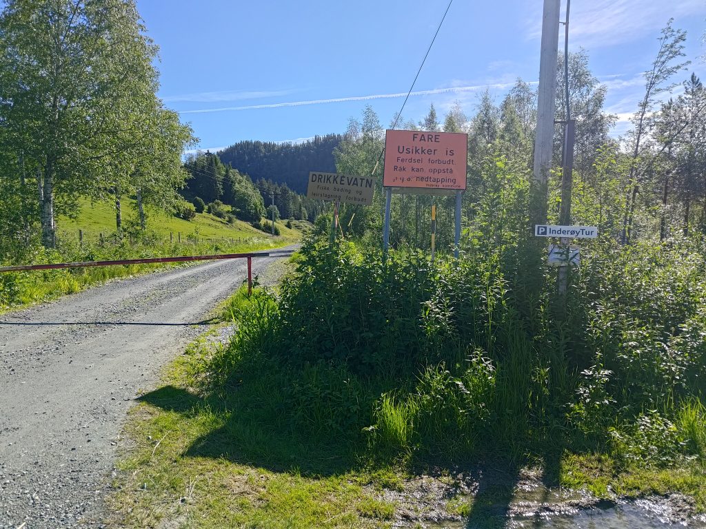
At the parking lot at Røflo Lake, our drinking water source. Blue sky and sunshine was nice after several rainy days.
We parked at Røflo Lake, which is Inderøy’s main drinking water source, so there are all sorts of signs to let one know that. No fishing or bathing is allowed, and you are not allowed to camp near the lake. In the winter there can be a problem with unsafe ice where water is taken for the water supply system. Inderøy has a major factory for producing jams and juices, so the water that is supplied has to meet critical standards. In recent years, there has been a problem supplying sufficient processed drinking water to the residents. This is not because there isn’t water, as I’ve never seen the lakes here low on water. The problem is the capacity to purify the water. Inderøy is now spending a lot of money on connecting itself to the neighboring municipalities of Steinkjer and Verdal, who don’t seem to have the same problem. I often wonder if that is a good use of investment funds, rather than investing in increased capacity within the community.
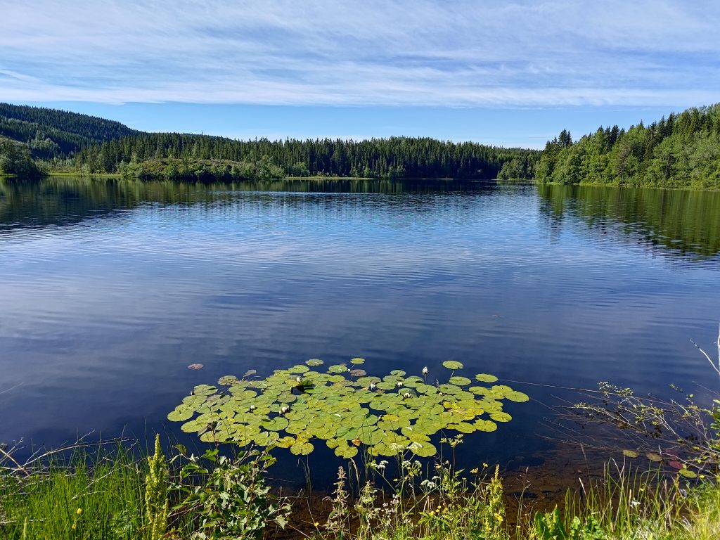
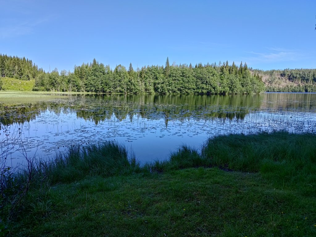
Røflo Lake, our water supply.
On Røflo Lake there are water lilies, which were almost ready to bloom. The flowers will open out in a couple of days, perhaps even later in the day. We started our walk about 10 am, so there would be lots of time as the day warmed up for the lilies to open up later. This lake is at about 188 meters above sea level.
Choices to be made. We are actually going to make it to the top of that treed hill, roughly in the center of the picture. They are hard to see, but there are two grazing sheep visible in this picture.
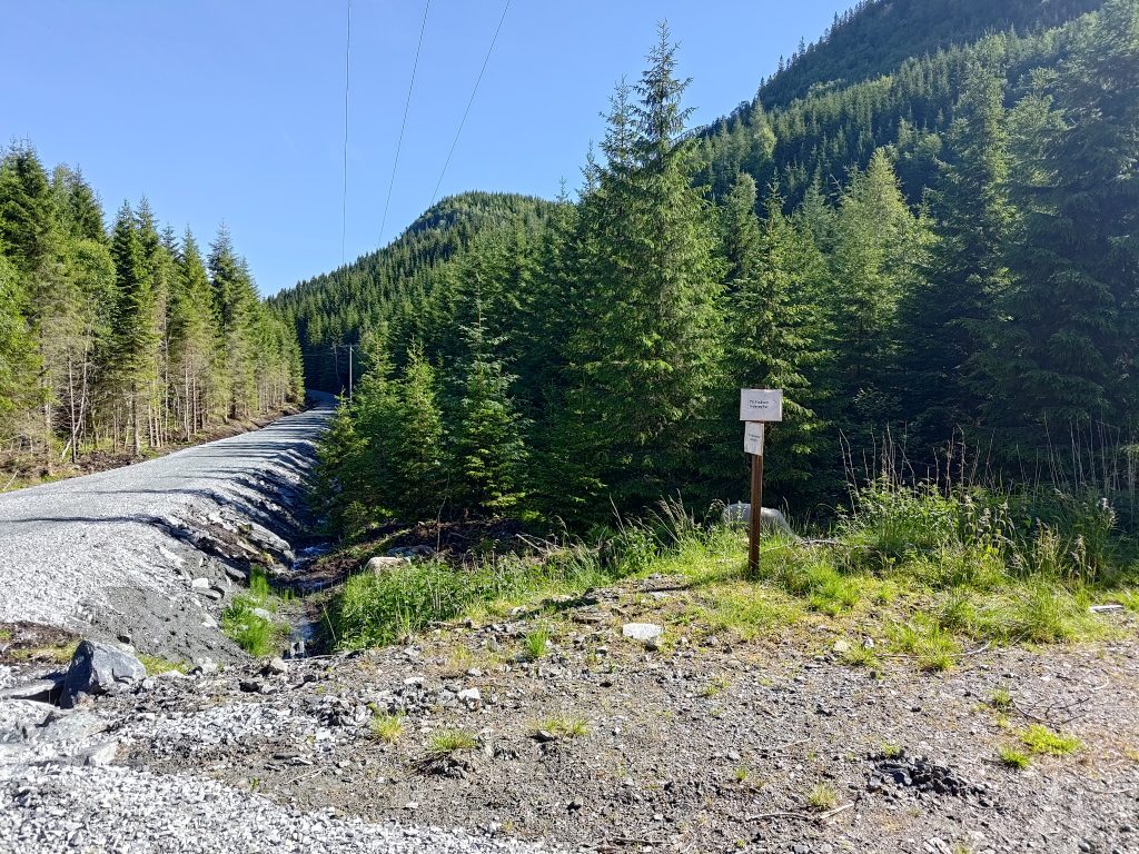
We wanted to walk to Vådal Lake first, which is the road off to the left. This has always been a gravel road, but they have much improved the road in the last year. This is the first time this year that we have been at this location. The road to Vådal Lake is restricted access for vehicles, but anyone can walk along it. They have improved the ditches on either side of the road and put down a lot of new rock to both raise it above the old road bed and to give a better surface.
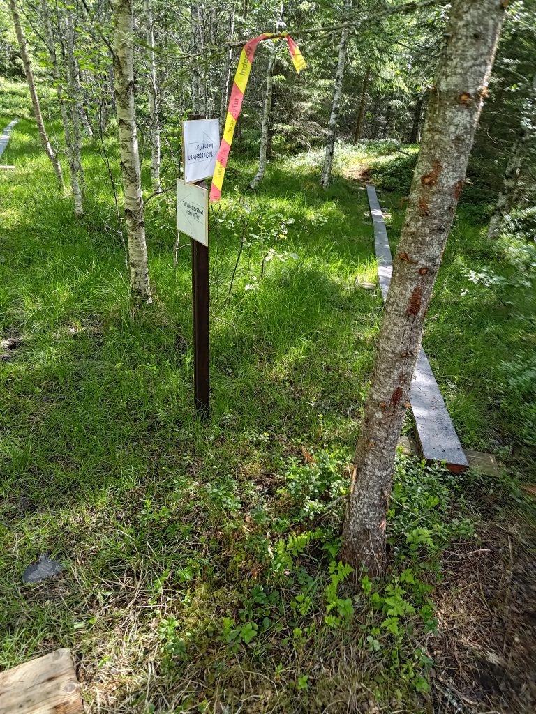
Because we were going to a new post this year, we also saw some new signs, indicating which choices one has. The old signs were still there, but now there were some additional ones that are probably only temporary. From this point, there are actually five posts that one can access. They all require a steep climb uphill, except for the first one on Vådal Lake, which is actually at only 158 meters above sea level, so at a lower elevation than Røflo Lake.
Our first post has been reached at Vådal Lake.
We used about 20 minutes to get to this first post as I stopped to take pictures along the way. I don’t put all of the pictures I take in a blog, but I pick out the best and most interesting ones. I find taking pictures in the sunshine and with sunglasses on a bit risky and I don’t always see whether they are good or not until I get them on my computer at home.
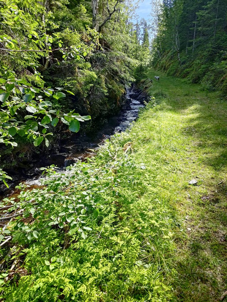
The southern end of Vådal Lake also has water lilies. The boundary between Inderøy and Steinkjer municipalities is probably about the edge of the picture on the right side. This is really just a small bay on a much larger lake.
Vådal Lake is also a drinking water supply lake, though most of the lake is in Steinkjer municipality and it drains at the far end, so the water actually flows north. The lake’s water eventually drains into the Figga River which empties into the fjord in Steinkjer. The stream from Røflo Lake flows west and empties into the fjord at Røra, though it is a very small stream as so much of the water is used for the water supply system.
After checking-in on our apps on our phones, we continued along the edge of Vådal Lake until the road/trail headed up the hill.
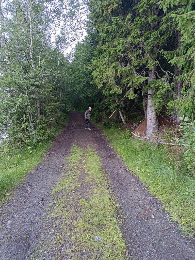
Vådal Lake to the left and my walking companion clearing dead branches off the road.
We have been along this route many times before, though this was the first time this year. About two days ago we had a lot of wind, so there were dead branches along this section of the road. My walking companion likes to use his walking stick to get these dead branches off the road. This road was probably originally used as a logging road and there are signs that it is still used for motorized vehicles, though where streams cross the road there are large grooves in the road. It is not suitable for car traffic at all.
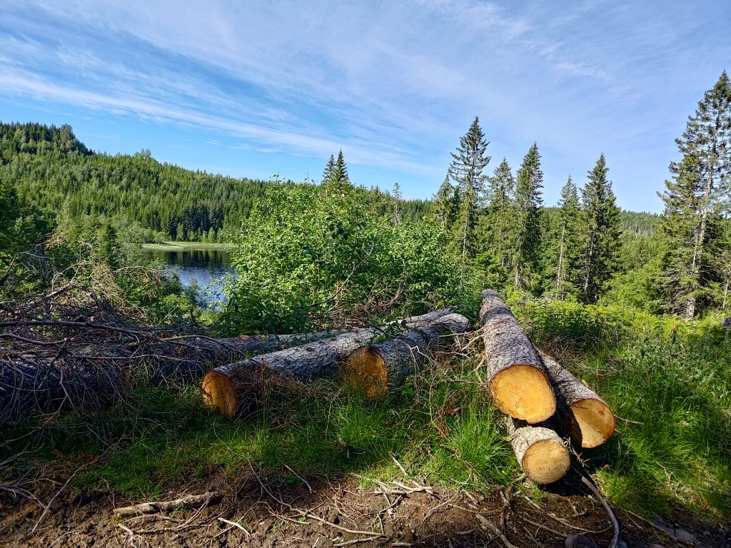
Signs of some logging activity in the woods. We have now started to climb uphill.
All this land would have private owners who are then asked to allow walkers access to the roads and trails. When a trail is marked for an Inderøy walk, there will be a lot of use of the trail. These trails may have to be maintained, either by a sports club or a property owner. Especially where people park their cars, it would have to be agreed with the land owners. Norway has a law that protects free access to uninhabited areas, but one still has to respect the rights of the landowner, whether it is a person, a business or the local municipality.
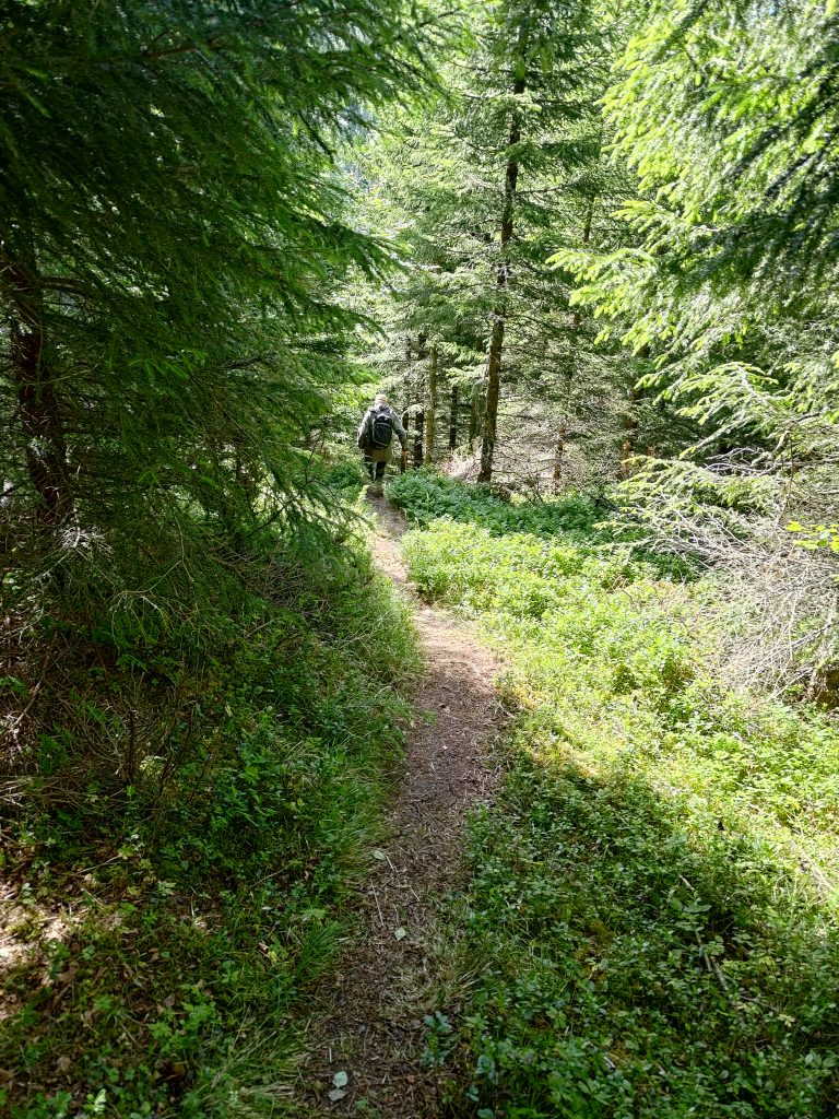
I stop to take pictures, so my walking companion can get quite far ahead of me. We are heading to the top of that hill in the distance. The road/trail we are following works its way up the hillside, primarily following a stream that flows between the hilltops.
Our walk now took us steadily uphill. Most sections were not that steep. There were sheep on the hillsides as well. In fact we were following one small lamb that seemed to have misplaced its mother. I hope it found its way back to her after we turned off the main trail.
We are following a stream, Bjørbekken, uphill. This stream basically follows the boundary between Steinkjer municipality and Inderøy, and drains a lake farther uphill. It goes to Vådal Lake. In the picture, you can also see a lamb that has gotten separated from its mother. It wanted to stay ahead of us, though I suspect the mother was farther downhill. I hope it was learning some navigation skills and not just keeping away from people.
Klingerhaugen, the hill we are attempting to climb, has a summit of about 300 meters above sea level, which means we have about 150 meters of elevation to climb. The route we took was relatively gentle and much of it was tractor road quality, meaning that we could walk side by side and chat. Though when we are climbing a hill, the chatting lessens as we go.
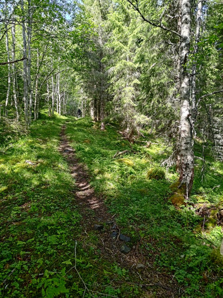
Eventually we turned off the trail that we had taken many times before and headed up a different trail. Initially this was also quite wide, as if it had been a logging road originally. Now it was a single track, and we continued to head uphill, but now turning back in the direction we had come from, but at a higher elevation.
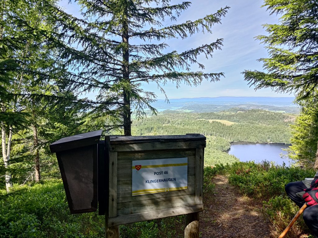
Like many of the hills in our area, Klingerhaugen has a steep, cliff-face, though it is covered with trees. To get to the top, one has to walk a long way round, and come at it from the back side. As this was the first time that we had taken this new trail, we were having to look out for the red and yellow markers hanging from the trees, and almost missed the viewpoint.
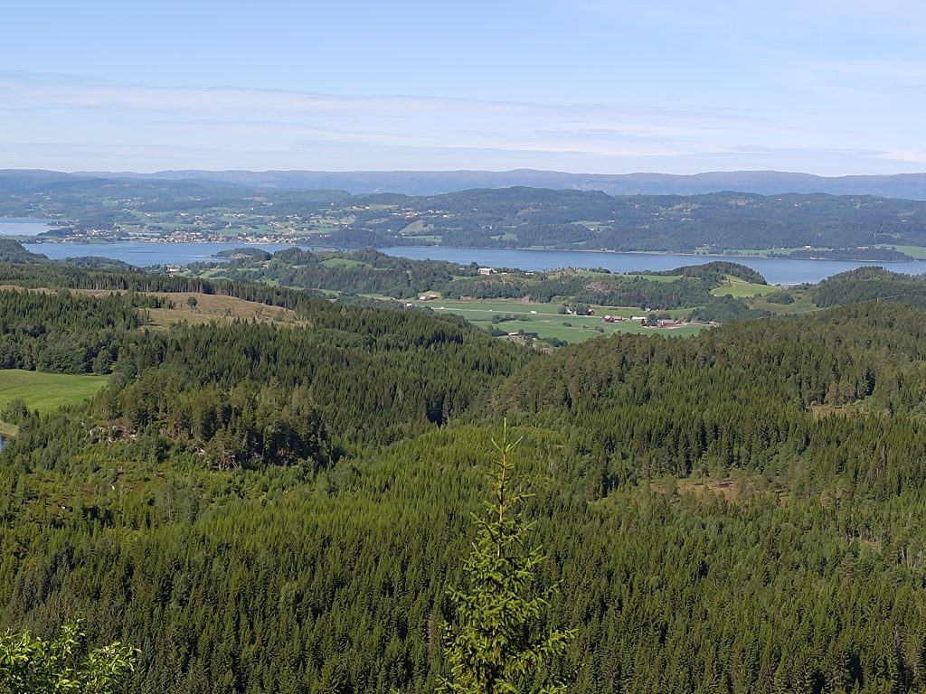
We finally found the post at Klingerhaugen and could see Vådal Lake a long way down. We’ve climbed about 150 meters in elevation from the lake. There was a book to write our names in and a picnic bench to have a rest on.Inderøy as seen from Klingerhaugen
In the above picture, one can see the village of Straumen, our local shopping area, towards the left of the picture. The hills in the far distance are in the municipality of Steinkjer and there would be a fjord arm between Inderøy and those hills. We live out of the picture off to the left. For those who know the area a bit, the main north-south road in Trøndelag, the E6, is also visible in this picture as it runs through some farm fields. Thankfully we were too far away to hear the noise of the traffic. One of the reasons we enjoy walking in these hills is the quiet and the lack of vehicle noise.
Another place to make decisions. We were able to check-in to the second post here and we had used about 45 minutes from the lake.
We came along the trail on the left and had originally thought of doing a third post so we actually started heading off to it using the trail on the right. However, though it started out as an okay trail we soon got into difficulties because of the steepness of the trail. As we age, we find narrow, steep trails in the woods more difficult to handle. Steep trails are best taken going uphill. We were going downhill on this one. The chances of sliding are much greater when going downhill.
This trail even has its own name, Finnstien, Finn’s trail. It is narrow and here I’m actually looking slightly uphill to take the picture.Brock is going down Finn’s Trail and just about to come to a very steep section. The trail actually goes along a wooded cliff at this point.
Even I felt that the trail was too dangerous for us, so we made the decision to turn around and go back the way we came. We sat down just beside the trail, had a drink of water and shared some of the chocolate bar I had taken with us. We both needed to de-stress before continuing. It was actually on the way back that we found the viewpoint from the cliff top.
We used about 2 hours and 20 minutes on this walk, so lots of fresh air and exercise. By the time we were back at the car, the temperature had risen to 20 degrees. However, we both found it a bit more tiring and stressful than we like, so this will not be a walk that we repeat, at least not this year. We will continue to go for long walks during the summer months and have agreed that a minimum of one a week is important for our health. It would be ideal if we set aside enough time for two such walks a week. I hope you too get out for walks in your neighborhood.
It was Sunday again and time for a walk, though I wasn’t that enthusiastic. Warm nights have meant that I haven’t been sleeping well, though I know that getting out in the fresh air and walking is good for me, no matter what my mood is. We didn’t want to drive that far, so decided on two posts that are about a 7 km drive from home.
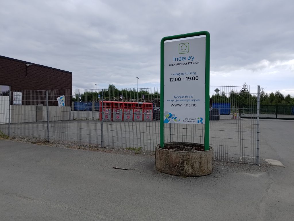
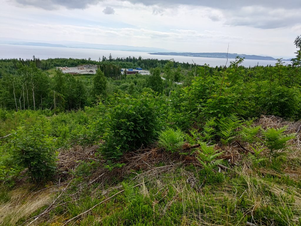
We parked near the recycling center for our municipality. It is only open two days a week, Tuesday and Thursday from noon until 7 pm. “Garbage” delivered here is sorted by the person bringing it. We have gotten to know it quite well since this new place was opened in September 2018 about the time we started fixing up our house and creating a lot of construction garbage. There are some bins for garbage that are available at all times. The red containers seen behind the fence are for clothing. We sort out metal, wood, impregnated wood, electrical appliances, paint, batteries, light bulbs, etc.
The recycling center where we have parked our car is seen as the eye-sore in the picture. It is quite practical for the residents and we put our garbage in different places or containers depending on what type of garbage we are delivering. This picture is taken from about halfway up the hill we climbed.
As you can see from the pictures, the weather was cloudy, but there was no wind or rain. The temperature, according to the car, was about 14 degrees, so a nice walking temperature.
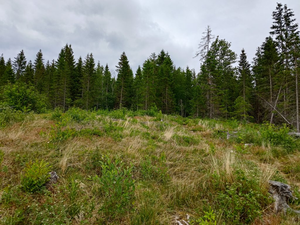
We climbed this hill which was logged not so many years ago.
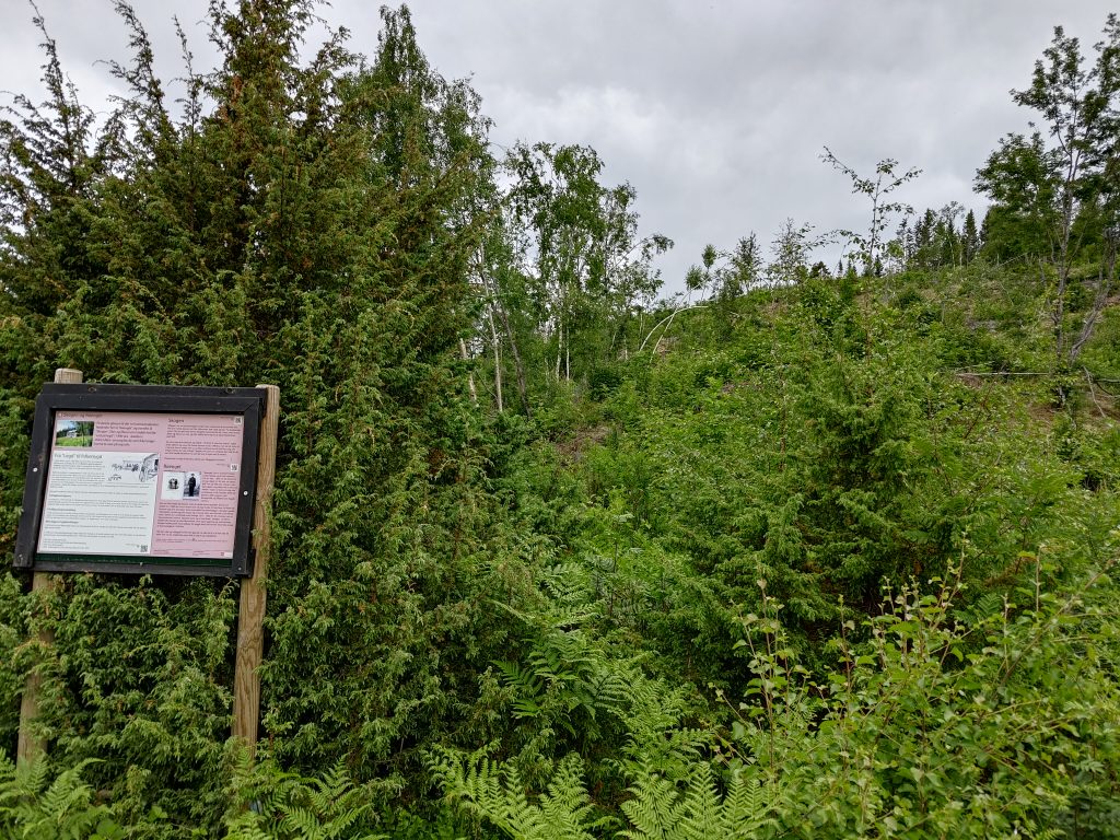
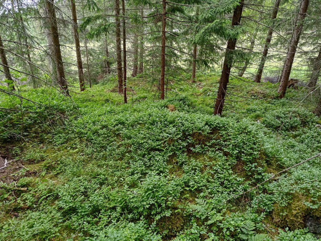
The first time we walked up to this post, called Stenemarka, this was a newly logged area. It was interesting to look at what vegetation has grown up since the first time I climbed this hill. Now small trees have started to grow, primarily birch and rowan. The old forest was primarily spruce. Ferns were abundant where the moisture collected.
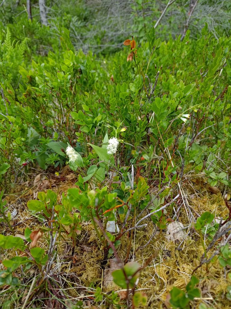
Where there are open spaces, small ground cover plants are blooming and there is a lot of berry plants growing too. Not all of the plants am I familiar with and I’ve had to look up even the Norwegian names for some of the ones in the pictures below.
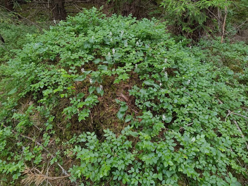
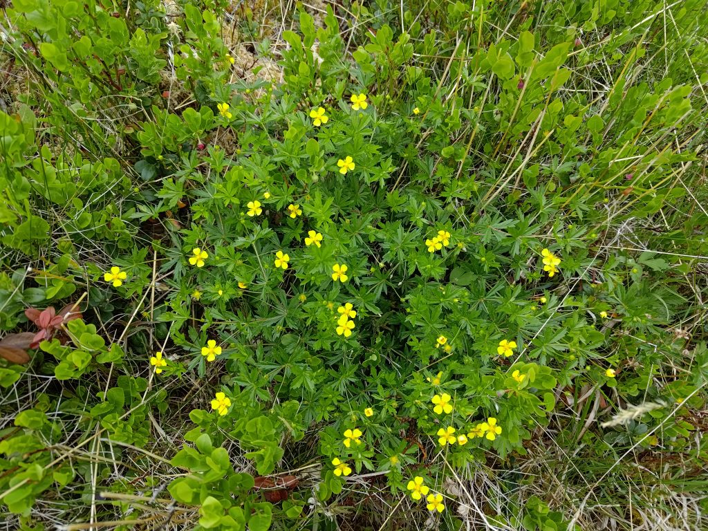
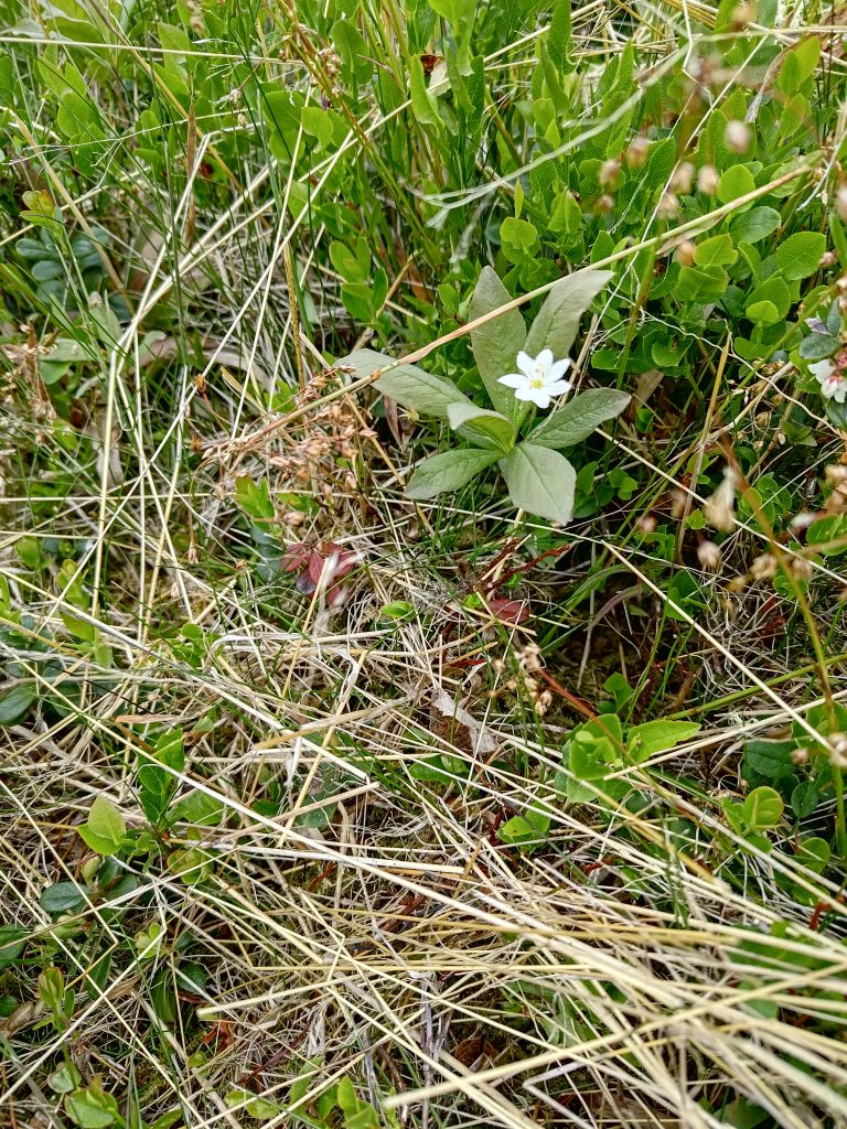
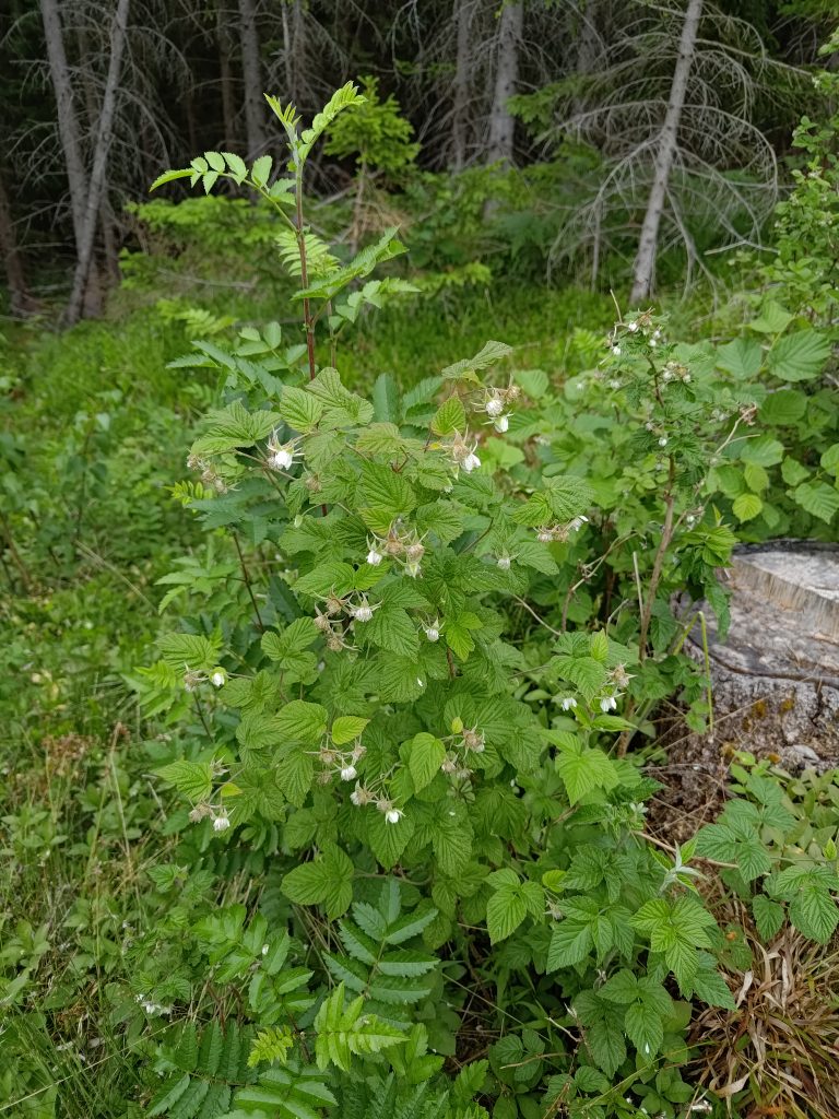
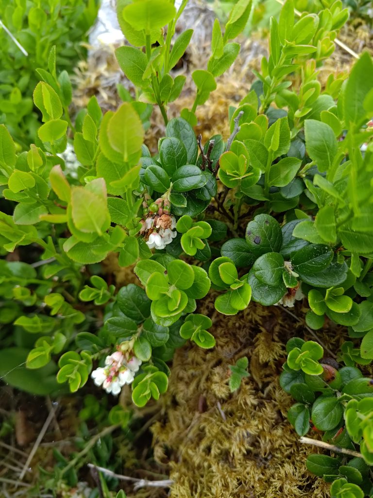
In Norwegian this is called “maiblom” (May flower) and in Latin it is called Maianthemum bifolium. In English it is called May lily or false lily of the valley.Later in the walk I found this small mound covered in Maianthemum bifolium.In Norwegian it is called “tepperot”, in Latin Potentilla erecta, and in English erect cinquefoil. It belongs to the rose family and will bloom from May until September. It usually grows in colorful clumps.I’m not sure, but I think this is “skogstjerne”, Trientalis europaea, or chickweed-wintergreen or arctic starflower in English.Raspberries grow wild here, especially on newly logged areas.Here is the undergrowth once we were back in the spruce forest. They are mostly blueberry or lingonberry (“tyttebær”).The lingonberry (“tyttebær”) is very common here and people will go out in the woods to collect the berries in August. For those of you who live in North America, it is used to make jam used with meats and tastes similar to cranberries.
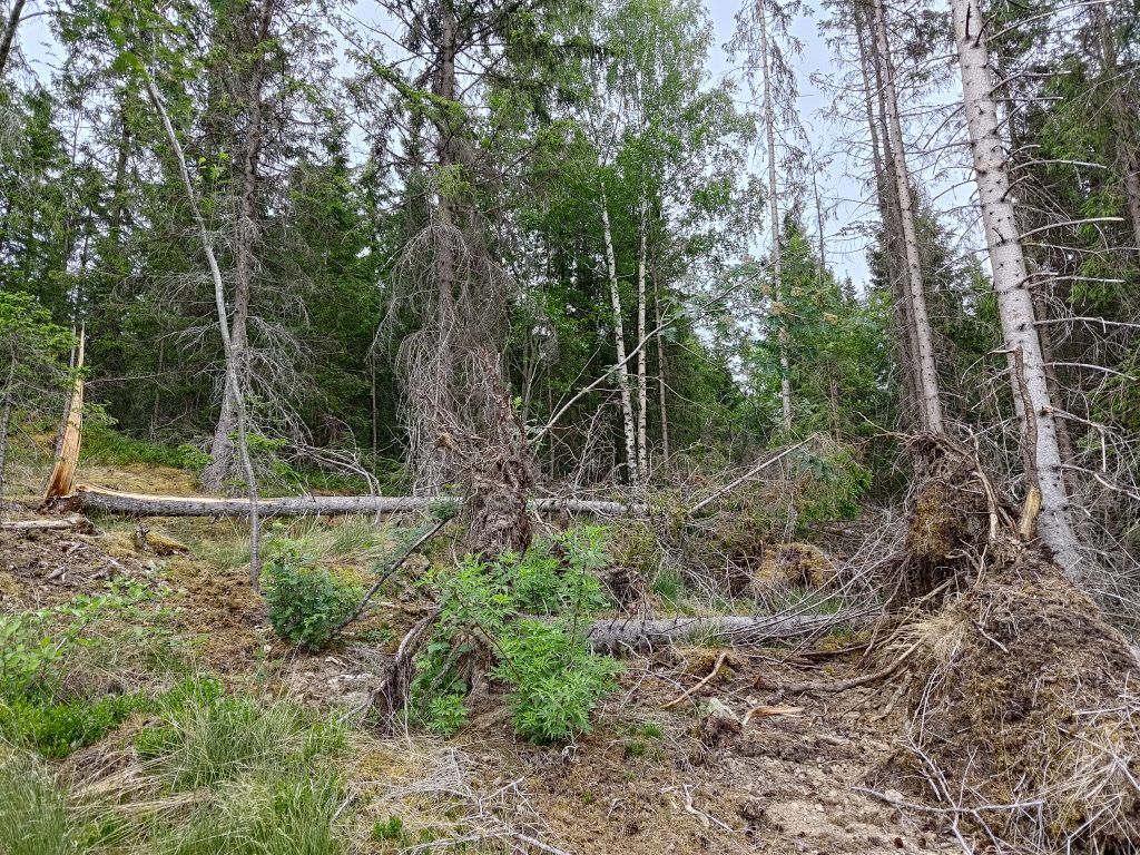
Where the logged area meets the old forest, the trees may have a hard time standing up if the wind blows hard from the open area. So along the edge of the old forest there are often a lot of dead trees.
Here is where the logged area meets the old forest that has not been logged.In storms, spruce trees are very susceptible to being blown over as they have very shallow roots. You can also see a tree that has cracked in the wind.
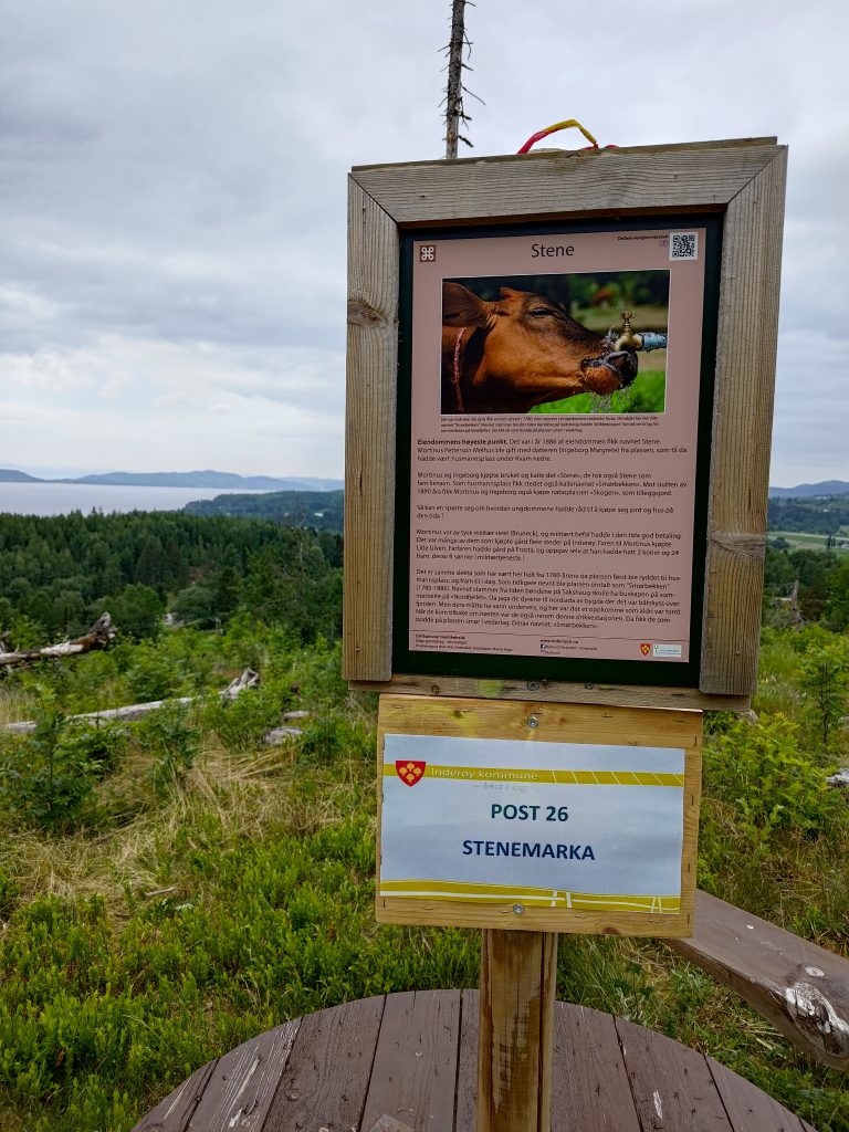
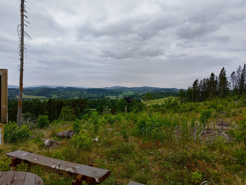
We were going to two posts today, Stenemarka and Furutoppen. The first one is in the open and gives a beautiful view over the area called Utøy and out to Trondheim Fjord. To reach the first post, one has a bit of a climb. The second one is in the old forest. The walk between the first post and the second post is pretty much a level walk. After the second walk one has to get down to the starting level again, so there are a few steep bits where one needs to be careful. We have had very little rainfall this spring, so the ground is very dry. There can be a lot of cones and dead needles on the ground which can make steep areas a bit slippery. Canes and gloves are useful, especially going downhill.
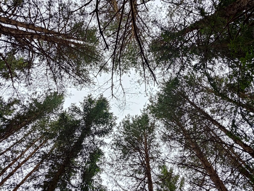
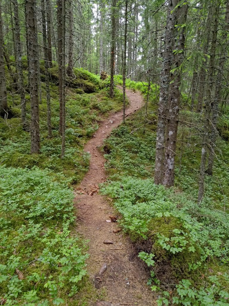
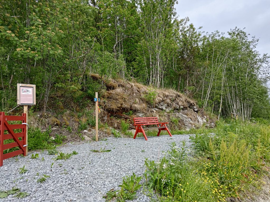
We’ve reached the first post, with information about the farm and a beautiful view over Utøy and the fjord. Here I’ve taken a picture looking south-west.Utøy has rolling hills and a lot of farms. The fields are primarily green now.The second post is in the woods with only a view of trees and ground plants.The view is looking upwards.There is a well-used trail through the forest and it was not difficult to follow.When we came out of the forest, there was a red bench and a red gate. The red gate is more symbolic than being used to close off an area.
We used about an hour on our walk, which is the minimum that we like to do on a Sunday. Cooler temperatures meant that we were able to keep up a good pace, even on the steeper sections, though there wasn’t really a large height difference. This is actually a walk that suits being done on a cool evening.