I’ve titled this blog with two words that I’d like to define. I think of nutrition as what we get out of food that is of use for our body for its functioning. I think of food as anything I might eat, thinking that it was good for me. The two concepts are linked, but don’t necessarily mean exactly the same thing, though they are often used to define each other. Not everything we eat is nutritious (think of sweetened drinks that are mostly sugar) or good for us (think potato chips), even if they taste good. So we can use the adjectives “good” and “bad” with both nouns. In this blog and the two following ones, I’m going to reflect over what is good nutrition for us, and therefore good food, with the science that is available in 2025.
Looking back
As a child my mother enjoyed baking in particular and dinner was always a homemade meal, so I learned from my mother quite a few things about food and nutrition, both good and bad. We always had cookies in the house, so I’ve always enjoyed sweet items. At school we learned about what was good food and what we should have in our diet. For example, I learned that the vegetables for dinner should be both colored (red, orange or yellow) and green varieties. I’ve also learned over the years that a dinner meal looks most appetizing if there is a variety of colors on the plate, and in the dish. But I also learned about proteins and carbohydrates.
I moved out on my own in 1971 and then had to start making all of my own meals. I had to make decisions of what was good food for me as well as what was relatively cheap to make. Many decisions about what food to purchase is also based on what one can afford to buy. Sometimes I ate at restaurants or cafeterias, but as I have always liked to make food, both dinners and desserts, I have never been one to buy a lot of ready-made foods. One of the concepts I learned about in the 1970s was that white flour and white sugar are bad for you. I also investigated vegetarian diets and have ever since had a liking for non-meat main dishes.
When Brock and I moved to Norway in 1980, we had a very limited income, so we rarely had meat as it was just too expensive for our budget. Fresh fish was affordable but chicken was almost non-existent in the stores. We used dairy products and eggs a lot for our protein and primarily used the local supply of vegetables which were affordable. At that time there were very few imported vegetables, though fruits such as oranges and bananas were imported. The choice of foods that we ate was based on what we could afford to buy.
We got our first child in 1983 and again I started reading about food for small children. I think I made some errors at this time thinking that juice was good for children. I have since learned that juice is actually not that good for us and haven’t bought any for years. My apologies to Alasdair for giving him so much juice (which is just naturally sugared water) when he was young. With small children (we eventually had a second child in 1989), the choice of foods was still very much based on what was affordable, but sweets were a major part of my food preparation, including cakes, pies and cookies on a regular basis. After all, that was what I was used to as a child myself. Though I do remember that when I was serving a lot of dinner guests, it was often a vegetarian meal using legumes as that was a lot cheaper than using meat or chicken.
A few years ago, my husband got the message from his doctor that his blood pressure was getting a bit high. So I cut out buying things like bread and made my own so that we could have a lot less salt in our food. That helped his health. If you look at the packaging, a lot of foods have very high salt and sugar content. I try to find products that are low in both and learn which items to avoid. One example I think of readily is peanut butter. A good peanut butter is made from peanuts with a little salt added (less than 1%), but you can also find peanut butter (that is cheaper) with sugar and all sorts of additives which makes it not such a good food.
Looking back at old blogs, I wrote quite a bit about nutrition in January 2020 shortly after I had taken an online course about nutrition. I found that course interesting, and you can read some of my old blogs if you follow these links:
- https://trish.mclellan.no/2020/01/21/nutrition-proteins/
- https://trish.mclellan.no/2020/01/24/nutrition-carbohydrates/
- https://trish.mclellan.no/2020/01/27/nutrition-fats/
- https://trish.mclellan.no/2020/01/29/to-eat-or-not-eat-meat/
In addition, I have written a few suggestions for making meals:
- https://trish.mclellan.no/2020/01/01/whats-for-dinner-color/
- https://trish.mclellan.no/2020/01/14/whats-for-dinner-salad-1/
- https://trish.mclellan.no/2020/01/18/whats-for-dinner-nutritional-balance/
- https://trish.mclellan.no/2020/01/19/black-eyed-beans/
- https://trish.mclellan.no/2020/01/27/crispbread/
The changes I’ve made over the years
I figure that we have a relatively good diet now, but that doesn’t mean that we can’t make it even better. Let’s look at the changes I have made since I first started living on my own, back in the 1970s.
Today, I use some meat, some fish, some chicken and some legumes and rotate them through the week to give us a variety of protein sources. But all dinner meals include lots of vegetables, sometimes cooked and sometimes raw. I like having a variety to my meals, though I must admit that I get lazy and tend to make the same things over and over again.
I eat a lot less meat than when I was a child. I’ve never been a big meat eater so we have that maybe once a week. I eat meat because it is a source of protein and animal proteins are actually necessary for our bodies as they provide nutrients we don’t get from other foods. At present, I would consider 100 grams of meat a sensible size of serving and we usually only eat meat once a week.
Whether I eat a lot of fish or not has varied over the years depending on the others in my family. Often fish is bought breaded, so we end up eating a processed food. Salmon, which is almost all farmed fish in Norway, is often eaten with a white sauce, but I often wonder how healthy farmed salmon actually is. We like fish and chips, but again that tends to be covered in something which may not be healthy. We eat fish perhaps twice a week.
Chicken is now abundant in Norway and a reasonable price as well. I am fond of chicken so that is eaten about once a week. I usually avoid the pre-cooked and pre-spiced varieties as I’m not fond of spicy food. We have had turkey for special occasions, but I’m starting to find that I don’t enjoy the work of cooking a turkey anymore. I’m just as happy with chicken. We eat eggs occasionally, but usually they are used in baking.
I love vegetables, both raw, often in salads, and cooked, sometimes stir-fried in oil. I actually like the taste of most vegetables, though I don’t like onion or garlic. So I don’t need a lot of sauces or spices to make the vegetables tasty, though I think others may prefer them both cooked and with sauces.
I like some fruits. Fruits tend to be sweet and I do have a sweet tooth. I try to have one fruit for breakfast and one fruit for my evening snack. Sometimes fruits are made into desserts. Oranges, grapefruit and bananas are our staple fruits, and occasionally we have grapes or melon.
When my children were young, we all drank a lot of milk. But for a long period, many years ago, I avoided dairy products as they seemed to affect my digestive system. After about 7 years of avoiding dairy products completely and taking calcium tablets to replace the loss of it from dairy products, I started using dairy products again. After those years of abstinence, my digestive system seems to accept dairy products again. Cheese is a staple in the Norwegian diet and I am learning to like a few cheeses, though usually fairly mildly flavored ones.
To get my carbohydrates, I tend to vary between bread, potatoes, pasta and rice. Occasionally we have bulgur or couscous, which are both grains made from wheat. In addition we often have porridge made from rolled oats, and in the summer months we often have granola or processed cereals.
When we moved to Norway, I learned how to bake bread as in the 1980s it was quite common for women here, even working women, to make their own bread. I have a kitchen machine that does all the heavy work and now that I’m retired, time is not a problem. By making my own, I can make a variety, but also find the type of bread that we like best, without all the additives that are found in bought bread.
I’ve always loved sweets, so cookies, cakes and desserts have always been a large part of my diet. In the last few years, I have been cutting back on how much of these I make. We often have milk puddings, served in small servings. Unfortunately, I also love ice cream and tend to indulge far too much in the warm months of the year.
Who does the science?
No matter what area of knowledge research is done in, the answers you get are only as good as who has actually done the research (do they know what they are doing) and who has paid for the research. What has not been mentioned in research results? What happens to new knowledge? Is it used, or ignored? When you read a newspaper article that tells you that three cups of coffee a day are good for you, can you believe it? Or is that just the coffee producers trying to make more money off of you? Wine and chocolate are also favorites for journalists to write about as everyone wants an excuse to consume products that they like, even if they aren’t certain if they are good for them. Marketing of food products is designed to make you buy them, not to dissuade you from making poor choices. All businesses want to make money off the consumer.
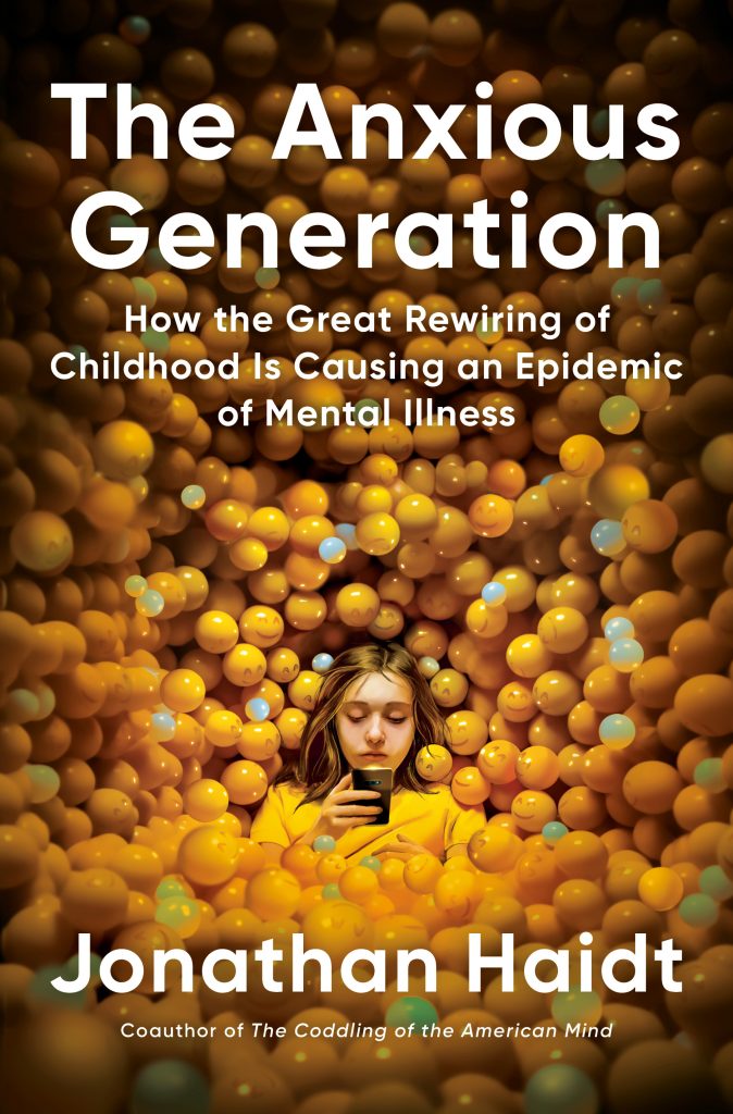
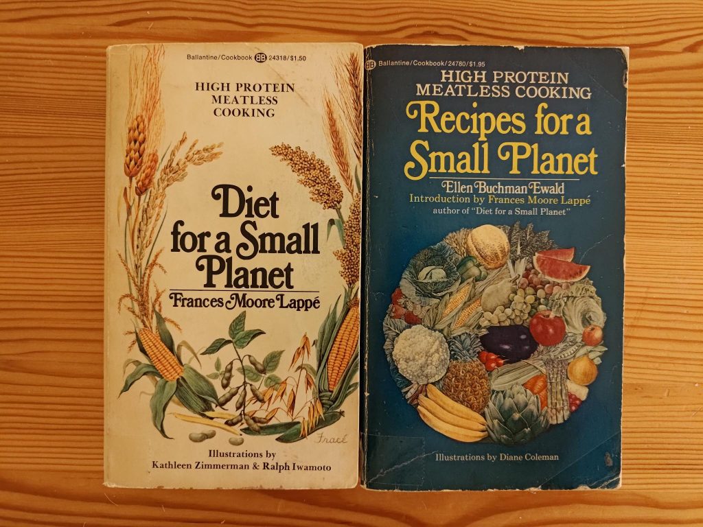
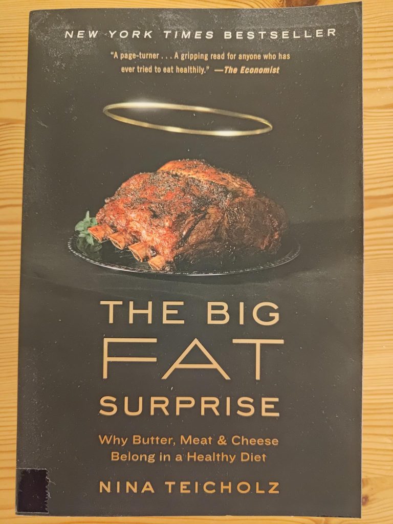
One concern I have when it comes to nutrition, is who can I trust? Whose information is correct? What has been left out of the information that we have been given? Back in the 1960s, they were getting concerned about the fat in dairy products and the cholesterol in eggs. So we should not eat eggs and we should only have low-fat dairy products. But there have been several authors who have looked at the science from the 1960s and said that it’s all wrong. Looking at the current food recommendations in Norway (Kostrådene from Helsedirectoratet), they are still recommending low-fat dairy products, even though low-fat food does not stop people getting overweight. Several books have been written about this change in scientific opinions. Below is one that I have read and it is from 2014.
What is good food in 2025?
I think good food is still the same as it ever has been and we still have to choose wisely in the store. By good, I really mean, what is good for us, not necessarily what tastes good. By good, I mean that the food gives us the nutrients our bodies need to flourish. Chocolate cake tastes really good, but I don’t consider it a good food. I think learning what is “good” can change over time. We also have to take into consideration that as we age we may need different nutrients than when we were younger and much more active.
A lot of sweet or salty food is not good for us. Processed foods may have little nutritional value, no matter what it says on the label. The best foods are the ones that you make yourself, from ingredients that are recognizable, such as carrots, broccoli, peas, legumes, chicken, milk, etc. What each individual likes will also influence what one buys, but one also has to train oneself to not over-indulge in foods that are known to be bad for us.
I have started reading books about food and what makes good food and one of the comments was that it’s not just what the food is, but what has been done to the food before it gets to our kitchen.
There has recently been an egg scandal in Norway, where millions of eggs had to be removed from the store shelves and destroyed. Why? Too much Vitamin D had been added to the feed for the hens. There were 9 egg farms affected by having received “bad” feed. It was only discovered because the hens were getting sick. One of the egg farms affected was the local farm that I often buy eggs from as it is within walking distance. Luckily, in January I had bought eggs from a different producer, so we did not have to throw out our eggs. But this scandal shows how even a simple basic food such as eggs have a history before we get them to our kitchen and we have no real knowledge about how much the food has been affected by the feed given to the animals or the fertilizers or insect repellents used when growing plants. You don’t get nice looking carrots without the farmers spraying their fields.
Another comment about how to choose good food was to look at the list of ingredients on the package. The more ingredients that are listed, the less likely the product is actually good food. Processing damages foods, taking the nutrients out of the original ingredients. But even so, we have to trust that what’s on the label is actually what’s in the package. Is the cod, cod? Is the beef, beef? How many additives are there? What processes have been used to change the food? Heating food changes it. For example, milk must be pasteurized to be safe to drink. This requires heating to a specific temperature for a specific time. In Norway, they can add Vitamin D to the milk, though the types of milk I buy don’t have it added.
At the moment I am reading a book by Robert H. Lustig, Metabolical, published in 2021. The main message in the book is that sugar is poison and that processed foods are killing us. I will be looking at some of his ideas in my next blog which is about Food and Disease. There will also be a third blog where I try to get to what food we should really eat and what we really have to either cut down on or cut out, if we can.